
- Home
- Rural Development
- Nature Trails
- Nature Trails
- Northwest Sector
- Ruta del Cantábrico
Stage 3. Foz - Burela
Description
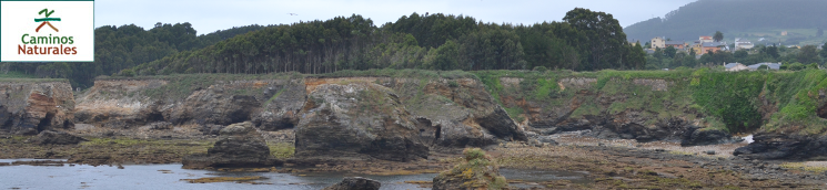
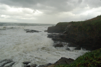
The action of elements has carved a coast of surprising shapes which has been inhabited (and defended) since ancient times.
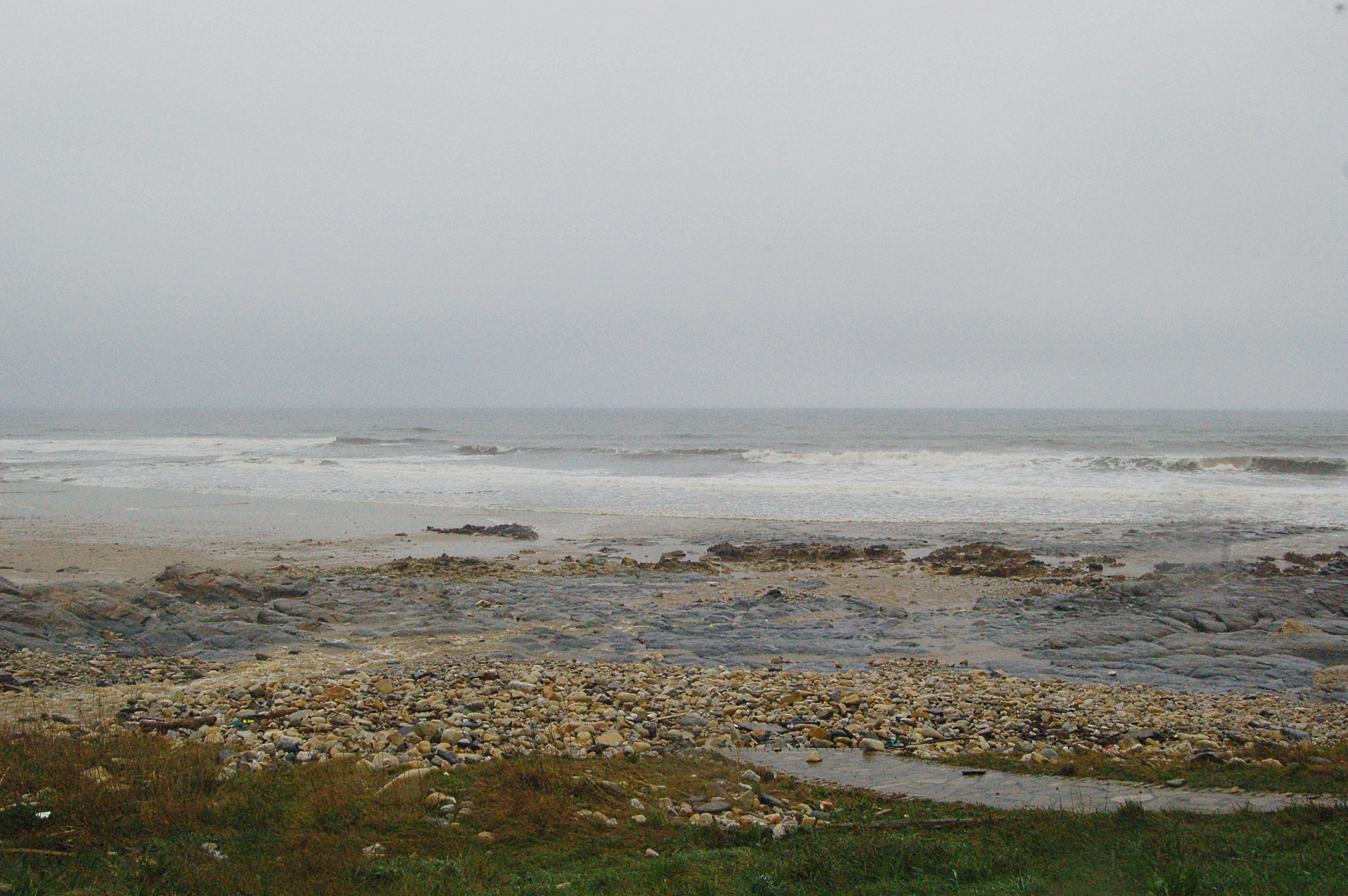
Starting in the fishing village of Foz, this third stage of the Cantabrian Sea Nature Trail continues travelling across the province of Lugo. This stage shall take the traveller across beautiful beaches and remains of ancient settlements, such as the Castro de Llas and the Castro de Fazouro. The traveller is welcomed to Cangas de Foz by the sight of San Pedro church, guarded by an impressive mulberry tree, which has been awarded a Special Tree status. This wonderful stage of the trail ends at the fishing village of Burela
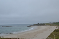
This stage starts at the village of Foz, more specifically, in a green area in the Travesía Riveira, and advances leaving the village to the left and its port to the right. Walking along the seafront promenade, the traveller reaches the wide A Rapadoira beach. The trail leaves Foz by climbing a gentle slope and winds along the cliffs, adapting its course to the capricious shape of the land. A wooden footbridge leads the traveller beyond the Cala da Ronqueira beach and to kilometre point 2 of this stage.
After walking for another kilometre, they arrive to the Llas beach, at the end of which there is a children's playground, and the Castro de Llas, which is located in the cape known as the Os Bois. Further down the road, the traveller goes past another children's playground and a benched area where they can take a break to recover their strength and enjoy the spectacular views before continuing to the Peizas beach.
A little after this beach, the trail follows a dirt path locally known as Camiño Corbelle and afterwards starts a section shared with motor traffic along the Rúa das Chaves. Please be especially cautious. In the following crossing, the trail takes a deviation to the right along the Camiño Caldouceiro and runs parallel to the narrow-gauge railway tracks until reaching the A Pampillosa beach. This beach and its environments are included in the Natura 2000 Network as the Ouro River Site of Community Importance (SCI).
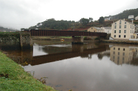
The trail goes on to the mouth of the Ouro river, leaving the car parking lot to its left and the A Pampillosa to its right. Once there, the trail turns left. The trail passes underneath the tracks of the narrow-gauge railway line from Oviedo to Ferrol, and then under the N-642 road to cross the Ouro river by the restored Ponte de Ferro bridge. Just at the other end of the bridge, the trail turns right and runs along the Camiño Ponte de Ferro among the houses of the village of Fazouro, crossing again the road and the railway tracks by a paved footpath.
After reaching the Fazouro Wastewater Treatment Plant, the trail starts a section shared with motor traffic by the Estrada Pampillosa asphalt road, and turns to the right when a signal indicates so. At this house, the trail turns right by a narrow path, marked by milestones indicating that this is a maritime-terrestrial public domain, which circle the property until reaching a new section shared with motor traffic in an asphalt road as the traveller gets close to kilometre point 9. The trail leaves the narrow-gauge railway tracks to their left; the traveller can see the Fazouro train stop. Shortly after this train stop, the shared section ends. At this point, the traveller must visit the nearby Castro de Fazouro.
Then, the trail takes a pedestrian path along a paved seafront promenade, which allows to enjoy the views of the Arealonga beach to the right, leaving the narrow-gauge railway tracks to the left. At the end of the beach, where a small parking lot is located, the Nature Trail continues climbing either a staircase or a ramp. A little further, both paths converge in an asphalt road which is again a section shared with motor traffic.
After kilometre point 11, a little detour to the right leads the traveller to the port of Nois, which in the past was devoted to whaling. Then we go back to the trail, leaving to our left a pretty red hórreo (elevated granary) located inside a private property, and shortly afterwards we reach the parochial church of San Julián in Nois.
Afterwards, the trail leaves behind the houses of Nois, hits kilometre point 12 and shortly after, arrives at the tiny As Polas beach. At the beginning of this beach, we leave the asphalt road and continue by the cobblestone pedestrian promenade until the Area da Fame beach. There, a new section, shared with motor traffic, begins, which, after a few metres, reaches the Xuncos beach.
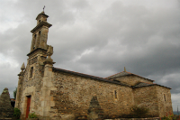
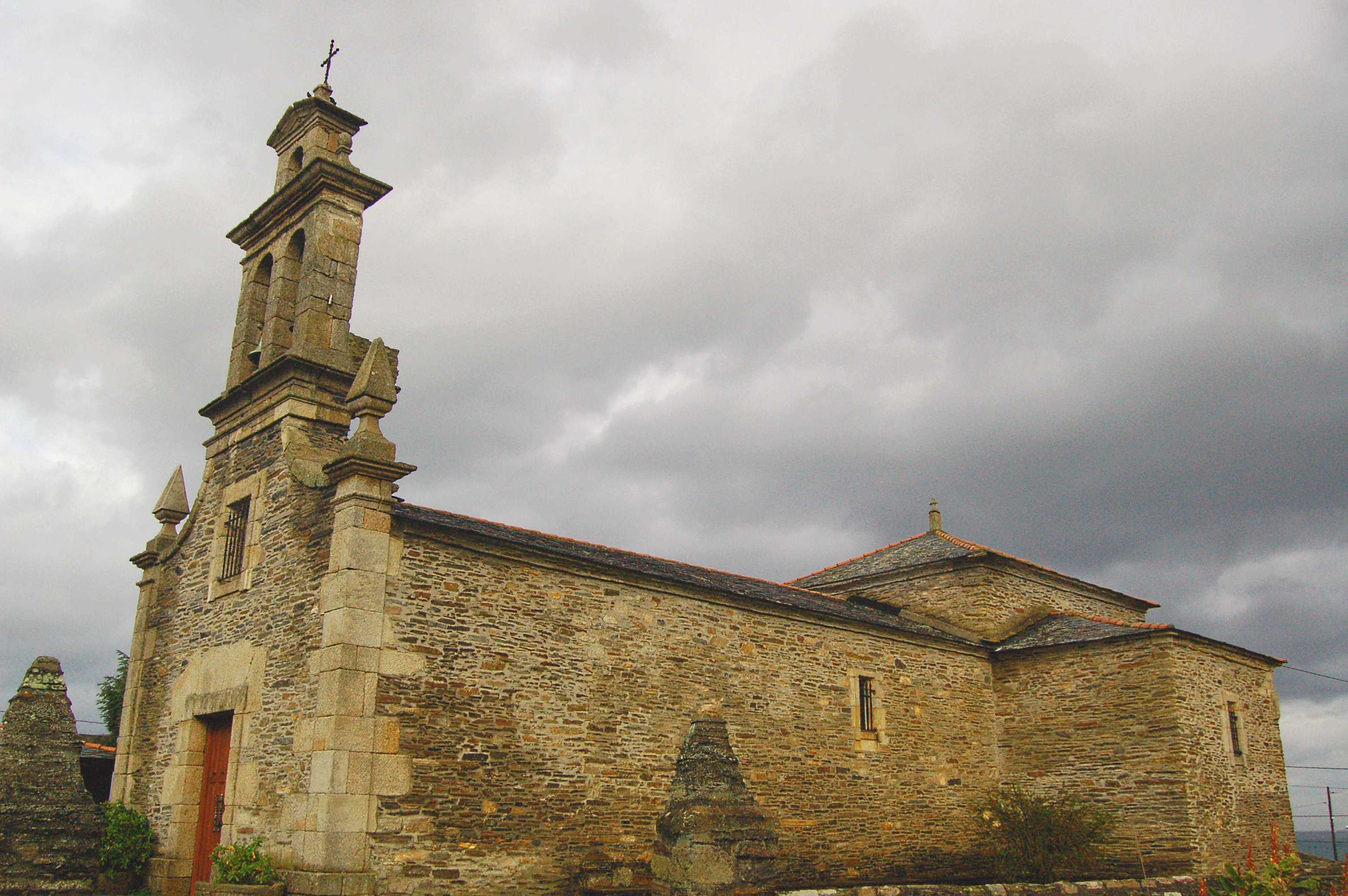
After crossing two eucalyptus patches, the traveller takes the dirt path to the right and crosses a wooden footbridge over the Rego de Alamparte creek. After enjoying the panoramic view over the Os Castelos islets, the dirt path becomes paved road and goes on to the parochial church of San Pedro y Cangas de Foz, flanked by a mulberry tree (Morus nigra) which is listed under the Special Trees of Galicia.
After circling the local football pitch, the trail continues along a new shared section which starts exactly at kilometre point 15 of this stage. Afterwards, the trail turns right and crosses the N-642 road by a nearby zebra crossing (please act with the utmost care), and follows the LU-162 for a few metres just before turning right after the narrow-gauge railway tracks. Following the signals, the traveller walks the streets of Cangas de Foz, and, after the last house, takes a dirt path that enters an eucalyptus woods; several turns right afterwards, it passes underneath the railway tracks and the N-642 road.
At the following crossing, the trail turns left and after crossing the railway tracks again, this time by an overpass, continues along a wooden footbridge. After hitting kilometre point 17, the traveller follows an asphalt road to the Areoura beach, and continues on by the same road to the O Cantiño beach, where it continues by the pavement and then by a paved seafront promenade. There, the traveller may take a break at a children's playground and a recreational area before starting the final section of this stage.
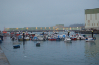
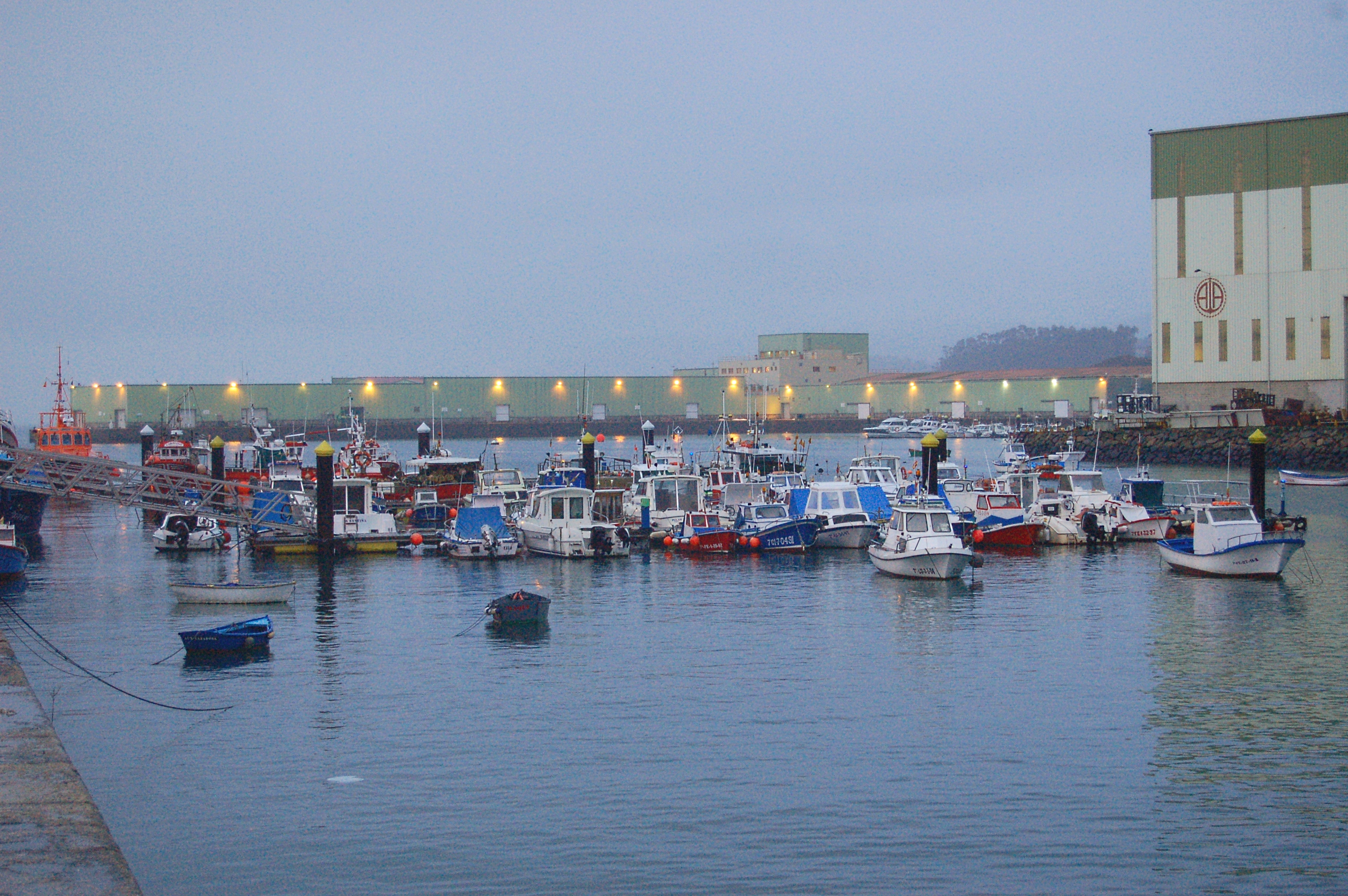
The trail continues along the coastline and enters the town of Burela by the Rúa do Río Landro, parallel to the railway tracks. At kilometre point 20, the trail takes the Rúa de Suafonte to the right and turns right again by the Rúa de Ejo Garay. This street lead to the port of Burela, where this third stage of the Cantabrian Sea Nature Trail, which runs from Foz to Burela, comes to an end.
Sites of interest
Map
Puntos de Interés
Orografía
Vegetación
Profile
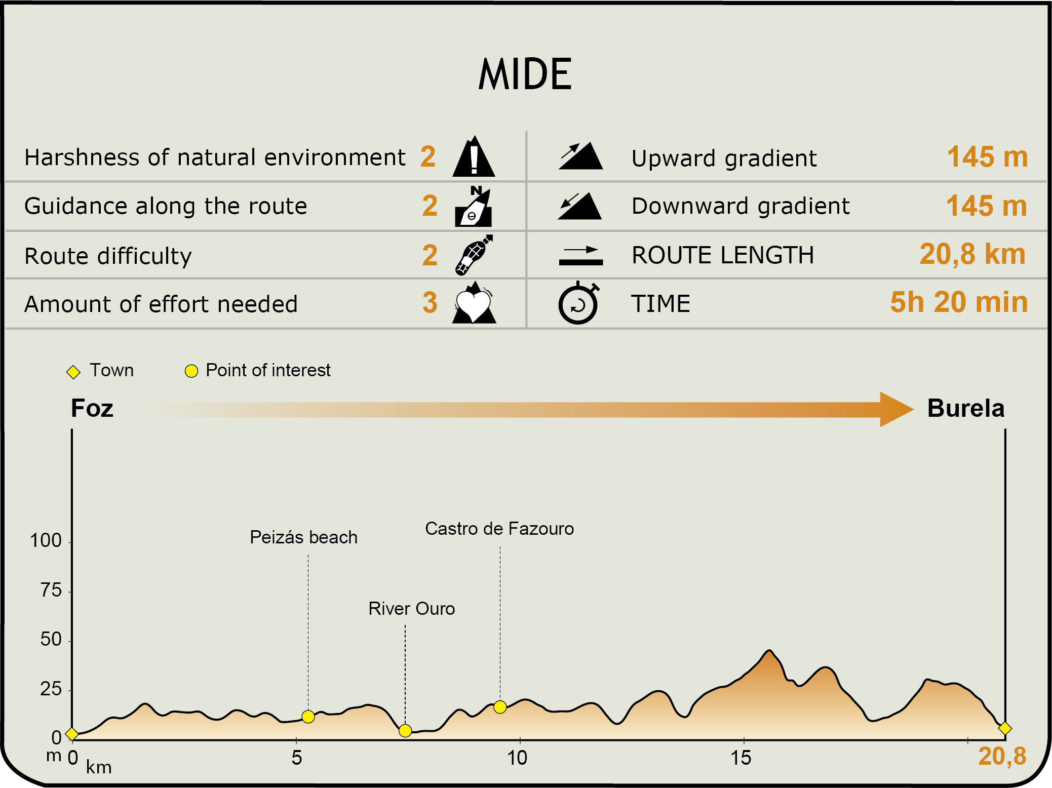
MIDE (Method for the Information of Excursions)
 Harshness of natural environment
- 1. The environment is not risk-free
- 2. There are more than one risk factors
- 3. There are various risk factors
- 4. There are quite a lot of risk factors
- 5. There are many risk factors
 Guidance along the route
- 1. Well defined trails and crossings
- 2. There is a clearly marked trail and signage
- 3. Requires the identification of geographic features and cardinal points
- 4. Requires off-path navigation
- 5. The trail is interrupted by obstacles that have to be gone around
 Route difficulty
- 1. Walking on a flat surface
- 2. Trails with different types of path
- 3. Walking on stepped paths or irregular terrain
- 4. The use of hands or jumping over the terrain is necessary
- 5. The use of hands is required to progress
 Amount of effort needed
- 1. Up to 1 hour of continuous walking
- 2. Between 1 and 3 hours of continuous walking
- 3. Between 3 and 6 hours of continuous walking
- 4. Between 6 and 10 hours of actual walking
- 5. More than 10 hours of continuous walking
Featured
Further information
SCI Ouro River
This area, which comprises the middle and lower course of the river and its ría over an area of more than 70 ha, , has been awarded Special Community Interest status. Legend has it that the riverbed was rich in gold nuggets, hence its name (Ouro, "gold" in Galician) which can be traced back to Roman times. This natural space is valuable by many reasons, among which the presence of freshwater mussels, the populations of stag beetles and the patches of sea ruch (Lucanus cervus) are especially noteworthy. Besides, many species of fish and birds are attracted by the conditions of this area, which are ideal to their development. The main architectural interest in relation to the river are the caneiros or small dykes that are built diagonally to the direction of the stream and they are used as small water reservoirs or fishing ponds. At the Ponte de Ferro, the Ouro River Trail separates from the Cantabrian Sea Nature Trail and runs for 12 km to the river's most important caneiro known as A Pena da Ruxida.
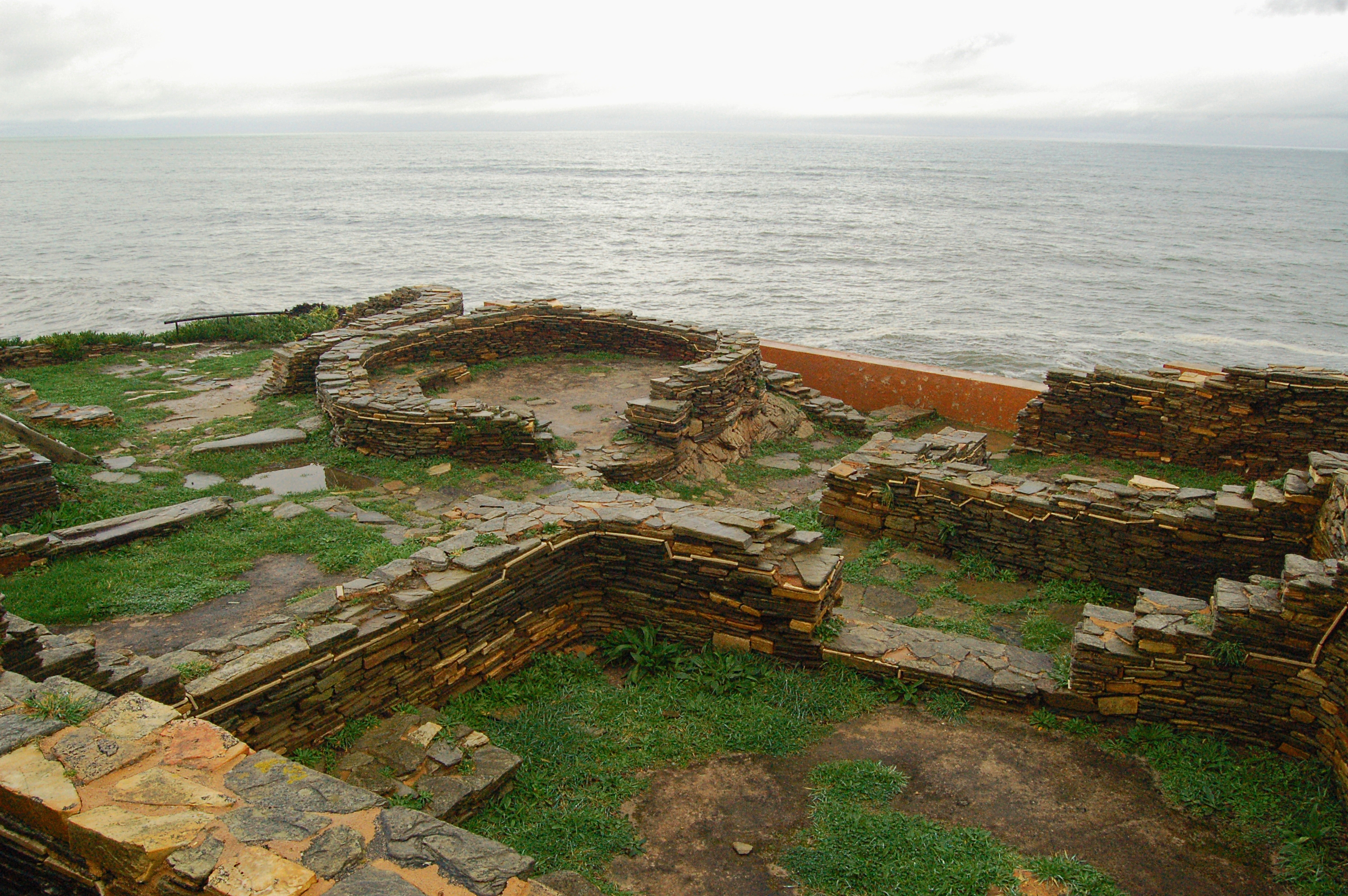
Castro de Fazouro
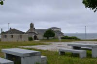
The whole province of Lugo is dotted with remains of ancient settlements known as castros. The excavation works at this castro were carried out in two separate periods: 1963-1965 and 1988-1992. Remains found at this castro indicate that is was inhabited from the end of the 1st century to the 3rt century A.D. For this reason, and due to the Roman influence, the buildings have square and rounded corners, as well as square plan. It includes rooms devoted to different uses: some were used as dwellings, others were used as kitchens, etc. Besides, remains of cattle have been found, which evidences that livestock farming was practiced.
Multimedia


Downloads
GPS Downloads
Cyclability
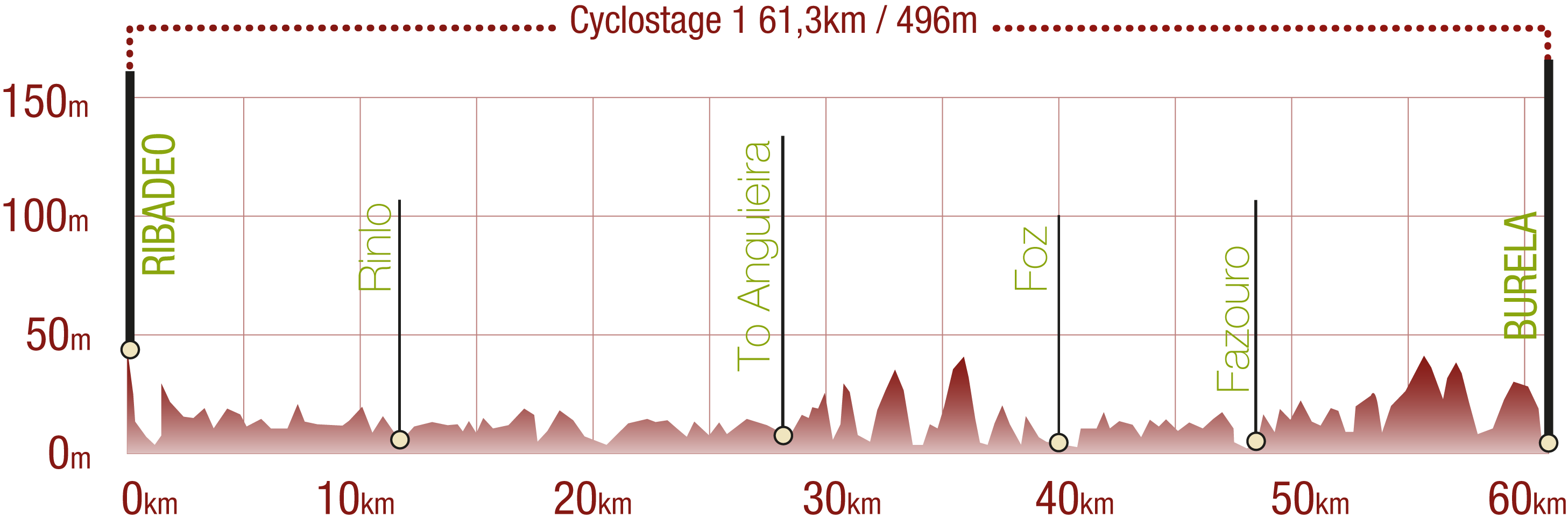
This Cyclostage corresponds to stages 1, 2 & 3 of the Nature Trail
PROFILE
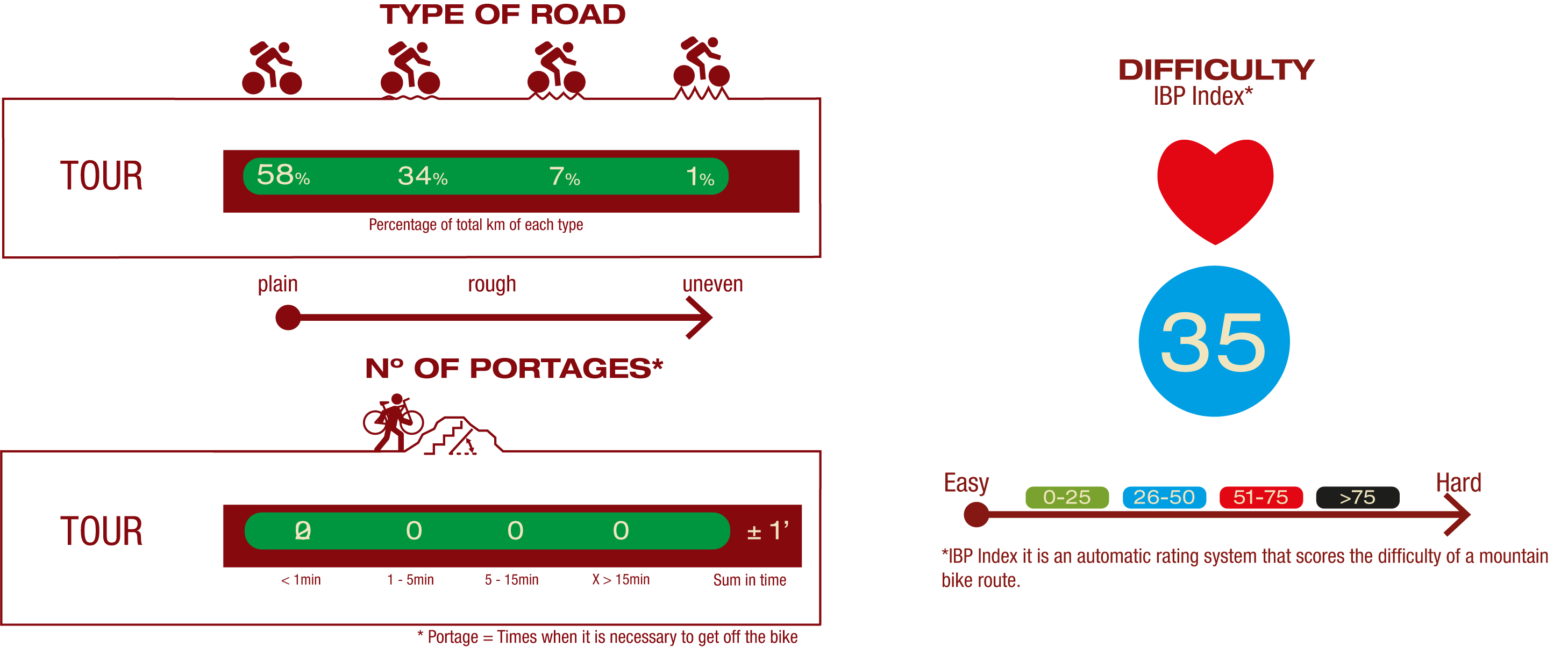
TYPE OF ROAD, PORTAGES & DIFFICULTY
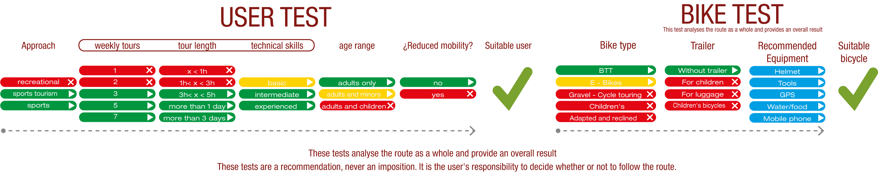
TEST
SAFETY RECOMMENDATIONS
- Sections shared with hikers.
- Transit through the centre of some population centres.
GENERAL RECOMMENDATIONS
- Find out about the technical aspects of the route and the weather on the day.
- Take care of the environment. Take care not to disturb animals or damage vegetation. Respect private areas.
- You must give priority to pedestrians and comply with general traffic rules.
- The environment in which you will be riding is open, free to move around and an area where many activities are carried out (sporting, forestry, livestock and agricultural activities). Always have an understanding, prudent, responsible and respectful attitude.