
- Home
- Rural Development
- Nature Trails
- Nature Trails
- Northwest Sector
- Ruta del Cantábrico
Stage 2. Las Catedrales - Foz
Description
Leaving the monumental Las Catedrales beach behind, the trail runs around the pretty Foz-Masma ría.
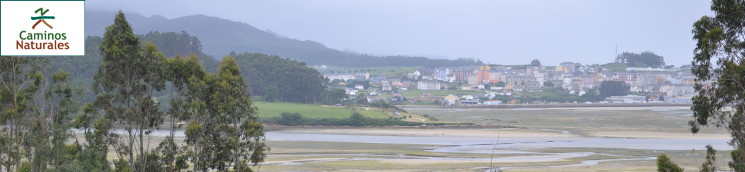
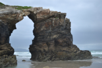
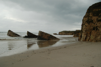
At this stage, the traveller waves goodbye to the Las Catedrales beach, a Nature Monument by taking wooden footbridges and enjoying the viewpoints where this paradise-like place is better admired. The trail continues, leaving behind many charming beaches until it reaches the mouth of the Masma river, which forms the Foz-Masma ría, which has been included on the Natural 2000 Network as a Site of Community Importance (SCI) and a Special Protection Areas for Wild Birds (SPAB). Finally, this stage end on the pretty town of Foz, which boasts a long fishing tradition.
The second stage of the Cantabrian Sea Nature Trail starts at the Las Catedrales beach and ends at the fishing village of Foz, running for a little over 21 km.
The traveller, a little after starting the trail, takes a wooden footpath which runs parallel to the LU-P-610 toad and to the Las Catedrales beach, and features viewpoints and balconies from where to enjoy the view.
The wooden footbridge ends at the beginning of the Arealonga beach, and the trail turns into a paved road running between the beach and the LU-P-610 road. This long beach houses, in its widest sections, patches of seaside vegetation of botanical importance, as well of all services needed to enjoy a good swim.
On kilometre point 2, the trail runs along the Rego do Forcón creek, almost at the end of the Arealonga beach, and then continues by a shale path that runs along the top of the cliff. The trail reaches then the Punta do Castro, where the remains of the castro, or ancient fortified village that existed on this small peninsula on the Cantabrian Sea, may be admired.
A gentle slope takes the traveller past the small As Pasadas beach and the Punta Corveira point to the Lóngara beach and kilometre point 4 of this stage. The Nature Trail, which at all times runs along the seafront promenade, zigzags along the shape of the cliffs, and reaches the Fontela beach, with its benches and viewpoints, where the traveller can take a break and regain their strength while enjoying the beautiful landscape.
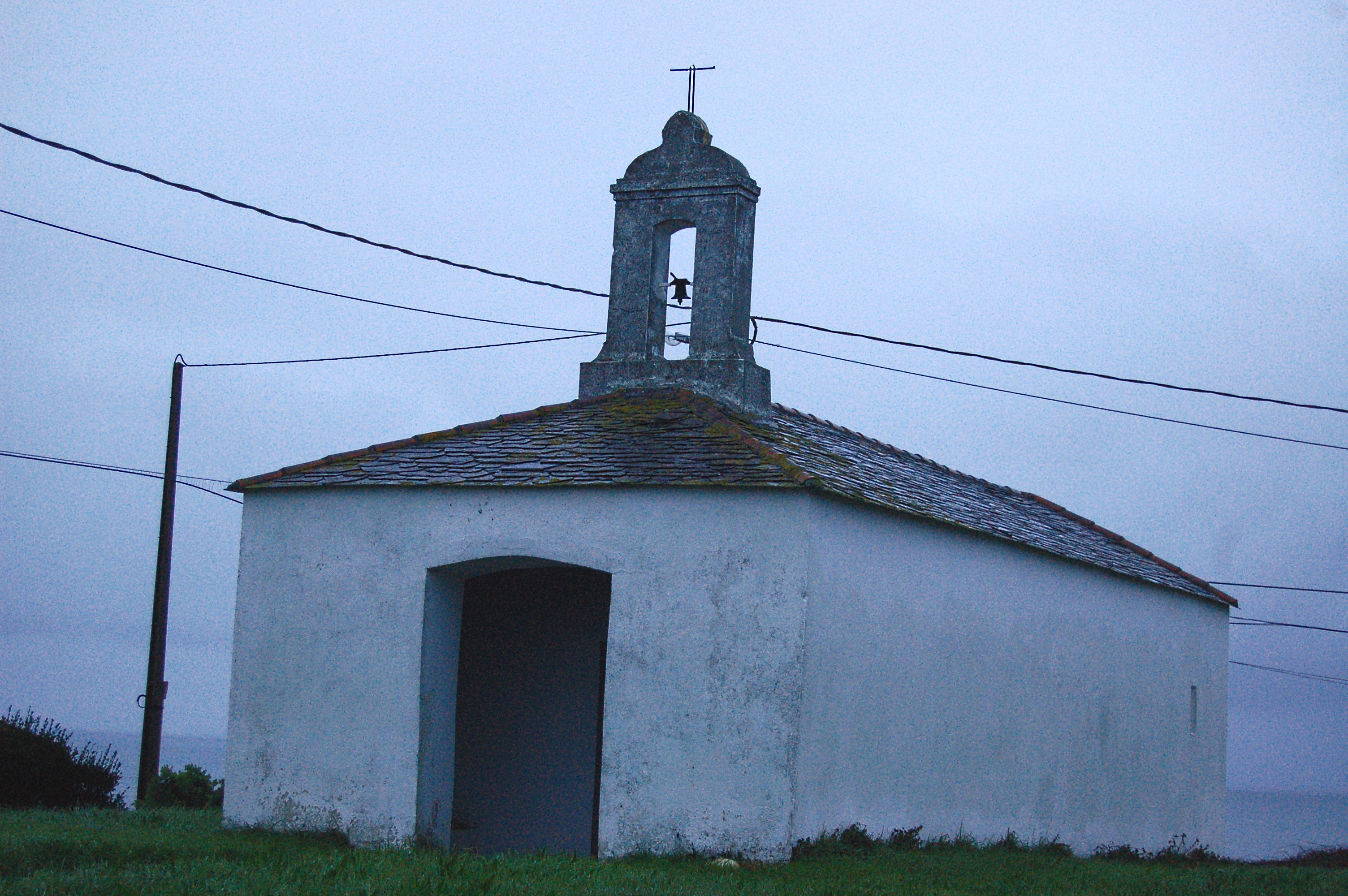
After hitting kilometre point 6 of this stage at the Coto beach, the trail continues along a wooden footpath which ends a few metres ahead of a car parking lot which coincides with kilometre point 7. The trail descends a gentle slope, leaving behind the Remior Cliffs, with the coastline at the traveller's right and a series of suburbs at their left, until reaching the San Bartolo beach, where the traveller may visit the nearby San Bartolo shrine.
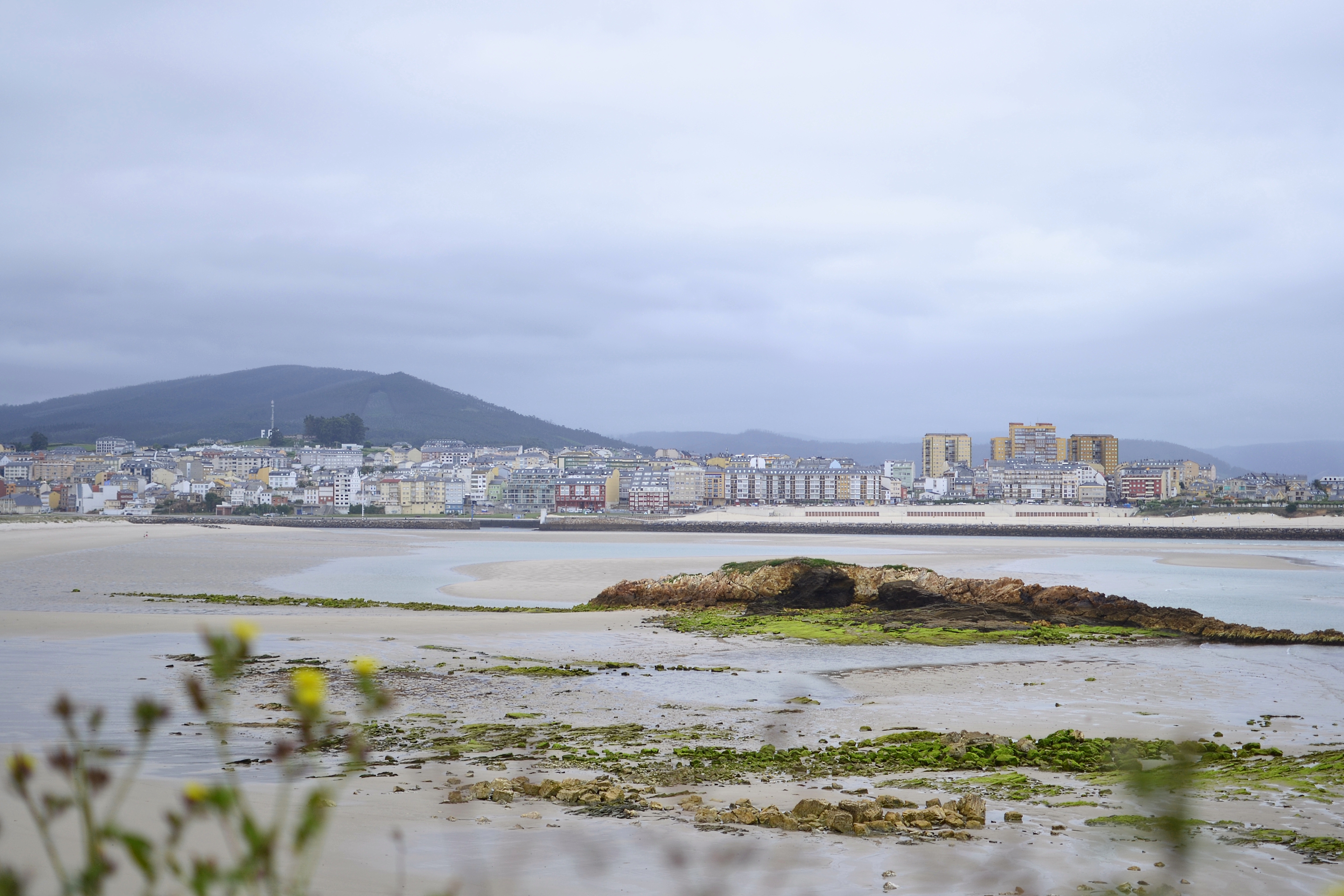
After leaving behind the Punta de Prados point, the traveller may see the village of Foz at the opposite bank of the ría of the same name, although not even half of this stage has been completed. The trail then turns south only to circle the ría, which shall take several kilometres.
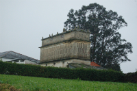
At kilometre point 10, the trail turns left and a few metres after turns right. From this point, the trail continues along the road, so please be especially cautious. A few metres after taking this road, the trail turns right to avoid this type of road; after two crossings, it takes the dirt road that lies to the right, where the traveller can admire an hórreo, or elevated traditional granary typical of Nortwestern Spain. This is of the Barreiros style, and has four floors.
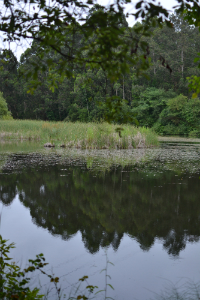
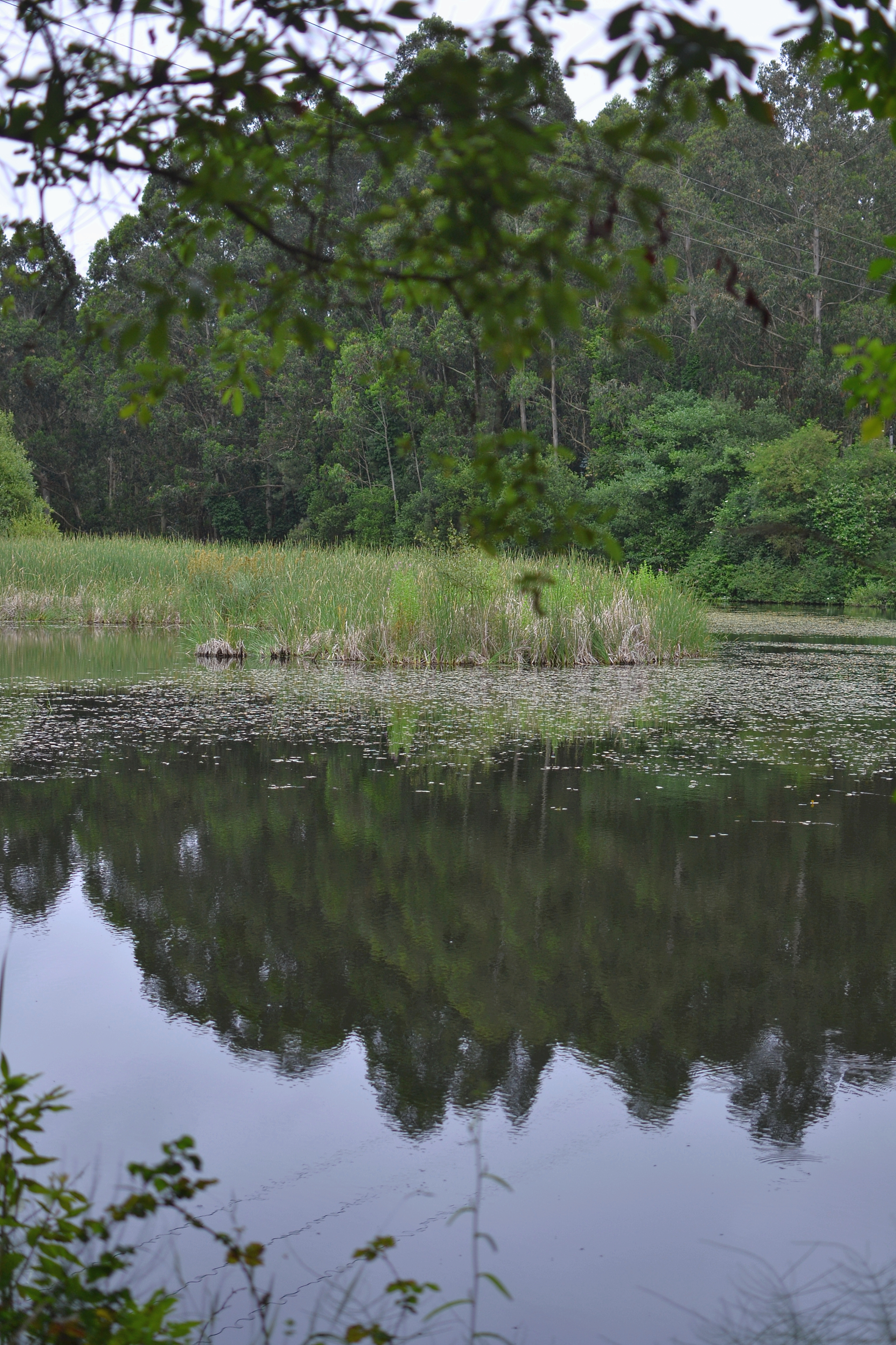
Afterwards, the trail enters a small wood patch of eucalyptus known as Os Pasos. When this path ends, the trail takes an asphalt road that runs between patches of Monterey pines (Pinus radiata) and Tasmanian blue gum (Eucalyptus globulus). Shortly after kilometre point 12, a section ascending along a slope begins. At the following crossing, the trail turns right and enters a dense eucalyptus patch before reaching the Laguna de los Patos lake. The traveller circles the lake by its right bank while enjoying this unique landscape. A few metres before reaching kilometre point 14, wide dirt path shred with motor traffic begins.
The trail descends an asphalt road until reaching the N-642 road. At this point, the trail turns right and continues by a wide dirt path which runs parallel to this road. It crosses the mouth of the Masma river by a wooden footbridge. The Masma river, when discharging to the sea, forms the Foz ría. The trail continues, some of its sections being wooden footbridges. A few metres after kilometre point 16, the trail turns right and, once on the left bank of the Foz-Masma ría, runs along a wide dirt path.
At kilometre point 17, the trail runs across the A Tellada residential area. The trail turns left and leaves to its right the path that leads to the Fondás beach. The trail continues turning right and takes an asphalt road, then turning right again by a dirt path. A little afterwards, the trails turns sharply to the left, hits kilometre point 18 and crosses a small wooden footbridge. After this footbridge, the trail takes the dirt path to its right.
Leaving the Foz ría to its right, the trail winds across a patch of eucalyptus and turns a little away from the ría bank so as to avoid its ins and outs. After a few metres along an asphalt road, the trail takes a dirt path to its right and runs again along the ría bank. The trail leaves the local football pitch behind, to its left, and turns right at the following crossing.
It continues along the dirt path until it is completed, and takes the Rúa Asteleiros street to its right, which shall lead the traveller to the Foz port. At the beginning of the Travesía da Riveira and the docks, the Cantabrian Sea Nature Trail layout coincides with that of the San Rosendo Nature Trail. A few metres afterwards, in a garden by the port, the traveller finds the information board that marks the end of stage 2 of the Cantabrian Sea Nature Trail between Las Catedrales beach and Foz, and the beginning of stage 3 between Foz and Burela.
Sites of interest
Map
Puntos de Interés
Cultura
Hidrografía
Infraestructura
Municipio
Orografía
Profile
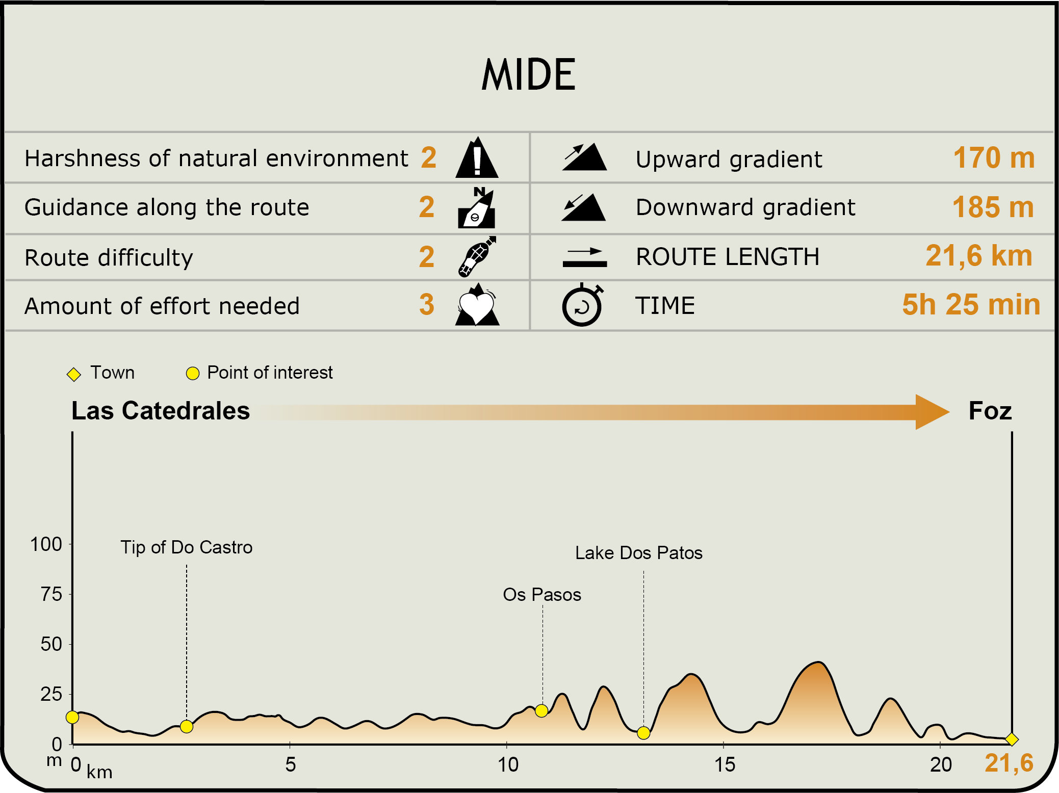
MIDE (Method for the Information of Excursions)
 Harshness of natural environment
- 1. The environment is not risk-free
- 2. There are more than one risk factors
- 3. There are various risk factors
- 4. There are quite a lot of risk factors
- 5. There are many risk factors
 Guidance along the route
- 1. Well defined trails and crossings
- 2. There is a clearly marked trail and signage
- 3. Requires the identification of geographic features and cardinal points
- 4. Requires off-path navigation
- 5. The trail is interrupted by obstacles that have to be gone around
 Route difficulty
- 1. Walking on a flat surface
- 2. Trails with different types of path
- 3. Walking on stepped paths or irregular terrain
- 4. The use of hands or jumping over the terrain is necessary
- 5. The use of hands is required to progress
 Amount of effort needed
- 1. Up to 1 hour of continuous walking
- 2. Between 1 and 3 hours of continuous walking
- 3. Between 3 and 6 hours of continuous walking
- 4. Between 6 and 10 hours of actual walking
- 5. More than 10 hours of continuous walking
Featured
Further information
SCIs and SPABs in the Foz-Masma ría
The Foz-Masma ría is a part of the Natura 2000 Network as a Site of Community Importance (SCI) and a Special Protection Areas for Wild Birds (SPAB), as well as a part of the Galician Network of Nature Protected Areas, and is included as an Area of Special Protection of Nature Values.
The ría is formed by the discharging of the Masma river into the sea. The Masma has its source in the Xistral hills, at an altitude of 920 m, and, after a course of a little over 46 km, discharges in the Cantabrian sea. The ría is a wide, calm body of water which is protected from the open sea mainly by the Altar de Barreiros beach and the A Rapadoira de Foz beach. For this reason, the vegetation formations irrigated by brackish waters and the communities of sea birds that are developed in this beautiful environment are of great ecological importance.
Foz
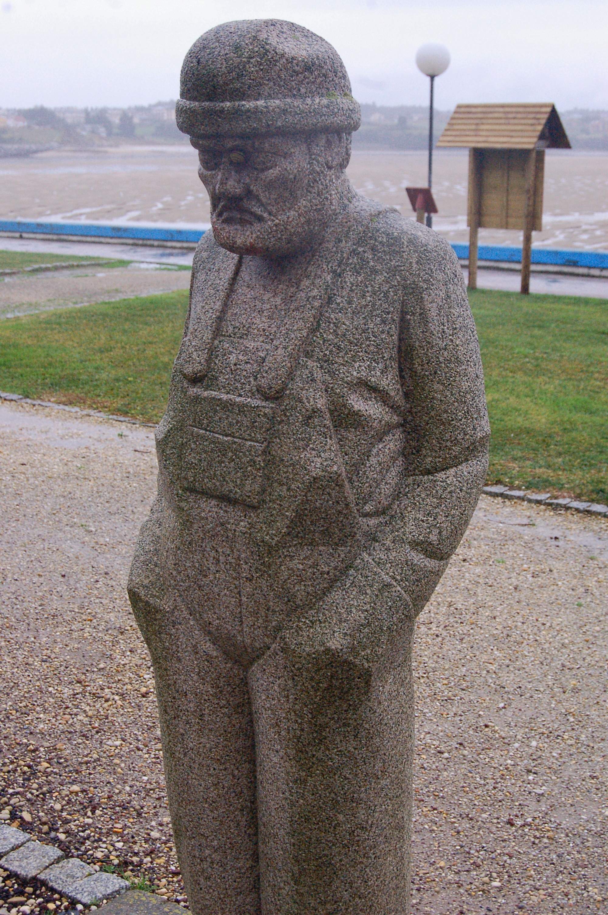
A town in the province of Lugo which belongs to the La Mariña county, which is composed of nine parishes, the most important of them being the parish of Foz. The village as such dates back to Roman times, although settlements from pre-Roman eras have been documented. The fishing sector has been of vital important to Foz's history, although the service sector is the most important from a financial perspective. Protected natural spaces are linked to the aquatic medium, and the main tourist attractions of the town are its many beaches. Besides, Foz has a rich architectural heritage, of which the Basilica of San Martín de Mondoñedo, the Castro de Fazouro and the A Frouxeira fort are especially noteworthy. Foz also has a rich ethnographic heritage, and the popular festivals dedicated to the Virxe do Carmo (Our Lady of the Mount Carmel) on 16 July and San Lourenzo (St. Lawrence), on 10 August.
Multimedia


Downloads
GPS Downloads
Maps
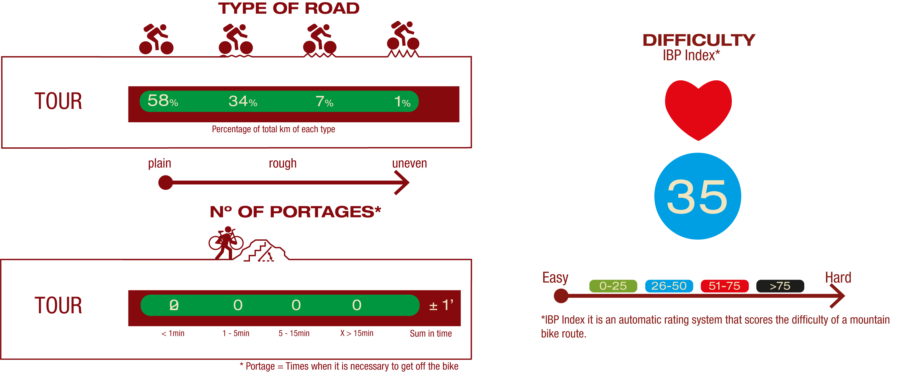
Cyclability
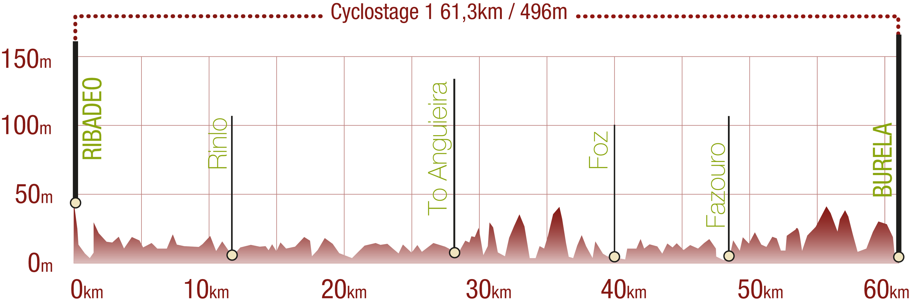
This Cyclostage corresponds to stages 1, 2 & 3 of the Nature Trail
PROFILE
TYPE OF ROAD, PORTAGES & DIFFICULTY
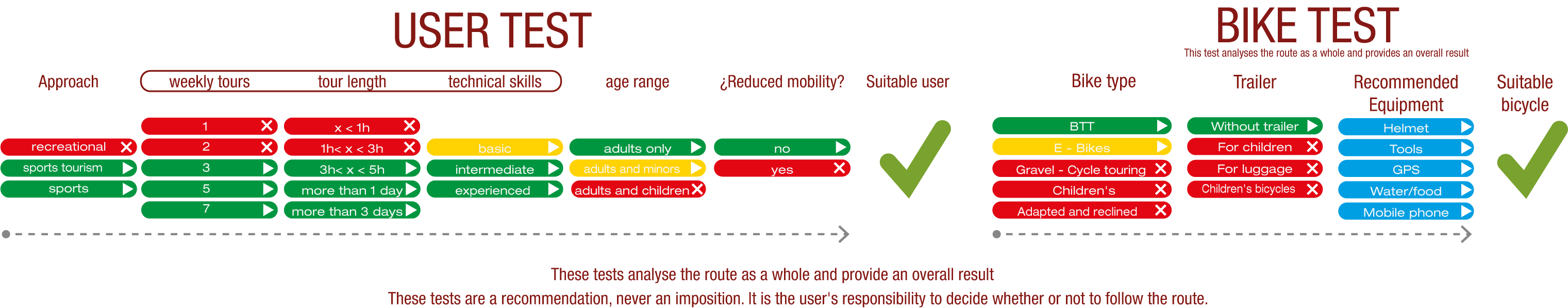
TEST
SAFETY RECOMMENDATIONS
- Sections shared with hikers.
- Transit through the centre of some population centres.
GENERAL RECOMMENDATIONS
- Find out about the technical aspects of the route and the weather on the day.
- Take care of the environment. Take care not to disturb animals or damage vegetation. Respect private areas.
- You must give priority to pedestrians and comply with general traffic rules.
- The environment in which you will be riding is open, free to move around and an area where many activities are carried out (sporting, forestry, livestock and agricultural activities). Always have an understanding, prudent, responsible and respectful attitude.