Baix Ebre section
Description
Among allotments and rocky faces
The Baix Ebre (Lower Ebro) section of La Val de Zafán Nature Trail is the final section of the old railway track of the Val de Zafán, a route that began in the Teruel town of Alcañiz and crossed the Bajo Aragón to enter Tarragona through the Terra Alta region.
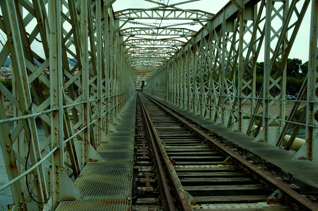
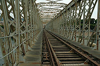
The entire route has been renovated and signposted from Xerta and each of the old stations has a picnic area and an interpretation panel. The start of this route is located next to the Camí dels Codonyers, close to the crossing of the C-12 highway, next to kilometre 18 and very near to the Sports Stadium of Tortosa. If you follow the rails to your rear, you will reach a metal railway bridge over the River Ebro, with Tortosa’s modern station on the other side, where the old overhead cables of the infrastructure are still preserved.
After coming to an information panel, you cross over the River Ebro’s right-side canal, reaching Ferreries, an industrial area with large warehouses, to subsequently pass under the TV-3421 highway. An ancient bridge preserved from the old railway structure and a sign for the GR-99 tells trail users they are going in the right direction.
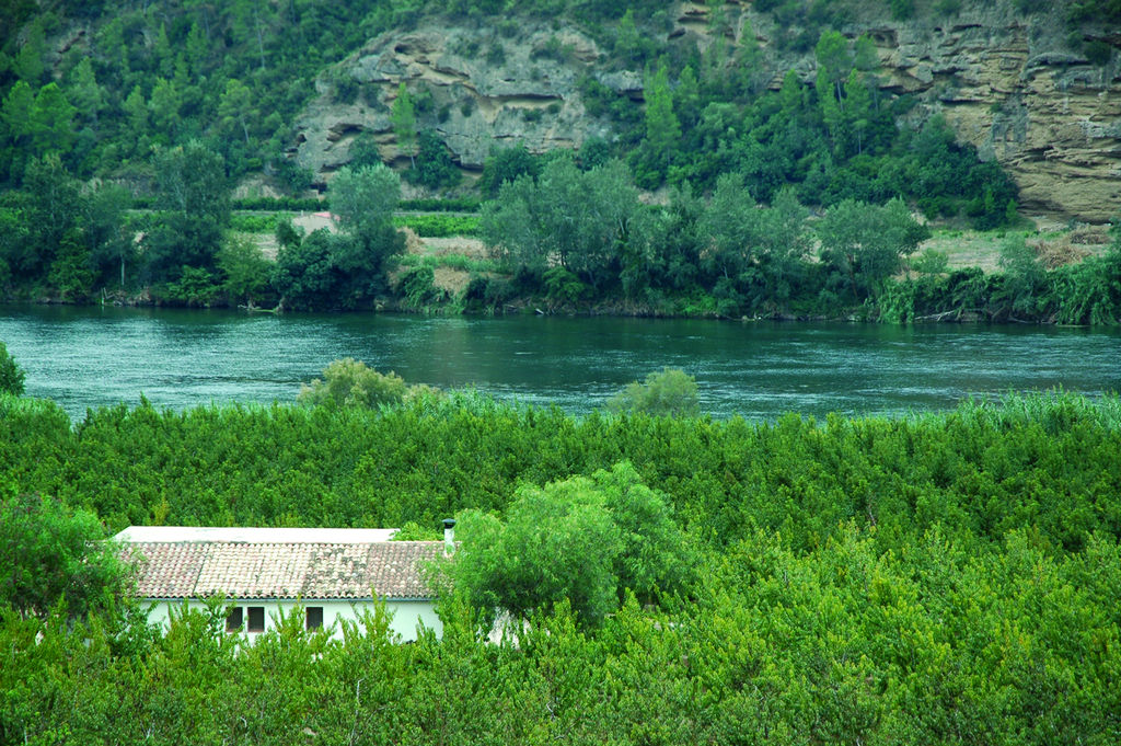
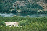
Continue along Calle Vial de Val de Zafán, crossing a roundabout, as far as a picnic area close to the town of Roquetas. After several intersections with roads, you will reach the old station of Aldover, a town that offers trail users its interesting river plate on the banks of the River Ebro.
The Trail, which runs along the old railway track, crosses orange tree orchards, Mediterranean hackberries (Celtis australis) and reedbeds, and passes under the C-12 highway to turn into a concrete track with a painted line in the middle. The route, which up until now has run between allotments and towns, gradually discovers a more rural and natural scenery, parallel to the C-12 highway, which coincides with the River Ebro Path (GR-99) from the Barranco de la Conca.
The concrete track turns into a dirt surface until it meets the C-12 highway. The route covers some 200 m along the left shoulder and you have to be very careful when crossing it as there is very heavy traffic. Once you have crossed over, take the old road until you reach a petrol station. The Trail passes once again under the road, approaching the River Ebro’s right-side canal and running next to it until you turn to the left to enter the town of Xerta.
Bordering the Church of La Asunción y San Martín, the path turns to the right and, once again, to the left at the following intersection. After crossing Calle de Antoni Anyón and the Gandesà road, the path turns to the right to reach Xerta station.
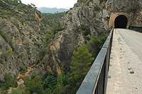
Leaving behind you an unusual lunar clock next to the road and a standing bridge-shaped monument that pays tribute to the builders of the floodgates of the River Ebro’s right-side canal, the Trail continues for a stretch that is only separated from the C-12 highway by a crash barrier. Straight ahead, you can see Els Ports mountain range, which separates the River Ebro from the Terra Alta region.
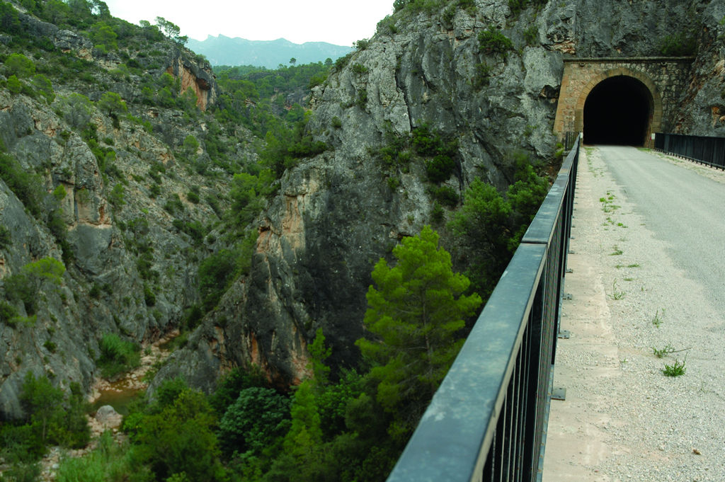
Further on, you will come to the ancient Xerta dam, which is always under maintenance due to the aggressive nature of the flooding and swelling of the behemoth of water known as the River Ebro. The Trail moves away from the river bank, entering the first of the many tunnels that you will cross all the way to the end of the route.
You must have a torch handy as another sixteen tunnels are still awaiting trail users, some of which are very long and, although originally they had electric lighting, on occasions it may not be in working order.
The C-12 highway runs close by the Trail and under it. You will soon come to the town of Benifallet, on the other bank, hidden behind a bend in the river. After entering several more tunnels, you finally leave the company of the River Ebro to plunge into the ravine of La Canaleta.
In this way, you will reach Benifallet station, which is currently under repair. If you want to visit the town, it is located 4.5 km away along the GR-7. A couple of ruined buildings appear on the way, probably the houses of road workers engaged in building and servicing the railway track and, after another tunnel, the route passes over to the other bank of the ravine via a viaduct.
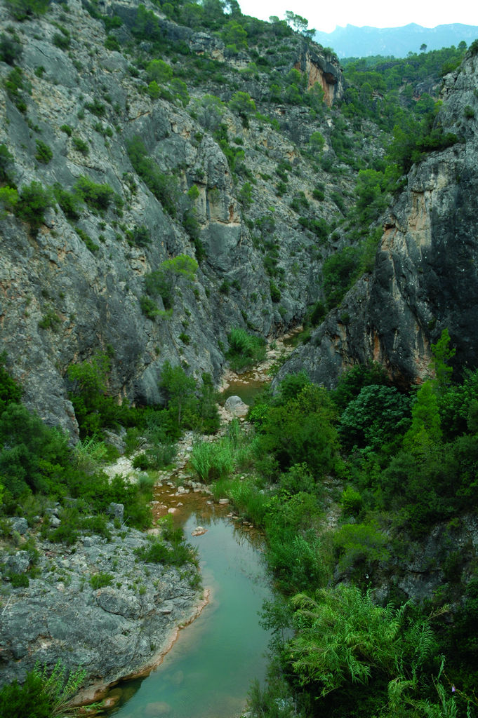
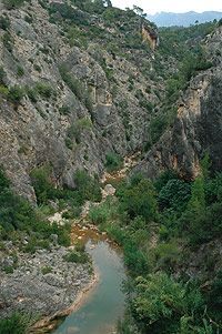
Now, you walk along the left bank of the River Canaletas. Several terraces, refurbished with benches, allow trail users to enjoy spectacular views of the canyon, a narrow river plain where small allotments and reedbeds appear which, as the Nature Trail continues, become gradually narrower transforming the landscape into spectacular vertical limestone faces, where caves and hollows abound, while pine woods and heather (Erica sp.) grow on the steep hillsides.
A little while after crossing the last of the tunnels, the Trail ends at the old station of Pinell de Brai, located at the exit of a tunnel next to the T- 324 (N- 230) highway, at kilometre 14, where there is a vehicles entrance and a car park.
Sites of interest
Profile
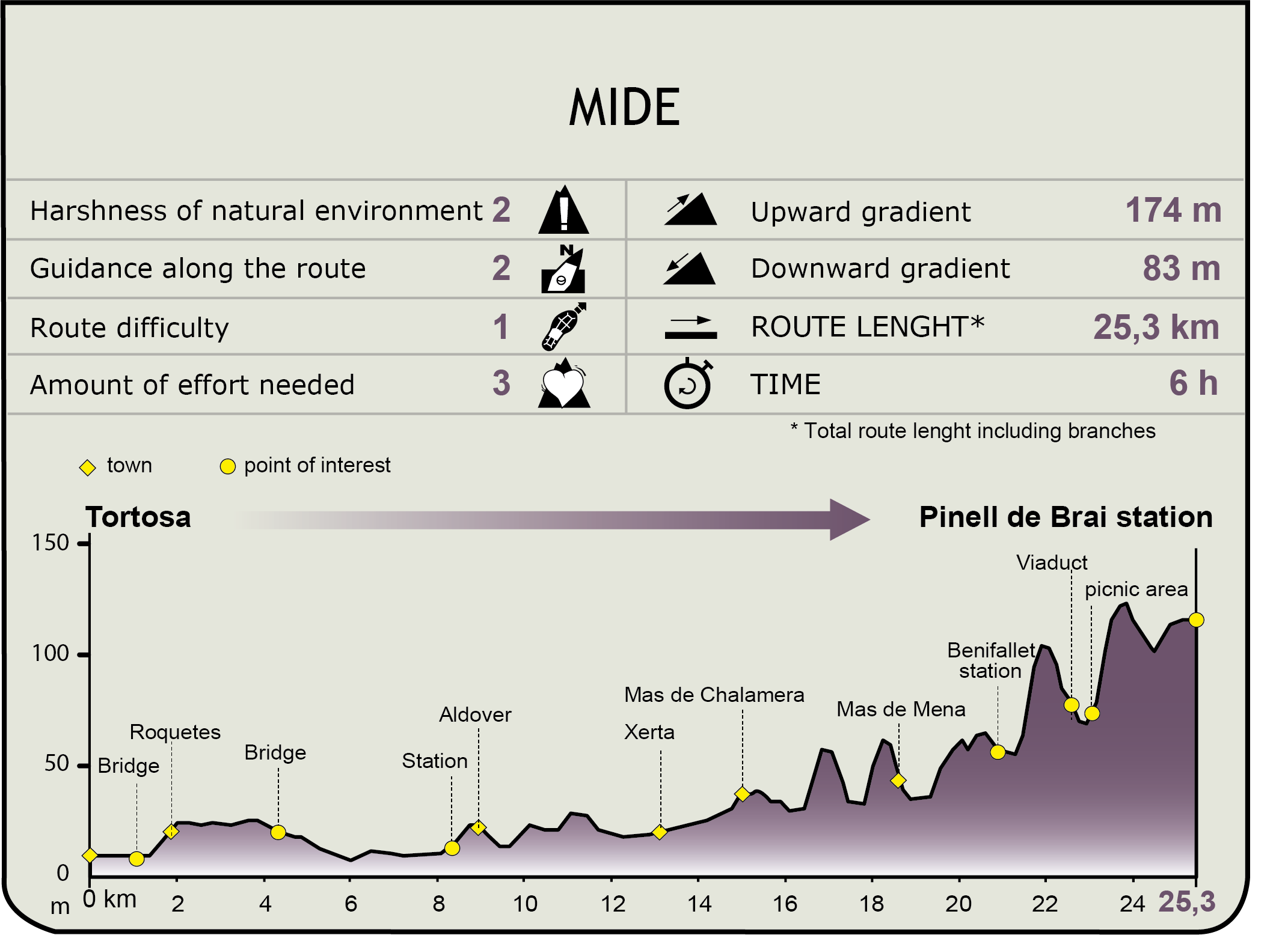
MIDE (Method for the Information of Excursions)
 Harshness of natural environment
- 1. The environment is not risk-free
- 2. There are more than one risk factors
- 3. There are various risk factors
- 4. There are quite a lot of risk factors
- 5. There are many risk factors
 Guidance along the route
- 1. Well defined trails and crossings
- 2. There is a clearly marked trail and signage
- 3. Requires the identification of geographic features and cardinal points
- 4. Requires off-path navigation
- 5. The trail is interrupted by obstacles that have to be gone around
 Route difficulty
- 1. Walking on a flat surface
- 2. Trails with different types of path
- 3. Walking on stepped paths or irregular terrain
- 4. The use of hands or jumping over the terrain is necessary
- 5. The use of hands is required to progress
 Amount of effort needed
- 1. Up to 1 hour of continuous walking
- 2. Between 1 and 3 hours of continuous walking
- 3. Between 3 and 6 hours of continuous walking
- 4. Between 6 and 10 hours of actual walking
- 5. More than 10 hours of continuous walking
Featured
Further information
Tortosa
Its origin possibly lies in the city of Hibera, an Iberian capital, whose settlement could have been on the hill where La Zuda castle is currently located. It still contains elements from the alAndalus period and is built on a Roman acropolis.
During the Roman empire, this town was known as Dertosa and subsequently, on being occupied by the Muslims in 740, was called Turtuxa.
Tortosa has always been an episcopal seat, and its city centre still houses many Christian buildings, such as the Convent of Santa Clara and the Cathedral of Santa María, located on the Roman forum, which was subsequently a mosque and much later a Romanesque Seo.
The main noteworthy architectural treasures of this lively city include the Renaissance Royal Colleges, the Jewish quarter, as well as diverse palaces from different eras and the modernist buildings of the market and the abattoir.
Multimedia