- Home
- Rural Development
- Nature Trails
- Nature Trails
- Northeast Sector
- Somontano de Barbastro
Stage 2: Alquézar-Las Almunias de Rodellar
Description
From Alquézar to Las Almunias de Rodellar via the narrows of the Balced
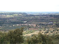
Although this stage is one of the longest and toughest on the Nature Route for its steep slopes, it is also contains the widest range of landscapes to be seen in the Natural Park of the Sierra y los Cañones de Guara: wander along the hillsides converted into fields and pastureland on the outskirts of Alquézar, Radiquero and Las Almunias de Rodellar, or lose yourself on a hill full of scrubland, gall oaks and hom oaks; walk between rock faces when the trail reaches the canyon of the Balced (as this section of the river Isuala is called) and discover the strange karst formations carved out by water.
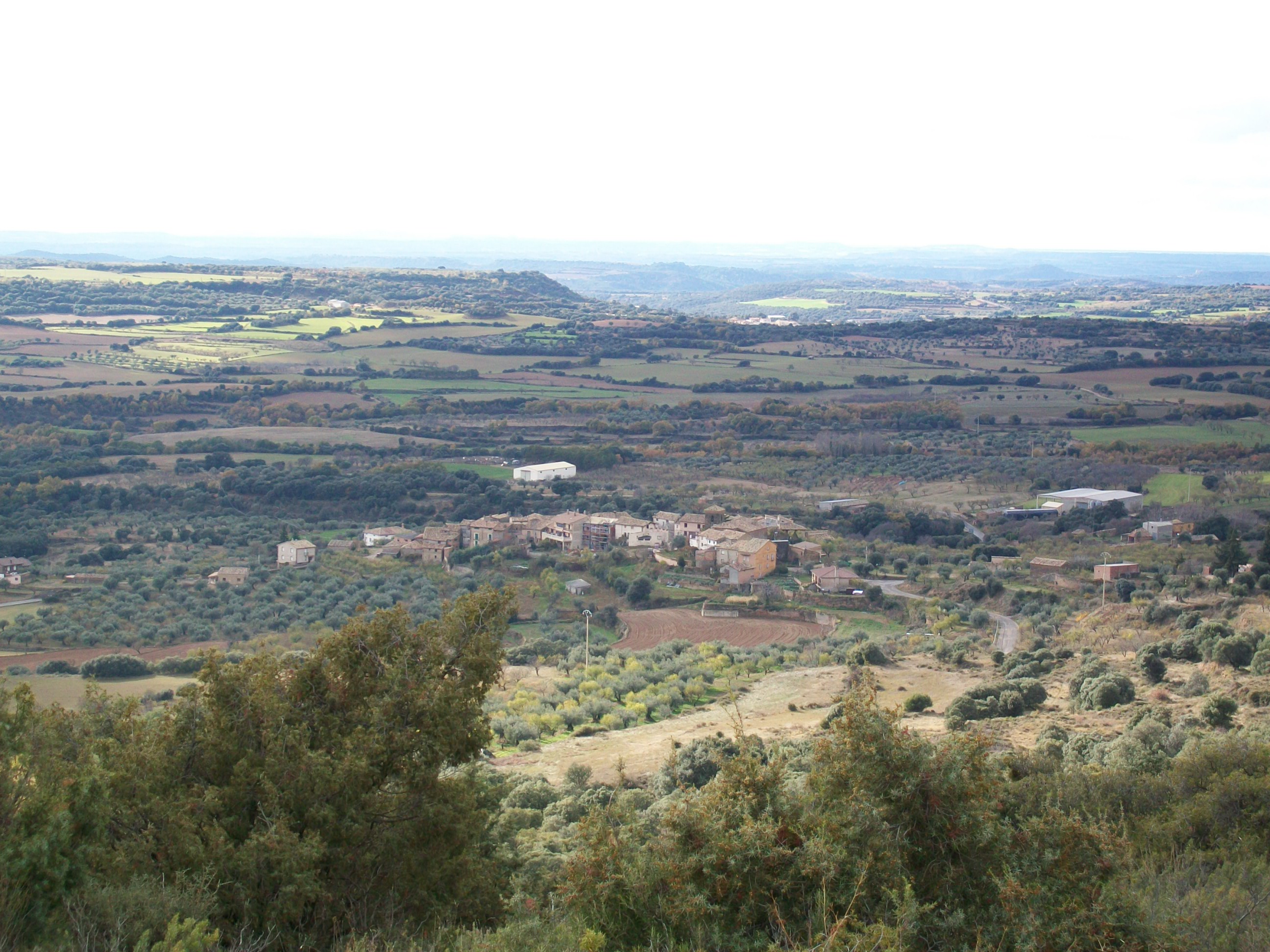
The second stage of the Nature Route commences at the same point as the first, in Alquézar, near the parish church of San Miguel Arcángel. Before setting off, take a moment to look around Alquézar, a historical town (dating back to the 9th century) that was declared a Historic-Artistic Site in 1982. The most notable feature, standing out from a hilltop, is the collegiate church of Santa María la Mayor. The first kilometres of this stage coincide with Stage 2, a circular route that takes you along the River Vero canyon, to the village of Colungo, and back to Alquézar.
The Route immediately enters the historical quarter of the town, running through cobbled streets surrounded by picturesque buildings for several hundred metres before leaving the town and heading north.
Then you come to a slope that heads in the direction of the hermitage of San Gregorio, passing close by a reservoir, the aljibe de San Gregorio. You pass along a broad forested track right at the diversion that takes you to the hermitage. Although the route continues along the forest trail, it's well worth paying a visit to the hermitage to see the fantastic views of Alquézar and the canyon of the river Vero. Another option is to pass by the church and keep walking until you reach a bird observatory, from where you can see carrion eating birds that come here to feed off the nearby 'muladar' (midden).
Continuing along the Nature Route through the forest trail for another kilometre, you come to a fork in the path. At this point Stages 1 and 2 separate. If you want to take Stage 1, take the narrower trail that heads off to the right, but in order to continue this Sateg, you must keep going by the forest trail.
Continue uphill in a northwest direction on the forest trail until you come to a hilltop where you have to take another broad trail that heads downwards to the southwest towards Radiquero. Just like the return trip to Alquézar from Asque in the previous stage, the first kilometres of this stage coincide with the GR 1.1 section of the GR 1 historical route.
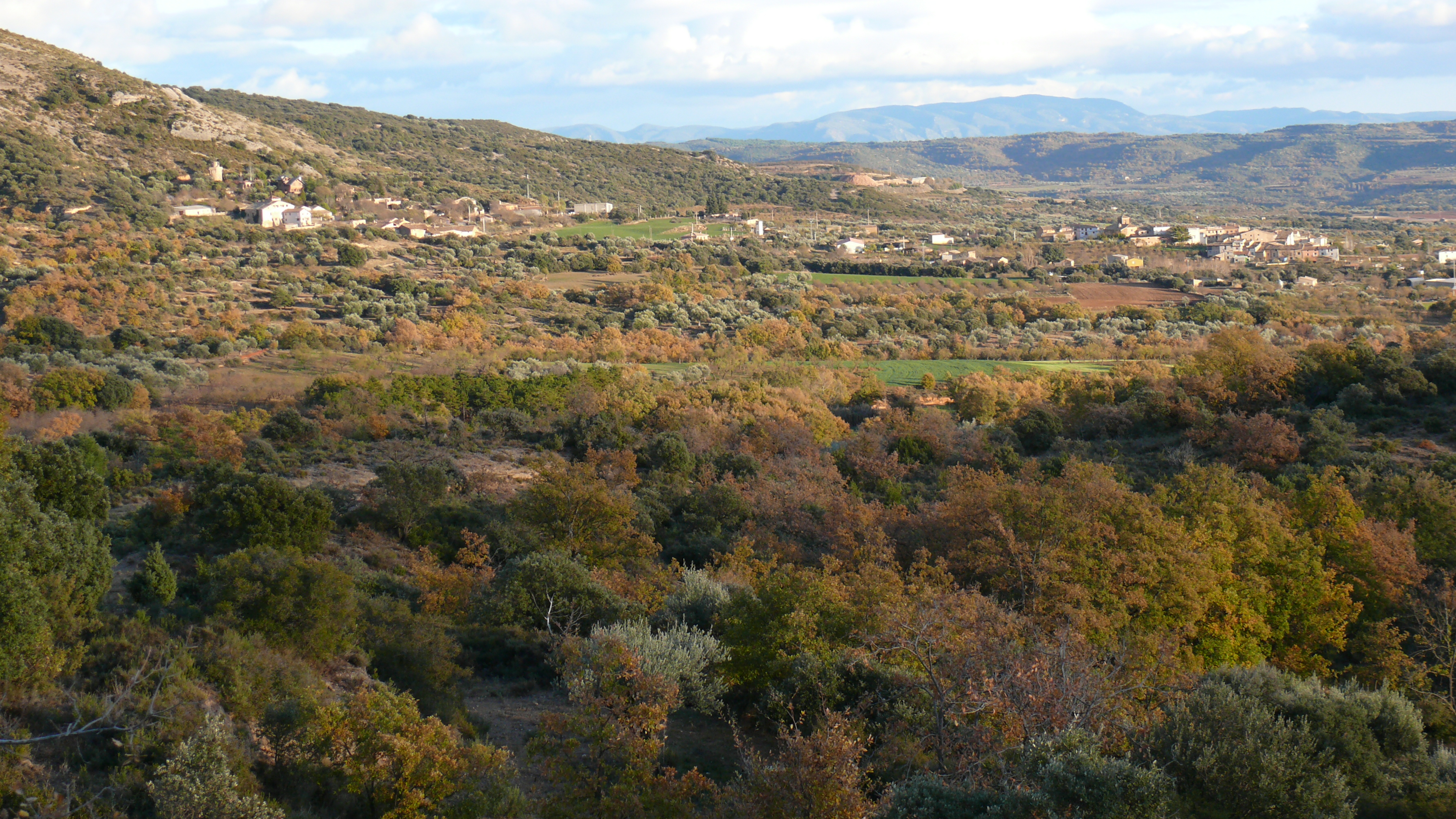
Before setting off downhill to Radiquero, a village that forms part of the municipality of Alquézar, stop to enjoy the views of a landscape that is typical of the Somontano de Barbastro, with wheat fields, vineyards (Vitis vinifera), olive groves (Olea europaea) and almond orchards (Prunus dulcis), that alternate with scrubland and slopes covered with groves of gall oaks (Quercus faginea) and holm oaks (Q. ilex).
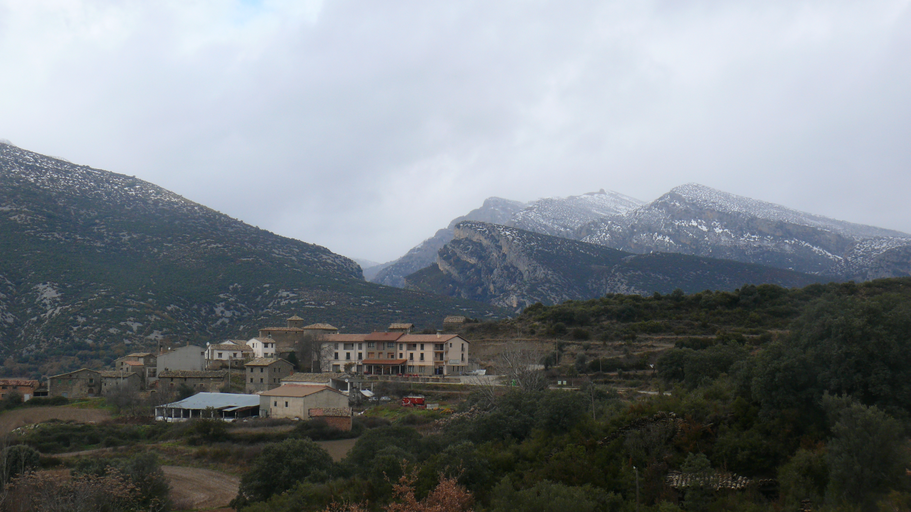
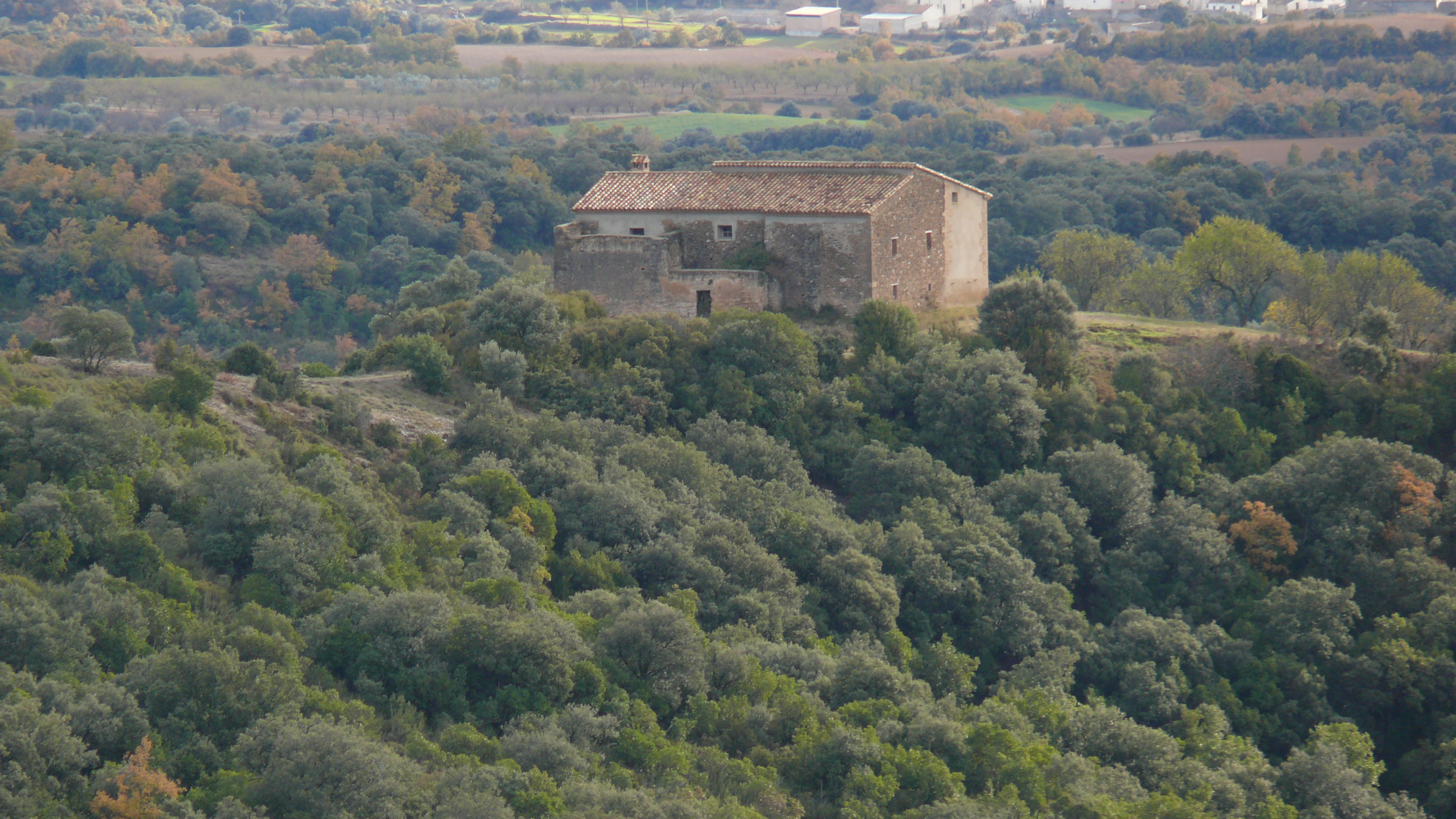
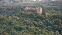
Once you reach Radiquero, walk through the village, passing by the church and you come to the A-1233, although the Route separates from the road almost immediately along a track that heads off to the northwest and takes you to the ruins of the hermitage of Santa Águeda, where we recommend stopping to take a break and enjoy the amazing views to be seen here.
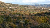
The next part of the route passes through land that was once an important area for livestock, but after gradually being abandoned has now been recolonised by a forest of holm and gall oaks. The slopes have also been repopulated by groves of Aleppo pine (Pinus halepensis).
After passing the Modovil ravine, take the old mountain trail, which is a bit narrower. It starts with a slight slope then zigzags upwards to the dividing line between this ravine and the gorge of the Avellaneras. Here the slope becomes gentler and the Route carries on along a slope covered with dense Mediterranean scrub until it crosses a wider track that takes you to the hermitage of La Virgen de la Viña.
Go left, and walk for about a kilometre downhill all the way to reach the hermitage. It's well worth the walk, since there is a beautiful view of the canyon of the Balced and the peaks of Guara. The simple church is the backdrop for a popular religious procession that takes place every 23 April, and a leisure and picnic area has been built nearby.
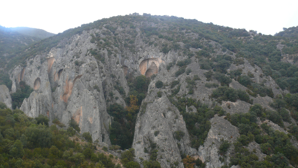
Head back to the main route and set off along a narrower track that passes through several limestone ravines. The intense erosion in this area has led to the vegetation prospering mainly on slopes that are less steep, or in the bottoms of valleys and small depressions, while the steeper areas are bare of vegetation, thus making what look like authentic walls of stone.
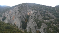
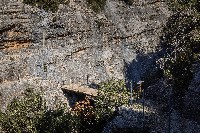
The basin of the Balced offers a wide range of rock formations throughout the Route and encourages the presence of Mediterranean forest, which was once intensely pastured and has a wealth of vegetation. Here you can discover kermes oak (Quercus coccifera), juniper and savin juniper (Juniperus sp.), rockrose (Cistus sp.), rosemary (Rosmarinus offinialis), strawberry trees (Arbutus unedo), lavender (Lavandula sp.) and thyme (Thymus sp.), as well as holm and gall oaks in the areas with deeper soil and Scots pines (Pinus sylvestris) in shadier areas. A testimony of the region's pastoral importance can be found in the area called the Corral Nuevo, where large flocks where brought together on their way through the sierra.
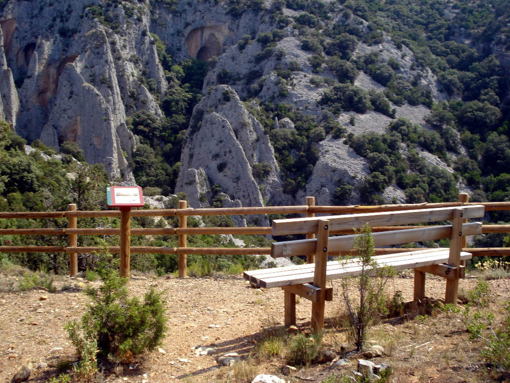
Now the route comes to Las Palomeras, an area of great geological value. The limestone terrain here has been highly eroded and given shape by water, and seen from the south at a distance looks like a flock of doves.
Continue and cross a narrow ravine (Barranco de Cautiecho) on the bridge of Las Bruxas. Normally, in this intricate and inaccessible terrain, where the silence is only broken by the sound of the wildlife that lives there, the water courses are seasonal. However, after heavy rainfall, this area can offer the spectacular sight of a veritable explosion of water that descends via a multitude of water courses.
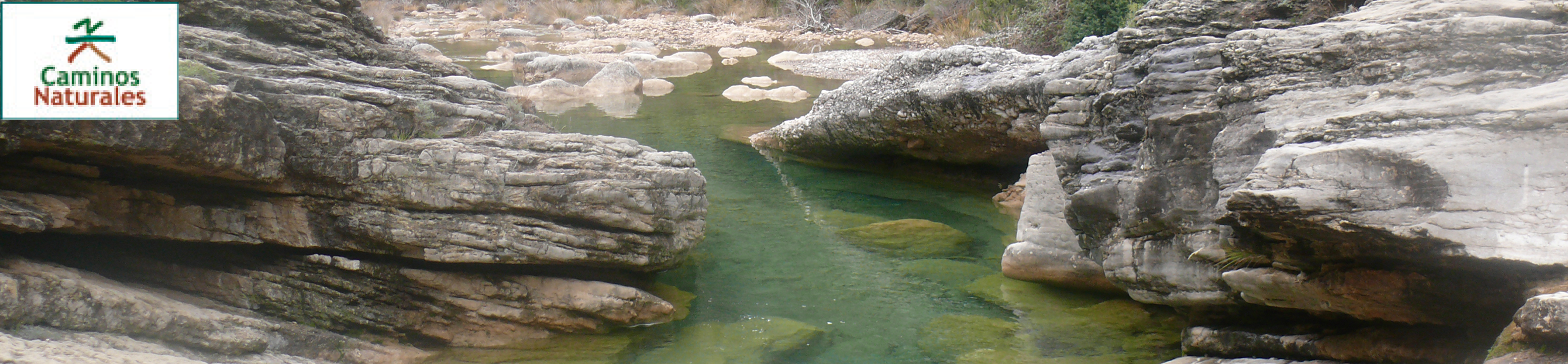
The Route continues along the left hand side of the Balced canyon, passing through small ravines and heading down to the river in the area called Tranco de las Olas. Cross the river over a rather unique structure made of metal located at a point where the river narrows. Here you can see the Marmitas de Gigante, a set of unique rock formations in the river bed caused by water erosion and small stones that gradually widen the walls of small natural wells.
Cross to the other side of the river, where the route finally leaves the Balced canyon and continues along the valleys excavated from the rock by their tributaries. Now there is a tough ascent that culminates at the crossing point with a forest trail at the point called the Collado de Las Almunias. Here you can find a rest area and one of the main access routes to the narrows of the Balced, along with some parking areas for people who want to take the forest trail to the west.
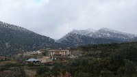
The Route leaves the trail at Collado de Las Almunias and continues along a narrow path that goes downhill all the way. As the valley opens up you can see the surrounding area of the village of Las Almunias de Rodellar, with fruit tree orchards and pastureland replacing the Mediterranean mountain.
Cross the HU-341, and head off down the last few hundred metres of this stage through the fields and pastureland of Las Almunias del Rodellar, a small village that forms part of the municipality of Bierge, where this stage ends.
Profile
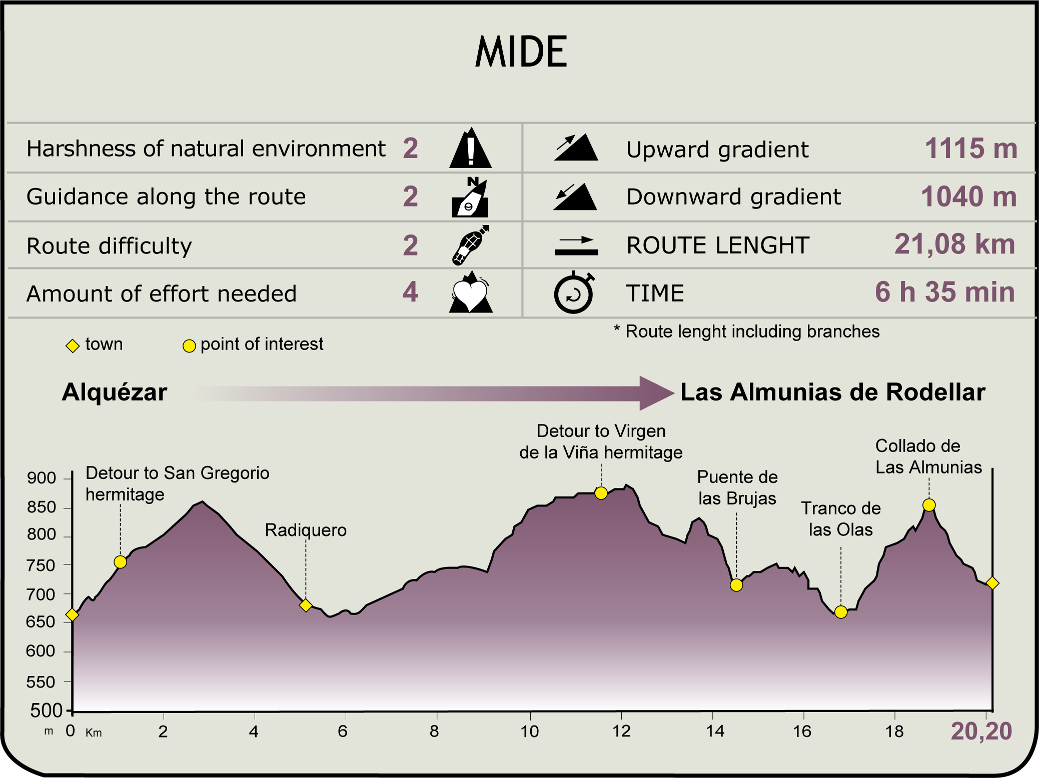
MIDE (Method for the Information of Excursions)
 Harshness of natural environment
- 1. The environment is not risk-free
- 2. There are more than one risk factors
- 3. There are various risk factors
- 4. There are quite a lot of risk factors
- 5. There are many risk factors
 Guidance along the route
- 1. Well defined trails and crossings
- 2. There is a clearly marked trail and signage
- 3. Requires the identification of geographic features and cardinal points
- 4. Requires off-path navigation
- 5. The trail is interrupted by obstacles that have to be gone around
 Route difficulty
- 1. Walking on a flat surface
- 2. Trails with different types of path
- 3. Walking on stepped paths or irregular terrain
- 4. The use of hands or jumping over the terrain is necessary
- 5. The use of hands is required to progress
 Amount of effort needed
- 1. Up to 1 hour of continuous walking
- 2. Between 1 and 3 hours of continuous walking
- 3. Between 3 and 6 hours of continuous walking
- 4. Between 6 and 10 hours of actual walking
- 5. More than 10 hours of continuous walking
Featured
Further information
Canyoning in the Sierra de Guara
The gorges of Guara were unknown until a Frenchman, Lucien Briet, discovered and explored them in 1904. His first journey of discovery included the gorges of El Gorgas Negras, La Peonera, El Vero and Mascún. In the 1950s a group of compatriots entered the gorge of La Choca for the first time. Then in the 1960s, groups of Spanish explorers discovered other gorges such as Otín, Gorgonchón, Cueva Cabrito, Chimiachas, etc. The Barranco d’os Fornazos was the last one to be discovered in 1996.
And now, although the times of exploration and discovery have ended, the Sierra of Guara still offers many hidden treasures to those who want to enter into the heart of the area, with more than 60 sports ravines that offer a wide range of techniques, settings and attractions. For this reason the region is now widely known as the cradle of canyoning in Europe and every year the number of visitors who come to do this sport increases.
All the gorges form part of the Natural Park of the Sierra y los Cañones de Guara, and so canyoning is regulated. This sport inevitably has some impact on the flora and fauna of the local ecosystems, and so visitors are responsible for minimising the effect of their presence by not touching animals or plants while they are in the gorges. After all, it's the canyoner who's the visitor here.
Multimedia