- Home
- Rural Development
- Nature Trails
- Nature Trails
- Northeast Sector
- Río Cidacos
River Cidacos Nature Trail
Description
A landscape carved by water
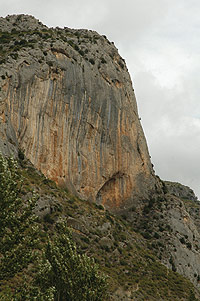
The River Cidacos is a tributary on the right-hand side bank of the River Ebro whose source is the Sierra of Montes Claros in Soria. In its final section, it bathes the fertile and productive meadowland where the towns of Arnedo and Calahorra are located and crosses the Biosphere Reserve - declared in 2003 - of the Valleys of Leza, Jubera, Cidacos and Alhama. Its numerous natural and cultural assets include its rocky cliffs and river canyons, which alternate with traditional terrace crops.
This route follows an old railway line that carved a path through the valley, which has been prepared for trekkers and cycling enthusiasts. The route is clearly defined and signposted, so you will be sure of the direction to take along almost the whole way, except when you arrive at the town of Arnedo, where you have to leave the old path marked by the train tracks to continue along a new one that runs parallel to the river.
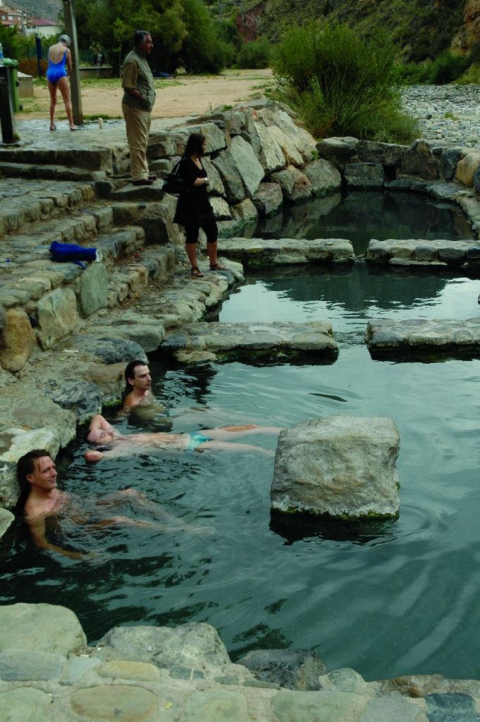
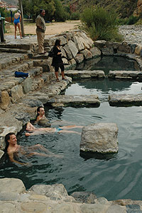
Its starting-point is the old train station of Arnedillo, which has recently been converted into a school, warehouse and bar. Next to this multi-purpose public centre, there are municipal swimming pools and, much closer to the river, some small public thermal water baths. Upstream, you can see the well-known health resort of Arnedillo, which is not far from where you can visit the remains of fossilised dinosaur footprints.
As soon as it begins, this Nature Trail takes advantage of a long 550-metre illuminated tunnel that passes under the town. On its exit, it crosses the River Cidacos via a modern concrete bridge, from where you can see the rocky outcrops that canalize its waters. The valley immediately opens up and the first fruit and olive tree orchards appear on the meadow among the stunted brushwood that has patiently colonised the hillsides.
A little further on, you come to the Viewpoint of Cidacos, where the Green Track of Préjano begins. Taking advantage of the old railway line, it climbs five kilometres to some mines located at the foot of Peña Isasa.
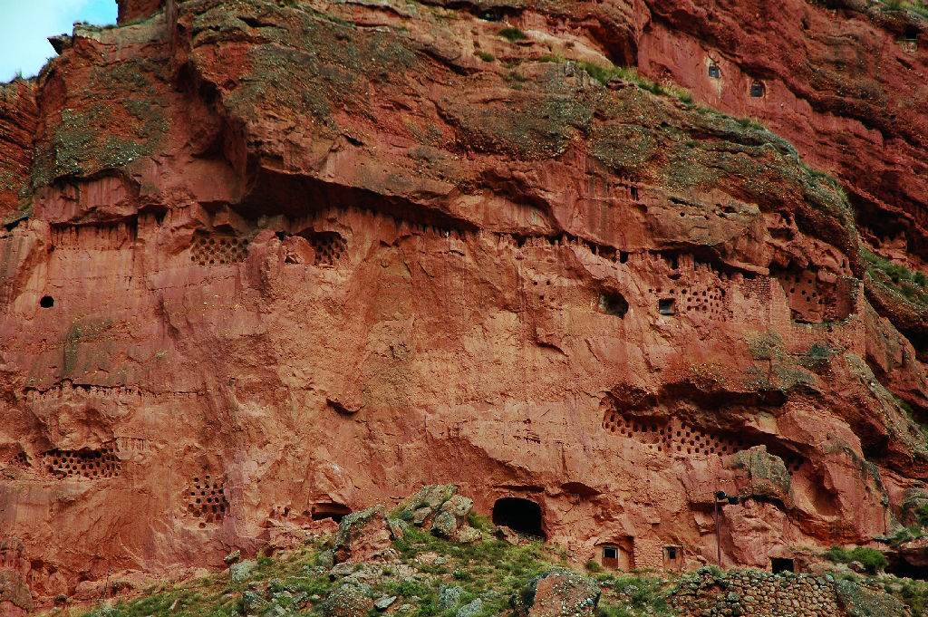
Along the route through the valley, you can see the sloping strata of Herce and the adjoining towns of Santa Eulalia Somera and Santa Eulalia Bajera, located on the other riverbank. The route carries on downwards until you cross the River Cidacos at Herce, where the trail finally passes over to the left bank. Through thick reed beds, the route reaches this town’s station, which is currently used as a youth hostel. The beautiful excavations known as the “Moor’s Pharmacies”, which are used as dovecots, appear on the cliffs of Herce.
The Nature Trail continues as far as the next town across the meadowland, among vegetable gardens and fruit trees. There may be some traffic in this section, due to the fact that some farms have been turned into private houses. Once you have passed the kilometre 24 milestone, you reach the only difficult point on the route. About 150 m further on, now close to Arnedo, the route branches off to the right along an asphalted surface next to the river, leaving the old railway track behind.
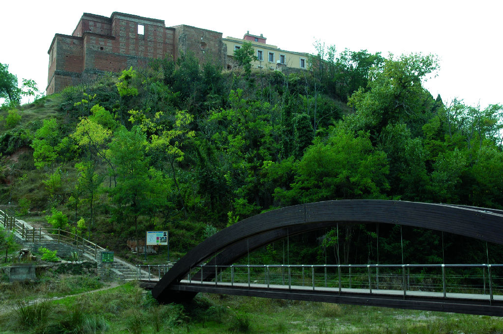
This turning takes the trail close to the riverbank, crossing the Linear Park that runs alongside the meadow of the River Cidacos, from where, if you cross the wooden pedestrian bridge that is located on the right-hand side, you can pay a visit to the monastery of Nuestra Señora de Vico, which is perched on a cliff over the river. Further on, some swings mark your arrival at the city of Arnedo, the third largest in population terms in La Rioja and the venue of a thriving shoe industry.
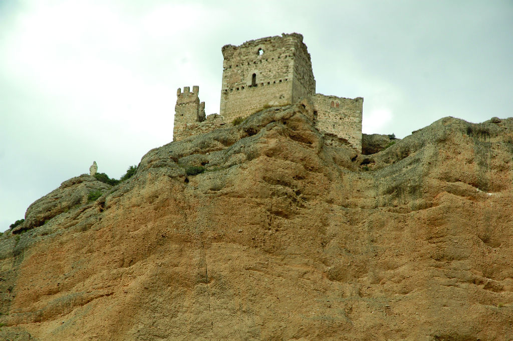
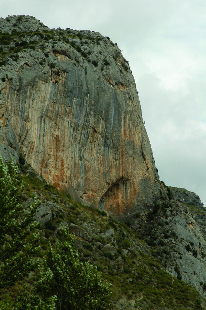
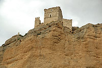
Once you have crossed the park of the River Cidacos, the route once again covers orchard land full of countless houses and zigzags until it returns to the old railway line. It crosses an industrial estate and the municipal recycling facilities, leaving Arnedo behind it. The trail heads towards Quel running parallel to a gas pipeline marked by yellow milestones. Inside this town, there is a section that is full of warehouses and a school where the old railway line gets lost once again. The route encircles this built-up block on its right-hand side, returning to the original track a little later on, where you can once again see the gas pipeline milestones, which serve as a guide to ensure that you do not get lost in this chasm presided by the Castle of Quel and the rocky escarpments of its crag where griffon vultures (Gyps fulvus) nest.
Once you have passed Quel, the Nature Trail continues under the gaze of large rocky cliffs on its left, while the meadow recovers all its productive splendour. The route crosses a dangerous intersection on the LR-115 highway, and reaches a 575-metre illuminated tunnel that crosses the Alto del Gollizo. From the trail you can see the lake of Vallalengua, which is covered by reed beds and located in a depression. A little further on, you come to the ruins of the old station of Autol, which features a picnic area beside it. The route then leaves the river meadow for a short while and the landscape changes into semi-desert brushwood hillocks.
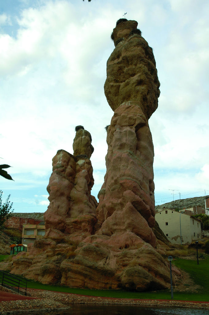
The presence of the Gollizo Tunnel means you do not have to pass through the town of Autol, although it is worth stopping to see “El Picuezo” and “La Picueza”, two large sandstone columns that are the natural outcome of water and wind erosion and currently form part of a municipal park. Autol boasts major agricultural and food industries dealing in vegetable garden and mushroom products, whose fertiliser impregnates the air of this section.
The Nature Trail crosses the LR-282 highway, a point where you have to take great care because visibility is poor and the traffic travels at great speed. Now the route runs parallel to this road, once again crossing the river meadow, which is wider in this sector.
The remaining route to Calahorra crosses large non-irrigated, vine and olive farms as far as the stopping place of the River Livillos, an area outfitted with tables where you can rest, although there is no shade.
Now, very close to Calahorra, you can see the pillars of the old Roman aqueduct of Calagurris. The trail heads towards this city, twisting to the right when it comes to the AP-68 highway, which it runs parallel to, passing under a viaduct before it reaches the park of Cidacos, next to the Cathedral.
Sites of interest
Profile
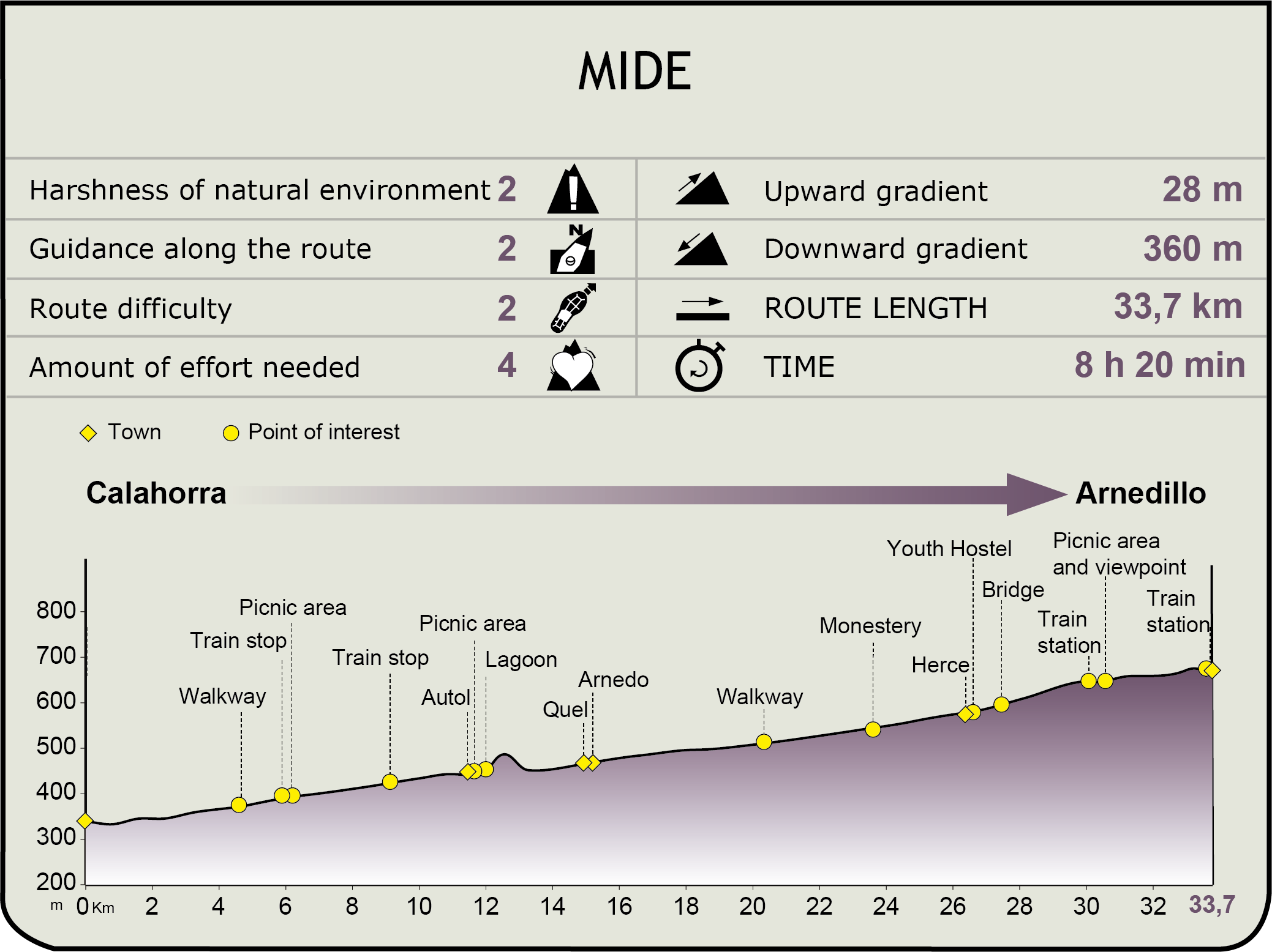
MIDE (Method for the Information of Excursions)
 Harshness of natural environment
- 1. The environment is not risk-free
- 2. There are more than one risk factors
- 3. There are various risk factors
- 4. There are quite a lot of risk factors
- 5. There are many risk factors
 Guidance along the route
- 1. Well defined trails and crossings
- 2. There is a clearly marked trail and signage
- 3. Requires the identification of geographic features and cardinal points
- 4. Requires off-path navigation
- 5. The trail is interrupted by obstacles that have to be gone around
 Route difficulty
- 1. Walking on a flat surface
- 2. Trails with different types of path
- 3. Walking on stepped paths or irregular terrain
- 4. The use of hands or jumping over the terrain is necessary
- 5. The use of hands is required to progress
 Amount of effort needed
- 1. Up to 1 hour of continuous walking
- 2. Between 1 and 3 hours of continuous walking
- 3. Between 3 and 6 hours of continuous walking
- 4. Between 6 and 10 hours of actual walking
- 5. More than 10 hours of continuous walking
Featured
Further information
Calahorra
This city was one of the most important Roman settlements in the River Ebro basin, as is vouched by the numerous archaeological remains that have surfaced in its surrounding area, including the noteworthy thermal baths and circus where naumachias, spectacular naval battles, were even held and for which water had to be brought from the River Cidacos via an aqueduct.
Calahorra’s territorial hegemony has remained since then; it is the seat of the Bishopric and, as a consequence, has a cathedral and an episcopal palace. Today, it is La Rioja’s economic hub and the second largest city in this Autonomous Community, whose horticultural products are famous for their top quality.
Multimedia