
- Home
- Rural Development
- Nature Trails
- Nature Trails
- Northeast Sector
- Matarranya Algars
Stage 1. Matarraña - Algars
Description
Upper course of Matarraña River
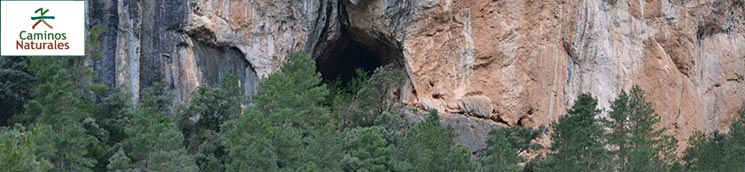
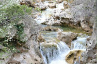
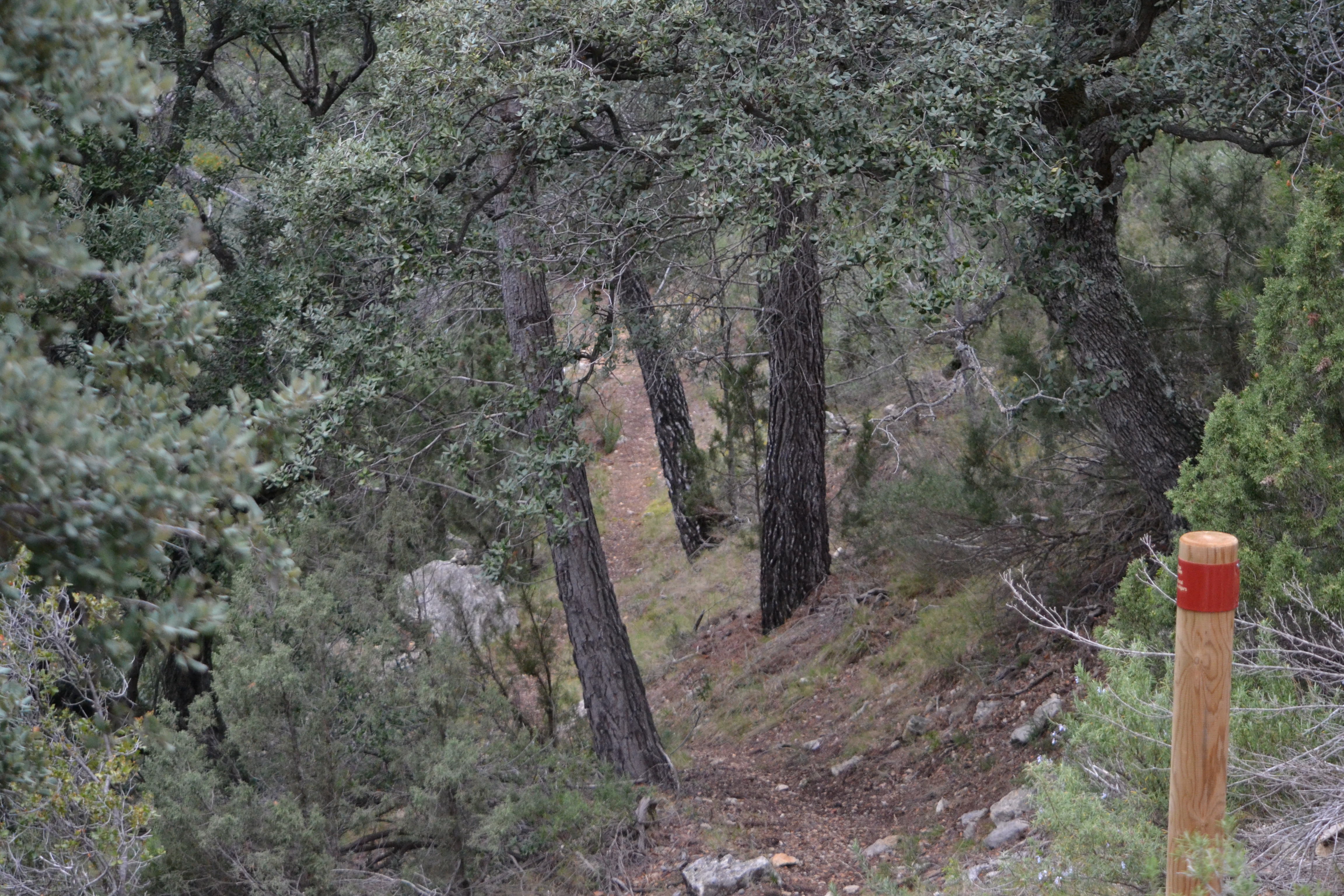
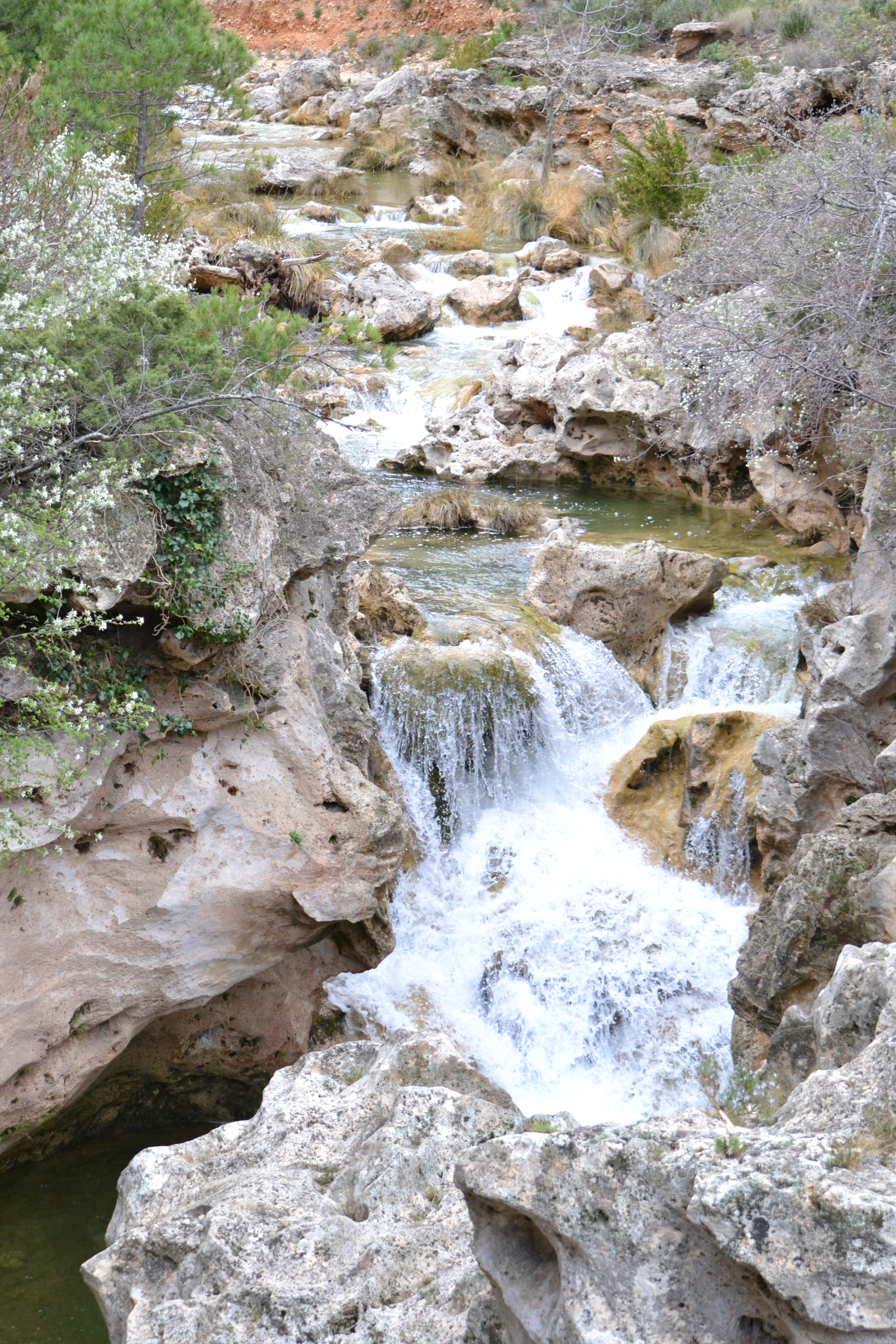
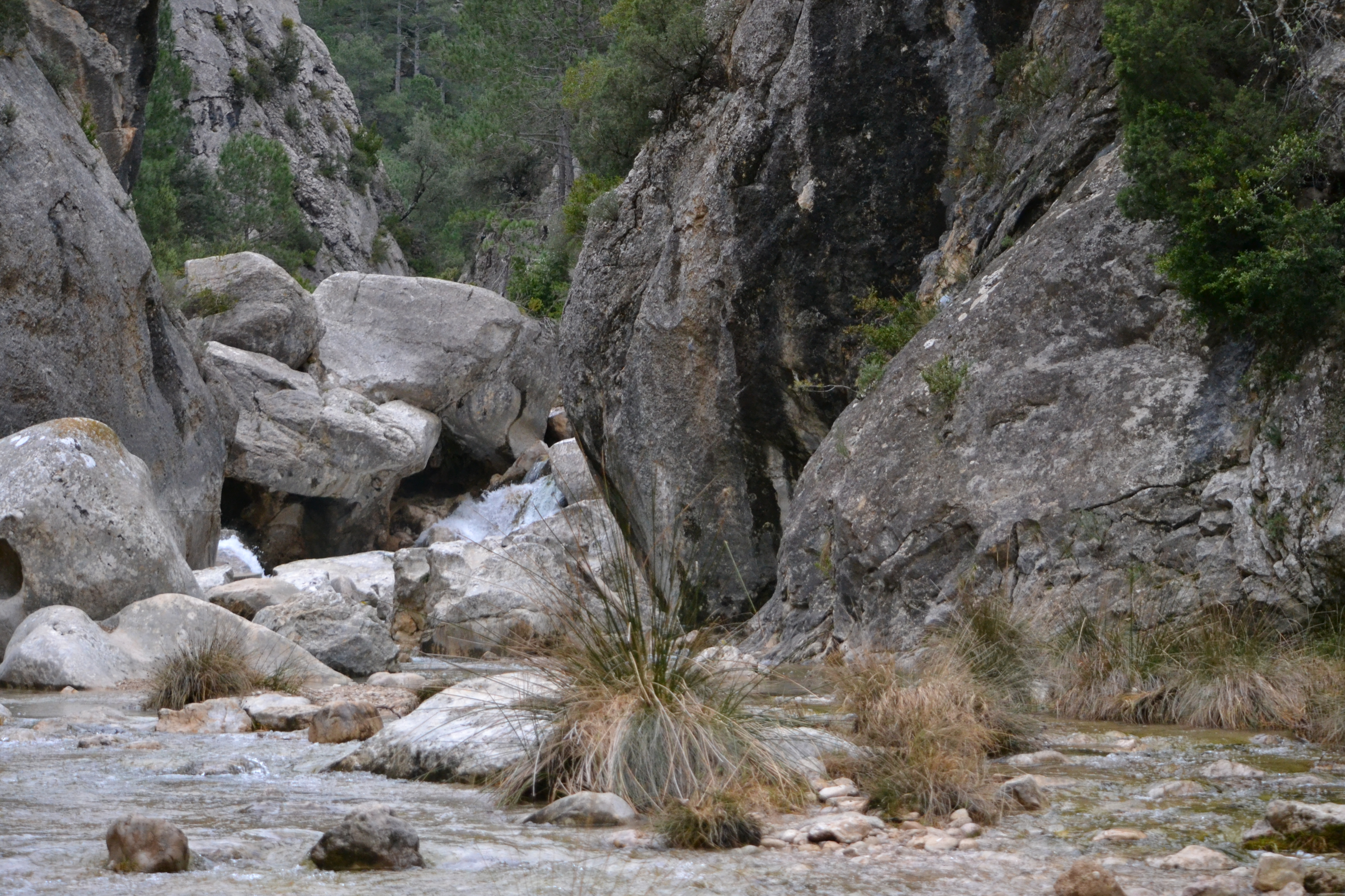
This stage departs from the vicinity of the El Parrizal rest area, within the limits of the Beceite mountain passes, an S.C.I. (Site of Community Importance) and S.P.A. (Special Protection Area) declared area. This first stage of the Matarraña-Algars Nature Trail follows the upper course of the Matarraña river, running between steep banks, to the town of Beceite. This route holds high landscape and ecological value.
This stage begins in the mine terrace, where traces from the coal-extracting period are still visible. This location is one kilometre away from the El Parrizal rest area (the closest point accessible by car, using the parking number 3 of El Parrizal).
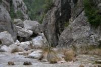
From this point on, you can go to the El Parrizal straits and trace back the course of the Matarraña river all the way to the Beceite mountain passes. Despite the existing safety ropes and walkways, this trail can only be covered on favourable weather conditions, as walking on the river course is sometimes necessary.
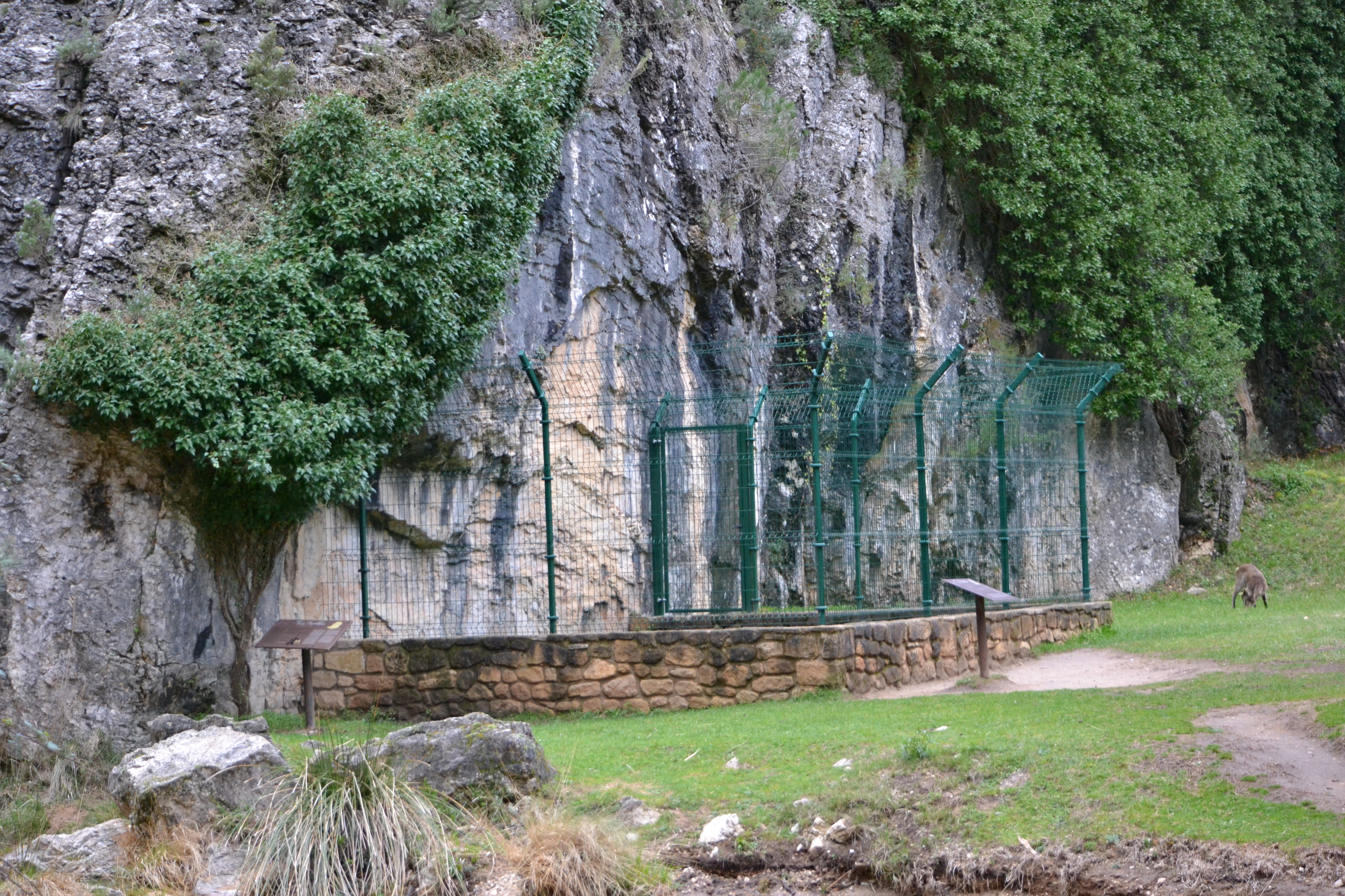
Leaving the mine terrace behind, the trail goes along the course of the Matarraña river past elements of natural and historical interest such as the Cueva de la Dona, the springs of the Fenellosa or, across the river and after through a rock-excavated tunnel, the ledge housing the Fenellosa cave paintings (the protecting fence can be accessed with low water levels).
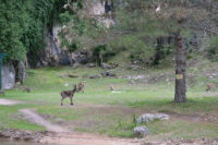
If lucky, the traveller might get to see herds of Spanish ibex (Capra pyrenaica) grazing in a nearby meadow.
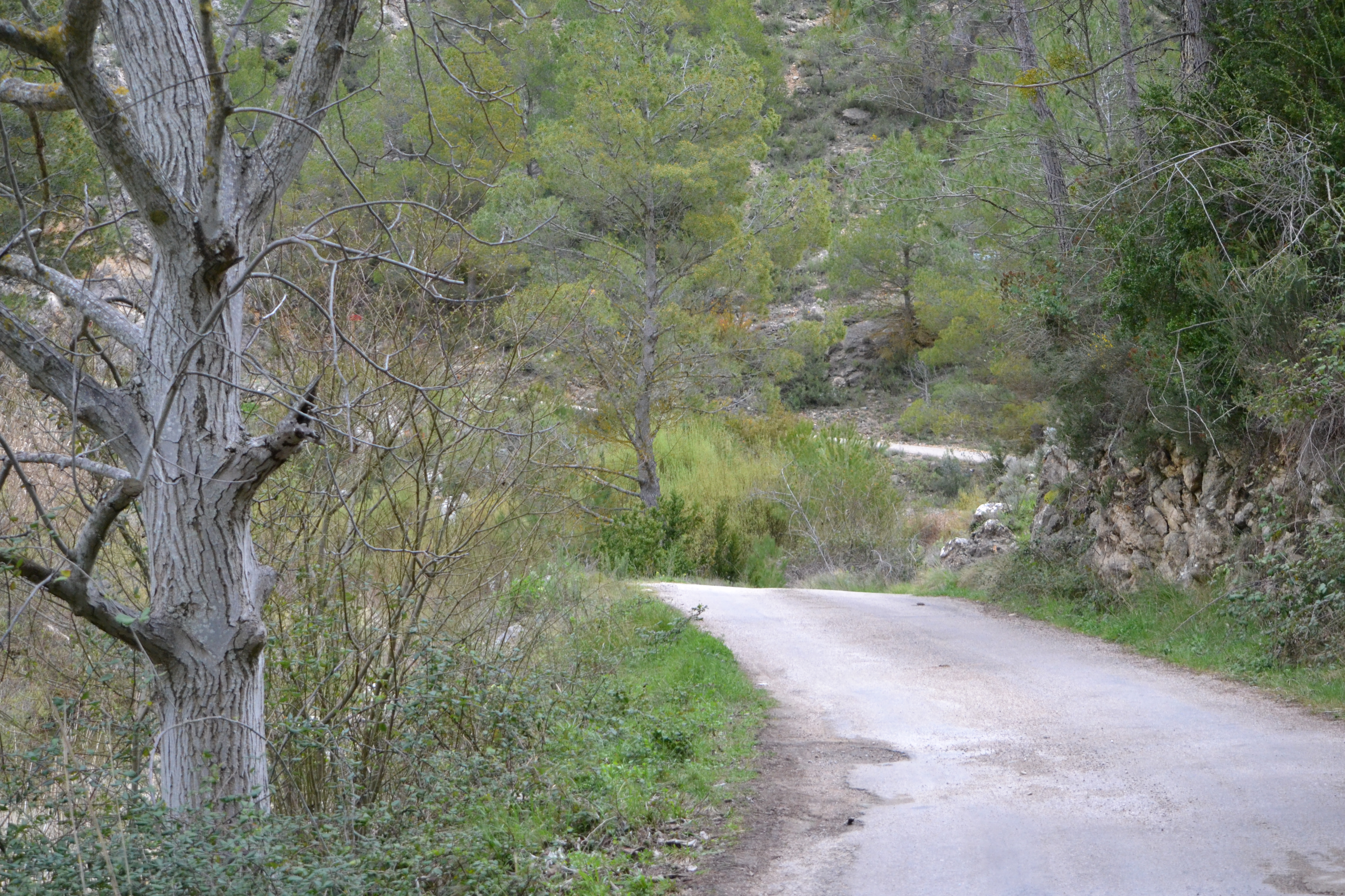
Through another tunnel, the trail gets to the El Parrizal rest area. You can then choose between taking the branch that goes up to the Masía de Sant Miquel or continuing along the river following the paved track to Beceite (shared with vehicles, so caution is required).
If you choose the latter option, the trail continues among the steep banks of the river canyon, the Matarraña river always on your left. Do not lose sight of the river for the peculiar rock formations sculpted by it. Yet, while the pools of its backwaters might be tempting, the river is a drinking water source and swimming is explicitly forbidden.
Four kilometres into this paved track you will reach the turn-off where the Sant Miquel alternative route rejoins the main trail. One kilometre later, the aqueduct of Beceite main irrigation canal announces your arrival to town. Wander around its picturesque streets, past the hermitage of Santa Ana and across a couple of bridges that will bring you to the left side of the Matarraña river. Only then does the trail reach its endpoint, not too far off from the tourist information office.
Alternative route through the Masía de Sant Miquel
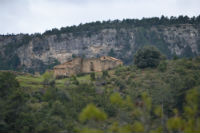
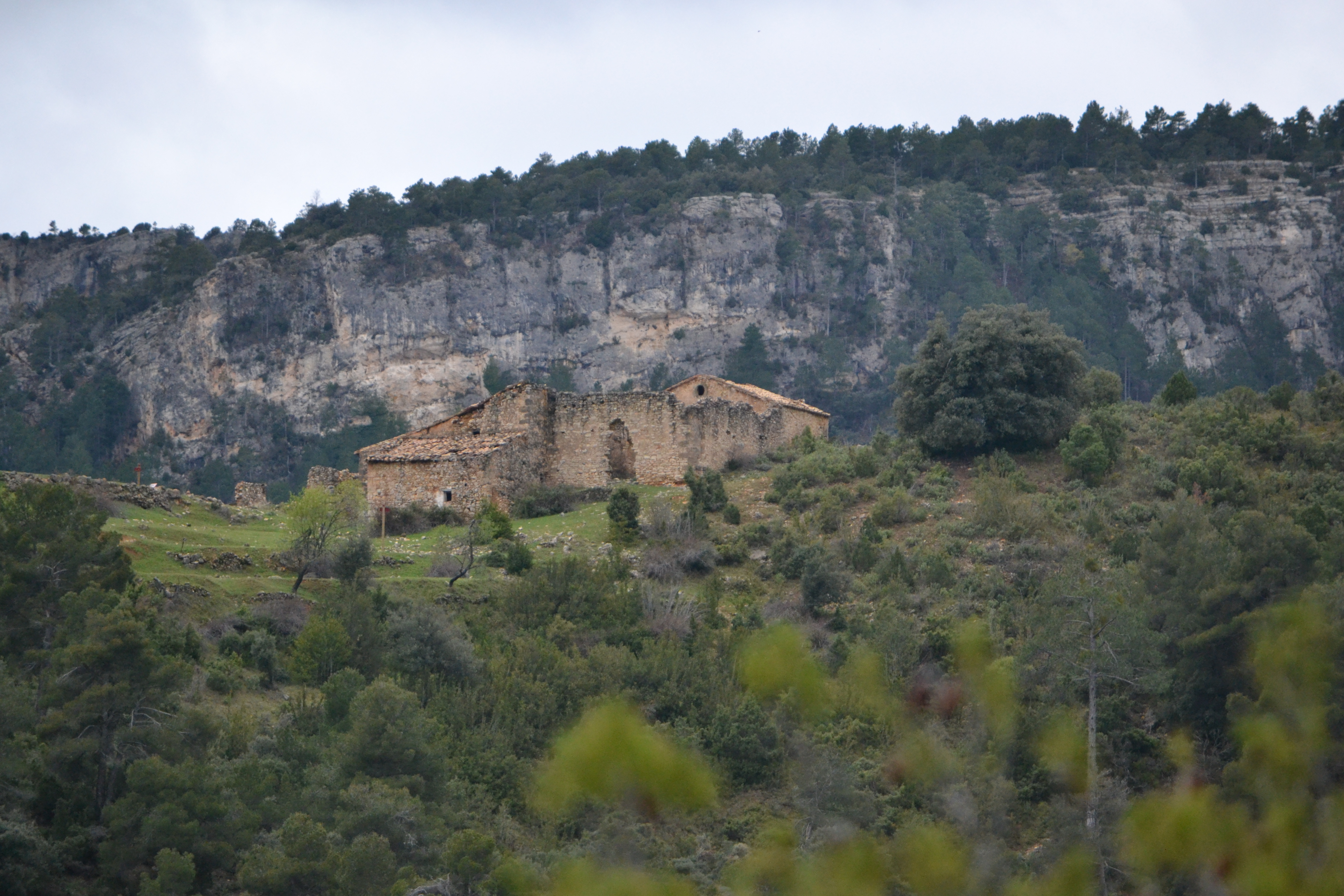
This alternative route departs from El Parrizal rest area and is roughly 4 km in length. You will get to visit the Masía de Sant Miquel, a set of buildings used as a hermitage and housing facility back in the day, and subsequently destroyed during the Carlist Wars.
Climbing up through the dense pine forest can be hard, as the slope is steep until you are halfway through. However, as you go up the view over the Matarraña canyon makes the effort pay off.
Scattered among the pines you will see olive trees on the terraced mountainsides preannouncing the nearby Masía. This is the highest point of this alternative route and of this whole stretch of the nature trail. It is well worth pausing at this spot to contemplate not only the panoramic views of the recently covered valley, but also those of a large part of the mountain range of Puertos de Tortosa-Beceite. The trail then starts to go down (again among pines) towards the gully of the Racó de Guera. You will have to wade across this gully to continue up the mountainside to the next valley, that of the Les Marrades gully.
Topping the slope opposite the one you are descending is the pillbox of Cabrera. It was named after general Cabrera, who ordered the pillbox be built during the First Carlist War. It can be accessed by a track that departs from the main route. The small path the traveller has been following joins a wide track, only leaving it next to a ruined building to meet the gully bed. The traveller will cross it several times before this alternative route meets the main route, four kilometres from departure.
Sites of interest
Map
Puntos de Interés
Geología
Hidrografía
Municipio
Profile
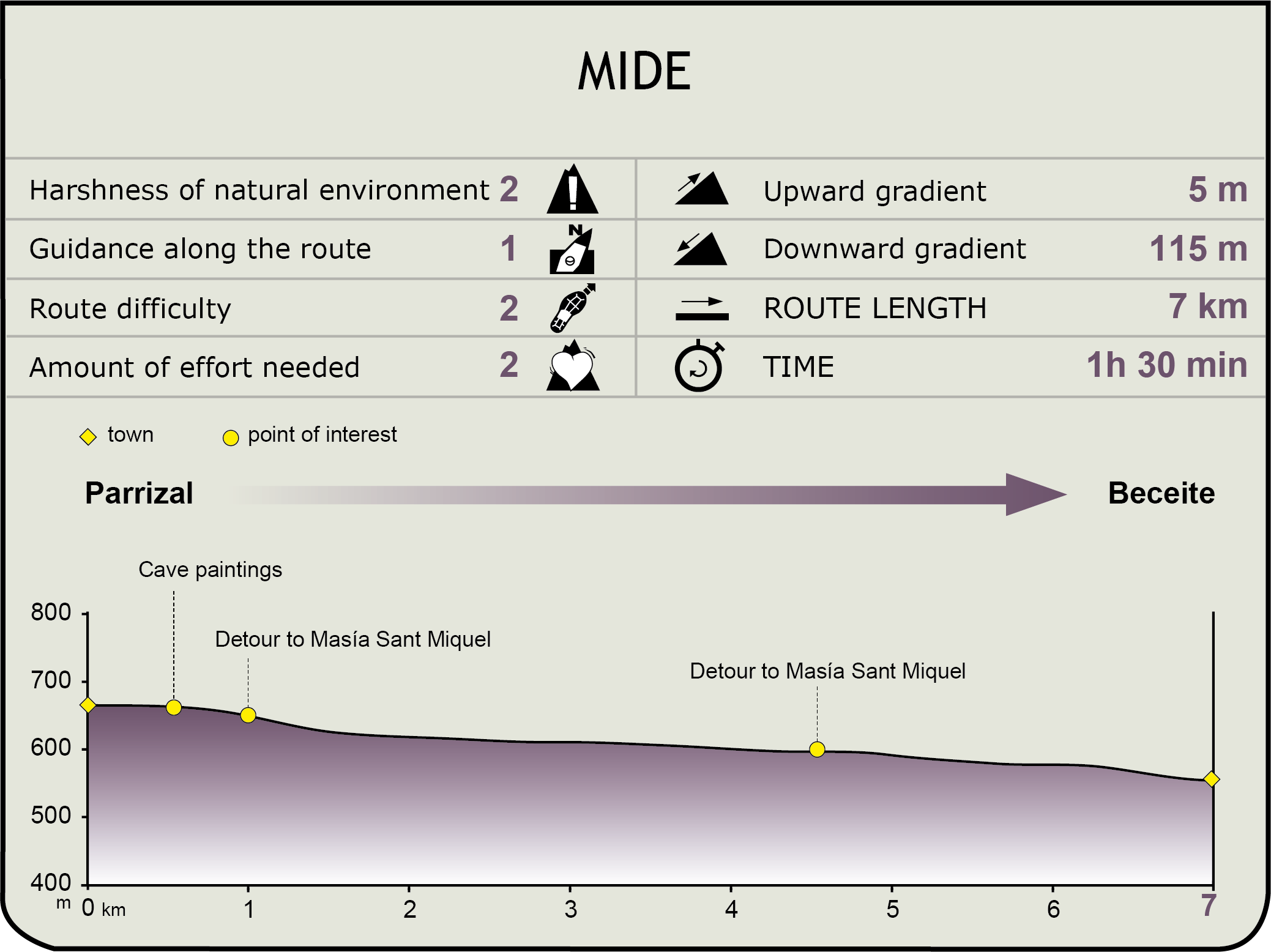
MIDE (Method for the Information of Excursions)
 Harshness of natural environment
- 1. The environment is not risk-free
- 2. There are more than one risk factors
- 3. There are various risk factors
- 4. There are quite a lot of risk factors
- 5. There are many risk factors
 Guidance along the route
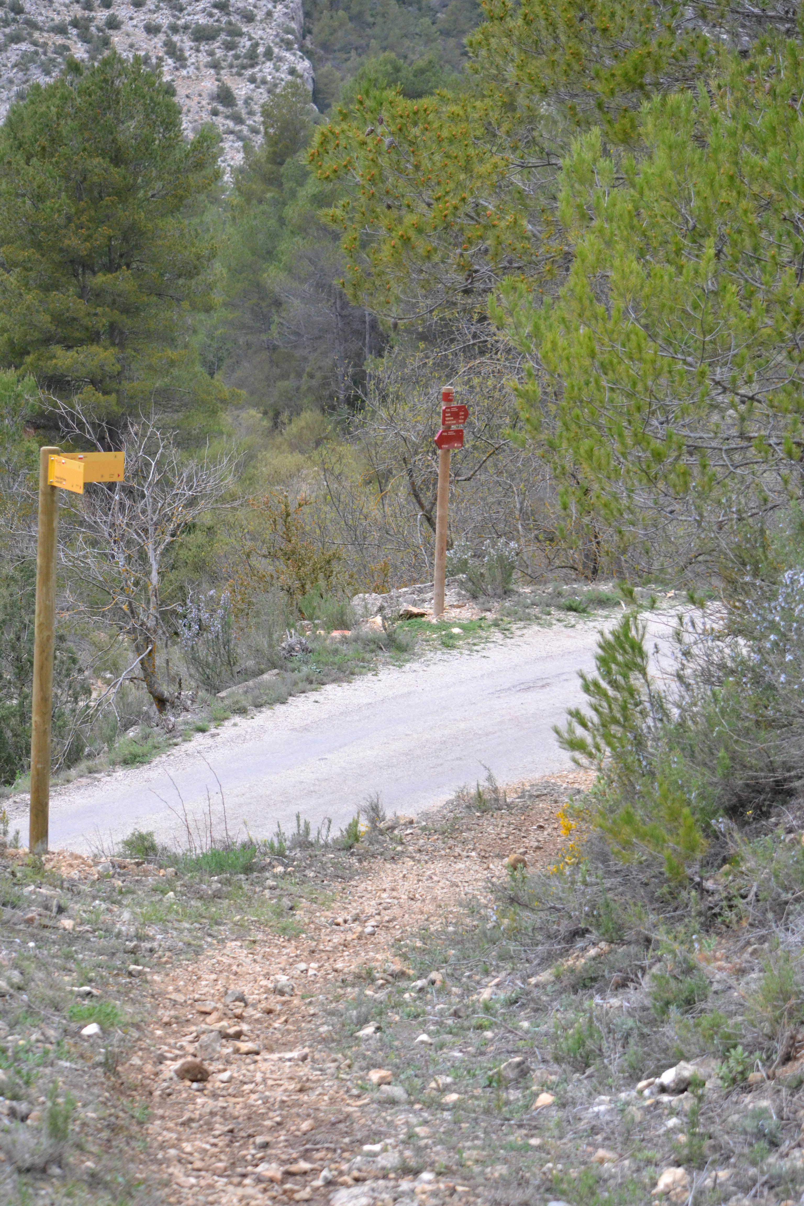
- 1. Well defined trails and crossings
- 2. There is a clearly marked trail and signage
- 3. Requires the identification of geographic features and cardinal points
- 4. Requires off-path navigation
- 5. The trail is interrupted by obstacles that have to be gone around
 Route difficulty
- 1. Walking on a flat surface
- 2. Trails with different types of path
- 3. Walking on stepped paths or irregular terrain
- 4. The use of hands or jumping over the terrain is necessary
- 5. The use of hands is required to progress
 Amount of effort needed
- 1. Up to 1 hour of continuous walking
- 2. Between 1 and 3 hours of continuous walking
- 3. Between 3 and 6 hours of continuous walking
- 4. Between 6 and 10 hours of actual walking
- 5. More than 10 hours of continuous walking
Featured
Further information
Matarraña river
The Matarraña-Algars Nature Trail runs parallel to the Matarraña river in its upper and middle sections. This Ebro tributary displays distinct Mediterranean characteristics: an irregular and relatively low flow with significant rise in level in the spring and autumn, and low water levels in the summer. This is one of the best preserved Mediterranean rivers, showing a great diversity of fish species and other aquatic organisms. It is among the few Spanish rivers where the native white-clawed crayfish (Austropotamobius pallipes) can still be found.
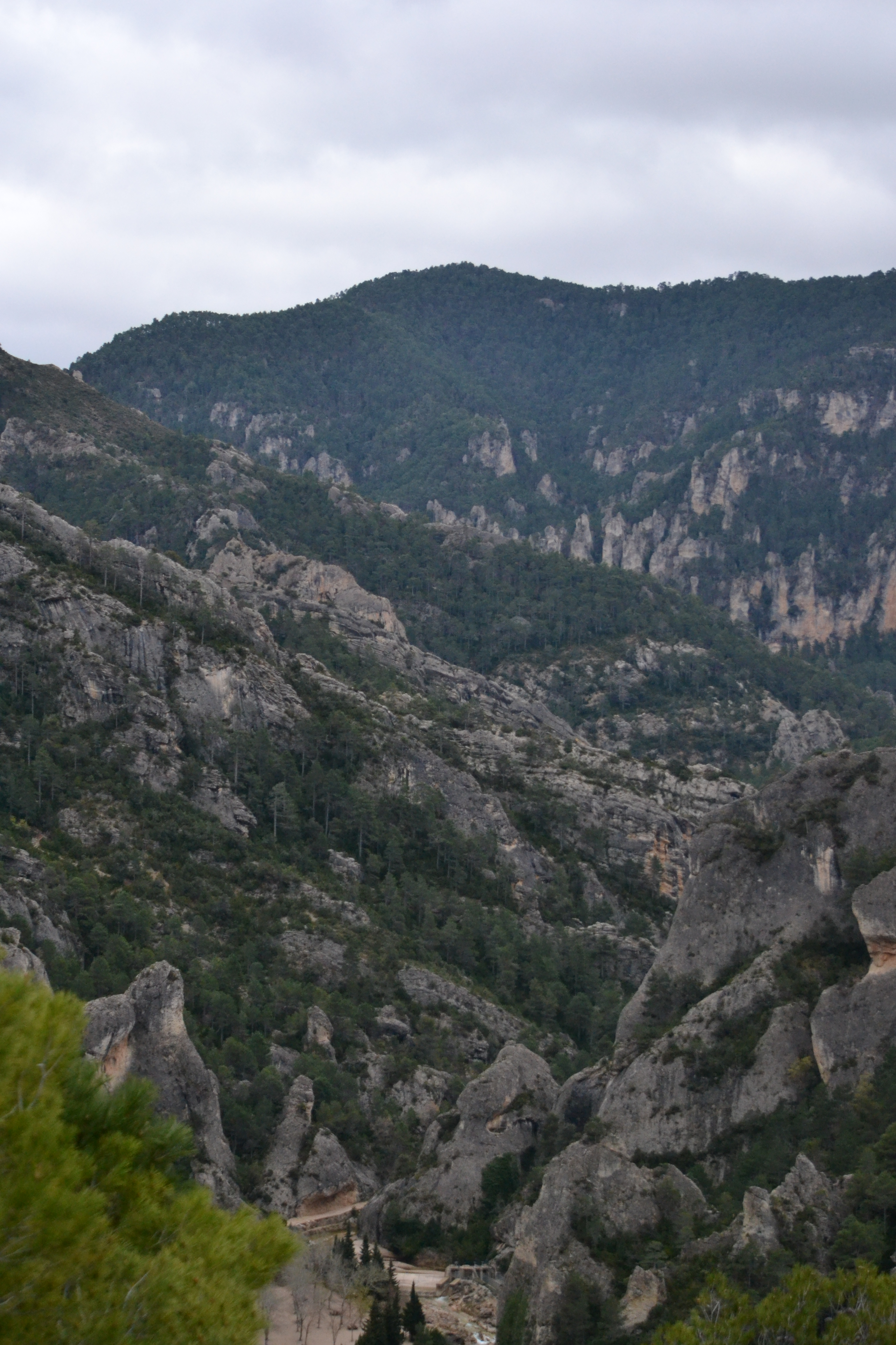
Puertos de Tortosa-Beceite
This mountain range is located among the provinces of Teruel (Aragon), Tarragona (Catalonia) and Castellón (Valencian Community), formerly known as the Crown of Aragon. This range connects the Iberian System and the Catalan Pre-Coastal Range, a union embodied by the Tozal del Rey (tossal dels Tres Reis) peak, convergence point of the three communities.
The vegetation in the area consists mainly of pine trees (Pinus nigra, P. sylvestris y P. halepensis) with boxwood understory (Buxux sempervirens) or groups of oaks (Quercux ilex, Q. coccifera and Q. faginea). Its fauna includes the largest colony of Spanish ibex (Capra pirenaica) in the peninsula, not to mention a large population of Eurasian otters (Lutra lutra), griffon vultures (Gyps fulvus), peregrine falcons (Falco peregrines) and golden eagles (Aquila chrysaetos). As for invertebrates, the white-clawed crayfish (Austropotamobius pallipes) and the Spanish moon moth (Graellsia Isabelae) stand out. It has been declared a nature reserve both in its Catalan (Parc Natural dels Ports) and its Valencian side (La Tinença de Benifassà Nature Reserve)
Enlaces de interés
Multimedia

Downloads
GPS Downloads
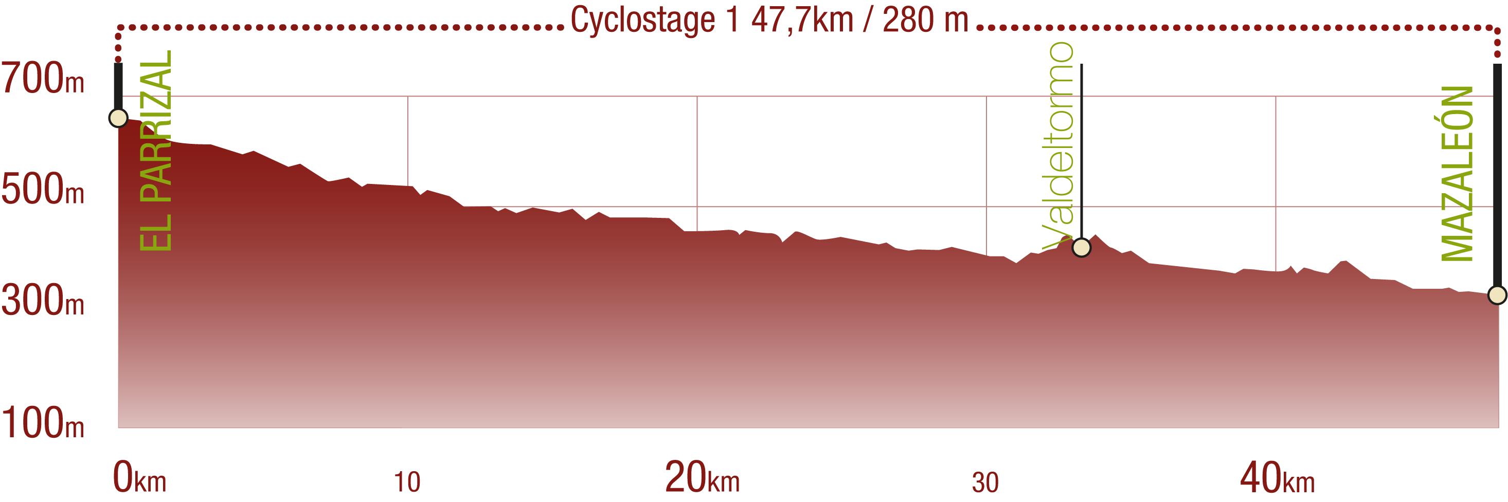
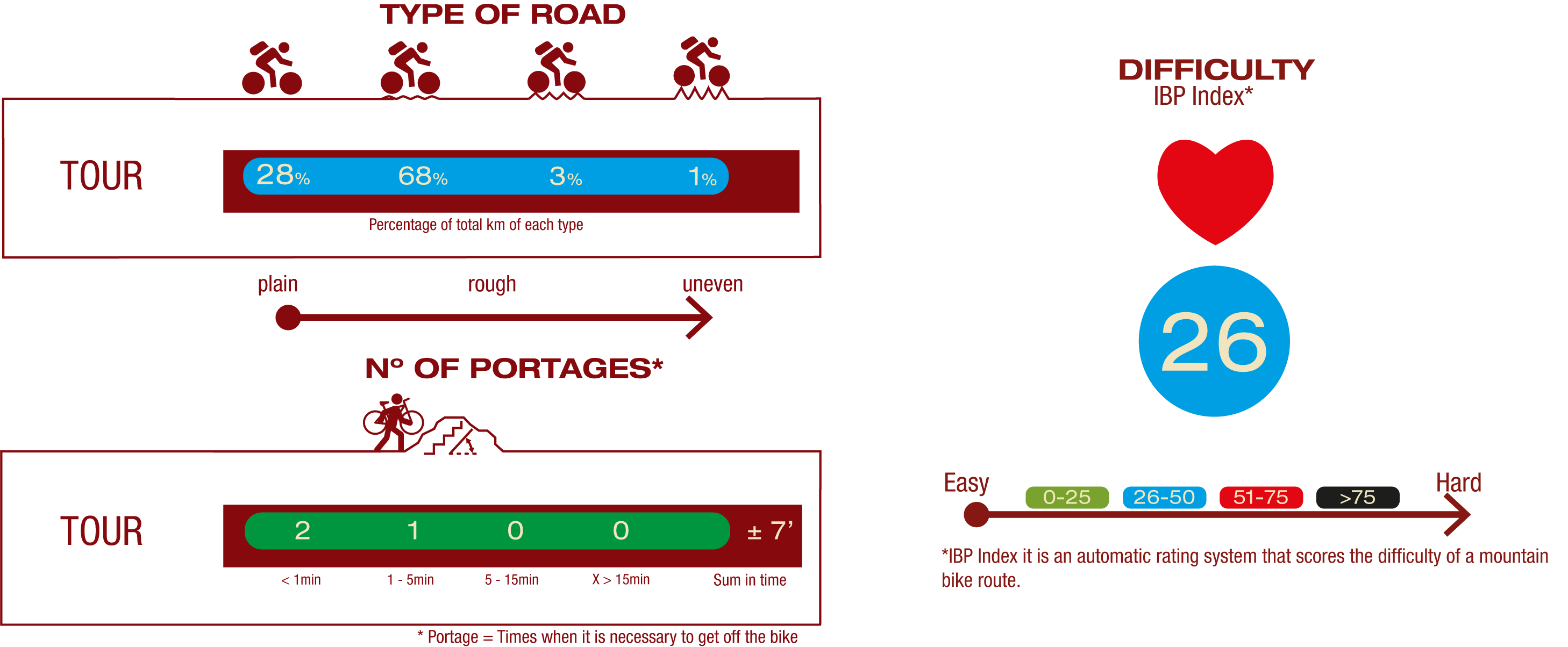
Cyclability
This Cyclostage correspond to stages 1 to 5 of the Nature Trail
PROFILE
TYPE OF ROAD, PORTAGES & DIFFICULTY
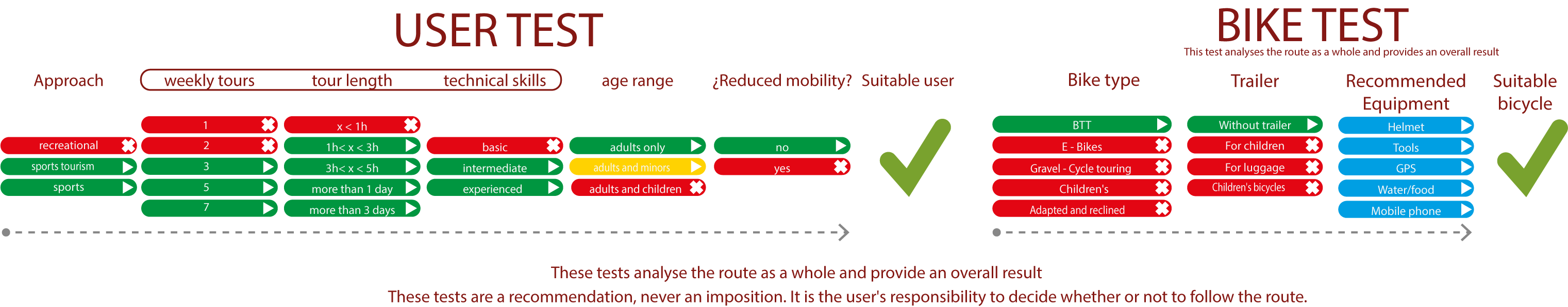
TEST
SAFETY RECCOMENDATIONS
- Sections shared with hikers.
- Transit through the centre of some population centres.
- Due to the fact that the route runs close to riverbeds, crossing them on several occasions, you are informed that there may be seasonal discontinuities caused by floods, increases in flow, floods or transit through flood-prone areas.
GENERAL RECOMMENDATIONS
- Find out about the technical aspects of the route and the weather on the day.
- Take care of the environment. Take care not to disturb animals or damage vegetation. Respect private areas.
- You must give priority to pedestrians and comply with general traffic rules.
- The environment in which you will be riding is open, free to move around and an area where many activities are carried out (sporting, forestry, livestock and agricultural activities). Always have an understanding, prudent, responsible and respectful attitude.