
- Home
- Rural Development
- Nature Trails
- Nature Trails
- Northeast Sector
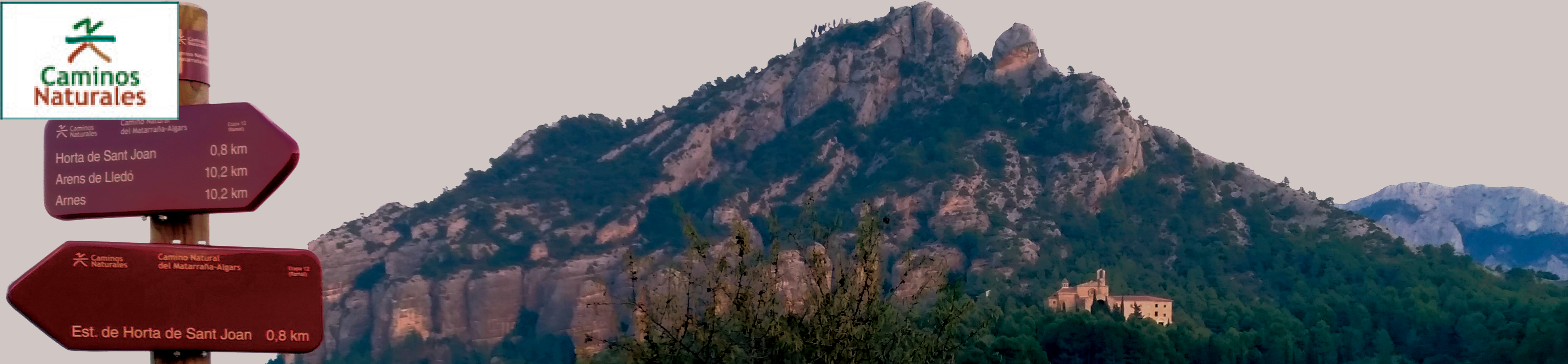
- Matarranya Algars
Stage 12. Arens de Lledó - Arnes
Description
Return to Puertos de Tortosa Beceite
Stage 12 takes us back to the presence of the Puertos de Tortosa Beceite mountain range on the horizon, where Stage 1 of the Nature Trail began. The trail runs through extensive fields for cultivation (fruits and olive orchards), especially the large plain that lies between Lledó and Horta de Sant Joan, this latter area being accessible through a detour that leads to its former train station. It is possible to access the Nature Trails of Terra Alta and Val de Zafán from this railway station, as well as from the disused station of Arnes-Lledó.
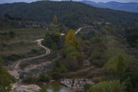
As mentioned in the previous stage, there are two ways to advance from Stage 11 to Stage 12, the first goes through the urban centre of Arens de Lledó and the second around it. In the first case, the end of Stage 11 which is marked by the information panel located near «lo Raig» (el chorro, in Spanish), is where Stage 12 begins immediately. It initially runs along the canal, following Calle del Río which descends to the River Algars which is crossed by a concrete ford built for this purpose. After reaching the opposite bank and advancing a few metres along the naturally eroded rocky terrain, we come to a country road that connects to the external variant. The second option (this same external variant, recommended for cyclists as it avoids passing through the aforementioned irregular rocky terrain) can be taken directly without entering the centre of Arens de Lledó (see Stage 11) or if we have decided to enter the urban centre, we can retake it by retreating a few hundred metres along the highway towards Calaceite and on the right-hand side, taking the detour that descends to the river and crossing it via a concrete bridge. Half a kilometre of walking along a dirt road brings us to the trail that ascends from the river as described in the first alternative.
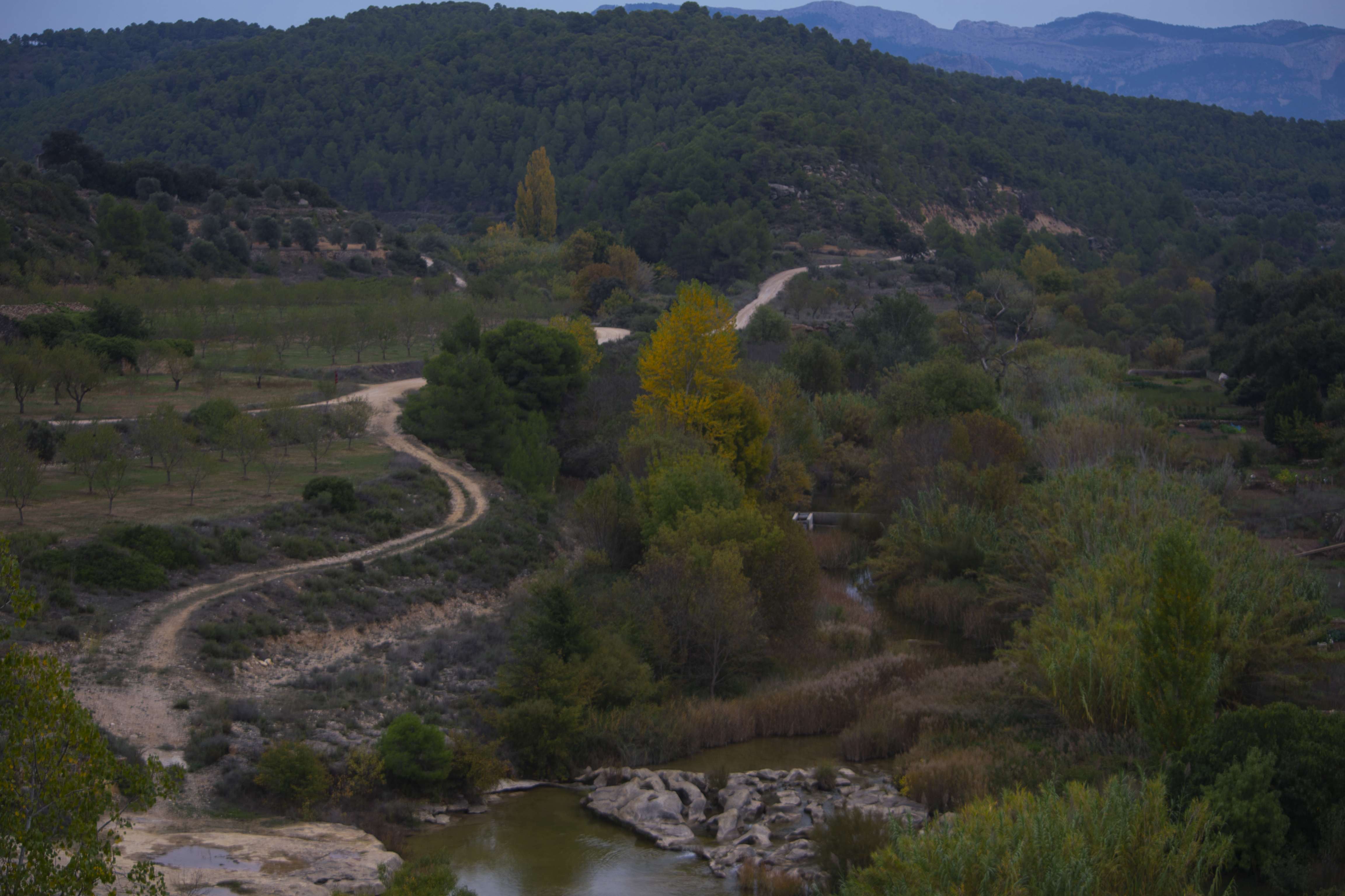
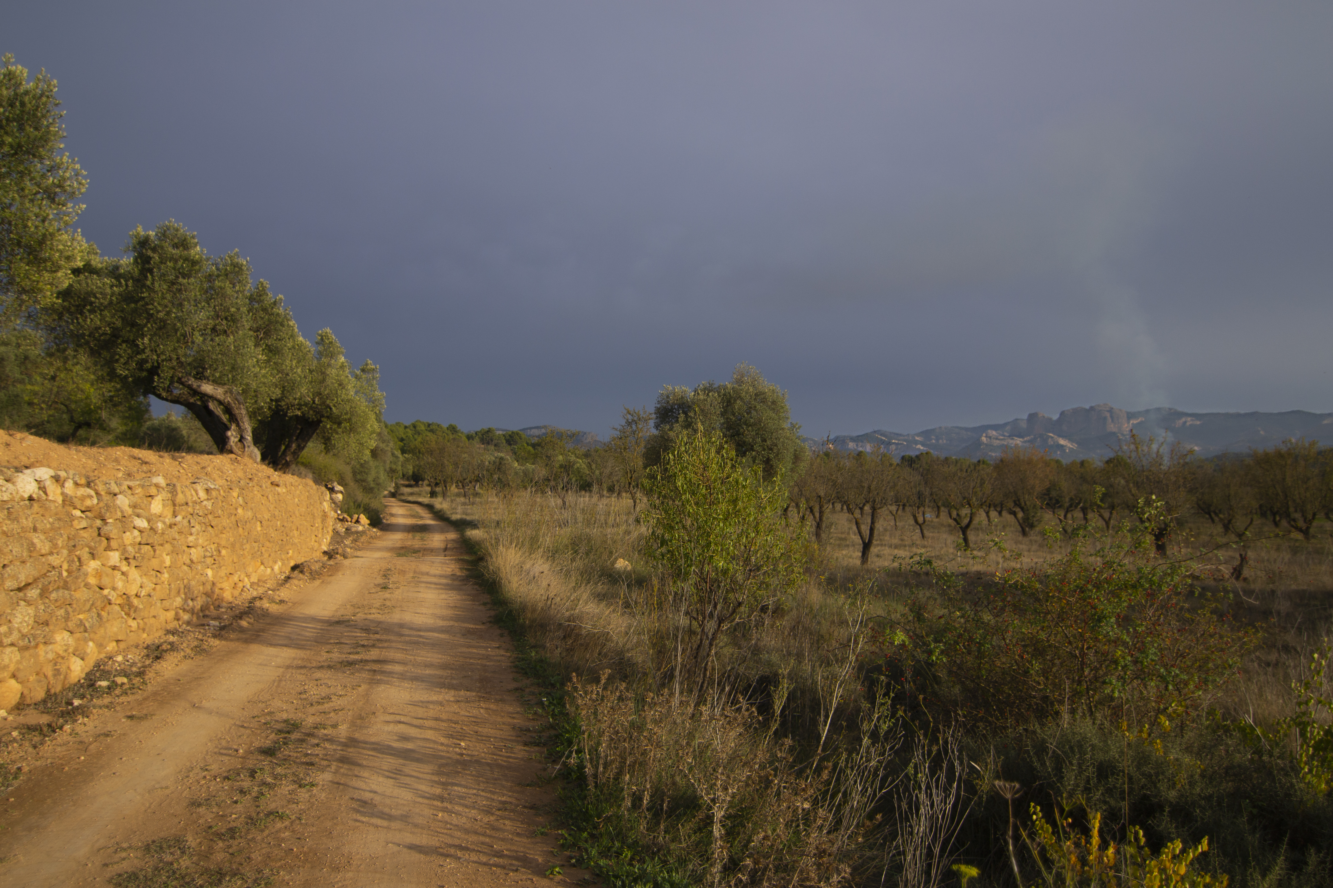
On this side of the river, we find ourselves in the province of Tarragona, with a landscape similar to the final section of the previous stage, consisting of fields for cultivation and some orchards where the river valley widens out, and with pine groves in the rougher areas. The trail soon meets up with the TV-3341 highway and continues on it for more than 200 m (while not very long, it is wise to take all precautions as this section is located between two bends in the highway). We then exit the highway by a path on the right and walk along a section very near the riverbed where pine groves and Mediterranean undergrowth blend with river vegetation such as reeds and rushes.
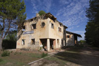
The trail turns to the right and comes to a bridge on the Algars which faces a large building, the “Molí de Fábrica” (currently a private property). After crossing the river and going around the building, the road turns left at a livestock holding to once again cross the river. During these last 800 metres on the left bank of the Algars, the trail has again entered the province of Teruel.
Subsequently, on the right bank (and therefore, in Tarragona), the road ascends gently and passes by another livestock holding and a brick chimney which is all that remains of the old Sulfuro del Cassol de Lledó building. The ascent ends at a viewpoint from where we can see another former mill (molí de Lledó) and the weir that diverted the waters of the river towards the mill.
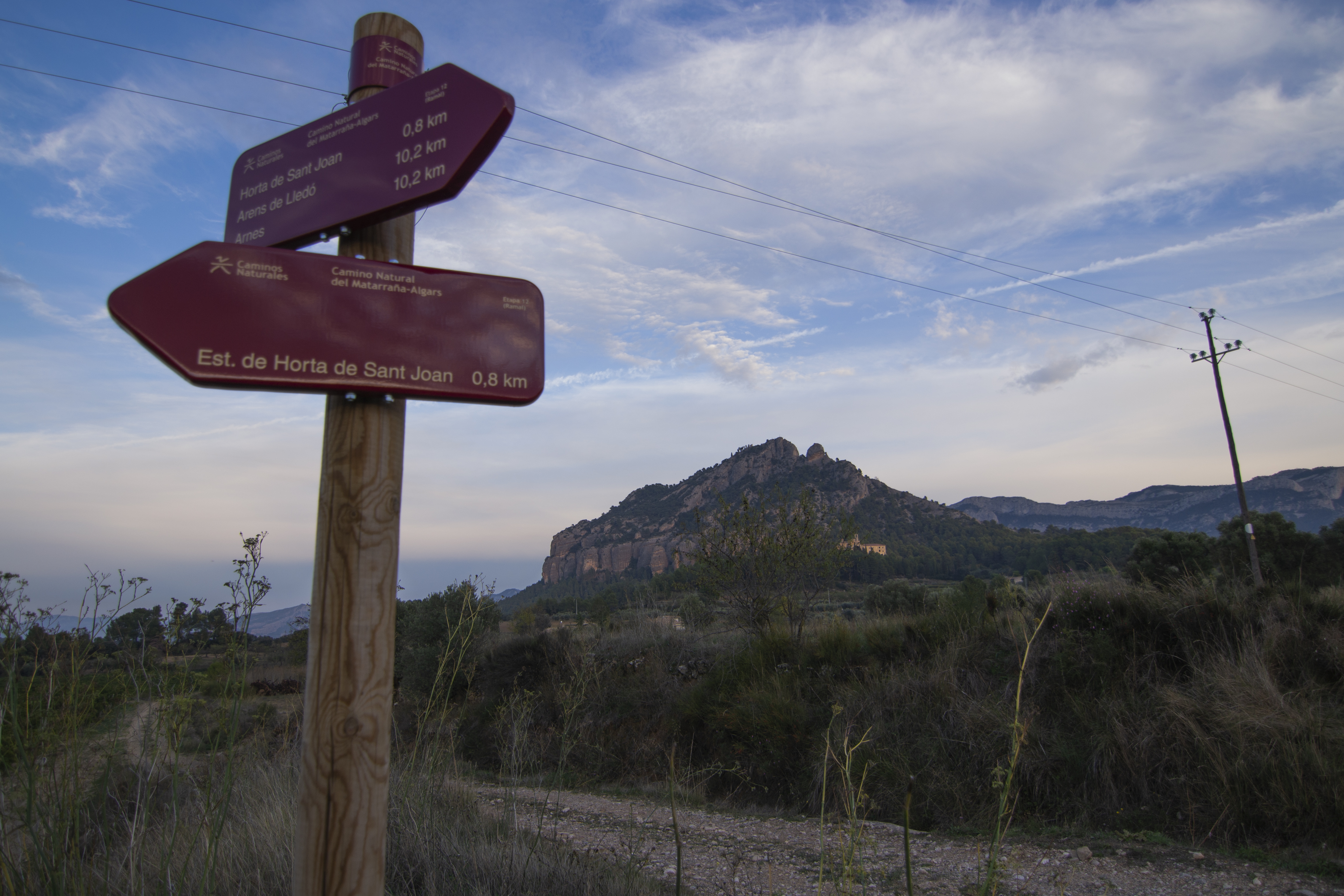
This ascent also means exiting the river canyon. From here onwards towards the south, a wide esplanade opens up where we see at a distance, the hill on which the town of Horta de Sant Joan is situated, La Magdalena mountain, and the cliffs of Puertos de Tortosa-Beceite.
The trail continues through farmlands until it reaches a small hilltop where it turns right to and goes around the hill by means of a smaller trail than the one that we have followed until now. Between this elevation to the left and the River Algars to the right, the trail enters a pine grove and after approximately an hour and a half, it comes to an intersection. To the left is the road leading to the town of Horta de Sant Joan and its former station, to the right the main trail towards Arnes continues.
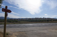
On the main trail, the pine grove soon opens up and provides a glimpse of the town of Lledó, to the right and on the other side of the river. Having returned to crop fields, the trail continues until it reaches a wide country road which it follows for a few metres until an intersection. Here, one can take the highway to the right towards Lledó, but the Nature Trail also continues on the right hand side until it crosses the old railway track of La Val de Zafán, now a Nature Trail. The remains of the former railway station of Arnes-Lledó lie less than 200 metres away and although its buildings are in ruins, a rest area has been established there. Two Nature Trails that share the same old railway track begin at this station, the Nature Trail of Terra Alta to the northeast and La Val de Zafán Nature Trail towards the southwest.
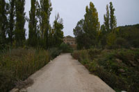
Leaving behind the former station, we proceed to the highway that leads to Lledó. After continuing along the highway for 200 metres, we take a trail to the left, under the imposing viaduct of Algás, which is part of the Val de Zafán railway network. Before arriving at Lledó, this highway passes near the parking lot of the bathing area of the River Algars, whose waters have formed pools with the aid of a weir.
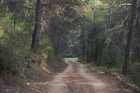
The trail again enters a pine grove, with glimpses of the viaduct available among the trees. The pine grove is interrupted by a small livestock holding and the descent to the River Estrets, which is forded by a concrete bridge. The pine grove then continues for another kilometre and half and opens up to a large plain covered with almond trees that extends all the way until the T-333 highway.
After we cross the highway and walk alongside it for a few metres, we turn left to the road leading to Arnes, thus ending this stage at the town entrance, and the crossing with Calle Onze de Setembre. A walk through this town is highly recommended, especially the square that holds the town hall and church, for a look at these two interesting buildings as well as the view of the cliffs of Puertos de Tortosa Beceite.

Branch to Horta de Sant Joan
From the above-mentioned crossing, the trail continues on the left through alternating pine and olive groves, until the latter dominates the terrain. This section passes over the Nature Trail of Terra Alta, by means of an old railway tunnel, and here we can see the trench taken by the other trail.
Two views loom over the horizon in this section, to the northeast we have Horta de Sant Joan (located on a hill) and behind the mountain of Santa Bárbara towards the southeast, we have Puertos de Tortosa-Beceite with its unique Roques de Benet formation; rocky outcrops that consist of conglomerate and limestone rocks with vertical walls up to 300 metres high.

After a distance of nearly 2.5 km, the dirt road converts into an asphalt road as it reaches Horta de Sant Joan. To access the town, enter through Calle Navarra which leads to the Plaza de Catalunya. Before leaving this town for the old railway station, take a walk through the old quarter to discover its rich architectural and historical heritage. You can also have a magnificent view of the mountain of Santa Bárbara and Puertos de Tortosa-Beceite from the viewpoint in the northeast section of the old quarter.
From Plaza de Catalunya, an asphalted road takes you down the hill through vineyards and almond orchards. After 1.5 km on this road, we come to a bridge over the old railway track. This detour of the Nature Trail ends past the bridge and to the left at the site of the former railway station of Horta de Sant Joan, now in ruins. Here we reconnect with the Nature Trail of La Val de Zafán (Terra Alta section).
Map
Puntos de Interés
Cultura
- Torre del Prior
- Iglesia de Santiago Apóstol
- Ruta túmulos ibéricos
- Iglesia de la Asunción
- Ermita Santa Madrona
- Ermita Santa Rosa de Viterbo
- Iglesia de San Juan Bautista
- Convento de San Salvador
- Iglesia parroquial de la Magdalena
- Pinturas rupestres del barranco del Calapatá
- Pozo de nieve
- Ermita de la Misericordia
Geología
Orografía
Vegetación
Profile
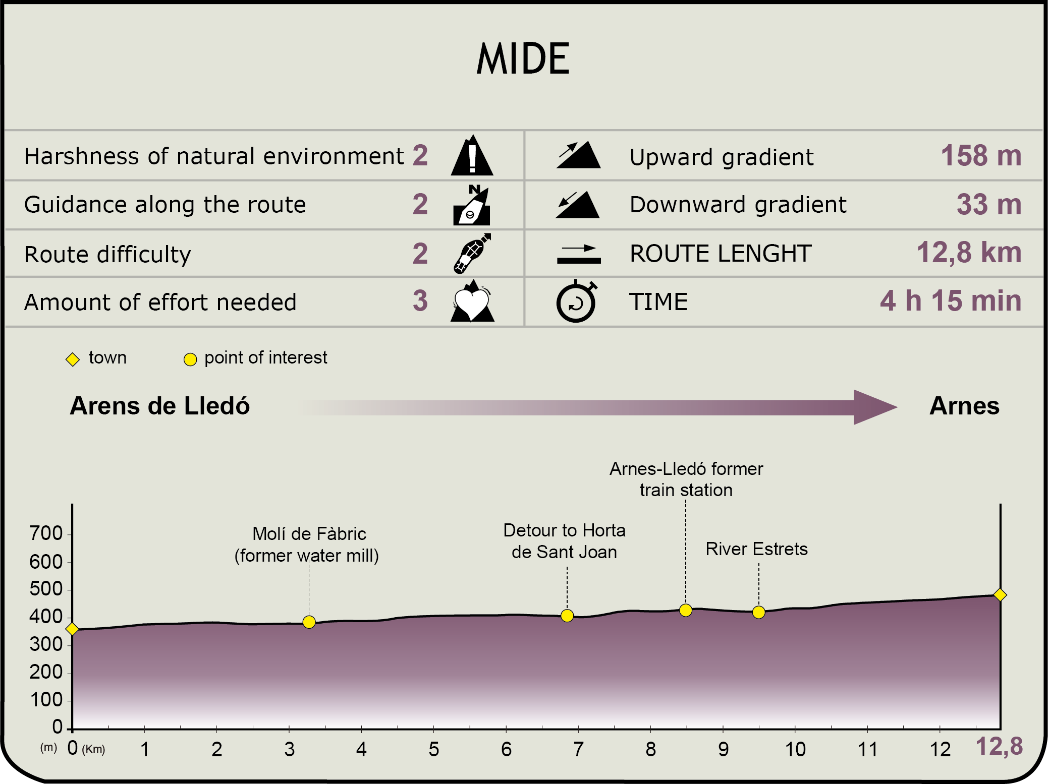
MIDE (Method for the Information of Excursions)
 Harshness of natural environment
- 1. The environment is not risk-free
- 2. There are more than one risk factors
- 3. There are various risk factors
- 4. There are quite a lot of risk factors
- 5. There are many risk factors
 Guidance along the route
- 1. Well defined trails and crossings
- 2. There is a clearly marked trail and signage
- 3. Requires the identification of geographic features and cardinal points
- 4. Requires off-path navigation
- 5. The trail is interrupted by obstacles that have to be gone around
 Route difficulty
- 1. Walking on a flat surface
- 2. Trails with different types of path
- 3. Walking on stepped paths or irregular terrain
- 4. The use of hands or jumping over the terrain is necessary
- 5. The use of hands is required to progress
 Amount of effort needed
- 1. Up to 1 hour of continuous walking
- 2. Between 1 and 3 hours of continuous walking
- 3. Between 3 and 6 hours of continuous walking
- 4. Between 6 and 10 hours of actual walking
- 5. More than 10 hours of continuous walking
Featured
Further information
Lledó
Humans have settled in these lands of Lledó since antiquity, as demonstrated by the archaeological remains dating back to the Iberian era in the entire region of Matarraña and bordering areas (Terra Alta, Bajo Aragón-Caspe, etc.).
During the Christian Reconquest, these lands were included in the land grant of Calaceite, and in 1205 the Order of Calatrava handed over Calaceite, Lledó and Arens de Lledó to Rolando de Cambrils and Dalmacio de Canyelles with the goal of resettling the territory. This attempt at repopulation was unsuccessful and in 1209, the King of Aragón, Pedro II made over Lledó to the bishop of Tortosa.
In October 1210, the bishop Gombaldo de Santa Oliva granted a Town Charter to the new inhabitants of Lledó, giving them houses and lands. The town would remain under the jurisdiction of the bishop of Tortosa until the 15th century at least. In 1834, it was granted municipal status and became part of the judicial district of Valderrobres, until it was finally included in Alcañiz in 1965.
A noteworthy example of its architectural heritage is the Parish Church of St James the Apostle, a 14th-century Gothic building in masonry, and the Town Hall, built in 1610. 4 km away from the urban quarter is the shrine of Santa Rosa de Viterbo.
Lledó’s economy has traditionally been reliant on agriculture, a sector that continues to be greatly important to the town. Within the agricultural sector, almost 1000 hectares of land have been dedicated to growing olives, almonds and other fruits. With regard to livestock, sheep raising is the only industry of the town. Tourism in this area has greatly increased in recent years, which has made it the only major alternative to agriculture and livestock farming.
Horta de Sant Joan
Although not much is known about the origins of this town, the remains of an Iberian settlement have been found in the upper section of the town. In the 8th century, Horta was under Muslim rule, and passed into Christian hands in the 13th century.
Under the Templars, the first local legislation was drafted (1296). In that period, the locality also included Arnes and Prat de Comte. After the dissolution of the Order of the Knights Templar, their assets, including Horta de Sant, were made over to the Knights Hospitaller.
In the modern age, the name of Horta has been linked, above all, to Pablo Ruíz Picasso, who resided in the town on two occasions while painting some of his landscapes.
The old quarter of Horta is worth visiting for its architecture, which still retains the medieval character of its narrow streets that spiral around the highest point of the town, where the now-vanished castle of Orta once stood. Apart from the church (of Gothic style, its construction began intermittently in the 12th and the 14th centuries, but it was completed in the 16th century), and the town hall (Renaissance style, 16th century), other noteworthy constructions are the porticoed square surrounded by Renaissance buildings, or the Casas del Pedido or Diezmo (a 16th or 17th century Renaissance palace).
Overlooking Horta de Sant Joan is the mountain of Santa Bárbara, 751 metres high. Its slopes hold the convent of San Salvador de Horta (while its real name is the convent of Virgen de los Ángeles, its more popular appellation is due to its having been the residence of the Franciscan friar San Salvador).
The economic activity of Horta de Sant Joan is based on agriculture. Apart from the three basic dryland crops (olives, grapes, cereal), almond trees also occupy a significant part of the arable land. Livestock farming consists mainly of pig farms and to a lesser extent, rabbits, cows or poultry, large-scale farming consists primarily of sheep and goats.
In recent years, the tourism sector has experienced an exponential growth (country homes, restaurants, tourist guides) which, as a more attractive sector when combined with farming, has provided employment initiatives and thus halted depopulation.
Multimedia


Downloads
GPS Downloads
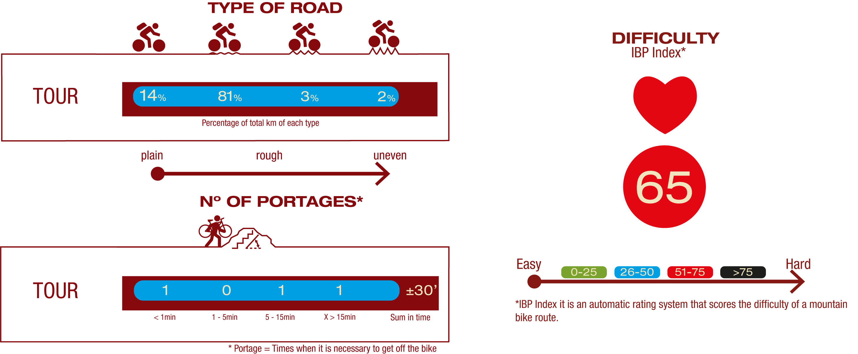
Cyclability
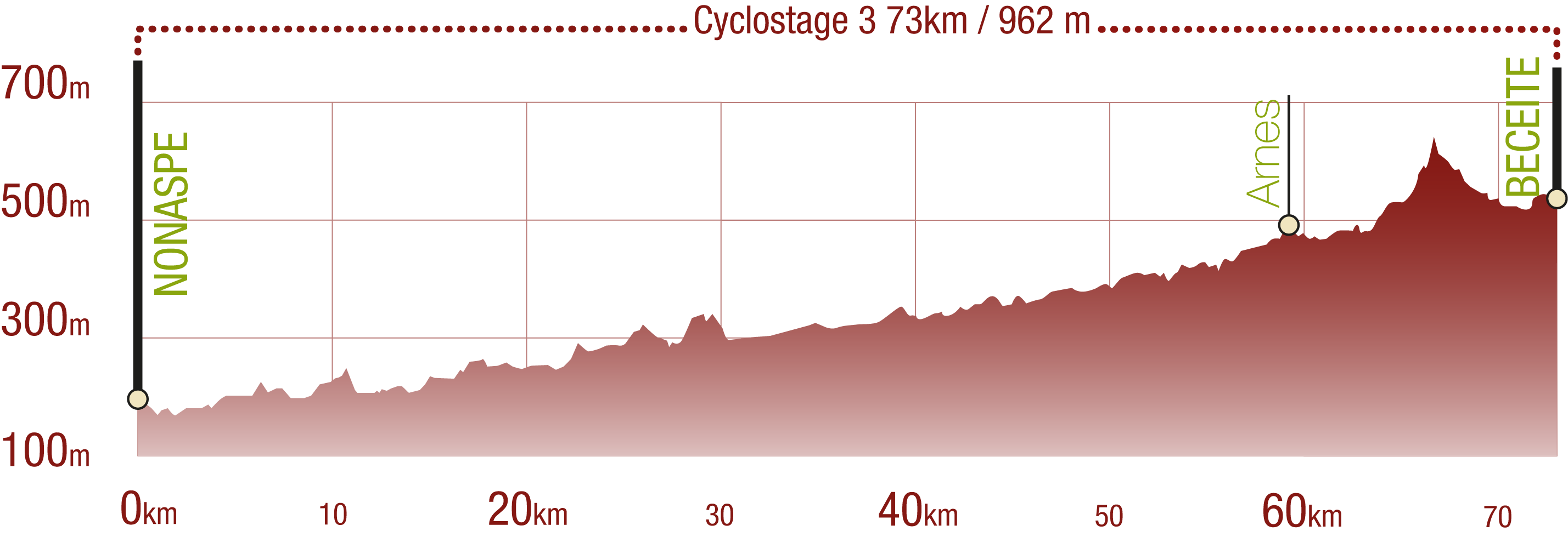
This Cyclostage correspond to stages 10 to 13 of the Nature Trail
PROFILE
TYPE OF ROAD, PORTAGES & DIFFICULTY
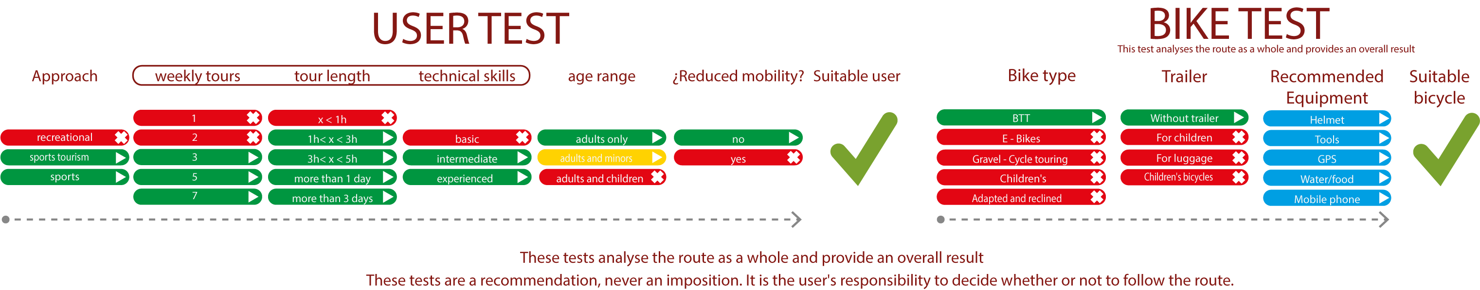
TEST
SAFETY RECOMMENDATIONS
- Sections shared with hikers.
- Transit through the centre of some population centres.
- Due to the fact that the route runs close to riverbeds, crossing them on several occasions, you are informed that there may be seasonal discontinuities caused by floods, increases in flow, floods or transit through flood-prone areas.
GENERAL RECOMMENDATIONS
- Find out about the technical aspects of the route and the weather on the day.
- Take care of the environment. Take care not to disturb animals or damage vegetation. Respect private areas.
- You must give priority to pedestrians and comply with general traffic rules.
- The environment in which you will be riding is open, free to move around and an area where many activities are carried out (sporting, forestry, livestock and agricultural activities). Always have an understanding, prudent, responsible and respectful attitude.