
- Home
- Rural Development
- Nature Trails
- Nature Trails
- Northeast Sector
- Matarranya Algars
Stage 10. Nonaspe-Caseres
Description
Tracing the lower course of the River Algars, the border between Autonomous Communities
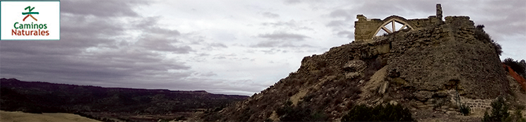
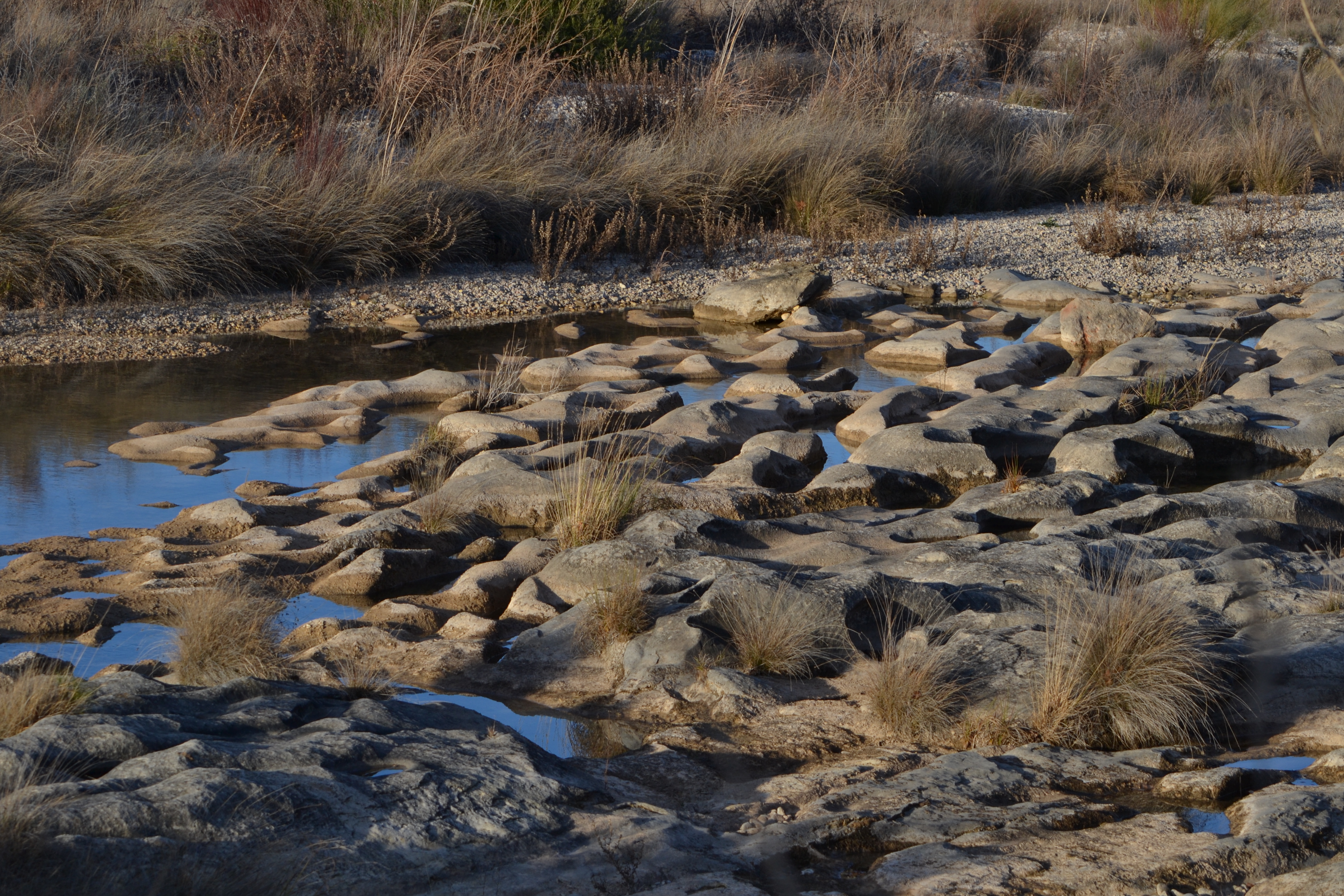
At nearly 36 km, this stage is the longest in the Nature Trail. It leaves behind the banks of the River Matarraña to follow the course of the River Algars, which serves as the boundary between Catalunya and Aragón. We shall follow the river for practically the entire route, which allows us to see the curious shapes made by the water on limestone and sandstone.

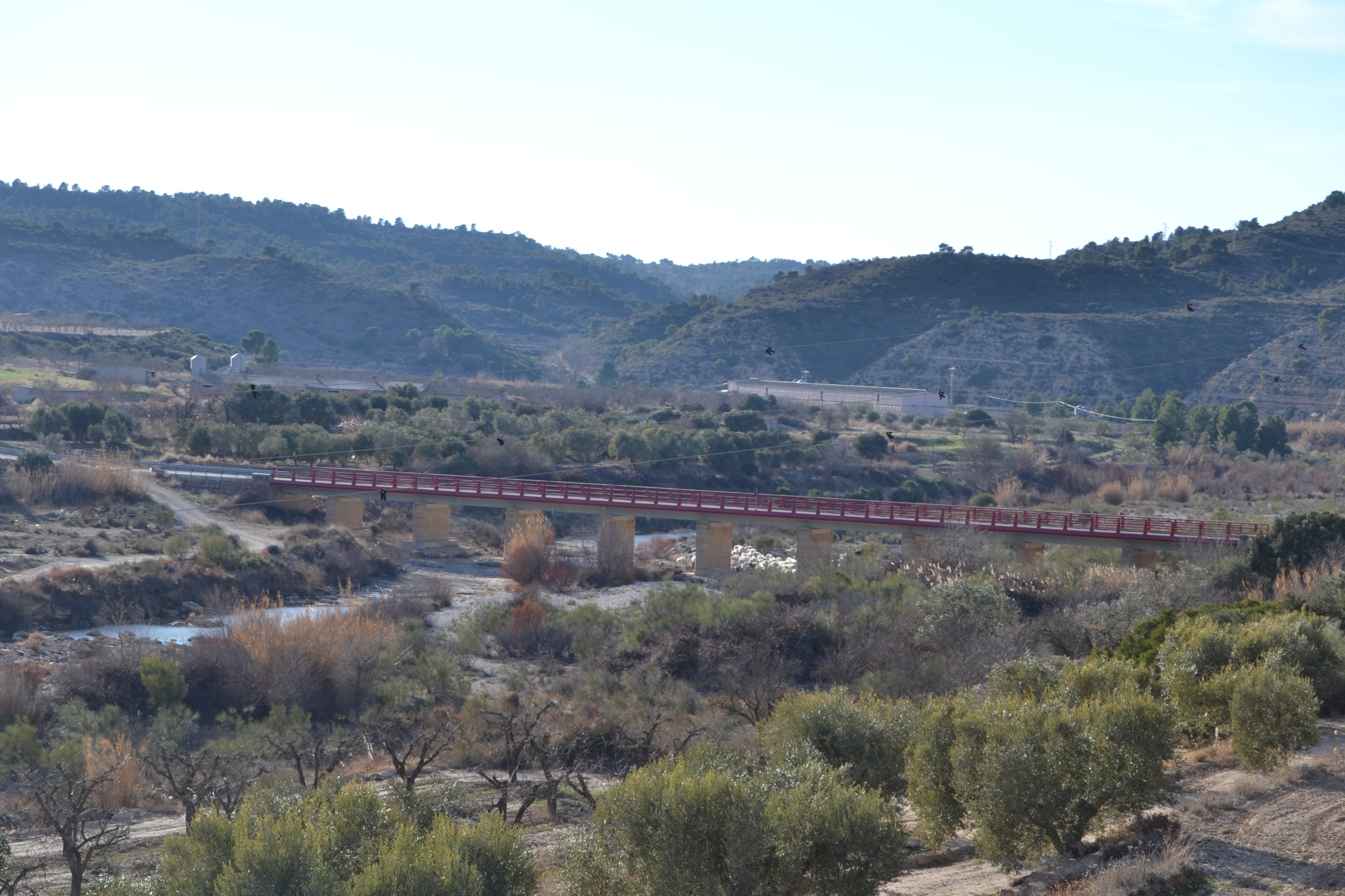
Starting from the end point of stage 8 in Nonaspe, to head towards Caseres, said town must be left via Avenida de Cataluña. During the next 700 m the trail follows the A-2411, in order to cross the River Algars via a bridge.
After crossing the river, take the first exit on the right, swapping the asphalt for the gravel or soil of the rural trails which will be followed until the end of the stage. Among the fruit crops and some livestock stables, the River Algars is reached again. It is crossed via a concrete crossing, and the left track is taken at the junction on the other side.
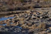
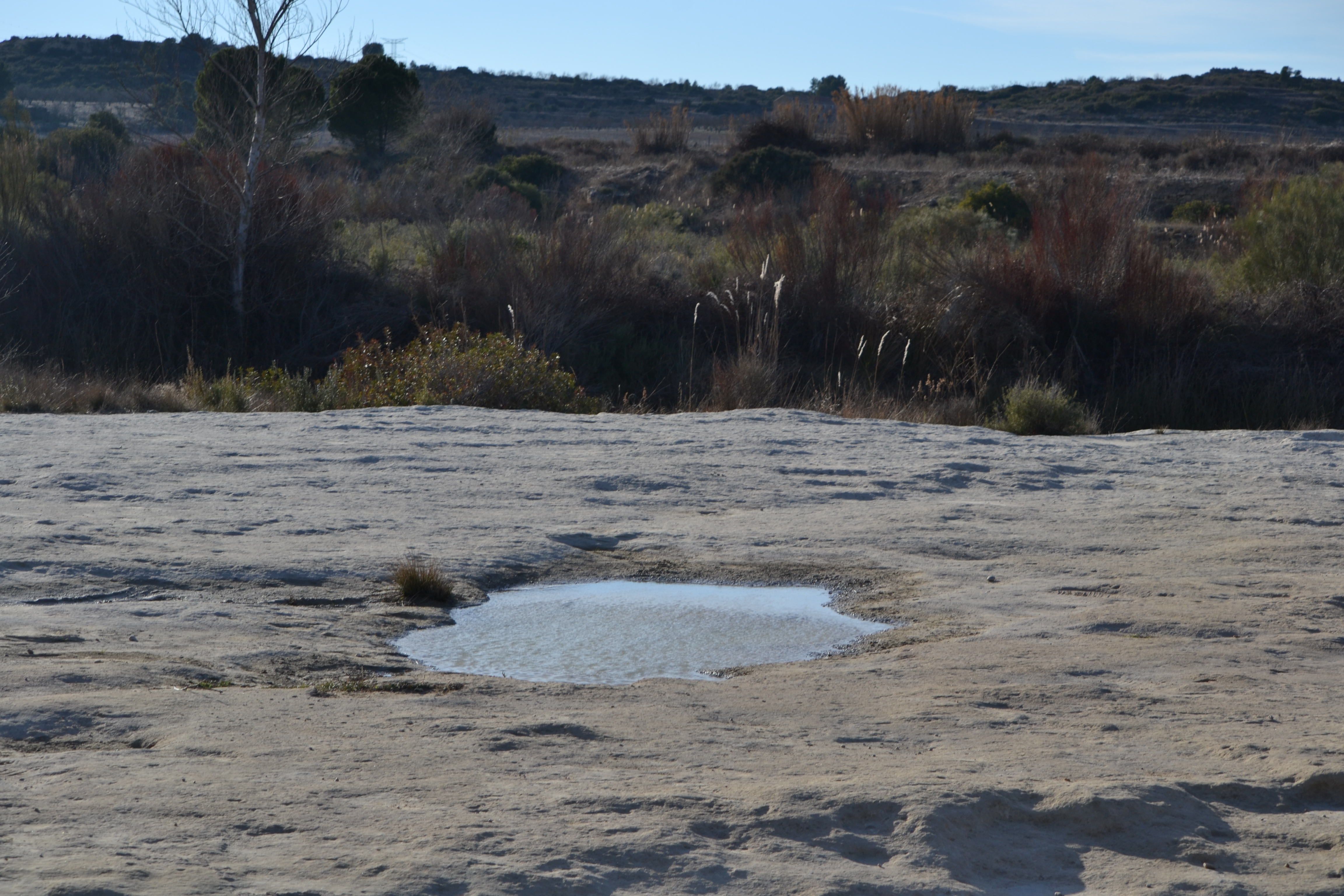
This trail continues once again through tree crops; avoid all the detours until crossing the Algars once again via another crossing. An immediate right turn must be taken, leaving some buildings in front, and continuing until reaching the Roca del Saladar; a rocky esplanade next to where the river has excavated a pool which locals uses as a bathing area.
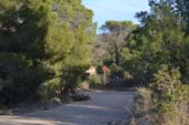
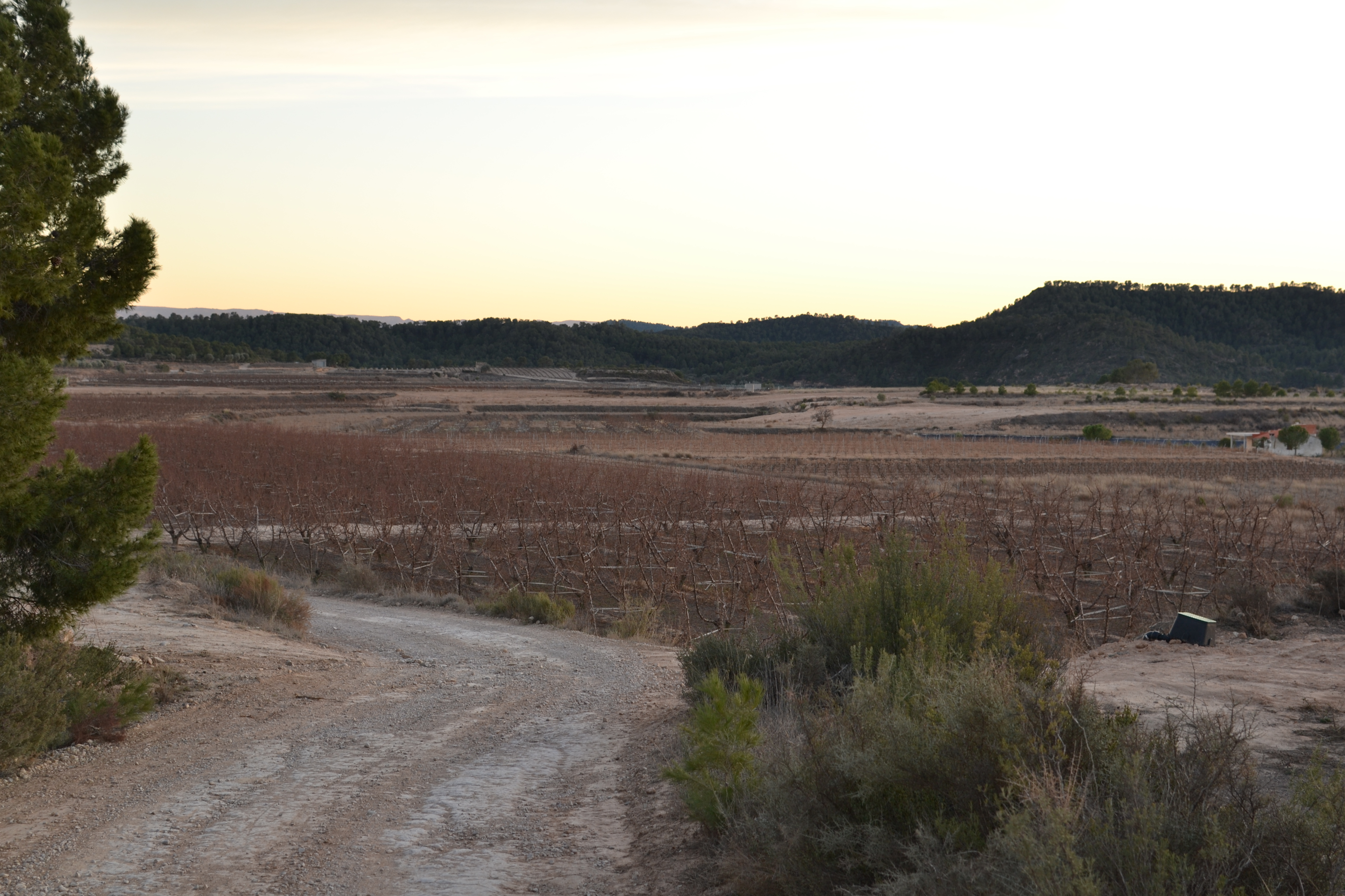
Although the landscape does not vary much, with the River Algars on the right and a few olive groves on the left, this is occasionally interrupted by a few patches of pine trees. This intensifies in the next section of the trail, in which the route leaves the river and takes a detour to the left, and then straight to the right after a small incline. The pine trees line the left hand slope, with just scrubland on the highest land, whilst on the right the anthropomorphised landscape continues.
After passing by irrigation pools and taking a detour on the right to circle an agricultural/livestock facility, the trail now passes through scrubland and pastures. Lots of other paths cross this trail, and although this is the core one, it is recommendable to pay attention to the signs.
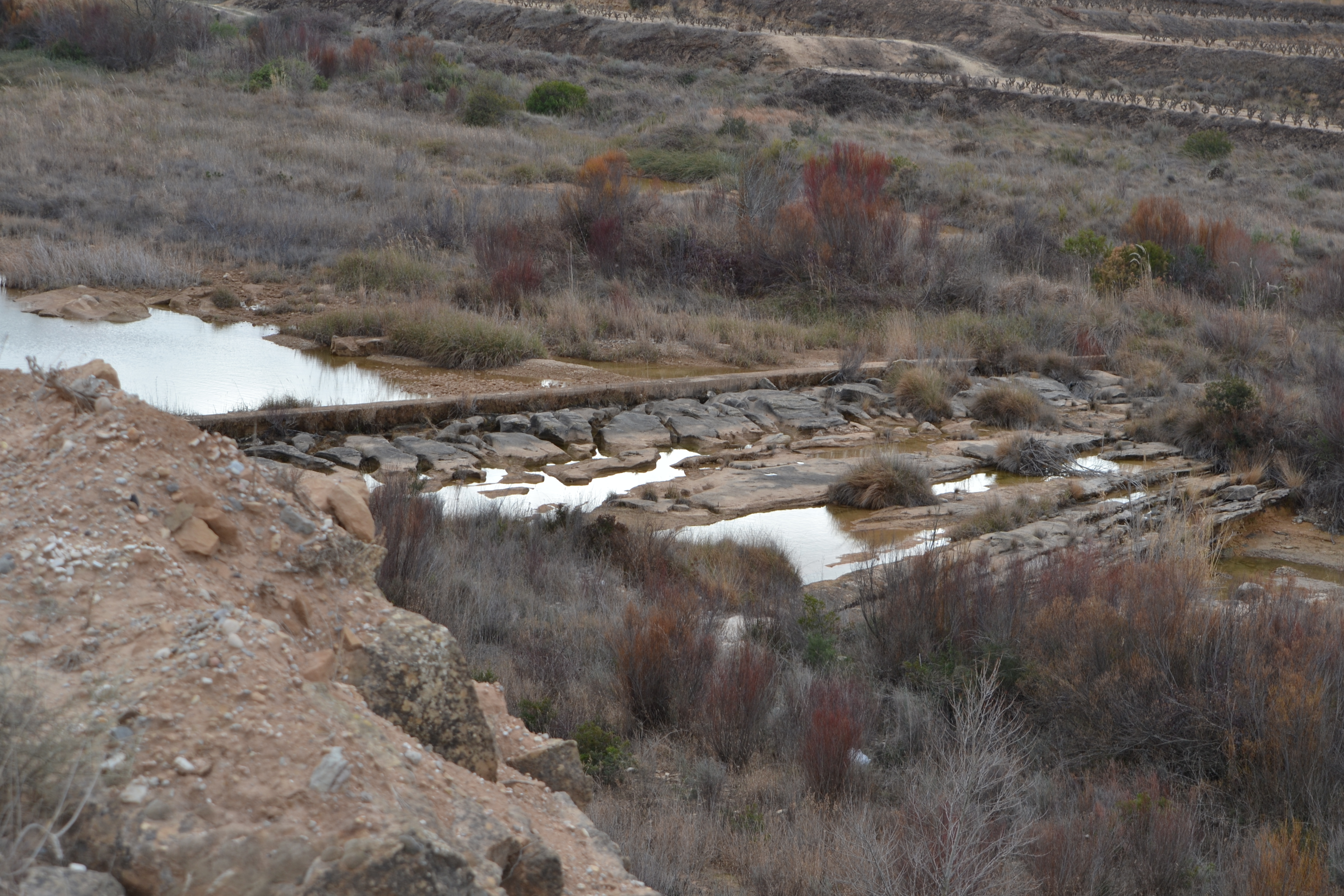
After circling around another area with tree crops, the trail turns to the right in search of the riverbanks to once again travel alongside it. Immediately one of the weirs which control the flow of the river Algars is reached, this has a prominent Mediterranean character. A few metres later, a crossing allows you to cross over the river.
This ford coincides with Stage 5 of the Jacobeo del Ebro Trail, which links Batea and Fabara. It crosses the River Algars, and although there are elements of great historic importance on the other side, such as the Roquizal del Rullo settlement (considered to be the most important Iron Age settlement in the Autonomous Community of Aragón, with items exhibited in the National Archaeological Museum), the route continues along the right side of the river. For nearly two kilometres it shares the route with the Jacobeo del Ebro Trail, after which it veers to the right to descend through pine trees and Mediterranean scrubland to once again reach the river. Here, the water has made whimsical images on the rock.
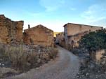
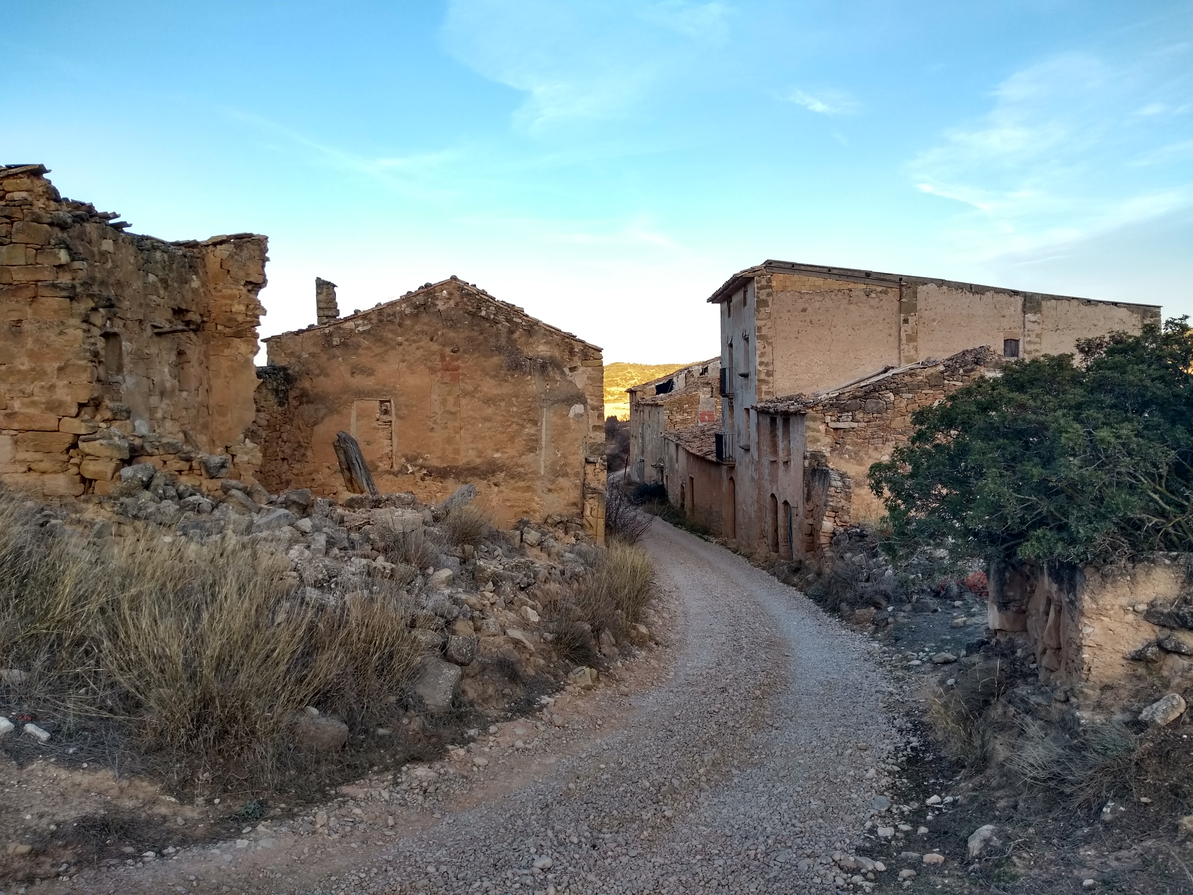
For the next 5 km, the trail goes past two meanders in the river, among crops, olive groves, scrubland and a few pine trees, passing next to newly excavated wells between rocks and the Les Cadolletes weir. Here, the trail has left the province of Zaragoza to now change Autonomous Communities and enter Tarragona. Moving away gradually from the river, the relative monotony in this section of the stage is interrupted by the abandoned town of Pinyeres (see additional information). Many of its buildings are still standing, especially the church which was built on the top of the hill that the town stands on.
Crossing Pinyeres and leaving the old cemetery behind, the trail continues along not-so-different surroundings. Another Iberian settlement lies on a hill to the right of the trail. It can be reached by taking a detour on the right hand side.
Although the trail has been somewhat away from the river for a while now, it has been passing through a protected area, the PEIN (Protected Space of Natural Interest) Ribera de Algars. Continuing the route and ignoring any tracks which lead off the main one, we come to an asphalt track which was once part of the old highway.
It carries on for a few meters towards the right, and then takes a detour which is again a dirt road. It descends until passing under a bridge which is part of the C-221 highway (from Batea to Maella). We then retake the trail until the edge of the highway. We then immediately take the dirt path on the left.
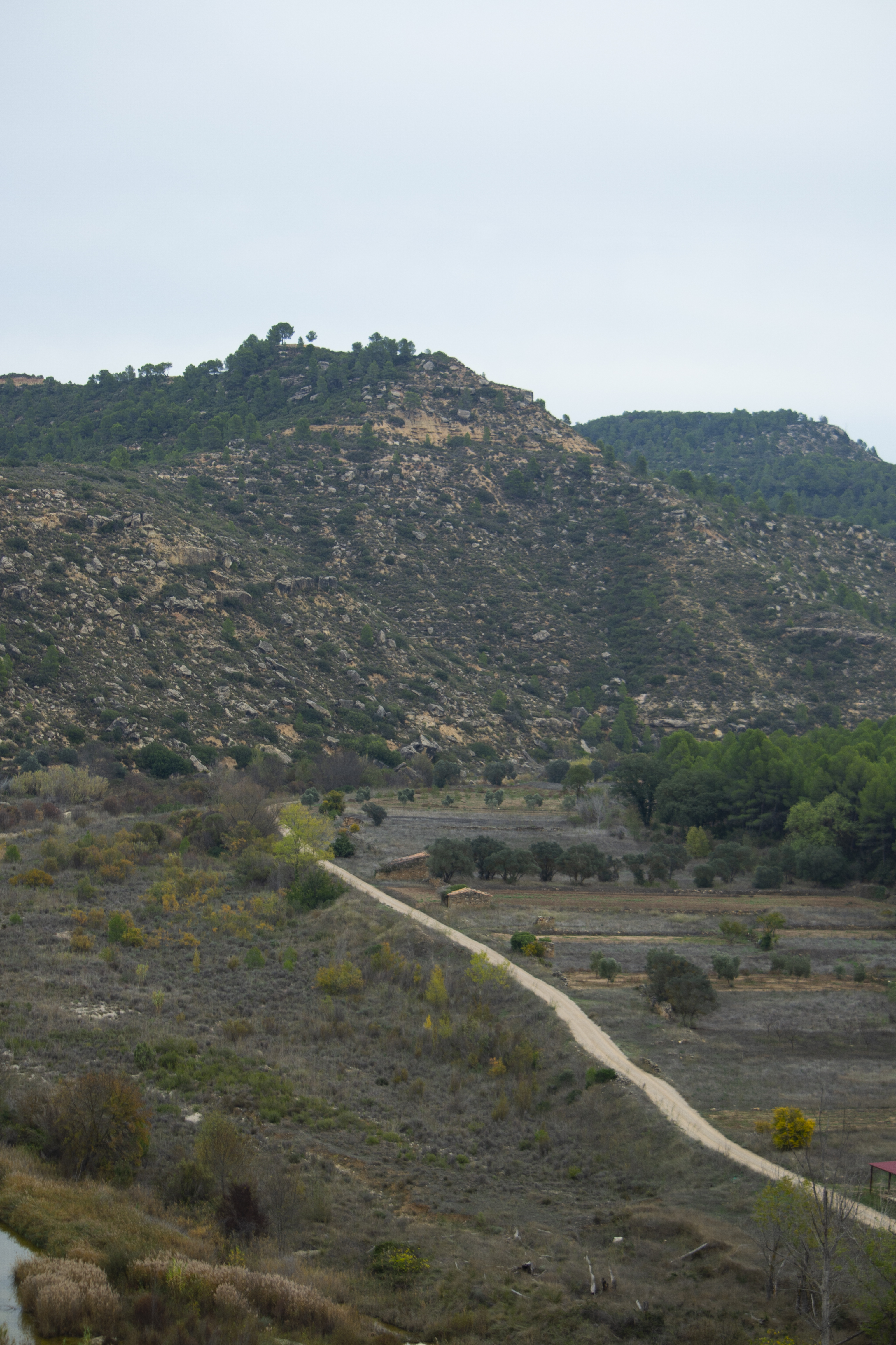
From this point, the town of Batea is less than 8 km away by the C-221 highway, although for greater security, the hiker can choose to continue along the nature trail and take a detour somewhat later and arrive at the town by using country trails. After a couple of kilometres between the river on one side and fields and scrubland on the other, we come to the detour that ascends to the shrine of Sant Joan d’Algars. Despite being somewhat demanding, this ascent through pine trees and on a gravel track is worthwhile for the spectacular views of the Algars valley. These are even more impressive if you have the energy to climb up to the ruins of the San Juán castle.
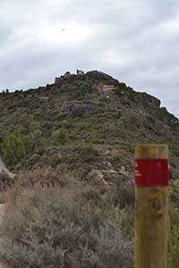
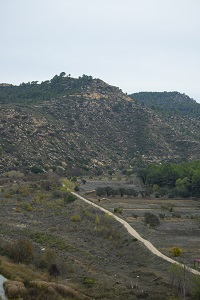
After passing by another weir, the trail momentarily moves away from the river that meanders significantly at this point, crossing olive groves and vineyards, to meet up again after a kilometre. The nature trail continues to run by the Algars for another 4 km, when it begins to ascend a hill that also causes another meander in the river. To the left, the Punta de la Gessera hill (at a height greater than 400 m, it is one of the most elevated points in this stage and there is an Iberian settlement at its peak) will be a constant landmark until we reach the end of this stage.
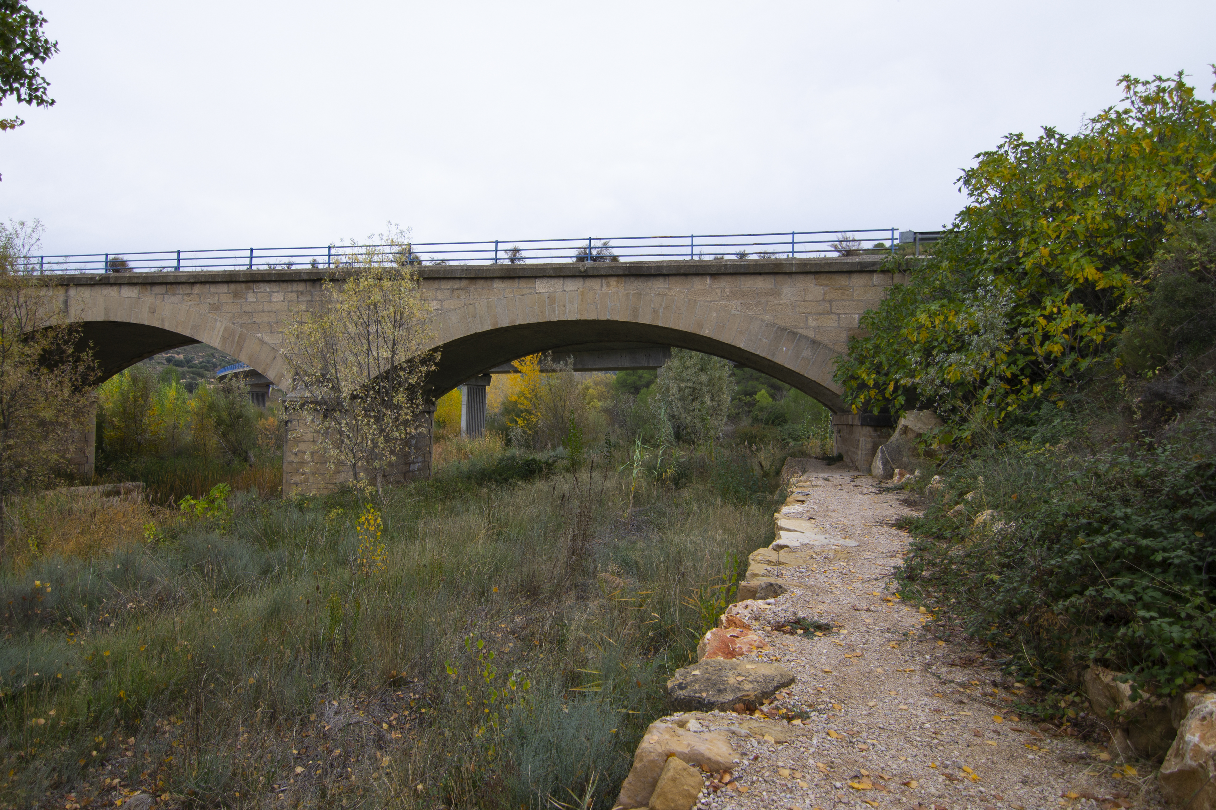
The height of the trail offers us good views of the valley of Algars before descending once again towards the river, which is crossed by a concrete ford with pedestrian sections. Changing the river bank once again implies changing the province, this time entering Teruel. Traversing the river’s floodplain through farmland for more than a kilometre, the trail then runs along one of the valley walls before coming to the N-420 highway.
The trail changes to a pedestrian path that descends next to the pillars of the two bridges that cross the river at this point (that of the aforementioned N-420 and the old highway that it replaced), to then ascend until it reaches the bridge of the ravine of Vall Robira.
Retaking the wide forest track, the trail enters a pine grove with Mediterranean undergrowth until it practically reaches the end of the route. Close to the river valley, the forest is replaced by rushes and reeds and the road takes a turn to the left and passes by some houses (Venta de Vidiella), crossing the river by a concrete ford. Once again in the province of Tarragona, this long stage ends at the outskirts of Caseres, next to the municipal swimming pool.
Map
Puntos de Interés
Geología
Hidrografía
Profile
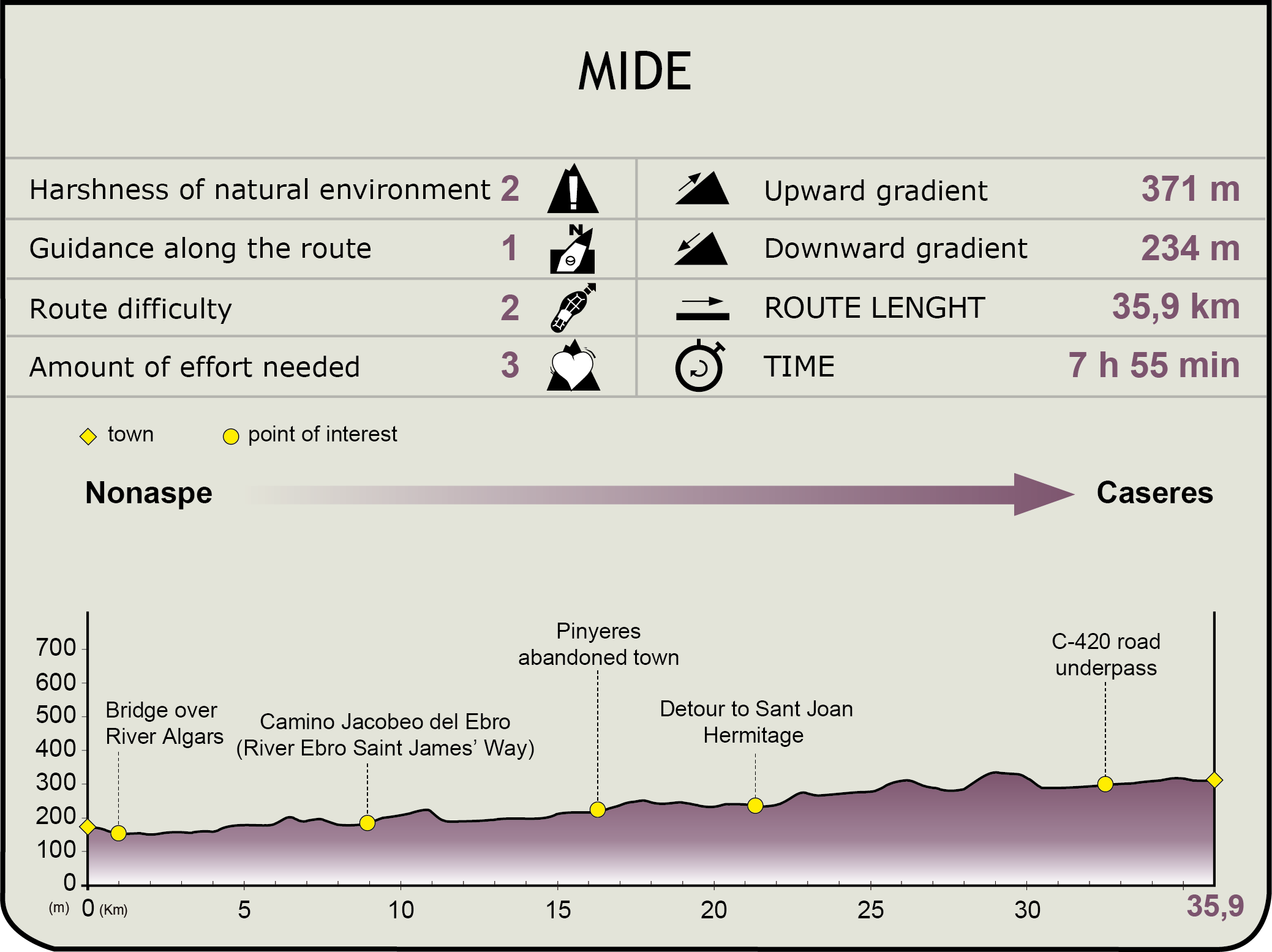
MIDE (Method for the Information of Excursions)
 Harshness of natural environment
- 1. The environment is not risk-free
- 2. There are more than one risk factors
- 3. There are various risk factors
- 4. There are quite a lot of risk factors
- 5. There are many risk factors
 Guidance along the route
- 1. Well defined trails and crossings
- 2. There is a clearly marked trail and signage
- 3. Requires the identification of geographic features and cardinal points
- 4. Requires off-path navigation
- 5. The trail is interrupted by obstacles that have to be gone around
 Route difficulty
- 1. Walking on a flat surface
- 2. Trails with different types of path
- 3. Walking on stepped paths or irregular terrain
- 4. The use of hands or jumping over the terrain is necessary
- 5. The use of hands is required to progress
 Amount of effort needed
- 1. Up to 1 hour of continuous walking
- 2. Between 1 and 3 hours of continuous walking
- 3. Between 3 and 6 hours of continuous walking
- 4. Between 6 and 10 hours of actual walking
- 5. More than 10 hours of continuous walking
Featured
Further information
Pinyeres
This hamlet, in the municipality of Batea, which is unpopulated these days, is located on the banks of the River Algars. It is an area that was inhabited since ancient times, as proven by the nearby Iberian village of Tossal del Moro.
Pinyeres started to have its own inhabitants in the 13th century, with two buildings which stood out among the others: the castle, which was destroyed and reused to make buildings for the locals; and the Transfiguración del Señor church, a beautiful example of a church from the Christian reconquest, transformed into a Gothic one. This is still standing and can be visited.
Its proximity to the river was a great advantage, as it had well irrigated land; however it was also a disadvantage as the location made it susceptible to epidemics. As such, in the period of illnesses and high temperatures, the town used to empty and the locals would split up among the nearby villages such as Batea, Fabara and Nonaspe.
Due to the fact that it is very close to nearby towns and villages with basic services, the population gradually decreased until the last inhabitants moved to Batea in the 1970s.
PEIN (Plan de Espacios de Interés Natural-Spaces of Natural Interest Plan) Ribera de l’Algars
In Catalonia, the Spaces of Natural Interest Plan (PEIN), approved in 1992, is a high level planning instrument which structures the system of protected areas in Catalonia and integrates this system throughout the entire territory..
Ribera de l'Algars is a riverside area located on the south western edge of the Central basin, which borders the province of Teruel. The River Algars, together with the River Montsant, is one of the most interesting and best conserved Mediterranean - Catalan rivers; plus it has a wide diversity of fauna, which includes populations of Iberian fish and otters. The landscapes are a stark contrast with the surrounding land, which is profusely dedicated to rainfed crops. As with all Mediterranean river systems, it is very sensitive to alternations.
Besides being within the PEIN, the Ribera de l’Algars is also a SCI and SPAB area.
Caseres
Although the centre of the town dates back to the 12th century, the municipality has been inhabited from the 7th century BCE at least, as proved by the Iberian settlements (the Ilercavones) of La Gessera, Los Corralets, Sierra Media, Coll del Moro of Mudefer and El Puig. Phoenicians, Carthaginians, Romans, Visigoths, Arabs, Cathars, as well as Templar and Hospitaller Knights have passed through this border area. In the modern era, it was a witness to the Reapers’ War , and the War of Succession, and later on, it was a victim of the bloody battle of Ebro during the Spanish Civil War.
Caseres is a municipality in Tarragona which belongs to the comarca or region of Terra Alta.
The parish church dedicated to Saint Mary Magdalene is a particular archaeological highlight. A Gothic church built in the 16th century, it has since been reformed. On the outskirts of the town is the ancient site of Almudéfer, which still conserves the remains of the castle and the church of Santa Ana.
The municipality of Caseres is part of the zone of production of three products with Protected Designation of Origin (PDO), Terra Alta olive oil, Terra Alta wine and Reus hazelnuts.
Multimedia


Downloads
GPS Doqnloads
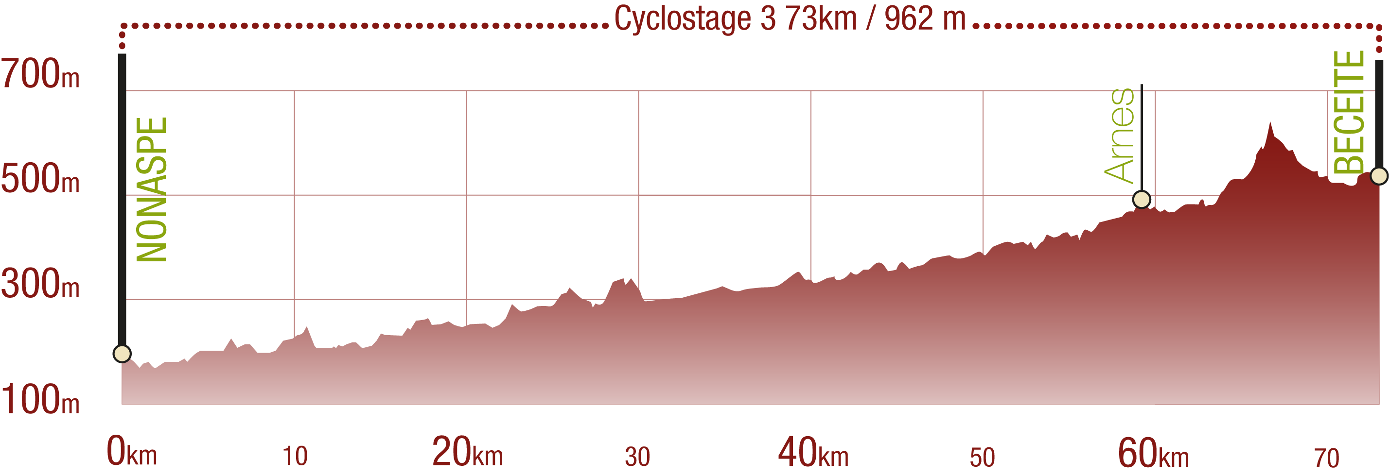
Cyclability
This Cyclostage correspond to stages 10 to 13 of the Nature Trail
PROFILE
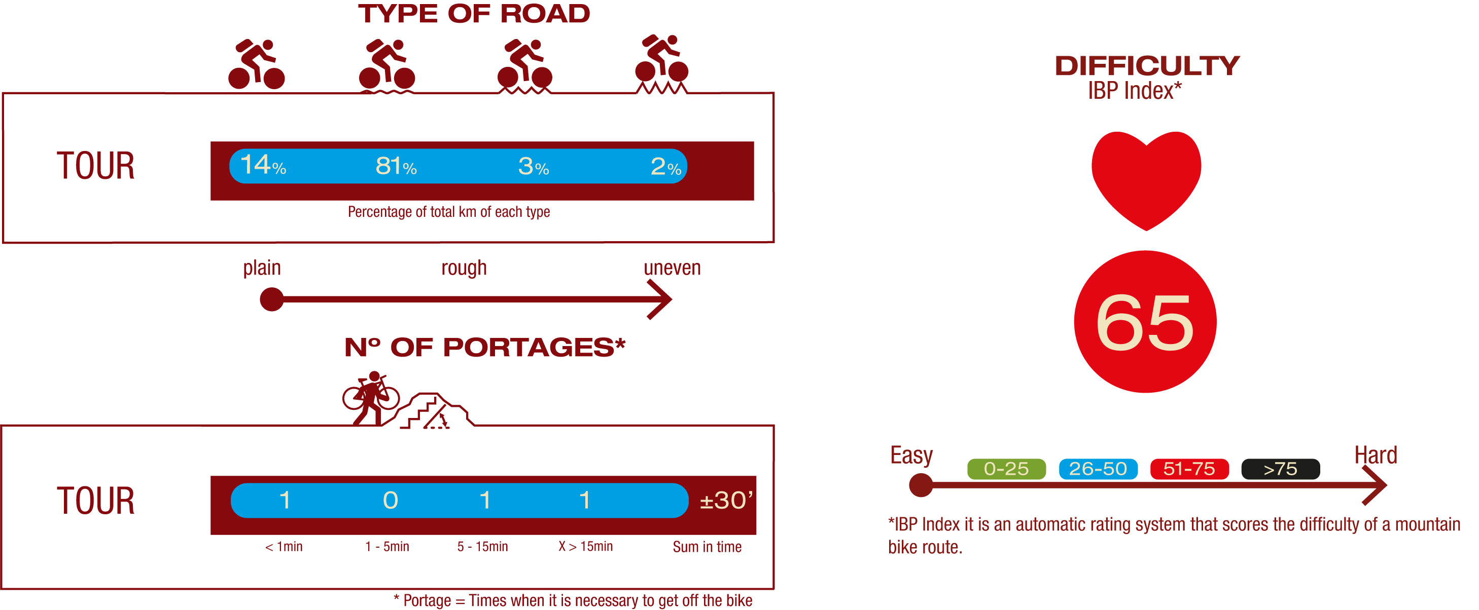
TYPE OF ROAD, PORTAGES & DIFFICULTY
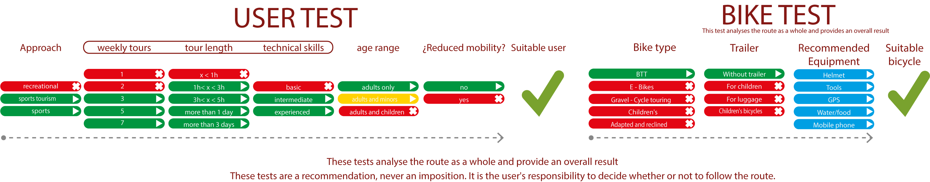
TEST
SAFETY RECOMMENDATIONS
- Sections shared with hikers.
- Transit through the centre of some population centres.
- Due to the fact that the route runs close to riverbeds, crossing them on several occasions, you are informed that there may be seasonal discontinuities caused by floods, increases in flow, floods or transit through flood-prone areas.
GENERAL RECOMMENDATIONS
- Find out about the technical aspects of the route and the weather on the day.
- Take care of the environment. Take care not to disturb animals or damage vegetation. Respect private areas.
- You must give priority to pedestrians and comply with general traffic rules.
- The environment in which you will be riding is open, free to move around and an area where many activities are carried out (sporting, forestry, livestock and agricultural activities). Always have an understanding, prudent, responsible and respectful attitude.