
- Home
- Rural Development
- Nature Trails
- Nature Trails
- Northeast Sector
- Matarranya Algars
Stage 6. Mazaleón-Maella
Description
From Teruel to Zaragoza by the mid course of the Matarraña River
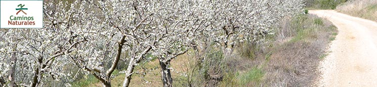
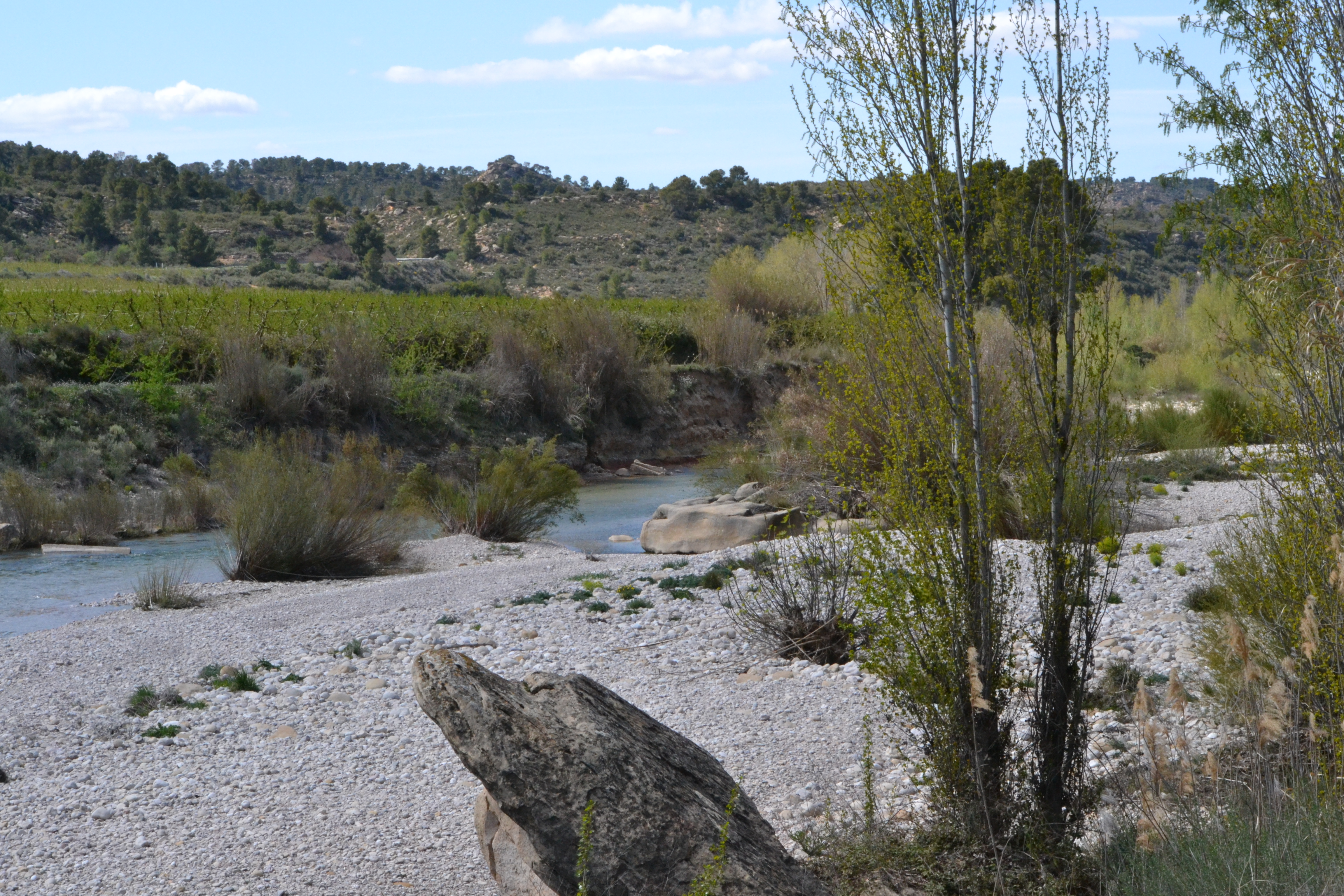
Along the sixth stage of the Matarraña-Algars Nature Trail, the traveller will cross the province border, leaving Teruel behind and entering Zaragoza. The closeness to the Matarraña river during this stage allows the traveller to enjoy the middle course of the Matarraña, which is very different compared to previous stages.
The traveller can continue discovering the Iberian legacy of this area before beginning the last stage of this phase of the Matarraña-Algars Nature Trail. There is a path leading to the Iberian archaeological sites of Escudines Altes and Baixes. This path is located 1.3 km before the end of the fifth stage in Mazaleón and it goes south through the A-1412 road.
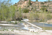
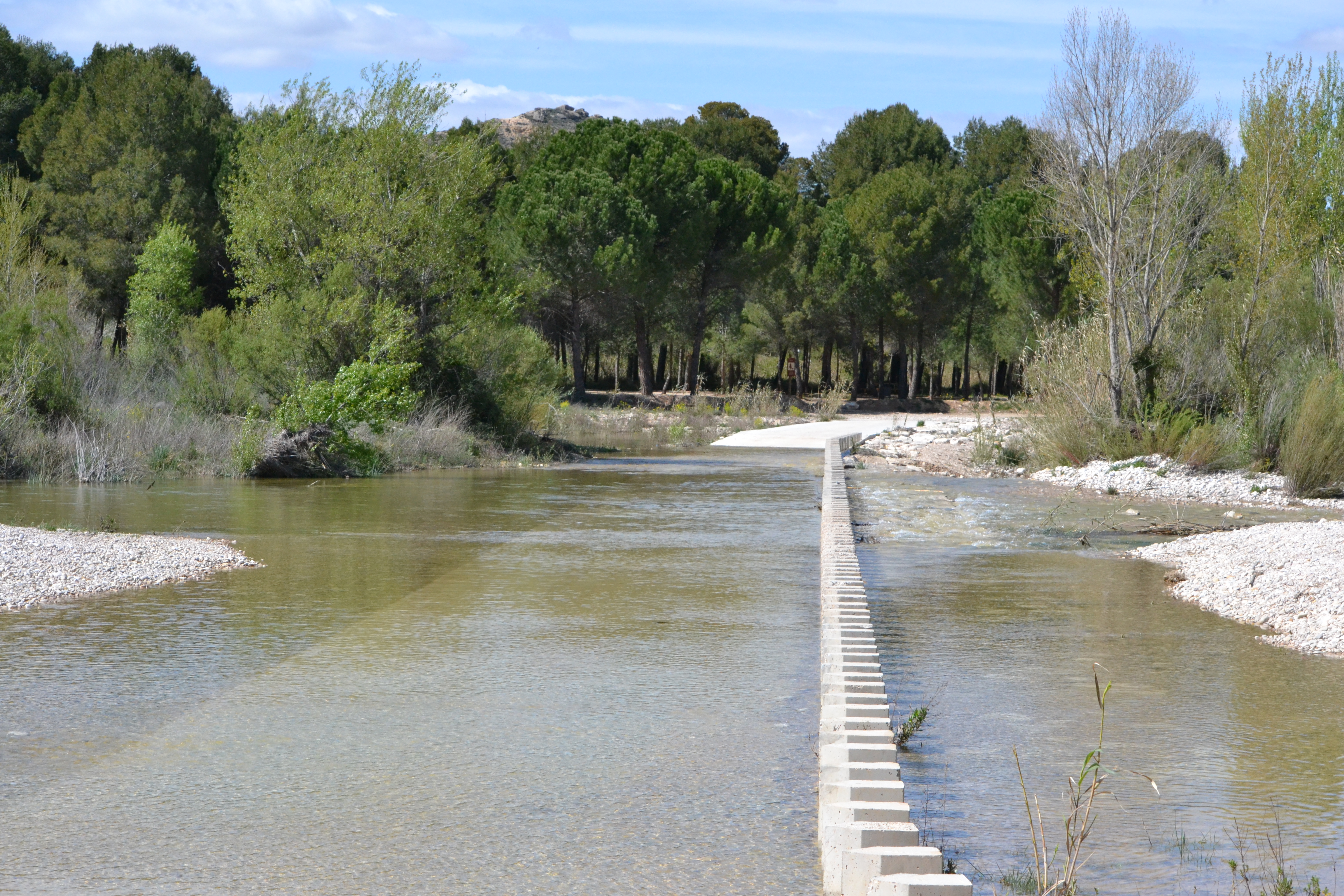
The traveller begins the sixth stage of the trail going through the last stretch of the previous one, leaving the town of Mazaleón behind and crossing the Matarraña river over a footbridge. Then, the route takes a branch on the left and the trail runs near the river, leaving crops on the right up to the point it arrives at a concrete ford where the traveller must cross to the other bank (as usual, if the river carries a lot of water, it can be difficult to cross it).
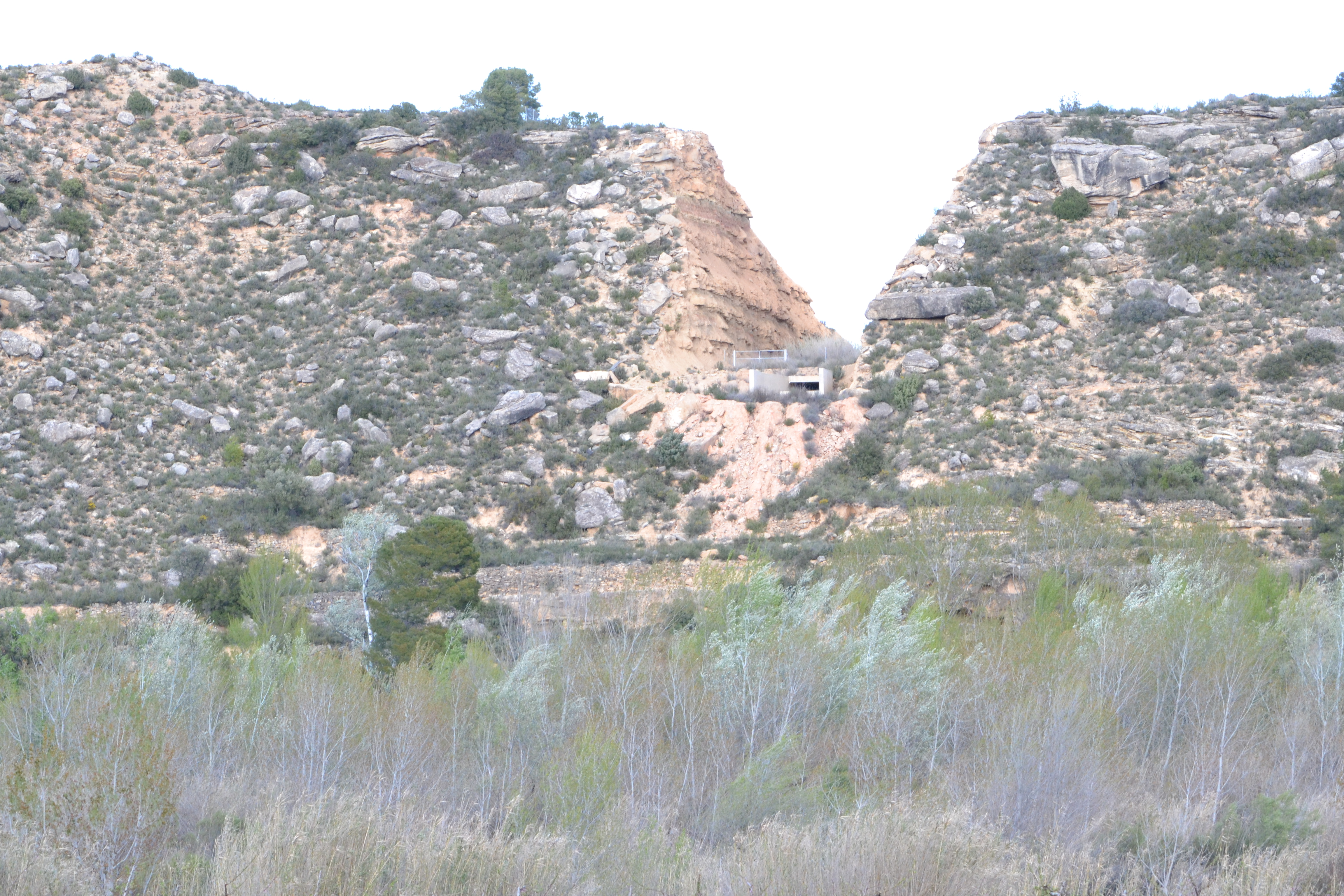
After walking over three kilometres along the left bank of the Matarraña river, the traveller will cross the river again thanks to another ford. If travellers look at the canyon walls in the background, on the right side of the river, they will see the overflow channels of the Val Comuna reservoir.
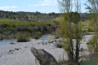
On the other side of the Matarraña river, the trail continues near the river and then bends 90 degrees to follow a dirt track. Along this stretch, the traveller will cross the province border, from Teruel to Zaragoza.
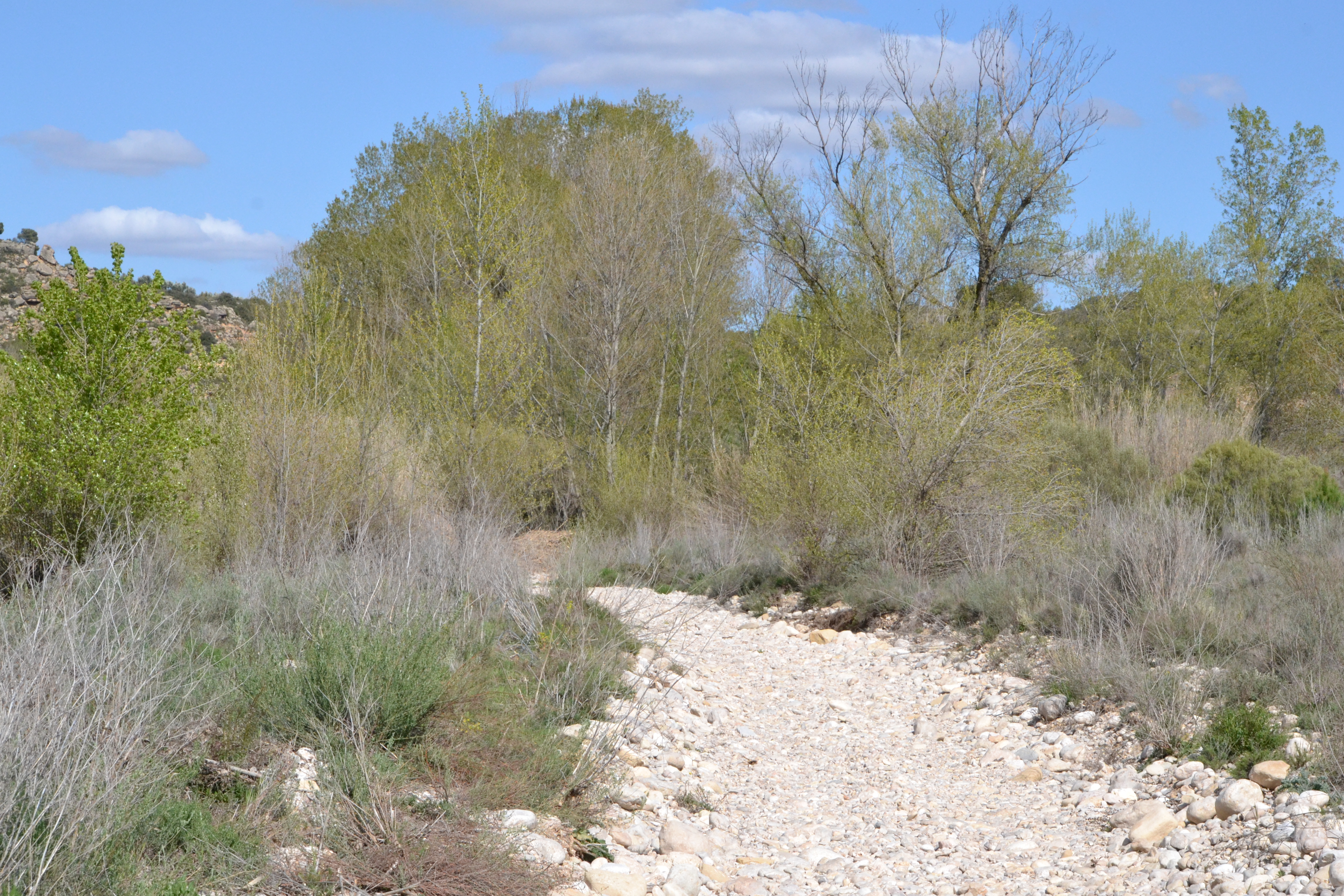
This stretch of the trail, where the traveller goes through the river meadows, is usually done through a path covered with thick gravel and river stones that will make it difficult for those who want to go by bicycle.
Although the trail goes back to the crop landscape, there are no pine forests on the right canyon walls, but Mediterranean scrub and olive trees.

Although there are still paths leading to private properties, there are fewer intersections than in the previous stage. The trail continues until it reaches a branch allowing the travellers to access the pine forest where Las Cherizas rest area is located. This branch is located 9.5 km into the route and the traveller will reach the rest area after crossing the river by means of a ford.
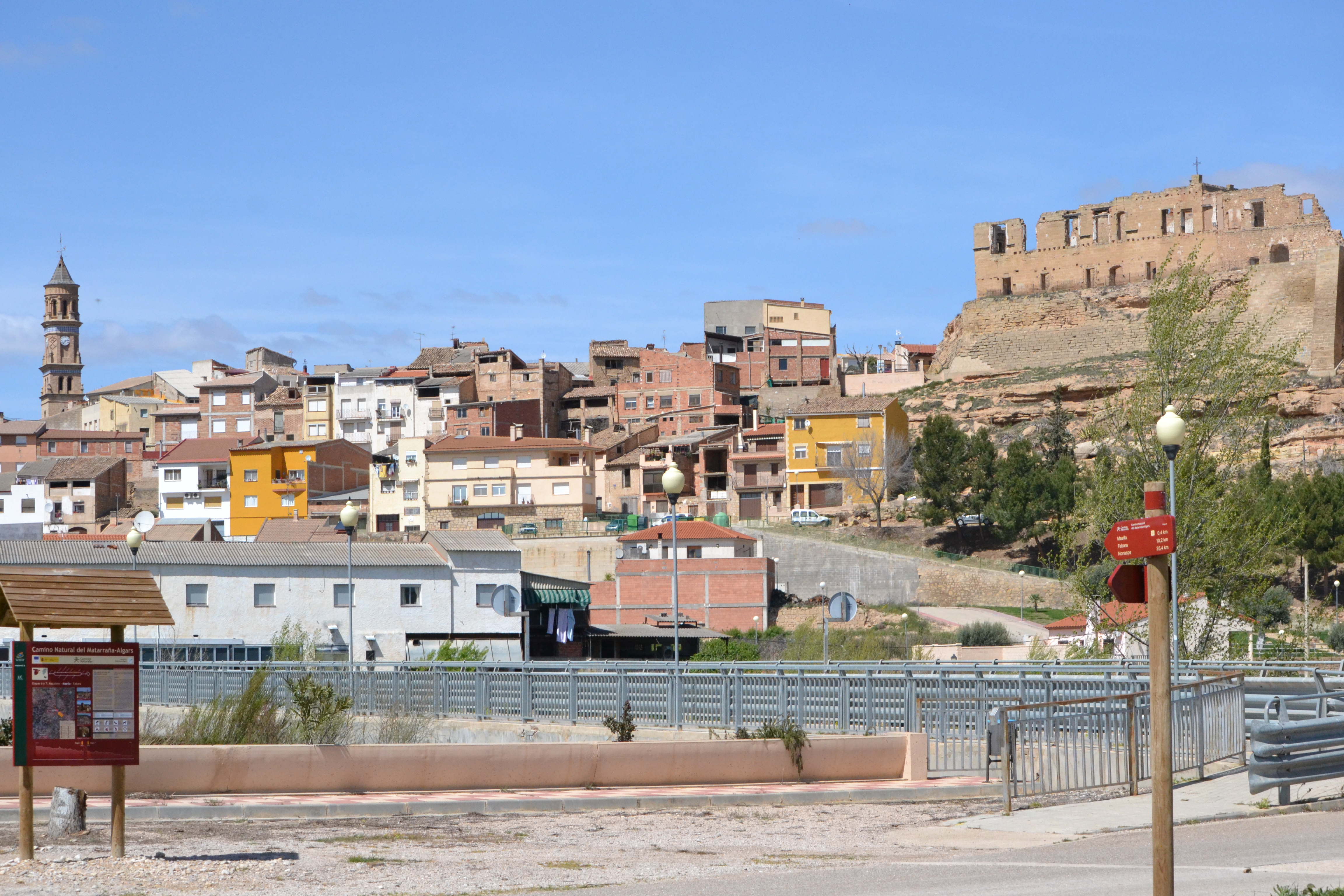
Less than 3.5 km before the end of this stage, the castle and the clock tower of Maella can be seen on the other side of the river, provided that the riverbank vegetation and the fruit trees make it possible. This stage ends next to the long bridge over the Matarraña river allowing the traveller to enter Maella, a monumental which is worth visiting.
Sites of interest
Map
Puntos de Interés
Hidrografía
Infraestructura
Municipio
Vegetación
Profile
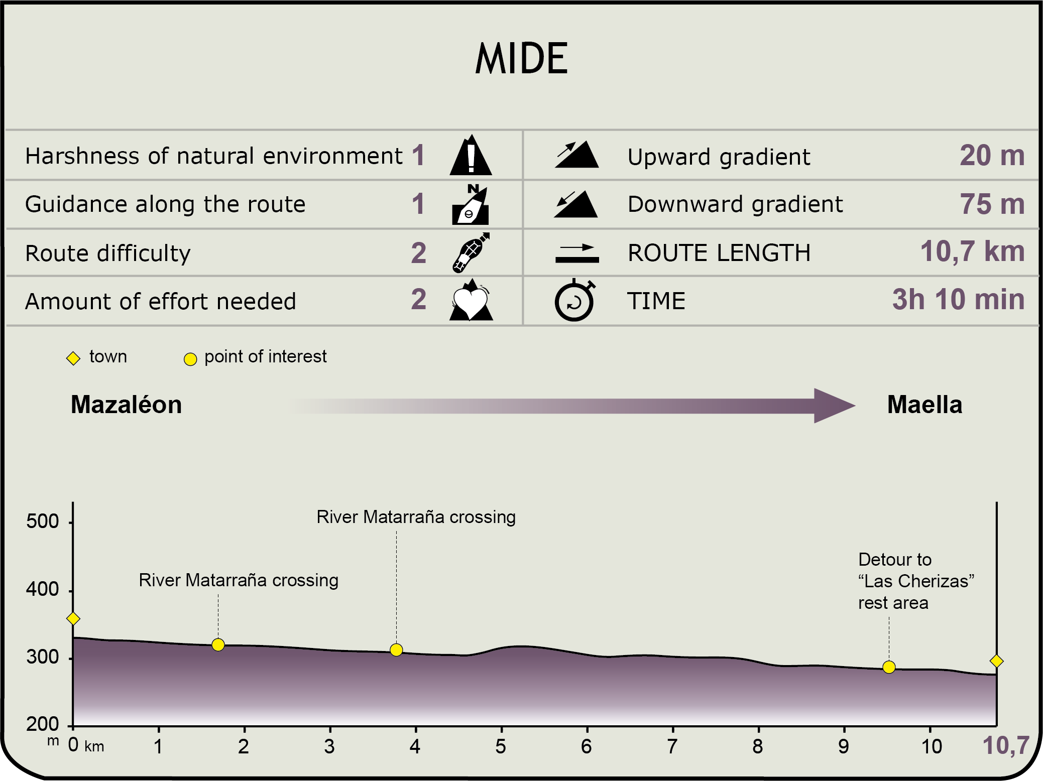
MIDE (Method for the Information of Excursions)
 Harshness of natural environment
- 1. The environment is not risk-free
- 2. There are more than one risk factors
- 3. There are various risk factors
- 4. There are quite a lot of risk factors
- 5. There are many risk factors
 Guidance along the route
- 1. Well defined trails and crossings
- 2. There is a clearly marked trail and signage
- 3. Requires the identification of geographic features and cardinal points
- 4. Requires off-path navigation
- 5. The trail is interrupted by obstacles that have to be gone around
 Route difficulty
- 1. Walking on a flat surface
- 2. Trails with different types of path
- 3. Walking on stepped paths or irregular terrain
- 4. The use of hands or jumping over the terrain is necessary
- 5. The use of hands is required to progress
 Amount of effort needed
- 1. Up to 1 hour of continuous walking
- 2. Between 1 and 3 hours of continuous walking
- 3. Between 3 and 6 hours of continuous walking
- 4. Between 6 and 10 hours of actual walking
- 5. More than 10 hours of continuous walking
Featured
Further information
Mazaleón
This is the most northern town in the Matarraña region. Although it has a lot of interesting buildings, the Gothic church of Santa María la Mayor, attached to the old wall enclosing the town and still boasting one of its towers, stands out. The City Council is also worth visiting. It is divided into three buildings and it has a market with access to its two façades. In the centre of the main façade, there is a relief with the town shield, a lion with a mace. Inside the building, there is the former prison, which has interesting graffiti made by the prisoners.
In the mountain pass, on the other side of the Matarraña river, lays the Iberian village of San Cristóbal. The hermitage of San Cristóbal and the Route of the Iberians Visitor Centre are next to the village. There are two more Iberian archaeological sites, Escudines Altes and Escudines Baixes, not far from the town centre.
Maella
Maella is a monumental town. On its highest area, there is a remarkable castle, still impressive despite being in ruins. It had different owners and its worst episode was during the Carlist Wars, when it caught fire. Today, travellers can visit its wine cellars, which have been recently restored. The church of San Esteban, with a façade with a three-space belfry standing out, is at the base of the castle. Another landmark is the church of Santa María. Its construction was started in the 14th century but underwent several stages, the last one in 1777. After being severally damaged during the Civil War, this church was restored and reopened in 1955.
Another interesting building in this town, also visible from the distance, is the Clock Tower, which was built between the 11th and 12th centuries and combines Romanesque and Mudejar styles. Pablo Gargallo house and museum is also worth visiting. He was one of the most important sculptors in the 20th century. The building was restored in 1985 and it holds some of the memories and works by this sculptor from Maella. The hermitage of Santa Bárbara, from the 18th century, is located outside the town centre, on the Calvario mountain.
Multimedia

Downloads
GPS Downloads
Maps
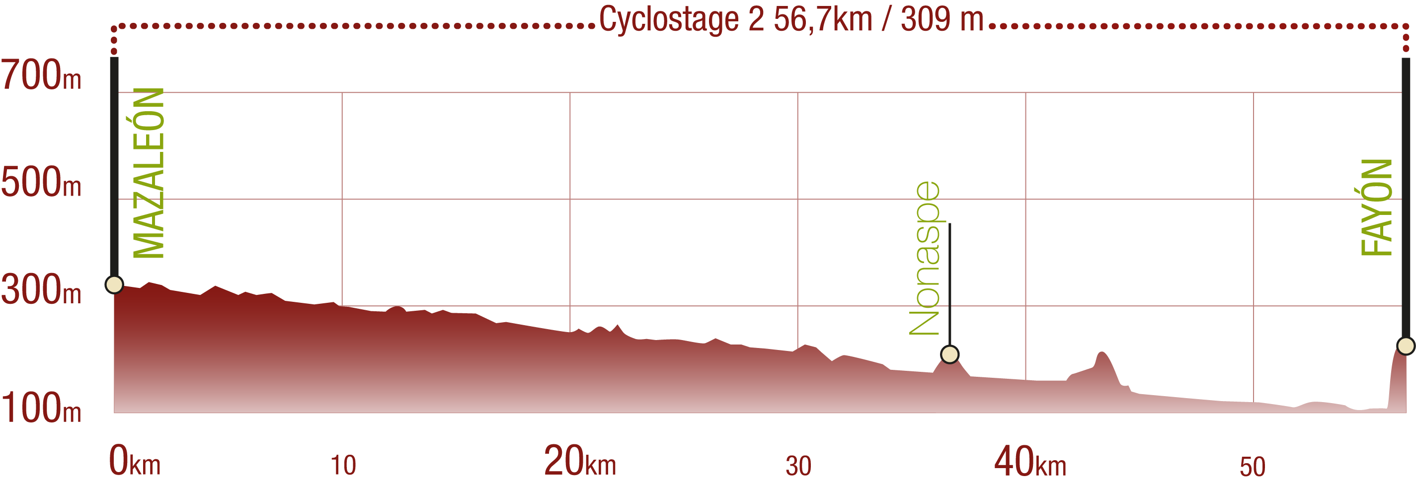
Cyclability
This Cyclostage correspond to stages 6 to 9 of the Nature Trail
PROFILE
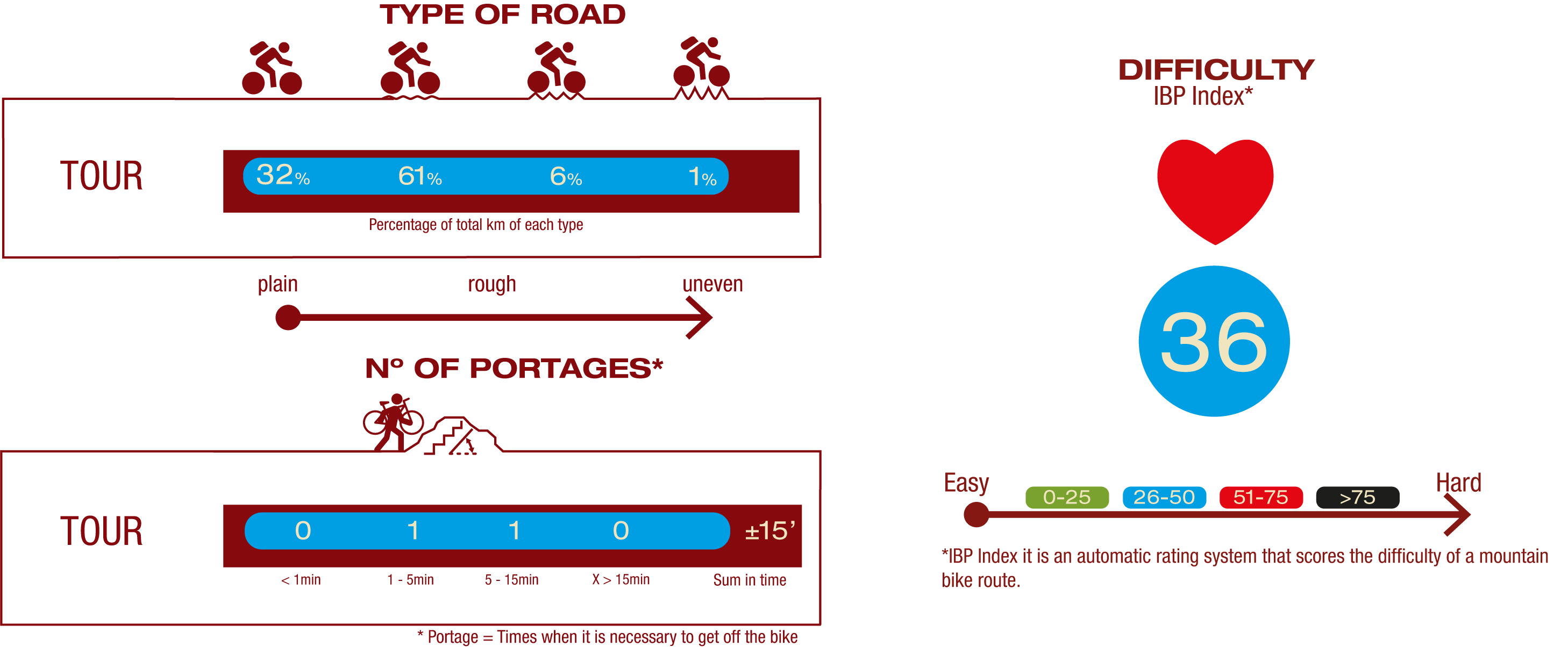
TYPE OF ROAD, PORTAGES & DIFFICULTY
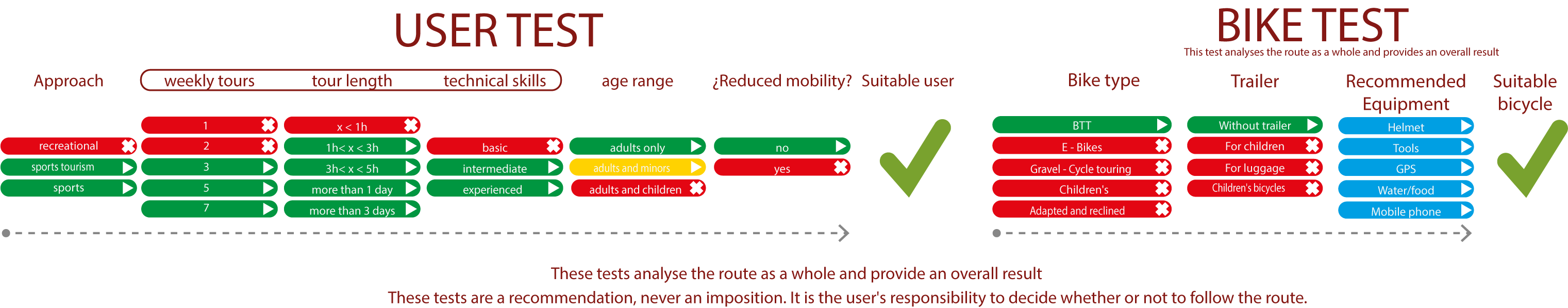
TEST
SAFETY RECCOMENDATIONS
- Sections shared with hikers.
- Transit through the centre of some population centres.
- Due to the fact that the route runs close to riverbeds, crossing them on several occasions, you are informed that there may be seasonal discontinuities caused by floods, increases in flow, floods or transit through flood-prone areas.
GENERAL RECOMMENDATIONS
- Find out about the technical aspects of the route and the weather on the day.
- Take care of the environment. Take care not to disturb animals or damage vegetation. Respect private areas.
- You must give priority to pedestrians and comply with general traffic rules.
- The environment in which you will be riding is open, free to move around and an area where many activities are carried out (sporting, forestry, livestock and agricultural activities). Always have an understanding, prudent, responsible and respectful attitude.