
- Home
- Rural Development
- Nature Trails
- Nature Trails
- Northeast Sector
- Matarranya Algars
Stage 9. Nonaspe-Fayón
Description
The River Matarraña seeks the River Ebro
This is the last stage that is entirely within the province of Zaragoza. The River Matarraña accompanies this section until it flows into the River Ebro, in the Riba-Roja reservoir. Walking between the walls that line the River Matarraña, this stage finishes in Fayón, a municipality that was witness to one of the most well-known battles in the Spanish Civil War: the Battle of the Ebro.
Starting from where stage 8 finishes in Nonaspe, to head towards Fayón you continue along Calle de Maella until arriving at San Bartolomé square. From the square, take Avenida de Millán, which leads downhill leaving the town behind it, passing below Avenida Orbe Cano.

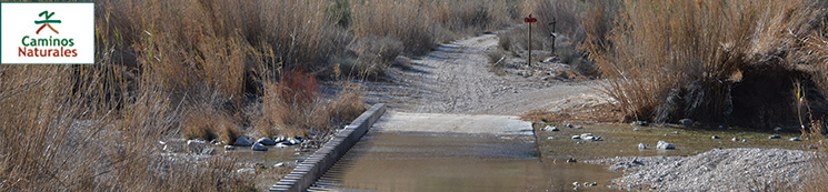
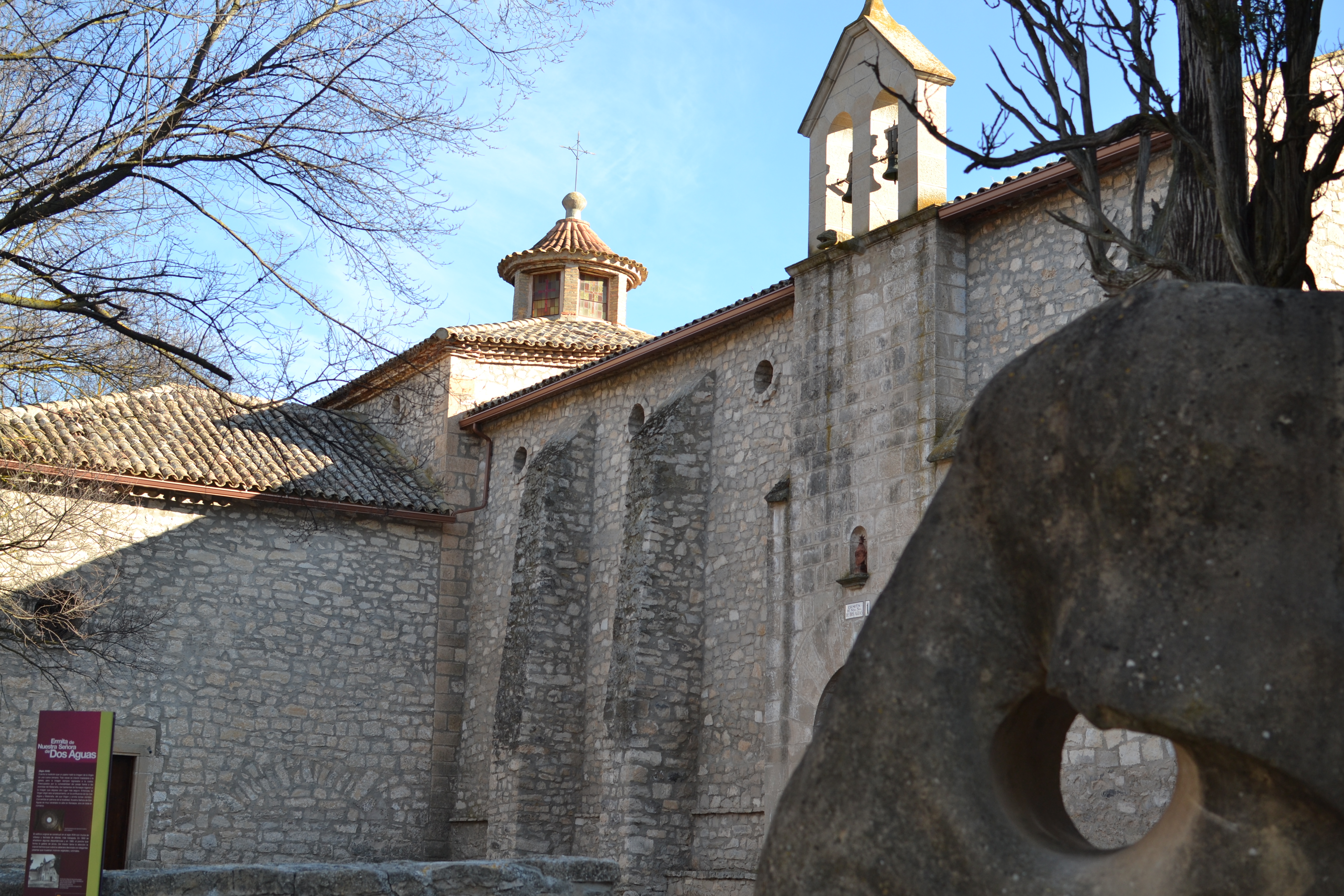
After arriving at the banks of the River Algars, the left trail must be taken which immediately arrives at a bridge. Before crossing and continuing the route, it is possible to carry straight on which takes you to the recreation area of the Nuestra Señora de Dos Aguas shrine. The name in Spanish for this 18th century Baroque shrine refers to "two waters", making reference to the fact it is located right where the River Matarraña merges with its tributary, the Algars. In addition to the religious building, this recreation area has benches and barbecues, a camping area and a reconstruction of an old oil mill: the Molí de la Plana.
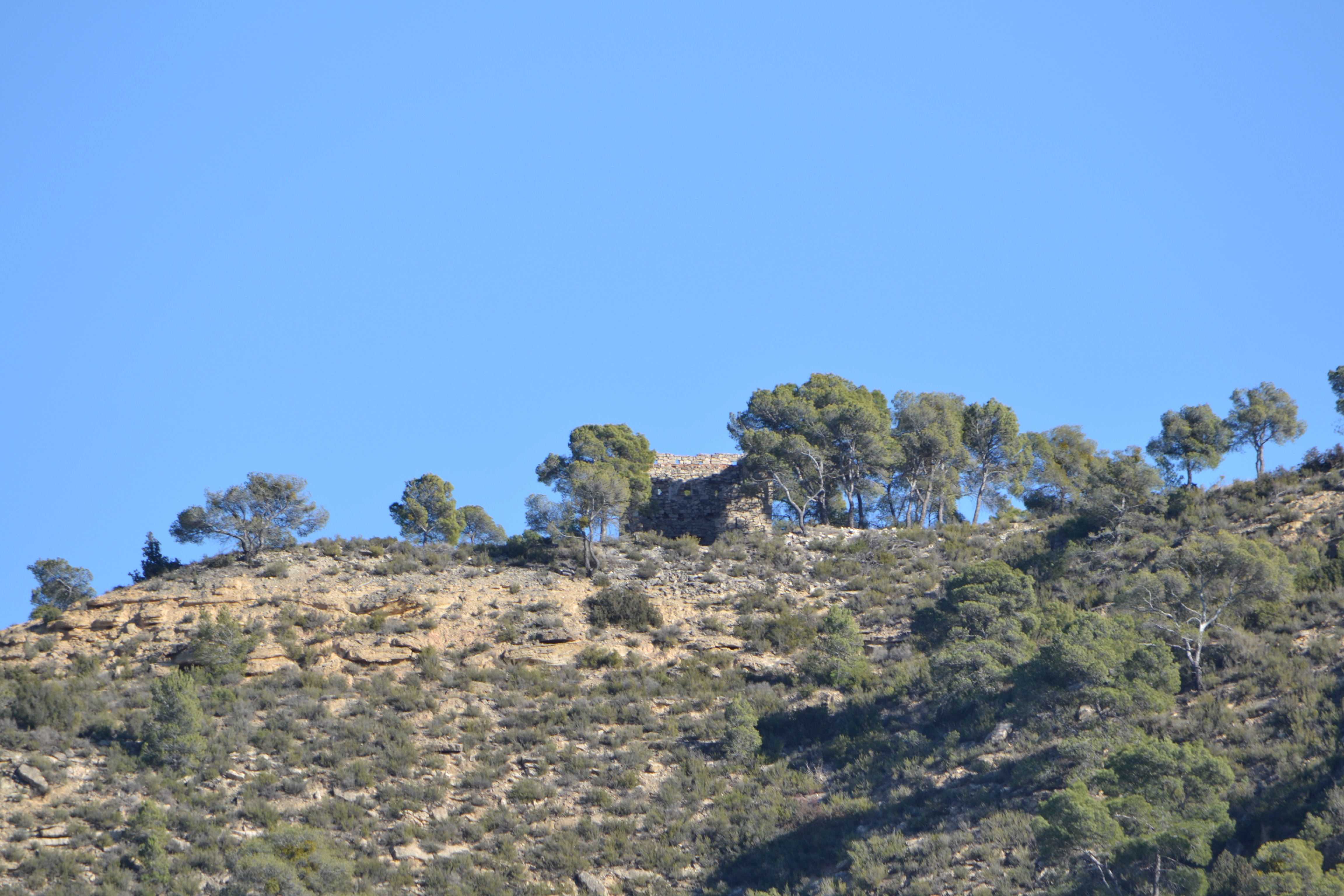
Getting back on the trail, cross the River Algars via a narrow concrete bridge which gives way to a gravel track that turns to the left and, just some hundred metres later, a crossing is reached. On the right a trail starts to head towards the castellet de Faió (castle of Fayón), a watch tower built during the third Carlist war. This looks over the track for the next four kilometres. The Nature Trail, however, continues straight along a track which switches between stretches of gravel and stretches of earth, with vineyards and fruit trees on the right, and the banks of the River Algars on the left.
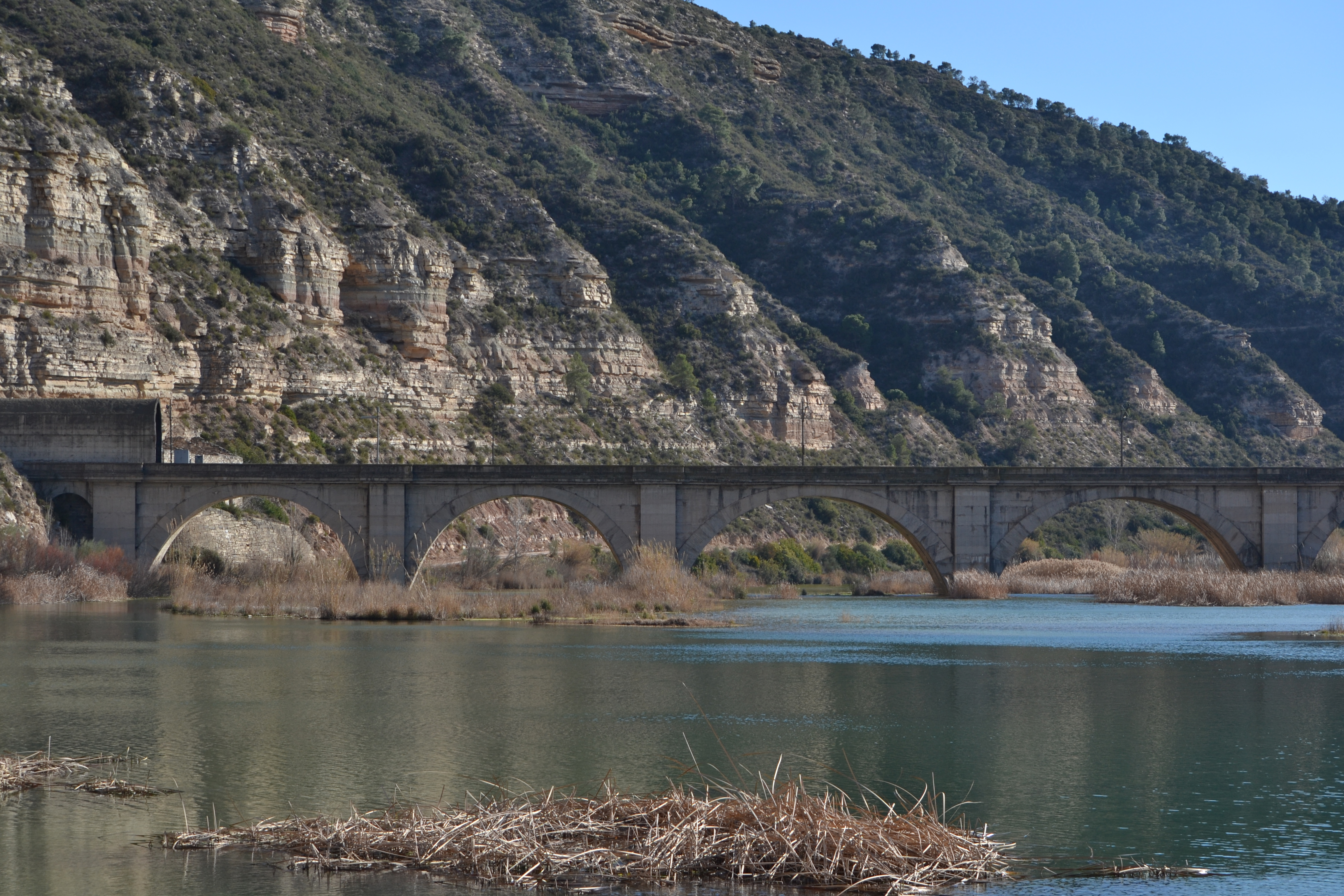
Less than a kilometre away from said crossing is the merger of the Matarraña and Algars rivers, and the Nuestra Señora de Dos Aguas shrine can be seen on the other side of the river. From here, the Trail leaves the River Algars behind and continues along the River Matarraña for nearly all of the remainder of the stage. From this point, the Zaragoza-Caspe-Barcelona railway is also visible; this is another constant element until the end of the trail.
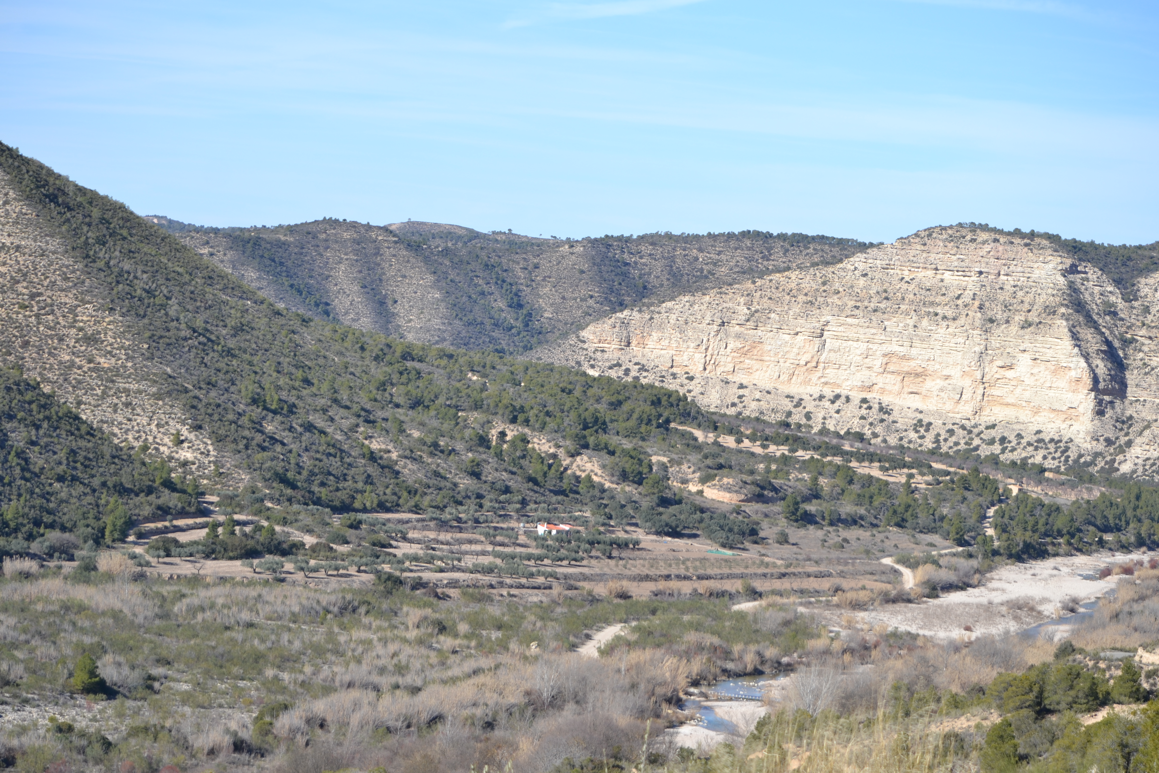
The trail hugs the vertical walls of the left riverbank, in this section hillside crops lay on the floodplains on the other side of the river. The accumulation of water in this part of the river (due to the "Pla Embatalle" weir) acts as a rest area for different aquatic birds such as cattle egrets, coot and ducks.
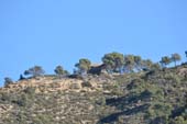
After passing underneath a railway viaduct, and next to said weir, the crops return to this side of the river. Afterwards the trail commences upon a demanding, although not too long (barely two kilometres), incline among Aleppo pines. After reaching the top of the mountain pass, and before setting off on the descent down the other side, it is worth talking a momentary detour to enjoy the views from the Revuelta de Ribers viewpoint. This does not just have spectacular views of both sides of the outcrop over the River Matarraña, but it is also easy to spot the griffon vultures that nest in this area and which fly very close by.
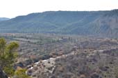
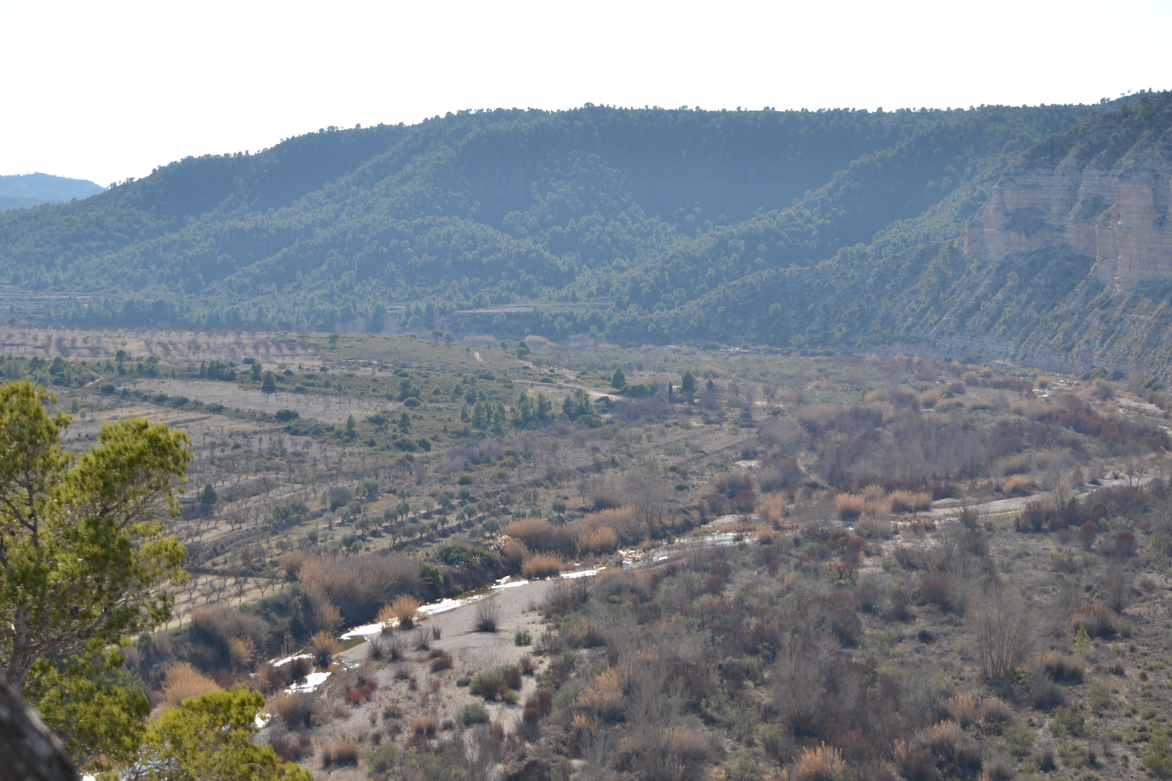
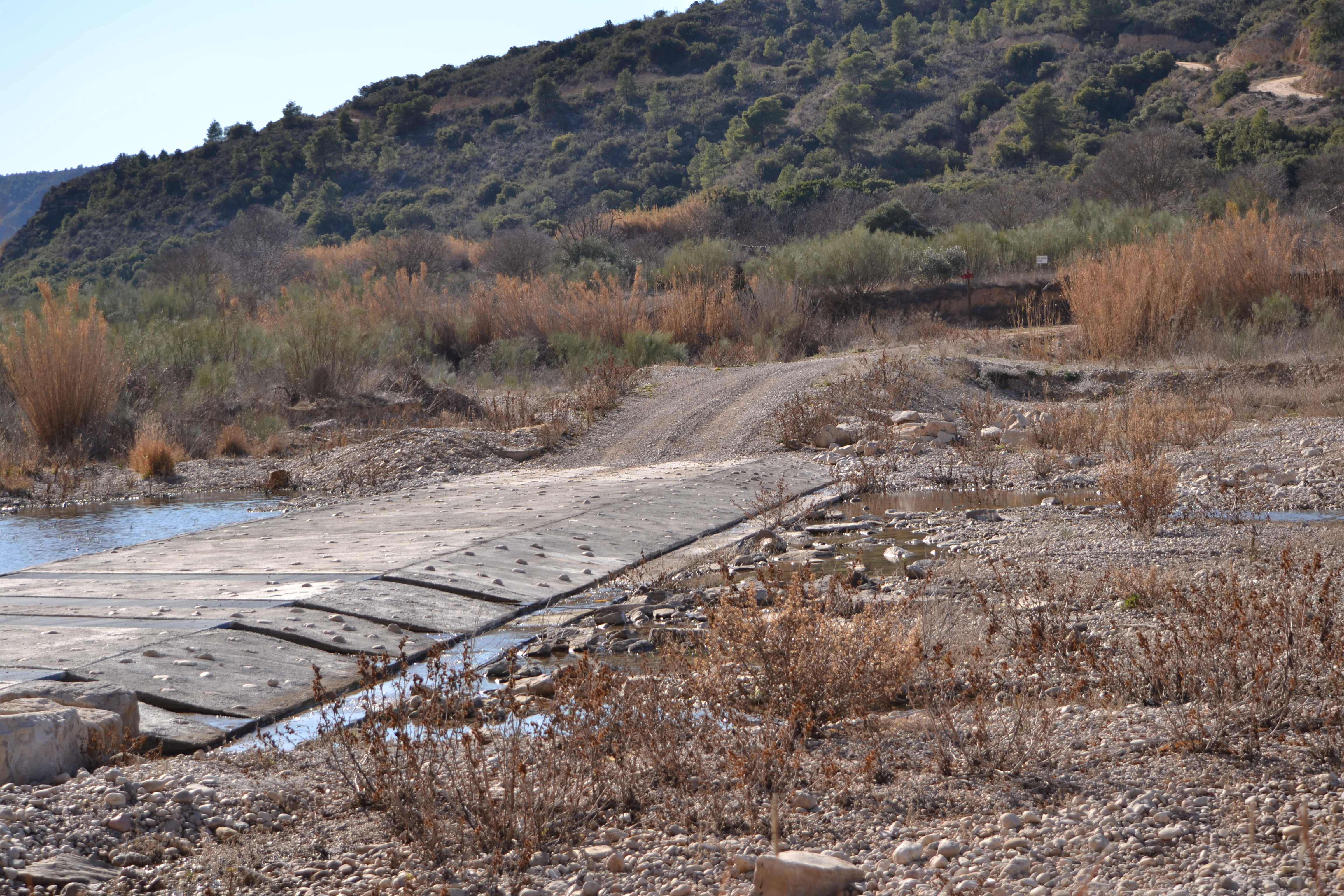
From here until its mouth, the river is narrower, but even so each centimetre of its floodplain is made use of for agricultural purposes. And so, after crossing banks once again over a concrete crossing, the trail starts to be accompanied by crops, although when nearing the river it is possible to see the strange shapes in the bedrock. On the opposite side of the valley the railway will also momentarily appear again.
The river is crossed once again by means of another crossing to overcome a new bend in the Matarraña, which is so boxed in over the next two kilometres that there is barely any space for crops. There are just pine trees, holm oaks and scrubland, although the crop land soon comes back after crossing the river via another concrete channel.
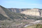
The river channel starts to increase significantly from here, which is an unmistakeable sign that it is nearing its merger. To start with, when the river is close, the trail is accompanied by reed beds, and when there is a few metres distance from the river, by pine trees. Further along there are olive groves until reaching the CV-103.
Barely 100 m is spent on this asphalt road, but care should be taken all the same. The road is left by means of a bridge via which the Fayón-La Pobla de Massaluca railway station can be reached, this is the end one of the stages of the Ebro Nature Trail GR-99; in fact, until the end of this stage, both trails share the same route heading towards Fayón.

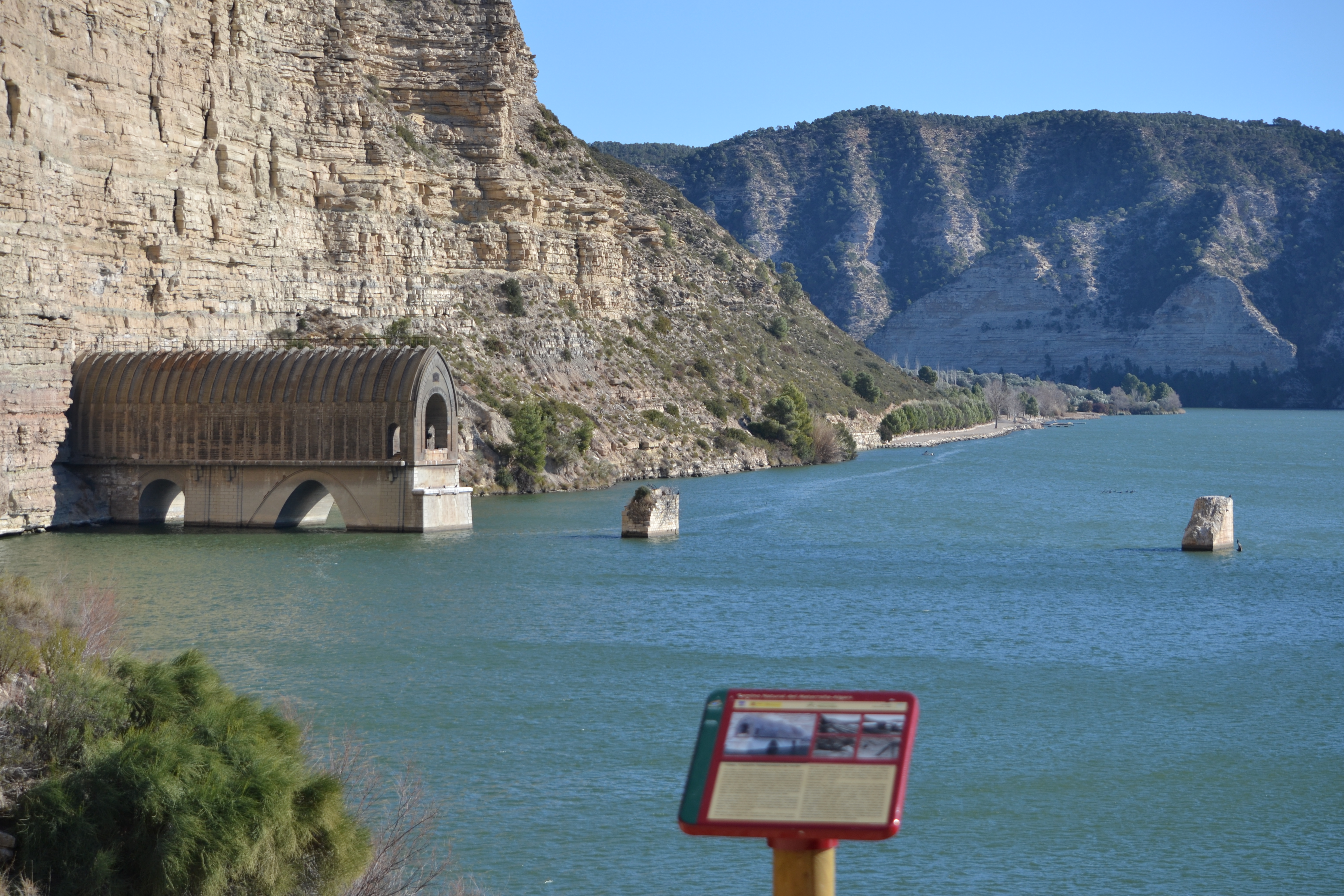
Leaving the bridge behind, the trail sets out on an incline between the ravine walls in order to reach Fayón, although there is still a surprise on the banks of the Matarraña. To the right, under one of the vertical walls which are characteristic of this final stretch of the river, the remains of the viaduct and tunnel that went through the mountain to get to the Viejo Fayón station jut out. The viaduct was knocked down and rebuilt many times, until it was eventually dismantled when Viejo Fayón was submerged under the waters of the Riba-Roja reservoir.
From here, there is only slightly over a kilometre until the end of the nature trail. The incline towards the town is a little steep, passing among the high walls of a ravine, but in just 800 m after passing through an olive grove, the Amanecer roundabout is reached, and when followed all the way around, the panel that marks the end of this stage can be found. The Ebro Nature Trail GR-99 continues its route from here, heading towards Mequinenza.
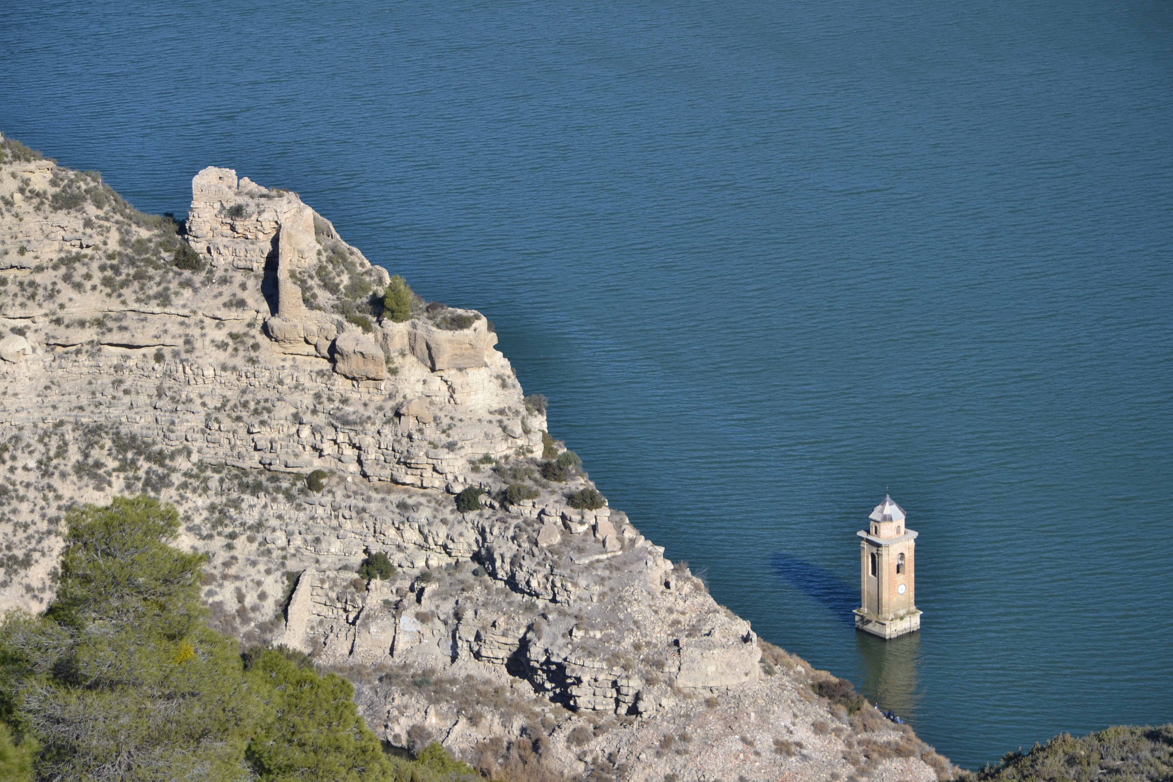
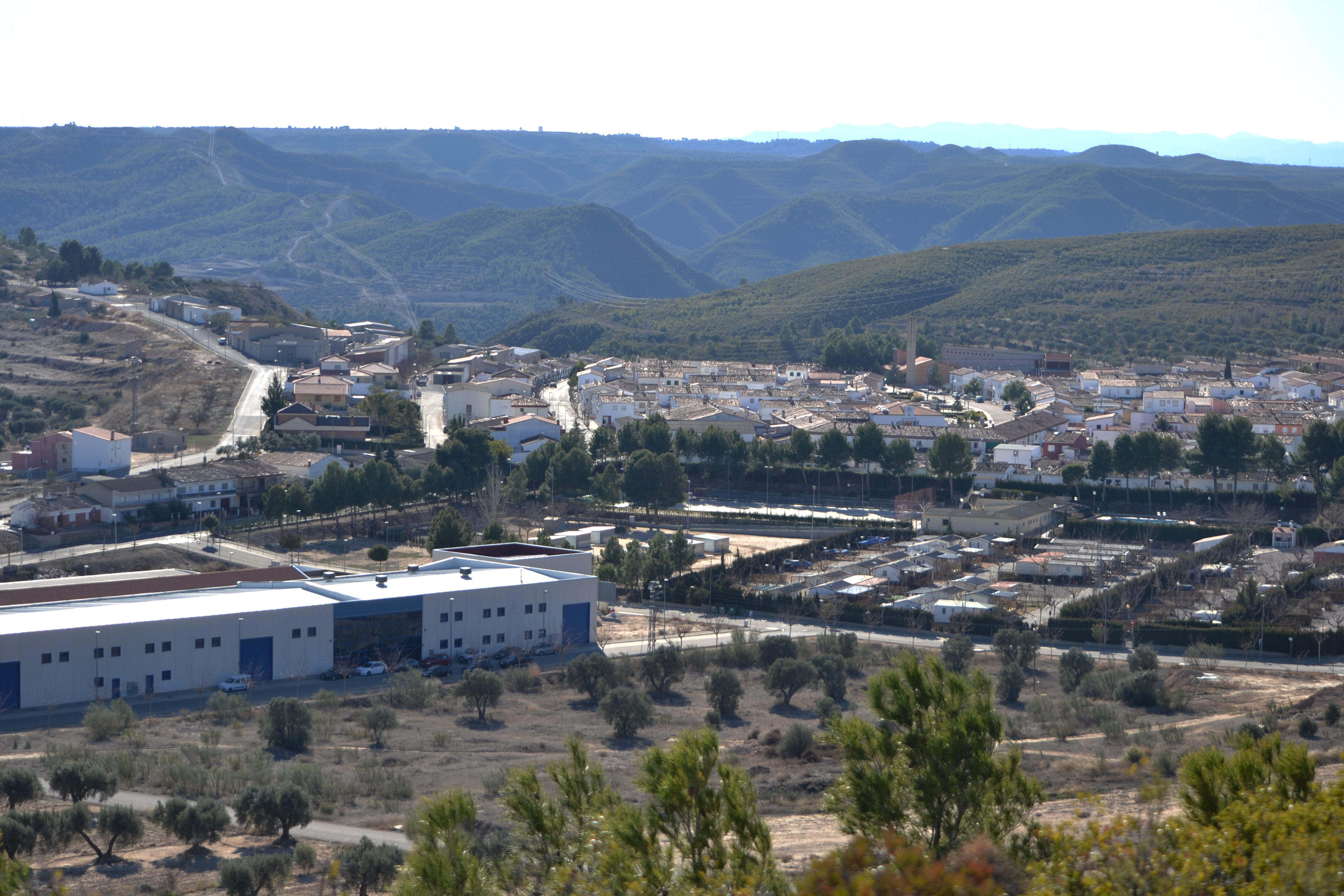
The town, which was founded fairly recently (in 1967), was built in order to house residents from the old town of Fayón (Viejo Fayón) which was submerged by the water from the Riba-Roja reservoir. It also has a museum dedicated to the Battle of the Ebro. The town's surroundings have places of interest which should not be missed. At the top of the hill next to the cemetery, elements which attest the Spanish Civil War can be found, specifically the Nationalist faction’s "Fayón position". Some two kilometres away, at the top of a hill surrounded by the Matarraña and Ebro waters, stands the Nuestra Señora del Pilar shrine. Here there is a wonderful viewpoint over the Riba-Roja reservoir, from which the ruins of the old town of Fayón can be seen, as can the ruins of the castle and church tower, the only building which was not demolished after the reservoir was filled.
Map
Puntos de Interés
Información
Profile
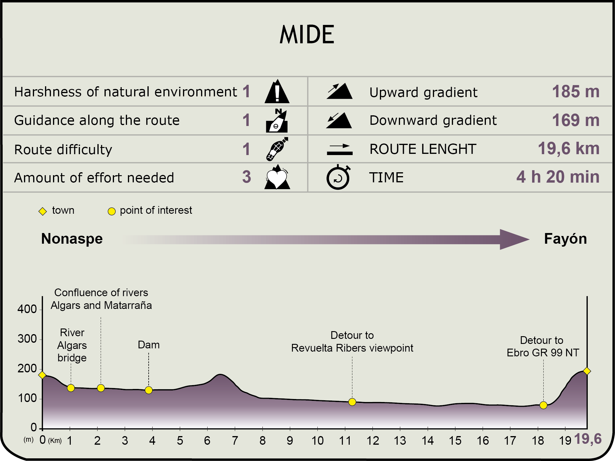
MIDE (Method for the Information of Excursions)
 Harshness of natural environment
- 1. The environment is not risk-free
- 2. There are more than one risk factors
- 3. There are various risk factors
- 4. There are quite a lot of risk factors
- 5. There are many risk factors
 Guidance along the route
- 1. Well defined trails and crossings
- 2. There is a clearly marked trail and signage
- 3. Requires the identification of geographic features and cardinal points
- 4. Requires off-path navigation
- 5. The trail is interrupted by obstacles that have to be gone around
 Route difficulty
- 1. Walking on a flat surface
- 2. Trails with different types of path
- 3. Walking on stepped paths or irregular terrain
- 4. The use of hands or jumping over the terrain is necessary
- 5. The use of hands is required to progress
 Amount of effort needed
- 1. Up to 1 hour of continuous walking
- 2. Between 1 and 3 hours of continuous walking
- 3. Between 3 and 6 hours of continuous walking
- 4. Between 6 and 10 hours of actual walking
- 5. More than 10 hours of continuous walking
Featured
Further information
The Battle of the Ebro Museum (http://www.labatalladelebro.com)
In an initiative from the Fayón association Memoria Histórica Militar Ebro 1938 [Ebro Military Historic Memory 1938], after a successful temporary exhibition a municipal vessel was granted, and thanks to the Tourism Development Plans, it has been possible to gain the means in order to finish preparing a museum space dedicated to this decisive battle in the Spanish Civil War. Its 1000 m2 of exhibition space displays artillery elements, armoury and uniforms, plus it also explains how the battle was developed through the use of an abundance of audiovisual resources (panels, videos, photos, etc.). The museum is in Fayón, located at Bajada de la Fábrica, S.N. (Calle B), and it is open Tuesday to Thursday 18:00 to 20:00 and weekends and bank holidays from 11:00 to 14:00 and 18:00 to 20:00.
Curiously, this organisation also organises a yearly historical recreation of the battle.
The Old Town of Fayón
Fayón, the village in which this stage of the trail comes to an end, is in fact the heir of another town with the same name that was submerged with the waters of the Riba-Roja reservoir.
Located on the banks of the river Ebro, this was a prosperous village with an abundance of lignite mining. Here, commercial products on their way to the Mediterranean used to pass through on the Zaragoza-Barcelona railway via Caspe.
When the Riba-Roja reservoir was built in the River Ebro between 1958 and 1967, the current town was built in order to house the residents, as the old town of Fayón was flooded by the reservoir's waters. Despite negotiations to reach an agreement with the National Hydroelectricity Company of Ribagorzana (ENHER) for the relocation of the residents, not all of the inhabitants of old town of Fayón moved to the newly built town.
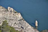
The best way of viewing the remains of the old town of Fayón is from the viewpoint of the Ebro, next to the Nuestra Señora del Pilar shrine. Towards the south east the railway houses still stand, and the ruins of the cemetery can be seen. Towards the north, the castle of Badón stands on a rock. This is a 14th century fortress which was built on top of a Muslim fort, of which barely a few scraps of its walls have been conserved (which were reformed during the Carlist wars), as well as the remains of the tower. Right at the foot of the castle, one of the area's most characteristic elements can be seen: the parish church tower which juts out of the reservoir's waters. This was built on top of a chapel at the end of the Renaissance, it was dedicated to John the Evangelist and on its main façade it had a couple of polished stone columns topped with a border.
Multimedia
Downloads
GPS Downloads
Cyclability
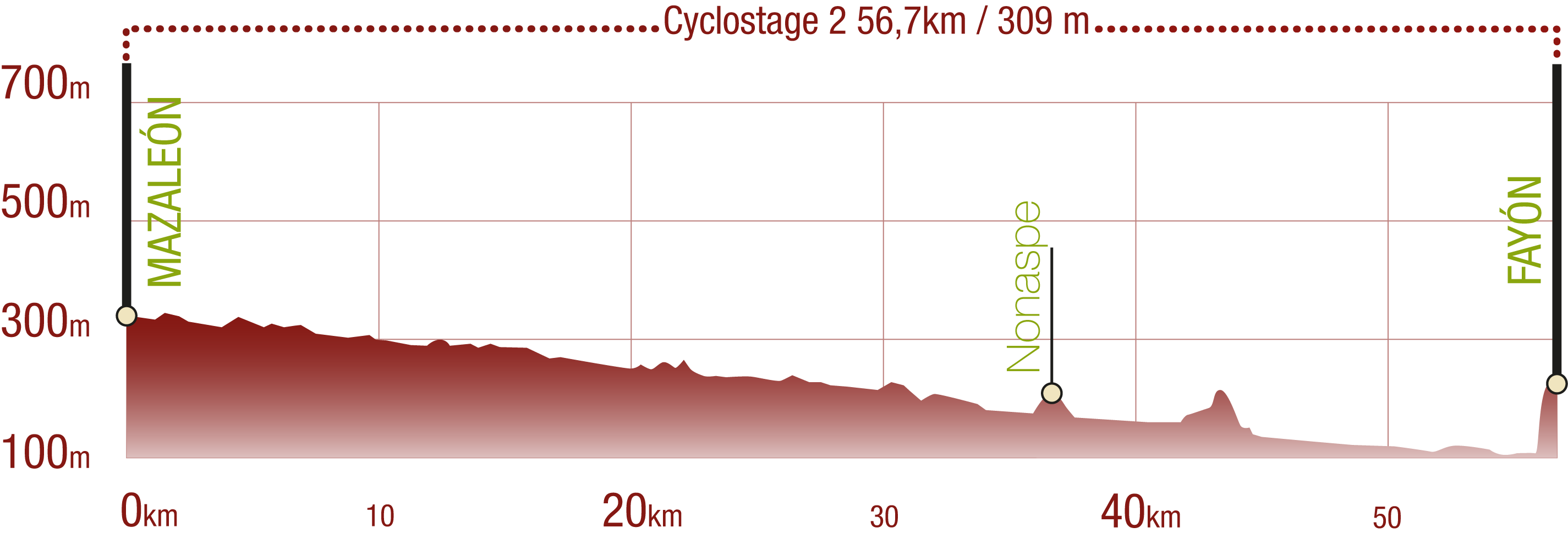
This Cyclostage correspond to stages 6 to 9 of the Nature Trail
PROFILE
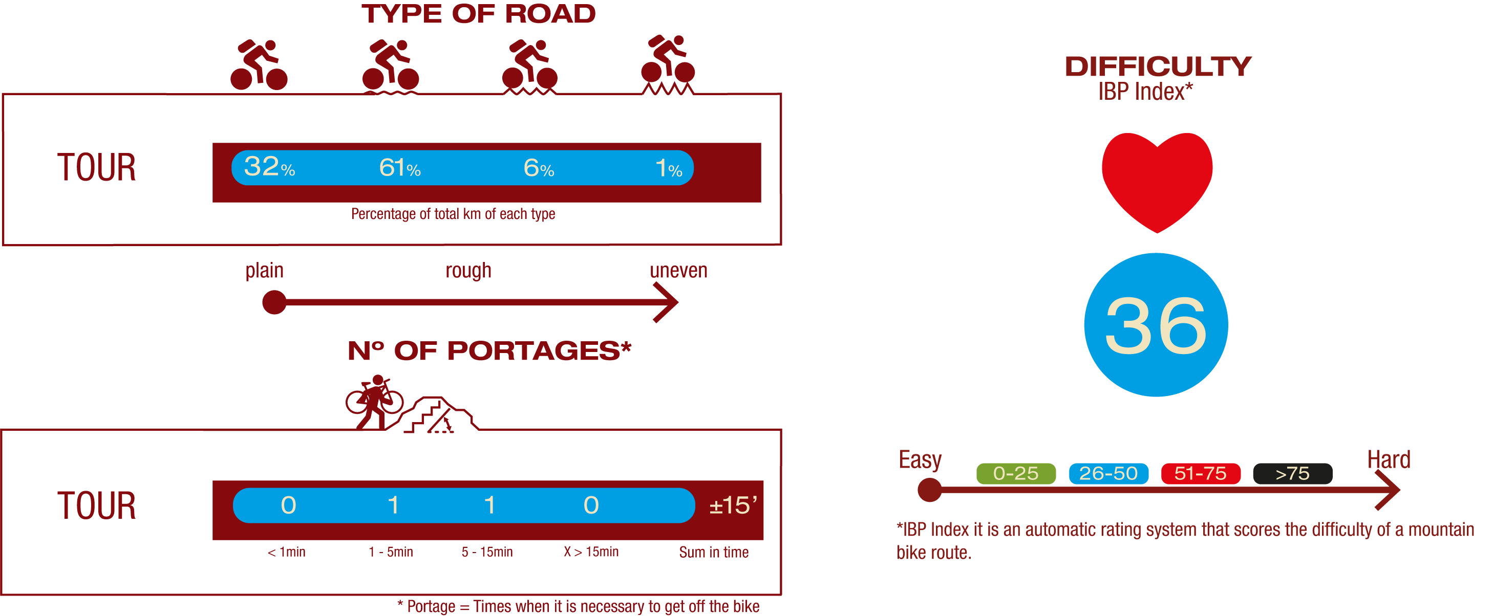
TYPE OF ROAD, PORTAGES & DIFFICULTY
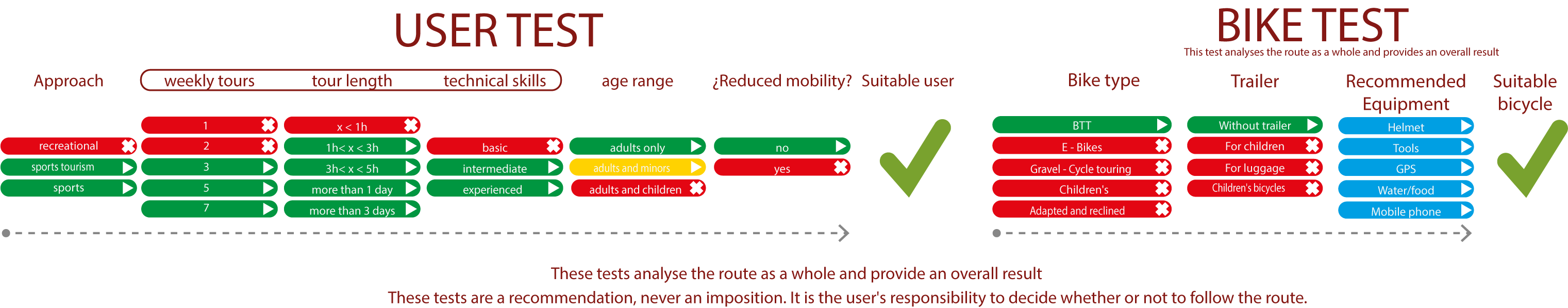
TEST
SAFETY RECCOMENDATIONS
- Sections shared with hikers.
- Transit through the centre of some population centres.
- Due to the fact that the route runs close to riverbeds, crossing them on several occasions, you are informed that there may be seasonal discontinuities caused by floods, increases in flow, floods or transit through flood-prone areas.
GENERAL RECOMMENDATIONS
- Find out about the technical aspects of the route and the weather on the day.
- Take care of the environment. Take care not to disturb animals or damage vegetation. Respect private areas.
- You must give priority to pedestrians and comply with general traffic rules.
- The environment in which you will be riding is open, free to move around and an area where many activities are carried out (sporting, forestry, livestock and agricultural activities). Always have an understanding, prudent, responsible and respectful attitude.