
- Home
- Rural Development
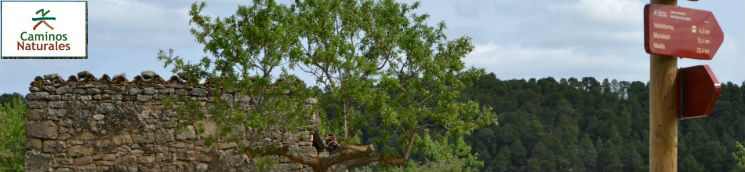
- Nature Trails
- Nature Trails
- Northeast Sector
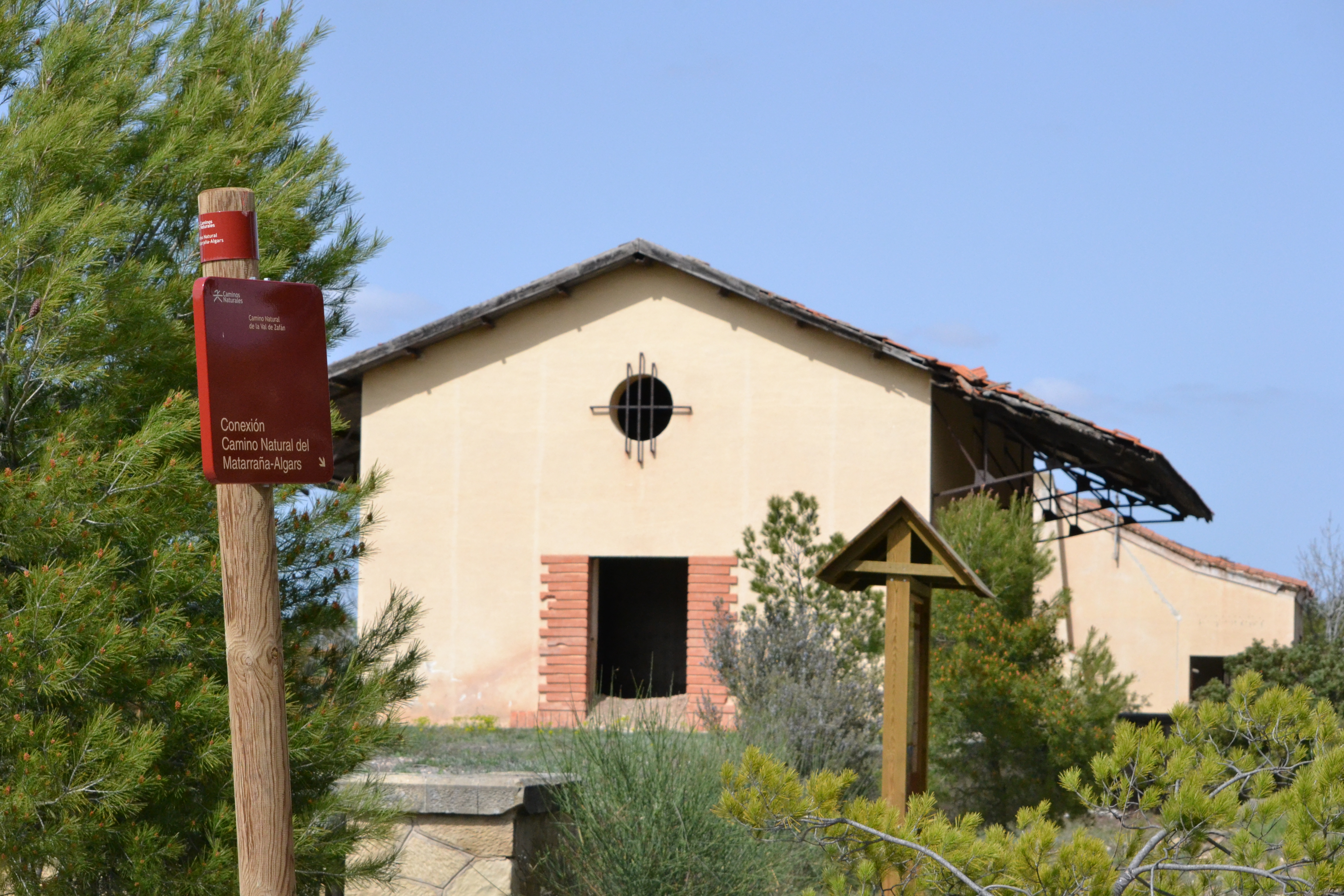
- Matarranya Algars
Stage 4. Torre del Compte-Valdeltormo
Description
Discovering the Iberian legacy of the region in the company of the Natural Way of Val de Zafán
This stage allows travellers to reach Valdeltormo following two different paths: they can either take the main route near the Matarraña river or the alternative route showing them part of the Iberian heritage of the region. Along this stage, travellers will have the opportunity to take the Val de Zafán Nature Trail, another of the trails crossing this area.
In order to start this stage, the traveller must go back to the last stretch of the previous one, to the bridge over the Matarraña river. The trail crosses the river through the bridge of the TE-V-3001 road (the traveller must be cautious, due to the narrow pavement) and takes a branch through a dirt track on the right.
Going back to the nature trail, the route goes through a track where the landscape is similar to that of the previous stage, only the crops of the Matarraña fertile meadows are now on the right side and the pines covering the high areas are on the left side. In this stage, pines are also replaced by olive trees where the land conditions are favourable.
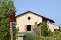
Two kilometres into this stage, there is an information display panel marking the branch leading to the town of La Fresneda through a track. The trail does not go through this town, but its important monumental heritage is worth visiting.

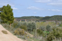
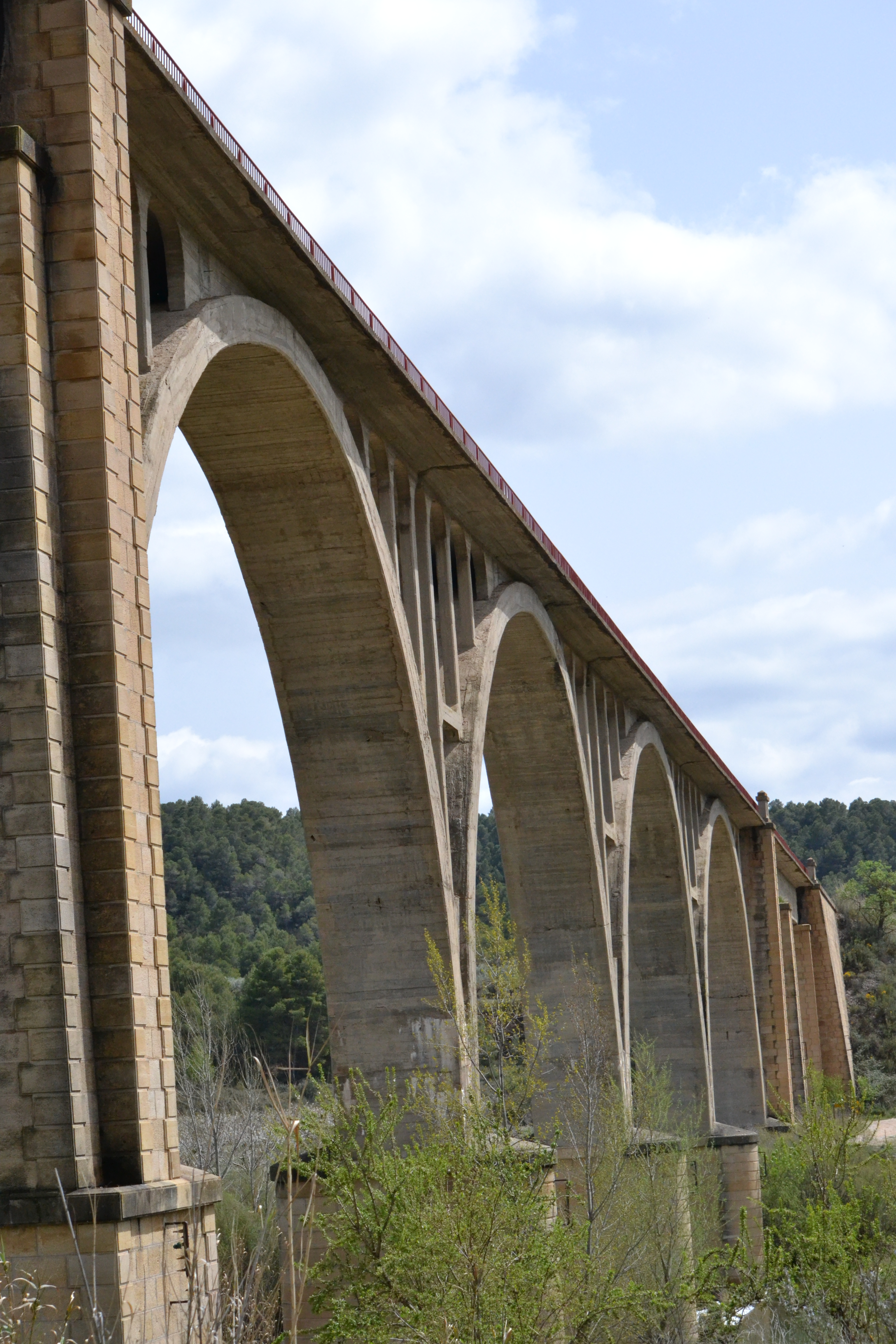
From this point on, the traveller will be able to see the next milestone on the route, the stunning viaduct over the Matarraña, through which another trail, the Val de Zafán Nature Trail, goes. Just before the trail goes under this viaduct, the traveller can take this alternative nature trail thanks to a branch marked by an information display panel.
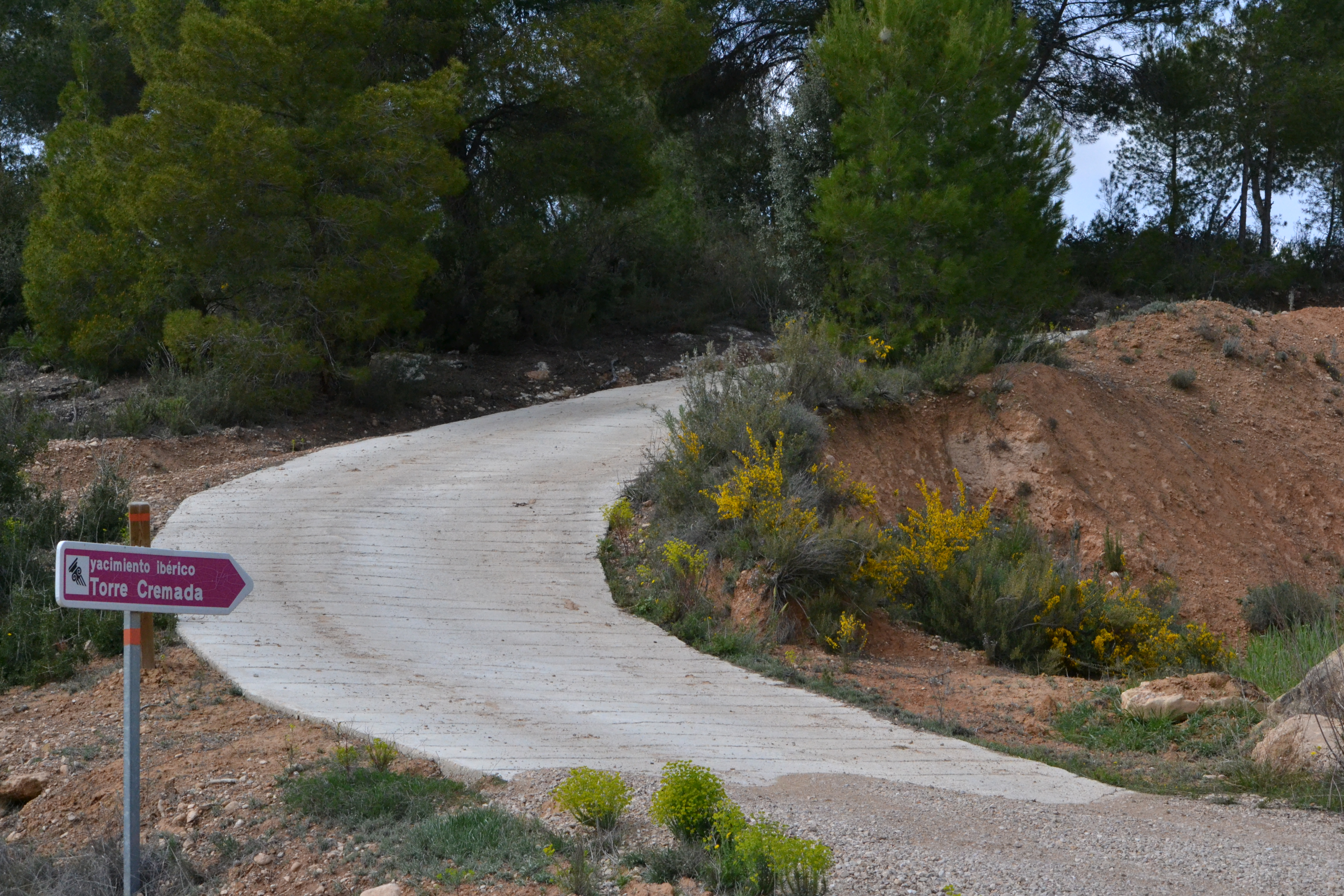
A few kilometres later, the alternative route towards Valdeltormo, the end of this stage, starts. This alternative route will allow the travellers to visit the Iberian sites of Torre Cremada and of the Tozal Montañés. The main trail goes among fruit crops until it reaches the rock of the Tormo the peculiar rock formation after which the last town of this stage is named. Right here, a stretch begins which is shared with the following stage, taking the traveller among a pine forest with the N-420 road to Valdeltormo on the right. Barely half a kilometre before reaching the town, there is an intersection where the alternative route through the Iberian sites links with the main trail again. From this intersection, the traveller can take the branch going to the old train station of Valdeltormo, belonging to the railway that used to link Puebla de Híjar with Tortosa, going through Alcañiz.
Stage 4. Alternative route through the Iberian sites.
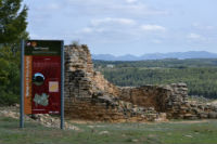
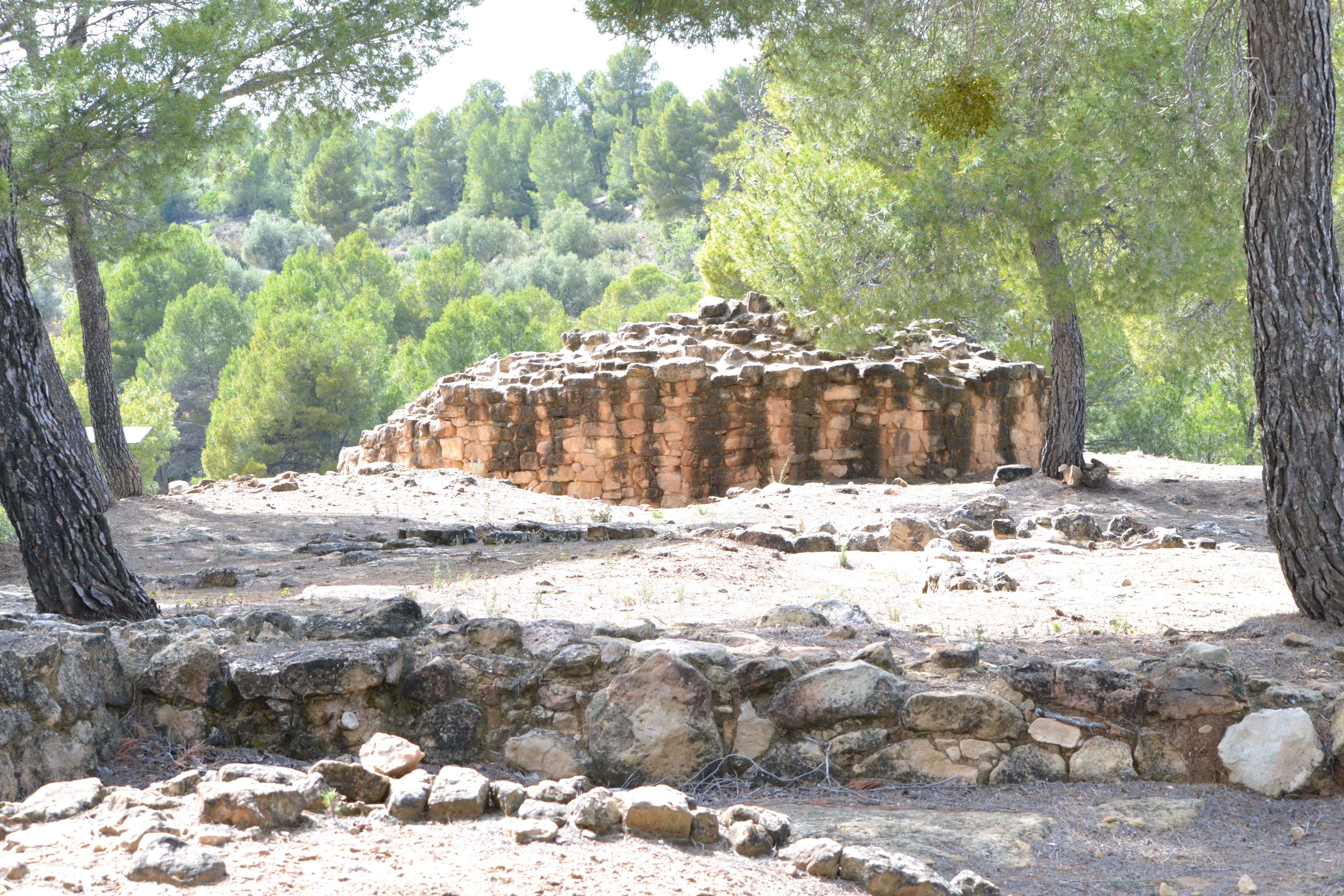
The traveller can get to the Iberian site of Torre Cremada going up a steep slope with a cement track among pines and olive trees. It is worth to have a walk through this defensive construction and see its fortified tower and, especially, the amazing views of the valley that it offers.
Almost a kilometre ahead, there is a well-indicated branch allowing the traveller to visit another Iberian archaeological site at the heart of a pine forest.
This Iberian archaeological site, the Tozal Montañés, is worth leaving the trail for a while, since it is a small settlement with a circular tower-house. As the traveller will see later, the trail passes by several sites showing the historical importance of this area. At the end of this stage, in Valdeltormo, there is an interpretation centre about the Iberian peoples, where the traveller can find out more about this culture.
The trail then changes direction, going northeast, and the traveller can see a cutting appear among olive trees on the right, a part of the old Val de Zafán railway works. The trail crosses this cutting over a bridge and then goes alongside it. Then, an intersection is reached where the traveller can choose between following this trail or taking the Val de Zafán Nature Trail. The route leaves this intersection aside and goes north, descending among olive trees until it meets the main trail again, half a kilometre from Valdeltormo.
Stage 4. Valdeltormo Station Branch.
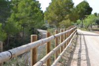
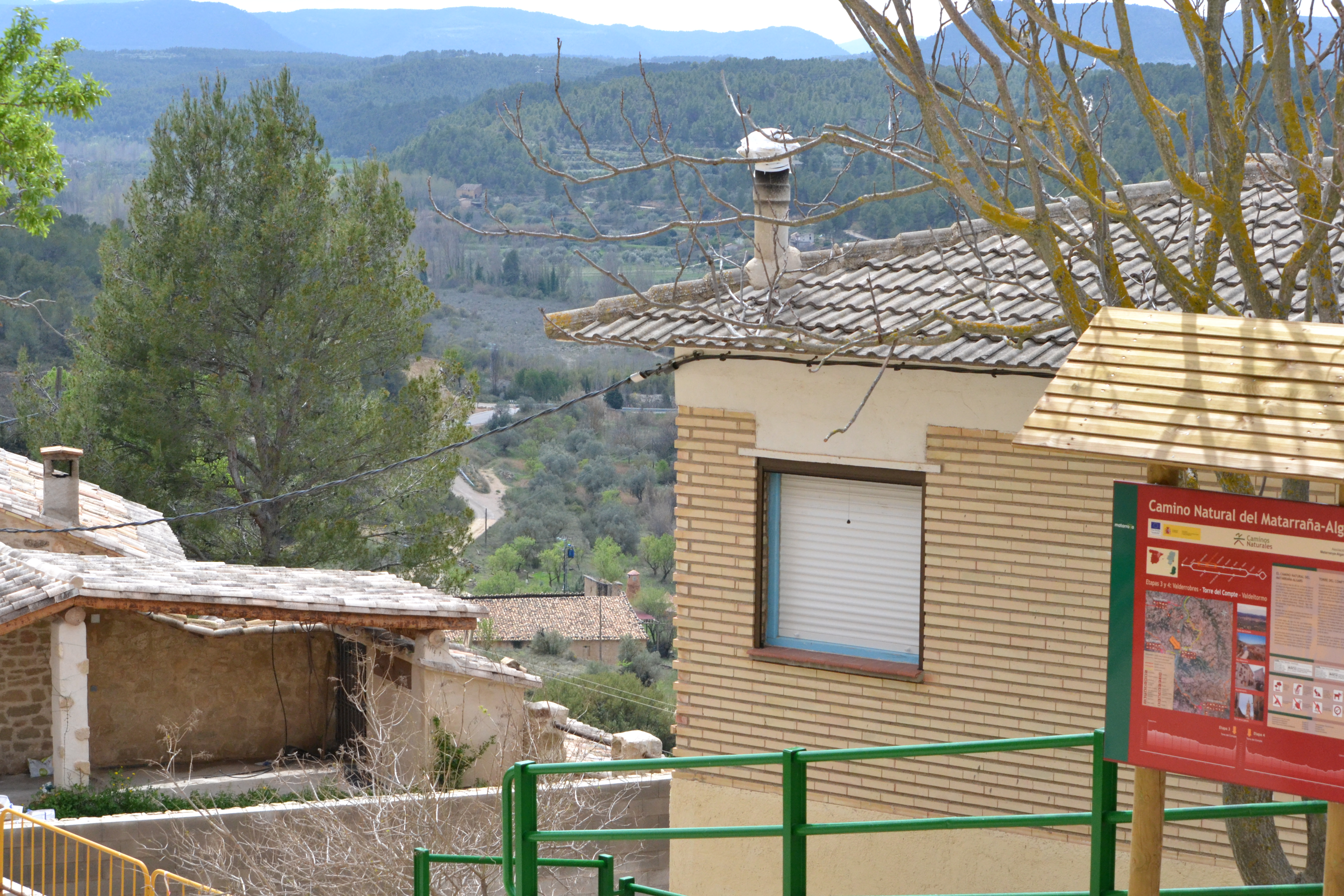
This route, more than 2 km long if the traveller begins the journey in Valdeltormo, goes through a paved secondary road among olive trees to Valdeltormo old train station. This station belonged to the Val de Zafán railway line, which used to link Tortosa (Tarragona) and Puebla de Híjar (Teruel). Although it stopped operating in 1973, the Val del Zafán Nature Trail goes through its railway platform today. This spot, with a rest area and an information display panel, is the third intersection where these two nature trails meet along this stage.
Sites of interest
Map
Puntos de Interés
Geología
Municipio
Vegetación
Profile
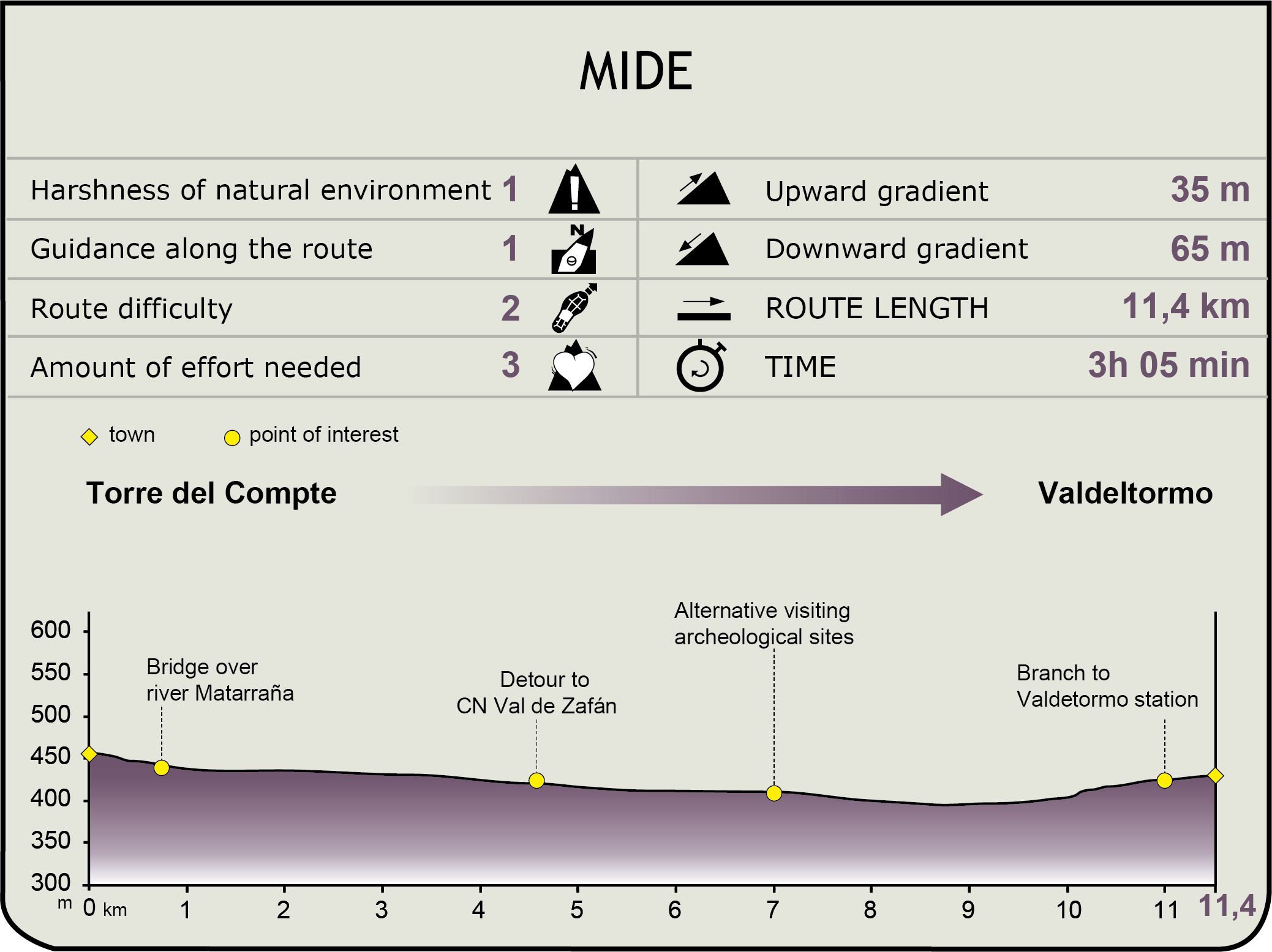
MIDE (Method for the Information of Excursions)
 Harshness of natural environment
- 1. The environment is not risk-free
- 2. There are more than one risk factors
- 3. There are various risk factors
- 4. There are quite a lot of risk factors
- 5. There are many risk factors
 Guidance along the route
- 1. Well defined trails and crossings
- 2. There is a clearly marked trail and signage
- 3. Requires the identification of geographic features and cardinal points
- 4. Requires off-path navigation
- 5. The trail is interrupted by obstacles that have to be gone around
 Route difficulty
- 1. Walking on a flat surface
- 2. Trails with different types of path
- 3. Walking on stepped paths or irregular terrain
- 4. The use of hands or jumping over the terrain is necessary
- 5. The use of hands is required to progress
 Amount of effort needed
- 1. Up to 1 hour of continuous walking
- 2. Between 1 and 3 hours of continuous walking
- 3. Between 3 and 6 hours of continuous walking
- 4. Between 6 and 10 hours of actual walking
- 5. More than 10 hours of continuous walking
Featured
Further information
Iberian Legacy
The Lower Aragón area is one of the places with the greatest number of examples of Iberian archaeological sites (of the Ausetani tribe in the Ebro Valley) in Aragón. The importance and quality of these sites has resulted in the creation of the “Iberian Heritage in Aragón” Consortium. This consortium is responsible for the cultural and archaeological tourism project “Route of the Iberians in Lower Aragón”. Eleven city councils from five different regions in the eastern area of Aragón take part in this project. This route includes nineteen archaeological sites which have been already excavated and eleven visitor centres about different topics that will provide the traveller with a comprehensive and detailed understanding of the Iberian culture.
The Matarraña-Algars Nature Trail allows the traveller to visit the Iberian sites of Torre Cremada and Tozal Montañés. It also goes near other sites (San Antonio and Tossal Redó in Calaceite, Escudines Altes and Baixes, San Cristóbal and Piuró del Barranc Fondo in Mazaleón). The traveller can also visit some interpretation centres in Calaceite, Mazaleón or Valdeltormo.
Val de Zafán Nature Trail
Along this stage of the trail, the traveller has three chances to access the Val de Zafán Nature Trail. This trail is 35.9 km long and links Valdealgorfa and Arnés-Lledó stopping places. At Arnés-Lledó, it meets the Terra Alta Nature Trail (23 km long), which continues towards Tortosa through the Baix Ebre Nature Trail (25 km long). These three consecutive nature trails follow the railway platform that used to link La Puebla de Híjar (Teruel) and Tortosa (Tarragona) and had been operating for 31 years before its closure in 1973.
Multimedia


Downloads
GPS Downloads
Maps
Cyclability
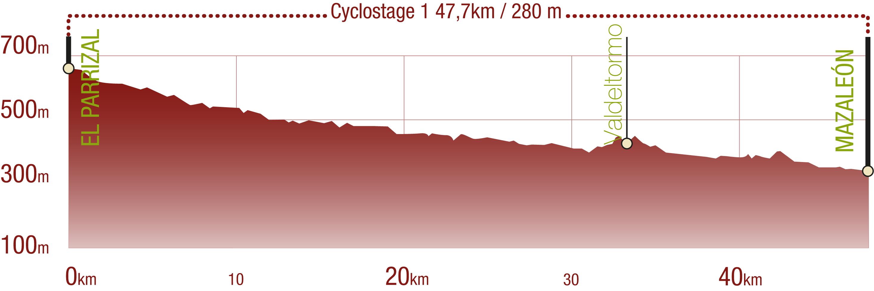
This Cyclostage correspond to stages 1 to 5 of the Nature Trail
PROFILE
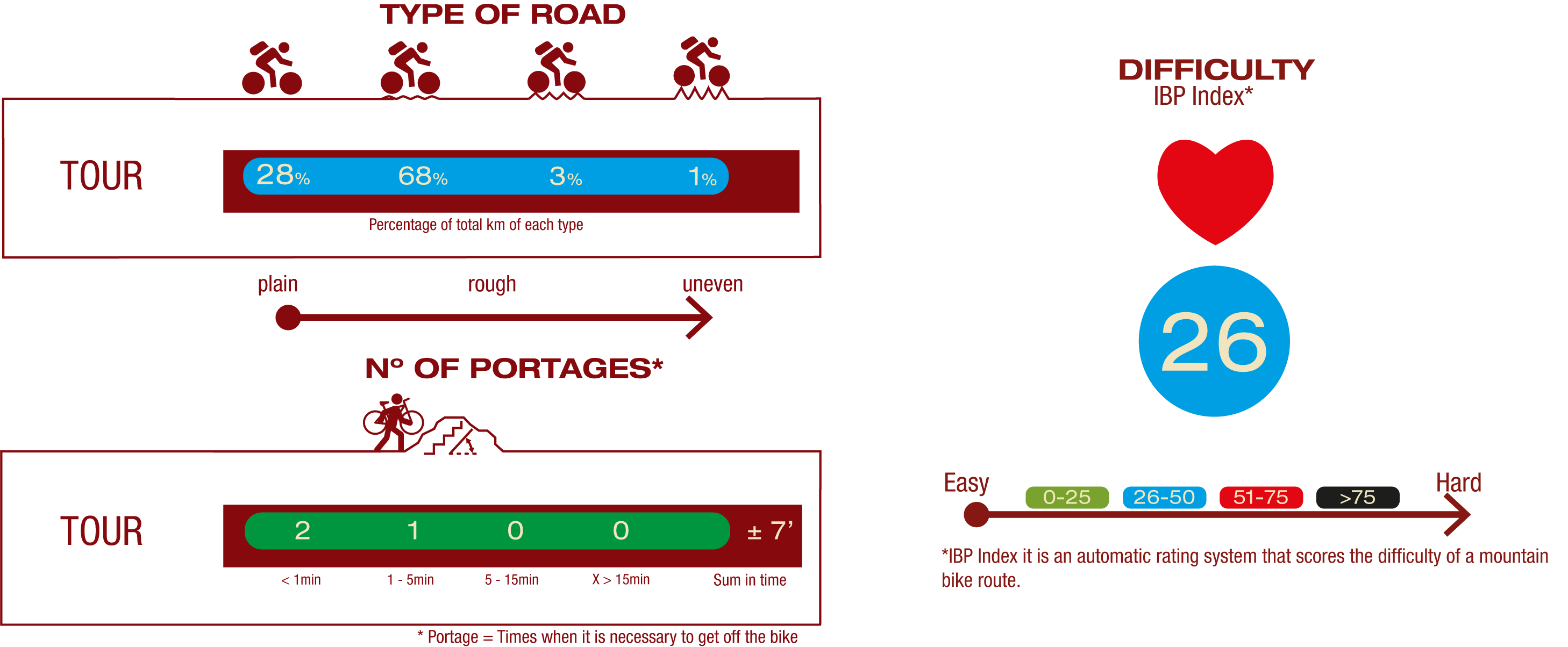
TYPE OF ROAD, PORTAGES & DIFFICULTY
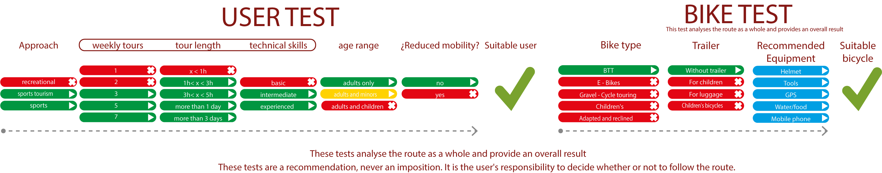
TEST
SAFETY RECCOMENDATIONS
- Sections shared with hikers.
- Transit through the centre of some population centres.
- Due to the fact that the route runs close to riverbeds, crossing them on several occasions, you are informed that there may be seasonal discontinuities caused by floods, increases in flow, floods or transit through flood-prone areas.
GENERAL RECOMMENDATIONS
- Find out about the technical aspects of the route and the weather on the day.
- Take care of the environment. Take care not to disturb animals or damage vegetation. Respect private areas.
- You must give priority to pedestrians and comply with general traffic rules.
- The environment in which you will be riding is open, free to move around and an area where many activities are carried out (sporting, forestry, livestock and agricultural activities). Always have an understanding, prudent, responsible and respectful attitude.