
- Home
- Rural Development
- Nature Trails
- Nature Trails
- Northeast Sector
- Matarranya Algars
Stage 3. Valderrobres-Torre del Compte
Description
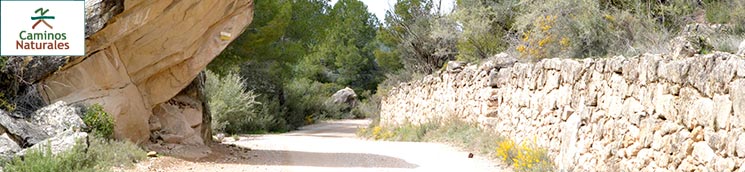
Between two charming towns among pine forests, olive groves and farmlands
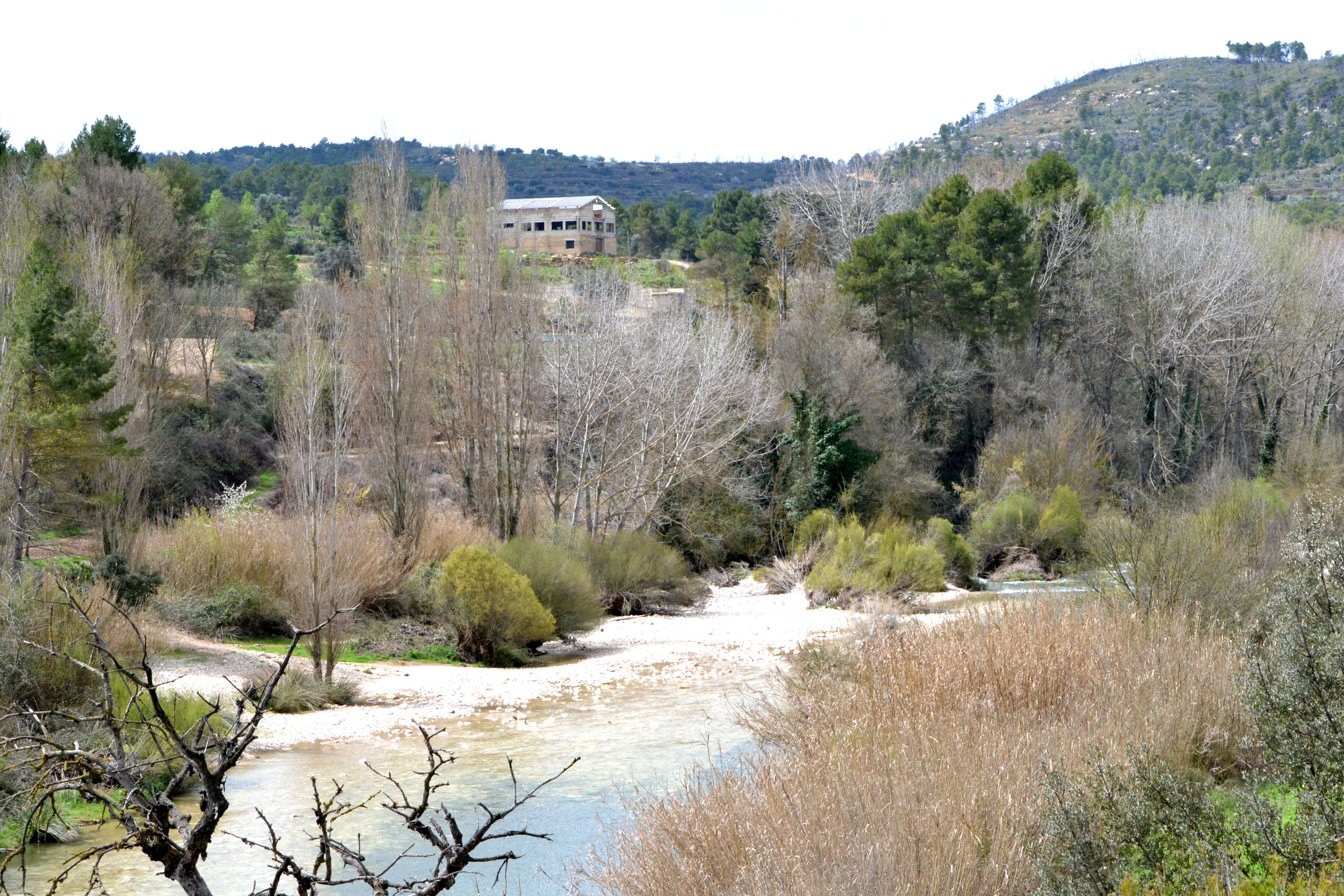
This third stage goes entirely along the right bank of the Matarraña river. The river widens, giving way to riverbank formations dominated by bitter and purple willows (Salix eleagnos and Salix purpurea) and its fertile meadows are dominated by fruit crops. Almost halfway along this stage, the Tastavins river, one of its major tributaries, joins the Matarraña river.
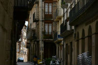
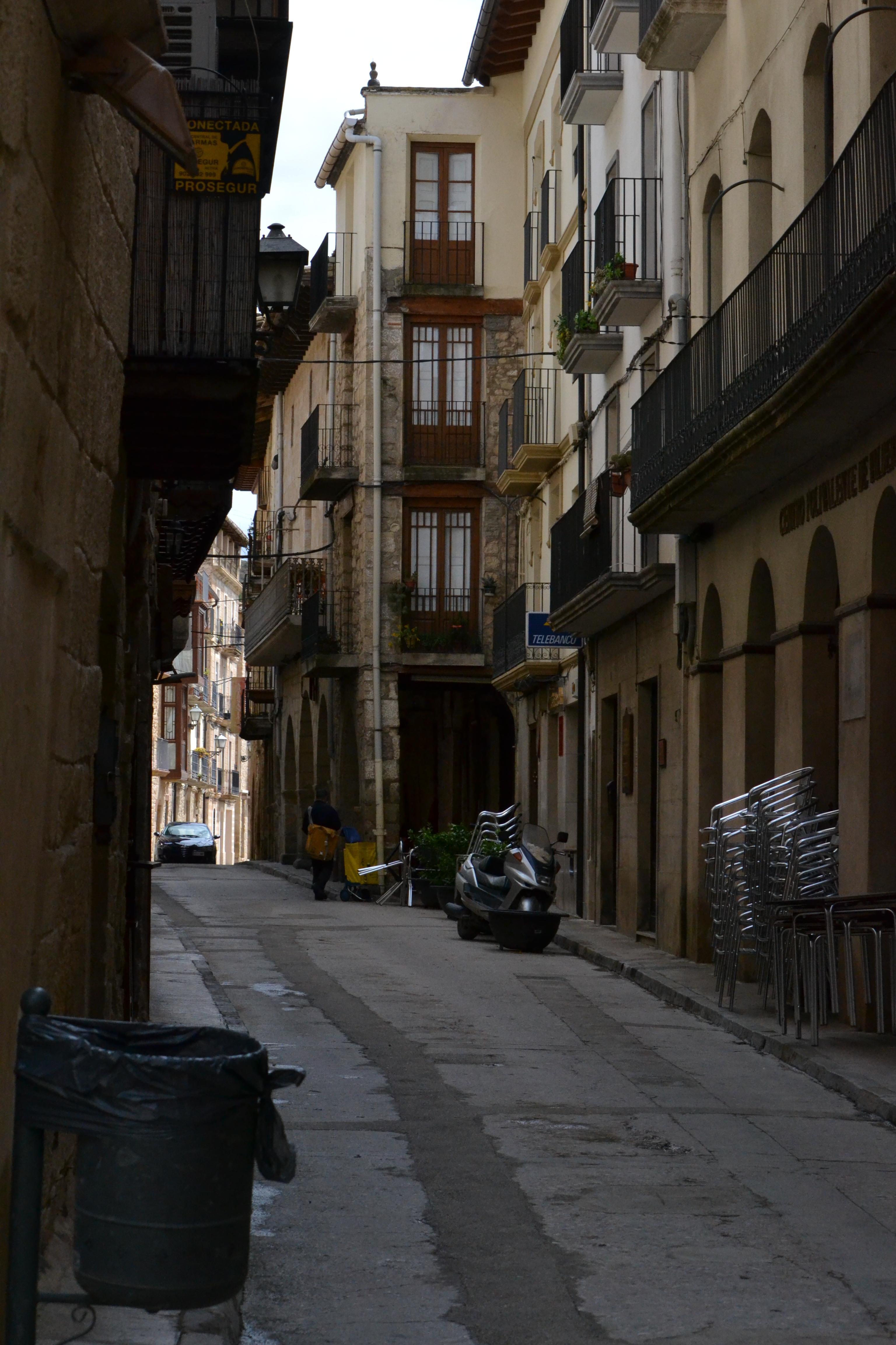
Departing from the Iron Bridge (Pont de Ferro), but always on the right bank of the river, the trail continues crossing the historical centre of Valderrobres, going through the Plaza Mayor and near the city council, from where the traveller can cross the Puerta de San Roque and go over the stone bridge (Pont de Pedra) to enjoy a magnificent view over the Matarraña. Leaving the last houses in the outskirts of Valderrobres behind, the paved track the trail follows becomes a dirt path.
On the left of the trail, the landscape is dominated by willows (a bank formation with different subspecies of Salix sp.) near the river and fruit crops in the meadows. On the right, where the land is steeper, the pines are the dominant species, sometimes replaced by olive trees. This landscape is interrupted by a sand and gravel extraction plant which the traveller goes past after crossing a bridge over the Segarra gully.
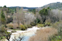
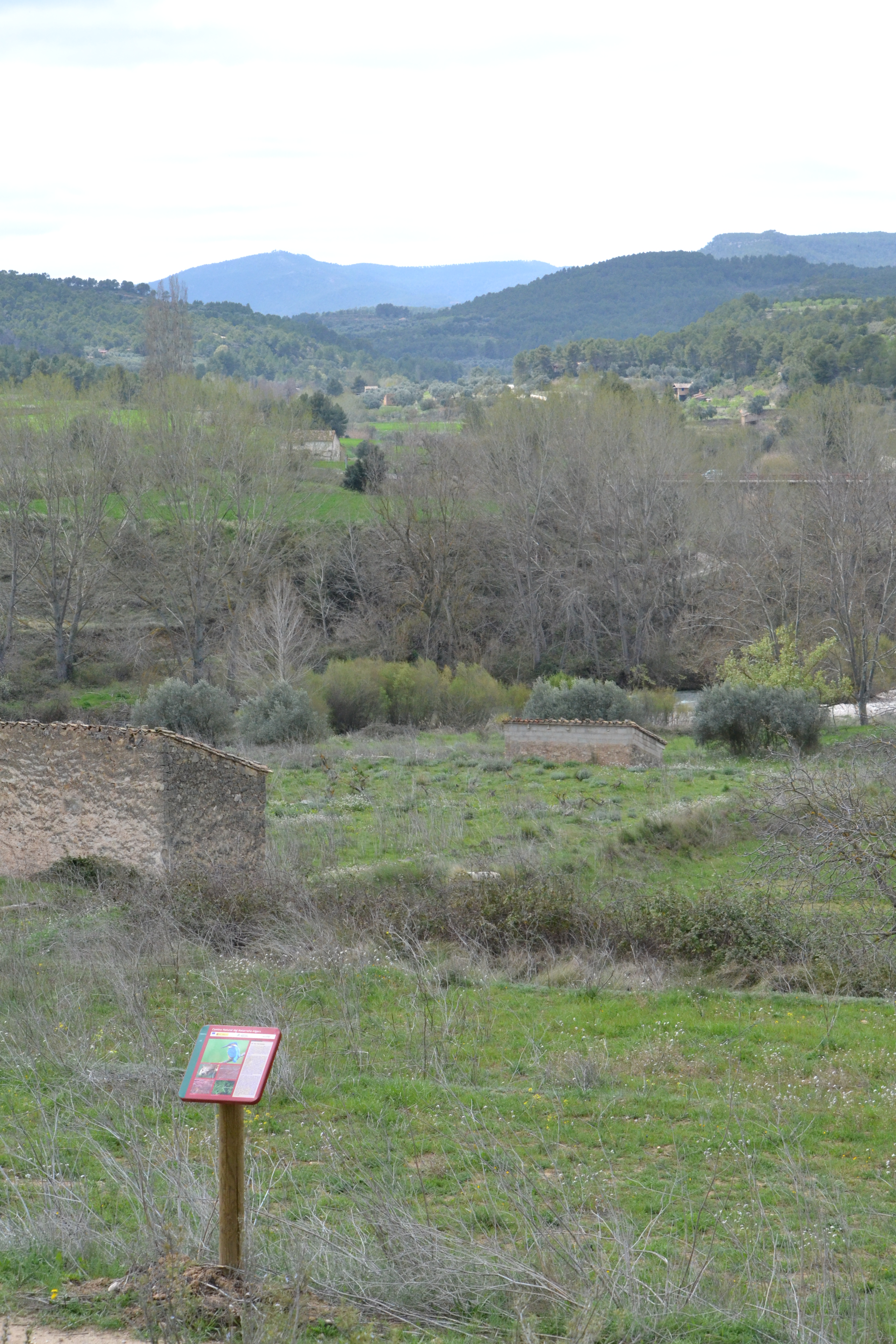
About 5 km into this stage, near a country house in ruins, the trail reaches the confluence of the Tastavins and the Matarraña rivers. This is an area of high ecological value and the traveller can learn more about it thanks to the information display panel there. After 5 more kilometres through similar landscapes, the trail reaches the TE-V-3001 road, linking Torre del Compte with La Fresneda.
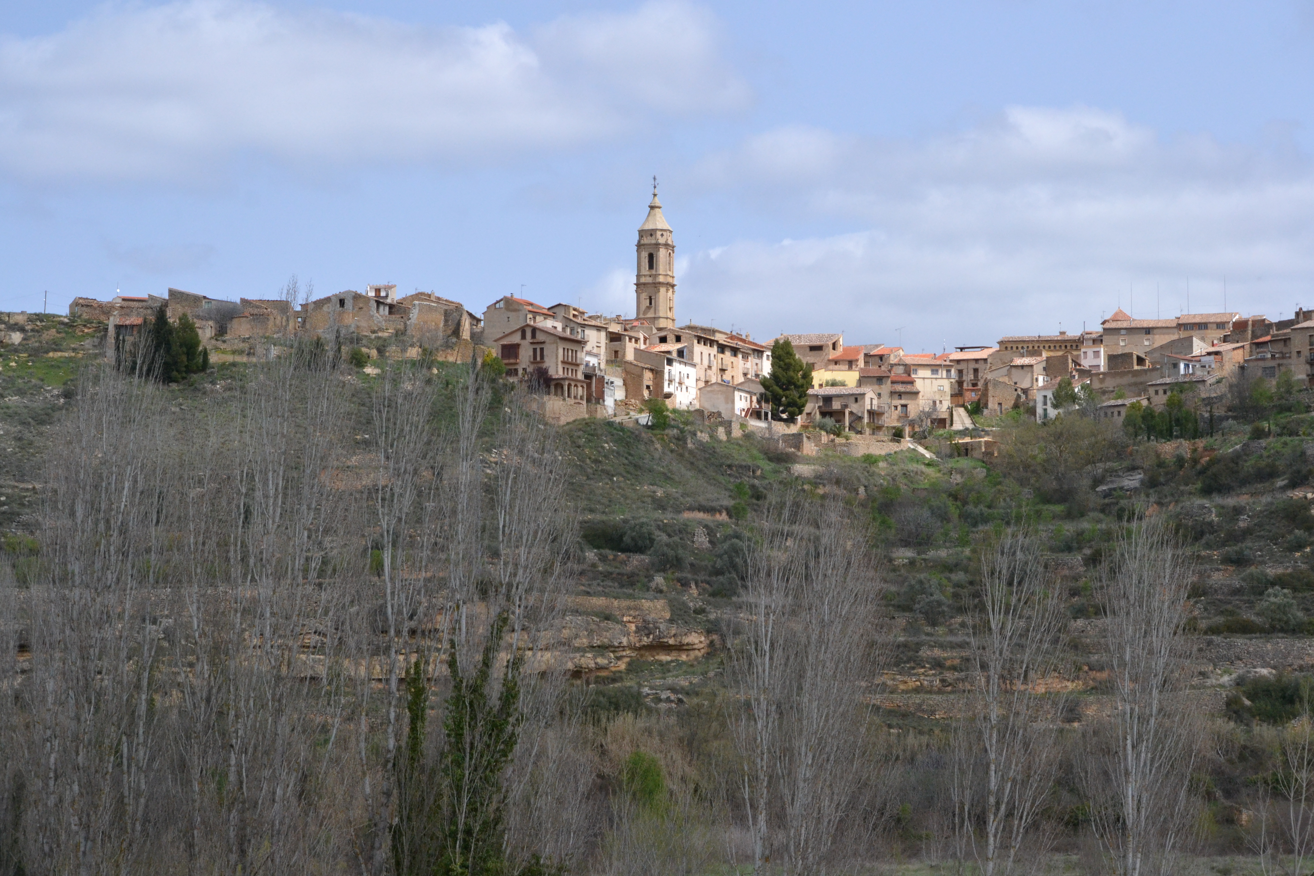
Leaving the bridge over the Matarraña (crossed by the next stage of this trail) on the left, the trail crosses the road to reach the town through a steep, but not very long path. This stage ends in the outskirts of Torre del Compte, next to one of the arches that used to give access to it when it was walled. However, its narrow Medieval streets are worth walking through, enjoying the spectacular view from the promontory where the town is located.
Map
Puntos de Interés
Hidrografía
Infraestructura
Municipio
Profile
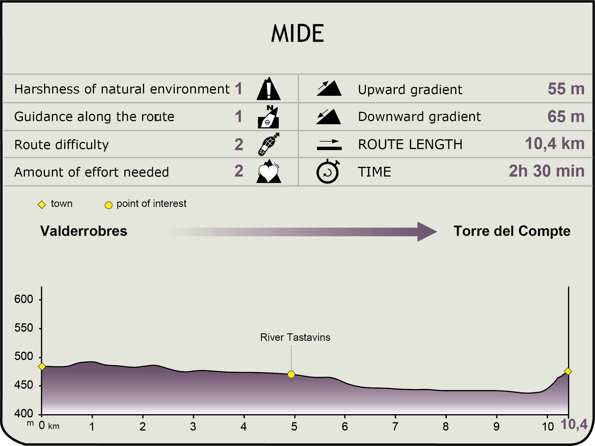
MIDE (Method for the Information of Excursions)
 Harshness of natural environment
- 1. The environment is not risk-free
- 2. There are more than one risk factors
- 3. There are various risk factors
- 4. There are quite a lot of risk factors
- 5. There are many risk factors
 Guidance along the route
- 1. Well defined trails and crossings
- 2. There is a clearly marked trail and signage
- 3. Requires the identification of geographic features and cardinal points
- 4. Requires off-path navigation
- 5. The trail is interrupted by obstacles that have to be gone around
 Route difficulty
- 1. Walking on a flat surface
- 2. Trails with different types of path
- 3. Walking on stepped paths or irregular terrain
- 4. The use of hands or jumping over the terrain is necessary
- 5. The use of hands is required to progress
 Amount of effort needed
- 1. Up to 1 hour of continuous walking
- 2. Between 1 and 3 hours of continuous walking
- 3. Between 3 and 6 hours of continuous walking
- 4. Between 6 and 10 hours of actual walking
- 5. More than 10 hours of continuous walking
Featured
Further information
Torre del Compte
The high location of this town over the right bank of the Matarrama valley, possibly due to strategic reasons, provides the town with spectacular views. The church of San Pedro Mártir, the city council (where the traveller can visit the Interpretation Centre of the Post-War Period without prior notice), the Plaza Mayor and the sundial of Casa Grande stand out among the narrow streets of this old walled town.
Tastavins River
The Tastavins river is one of the most important tributaries of the Matarraña river. This river is born in the mountain passes of Beseit and in the Tinença de Benifassà and ends in the Matarraña river between Valderrobres and Torre del Comte.
The Matarraña-Algars Nature Trail goes near the confluence between these both rivers: an area of high ecological value where there are Eurasian otters (Lutra lutra), as well as common kingfishers (Alcedo atthis). As for plants, field elms (Ulmus minor) and willows (Salix eleaganos and S. Purpurea) make up the riverbank vegetation in the areas where the flow of the river is constant.
Multimedia
Downloads
GPS Downloads
Cyclability
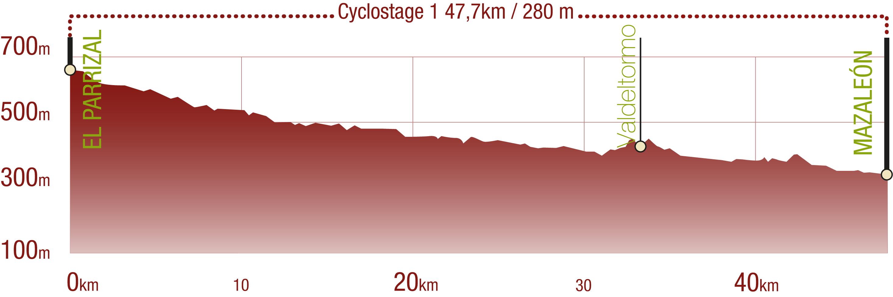
This Cyclostage correspond to stages 1 to 5 of the Nature Trail
PROFILE
TYPE OF ROAD, PORTAGES & DIFFICULTY
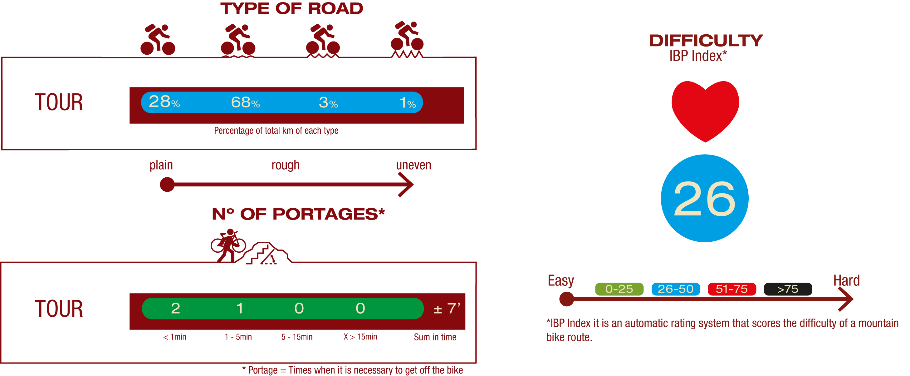
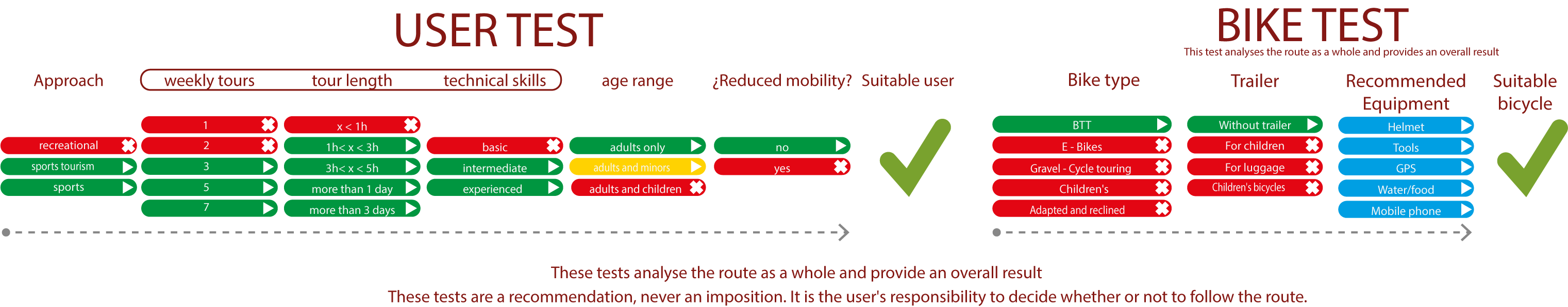
TEST
SAFETY RECCOMENDATIONS
- Sections shared with hikers.
- Transit through the centre of some population centres.
- Due to the fact that the route runs close to riverbeds, crossing them on several occasions, you are informed that there may be seasonal discontinuities caused by floods, increases in flow, floods or transit through flood-prone areas.
GENERAL RECOMMENDATIONS
- Find out about the technical aspects of the route and the weather on the day.
- Take care of the environment. Take care not to disturb animals or damage vegetation. Respect private areas.
- You must give priority to pedestrians and comply with general traffic rules.
- The environment in which you will be riding is open, free to move around and an area where many activities are carried out (sporting, forestry, livestock and agricultural activities). Always have an understanding, prudent, responsible and respectful attitude.