
Les Mines Nature Trail
Description
Black coal mountains, white water river
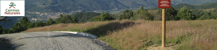
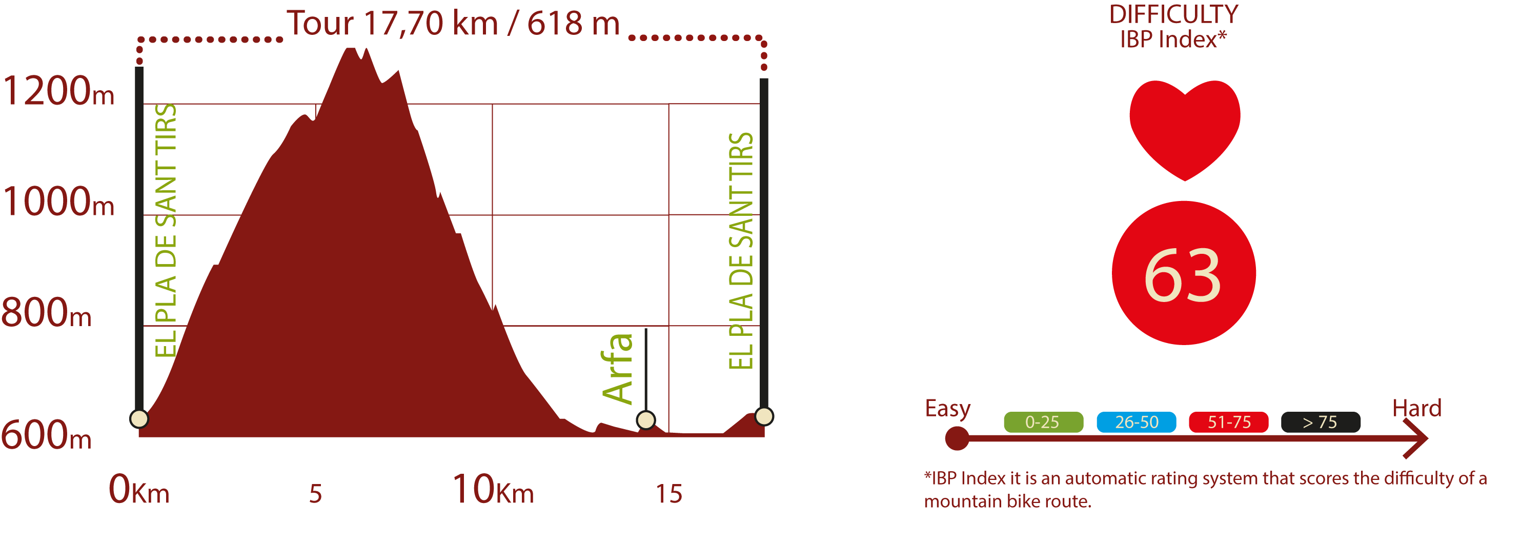
The Nature Trail of Les Mines de la Ribera de Urgellet has a circular route of some seventeen kilometres (including two branches and an alternative path) (the main path is 17.5 Km long) which covers the plains of the municipality of El Pla de Sant Tirs, passing through the mountains of Arfa and of La Coma and offering spectacular views of the mountains of Andorra, to end up accompanying the waters of the River Segre. In addition to offering a diverse array of landscapes, the aim of the path is to keep alive the memory of the coal mining activity that has been carried out in this area since the early 20th century.
The beginning of the path can be found in the northern part of the town of El Pla de Sant Tirs. Around kilometre 108 of the C-14 highway, you should take the turn-off on the right signposted to La Freita and La Coma de Nabiners in order to reach the beginning, a few metres away from this road.
Trekking is easy going along the first few metres as you leave the Riu del Pla to your left. Nevertheless, when you have covered barely three hundred metres, on crossing a bridge over this river, the incline increases greatly and remains like this until you have completed two kilometres of the path, ploughing through very steep, sharp bends.
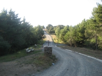
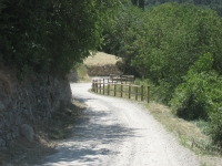
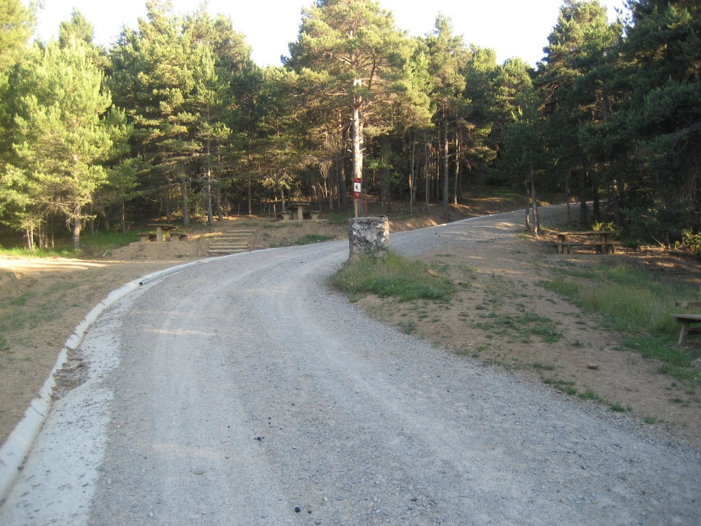
A short distance from the bridge, at a sharp turn to the left, you come to a barrier with a side entrance set aside for trekkers and cyclists that marks the end of the section whose use is shared with motor vehicles. From this point onwards, its use is exclusive to trekkers and cyclists. The path is in perfect condition, with a width of around three metres, a gravel surface and concrete kerbs. The whole route is properly signposted.
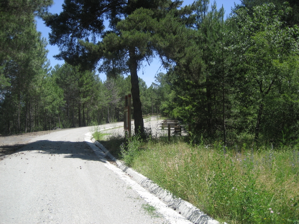
When you have walked a few metres from the kilometre two milestone, you come to a turn-off on the left where you can take the Cable Car and the River Arfa Branch, which is two thousand three hundred metres long and whose profile is quite flat and easy to walk on. Once you have turned off onto this branch, five hundred metres from the crossroads, you will come to the old cable car recreational / educational area, where you can see the buildings which, in bygone times, stored the coal as well as the departure bay for the wagons that carried the material as far as the power plant that stood in the vicinity. The area also has several tables and benches, which are ideal for taking a break on the tough climb.
Following along the branch road, the path narrows noticeably and runs between a marked moss-covered clearing on the right, and a ravine on the left, which is permanently protected by a wooden railing. At the end of the branch, you come to the River Arfa rest area, which affords an interesting perspective on the source of this watercourse.
When you return to the main path, you will notice a sharp drop in the gradient, although it is still tough, especially until you reach the third kilometre after three consecutive sharp bends. Furthermore, the oaks that until now formed the predominant type of vegetation start to intermingle with pines that will dominate the top part of the route. At kilometre 3.700, you cross a cattle grid that marks the beginning of gentler slopes. A little further ahead, after walking four kilometres, you reach a turn-off to the left of the Les Mines Branch.
This is a short branch measuring barely seven hundred metres, which begins downhill and then flattens out to reach the Les Mines rest area, where you can see the entrance to a mine built in stonework in the shape of an arch.
Once again, on the main path, the route continues as far as the Mas d’en Planes rest area, which is easy to walk, as the climb practically loses its incline, and can be described as slightly uneven.
The aforementioned area is level with a hillock that gives way to the two sides of the mountain; both hillsides were mined and have two open entrances. In this area, you can find an old building that was used as a hostel for the foremen of the nearby mines. It is currently in ruins as the roof of the main building has collapsed. Nevertheless, right next to it, a couple of tables and benches have been outfitted which are ideal for resting before facing the last section of the climb, which once again has quite demanding slopes.
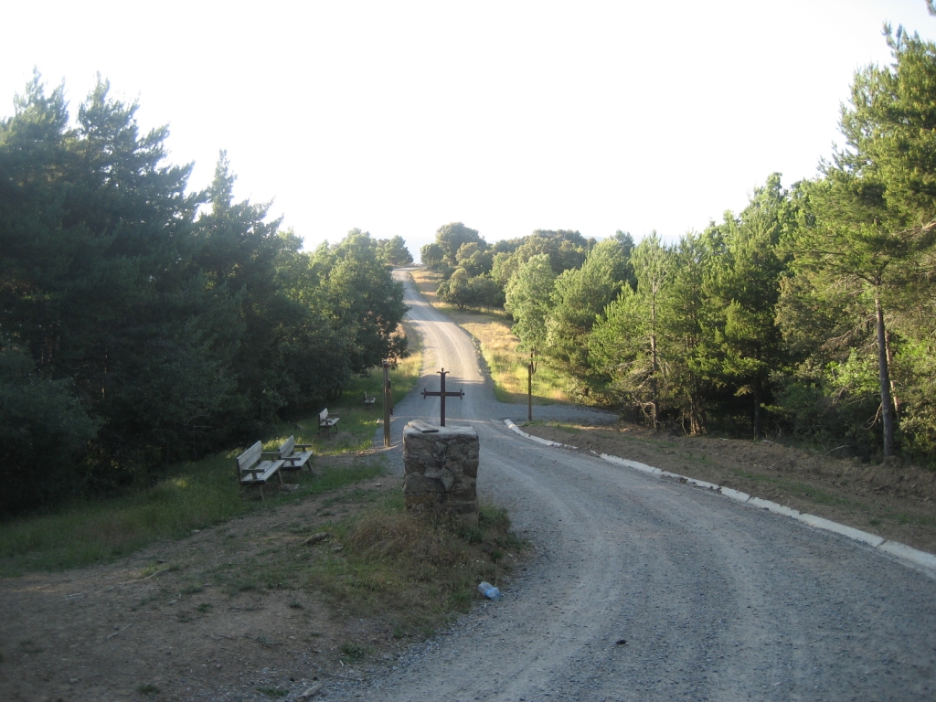
When you have recommenced your climb, and a few metres after kilometre five, on the right-hand side of the path, you come to a small pond that will draw your attention because it is unusual at these altitudes. Throughout the final metres of the ascent, areas of dense vegetation alternate with other clearer areas, where the sun beats harshly down. You will almost reach the summit at kilometre six, on a small hill, just before the second cattle grid on the path, and in just a few metres you will come to the La Freita-Nabiners rest area. This area stands out owing to the existence, on the right of the path, of a monolith with a metal cross. Here, there are tables and benches available where you can recoup your strength. Approximately three hundred metres from this area, you will find an explanatory panel on characteristic fauna in the area.
In this rest area, just before the monolith with the cross, there is a turn-off on your left. It is a path that goes from Arfa to La Freita. This path can be regarded as an alternative to the main route and which shortens the distance considerably. Nevertheless, it must be pointed out that, in spite of the fact that the whole route is signposted, it is a narrow, stony path with steep slopes, which we do not recommend cycling along.
If you continue along the main path, for roughly one kilometre, you will encounter a crest area, which alternates steep slopes both upwards and downwards, and which features an area with sparse vegetation that enables you to see an incredible view of the surrounding summits and landscape.
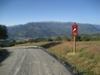
Having passed kilometre seven, you will come to a sign that warns of steep slopes, and it can be said that it is from this moment on when the downward trek really begins. It is a descent with areas of very steep slopes and others with short landings; you can also find sections of the path where the surrounding vegetation is very thick and others encircled by very open land. As a final detail, this descent has several very sharp bends.
In this section, level with kilometre 8.500, you will find a descriptive panel on the Cadí-Moixeró Natural Park, at a point where the views over the mountainous barrier formed by these ranges are extraordinary. One kilometre further on, after a sharp bend on the right, you enter the final section of the descent, with a gentler and more continuous slope, where the vegetation includes a significant number of Holm oaks (Quercus ilex). Another sharp bend on the left marks the end of the part whose use is exclusively for pedestrians and cyclists. From this point onwards, the wear-and-tear of the track caused by the passing of motor vehicles is obvious.

The descent continues, leaving a farm on the left hand side (with a road blocked sign indicating no entry) and crossing the Torrent de la Freita via a short bridge. The path straightens and passes by another farm until you reach an asphalted area. At the next fork, you have to turn left, as on the right you would enter private houses. You walk down a short section that takes you near to the River Segre, along an asphalted track that runs alongside it which you have to take in a southerly direction, turning to the left. At the intersection with this track, you will find a panel that includes information on the water birds in the area. There are two huts in the surrounding area especially set aside for this purpose to make birdwatching easier.
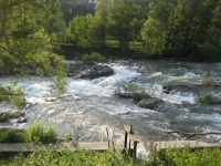
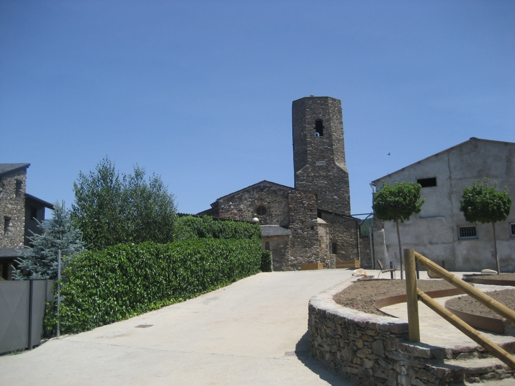
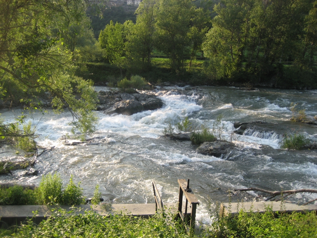
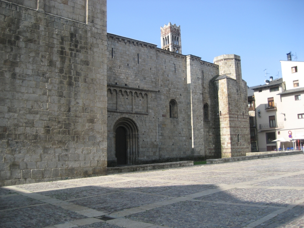
The path stays parallel to the River Segre, allowing trekkers to see the incredible force of the water in several whirlpools and rapids, especially in one that is located next to the beginning of an irrigation canal. On the other bank you can see the town of Montferrer, set on the mountain. You zigzag across this canal and reach the place where the informative panel on the riverside vegetation is installed. The road leaves the river temporarily, across some short slopes so you can reach, after leaving a plant nursery area on your left, the town of Arfa. Worthy of note in this town is the 12th-century church of San Serni, and a bell tower that dates back to 1707, which has a square base and an octagonal top and which is crowned by a geodesic vertex. Once again next to the river, there is a small rest area with a sign describing the town and its monuments.
In order to continue along the trail, you have to border the town of Arfa, first across a bridge to go around the lower part and then, after leaving on your right the beautiful stone bridge that crosses the River Segre, along an upward road which stands out from the side of the mountain where the town lies. In this area, once again, worthy of note are the wild waters of the river, where there are sports facilities that can be used for slalom canoeing trials. You continue bordering the town centre until you reach a park outfitted with children’s games and a fountain. At this point, you will find the signposts that indicate the proximity of the aforementioned Arfa-La Freita path. To reach the beginning, you have to climb up the streets of the town to the highest part, where the path begins and which firstly runs among agricultural fields to then enter a closed forest. The marks showing the route are arranged exactly in the places where the different sections of the path begin; hence, you should use them as a reference.
If you continue along the main path, whose entire section parallel to the river coincides with The Way of St. James’s, the track becomes dirt once again and passes by several farms. Depending on where you are, the river moves closer to or further away from the path, although its murmur is a constant companion. Close to kilometre fifteen, the path crosses over the River Arfa, whose source was visited previously. One kilometre further on, you come to the C-14 highway, which has the Adrall Power Plant on its opposite side. From this point onwards, the road runs between the River Segre and the path; hence, the murmur of its waters is lost to a great extent.
For roughly three hundred metres, the track runs parallel to the road, until it reaches an asphalted turn-off on the left, which emerges from the aforementioned C-14 highway and accesses a restaurant. After covering this short section, the path climbs and separates from the road to reach an area of kitchen gardens and an irrigation channel, which is separated from the path by a wooden railing. The path continues to draw closer to the road, but when it is about to cross it, trekkers will see how it moves away again to the left heading towards the village of El Pla de Sant Tirs and reaching the point where the main route began and where the panel marking the beginning of the path is located.
Sites of interest
Profile
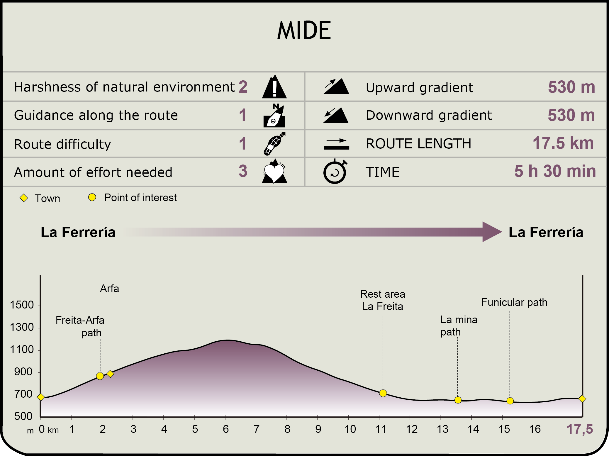
MIDE (Method for the Information of Excursions)
 Harshness of natural environment
- 1. The environment is not risk-free
- 2. There are more than one risk factors
- 3. There are various risk factors
- 4. There are quite a lot of risk factors
- 5. There are many risk factors
 Guidance along the route
- 1. Well defined trails and crossings
- 2. There is a clearly marked trail and signage
- 3. Requires the identification of geographic features and cardinal points
- 4. Requires off-path navigation
- 5. The trail is interrupted by obstacles that have to be gone around
 Route difficulty
- 1. Walking on a flat surface
- 2. Trails with different types of path
- 3. Walking on stepped paths or irregular terrain
- 4. The use of hands or jumping over the terrain is necessary
- 5. The use of hands is required to progress
 Amount of effort needed
- 1. Up to 1 hour of continuous walking
- 2. Between 1 and 3 hours of continuous walking
- 3. Between 3 and 6 hours of continuous walking
- 4. Between 6 and 10 hours of actual walking
- 5. More than 10 hours of continuous walking
Featured
Further information
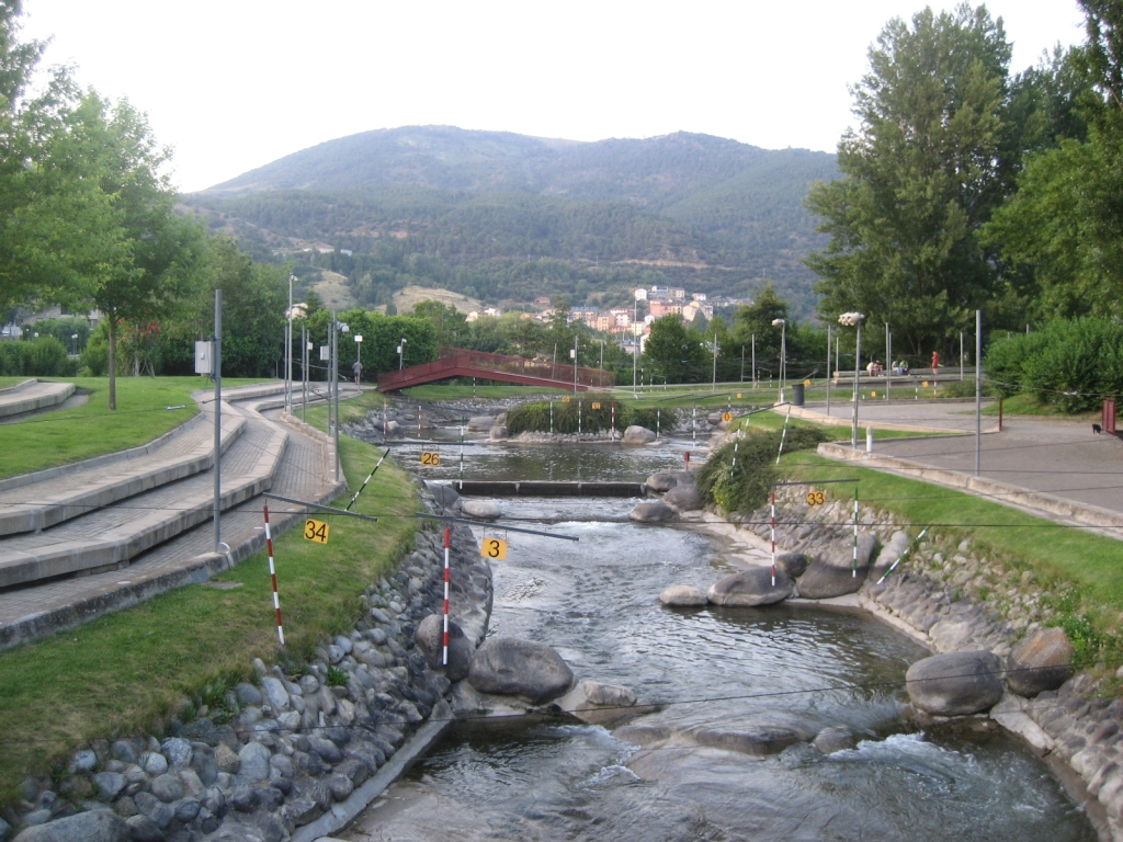
Wildwater canoeing
Slalom canoeing is an Olympic discipline whose aim is to kayak or canoe down, in as short a time as possible and without penalties, a wildwater canal whose technical difficulty increases via gates that the participants have to pass through. The gates are formed of one or two vertical poles marking their bounds, a support they hang from, and a white or yellow board indicating the number of the order the gates have to be passed through and in which direction. They are between 1.2 and 4 m wide and depending on their colour, they have to be cleared in the direction of the current (green and white gates) or in the opposite direction to the current or upstream (red and white gates). There can only be six of seven of the latter gates along the whole route.
In the Alto Urgell, this activity is highly developed, taking advantage of the magnificent flow of the River Segre, a fact that can be verified on the route of the Nature Trail of Les Mines, on its way through the town of Arfa. Nevertheless, this sports’ facility that stands out in the region is the Olympic Park of the River, which was a secondary venue for the Olympic Games of Barcelona 92 for this canoeing modality. It is an artificial canal, in the town of La Seu d´Urgell, which features two canoeing canals: a calmwater one which is 800 m long, and a wildwater canal, with a length of 500 m, a slope of 6.5 m and an adjustable flow of 5 to 15 m³/s, in addition to a system of mechanical lifts, unique in the worldwide, and a mini-power plant that regulates the flow of the water, which guarantees the activity year-round. In addition to the water activities, the park offers a diverse array of possibilities, including its noteworthy sign-posted mountain cycling routes measuring over one thousand kilometres.
Multimedia


Downloads
GPS downloads
Brochure and maps
Cyclability
PROFILE & DIFFICULTY
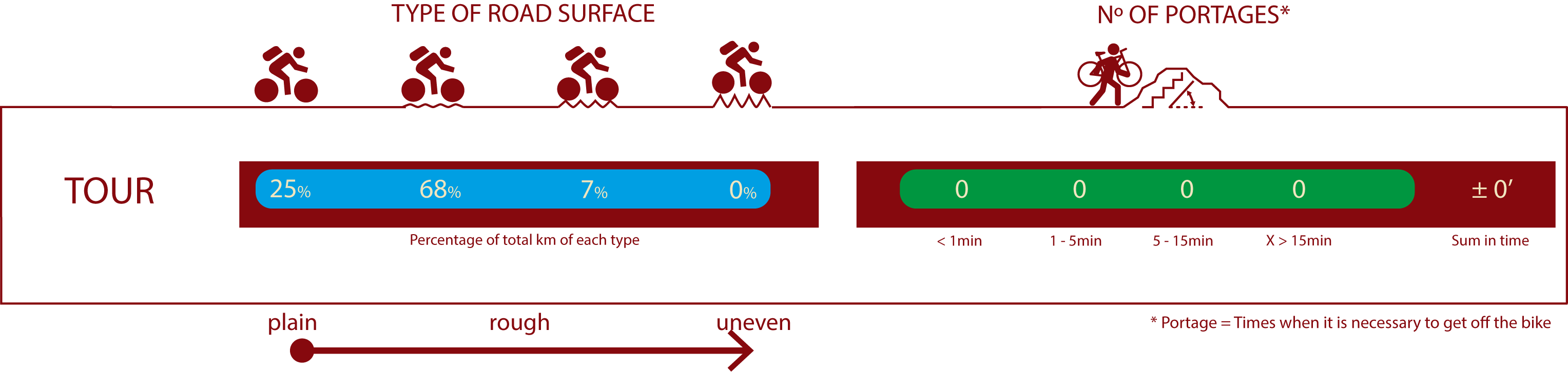
ROAD TYPE & PORTAGES
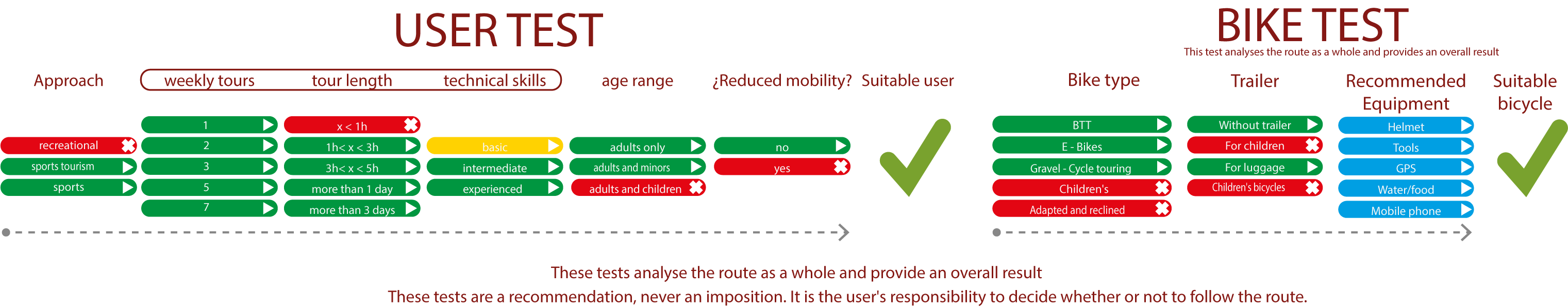
TEST
SAFETY RECOMMENDATIONS
-Sections shared with hikers and agricultural vehicles.
-Transit through the centre of some population centres.
-Take caution on the downhill section.
RECOMENDACIONES GENERALES
-Find out about the technical aspects of the route and the weather on the day.
-Take care of the environment. Take care not to disturb animals or damage vegetation. Respect private areas.
-You must give priority to pedestrians and comply with general traffic rules.
-The environment in which you will be riding is open, free to move around and an area where many activities are carried out (sporting, forestry, livestock and agricultural activities). Always have an understanding, prudent, responsible and respectful attitude.