La Séquia Nature Trail
Description
An irrigation canal in the heart of Catalonia
As is told in chronicles, in the 14th century the entire region of Bages suffered a devastating drought which forced its inhabitants to demand better water distribution to prevent supply problems in the future. The final solution to the problem appeared in 1383 with the termination of the construction of La Séquia, a 26-kilometre long canal which for over six hundred years has continued to carry the waters of El Llobregat from Balsareny to Manresa.
In order to maintain this impressive engineering work, a parallel pathway was restored whose route has been suitably prepared for walking.
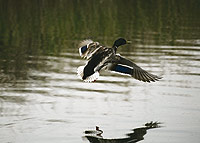
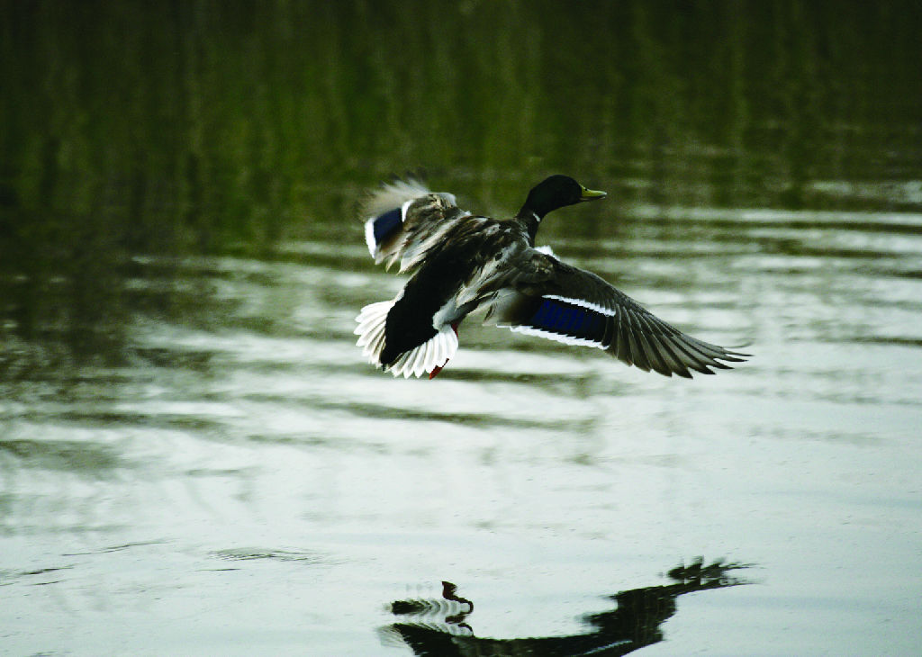
The starting-point of this Nature Trailorants (Phalacrocorax carbo), wild ducks (Anas platyrhynchos), Eurasian coots (Fulica atra), common moorhens (Gallinula chloropus) and countless passerine bird species, among others.
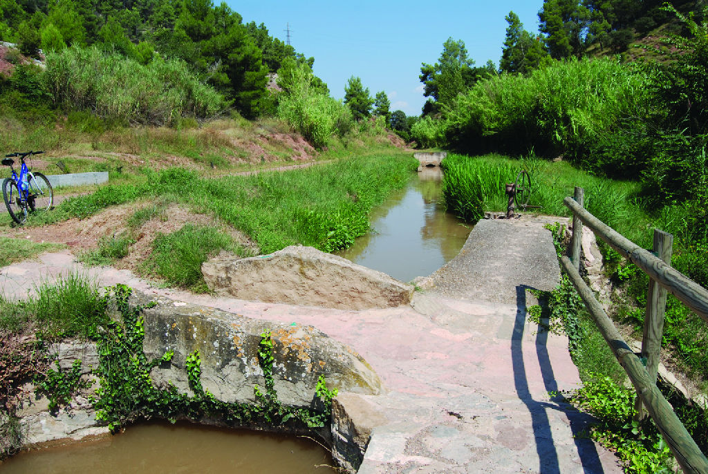
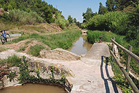
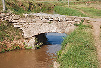
From the Balsareny dam, the Trail runs along the banks of El Llobregat through a riverside forest that gives way to a group of crammed, hundred-year-old market gardens, which depend on the waters of La Séquia. The first crossroads gives you the option of visiting Balsareny castle, a Gothic-style building, just 1.6 km away, although the route continues towards the Santa María aqueduct, which the trail user will come to before the majestic bridge built at this point over the River Llobregat. Here, visitors can have a drink of water in the Sant Roc Fountain, before continuing on their way among small orchards. is La Reclosa dels Manresans in Balsareny, where the waters of El Llobregat are captured in a semi-circular dam originally built using wooden trunks and later covered in concrete. In an adjacent site hut, the entrance of water to the canal is regulated, which in the first section is underground. It is a very interesting place as it is a meeting-point for numerous water birds and, because of this, an observation post has been installed where you can catch sight of many species, such as great corm
The Trail passes under a road and runs parallel to it along a Persian-walnut bordered promenade (Juglans regia). At this point, you can spot the old “El Molino” textile factory, and a little further on you will come to a turn-off on the left-hand side that leads to the Vinya d' en Martí aqueduct. The route continues along the edge of the irrigation canal and accompanies the road as far as another crossroads where you have to be very careful as there is no walkway specifically designated for pedestrians and at this point the traffic travels at great speed.
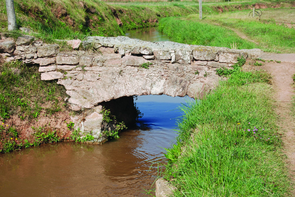
The following stretch of the path passes a quarry on the right before reaching a resting area, where an interpretation panel describes the most outstanding features of the itinerary. At all times, signs indicate the direction you have to take and the distance remaining until you get to the next point of interest, the Conangle Aqueduct, which was built in 1340 and consists of seven arches with a total length of 103 m.
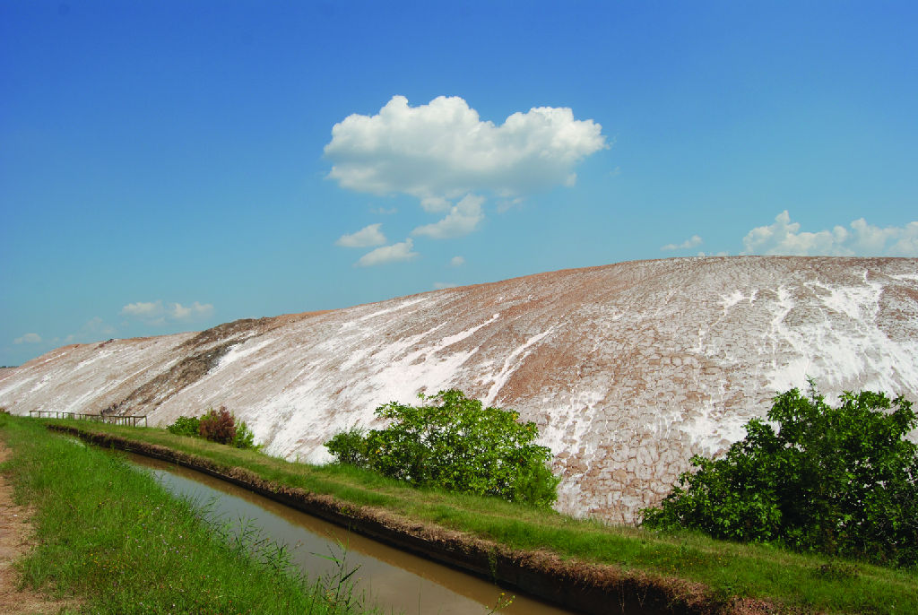
The irrigation canal crosses a farm until it reaches the outskirts of Sallent, where the route draws close to the highway. At this point, it is channelled underground following the direction of the road, but the path runs parallel to a railway track which transports potassium salts from the mines of Sallent, which are located further on, to Barcelona. Passing the turn-off to the Vilar aqueduct, which nowadays is in disuse, you carry on until reaching the tracks. The irrigation canal surfaces once again on the other side of the railway.
(For safety reasons, so as not to have to cross the tracks, there is a path that runs parallel to them for less than 1 km, until an overpass, in the route to El Cogulló iberian town, that, if taken to the left, reaches once again the vecinities of the irrigation canal and the Natue Trail in the detour mentioned in the next parragraph.)
The adjacent mountains, which have a lunar appearance, are the mineral remains resulting from the potassium extraction works that attract the attention of trail users until they reach the turn-off for the Iberian town of El Cogulló, which was an “oppidum” or a walled town that was abandoned in the Roman era. If you should wish to visit it, you have to make an appointment in advance.
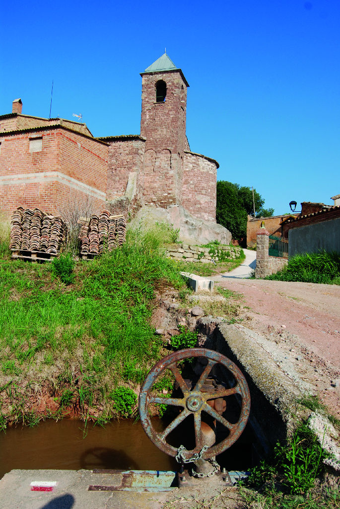
The Trail continues next to La Séquia, crossing it on occasions before reaching La Mas de Les Coves, an ancestral home that preserves a typical mediaeval structure with a fortified compound presided by a defence tower. From this point onwards, the path opens onto a rural, farmland landscape in the middle of which the Romanesque chapel of Santa Magdalena Bell-lloch rises, which can be accessed from the same crossroads that lead to the Font del Rei, barely 150 m away.
Further on, you will enter a luxuriant holm oak (Quercus ilex) forest where, in a clearing, you will come to the “Anfiteatro de la Sala”, a space used as an open-air Nature Classroom.
Water flows along La Séquia passing through the thirty-one aqueducts that it crosses on its way until, in the distance, you can see the Santa Ana industrial estate. After crossing it, you have to continue in the direction of the Bonegues Aqueduct, to then carry on along a pleasant pine-tree (Pinus sp.) covered promenade that leads to a road which, once again, you have to cross carefully.
The Trail continues along clayey lands as far as the drinking water treatment system of Sant Fruitós de Bages, offering you, at the first intersection, located a little further on, the chance to visit the well-preserved Romanesque chapel of Santa María, built in the 12th century, or that of Santa Anna de Claret, built in 1762, in Baroque style.
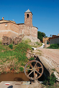
Barely 600 m away, the Casa del Sequiaire appears, a building where the irrigation canal maintenance officer lived. After crossing another of the impressive aqueducts, this time that of the Riu d’Ordoscientos, the Trail reaches the recreational area of the Font de la Riera, where you can fill up your water supplies while enjoying a reinvigorating rest.
The last leg of the route winds between market gardens and crops, on occasions guarded by scarecrows, until you cross the railway track in order to reach the “Ermita i Mas de Sant Iscle”, one of the oldest mediaeval houses in the region of Bages, where you can also visit another Romanesque church.
After passing a resting area, you cross a tunnel under the C-25 highway, which leads to L’Agulla Park, where an artificial pond guarantees the water supply and collects the flow of the canal. This Nature Trail ends a few metres away at the Séquia Park visitor’s centre.
Profile
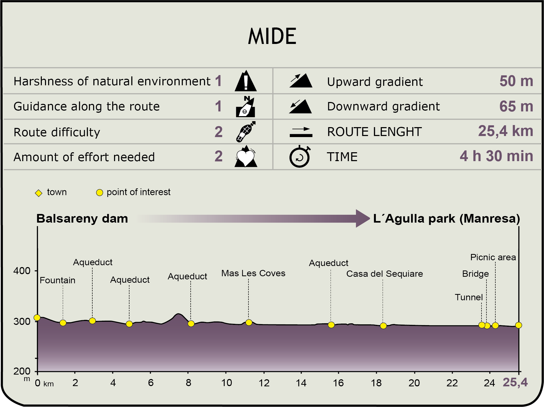
MIDE (Method for the Information of Excursions)
 Harshness of natural environment
- 1. The environment is not risk-free
- 2. There are more than one risk factors
- 3. There are various risk factors
- 4. There are quite a lot of risk factors
- 5. There are many risk factors
 Guidance along the route
- 1. Well defined trails and crossings
- 2. There is a clearly marked trail and signage
- 3. Requires the identification of geographic features and cardinal points
- 4. Requires off-path navigation
- 5. The trail is interrupted by obstacles that have to be gone around
 Route difficulty
- 1. Walking on a flat surface
- 2. Trails with different types of path
- 3. Walking on stepped paths or irregular terrain
- 4. The use of hands or jumping over the terrain is necessary
- 5. The use of hands is required to progress
 Amount of effort needed
- 1. Up to 1 hour of continuous walking
- 2. Between 1 and 3 hours of continuous walking
- 3. Between 3 and 6 hours of continuous walking
- 4. Between 6 and 10 hours of actual walking
- 5. More than 10 hours of continuous walking
Featured
Further information
The Mysterious Light
In the 14th century, following a period of severe drought, the town of Manresa asked King Pere III of Catalonia to build an irrigation canal that would guarantee the water supply. The Bishop of Vic was opposed to the work of La Séquia because he refused to let the canal cross the bishopric’s lands, even threatening to excommunicate the inhabitants of Manresa if the work began.
It is said that it is then that a miracle occurred which was repeated three times: a surprising beam of light reached the Church of El Carme from the Montserrat mountain range. This event was interpreted as a divine sign that made the Bishop of Vic change his mind and grant permission.
After a five-year interruption in the work, the King promulgated a so-called “Concordia” which was supported by Pope Clement VI and water finally reached the capital of the region of El Bages.
Since then, a popular festivity called “La Festa de la Llum” has been held every February to commemorate these prodigious events.
L’Agulla Park
In 1962, the Manresa Water Board saw the need to build an artificial lake in order to guarantee the city’s water supply in case La Séquia should break down.
The construction works began four years later but, due to the type of land, the whole surface area of the pond had to be covered with reinforced concrete slabs. Its construction was finished in 1974.
This lake, located in l’Agulla Park, has a capacity of 200,000 m3 of water and guarantees supplies to the city’s tanks for six or seven days.
In order to prevent industries from setting up around the reservoir, a protected space was created which today forms the l’Agulla Park and is one of the favourite recreational spots of the inhabitants of Manresa.
Multimedia