- Home
- Rural Development
- Nature Trails
- Nature Trails
- Northeast Sector
- Hoya_Huesca
Stage 8 - Casbas de Huesca- Bierge
Description

A land marked by its rivers
This Stage, the shortest on La Hoya de Huesca Nature Trail, joins together the towns of Casbas de Huesca and Bierge, enabling it to link up to the Nature Trail of El Somontano de Barbastro in the vicinity of El Salto de Bierge. Along this 8.6 km route, you will cross and walk beside several rivers, such as the Formiga, the Isuala and the Alcanadre, which cross the Sierra of Guara perpendicularly from north to south, forming deep valleys on their way.
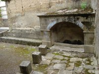
To begin this Stage, you must leave the designated rest area at the entrance to the town of Casbas de Huesca. Heading towards the town, you will come to the Cistercian monastery of Nuestra Señora de la Gloria, a group of several buildings where a beautiful 12th-century Romanesque façade is maintained as well as a 15th-century cloister and the Renaissance Abbey’s Palace. On this monastic site, several infrastructures relating to water use, such as an old fountain with a lowered arch and a washhouse next to it, have also been preserved.
After this recommendable visit, return to the trail by crossing the town and, on the outskirts, turn off by taking a dirt track on the left towards Bierge. Here, you will enjoy the characteristic landscape of this region of Huesca, where the cereal plain is interspersed with Holm oak trees (Quercus ilex), offering a beautiful, colourful mosaic, with the Sierra of Guara dominating the horizon.
Some metres before the irrigation canal stream, after walking close to 1 km, leave the path on the right, passing next to an estate with some vineyards. Some metres further ahead, the path forks and you should continue along the one on the left. Level with the 18th-century chapel of San José, located on a sandstone hillock, you should take the signposted fork to the left and carry on along the path among olive (Olea europaea) and oak trees until you come to a wooden railing where the trail turns into a path and you begin walking down to the River Formiga.
This winding descent across the hillside offers beautiful views of the region and of the ravine of the River Formiga, with steep rocky sandstone sides. Walking down through a beautiful oak grove, comprising species such as strawberry tree (Arbutus unedo), junipers(Juniperus communis), kermes oaks (Quercus coccifera), gorse(Genista scorpius), honeysuckles(Lonicera sp.), prostrate Canary clover (Dorycnium pentaphylum), and lavender (Lavandula sp.), there are different sections of railing and wooden steps in the steepest areas until you come to a track that leads you to a walkway that enables you to cross the River Formiga, which some metres further on pours its waters into the River Alcanadre.
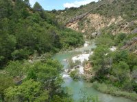
Having crossed the riverbed, the trail continues along a track for some 30 m and turns to the left changing into a path that climbs up the hillside, offering excellent views of the River Alcanadre on the right of the route. The path once again descends among kermes oaks, oak trees and the occasional Aleppo pine (Pinus halepensis) as far as the riverbed, which you will walk beside for a few hundred metres, among numerous remnants dragged by these crystal-clear waters.
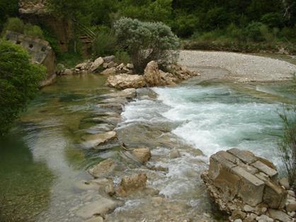
You will see in front of you the remains of the bridge of Las Aguas, one of the oldest bridges built over the River Alcanadre, the fullest and longest river along El Somontano. This bridge of Romanesque origin connected both riverbanks together, allowing the muleteers who transported goods from the high lands of El Somontano to the flatlands of La Hoya de Huesca to pass over it, forming part of a bridle path known as “the carriers” and of a Royal Path. Its collapse was notified in April 1994 and all that remains at the present time is part of the abutments that rested on the rock, the central pillar and part of the two pointed arches that formed the bridge’s spans. Here, large stones have been arranged like stepping-stones so that the river, which in this area is known as the Ajuntadero or the “joiner”, can be forded. Its waters merge with those of the River Isuala, increasing its flow and its strength. This river should be crossed with care as, depending on its flow, some of the stones could be covered with water or be slippery.
Now, on the other bank, you begin to walk down a steep path that offers excellent views of both rivers’ basins, with a clear V-shaped profile and very tilted strata of different hardness, showing the differential erosion between the softest (clays) and the more resistant (sandstones) materials.
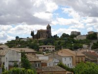
After the climb, you walk under oak trees around a crop that you will leave a few metres ahead, to then continue along the valley of the River Alcanadre, which allows you to see the town of Bierge in front of you. After continuing for some 700 m next to diverse dry crops, the path merges with a track on the left that heads towards the town.
The Nature Trail carries on following the main track among olive trees, cereals and oak trees, reaching the ravine of La Tejería, where there are some kitchen gardens and fruit trees. One last slope leads you to the path of Batanaz, and, after a turn-off to the right, you enter the town of Bierge, the gateway to the Natural Park of the Sierra and the Guara Canyons, where a large number of active tourism companies and services are gathered offering a diverse array of nature activities.
The late Gothic church of Santiago el Mayor, which was built over another of Romanesque origin, stands on your left at the top of the town. You pass by the door of an old restored oil mill and continue as far as a car park and a play area where you can consult a panel containing information on the Nature Trail. From here, the path continues among olive trees and cereal crops as far as the A-1227 highway.
At the exit from Bierge to Rodellar, you will find the Interpretation Centre of the Natural Park of the Sierra and Guara Canyons. In the village, you can also visit the 13th-century, Romanesque style chapel of San Fructuoso, declared a Historic Artistic Monument.
When you reach the A-1227 highway, you must walk beside it with great care. In a distance of 50 m, the path crosses it and climbs a small hill on the right via a path, to then descend as far as the small ravine of Viatres. Once the trail arrives at the road again, but without crossing over, it turns to the right along a track that continues as far as the connection with the Nature Trail of El Somontano de Barbastro, the end of the Stage and of the Nature Trail of La Hoya de Huesca. In just 200 m, you will come to a car park and several informative panels on both Nature Trails around the popular Salto de Bierge; a weir built to operate one of the eleven flourmills that existed on the River Alcanadre.
Profile
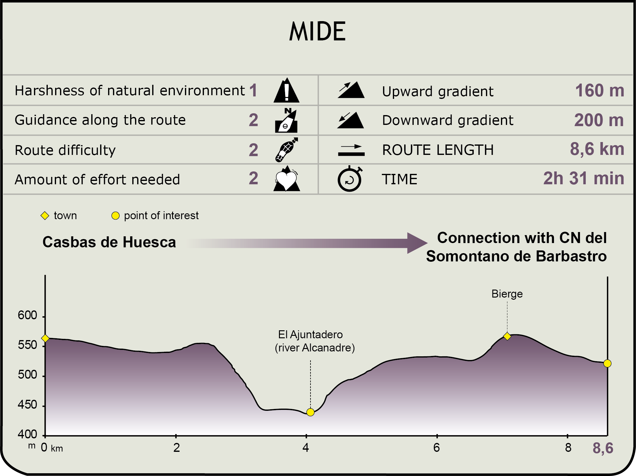
MIDE (Method for the Information of Excursions)
Featured
Further information
River Alcanadre. Bridge of the waters
This river’s name comes from the Arabic Al-qanatir,the plural of Al-qantara and means “the river of the bridges”. It is the longest and fullest river of those that cross the outer Sierras of Huesca, although its regime is very irregular and runs both high and low depending on the year.
It owes its name to the fact that, from its source in the Sierra of Galardón as far as its mouth on the River Cinca, in the town of Ballobar, the remains of sixteen old stone bridges have been preserved.
This river crosses the Sierra of Guara and forges deep ravines, canyons and gorges, which, every year, welcome canyoners of all nationalities. The four sections that are formed are called Gorgas Negras (the hardest Stage for canyoning in the whole sierra), Barrasil, Peonera Superior and Peonera Inferior.
Its most important tributaries are the Rivers Balcés, Mascún, Flumen and Guatizalema.
Out of all the old bridges that have remained standing, the purpose of the bridge of “Las Aguas” of Bierge or of “as cabras”, which has not been used since 1994, was to facilitate the traffic of goods that were headed towards the high lands of El Sobrarbe, and passed through Bierge towards Casbas and from there to the plateau of La Hoya de Huesca. It also formed part of a Royal Path from Huesca to Alquézar.
This bridge dates back to the late 16th or early 17th century. When it was in use, it was formed of two pointed arches separated by a pillar that rested on a rocky area of the river and upstream it had a triangular breakwater with a pyramidal structure. On the arches, there rested a gabled, paved, slightly tilted deck, whose centre was approximately at the point where it met the dome of the breakwater. The bridge channelled the current via fan-shaped, staggered flaps and was built out of blocks joined together with mortar and in regular rows.
At the present time, following its collapse, the only elements still remaining are the abutments, which are partly resting on the rock, the central pillar and the stem of the arches on both sides.
