- Home
- Rural Development
- Nature Trails
- Nature Trails
- Northeast Sector
- Hoya_Huesca
Stage 7: Santa Eulalia la Mayor – Casbas de Huesca
Description
Through the old Abbotship of Montearagónn
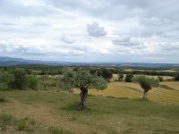
This long Stage of the Nature Trail of La Hoya de Huesca runs through villages of the former Abbotship of Montearagón, where you can visit a large number of sites of great cultural and ethnological interest, such as the mediaeval bridge of Sipán, the church of San Miguel de Foces, the chapel of San Esteban and the Monastery of Casbas. Along the route’s 25.7 km, you will cross the municipalities of Loporzano, Siétamo, Ibieca and Casbas de Huesca through a landscape of agricultural crops and oak groves located in the Somontano of the Sierra of Guara.
From Santa Eulalia to Sipán

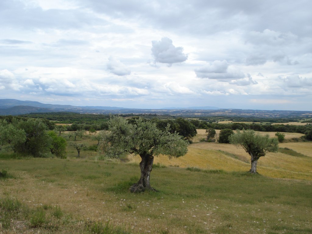
The path leaves the town of Santa Eulalia la Mayor by descending the road towards the plain, to then turn off on a sharp bend on to a track that heads rightwards among olive fields (Olea europaea). You continue downwards among the olive and almond trees (Prunus dulcis) for around 900 m and after a chasm on the right and then on the left, the trail carries on among dry herbaceous crops, with the picture of the village of Castilsabás on the side of a small hill.
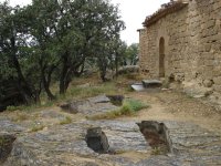
After some 500 m, you come to a turn-off on the right to an alternative route by an Oil Mill and by the chapel of the Virgin of El Viñedo. If you follow the sign, you will come to the old mill, a rectangular, one-eaved building that stands next to an explanatory panel. Both the building and its interior have recently been restored; its original structure has been maintained and inside you can still see the grindstone, the press, the basins and channels needed for the entire process for transforming olives into oil. From here, the trail leaves in the direction of the neighbouring chapel of Nuestra Señora del Viñedo, which is surrounded by olive trees and is a little over 100 m away. Nearby, there is El Viñedo Visitors’ Centre, which is oriented towards the Park of the Sierra and Guara Canyons.
After crossing the road, you continue along a track, which, as occurs with a large part of the route, is perfect for cycling. Surrounded by extensive cereal fields, you leave on your left Castilsabás, which is located on a hill covered with oak trees (Quercus ilex), kermes oaks (Quercus coccifera) and junipers (Juniperus communis).
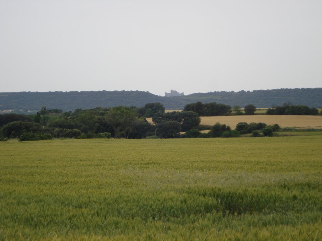
Carry on along the main track where you will see several posts marking the Nature Trail and the outline of the great castle of Montearagón on the horizon.
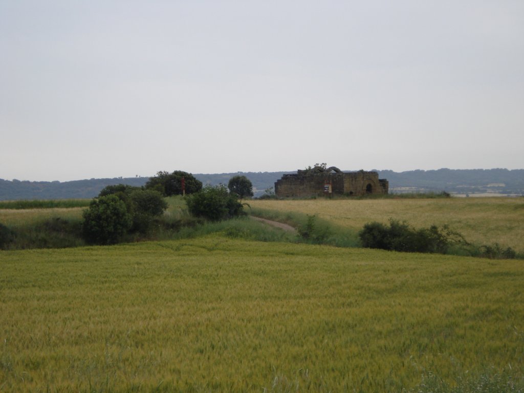
After leaving the path to Loporzano on your right, in less than 1.5 km, you will come to the first of the numerous chapels that you will find along the route. The ruins are of the chapel of San Fertús, located on a small plateau where a small mediaeval village used to stand.
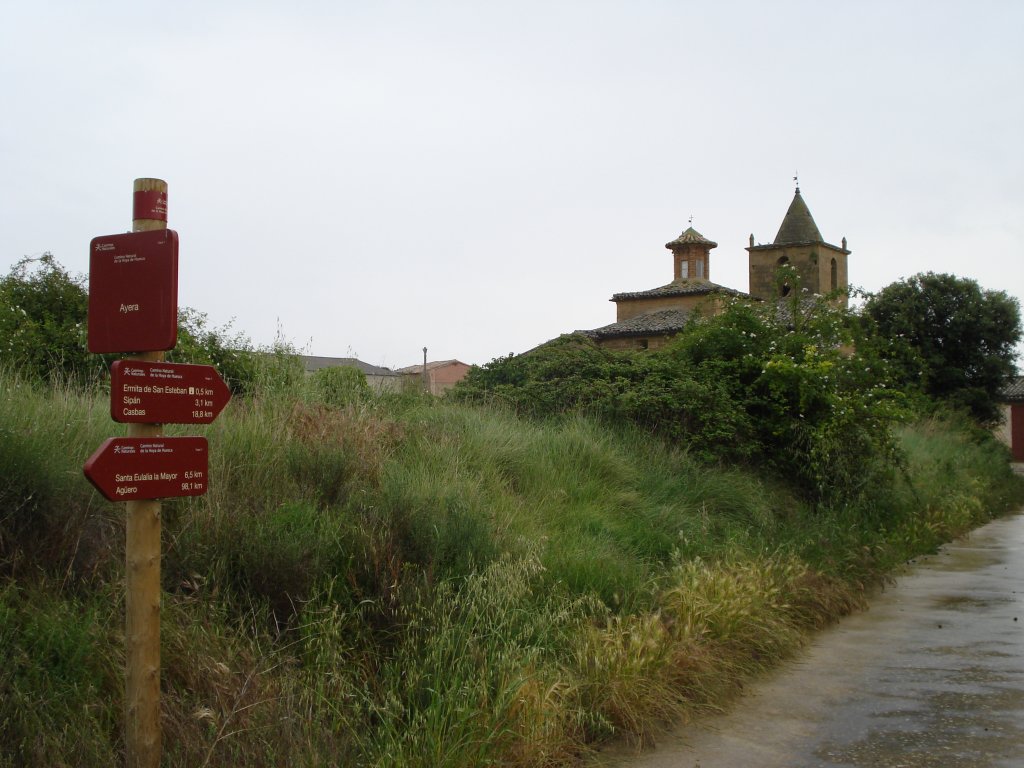
The path continues in a southeasterly direction towards Ayera, which, after taking a sharp bend on the left, now appears in front of you. Once you have crossed the small village along its main road, you should turn to the left along a gravel track leading to the chapel of San Esteban.
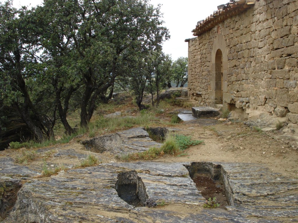
After a few metres, you will come to the ruins of this modest chapel, which was built between the 13th and 14th centuries, on a hillock from where large sandstone blocks have fallen and where the excavated remains of two silos and a mediaeval necropolis containing anthropomorphic graves are preserved.
After your visit, return to the path and carry on for 1.5 km across the cereal plain, which is only interrupted by a small slope among oak trees.
After climbing this small rise, carry on along the trail past two intersections 800 m apart, which you must cross straight ahead to reach the small village of Sipán, where the 16th-century Renaissance church of Santa María is located.
From Sipán to Ibieca

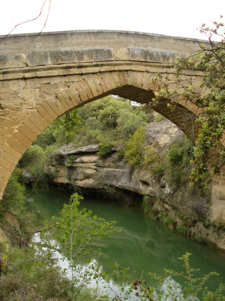
Leave Sipán by crossing the A-1227 highway and carry on downwards among oak trees as far as the rest area located next to the mediaeval bridge of Sipán, which was built taking advantage of a small narrowing of the River Guatizalema.
After crossing this simple but well-preserved bridge and enjoying the rewarding setting offered by the river, you once again enter an area where there is a predominance of cereal crops that are interspersed with the rounded tops of the oak trees that speckle the landscape. After passing over an intersection, continue straight ahead, where the trail bears to the left turning into a narrow path that now descends in the shade of a kermes oak grove towards the bed of the ravine of La Ripa. After crossing a small riverbed via some stones, you being climbing across a sandstone area covered with oak trees, kermes oaks, box plants (Buxus sempervirens) and gorse (Genista scorpius), where you can see several sandstone landslides caused by the erosion of the lower clayey materials, which are softer and more easily weathered. In the last part of the climb, the path changes into a track that continues by crossing a landscape dominated by Holm oak groves and, after passing by two small crop fields, you arrive at a track where you must turn to the left, following the instructions for the path for Ibieca, which will come into view in a few metres. On continuing along the main path, you will pass over a junction as you gradually draw nearer to Ibieca across a landscape that is increasingly dominated by dry crops.
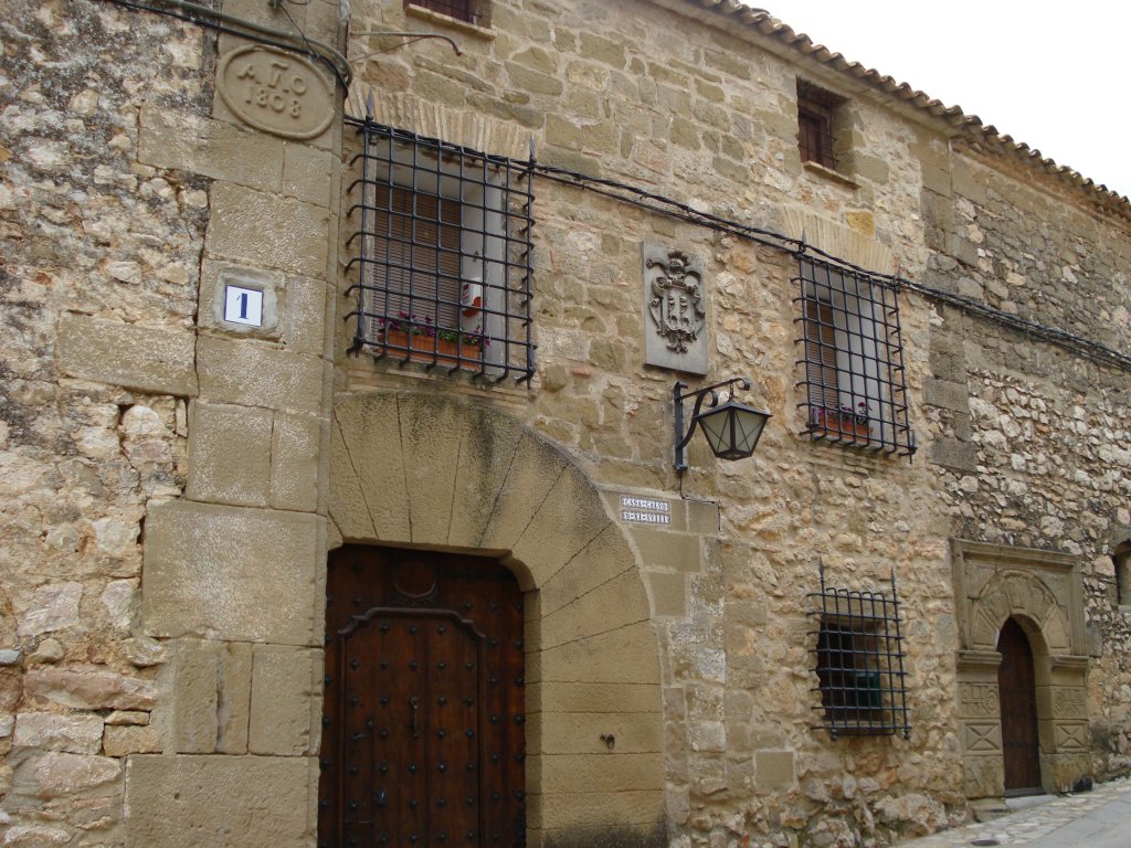
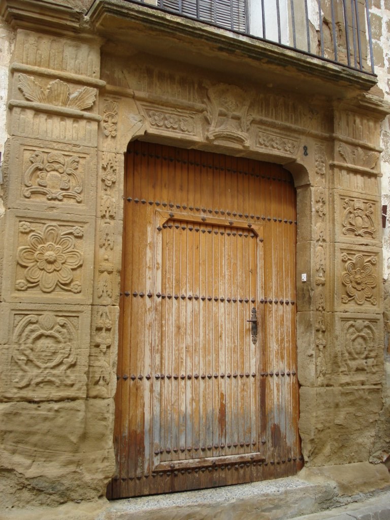
After passing the area of the fountain of Aquillán, you will come to Ibieca’s cemetery, where the trail turns rightwards, sharing its route with the road that leads to the village. You will pass by its large rectangular square, where several houses with pointed arches and large segments over their doors and coats-of-arms on the main facades stand out.
From Ibieca to Casbas de Huesca

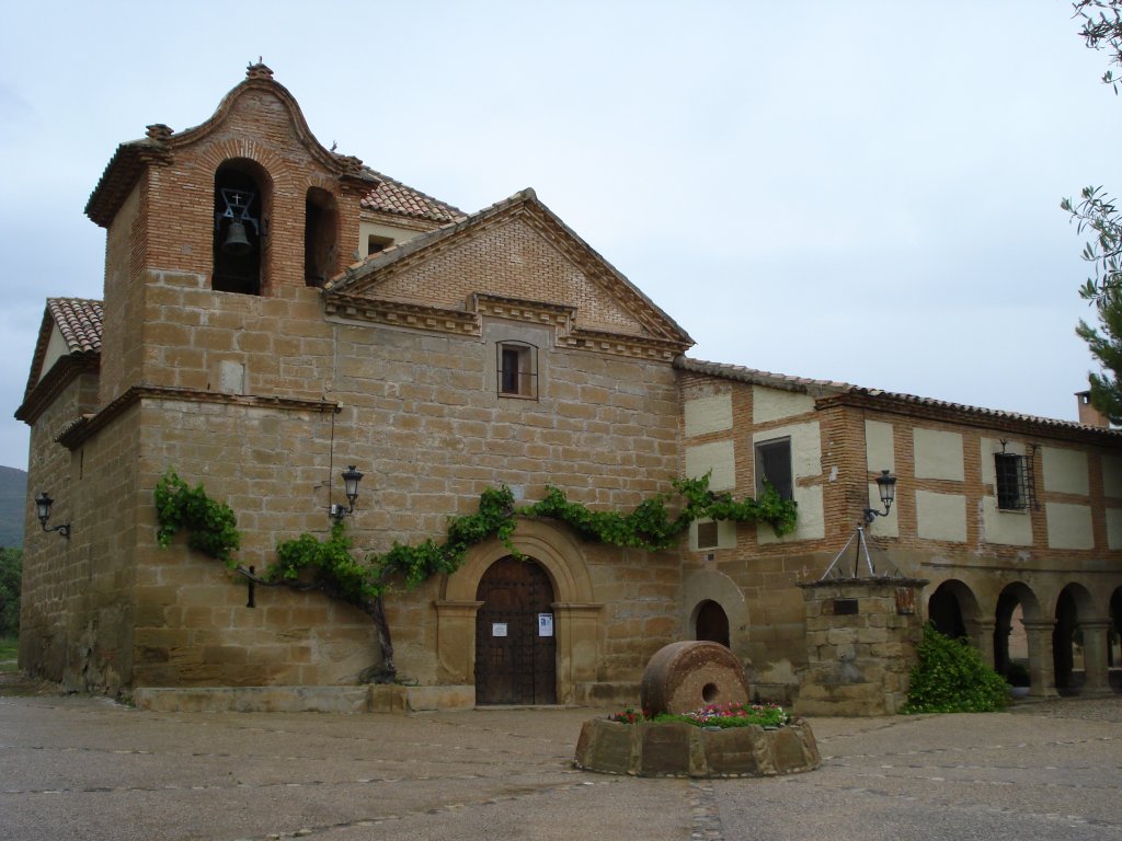
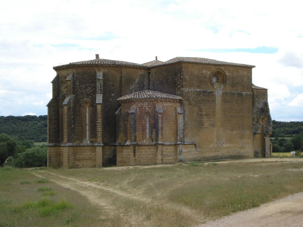
From the square you head leftwards passing by the sturdy church of San Clemente, to then, level with an iron cross on the outskirts of the village, turn to the left, towards the chapel of San Miguel de Foces. Carry on across a clearly agricultural landscape where there are some fields of olive trees and disperse Holm oak groves, among the predominant dry crop fields, until, in a little over 2 km, you come to the chapel of San Miguel de Foces. This superb construction, which was declared a National Monument, was built in the Romanesque to Gothic transition period and is regarded as one of the most important Gothic buildings in Aragón.
After the rest area next to the monument, the trail turns leftwards along a path that continues beside a small stream among blackberries (Rubus sp.), rushes and a herbaceous carpet that denotes some humidity. After crossing the track, the trail carries on under the rounded tops of the oak trees creating a beautiful natural tunnel, and, in 150 m, it merges once again with the track that continues across the almost flat crop fields. The landscape changes for a moment on crossing the ravines of Alvarín, of Las Hoyas and a little further on that of Cañeto, with some sandstone blocks jutting out and where the tree vegetation is somewhat more abundant. Next to these small riverbeds, typical riverside vegetation grows, comprising plenty of blackberries, poplars(Populus sp.), ashes(Fraxinus sp.) and the occasional large Holm oak tree.
Walking along the path of Las Velillas, you leave on one side the chapel of San Blas or the Virgin of Los Olivares, from where you can now see the tower of the refurbished church of San Martín de Sieso de Huesca.
With the end of this Stage now in sight, you should cross Sieso de Huesca via one of its streets and, on the outskirts, take a track on the right to Casbas. After two stone bollards that prevent vehicles from passing, you will come to the A-1228 highway, which you should cross to enter Casbas de Huesca. Next to the crossroads, you will find a rest area and a bicycle park with an informative panel, which is the end of this long Stage of the Nature Trail of La Hoya de Huesca.
Worthy of note in Casbas de Huesca is the female Cistercian monastery of La Gloria, a diverse group of buildings from different eras, which currently belongs to a foundation that is attempting to renovate it.
Profile
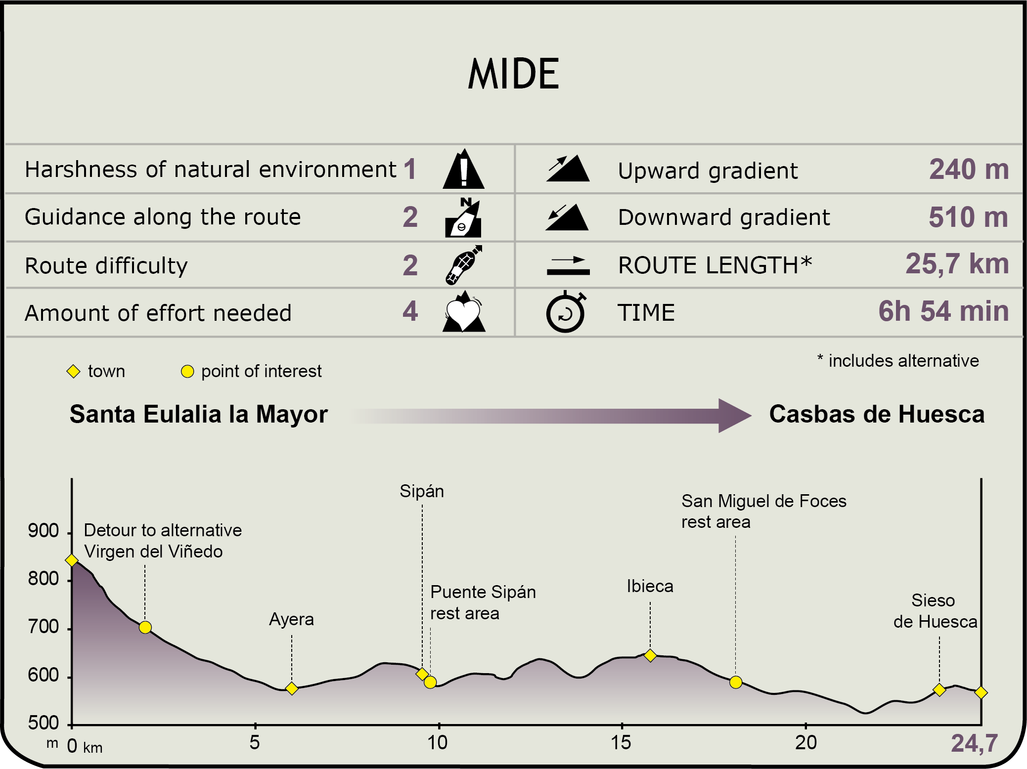
MIDE (Method for the Information of Excursions)
 Harshness of natural environment
- 1. The environment is not risk-free
- 2. There are more than one risk factors
- 3. There are various risk factors
- 4. There are quite a lot of risk factors
- 5. There are many risk factors
 Guidance along the route
- 1. Well defined trails and crossings
- 2. There is a clearly marked trail and signage
- 3. Requires the identification of geographic features and cardinal points
- 4. Requires off-path navigation
- 5. The trail is interrupted by obstacles that have to be gone around
 Route difficulty
- 1. Walking on a flat surface
- 2. Trails with different types of path
- 3. Walking on stepped paths or irregular terrain
- 4. The use of hands or jumping over the terrain is necessary
- 5. The use of hands is required to progress
 Amount of effort needed
- 1. Up to 1 hour of continuous walking
- 2. Between 1 and 3 hours of continuous walking
- 3. Between 3 and 6 hours of continuous walking
- 4. Between 6 and 10 hours of actual walking
- 5. More than 10 hours of continuous walking
Featured
Further information
The Abbotship of Montearagón
Around 1085, the Aragonese King Sancho Ramírez, following in the footsteps of his grandfather King Sancho III in the Reconquista he began from Loarre southwards, decided to build a fortress at the entrance to Huesca, from where he could initiate an attack on the city, although it was to be his son, Pedro I, who completed its conquest in 1096.
In 1093, the construction of the church began and a monastery was founded by the Augustine order, which was fed by the canons that were in Loarre, to end up unifying religion and military strategy under its jurisdiction; thus creating the abbotship of Montearagón.
Little by little, the King increased his power and the privileges of the Abbey with the incorporation of new territories such as La Almunia del Romeral, Ayera, Bandaliés, Barluenga, Castilsabás, Chibluco, Loscertales, Loporzano, San Julián de Banzo, Santa Eulalia la Mayor, Sasa del Abadiado and Sipán. To this very day, these twelve towns are still known as the Abbotship of Montearagón and the Virgin of El Viñedo is the site’s centre of religious and historic life.
Even with Felipe II, now in the 16th century, the Abbotship of Montearagón held jurisdiction over 77 towns and villages, although monastic life ended with the disendowment of Mendizábal in 1835.
Subsequently in 1845, the castle of Montearagón was burnt down, which left it in its current ruined state. In 1931, it was declared a National Monument. The central government and the Association of Friends of the Castle of Montearagón are currently seeking a purpose for this monument that will enable it to be restored.
Worthy of note among the chapels linked to the twelve original villages of the abbotship of Montearagón is the chapel of the Virgin of El Viñedo. From 1092 and during the reign of Sancho Ramírez, this chapel, whose origin results from the appearance of the Virgin before a shepherd in the 11th century, belonged to the Abbotship of Montearagón. So that they would believe his story, the Virgin told him that the palm of his hand would become joined to his cheek, and that is what happened. The villagers erected a chapel in the place shown by the child.
Another tradition that has lasted until this very day relates to a favour that was granted by the Virgin in the 12th century, when a fatal illness spread among new-borns, wiping out all the children. The inhabitants of the area met and held a procession and mass and begged the Virgin to end the epidemic. As it ended a short while later, the residents took a vow to hold a procession to the chapel from then onwards. This takes place on May 1, the day when the twelve villages in the Abbotship stage a procession to the chapel.
Other interesting Romanesque chapels, although they are currently deserted, are those of San Fertús, located halfway between Ayera and Sasa del Abadiado, and the chapel of San Esteban and its necropolis, in the vicinity of Ayera.
The chapel of San Miguel de Foces, which was restored in 2003 and 2004 and is located in an unparalleled spot with the Sierra of Guara in the background, marks the transition from late Romanesque to Gothic styles, as it was built in the 13th century, with the building of the Foces family vault. It has been a National Monument since 1916.
Multimedia