- Home
- Rural Development
- Nature Trails
- Nature Trails
- Northeast Sector
- Hoya_Huesca
Stage 6: Nocito – Santa Eulalia la Mayor
Description
From the Sierra of Guara to the Somontano of Huesca
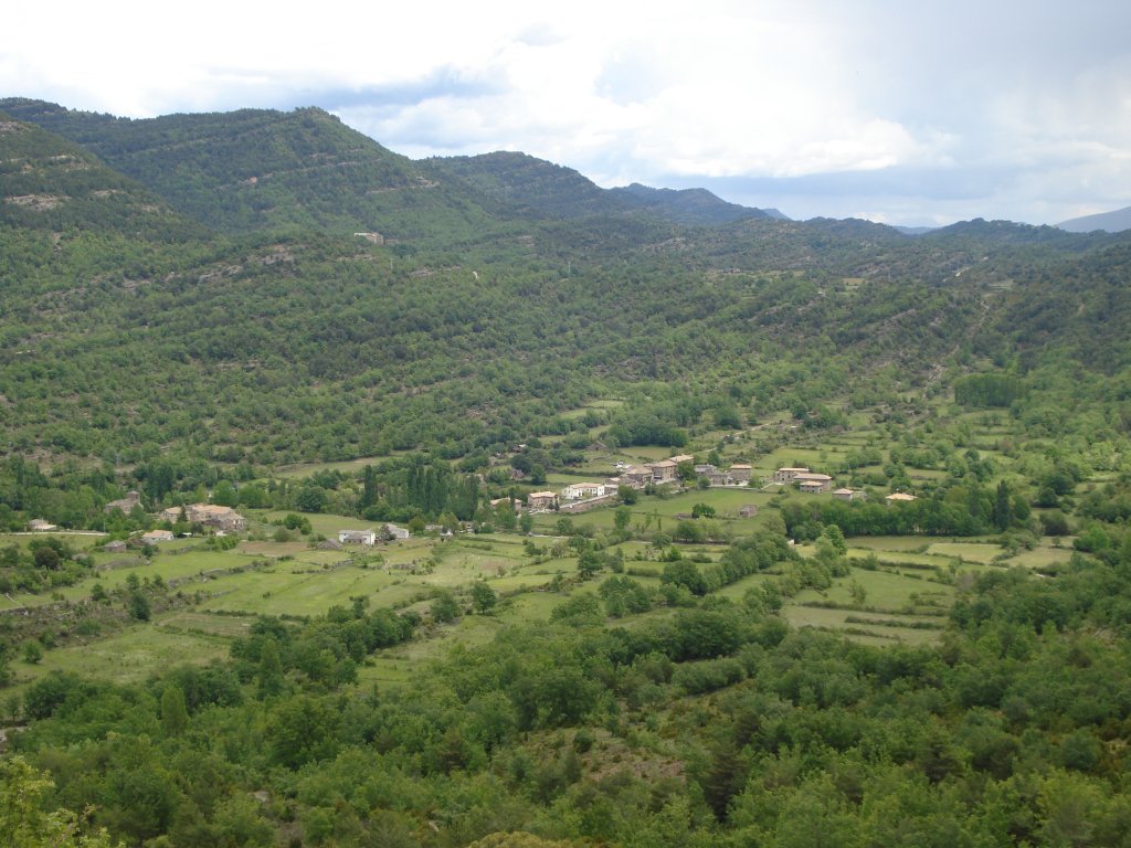
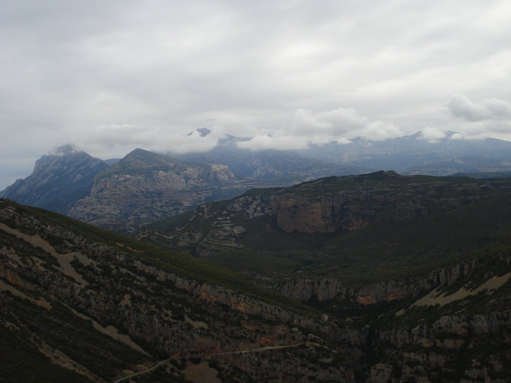
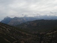
The sixth Stage of this Nature Trail crosses the Sierra of Guara on its extreme western side, covering the valley of the River Guatizalema with its typical gorges and conglomerate walls of the area of Vadiello, until it comes to the flat area of the Somontano de Huesca. Along its 21.6 km, it crosses the municipalities of Nueno and Loporzano and the extreme western edge of the Natural Park of the Sierra and Guara Canyons.
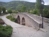
Leaving from the mediaeval bridge of Nocito, the path offers two alternatives: one crossing the district of San Pedro on the other side of the bridge, and the other directly along the track towards the Inn of Nocito and Vadiello, both merging a little further ahead.
After crossing the mediaeval bridge, you enter the district of San Pedro via a sloping cobbled street filled with beautiful mountain houses, some with coats-of-arms embellishing their facades. At the top part of the village, the path turns rightwards and descends as far as the last houses, where it turns to the left along a cobbled path next to the campsite. A very tiny branch, which is also cobbled, leaves this cobbled path on the right, leading you to an old fountain. On returning to the main path, it carries on leaving on the left the turn-off to the chapel of San Andrés and crossing the River Guatizalema via a small walkway. A few metres further on, it joins a track that comes directly from the bridge of Nocito, parallel to the River Guatizalema, and which runs as far as this point among estates where you can see horses grazing.
From here, the track continues following the River Guatizalema and, in approximately 1 km, you reach a typical mountain stone building with a courtyard and an oven, the Mesón de Nocito, where you will find the entry sign for the Natural Park of the Sierra and Guara Canyons. A little further on, you come to a turn-off on the left that climbs up to El Tozal de Guara and the ravine of La Pillera; however, you should carry on in the same direction until you reach the river. At this point, the trail leaves the track that fords the riverbed to take a signposted path on the right staying on the right-hand-side bank of the River Guatizalema in the direction of Vadiello, which is 13.3 km away.
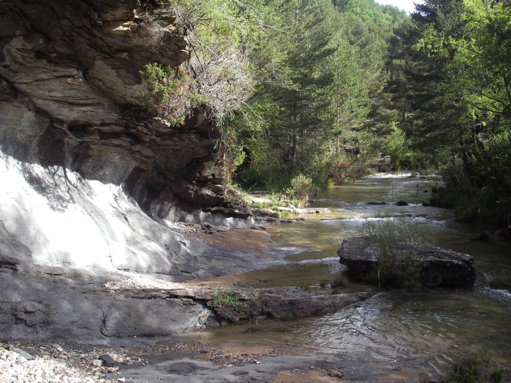
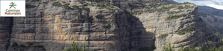
In its initial Stage, the path passes next to the riverbank, which runs over pleated limestone strata forming terraces, to then separate and climb among vegetation comprising a good deal of box plants (Buxus sempervirens), gall-oaks (Quercus faginea) and pines (Pinus sylvestris) along the right-hand-side of the valley that begins to widen.
After fording the ravine of the River Cajical via some stones right next to the informative panel on the Natural Park, in a few minutes, you will come to a turn-off on the right to the dolmen of El Palomar and Santa Eulalia la Mayor via the Cuello Bail. Your path begins to descend towards the river across an area of steps and railings, until you cross a track, drawing close to the riverbank itself, via a more luxuriant area where you will carry on between meanders.
The path crosses the River Guatizalema thanks to the stones placed there for this purpose. You must take care at this point as, depending on the time of year, some of them might be covered with water and even dragged by the current. Once on the left-hand-side bank and following the sign for Vadiello some 10.5 km from here, the path rises across a woodland area of thick oak trees, which alternates with clearer areas where you can see above you the whitish limestone walls of the Fragineto Peak and, below you, the River Guatizalema, which, little by little, tucks further into the bottom.
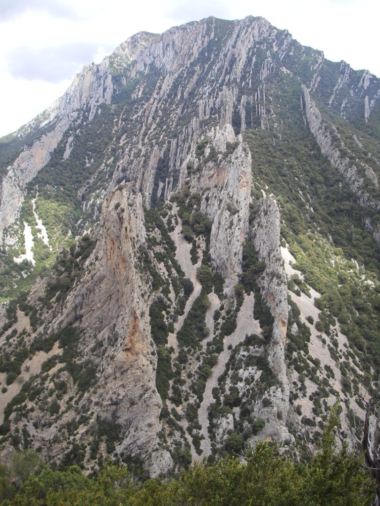
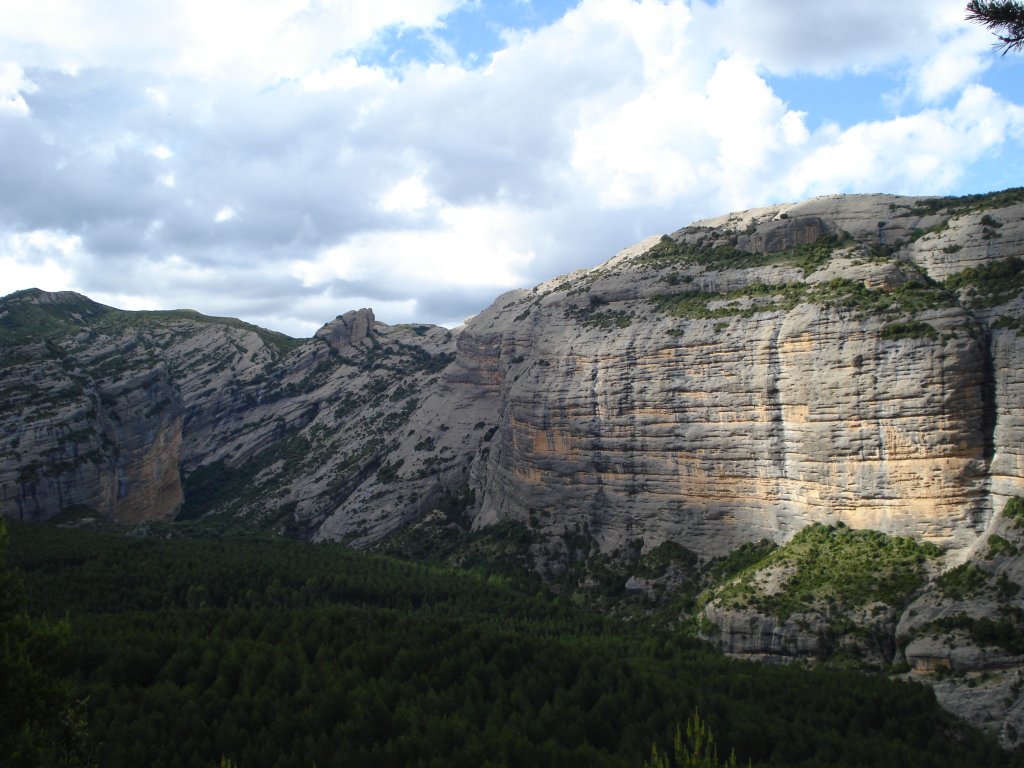
The path continues among abundant vegetation crossing an area of stone slabs, with views of the gorges of the River Guatizalema at the bottom of the valley, and limestone walls and crests at the top of both sides of the valley. You will carry on gaining altitude until you reach a point where the path begins to descend rather abruptly through a wooded area, crossing the occasional stone block that has fallen from the limestone walls overhead, and continue descending towards the riverbank, which you will see closer to you.
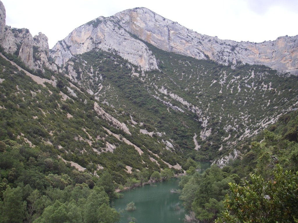
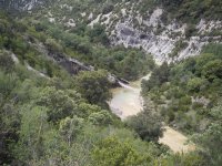
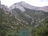
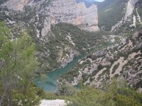
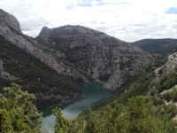
The path goes as far as the riverbank next to an area where the vertical limestone walls on both sides close the valley. In order to cross the river, you will find some stones arranged for this purpose but, as with the previous crossing, you must take care as, depending on the time of year and the floods, some may be missing or covered by water, as you are practically at the tail end of the Vadiello reservoir. You cross the river in a spectacular setting surrounded by limestone walls and you begin to climb once again along the right-hand-side bank between thick woodland and scree under the Proyectil peak, with the vertical strata of the western face of the Fragineto on the opposite bank and, in the bottom of the valley, the stagnated waters of the tail end of the reservoir following the curves of the orography.
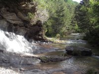
The path narrows a good deal and carries on over sections of scree with loose stones and box (Buxus sempervirens) and gall-oak(Quercus faginea), brushwood, with the precipice over the reservoir on the left, where a cave appears in the limestone walls that rise overhead. A little further on, the path begins to descend close to the riverbank, on one of the reservoir’s bends, where there is a naked limestone rock area with timber on the floor to make it easier to cross.
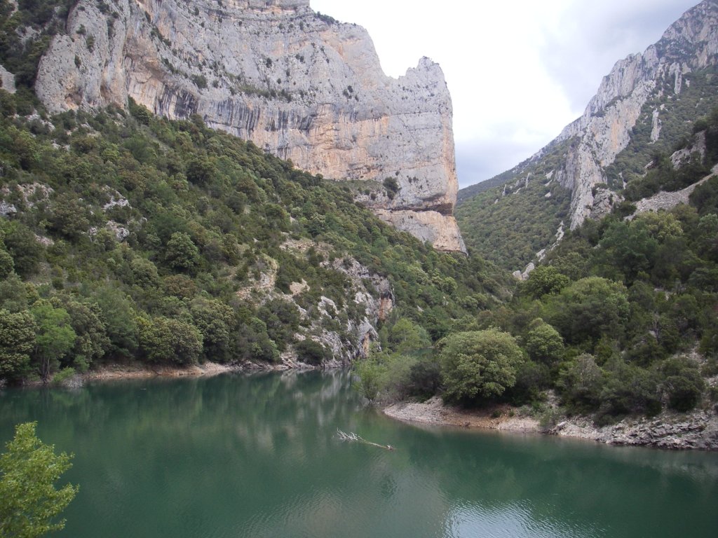
From here onwards, the path begins to zigzag upwards quite abruptly across scree until it reaches a small viewpoint with an informative panel on the gorges of the River Guatizalema and the Guara canyons, which offers a spectacular view northwards of your path.
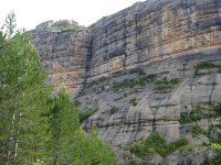
The trail begins to descend across the eastern side of the peak of El Borón with the reservoir precipice on the left, crossing scree and quite exposed areas. In some sections protected by metallic towropes, you will see ever closer the steep conglomerate walls of the southern part of the reservoir. The path crosses a hillock from where you can see the crags of El Huevo and San Cosme on the opposite bank of the reservoir, and the mallos of Ligüerri, on the side you have been walking along.
After passing several sections protected by a metal towrope railing, you reach the transition area between the limestone of the northern part of the reservoir and the conglomerates of this southern area, right where the path begins to turn rightwards to go round the branch of the reservoir known as the ravine of El Diablo, which you cross via a metallic walkway. The path continues southwards, ascending as far as a small hillock, from where you can see, in the bottom, the road and, on your left, a wall of conglomerates outfitted with pegs for climbing.
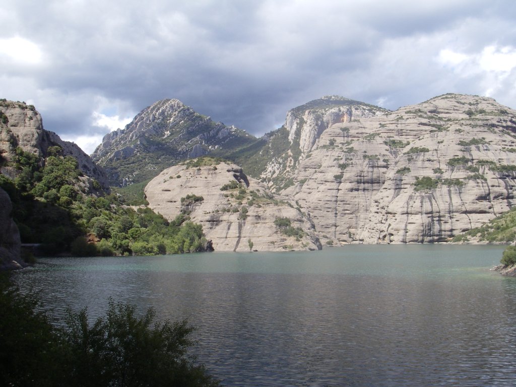
The trail goes down to the bank and soon comes to a rest area outfitted with informative panels, wooden benches and a walkway that accesses the end of the road and the old bridge, which has partly collapsed, under impressive extremely vertical conglomerate walls. You are now in the area of the mallos of Ligüerri, geological formations whose origin is similar to the famous mallos of Riglos, but with their characteristic darker grey strips, more rounded appearance and, in general, smaller. In this case, they are also ideal for practising rock climbing. In Vadiello, you will discover two massifs separated by the reservoir; on the left-hand-side bank, you will see the walls of La Predicadera, El Huevo de San Cosme and the area of the Sanctuary of San Cosme and San Damián; whereas, on the right-hand-side bank, you will see another massif formed of several groups of mallos; those of Ligüerri to the east next to the reservoir, those of Lazas in the centre, and those of Los Pepes in the western part, where the cave chapel of San Chinés is also concealed. You must not forget that, as you are inside the Natural Park of the Sierra and Guara Canyons, climbing and canyoning are regulated activities, with specific periods for the practice of these sports in the different sectors, avoiding nesting seasons and the breeding of birds and other protected species.

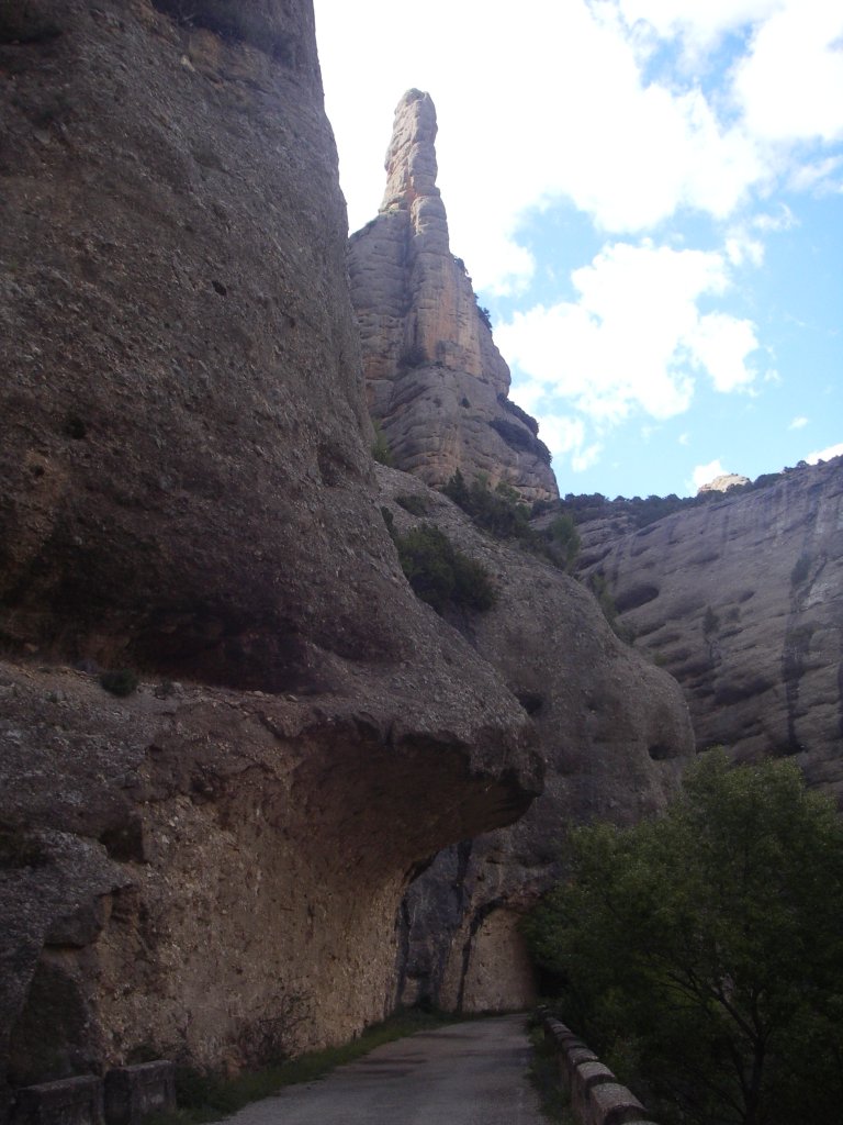
After crossing the walkway, the path continues through a tunnel and joins the road, which is cut off by a fence on the other side of the tunnel. Along the road, you pass through a second tunnel, leaving on your left a small parking area, and you continue through a third tunnel, this time a little longer and also unlit, which ends at a car park located next to the hut of the Hydrographic Confederation of the River Ebro. Here, there are different informative panels and an asphalted turn-off on the left that leads to the reservoir of Vadiello, which was built in 1971 to supply the city of Huesca with drinking water.
The trail continues along the road, crossing a final tunnel and leaving the houses of Vadiello on your right. It carries on for some 400 m as far as a bend where the path turns off the road along a path on your right towards Santa Eulalia la Mayor. You will find yourself in the Ravine of Vadiello, which provides access to several itineraries and climbing routes, such as the area of the cirque of Ligüerri and the Palomo channel.
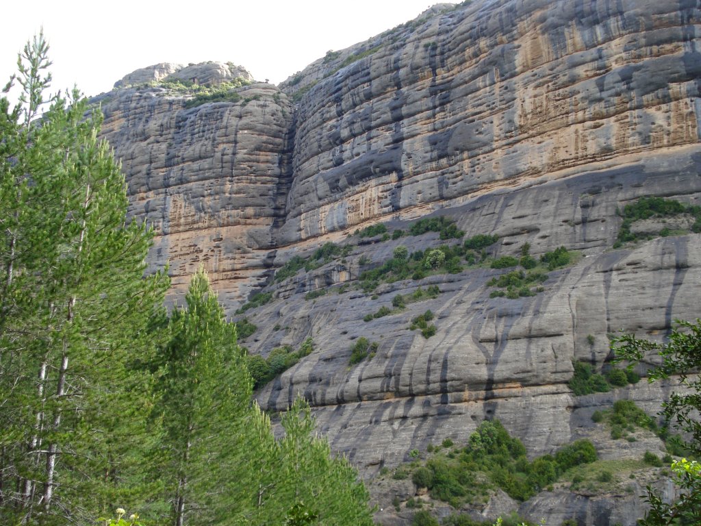
After some metres, you will come to a panel containing information on the path and a bicycle park, and on the left, on the other side of the stream, a rest area under a beautiful, shady poplar tree. On returning to the trail, and after walking a few metres, cross the ravine of Vadiello via some stones and then climb upwards through a wooded pine area. After continuing across the flat hillside under the impressive walls of the cirque of Ligüerri, the path turns to the left entering a thick afforestation pine grove(Pinus nigra) which covers this terraced hillside, to then, in 500 m, return to the clearing and continue almost flat as far as a reed-filled area in the ravine of Los Terreros. Here, you will come to a pond and a panel containing information on the path. Behind you, ever watchful, are the conglomerate walls of the ravine of Vadiello, on whose ledges you can see feral domestic goats or “cimarronas”, sharing territory with the most characteristic inhabitants of these geological formations: large birds of prey such as the griffon vulture(Gyps fulvus), the Egyptian vulture (Neophron percnopterus), bearded vultures (Gypaetus barbatus), the royal eagle(Aquila chrysaetos), peregrine falcons (Falco peregrinus) and the royal owl (Bubo bubo). Other small birds also make an appearance, such as the wallcreeper (Tichodroma muraria), which nests in the Pyrenees but usually spends the winter in Vadiello; the blue rock thrush (Monticola solitarius), the black redstart (Phoenicurus ochruros), the black wheatear (Oenanthe leucura) and red-billed choughs (Pyrrhocorax pyrrhocorax).
The trail continues among pine groves leaving on one side the turn-off to the chapel of San Chinés, next to the Hut of San Román, zigzagging upwards until it reaches another track that comes from Vadiello, heading towards Santa Eulalia. You will carry on climbing with impressive views behind you of the steep conglomerate walls of the mallos of Lazas and Los Pepes, until you reach a hillock where the path towards the ice wells of Cuello Bail emerges on the right. The Nature Trail continues straight ahead making its way through the pine grove, until it takes a bend on the left where the trees give way to a brushwood area of box and juniper, which offers spectacular views of La Hoya de Huesca.
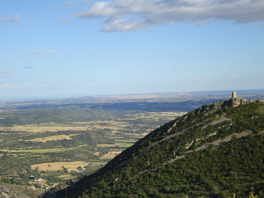
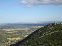
The path continues downwards to Santa Eulalia la Mayor, going around the Forcas hill, as far as a small rest area located at the viewpoint of La Gabardiella, right at the turn-off towards the chapel of the Virgin of Sescún and the mediaeval tower of La Atalaya. Next to this 12th-century chapel with a rectangular layout, you will find a rest area and a fountain, and, a little further on, you will reach the tower of La Atalaya, which was recently rebuilt and belongs to a Muslim castle of uncertain origin that changed into Aragonese hands in the 11th century. From this location, you will have impressive views both of the southern face of the Sierra of Guara and of the flat area of La Hoya de Huesca.
From the turn-off, you immediately enter the village of Santa Eulalia la Mayor, taking another turn-off on the right that leads you to an informative panel next to the first houses and another a little further down next to the 17th-century church of San Pedro, which separates the village into two districts. In the lower district, there are typical manor houses of the area, with rounded arches and their coats-of-arms on the facades, in this place also known as Santolaria.
Profile
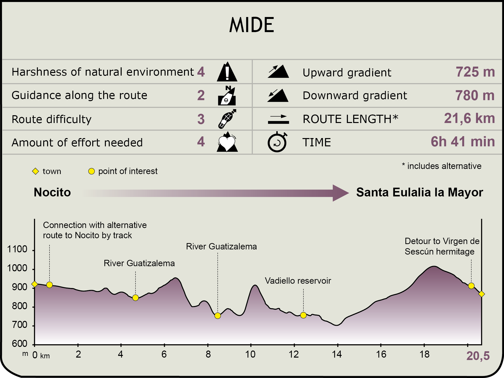
MIDE (Method for the Information of Excursions)
 Harshness of natural environment
- 1. The environment is not risk-free
- 2. There are more than one risk factors
- 3. There are various risk factors
- 4. There are quite a lot of risk factors
- 5. There are many risk factors
 Guidance along the route
- 1. Well defined trails and crossings
- 2. There is a clearly marked trail and signage
- 3. Requires the identification of geographic features and cardinal points
- 4. Requires off-path navigation
- 5. The trail is interrupted by obstacles that have to be gone around
 Route difficulty
- 1. Walking on a flat surface
- 2. Trails with different types of path
- 3. Walking on stepped paths or irregular terrain
- 4. The use of hands or jumping over the terrain is necessary
- 5. The use of hands is required to progress
 Amount of effort needed
- 1. Up to 1 hour of continuous walking
- 2. Between 1 and 3 hours of continuous walking
- 3. Between 3 and 6 hours of continuous walking
- 4. Between 6 and 10 hours of actual walking
- 5. More than 10 hours of continuous walking
Featured
Further information
Natural Park of the Sierra and Guara Canyons
Created through Act 14/1990 of 27 December of the Parliament of Aragón, it covers an area of 47,450 ha and the peripheral protection area represents another 33,750 ha.
This Pre-Pyrenean sierra boasts altitudes that range from between the 430 m of the River Alcanadre up to the 2,077 m of the peak of El Tozal of Guara.
The combination of a geology dominated by karstic rocks coupled with the laborious erosion produced by water over thousands of years have caused the special layout of the park, with its canyons, torrents, abysses and mallos.
This has led to the fame of the narrow, deep ravines of its rivers, mainly Vero, Alcanadre, Guatizalema and Mascún (some with lengths of over 20 km and differences in altitude of more than 800 m), where, every year, canyoning and climbing move masses of people who come to enjoy these sports.
On being located in a transition area between the depression of the River Ebro and the Pyrenees, the climate changes a good deal, in addition to the different microclimates that are generated in the ravines, which leads to a rich variety of flora.
As regards the fauna, worthy of note is the presence of birds of prey and endangered aquaculture. The former includes the Bonelli’s eagle (Hieraaetus fasciatus) and the bearded vulture (Gypaetus barbatus), and with respect to the river environment, the Pyrenean newt (Calotriton asper).
Worthy of note is the presence of countless butterflies, which evidences the environmental quality of the Park, and diverse cave endemisms, such as the columbine (Aquilegia viscosa subsp. Guarensis), the “rock breaker”(Petrocoptis guarensis), Pyrenean violet (Ramondamyconi) and yellow saxifrage (Saxifraga longifolia).
With respect to vegetation, it differs greatly depending on its orientation: on the southern hillsides, there is a predominance of Mediterranean vegetation with brushwood containing species such as the Holm oak (Quercus ilex) and the juniper (Juniperus communis), accompanied by thyme (Thymus vulgaris) and rosemary (Rosmarinus officinalis).
On the contrary, on the northern hillsides, the vegetation is more Atlantic in nature and is represented by beech tree (Fagus sylvatica), Scots pine (Pinus sylvestris) and fir tree (Abies alba) forests.
Multimedia