
- Home
- Rural Development
- Nature Trails
- Nature Trails
- Northeast Sector
- Ferrocarril Vasco-Navarro
Basque Navarre Railway Greenway Nature Trail. Murieta-Ermita Santo Toribio section
Description
Through woodland and fertile crops
La Montaña Alavesa and the western strip of the region of Tierra Estella are two neighbouring territories where people are few and far between and steep sierras abound. Their mountains are home to transition forests between the vegetation of the Mediterranean and of the Atlantic, and the numerous chalky cuts in their landscape are a safe haven for large birds of prey.
One of the best ways to become familiar with the exceptional richness of nature is by touring some of the stretches of the old Basque-Navarre passenger train especially designated for this purpose which linked Estella to Vitoria and Bergara. Affectionately known as “the little train” or the “crabber”, it was dismantled in 1967. This Nature Trail rounds off the Laminoría-Murieta section, where the River Ega/Berrón forms its cornerstone.
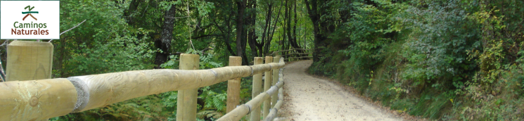
The route begins at Murieta, at the kilometre 11 milestone, the lowest point of the tour, where the Trail heads in a gentle, steady, upward direction that does not require too much effort. Information panels, signposts and kilometre milestones continuously guide trail users along the Trail, hence it is easy to follow.
The Trail that leads to the right towards Estella has yet to be renovated although you can walk along it in some discontinuous sections. Once you have crossed the town, leaving towards the left, you will soon reach the old station which has currently been restored as the Town Hall. From this point, and after skirting some houses situated on the platform of the old track, continue your journey towards Mendilibarri, a town that lies a few metres to the left of the route.
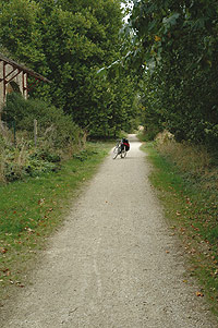
The initial leg of this route is a tarmacked pathway that crosses wheat fields, which is why vehicles are also permitted to use it, although there is very little traffic. The hillsides and embankments of the Trail serve as refuge for natural vegetation, where holm oaks (Quercus ilex), which form hedges and in the summer offer trail users an oasis of shade, grow
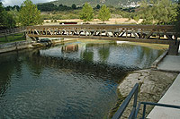
A short distance before reaching Ancín, the tarmacked surface changes into gravel. The route enters the town via the cemetery, crosses the town centre, and carries on in the same steady upward direction until it reaches the old station, the current Town Hall, after passing by an old train electricity tower and the nearby municipal swimming pools.
On the next stretch between Ancín and Acedo, the scenery consists of alternating wheat fields and the first holm-oak woods which become even thicker after the route crosses the River Ega and approaches the mountain slope. Meanwhile, on the right-hand side, you can enjoy the best views of the Sierra de Lokiz.
Several barns signal that you are reaching the town of Acedo, but before you get there, some signposts indicate that this Nature Trail takes a turn towards the right in order to cross, via several farm lanes, a stretch of some 300 m lost from the original railway route.
In Acedo, there is also a short section that has disappeared, which is why you have to cross its city centre, meandering through its streets until you reach a resting place with a fountain and tables that is located next to the refurbished municipal laundry. From here, you climb up to a small bridge to take the old track once again, which enters a deep cutting that heads towards the Arquijas tunnel. This 1,415 metre-long passage is well-lit, although it is a good idea to carry a torch in your luggage, as well as a sweater, as the damp inside makes it cold.
On exiting the tunnel, the scenery changes completely. The route passes by cereal plains and proceeds towards the River Ega, between the sierras of Lokiz and Codés, now taking a forest track that climbs upwards from the old train halt to the nearby Chapel of Nuestra Señora de Arquijas.
After this stage, the route reaches the broad valley of Campezo, hence the scenery opens up to extensive cultivated plains once again. After crossing the road that provides access to Zúñiga, you reach a resting place next to the ruins of the old local station, from where a more than four-kilometre straight path stretches out across the plain that leads to Santa Cruz de Campezo. This leg of the route has intermittent shade thanks to the plant hedgerow that has grown on the inclines and embankments of the track, flanked by extensive cereal plains. At this point, for the first time, bollards also appear that prevent motor vehicles from accessing the pathway.
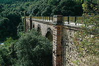
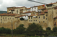
Visiting the mediaeval village of Santa Cruz de Campezo is a must. It also has a tourist information point about La Montaña Alavesa. Following the Trail, a little further ahead, you will pass by the Fresnedo Park, where a wooden walkway crosses the A-132 highway, at the same time as allowing trail users to enjoy excellent views of the valley and the mountains surrounding it.
Leaving behind the River Ega to carry on next to its estuary, El Berrón, the Trail continues along the old railway route as far as Antoñana, where you enter the town centre via a tarmacked road with barely any traffic. Once you cross the A-132 highway via a walkway, the route runs parallel to it, passing through a short tunnel and crossing the river at several points until the old railway route gets lost among the vegetation. At this point, you have to take an alternative route that continues along the other bank of the river, which is reached by crossing a pedestrian walkway.
After covering a good stretch, the Nature Trail continues along the first dirt track that appears on the left-hand side. If you carry straight along it, you will once again cross the river via another walkway and, after passing under the A-132 highway, the route continues in the direction of a disused tarmac factory, turning just before you reach it into another track that leads, to the right, to Atauri, a small borough located at a narrowing of the river. When it reaches the old train station, which has a disused tunnel in front of it, the Trail continues to the right along another dirt track that flanks the hillside and reaches an open area where the Chapel of La Soledad is situated.
Once again, the route of this pathway enters a wooded stretch until it crosses the A-132 highway and recovers, on reaching Zumalde Park, the origin railway route, accompanied at this point by a large water pipe.
Maestu welcomes walkers with its magnificent station that has been revamped and turned into the Town Hall. The route crosses the town, where it is worthwhile strolling around its stately streets and greeting the “Papamoscas”, a mechanical figure installed in the church clock tower, which moves its hand when it marks every hour.
The final leg of the route crosses the A-3114 highway via a metal walkway and another quite short tunnel. The Trail leaves the municipality of Zekuiano towards the right. A little further on, on a stretch in which the old track has yet to be renovated, it takes a right turn into a concrete slab path which descends a steep slope towards the Chapel of Santo Toribio where there is a picnic area that marks the end of the route opposite the nearby mine of Laminoría.
Sites of interest
Map
Puntos de Interés
Cultura
Profile
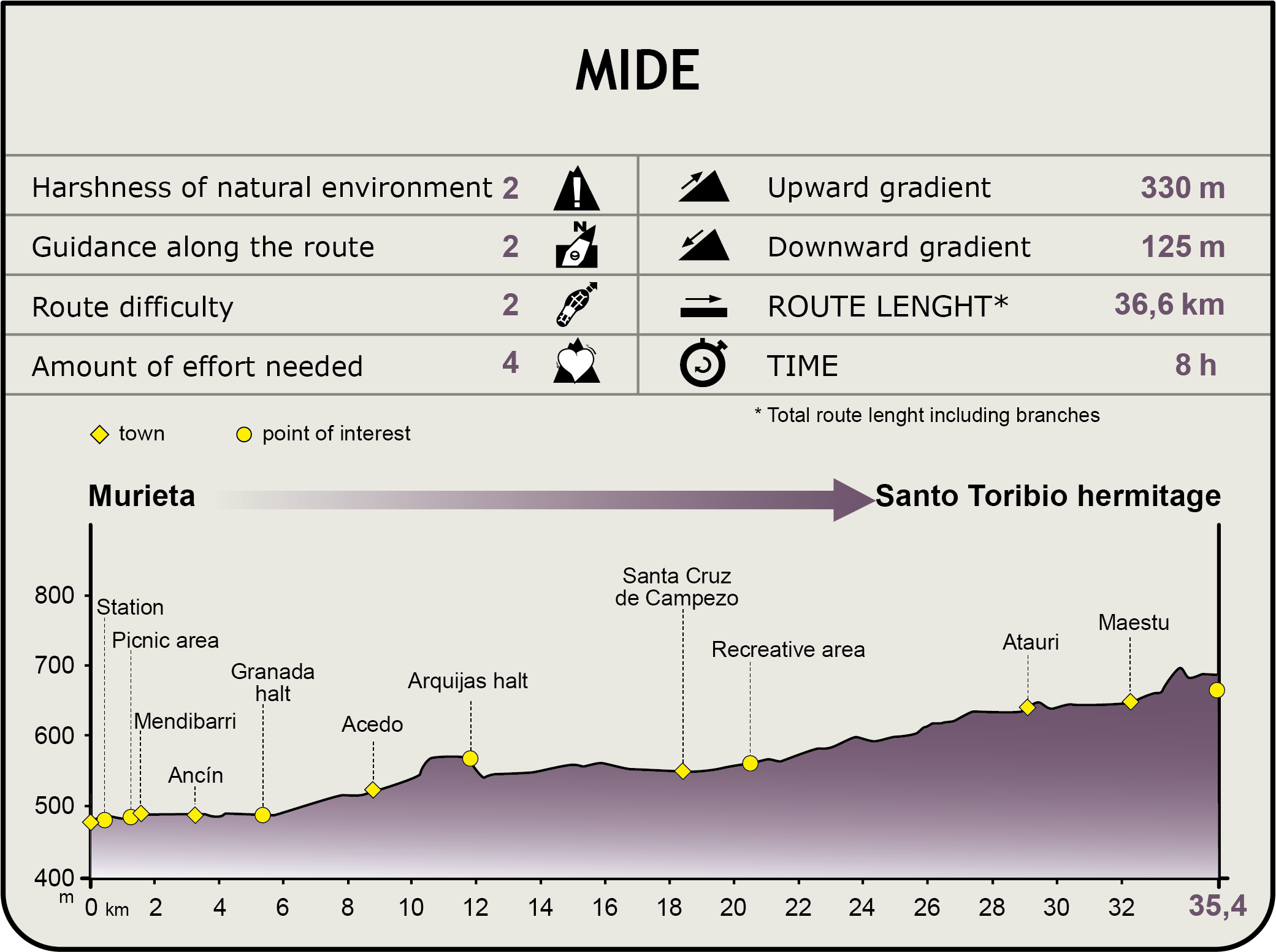
MIDE (Method for the Information of Excursions)
 Harshness of natural environment
- 1. The environment is not risk-free
- 2. There are more than one risk factors
- 3. There are various risk factors
- 4. There are quite a lot of risk factors
- 5. There are many risk factors
 Guidance along the route
- 1. Well defined trails and crossings
- 2. There is a clearly marked trail and signage
- 3. Requires the identification of geographic features and cardinal points
- 4. Requires off-path navigation
- 5. The trail is interrupted by obstacles that have to be gone around
 Route difficulty
- 1. Walking on a flat surface
- 2. Trails with different types of path
- 3. Walking on stepped paths or irregular terrain
- 4. The use of hands or jumping over the terrain is necessary
- 5. The use of hands is required to progress
 Amount of effort needed
- 1. Up to 1 hour of continuous walking
- 2. Between 1 and 3 hours of continuous walking
- 3. Between 3 and 6 hours of continuous walking
- 4. Between 6 and 10 hours of actual walking
- 5. More than 10 hours of continuous walking
Featured
Multimedia


