
Stage 35: Vall de Freixes - Mequinenza
Description
Through the Sierra de Rincones
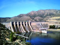
This stage runs through the inhospitable terrain of the Sierra de los Rincones, which skirts the right bank of the Ebro; on a clear day you can see the outline of the Pyrenees from its peaks. The route starts by climbing up the Vall de Freixes gorge before passing the Fustigueras tower and continuing along the plain to the Tapioles gorge, where it descends again to the area near the Mequinenza reservoir. Continue along the track to the bed of the Tamariu gorge, at the end of which the reservoir dam rises, and enter Mequinenza via the N-211 road, crossing the bridge over what is now the tail of the Riba-roja reservoir.
This stage is predominantly mountainous, crossing as it does the highest part of the Sierra de los Rincones, avoiding the endless inlets and salients that reservoir traces on this rugged relief. When the Mequinenza dam was commissioned, all the traditional trails that hugged close to the Ebro were flooded under the level of the dam. Over time, other tracks and paths have opened up along the new water limit, but in several sections in this area there are no such paths, so the Nature Trail must cross the sierra in search of the highest altitude. To compensate for the effort, on clear days with clean air you can see the outline of the Pyrenees in the distance.
Located in the riverside shelter of the Vall de Freixes gorge, it follows the path track that climbs the valley among pine trees. At a crossroads, now in the highest part of the sierra, turn right and, flattening out between cultivated fields, you will reach the Fustigueras tower and its geodesic vertex.
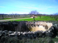
Alongside crop fields and pine stands, the latter of which are located where the slope of the land has prevented them from being ploughed, you continue on the main path, ignoring the secondary accesses to fields and houses. Leave the Beanta house and continue along the Plano path. Two tracks in good conditions, one from the right and the other from the left, now meet the Nature Trail. Finally, a few metres before the path begins its descent of the Tapioles gorge, it reaches a complex of houses and warehouses which still preserve the ruins of an old cistern, on the left side of the path: this is Mas de Falonet (Falonet Farmhouse).
Go straight on (east), around 350 m from the Mas, leave the main track and take another, secondary one on the right. Walk along it for a further 170 m, after which a path turns almost 180º to the left and leads into the Tapioles gorge. It then begins a steep descent by which the path heads towards the shore of the reservoir. Ignore the first turning to the right and at the second, under some buildings, turn onto a track, which is in good condition, that gradually ascends the slope, now among fields of almond and olive trees.
You will leave behind you the entrance to one house and more as you reach the top, on a wide esplanade, which is occupied by a farmhouse. Further on, there is a pass where the tracks cross, beside some livestock sheds. Take the diversion that descends straight ahead and describes a long loop before ending at the bottom of the Tamariu stream, along another forest track.
The route descends northeast, running along the right shore of the waters of reservoir which, at this point, go up the bed of the gorge. Moving forward becomes a little more difficult, since twice the traveller must pass between narrow walls to reach a crossroads where you must turn right onto a paved lane that will give you some relief as you walk. After 50 m, leave this lane on the left and take another one which, after a few metres, reaches the upper part of the Mequinenza dam.
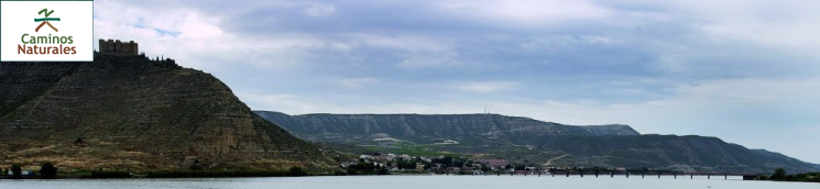
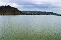
Continue the descent that will lead the path down to the fertile plain and join the N-211, very near the banks of the Ebro. Its waters are still calm at this point, now forming the tail of the Riba-roja reservoir. The route begins at this point and then follows the road along its left hand shoulder, reaching the bridge over the Ebro, from where the route of stage 36.1 starts, towards Fayón. Upon crossing the river, you can see, on the sunny slope opposite, the barely perceptible ruins of the historic quarter of Mequinenza, under the dominant figure of the medieval castle. In just over a kilometre, along the hard shoulder of the road and using a rest area on the shore, this stage ends in the town of Mequinenza.
It is a new village built to replace the old one, which has been under the waters of the Riba-roja reservoir since the early 1970s. Having been on the banks of the Ebro, it is now on the right bank of the Segre. An important jetty for lignite coal from its many mines, it kept an important fleet of llaüts, the traditional river transport barges of the lower course of the Ebro, which were used to sail to the Fayón railway station and Tortosa. The construction of the Riba-roja reservoir did away with boats and goods. Now its inhabitants work in services related to fishing and sailing, although there is still some mining.
Sites of interest
Map
Puntos de Interés
Profile
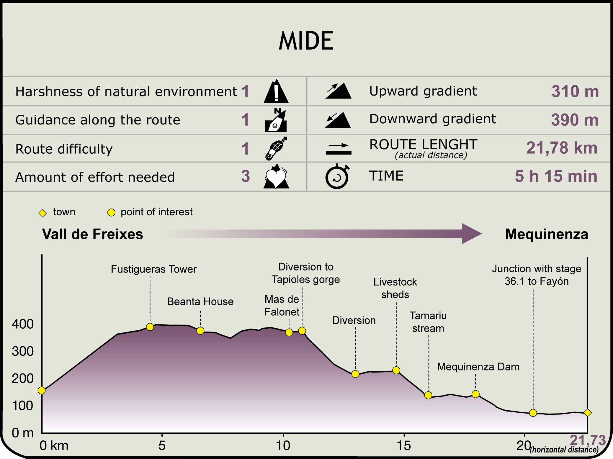
MIDE (Method for the Information of Excursions)
 Harshness of natural environment
- 1. The environment is not risk-free
- 2. There are more than one risk factors
- 3. There are various risk factors
- 4. There are quite a lot of risk factors
- 5. There are many risk factors
 Guidance along the route
- 1. Well defined trails and crossings
- 2. There is a clearly marked trail and signage
- 3. Requires the identification of geographic features and cardinal points
- 4. Requires off-path navigation
- 5. The trail is interrupted by obstacles that have to be gone around
 Route difficulty
- 1. Walking on a flat surface
- 2. Trails with different types of path
- 3. Walking on stepped paths or irregular terrain
- 4. The use of hands or jumping over the terrain is necessary
- 5. The use of hands is required to progress
 Amount of effort needed
- 1. Up to 1 hour of continuous walking
- 2. Between 1 and 3 hours of continuous walking
- 3. Between 3 and 6 hours of continuous walking
- 4. Between 6 and 10 hours of actual walking
- 5. More than 10 hours of continuous walking
Featured
Further information
Mequinenza
Located near the confluence of the rivers Segre, Cinca and Ebro, the village we know today was founded a few years ago, when the Riba-roja reservoir was built in the middle of last century, leaving the old Mequinenza flooded by the waters and forcing its inhabitants to build a new place to live. Today the region’s economy centres around pig and sheep farming, fruit growing and tourism, with some lignite mining.
Of the old village, which was of Muslim origin, little more than the memory remains, because it was destroyed before being flooded. Even so, in the new village it is worth visiting the castle-palace of the Moncada family, a recently restored 15th century Gothic building, the ruins of the old church of Nuestra Señora de los Ángeles, the oil mill museum, the archaeological site of Castellets and the mining museum.
Multimedia


