
Stage 33: Caspe - Mas de la Punta
Description
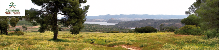
Skirting the “Sea of Aragon.”
After going up the lush plain of the Guadalope, the path reaches the Moros dam and the Three Tunnels, which were built to divert the river and prevent the Mequinenza reservoir from flooding this strip of orchards. By track, you will reach the beaches of La Herradura, the tip of an old meander with the Mediana island in the middle. Continuing along the old Caspe to Mequinenza road, you will cross the Falcón slope area and the Arroyo de Pilas stream before arriving at the Lake Caspe nautical campsite, whence a forest track connects with the Mas de la Punta site, a municipal complex for recreational use in the Vuelta de la Magdalena double meander.
Sheltered by the promontory on which Caspe sits, the stage begins at the back of the town’s municipal park(107 m), which you must cross to go up the left bank of the lush fertile plain of the Guadalope. The path then takes the paved path, parallel to the river, and continues upstream. It then runs between a large escarpment and the fertile plain and, after passing a poplar grove, it leaves the riverbank and traces an upward curve, where all the exits on both sides are bypassed. When it is halfway up the riverbank, the path reaches the Moros dam, which diverts the waters of the river towards the three mouths connecting it with the mighty Ebro. The construction of the Mequinenza reservoir brought with it the flooding of this entire fertile plain, which is why a dike had to be built between the flood plain and the reservoir, as well as this dam, which diverts the waters of the Guadalope.
On the other side of the dam, the track ascends as far as the Guadalope-Ebro interfluve, where, through a passageway, it crosses the railway line before turning right and, after a few metres, dropping off and going under the railway and the N-211. Thus, continuing on the right, the route continues along the old road. This point is on the drain that serves the aforementioned three tunnels.

The route then continues, after a short stretch along the old N-211, before moving onto a lane on the left, which turns and passes by some houses, alternately following and leaving the more important tracks until it arrives at a corridor where poplars and tamarisk trees momentarily protect the traveller’s steps. After passing it, you reach a more substantial track that leads in from the right and follows the Rebalsa cove on the left. The Nature Trail follows it in that direction for 500 m; it then abandons it and takes a path to a high point, following its watershed northwards. After crossing two of the reservoir’s inflows, alternating between paths and trails, it connects with the paved track of La Herradura, an immense peninsula that hugs an elongated meander and where the ruins of the optical tower of Turlán still stand.
The paved path will accompany the traveller’s steps for 500 m, firstly to the left before leaving it to take a path on the right that climbs up to the edge of the reservoir (an excellent viewpoint of the island of La Herradura). But there is no rest: continue along the wide bend of the same name on uncultivated land. The path becomes convoluted, passing some ruined buildings, crossing a cultivated gorge and climbing a zigzagging path, before reaching a track that is in good condition, along which it continues to the right (east). Around 200 m further on, at the junction with the Cuesta Falcón track, there is a shelter the same name.
The route becomes a mix of trails and paths, until you see a new lane that leads from the road to the bank of the reservoir on the left side of the Valdepilas gorge. Follow it on the right (southeast) for 500 m until you find a way across the stream and continue, on a path, the bank of the reservoir, now heading north. The path then crosses a small tamarisk copse, before meeting a drove road which, sooner rather than later, climbs the shoulder of the N-211 road. After 500 m you will reach the entrance to the Lake Caspe campsite.
Without having to approach the campsite gate, at the southern end of its cypress hedge, a forest track opens up between it and a shelter, running between fields, thirstily searching for the banks of the Ebro. The track runs flat through pine-forested hillside with good views of the reservoir, making this last section of the walk easier. After leaving the secondary tracks, you reach the Dolader corral and, before the track disappears in a small tamarisk grove, after turning right (east), you will enter the poplar grove that precedes the area around Mas de la Punta.
Sites of interest
Map
Puntos de Interés
Cultura
Hidrografía
Información
Infraestructura
Municipio
Orografía
Profile
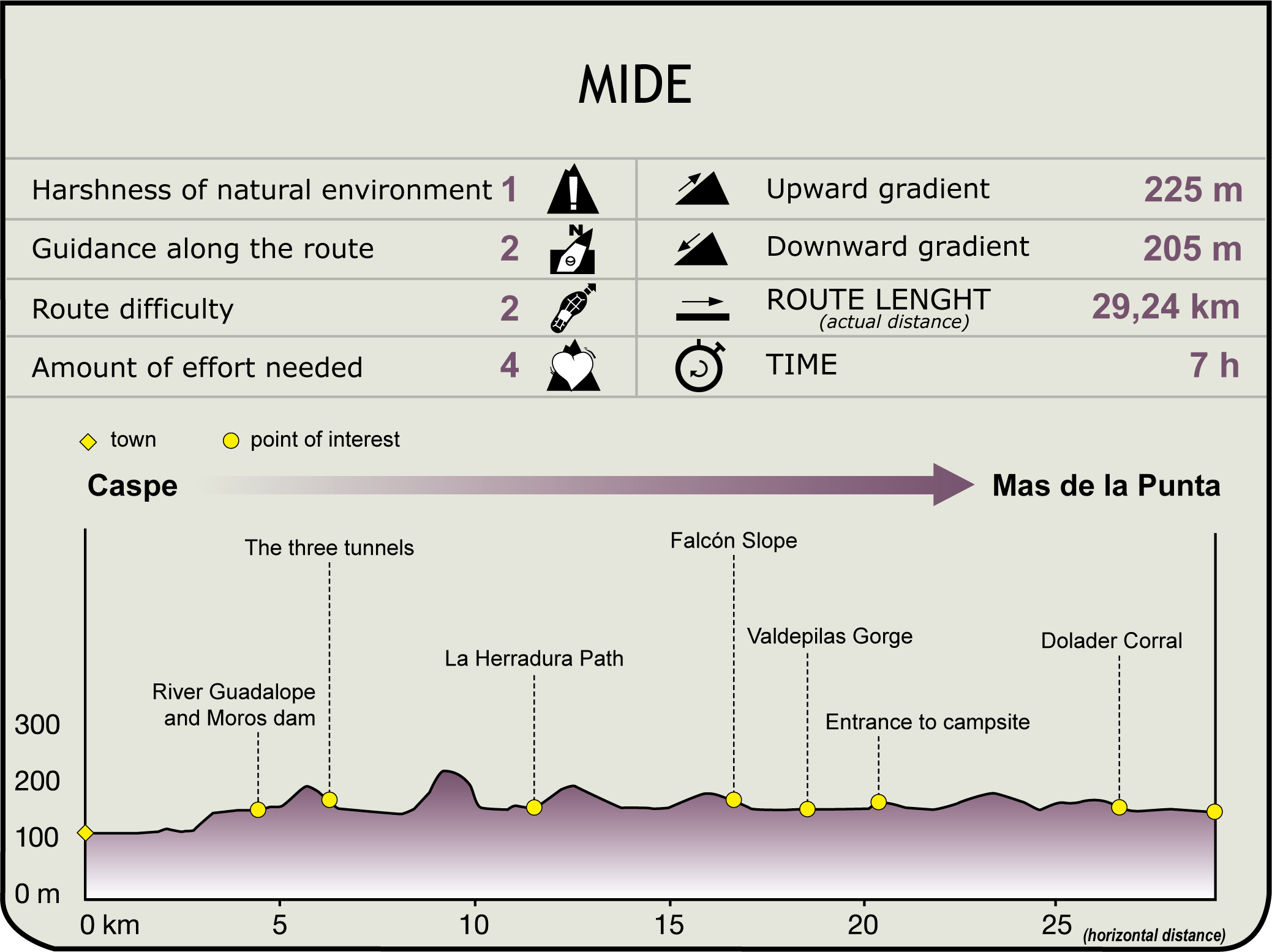
MIDE (Method for the Information of Excursions)
 Harshness of natural environment
- 1. The environment is not risk-free
- 2. There are more than one risk factors
- 3. There are various risk factors
- 4. There are quite a lot of risk factors
- 5. There are many risk factors
 Guidance along the route
- 1. Well defined trails and crossings
- 2. There is a clearly marked trail and signage
- 3. Requires the identification of geographic features and cardinal points
- 4. Requires off-path navigation
- 5. The trail is interrupted by obstacles that have to be gone around
 Route difficulty
- 1. Walking on a flat surface
- 2. Trails with different types of path
- 3. Walking on stepped paths or irregular terrain
- 4. The use of hands or jumping over the terrain is necessary
- 5. The use of hands is required to progress
 Amount of effort needed
- 1. Up to 1 hour of continuous walking
- 2. Between 1 and 3 hours of continuous walking
- 3. Between 3 and 6 hours of continuous walking
- 4. Between 6 and 10 hours of actual walking
- 5. More than 10 hours of continuous walking
Featured
Further information
Mas de la Punta
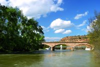
It is a municipal extension of Caspe occupying a broad spur of land: the Vuelta de la Magdalena, which is formed by a double meander of the Ebro. The interior is used for experimental crops and the entrance area has recreational areas, a jetty and a hut-shelter that can be used freely. Facing the refuge, on the other shore, standing on a promontory (which at times becomes an island) is the La Magdalena hermitage, the last remaining building of what was once the convent and village of La Magdalena, with its fertile plain, today submerged. The wide expanse of the water, in contrast with the ruggedness of its banks, offers a much-admired panoramic view.
Multimedia


