Carrilet II Nature Trail. Girona a Sant Feliu de Guíxols section
Description
A gentle stroll down to the seashore
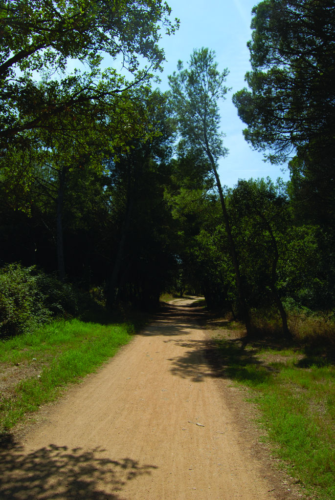
The Carrilet II Nature Trail crosses the regions of El Gironès and of El Baix Empordà, descending gently where the narrow-track train used to run, commonly known as the “Feliuet”, which linked Girona to Sant Feliu de Guíxols until it was closed at the end of the 60s.
The route, which is 40,9 km long, begins in Gerona at a height of 70 m, rises gently to the 130 m of Cassà la Selva, and continues until it reaches the Mediterranean sea.
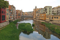
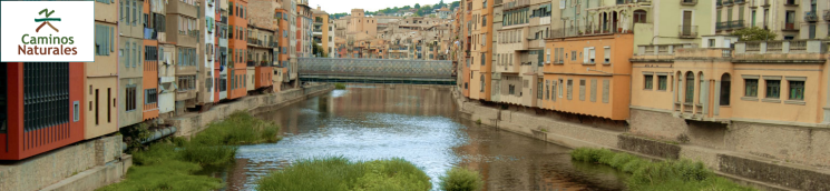
The Trail begins at Devesa Park, the point where it joins the Carrilet I route, crosses the city centre of Gerona and entices you to visit the most attractive areas of this city. From the Plaza de la Independencia, it continues along the shopping street of Santa Clara until it crosses a stone bridge which, turning to the left, leads to the Puente del Rey, passing close to the Plaza de Cataluña.
Following the bicycle lane, you leave the town of Gerona, to take a pathway, parallel to the Sant Feliu road, which descends to the left next to the River Onyar and passes under the road until it reaches the houses of Creueta, where a drinking water fountain invites you to make a stop on your journey.
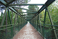
Then, the track runs between barriers of common reeds (Phragmites australis) where you can become familiar with local birdlife. Further on, you pass a country house on the right and, after a short tarmacked stretch, you pass under a bridge but do not take the turn-off to the left. You will soon see an iron bridge and, from this point onwards, you will enjoy rural scenery until you reach the bicycle lane pertaining to the town of Quart. From here, the Trail leads to the old station of Llambilles where there is a reproduction of the old “Feliuet” or railway. The track changes into a street like any other in the town until, on the outskirts, it looks like a path again plunging into the fertile farmlands.
The route now enters a mixed wood of holm oaks (Quercus ilex) and oaks (Quercus sp.) which alternate with plots used to grow grain, until you reach an intersection in front of an estate which grows fruit trees on the left. Further on, you will see the first signs of the bicycle lane that crosses the industrial estate of Cassà de la Selva. From here onwards, it is advisable to take great care as this section crosses the road and runs parallel to the traffic.
On reaching a roundabout, close to the cemetery of Cassà de la Selva, take the turning on the left, which leads to the old station of this municipality where a modernist building, the current seat of the town hall, will draw your attention. Leaving this town behind, you will carry on through a farm setting with entrances to private estates on both sides of the route, which is clearly signposted with green signs. An iron bridge leads to the first hint of a Mediterranean wood formed of stone pine trees (Pinus pinea) and oaks, and you continue by crossing small stream beds via successive bridges until you have a view of the town of Llagostera, the route’s half-way point, from where the contour of the bell tower of Sant Feliu church emerges.
After stopping for a rest at Llagostera station, a promenade of mulberry bushes (Morus sp.) leads outside the town and passes under the C-65 highway to continue parallel to it. Here the influence of man has changed the scenery as the original vegetation was altered by a plantation of eucalyptus trees (Eucalyptus sp.) in order to obtain pulp, a crop which, nevertheless, has not eradicated the traditional farming of cork oak trees (Quercus suber) in the area to produce cork, the cornerstone of this town’s economy.

After passing several perfectly signposted crossroads and a couple of underpasses, you will come to a fork where the ruins of an old level crossing hut are located. This leg of the Trail crosses the natural space of Les Gavarres and crosses two iron bridges, among cork oak, pine and oak trees until you reach the railway halt of Bell-Lloch-Font Picant.
From this point, there are only three kilometres left before you reach Santa Cristina d’Aro, the first coastal town in the region of the Baix Empordà. Passing by the Tourist Information Bureau, which used to be a railway station, the route crosses two bridges and farmland irrigated by the waters of the River Ridaura to reach the bicycle lane of Castell d’Aro, drawing close to its old station which is surrounded by a miniature replica train track.
At this point, the signpost directs trail users to a promenade of London plane trees (Platanus hispanica) until the surface becomes tarmacked. The Trail continues across a bridge and through an underpass. Among cork oak and stone pine trees, genuine representatives of the Mediterranean forest, you will come to a heliport on the side of the road.
The Carrilet II Nature Trail now continues through the municipality of Sant Feliu de Guíxols, passing under the busy road to Platja d’Aro. In this last stretch, where coastal residential areas abound, the Trail enters via Carrer Via del Tren. Yellow lines mark the continuation of the route that, after crossing two roundabouts straight ahead, turns into a cycle lane which heads to the marina, where this Nature Trail ends.
Sites of interest
Profile
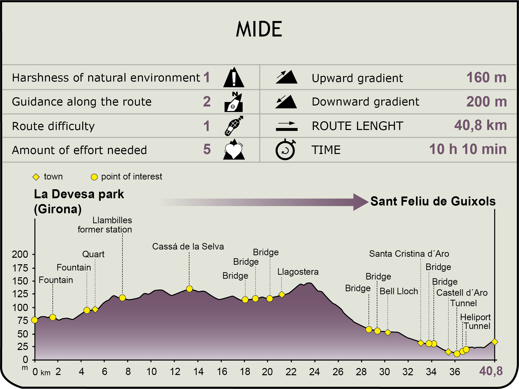
MIDE (Method for the Information of Excursions)
 Harshness of natural environment
- 1. The environment is not risk-free
- 2. There are more than one risk factors
- 3. There are various risk factors
- 4. There are quite a lot of risk factors
- 5. There are many risk factors
 Guidance along the route
- 1. Well defined trails and crossings
- 2. There is a clearly marked trail and signage
- 3. Requires the identification of geographic features and cardinal points
- 4. Requires off-path navigation
- 5. The trail is interrupted by obstacles that have to be gone around
 Route difficulty
- 1. Walking on a flat surface
- 2. Trails with different types of path
- 3. Walking on stepped paths or irregular terrain
- 4. The use of hands or jumping over the terrain is necessary
- 5. The use of hands is required to progress
 Amount of effort needed
- 1. Up to 1 hour of continuous walking
- 2. Between 1 and 3 hours of continuous walking
- 3. Between 3 and 6 hours of continuous walking
- 4. Between 6 and 10 hours of actual walking
- 5. More than 10 hours of continuous walking
Featured
Further information
La Cova D´en Daina Dolmen
Daina’s Cave is a megalithic dolmen located in the municipality of Santa Cristina d’Aro which, according to the shaping of the tomb, probably dates from 2700-2000 BC. It is comprised of a U-shaped burial chamber, enclosed by a cromlech or a structure formed of granite menhirs arranged in a circle.
The largest pieces of this grave dowry were found in 1900 when the owner of the land, Pere Cama i Casa, discovered the dolmen. Subsequent excavations revealed a large number of fragmented bones, teeth, seven silex points, remains of knives, pieces of pottery and beads from a necklace.
Today it is one of the most visited monuments in the region.
Les Gavarres
Les Gavarres mountain range is located to the extreme north of the Catalan coastal mountain range. Its formation took place 600 million years ago, when the rocks that form part of it were still submerged under the sea.
The mountain range’s original vegetation was comprised of extensive alzinares, holm-oak woods on the Catalan coast, which were affected by intensive use for firewood and coal, thus stimulating their replacement by cork oak and pine tree plantations.
Nowadays, the abandonment of these uses has translated into the slow recovery of these unique forests, which are characteristic of the northern Mediterranean area.
Multimedia