Carrilet I Nature Trail. Olot to Girona section
Description
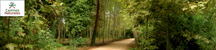
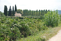
Among dormant volcanoes
A narrow track railroad linked the towns of Olot and Gerona and was one of the main channels of communication for almost a century, until it was dismantled on July 16, 1969. Along its 66 kilometre length (cycle lanes included), it crossed three regions, twelve towns and passed through the valleys of the rivers Fluvià, Brugent and Ter, making interchange and relations between lands in the province’s interior much easier.
The route leaves from the old railway halt of Olot, the capital of the region of La Garrotxa located at an altitude of 440 m, and a town surrounded by four dormant volcanoes, from where it descends to Gerona, only 70 m away, reaching, during its route, its maximum height of 600 m at Collado d’en Bas. Hence, it is advisable to follow the route in the direction described here.
From Olot station, which is in a perfect state of repair, you cross the municipality’s show ground until you reach Sant Roc bridge (from this point start, heading noth, one of the branches), where Fonts de Sant Roc Park begins with a resting area. A man-made tunnel enables you to pass under the eponymous chapel. The track leaves the town and passes, on its right, the municipal athletics track, which forms part of the Natural Park and where there is a bicycle parking area.
At a distance of 2.5 km, you will come to the railway halt of Sant Privat, within the landscaped area that belongs to the Pedra Tosca Park, in whose setting you can follow different itineraries in order to discover how these harsh volcanic lands were cultivated.
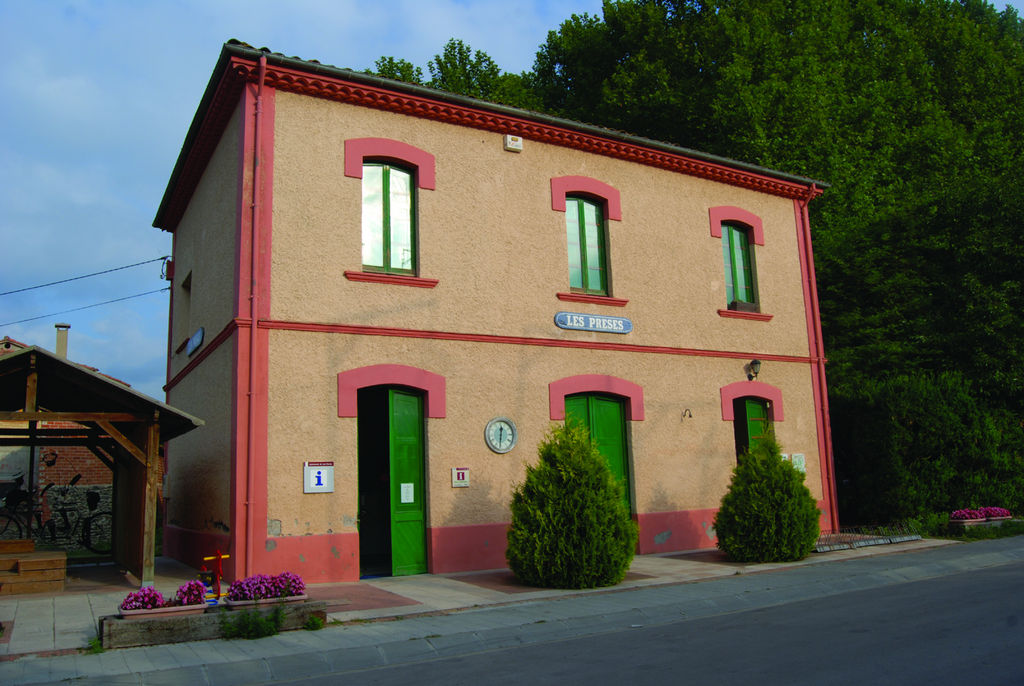
The Nature Trail continues by delving among dense corn fields that inundate the bottom of the valley until, after passing numerous entrances to crop fields, it reaches the old station of Les Presses, now transformed into an Information and Tourist Information Bureau.
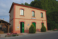
Your route continues by crossing farmland until it reaches a turn-off that leads to the recreational area of Xenacs, from whose viewpoint you have a splendid bird’s eye view of the volcanic area. Without taking the turn-off, the Trail passes under a roundabout on the road and enters the town of Sant Esteve d’en Bas. In this town, the old station has been refurbished and is currently a nursery school.
Following the yellow lines drawn on the ground, the route moves away from the town, crossing two bridges until it reaches an old level crossing that has now been converted into a bar.
After reaching the top of the Collado d’en Bas, the highest point on the route, your descent begins towards the 11th century Romanesque Church of Sant Miquel de Pineda. A little further on, there is also a turn-off to the Chapel of Santa Cecilia, which has been rebuilt thanks to the efforts of the residents of Sant Feliu de Pallerols, a spot where a pilgrimage is held every last Sunday in November.
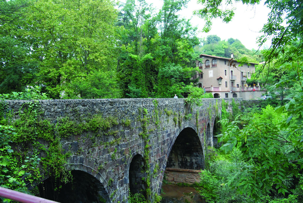
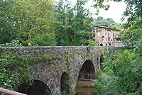
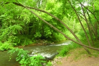
Before reaching Sant Feliu de Pallerols, you cross the River Brugent via an iron bridge, the only remaining structure of the old railway on the entire El Carrilet route, and you pass by a fountain. From Sant Feliu station, to the southwest, you can see a Health Sanctuary in the middle of a forest where travellers can stay.
The old railway holding walls flank the Trail and lead to the foot of the castle d’Hostoles, which represents the most famous defence fortress of the "remensas" (mountain peasants). After crossing a special tunnel with automatic lights, which turn on and off as trail users pass through, you will be rewarded with a view of the town of Les Planes d’Hostoles, located on the lava flow of the Traiter volcano.
Once in the town, you will pass the station on the left where there is a sports track built on the old railway route. On the left, you will pass an entrance to La Parada Park, a resting area where you can also have a drink of water.
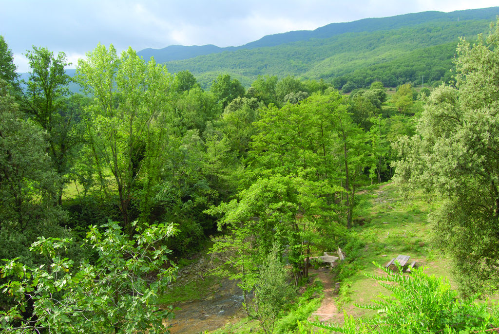
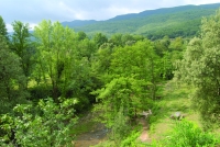
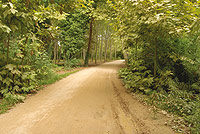
From Les Planes d’Hostoles an especially striking stretch of the Nature Trail begins, which plunges into a thick holm oak (Quercus ilex) and oak (Quercus sp.)forest, strewn with sweet chestnut trees (Castanea sativa). You will pass over several long bridges that will enable you to cross different water courses reaching, at kilometre 28, a turn-off for the Font Picant d´Amer, which is a natural carbonic water fountain.
The route crosses a pine forest that is full of enormous pine trees and leads to an old railway repair workshop which today has been converted into the Amer firemen’s station. Typical products of this municipality are handmade biscuits and turrones made out of hazelnuts from this area.
On moving away from the town, the track rises sharply until it meets the road. The Trail does not follow the original route of the railroad but takes advantage of several forest tracks so that, on crossing the bridge over the River Ter, you can see the impressive viaduct that the train used in bygone times.
On the other side of the river, you will find another of the old railway line facilities that is currently used as an Art College. Carry on following the signposts. Immersed in farmland, the Nature Trail goes on its way and reaches a crossroads with the C-63 highway which a little further on leads to the Font de Can Pla.
You enter the town of Cellera de Ter, located between the River Ter and the Arroyo de Osor, a water-carved gully that crossed the railway as far as kilometre 37 in Anglés. Although the mediaeval nature of the streets has remained in the old part of the town, in recent years business activity has increased, transforming the municipality into a more industrialised landscape..
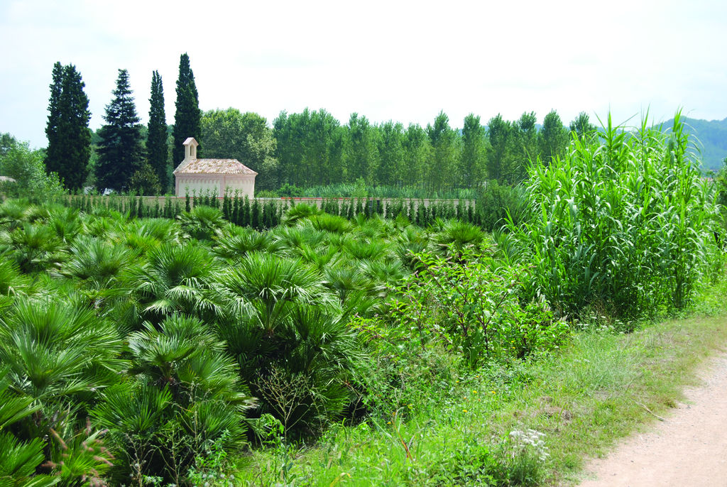
The route then passes by the old station along a promenade of palm trees, and continues parallel to the N-141 highway, passing the town on the right-hand side, as far as Bonmatí station. From here onwards, you have to take great care as the proximity of the road and some crossroads may be dangerous. Before reaching the old station of Bescanó, a power plant will remind you of the numerous hydraulic uses that have been made of the river.
Barely 100 m from an underpass that crosses under the road, you will see signs for Gerona. At this point, you can choose between two alternatives to reach your destination: the upper one, to the right, crosses the most developed part of Salt and enters via the Passeig d’Olot; whereas the lower one, to the left, avoids the town centre of Salt and enters this town via Les Devesses. The route, which is well signposted, keeps to the banks of the River Ter between London plane trees (Platanus hispanica) following rural paths until it arrives in the northern part of Gerona. Here you must turn slightly to the left until you reach a roundabout and border the Auditorium on the left to reach your final destination of Devesa Park.
Map
Puntos de Interés
Información
- Desvío a Castell D'Hostoles y a Gorg del Molí de Murris
- Ruta alternativa a Girona
- Bassa dels Carros
- Camino de Santiago Catalán
- Área recreativa de Xenacs
- Parc de les Deveses de Salt
- Parc de Pedra Tosca
- Hortes de Santa Eugènia
- Cruce con las rutas "La Cuna de Verntallat" y "hayas entre volcanes"
- Ruta alternativa por Camps de Can Miquel
- Parc Natural de la Zona Volcánica de La Garrotxa
Infraestructura
- Cruce carretera C-63
- Trinchera del antiguo ferrocarril
- Canal de Vilanna y Bescanó
- Ruta a volcán de San Marcos
- Túnel de la carretera AP-7 E-15
- Font Picant
- Puente de Bonmatí
- Font de la Teula
- Área de pícnic de Les Planes
- Cruce carretera C-63
- Túneles de el Carrilet
- Central hidroeléctrica de Vilanna
- Central hidroeléctrica de Bescanó
- Túnel
- Puente de Can Pipeta
Profile
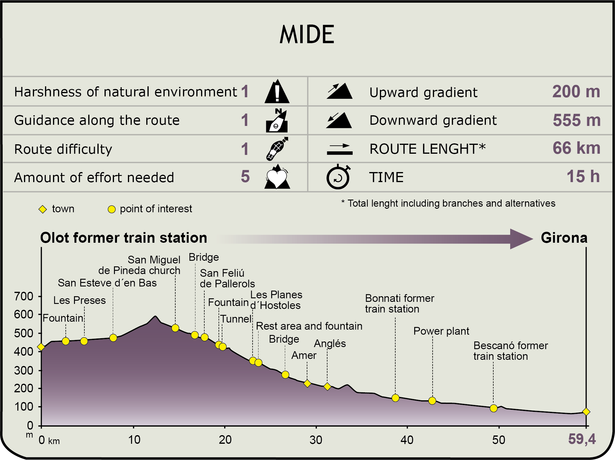
MIDE (Method for the Information of Excursions)
 Harshness of natural environment
- 1. The environment is not risk-free
- 2. There are more than one risk factors
- 3. There are various risk factors
- 4. There are quite a lot of risk factors
- 5. There are many risk factors
 Guidance along the route
- 1. Well defined trails and crossings
- 2. There is a clearly marked trail and signage
- 3. Requires the identification of geographic features and cardinal points
- 4. Requires off-path navigation
- 5. The trail is interrupted by obstacles that have to be gone around
 Route difficulty
- 1. Walking on a flat surface
- 2. Trails with different types of path
- 3. Walking on stepped paths or irregular terrain
- 4. The use of hands or jumping over the terrain is necessary
- 5. The use of hands is required to progress
 Amount of effort needed
- 1. Up to 1 hour of continuous walking
- 2. Between 1 and 3 hours of continuous walking
- 3. Between 3 and 6 hours of continuous walking
- 4. Between 6 and 10 hours of actual walking
- 5. More than 10 hours of continuous walking
Featured
Further information
The War of the Peasants
The remenses were peasants who worked land that they did not own, but which they were assigned to it in a hereditary manner. In 1462, they were the protagonists of a great revolt against the nobility known as the “First Rebellion of the Remences”, which was followed a decade later by a second revolt.
Under the orders of Francesc de Verntallat, these peasants fought against the malos usos or feudal abuses, which were the rights that the nobility had over them. At the time, the Castell d´Hostoles was used as a barracks until 1486, when the Judgement of Guadalupe, which put an end to these revolts, forced them to surrender and it passed into the King’s hands. Today, only a few ruins of the fort remain in memory of this historic event.
A volcanic region
The Zona Volcánica de La Garrotxa Natural Park features around forty volcanic cones and some twenty basaltic lava flows of quaternary origin. This particular environment gives rise to diverse, rich and, on occasions, very luxuriant vegetation filled with holm oak, oak and beech woods of exceptional scenic value.
Out of the extraordinary signs of volcanic activity, it is worth visiting not only La Fageda d’en Jordá, an exceptional beech wood located on lava flow from the Crosat volcano, but also the Santa Margarida volcano, very close to Olot, which erupted and created a wide circular crater on which a chapel that lends its name to the volcano stands.
The combination of magnificent shapes, coupled with the abundant plant coverage of this area, creates the best example of volcanic landscape on the Iberian peninsula.
Enlaces de interés
Multimedia