- Home
- Rural Development
- Nature Trails
- Nature Trails
- Northeast Sector
- Camí de l´Aigua
Camí de l´Aigua Nature Trail
Description
The Romanesque route
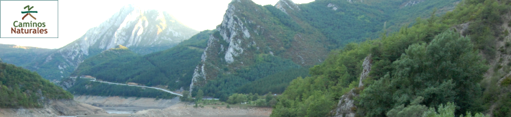
Under the protection of summits that surpass 3,000 m, and close to Aigüestortes i Estany de Sant Maurici National Park, one of the first protected territories in Spain, this route proposes a journey back in time, visiting the best examples of Catalan Romanesque architecture.
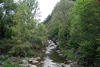
The Camí de l´ Aigua Nature Trail begins next to the River Convent, in the recreational area of La Mena Fountain, which can be accessed by the N-260 highway, where there is an interpretation panel that describes the itinerary. From this point, not far from the ruins of Lavaix Monastery, the route continues towards Pont de Suert.
The Trail ascends next to a wooden fence until it passes kilometre 2 of the route, where you can enjoy a panoramic view of Pont de Suert. The following downward leg ends at some steps, which take the route close to a poplar plantation and then to the road, where you will find another interpretation sign for the Trail.
After passing the Fauna Centre in Pont de Suert, the route enters the town center, crossing N-230 road and the River Noguera Ribagorzana, running close to the Catalan School of Mountain Sports, to reach, at kilometre 4, a walk among ashes (Fraxinus sp.), black poplars (Populus sp.) and willows, frequently used by inhabitants of the area, where another interpretation panel explains to trail users the most noteworthy features of this stretch.
The Nature Trail leaves Pont de Suert and the River Noguera Ribagorzana after crossing over it, and climbs up near River Noguera de Tor. The N-230 road is crossed again and the trail reaches the Chapel of El Remei, where it continues its route towards Llesp and Barruera.
The route descends once again, crossing a forest next to a wooden fence towards a meander formed by the river and, after crossing two hills, it heads towards Llesp reservoir among hazel-nut trees (Corylus avellana).
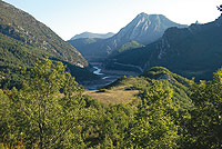
Built in 1951 to supply water to the hydroelectric power station of Pont de Suert, this reservoir is currently a wetland that boasts enormous ecological value on account of the great biodiversity it contains, part of which can be easily discovered thanks to the bird observatories located on its banks.
Carrying on along a path that allows the transit of motor vehicles as far as a bridge leading to the nearby of Llesp, the Trail continues parallel to the river among pastures until, after passing a wooden bridge, it climbs up to kilometre 11.
On drawing close to the boundary of a wild pine forest (Pinus sylvestris), the route leads to a road, just at kilometre 12. From this point, you should carry on along a crop-lined tarmacked lane in the direction of Baruera, ignoring unsignposted turn-offs and making your way among country houses until you pass under the road and cross the riverbed of a stream, which is usually dry, over a wooden walkway.
On reaching kilometre 13 of your trek, located between a wooden fence and a stone wall, the scenery changes into a forest of hazel-nut, common boxwood (Buxux sp.) and tall black poplar trees, sometimes strewn with ash trees, after which you will reach a pedestrian walkway over the River Noguera del Tor.
The route continues as far as a small resting area next to the willow plantation of Barruera, where another interpretation panel for the Camí de l’Aigua explains the importance of this rare wetland for migratory birds.
This natural space, which forms part of Red Natura 2000, houses the typical rich biodiversity of mountain wetland areas. The small species proper to these riverbank forests are the hoary willow (Salix eleagnos) and the purple willow (Salix purpurea), which are the trees that lend their names to this place and which can be seen by taking a detour off the trail up some steps leading to the viewpoint of El Salencar.
The valley route runs between the left bank of the River Noguera del Tor and the road. It subsequently joins a tarmacked lane that accesses the town of Barruera. Along this landscaped itinerary, there are fountains where you can fill up with water every few metres. After crossing the outskirts of the town, you will pass by a football field and a recreational area, leaving behind you the town centre where Sant Feliu church, which belongs to the Romanesque group of buildings of the Vall de Boí, stands out.
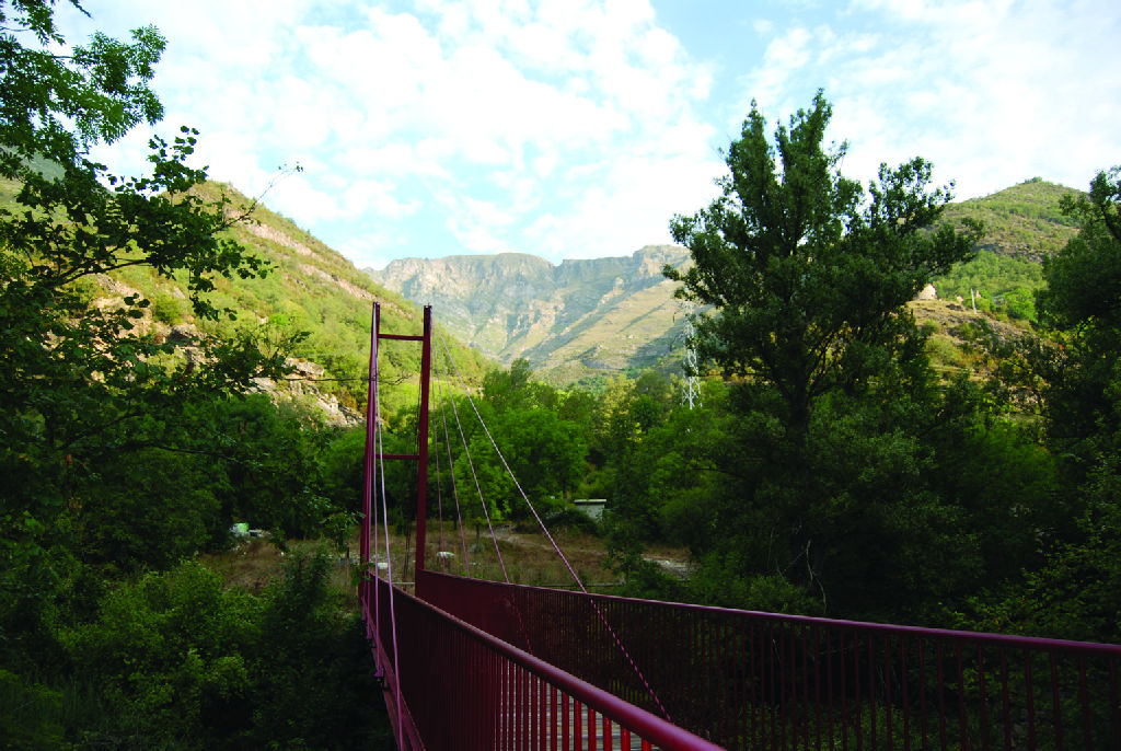
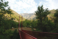
Another Nature Trail sign informs trail users that the path continues along a hanging bridge used to cross the river and carries on along its bank moving away from the municipality until it reaches a hydroelectric power station. From here onwards, it runs between pastures and ash, poplar and hazel-nut trees until it turns into a path bordered by small stone walls, which climbs upwards to Boí at kilometre 20 of the route.
The Nature Trail gains a difference in altitude of 200 metres, passing a valley to then enter a wood of common boxwood trees, until it reaches a viewpoint where you will have a beautiful bird’s eye view of the valley and the towns of Barruera, Erill la Vall and Boí, as well as the impressive summit of L’Aüt.
The last leg before you reach Boí crosses rural countryside consisting of pastures bordered by the traditional stone walls of this area, passing a crossroads from where you can go to Durro following Grand Route itinerary GR-11-20.
After filling up with water at the fountain on La Plaza del Riu, at kilometre 21 of the itinerary, you cross the bridge and the old district of the town. Along this route, the Nature Trail passes in front of the couse of the Aigüestortes y la Font de Quelet National Park, in order to reach Sant Joan church, from where you carry on crossing a road, where another information panel describes the most outstanding features of this town.
The route continues from Boi, through Sant Pere road, next to a small cross dedicated to the patron saint of this town, to continue on your way to the L-5000 highway. Once on the tarmacked surface, go down to the bridge over the River Noguera de Tor, next to a guesthouse where more Nature Trail instructions will guide you in the direction of small adjacent pastures and where you will be accompanied on your right by the river towards Caldes de Boí.
The route then begins to climb slightly and, just at kilometre 25, it crosses a stream. The scarce vegetation cover on this leg enables you to enjoy an unbeatable view until you reach a point where, on the other side of the valley, you will see the hydroelectric power station that takes advantage of the force of these mountain waters.
The last leg of the Camí de l’Aigua gradually gains height, while it crosses a forest of wild pine trees with a thick common boxwood undergrowth that closes over the path little by little, although you can see majestic peaks in some clearings. Accurate instructions enable the trail user to pass forks on both sides, while the route carries on over bridges and wooden steps.
On occasions, the surface of the path, which becomes increasingly shaded, has been strengthened with wooden slats and rocks so it can cross the many streams in its way. Very close to the end of the Trail, you can see a water bottling plant on the other side of the river, while the route continues between beech (Fagus sylvatica), fir, sorb (Sorbus sp.) and common boxwood trees, until it reaches kilometre 27, a resting area close to the fountains of the Caldes de Boí health resort, where the last information panel marks the end of your trek.
From this point, you can cross the health resort via a slate path and reach the L-5000 highway which, passing through Barruera, returns to Pont de Suert.
Sites of interest
Profile
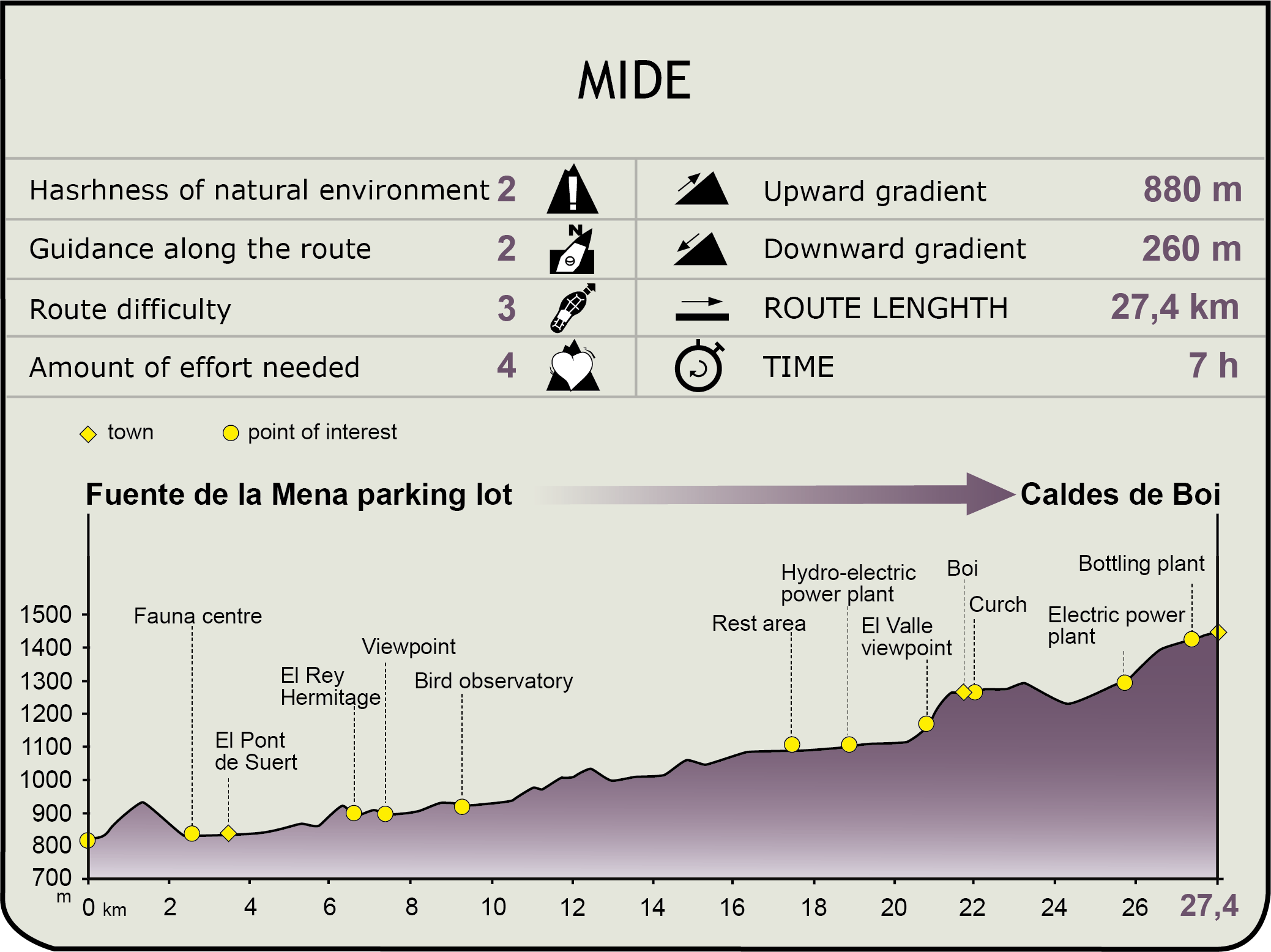
MIDE (Method for the Information of Excursions)
 Harshness of natural environment
- 1. The environment is not risk-free
- 2. There are more than one risk factors
- 3. There are various risk factors
- 4. There are quite a lot of risk factors
- 5. There are many risk factors
 Guidance along the route
- 1. Well defined trails and crossings
- 2. There is a clearly marked trail and signage
- 3. Requires the identification of geographic features and cardinal points
- 4. Requires off-path navigation
- 5. The trail is interrupted by obstacles that have to be gone around
 Route difficulty
- 1. Walking on a flat surface
- 2. Trails with different types of path
- 3. Walking on stepped paths or irregular terrain
- 4. The use of hands or jumping over the terrain is necessary
- 5. The use of hands is required to progress
 Amount of effort needed
- 1. Up to 1 hour of continuous walking
- 2. Between 1 and 3 hours of continuous walking
- 3. Between 3 and 6 hours of continuous walking
- 4. Between 6 and 10 hours of actual walking
- 5. More than 10 hours of continuous walking
Featured
Further information
Aigüestortes I Estany de Sant Maurici
The Camí de l’Aigua Nature Trail runs through the influence area of Aigüestortes I Estany de Sant Maurici National Park. This space, which has been protected since 1955, preserves the best example of the high-mountain eco-systems of the Pyrenees, in a setting shaped by the action of glaciers in the Quaternary era. They eroded the landscape creating U-shaped valleys, filled with luxuriant deciduous and coniferous forests, leaving among their summits more than 200 crystalline-clear water lakes.
This strip of the Pyrenees includes four summits over 3,000 m in height and below which you can find rich biodiversity including over 1,500 plant species, and more than 150 birds, some as endangered as the bearded vulture (Gypaetus barbatus).
The ideal way to discover the many natural wonders of the park is to plunge deeply into it along the many well-signposted paths that cross it.
Romanesque Churches
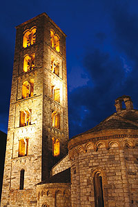
The series of Romanesque buildings in the Valle de Boí, declared a World Heritage Site by the UNESCO in 2000, is comprised of the churches of Sant Climent and that of Santa María in Taüll, Sant Joan in Boí, Santa Eulàlia in Erill la Vall, Sant Feliu in Barruera, La Nativitat in Durro, Santa Maria in Cardet and Santa Maria in Coll, which are coupled with the Chapel of Sant Quirc in Durro.
All built in the 11th and 12th centuries in Lombard-Romanesque style under the influence of northern Italy, they evidence meticulous stone and decorative element work, although the most outstanding components of their architecture are the slender, square floor plan bell towers, which were used for communication purposes and as territorial watch towers.
The meticulous wall paintings of their interiors served to convey to mediaeval society the spiritual values of the Catholic faith. The most noteworthy of all, on account of their symbolic charge summarised by Catalan Romanesque art, are the frescos in Sant Climent church in Taüll, whose original Christ Pantocrator is currently preserved in the National Art Museum of Catalonia.
Multimedia