
- Home
- Rural Development
- Nature Trails
- Nature Trails
- East Sector
- Turia-Cabriel
- Turia-Jaraguas
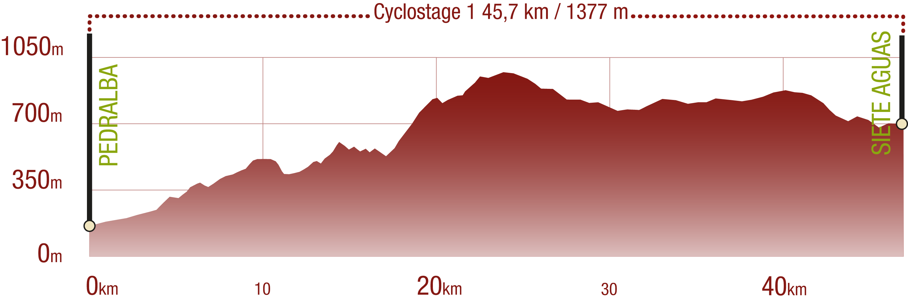
Turia - Cabriel Nature Trail. Turia - Siete Aguas Section
Description
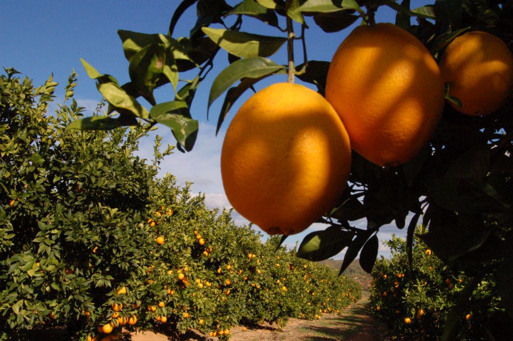
This section starts at the orange groves by the Turia and enters the perfumed mountain air to find its conclusion among olive groves and vineyards.
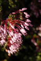
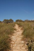
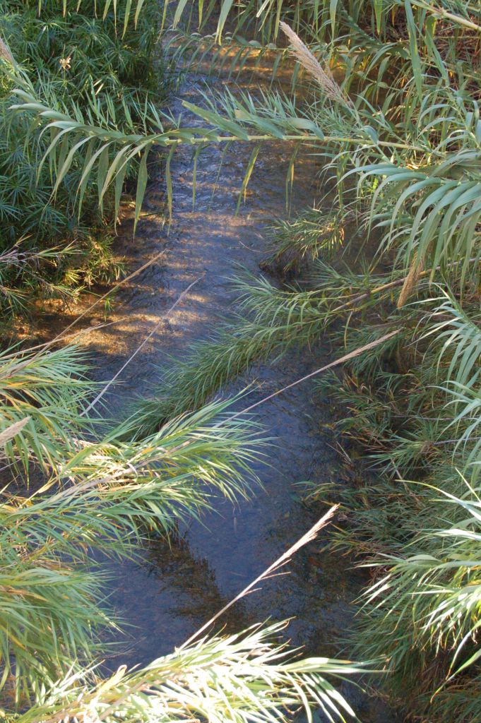
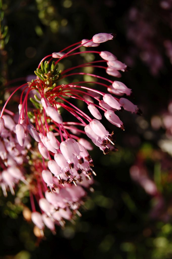
Starting at the Turia riverbanks, the trail zigzags in the perfume of orange blossom and slowly enters the mountains, where cisterns and coops hint at the way of life of that area, that has survived, albeit less widespread, to this day. The trail, as it crosses mountaintops and ravines, is perfumed by the smells of rosemary, heather and rockrose, and spectacular views may be admired all around and all along this sun-drenched route.
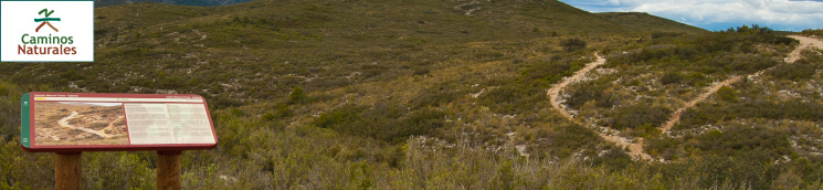
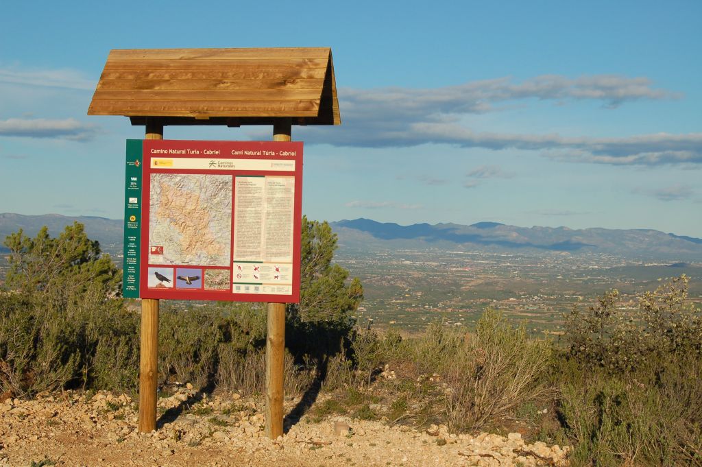
This trial starts at the outskirts of the town of Pedralba, in the Turia Natural Park, just after crossing the bridge over the CV-370 road, under which the River Turia rolls. A roofed panel both marks the start and offers detailed information about the route.
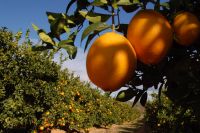
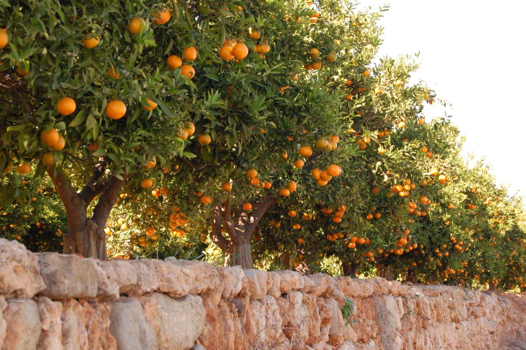
The first part of the trail runs along an asphalt road, which runs among orange and tangerine groves, dotted by buildings that originally were for agricultural use but today are also used as dwellings.
Just before completing the first 500 m of road, the route crosses the Chiva rambla (ravine) and the Cordel de Castilla, a cattle road used for transhumance livestock, along which several grazing area are located. The Natural Trail continues among citrus groves as the asphalt road turns into a dirt path. At that point, an information panel informs that the trail enters the Alto Turia y Sierra del Negrete Special Protection Area for Birds. Subsequently, the trail continues along a very steep concrete road, and the surrounding landscape changes from the ubiquitous citrus groves to the scrublands of the La Serratilla Forest of Public Use.
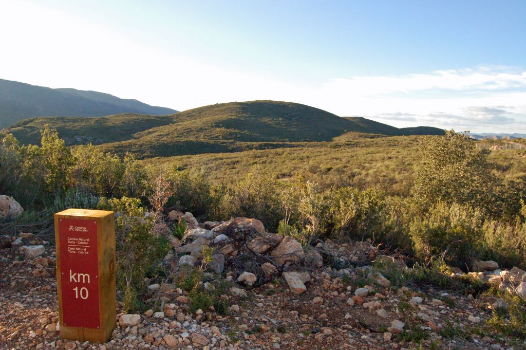
As the road hits kilometre point four, it turns again to a dirt road and passes by several specimens of Aleppo pine before reaching the top of the climb at the rest area located in La Muela, at an altitude of 309 m. From that point, it will be necessary to overcome many ups and downs that will, without a doubt, test the strength of hikers and cyclists.
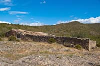
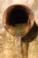
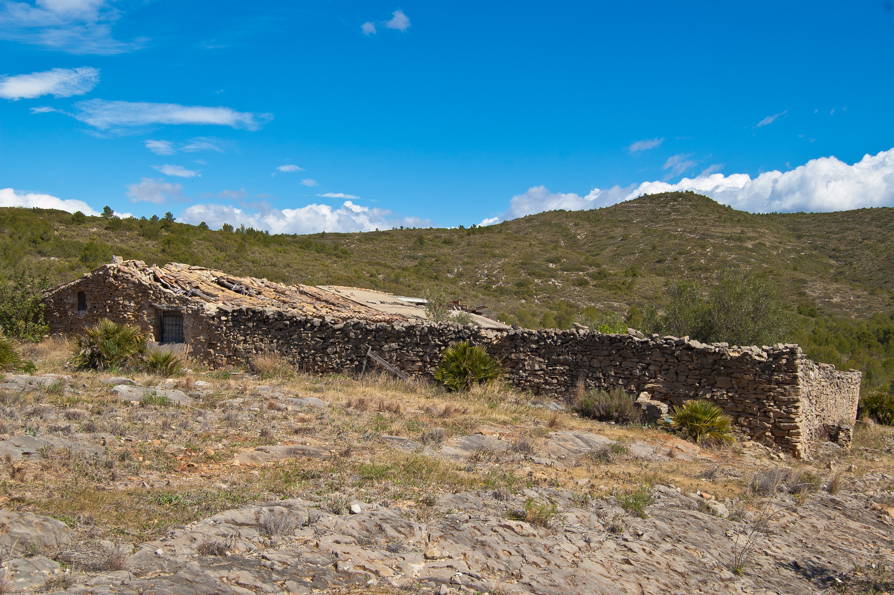
Just before kilometre point seven a well-preserved cistern may be seen; this was used in the past for allowing livestock and horses to drink. Just afterwards, the La Balsa Coop, built in stone and mortar, may be found, which was used as a dwelling and livestock shelter up to recent times. Just a few metres further, the route crosses the rural path called Coladas de Cheste a Chulilla. This is a cattle road a little over 14 km long, which was used for short livestock relocations, between the pastures of the Serranía de Cuenca and the Sierra de Javalambre with the seaside mountains in Valencia which served as livestock’s winter residence. At this point, there is a 110 m detour that leads to another livestock shelter, known as Corral de los Calzones, and which was used to spend the night when there was so much work to do in the fields that there was no time to return home.

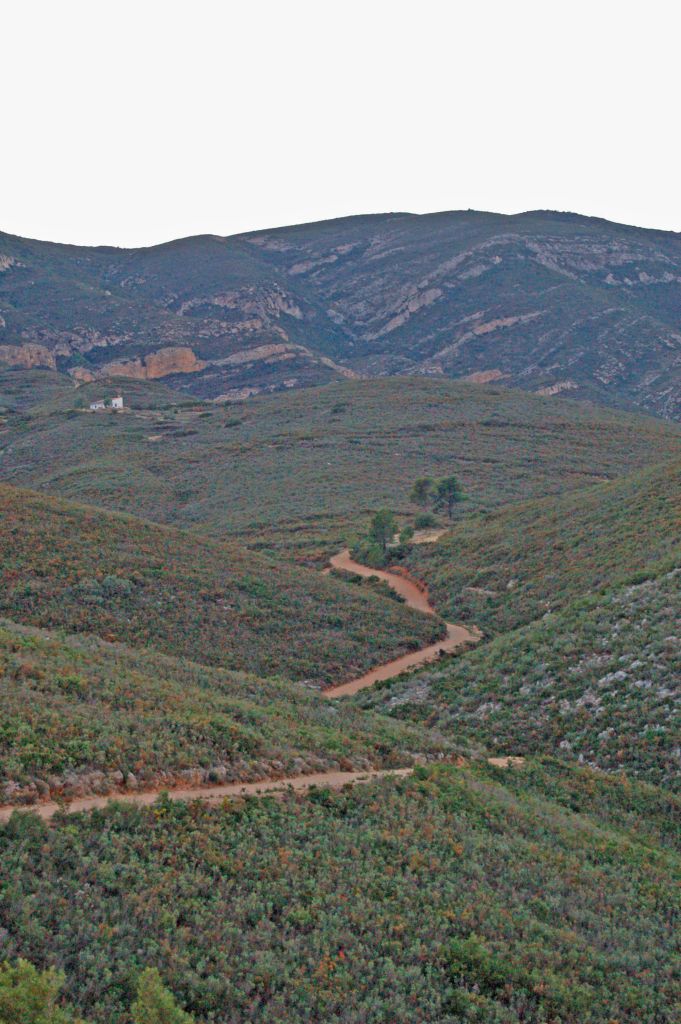
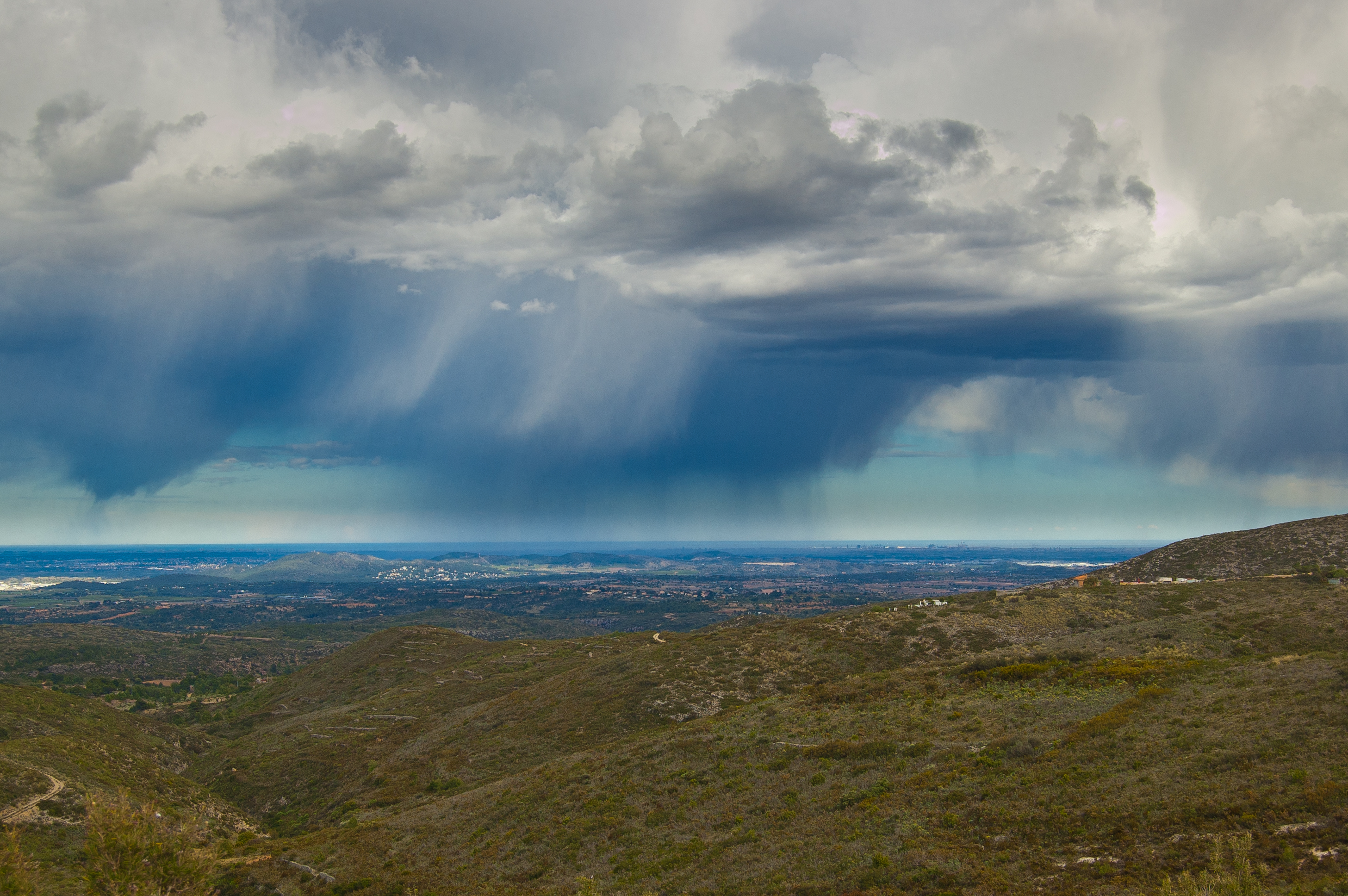
After kilometre point eight, a beautiful panoramic view opens before our eyes, which, on clear days, allows to see the city of Valencia and the Mediterranean sea. Afterwards, the route reaches a rest area and, shortly afterwards, a water spring used by wildlife and a heap for rabbits. The route climbs up for same time until it reaches the hunters’ cistern, a modern construction promoted by the Hunters’ Society of Cheste. Shortly afterwards, the route crosses the Colada de Bugarra, which is the local name of the cattle road that links Cheste y Chulilla.
After barely ten kilometres, the route leaves the main road and turns to a path that crosses a small but dense patch of young Aleppo pines. After this pine patch, there is a residential community surrounded by crop fields that lead to the crossing of this Nature Trail with the CV-379 road. This part of the route is not easy to cycle, especially for less-experienced cyclists; however, an option for them is to continue along the road until reaching CV-379, although they would be forced to cycle along a road without side lanes.
Once this road has been carefully crossed, the route arrives at an area dominated by vineyards and olive groves dotted by cottages. Shortly afterwards, the structure known as Corral del Carnicero can be seen; this is a traditional building for keeping cattle, which has undergone several renovation thanks to which it is still used nowadays. Slowly, the landscape is again characterised by the presence of Aleppo pine and heather (Erica sp.) until it reaches another rest area. The route continues by a steep up and down section.
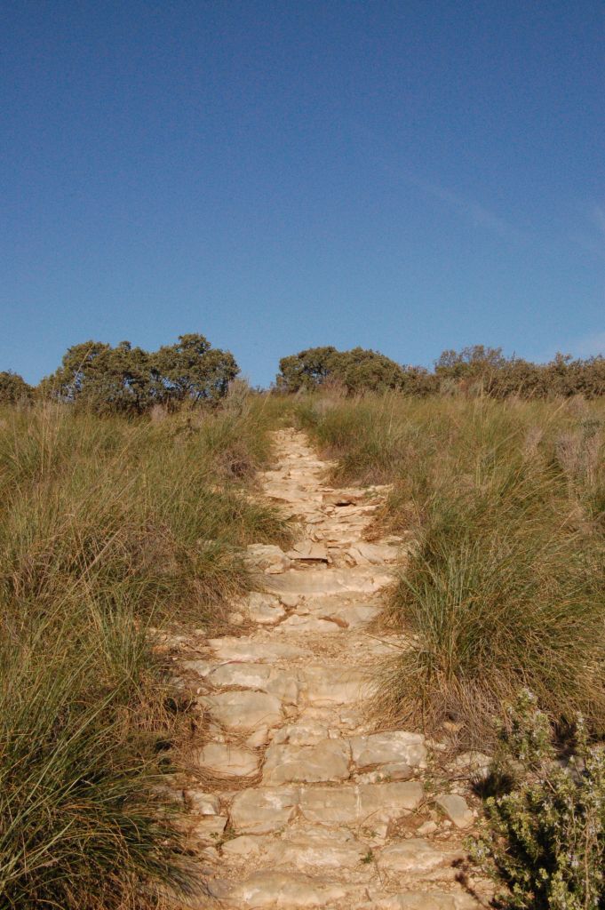
It once again leaves the road and turns by a short path, no longer than a kilometre and a half, which ends at a rest area located in the zone known as Alto de Cazoleta. The technical difficulties to carry out this section by bike are higher than in the former section. Cyclists are advised to do this section on foot.
After leaving this path behind, the hardest to hike in this first section of the Turia – Cabriel Nature Trail, the route goes once again up and down until reaching a rest area with a marvellous panoramic view. The route then crosses the road called Vereda Real from Gestalgar a Godelleta, a cattle road that connect the Cordel del Mas del Pinar cattle road with the seaside mountains. After recovering one’s strength, it is possible to visit the Micro Natural Reserve of Umbría de las Carrasquillas. After this point, the Nature Trail runs consistently downhill.
Halfway between the municipalities of Gestalgar and Chulilla, the route crosses a cattle road locally known as Vereda de Chiva a Chulilla. At this area, the vegetation is dominated by evergreen oak (Quercus ilex) scrubland and rosemary (Rosmarinus officinalis) undergrowth. Besides, after 27 kilometres of hiking, it is possible to find a patch next to a rest area that has been repopulated with forest species.
Infrastructure linked to livestock activities is a constant along the entire Nature Trail. An example of this is the Corral de Medineta, a building used in the past for keeping cattle and nowadays as a dwelling. From this point, vineyards and olive groves, dotted by some almond groves, dominate the landscape. Among the vineyards, two local varieties are especially noteworthy: the bobal grapes and the tardana grapes, which are mixed with other more mainstream Spanish grape varieties. Most olive groves are of the manzanilla variety in the warmer areas, and of the cornicabra variety in the cooler areas.
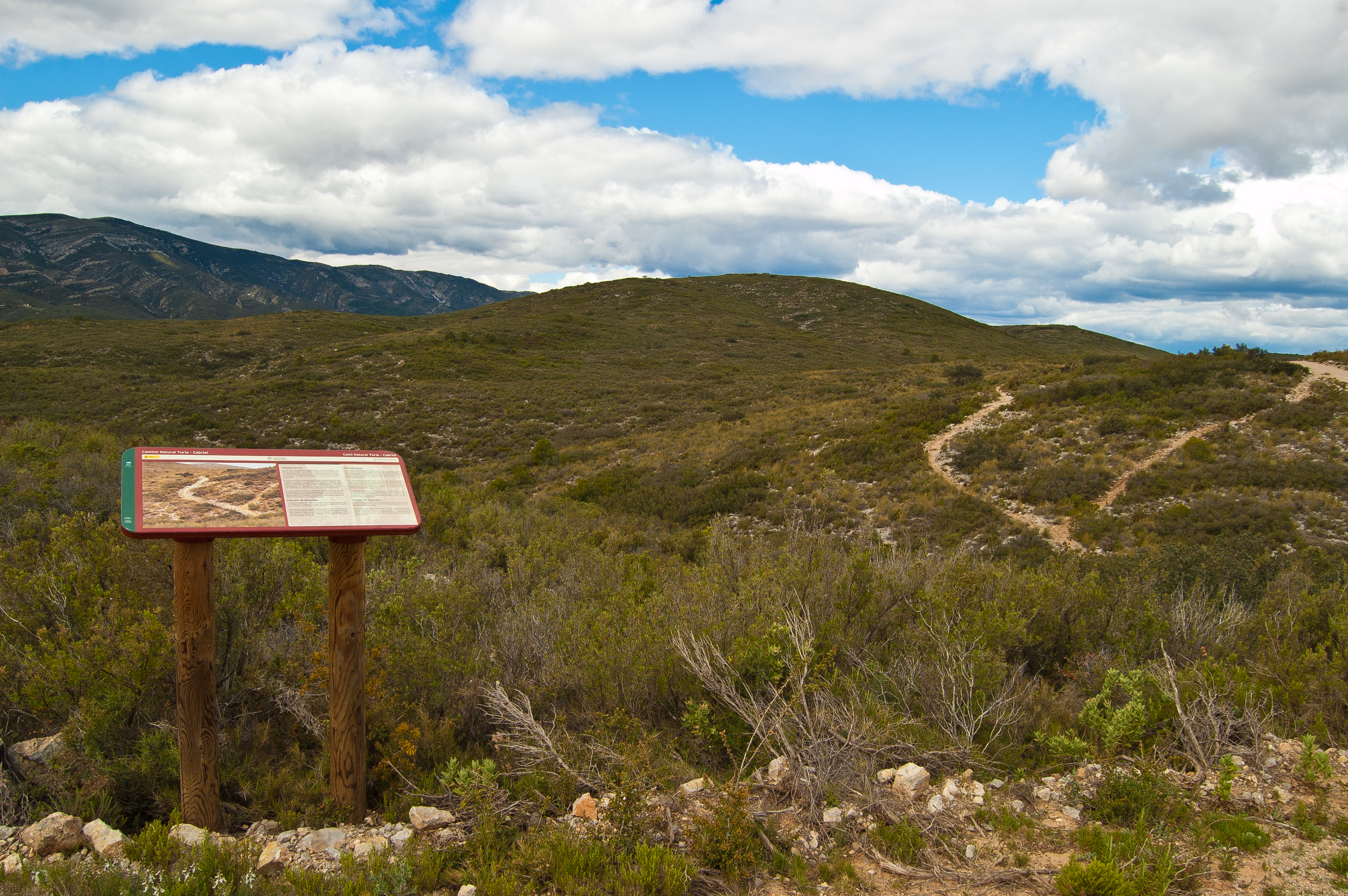
After this brief section walking among crops, the landscape becomes once again scrubland before hitting kilometre point thirty-two, where a panel displays information about the Sierra de Chiva Municipal Area, the area across which the next few kilometres of this Nature Trail run.
Almost at the demarcation between the municipalities of Chiva and Siete Aguas there is another rest area, surrounded by fairly high pines that provide a very welcome shadow, after a trail which has almost entirely run under the sun. After a stop in this oasis, the route continues across a cattle road, known as Azagador de Tejera.
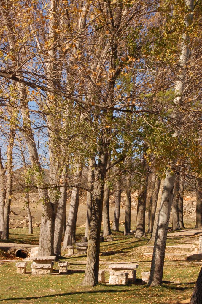
A kilometre after, there are detours both to the right and to the left. The first one, after running for a little over 350 m, leads to a hydraulic construction called cenia, which was used in the past to fill up an adjacent reservoir built in masonry. The second deviation leads, after 200 m, to the La Vallesa recreational area, where a beautiful poplar patch, together with the water spring that gives its name to the area, precede an area furnished with stone and wooden tables, bike racks and barbecues that allow hikers and cyclists to recover their strength in the cool shadows.
Back to the Nature Trail, which runs to a third path about three kilometres long across a dense scrubland where the evergreen oak is the dominant species. This path is not suitable for bikes, and therefore cyclists must take an asphalt road that leads from the La Vallesa recreational area to near Siete Aguas, where they may continue along the Nature Trail.
The Nature Trail goes up and down once again until hitting the 37-kilometre mark at a spot where a beautiful specimen of Aleppo pine (Pinus halepensis) grows. From that point, the way down begins, and in this section of the trail ends less than a kilometre later.
Then, Nature Trail continues along a wide dirt path leaves behind the mountain known as Peña Rubia and runs towards the town of Siete Aguas. The way down shares its tracing with a 700 m long asphalt road, which comes to an end at the El Papán rambla (shallow ravine) at the fountain of the same name and the rest area. Also at the right lay the Fuente de la Gota, Fuente de la Roca y Fuente del Garbanzo fountains, which are located just before the town of Siete Aguas.
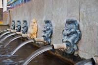
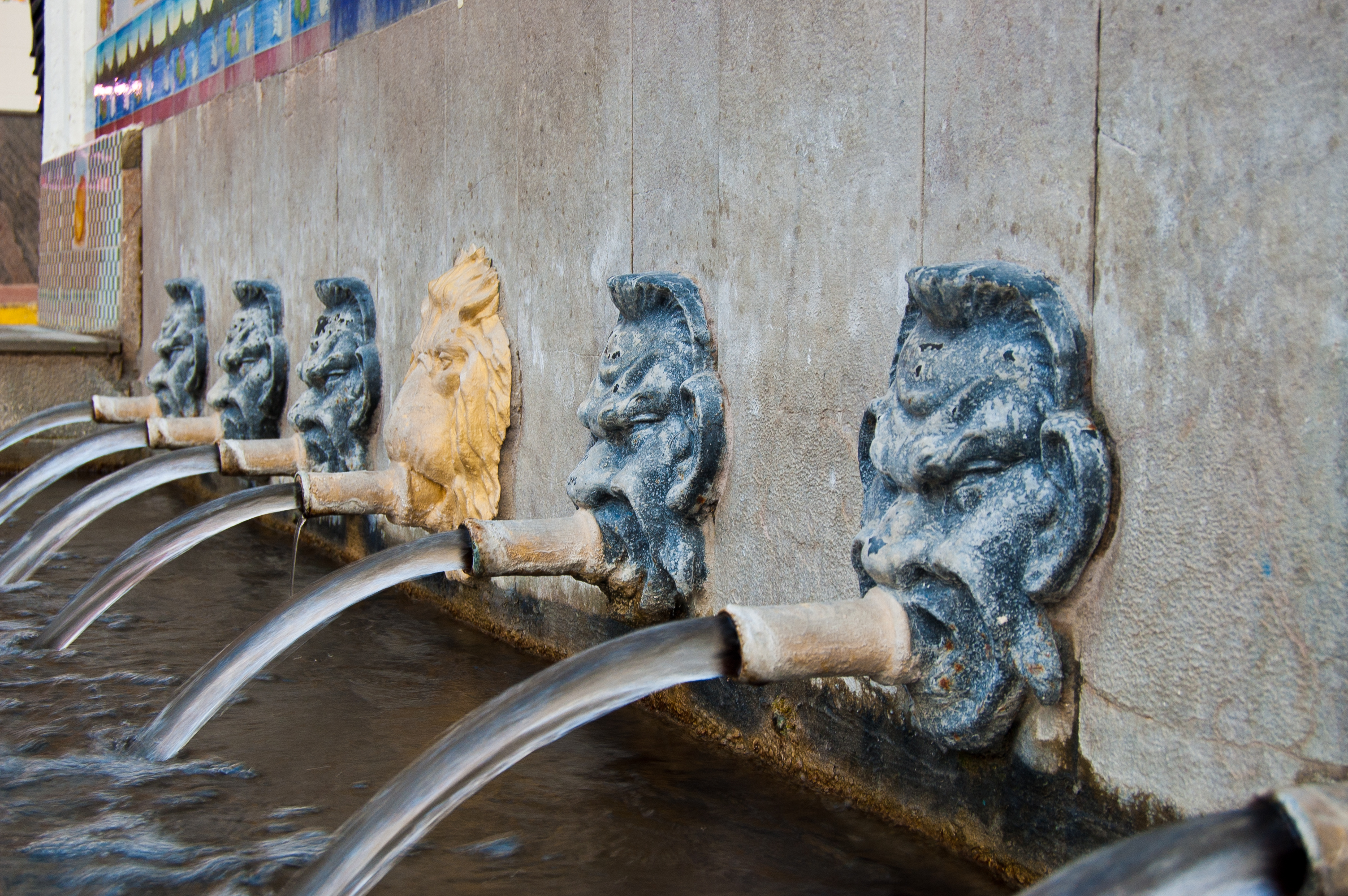
The town is accessed by the Avenida Fuente de la Gota, where this first section of the Turia – Cabriel Nature Trail ends. The finishing spot is marked by the interpretation panel located in the park, next to the Fuente de los Siete Chorros fountain.
Profile
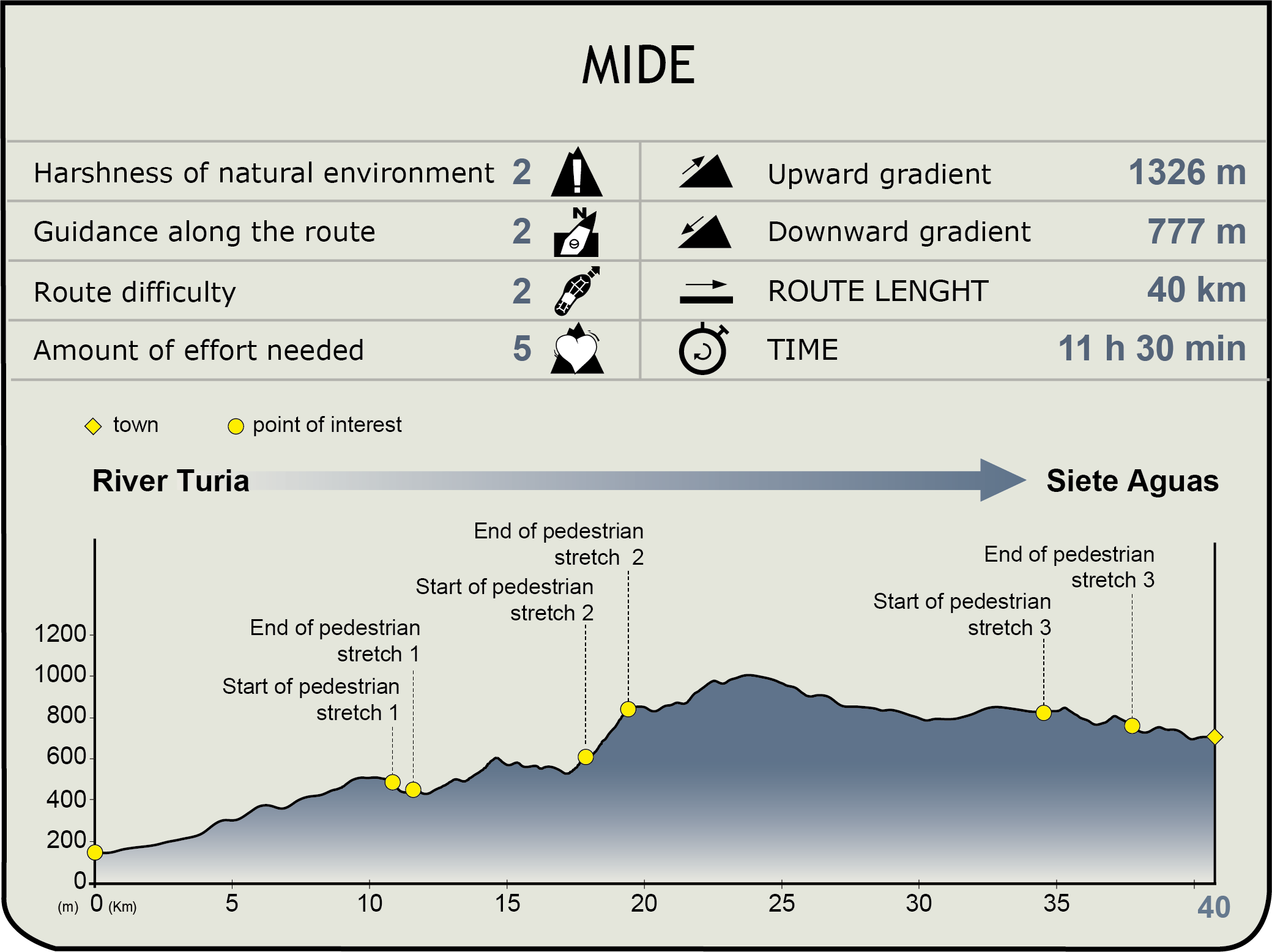
MIDE (Method for the Information of Excursions)
 Harshness of natural environment
- 1. The environment is not risk-free
- 2. There are more than one risk factors
- 3. There are various risk factors
- 4. There are quite a lot of risk factors
- 5. There are many risk factors
 Guidance along the route
- 1. Well defined trails and crossings
- 2. There is a clearly marked trail and signage
- 3. Requires the identification of geographic features and cardinal points
- 4. Requires off-path navigation
- 5. The trail is interrupted by obstacles that have to be gone around
 Route difficulty
- 1. Walking on a flat surface
- 2. Trails with different types of path
- 3. Walking on stepped paths or irregular terrain
- 4. The use of hands or jumping over the terrain is necessary
- 5. The use of hands is required to progress
 Amount of effort needed
- 1. Up to 1 hour of continuous walking
- 2. Between 1 and 3 hours of continuous walking
- 3. Between 3 and 6 hours of continuous walking
- 4. Between 6 and 10 hours of actual walking
- 5. More than 10 hours of continuous walking
Featured
Further information
Pedralba
Valencian town by the Turia riverside. The first human settlements found in the area date back to the Mesolithic, although the town as we know it would be gradually consolidated over the Roman and Muslim times.
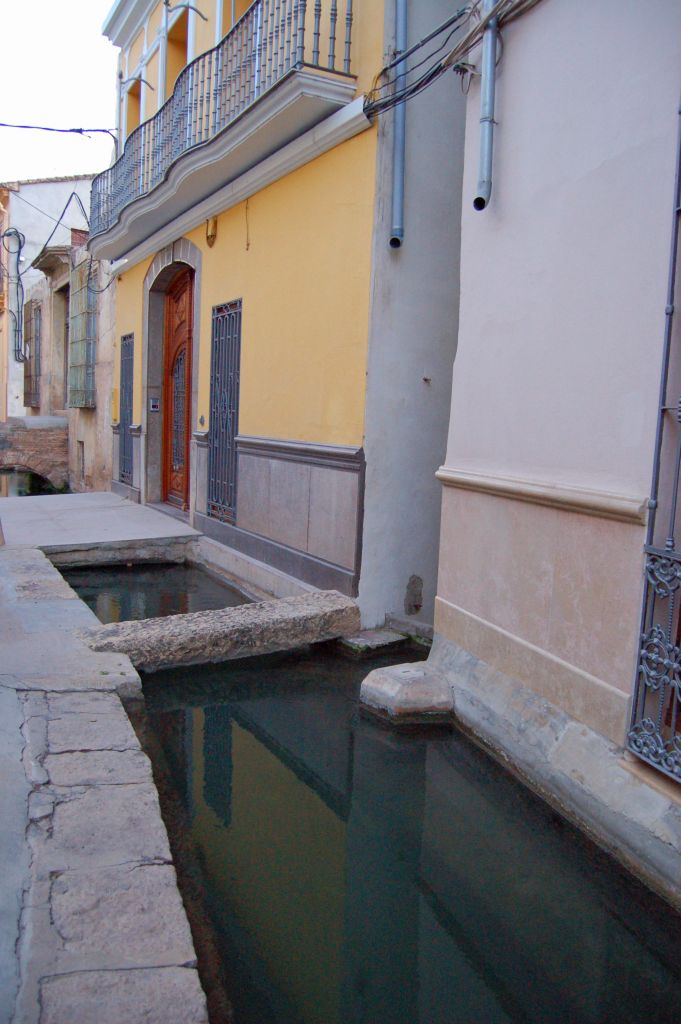
Close to Pedralba’s Plaza de la Constitución stands the 18-century Church of the Purísima Concepción with its spectacular façade. Other remarkable elements of this town are: the shrine of Our Lady of Luján, whose image was brought from Argentina in 1969; the Pedralba 2000 Modern Art Museum, located in a traditional agricultural house, and the Calle de la Acequia, which takes its name from the fact that the main irrigation ditch, called acequia madre or “mother channel” in Spanish, runs along it, and some houses even have tiny access bridges.
Protected Natural Areas
The first section of the Turia – Cabriel Nature Trail, which runs between Turia and Siete Aguas, stretches along over 40 km across four Protected Natural Areas, which are:
- • Turia Natural Park: with a surface of 4.962 hectares and structured along both riversides of the River Turia between the town of Pedralba and Paterna.
- • Alto Turia y Sierra del Negrete SPA(Special Protection Area for Birds): covers an area of over one hundred thousand hectares of mostly mountain, which hosts nesting population of over 18 bird species included in Directive 79/409/EEC on the conservation of wild birds, among which the Bonelli’s eagle (Hieraaetus fasciatus) and the golden eagle (Aquila chrysaetos) are especially noteworthy.
- • Umbría de las Carrasquillas Micro Natural Reserve: small area, barely over half an hectare, located in the shadowy slope (umbría meaning “shadow” in Spanish), and includes evergreen oak (Quercus ilex) together with gall oaks (Quercus faginea), maples (Acer granatense) and ash trees (Fraxinus ornus), besides an undergrowth rich in endemic species.
- • Sierra de Chiva Municipal Natural Space: this space encloses 5,500 hectares, which include the Sierra de los Bosques and part of the Sierra de las Cabrillas mountain ranges. A mountainous area, it is crossed by several hiking routes that allow to get to know its many water springs and its heritage, of which the ensemble of rock art classified as a World Heritage Site by Unesco in 1998, is the finest example.
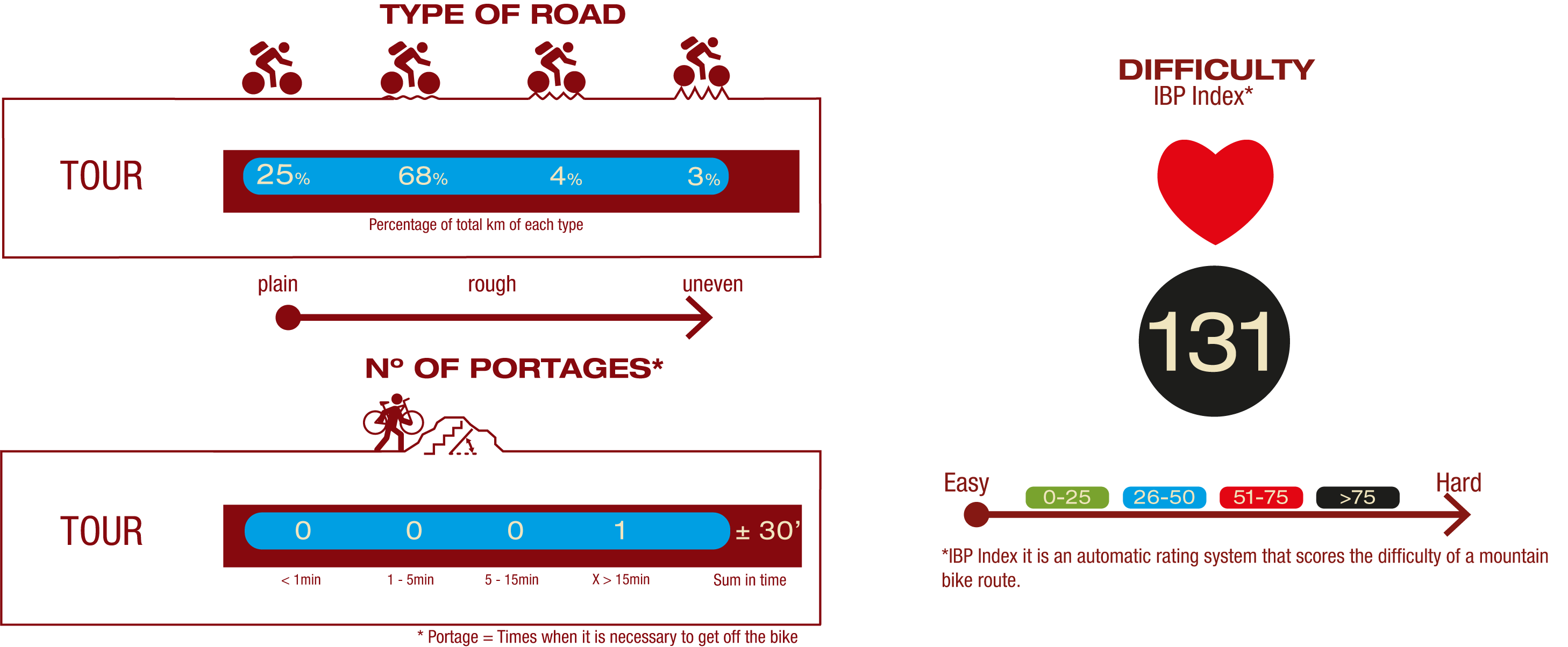
Cyclability
| Stretch(km) | Degree of cyclability | |
| 0,0 to 3,7 | High | |
| 3,7 to 10,9 | Medium | |
| 10,9 to 11,6 | Low | |
| 11,6 to 18,0 | Medium | |
| 18,0 to 19,3 | Non cyclable (path) | |
| 19,3 to 34,8 | High | |
| 34,8 to 37,8 | Non cyclable (path) | |
| 37,8 to 40,6 | High |
Multimedia

Downloads
GPS Downloads
Brochure and Maps
Cyclability
PROFILE
TYPE OF ROAD, PORTAGES & DIFFICULTY
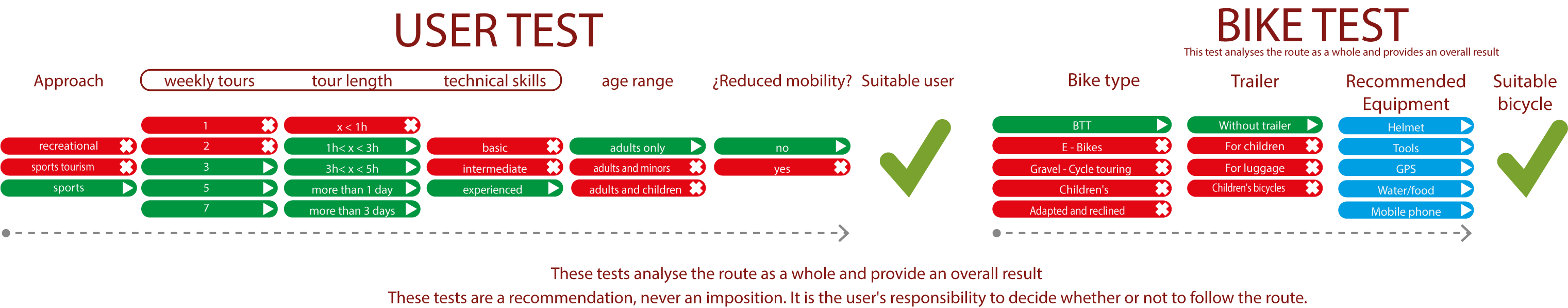
TEST
SAFETY RECOMMENDATIONS
- Sections shared with hikers.
- Transit through the centre of some population centres.
- The Nature Trail has two potentially flood-prone sections in stage 2. This is a seasonal circumstance, during the rainy season or when there is an increase in water flow.
GENERAL RECOMMENDATIONS
- Find out about the technical aspects of the route and the weather on the day.
- Take care of the environment. Take care not to disturb animals or damage vegetation. Respect private areas.
- You must give priority to pedestrians and comply with general traffic rules.
- The environment in which you will be riding is open, free to move around and an area where many activities are carried out (sporting, forestry, livestock and agricultural activities). Always have an understanding, prudent, responsible and respectful attitude.