Noroeste Greenway Nature Trail. Murcia to Baños de Mula
Description
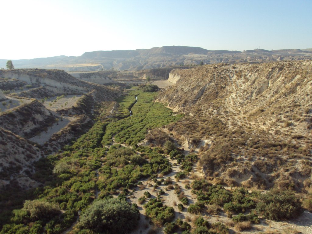
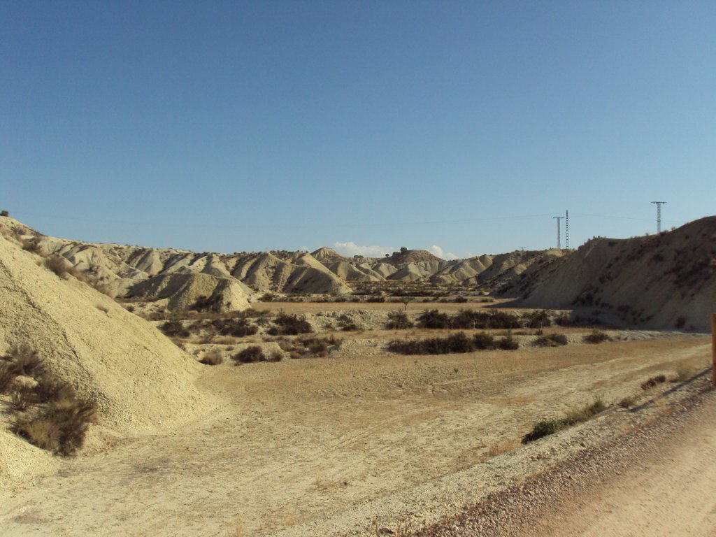
Trekking across the Badlands of Murcia
This is one of the two sections of the Nature Trail that links Murcia to Caravaca de la Cruz via the old railway line. This line fell into disuse in 1971 after 40 years’ poor service. On covering this route, you will be able to see the contrasting scenery in the region of Murcia, ranging from the fertile vegetable gardens of La Vega del Segura to the badlands or uncultivated plots that extend across the plains in the north-west region.

The route begins at the University Campus of Espinardo where, right from the starting-point, you can see the characteristic cuttings built to make the railway platform.
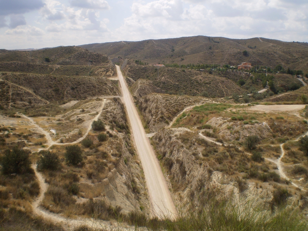
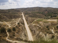
You follow the levelling created for the trail surface for practically the whole route, which is only interrupted sporadically on urban stretches and at a few other points on your trek.
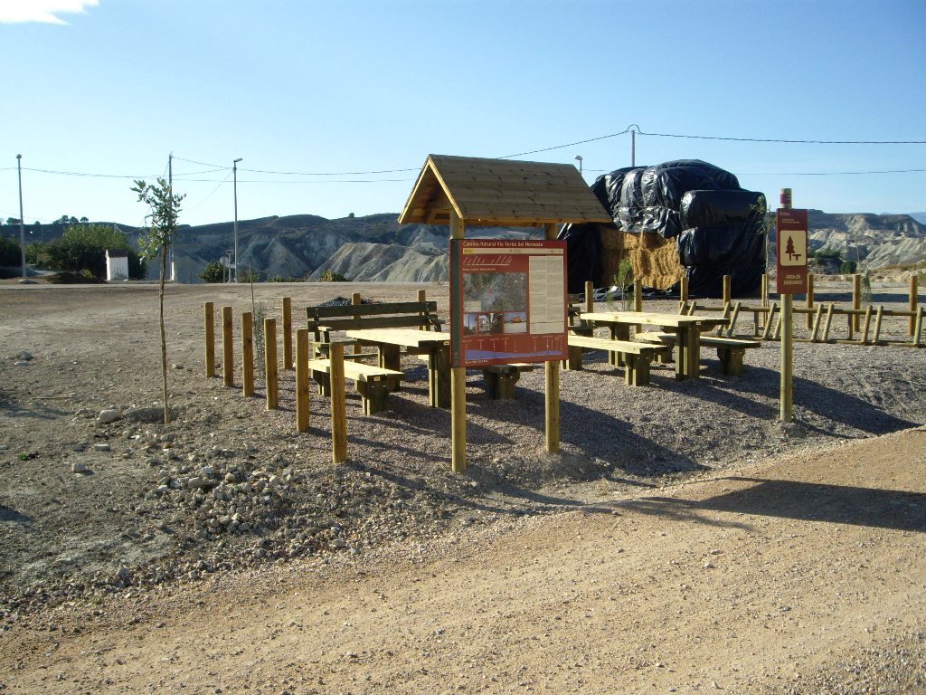
After covering a little more than 1.5 km, you come to the first halt in your journey. In a resting area next to the trail, you will see a sign indicating a turn-off via Los Cordeles eco-tourist itinerary to reach El Cabezo del Aire. Continue along the old railway cuttings where you will be able to see remains of their past in the form of signposts.
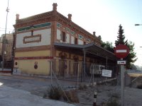
Immediately after the tunnel, you see the town of Ribera de Molina with its old train station next to the trail and a hangar converted into a bar alongside it. There is no chance of getting lost as you continue along the train route until you come to a couple of crossroads with urban roads exiting the town. After leaving Ribera de Molina, you travel one kilometre to then enter Molina de Segura.
Once you have returned to the route again, you continue parallel to the N-301 highway, the old road to Madrid, for a little over 500 m until you reach the old train station of Molina de Segura, a place where a Red Cross walk-in clinic is now located. Follow the Trail, passing an industrial warehouse on your right, to cross the N-344 highway, which links Molina de Segura to Alguazas.
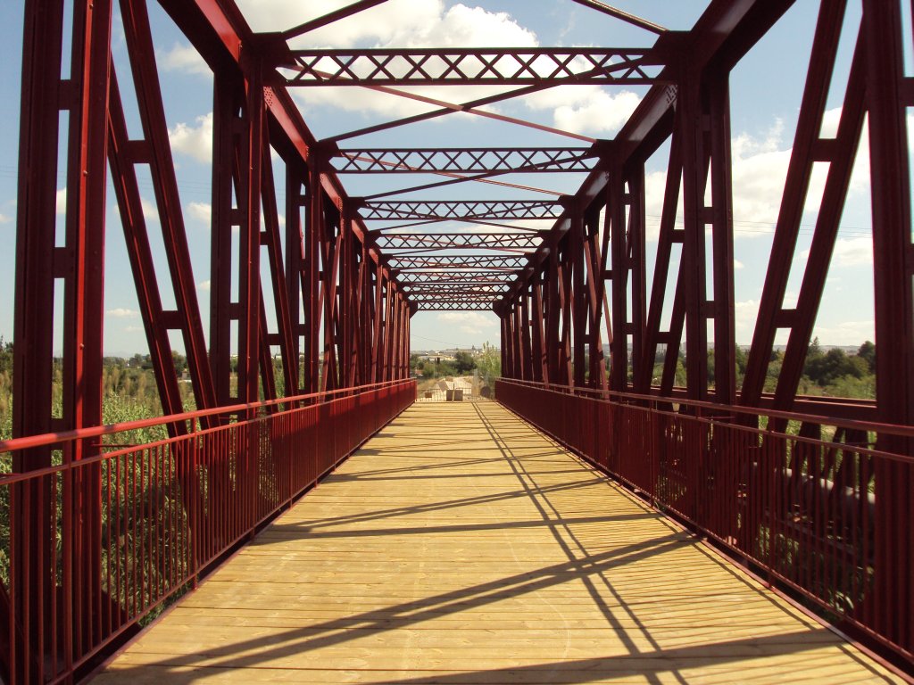
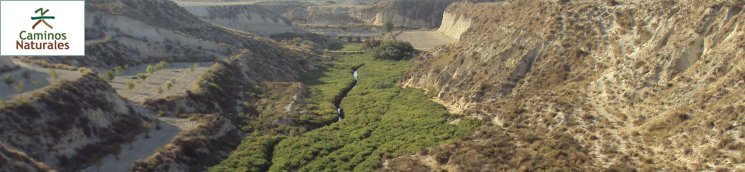
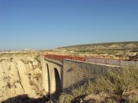
Once you leave the municipality of Molina de Segura, you pass through the Vega del Segura, where you can see an excellent example of the vegetable garden landscapes that are characteristic of the region of Murcia until you reach the bridge that crosses the river. This bridge, which has recently been restored, is another of the many remains of the passing of the railway on the route.

After crossing the bridge, you continue along the railway line until you leave it some 500 m further on and take a pedestrian path on the left-hand side on reaching a crossroads with a tarmacked road. Via this pedestrian path you will enter the town of Alguazas and reach the Town Hall square.
You leave this town along a dirt path, which has only been cleared of scrub, cleaned and profiled due to the existence of an old sewage pipe close to the surface. This stretch comprises some 3.5 km, until you get back to the old railway route once again. Once the new water-treatment plant comes into operation this section is likely to be renovated.
At this point, the route becomes easier and gradually plunges into a landscape that is characteristic of the Murcia badlands relief. You will cover approximately 3.5 km among cultivated land where you will cross three roads altogether until you reach the water-treatment plant of Los Rodeos. From here, you go another three kilometres until you reach the deserted railway station of Los Rodeos. Then, cross a road and follow the trail along the old railway route for another kilometre and then leave it once again along an uphill path on your right-hand side.
Continue along this path until a short distance before you reach the MU-531 highway, which links Alguazas to Campos del Río. At this point, take the lane parallel to this road on the left-hand side, cross over when the lane ends and continue in the same direction along the right-hand side. After passing by a bridge under the road, take the next turning on the right which will lead you once again to the railway track embankment after climbing up a small slope.
A little further on, you will cross another road after passing through an open metal gate and carry straight on along the path in front of you which borders a small irrigation pond. From here, you can see the town of Campos del Río, which you will reach by continuing along the path. Keep on in the direction of the entrance to the town until you come to a square where the old train station is situated.
You leave this town along a path that climbs up next to the cemetery, crossing farming areas until it takes you once again to the old railway route where the water-treatment plant is situated.
After passing over the bridge that crosses the Rambla del Arco, you will come to the municipality of Albudeite. Without changing direction, you pass in front of the old station of Albudeite and then leave the town once again. Seven hundred metres after leaving Albudeite, on the walkway over a tarmacked road, you will see a sign for the turnoff for the eco-tourist route of the Muela de Albudeite.
Carry on just a little further to face the last leg of the Nature Trail, without missing the opportunity to contemplate the view on crossing the bridge of the Barranco del Carrizal, with the Sierra de Ricote in the background and fields of fruit trees.
You will finally reach the old train station of Baños de Mula, where you will be able to link up with the Noroeste Greenway Nature Trail in the direction of Caravaca or end your journey right there and then.
Profile
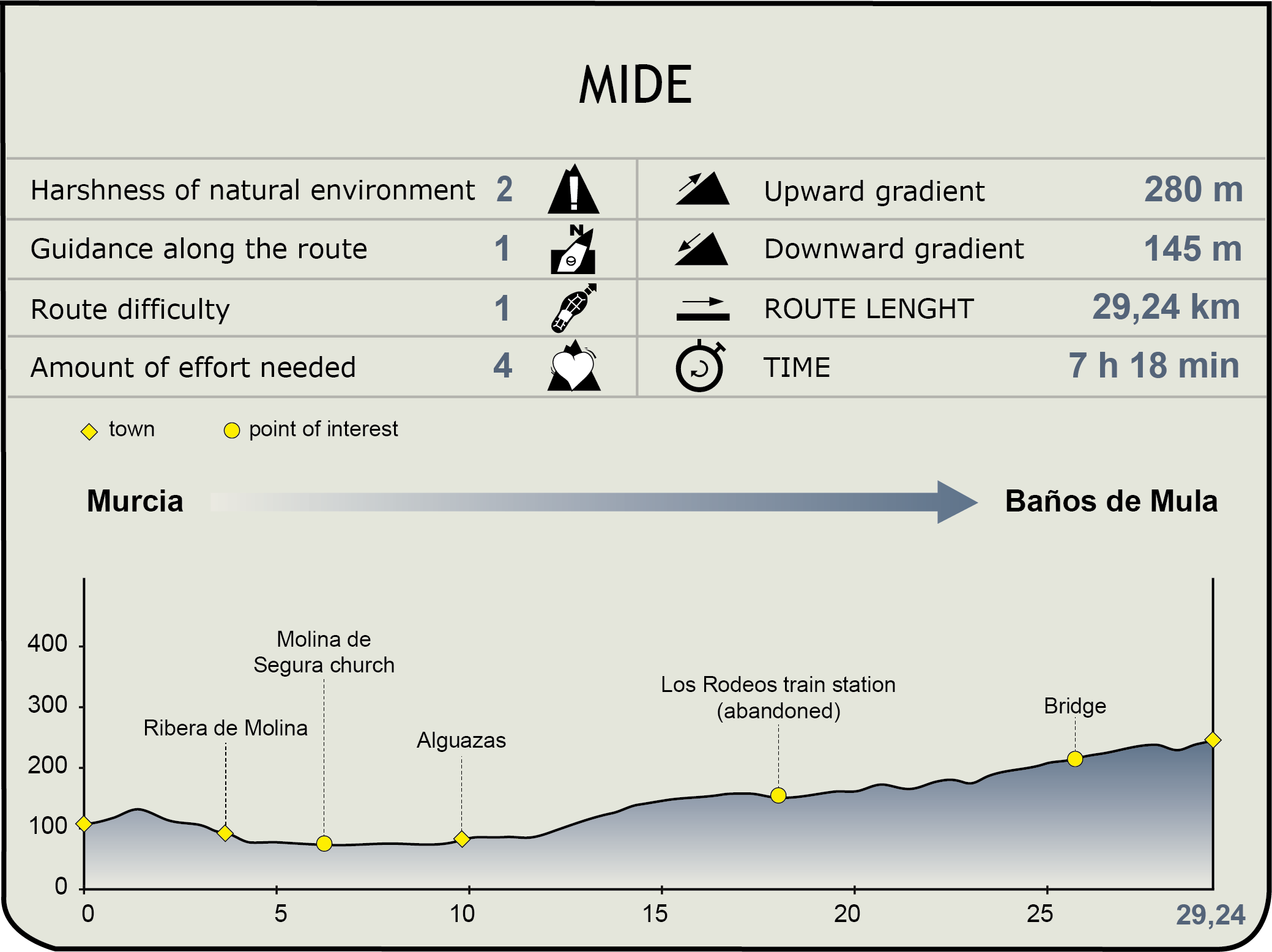
MIDE (Method for the Information of Excursions)
 Harshness of natural environment
- 1. The environment is not risk-free
- 2. There are more than one risk factors
- 3. There are various risk factors
- 4. There are quite a lot of risk factors
- 5. There are many risk factors
 Guidance along the route
- 1. Well defined trails and crossings
- 2. There is a clearly marked trail and signage
- 3. Requires the identification of geographic features and cardinal points
- 4. Requires off-path navigation
- 5. The trail is interrupted by obstacles that have to be gone around
 Route difficulty
- 1. Walking on a flat surface
- 2. Trails with different types of path
- 3. Walking on stepped paths or irregular terrain
- 4. The use of hands or jumping over the terrain is necessary
- 5. The use of hands is required to progress
 Amount of effort needed
- 1. Up to 1 hour of continuous walking
- 2. Between 1 and 3 hours of continuous walking
- 3. Between 3 and 6 hours of continuous walking
- 4. Between 6 and 10 hours of actual walking
- 5. More than 10 hours of continuous walking
Featured
Further information
Badlands
Uncultivated lands or badlands are a type of landscape that is characteristic of arid areas and of rock formations rich in clays that have been badly eroded by the wind and water. The presence of geological forms such as canyons, channels, ravines and “fairy chimneys” (rock pillars with shapes on their peaks) is usual.
Although Badlands is a term used to refer to barren land, land that has little vegetation and where floods have contributed to forming deep channels is also referred to as a lunar landscape. It affects the slopes of soft rocks (clays, pipeclays, gypsum) in a sub-desert climate as a result, in general, of man’s destruction of the plant cover.
Badlands are well developed in certain areas of the Mediterranean side of Spain, especially in the southeast of the Peninsula: the area of Tabernas, the Vera basin and, in the region, the Mula-Fortuna basin and in sectors drained by some tributary watercourses of the Rivers Guadalentín y Segura. Other examples of these formations are the Bardenas Reales in Navarre.
Multimedia