- Home
- Rural Development
- Nature Trails
- Nature Trails
- East Sector
- Molins D'aigua
Ruta dels Molins d´Aigua Nature Trail
Description
A route for walking, swimming, enjoying and learning
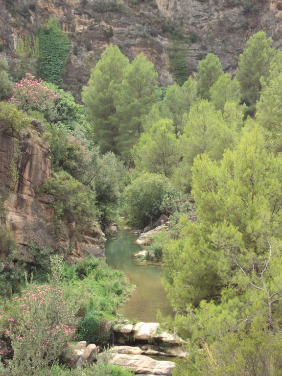
Along the Molins d´Aigua Nature Trail, you can verify the different ways in which man was related to water in the past, maintaining a balance with the environment he lived in. This relationship between water and man is evidenced in the different uses that can be seen along the trail, such as for energy, production and recreational purposes, which are materialised through mills, vegetable gardens and bathing areas.

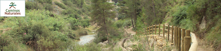
This route runs along diverse types of paths and enables you to get to know the valley of the Lucena river from different perspectives, as you can walk at riverbed level and climb up to where you can see the whole river, enjoying spectacular views of the valley and the town of Lucena del Cid.
The trail begins at the source of the Lucena river. From the CV-1740 highway, you access a forest track which takes you to the beginning of the trail. Following the signs, you will walk down along a trail and then along a path until you reach the river. From this path you can contemplate, next to the ruins of a country house, an interesting panoramic view of the valley. This path takes you to the first mill you will find on the route.
From the Molí Ros, you take a dirt track that climbs along the hillside to then take the dirt track where the route began. A detour a little bit further on crosses a small group of houses called Mas de Galapo. After passing the houses, you take a track that leads you once again to the riverbed. The trail continues, following its course and crossing over it via a concrete ford. A little further on, you will come to the next mill, Molí Goçalvo.
From here, you cross the river via an unusual structure that is an irrigation canal, a ford and an irrigation dam all at once. Now, on the right-hand bank of the river, the track starts its climb. Along this stretch you can see traditional vegetable gardens irrigated by the river, a country house estate (Mas de Mollón) and the environment.
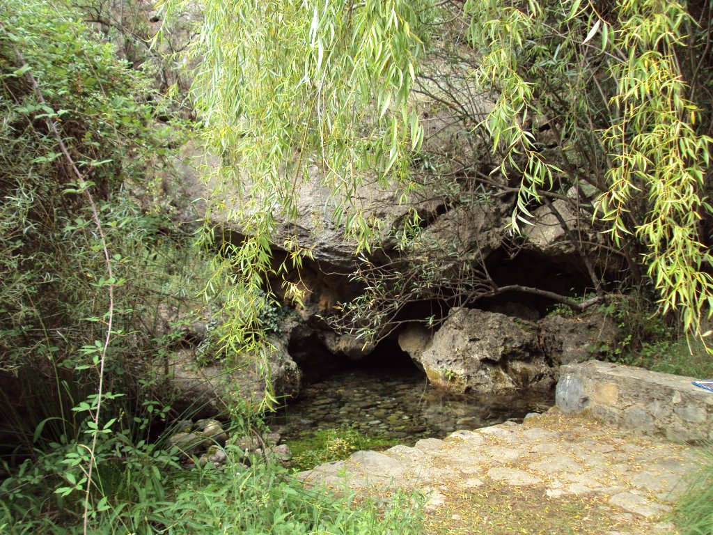
On passing over a stone bridge, you join a concrete section that runs along the left bank. After passing by an interesting washing place built over the irrigation canal you cross over the river again via another ford. After passing nearby a restored mill, it is interesting to stop and look at an old stonework wall.
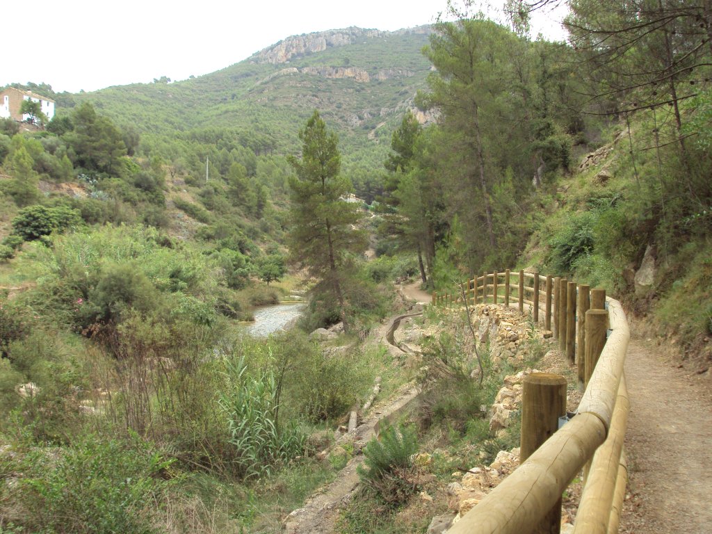
The trail continues at river level to then climb slightly and link up to a tarmacked section leading to a small group of houses, and then lead you to the riverbed once again further on. A short way on along this stretch, you will soon come to a small gravel beach. Approximately at this point, the trail is raised over the river and has a very well preserved 200-300 metre-long traditionally paved stretch.

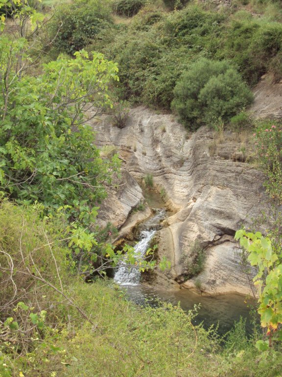
Just before crossing an old stone bridge, you can stop to look at a small canyon dug out by the water. Once you have passed the bridge, you reach the ruins of a group of mills that used water power in a sequential way, passing from the highest to the lowest. The latter was destroyed by a flood. A few metres further on, the trail turns to the right, climbing above the valley to then descend again to the level of the riverbed. On the right, you can see a long walkway over the river, La Badina, which leads to the town of Lucena del Cid.
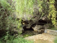
The trail continues alongside the river to then immediately reach one of the most interesting bathing points on the journey. In addition to a small canyon dug out of the rock, this spot contains an area of water retained by an irrigation dam and a recreational area.
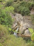
The trail continues by following the course along the left bank passing in front of the Molino el Batán, which was used in bygone times to card wool. A few meters further on, you will cross the river once again at the point indicated to then follow its course up a slope on the right bank. You will leave, on your right-hand side, the wastewater plant of Lucena del Cid, where the track changes into a path and, after going round a couple of sharp bends, a signpost indicates that you have to take a path that goes down to the river. After following its course you will pass by a small waterfall formed by the pond of the Molí de Panissares.
It is at this point where you must cross the river to go up a steep slope on the other side. After reaching the top of the upper part of the path, the descent begins, leading you for the last time to the Lucena river.
Before you get there, you should stop half-way down to take a look at the panoramic view of the spot known as Toll Blau. Here you can also see the last mill on this route, known as the Molí de Penya Roja. After passing over the walkway that crosses the river, you should take the track on the right to then reach, just after passing the Mas de Penya Roja, the end of this route.
Sites of interest
Profile
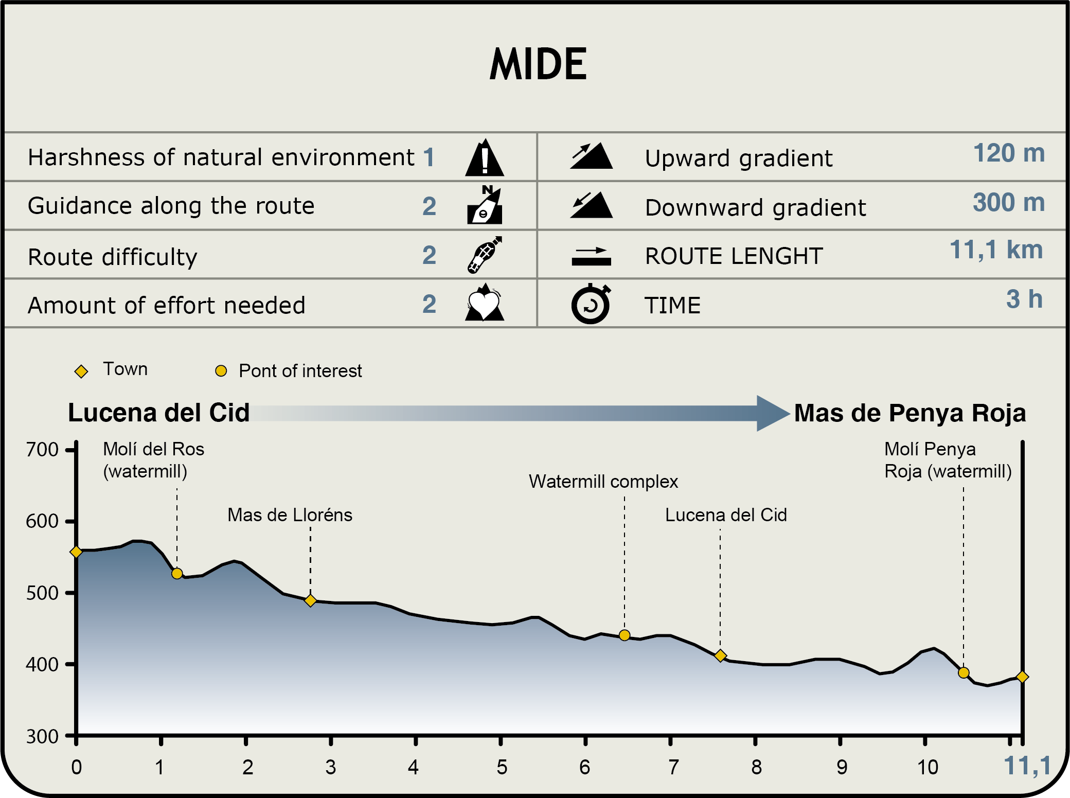
MIDE (Method for the Information of Excursions)
 Harshness of natural environment
- 1. The environment is not risk-free
- 2. There are more than one risk factors
- 3. There are various risk factors
- 4. There are quite a lot of risk factors
- 5. There are many risk factors
 Guidance along the route
- 1. Well defined trails and crossings
- 2. There is a clearly marked trail and signage
- 3. Requires the identification of geographic features and cardinal points
- 4. Requires off-path navigation
- 5. The trail is interrupted by obstacles that have to be gone around
 Route difficulty
- 1. Walking on a flat surface
- 2. Trails with different types of path
- 3. Walking on stepped paths or irregular terrain
- 4. The use of hands or jumping over the terrain is necessary
- 5. The use of hands is required to progress
 Amount of effort needed
- 1. Up to 1 hour of continuous walking
- 2. Between 1 and 3 hours of continuous walking
- 3. Between 3 and 6 hours of continuous walking
- 4. Between 6 and 10 hours of actual walking
- 5. More than 10 hours of continuous walking
Featured
Further information
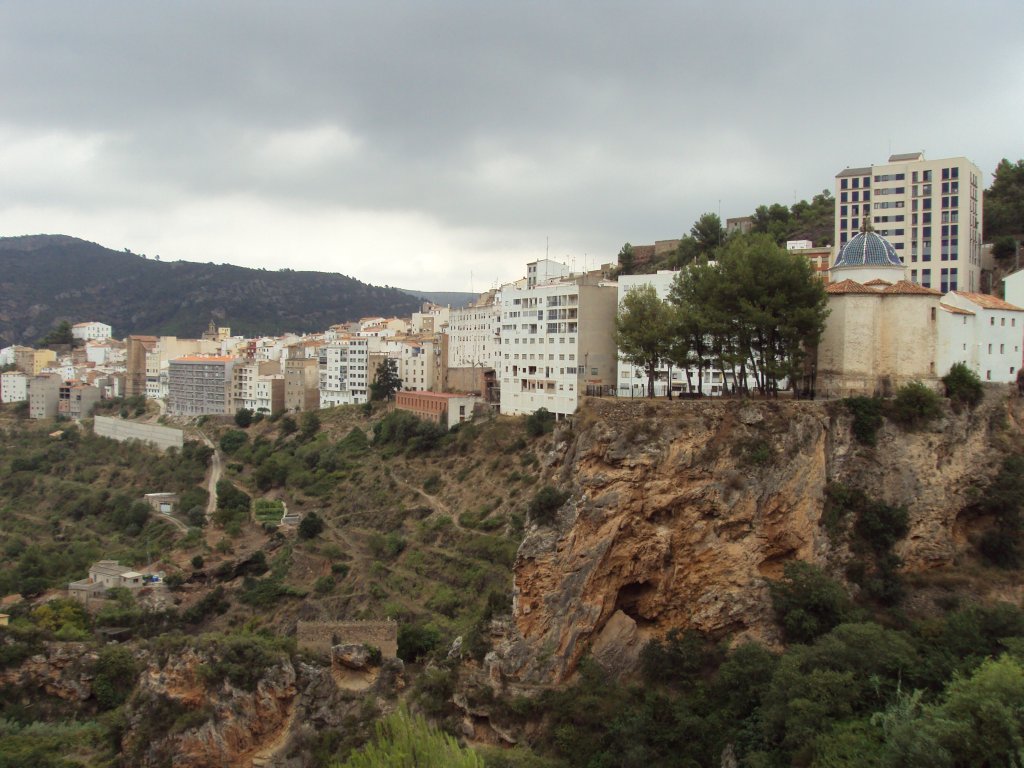
Lucena del Cid
Situated on the medium-sized mountain of l’Alcalatén, at an altitude of 568 m, and 33 km from Castellón, Lucena del Cid is strategically located on the narrow, elongated back of a mountain spur, in the middle of some foothills which, like a gigantic and rough staircase, descend from Penyagolosa (the maximum height in Valencia) to the sea. From its high position, it dominates the eponymous deep river valley, which has been a route of access to the high lands of the interior since bygone times
Multimedia