
Stage: Plasencia - Jarilla
Description
From the monumental Plasencia and the banks of the River Jerte to the Tierras de Granadilla
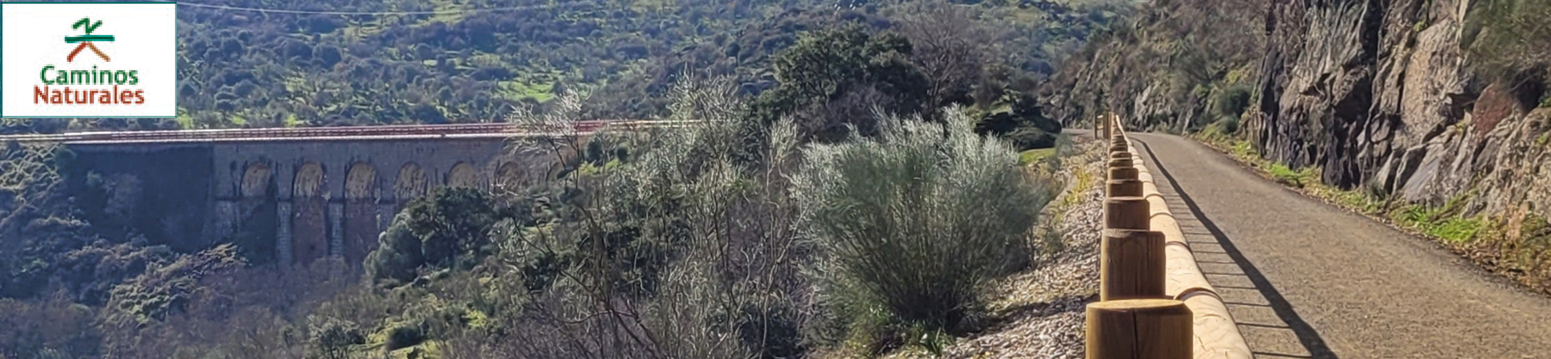
This stage of the Via de la Plata Nature Trail harnesses the route of the old Plasencia-Astorga railway (also known as Palazuelo-Astorga) to take travellers from the Plasencia railway station to the municipal boundary between Jarilla and Casas del Monte. Along the trail you will discover only railway infrastructure such as viaducts, tunnels and stations which have been given a new life for recreational use.
This is a fairly simple and safe itinerary for hikers or cyclists. Except for a first urban section, the remainder of the route follows the old railway platform, running over a compact and wide road surface, with wooden fences or metal handrails to protect travellers where necessary. Before starting out of this section of the Vía de la Plata Nature Trail, if the traveller does not yet know Plasencia, visiting the city’s historic centre, which has been declared an asset of cultural interest since 1958, is highly recommendable.
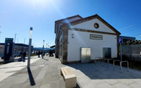
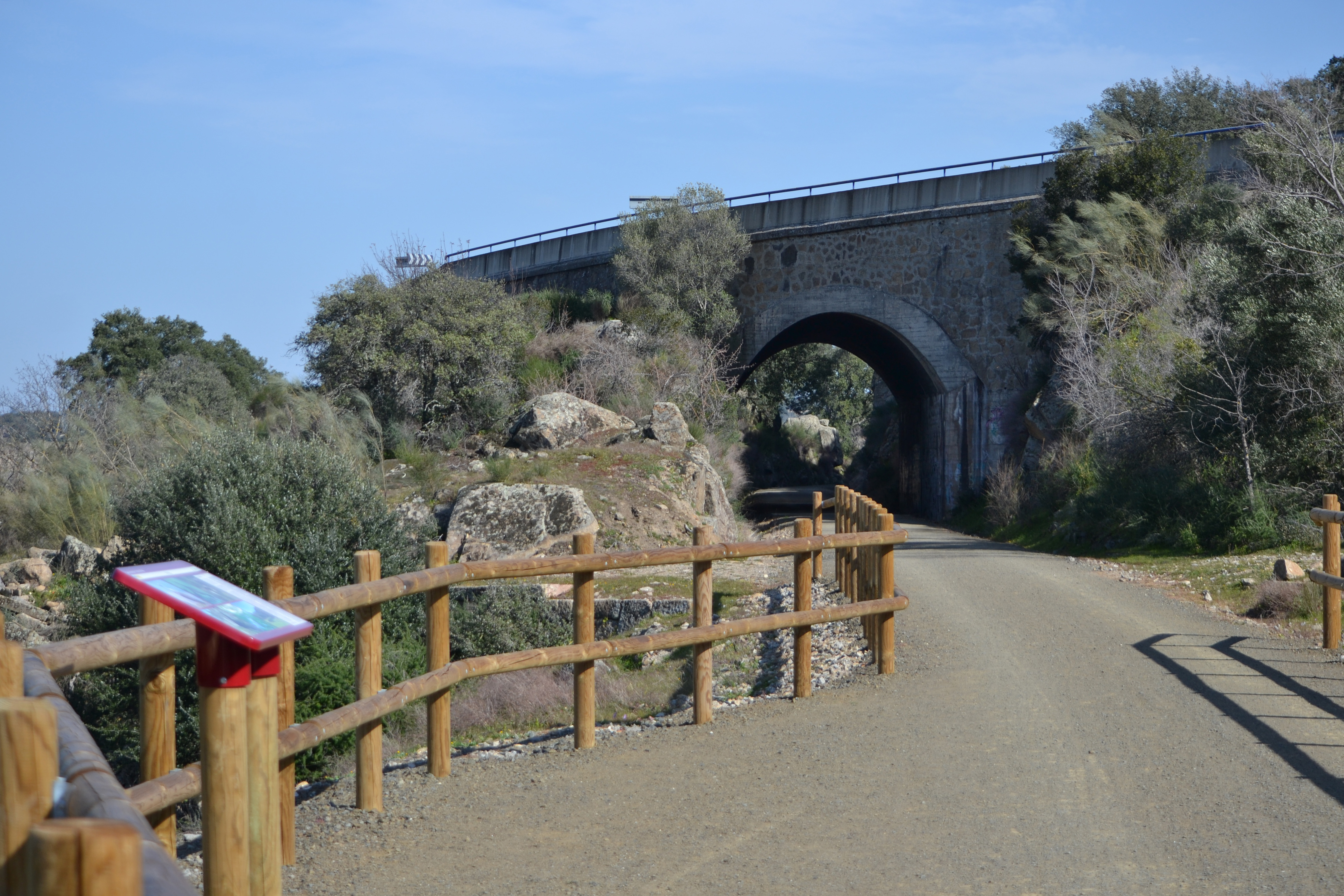
This route begins at the gates of Plasencia train station. This infrastructure is currently operational and has connections with Badajoz, Cáceres, Mérida, Madrid and Seville, among others. The first kilometre is exclusively urban, running through the streets surrounding the station until you reach the River Jerte, beside the Tenerías bridge. From here, turn left towards a tunnel that passes right under the railway lines. Once on the otherwise, you will find a panel showing information about the Nature Trail and from here you can take a path that starts on the right and leads up to the old railway station platform.
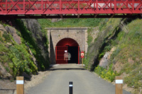
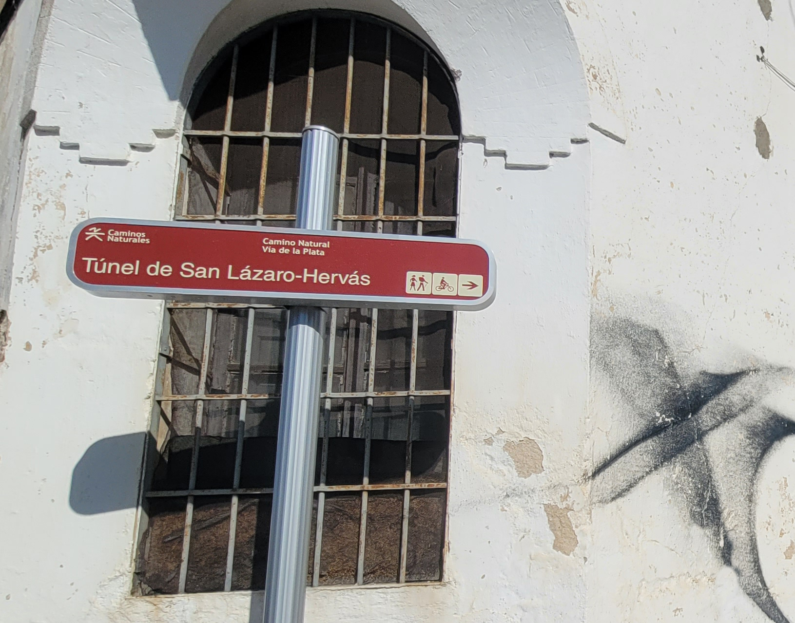
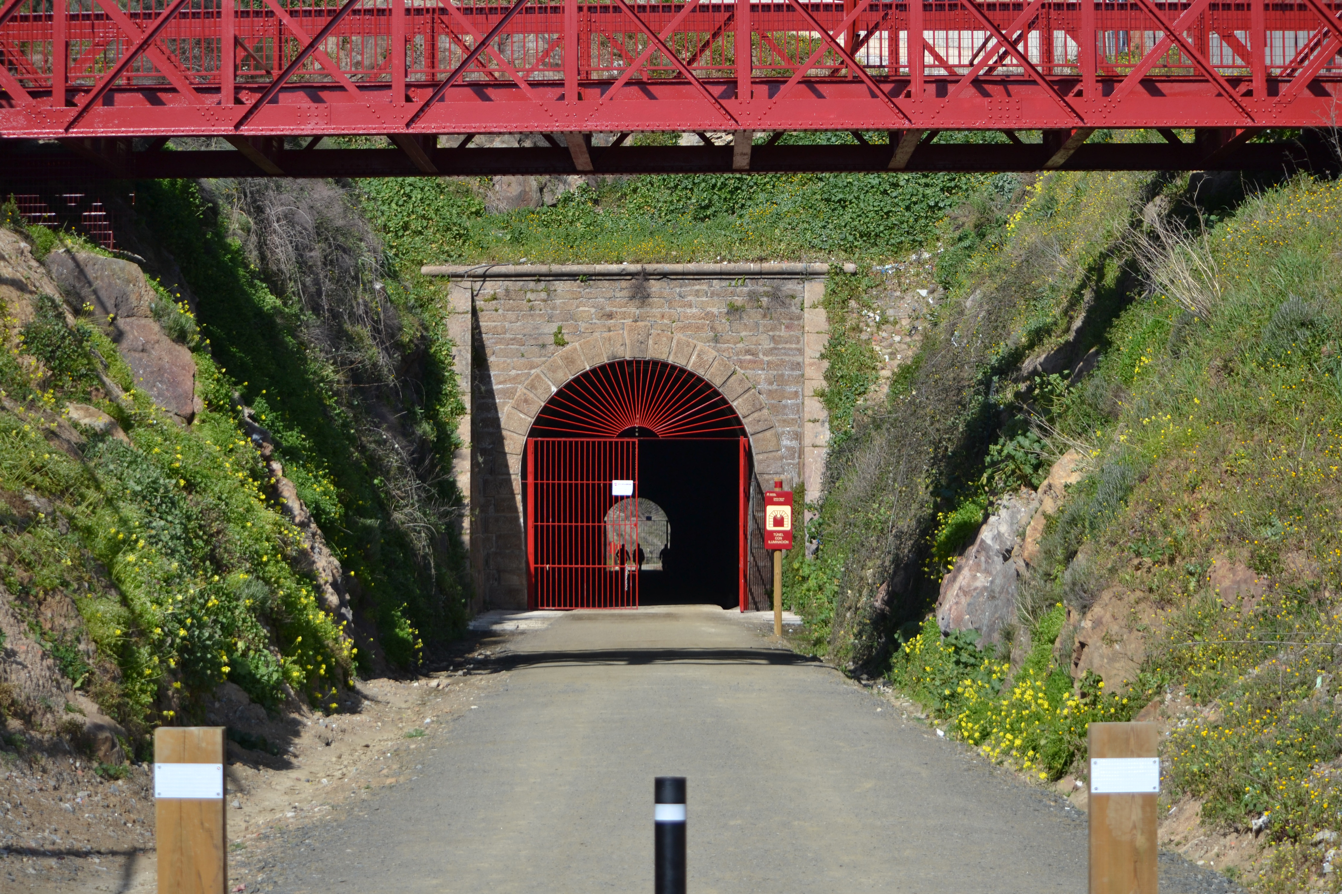
From this point on, only pedestrians and cyclists may pass; there are occasional crossings giving access to farms or houses in some sparsely-populated areas, albeit they are clearly signposted. You will immediately reach the first of the major pieces of infrastructure that were built for this railway line: the San Lázaro tunnel. This 178 m tunnel was built in the late 19th century. It has lighting and access is closed between 19.00 and 09.00.
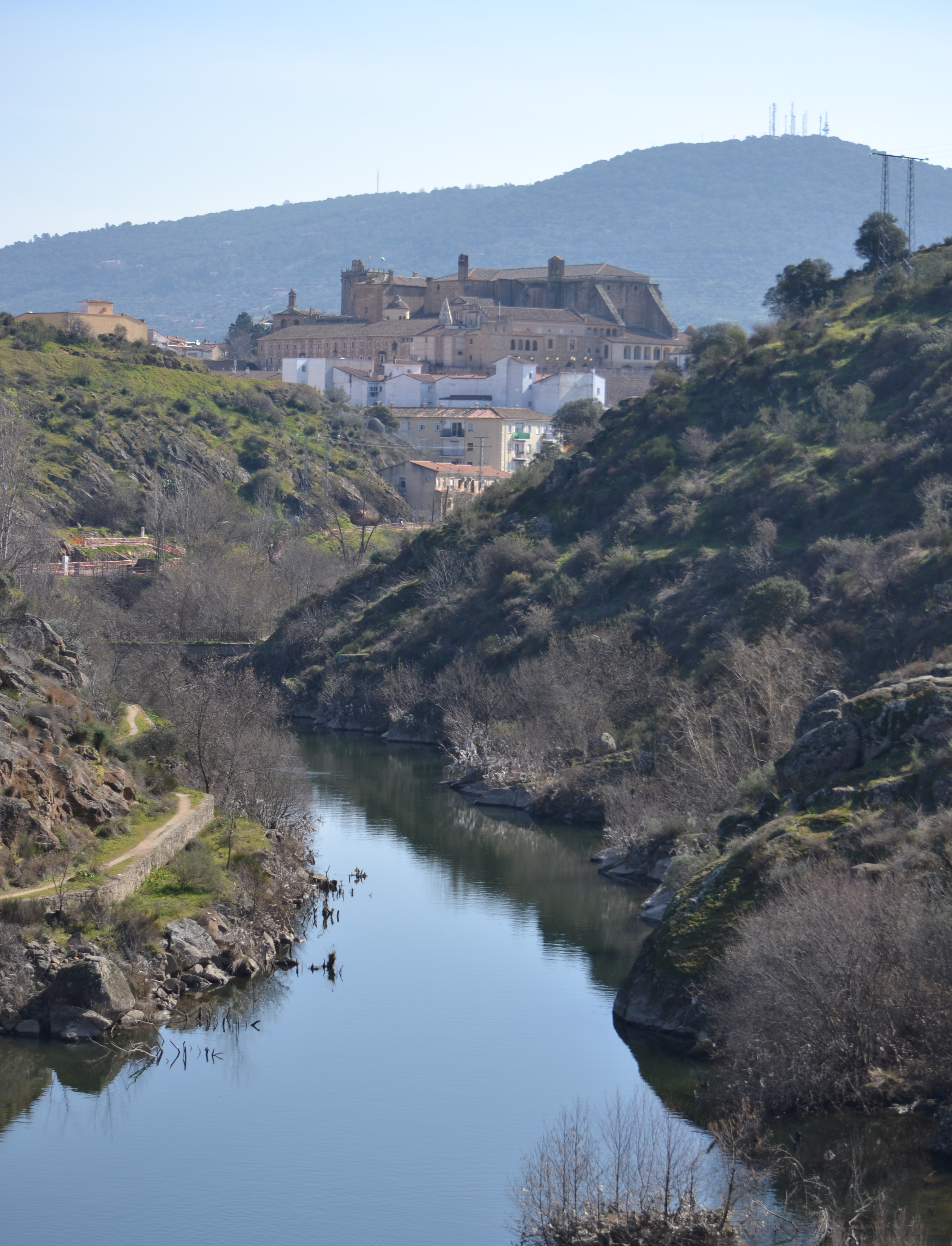
Once you have passed through the tunnel, the change of landscape is surprising, going from a purely urban environment between the streets in the outskirts of Plasencia to a stroll over the Jerte on its left bank, which in this section is sandwiched between granite slopes. About 300 m from the tunnel exit, a viewpoint has been set up that will allow you to admire this whole area.

As the route continues its gentle yet steady ascent, on the other side of the river you can see a variety of hydraulic features, such as the ruins of old mills and a dam. Just before it narrows into a trench running under the N-630, you can also see the water treatment plant and the unmistakable silhouette of the Plasencia conference centre.
From this point on, and for the entire route, on both sides of the trail you will see the classic auxiliary buildings, now disused, such as the navvies’ or railwaymen’s huts.
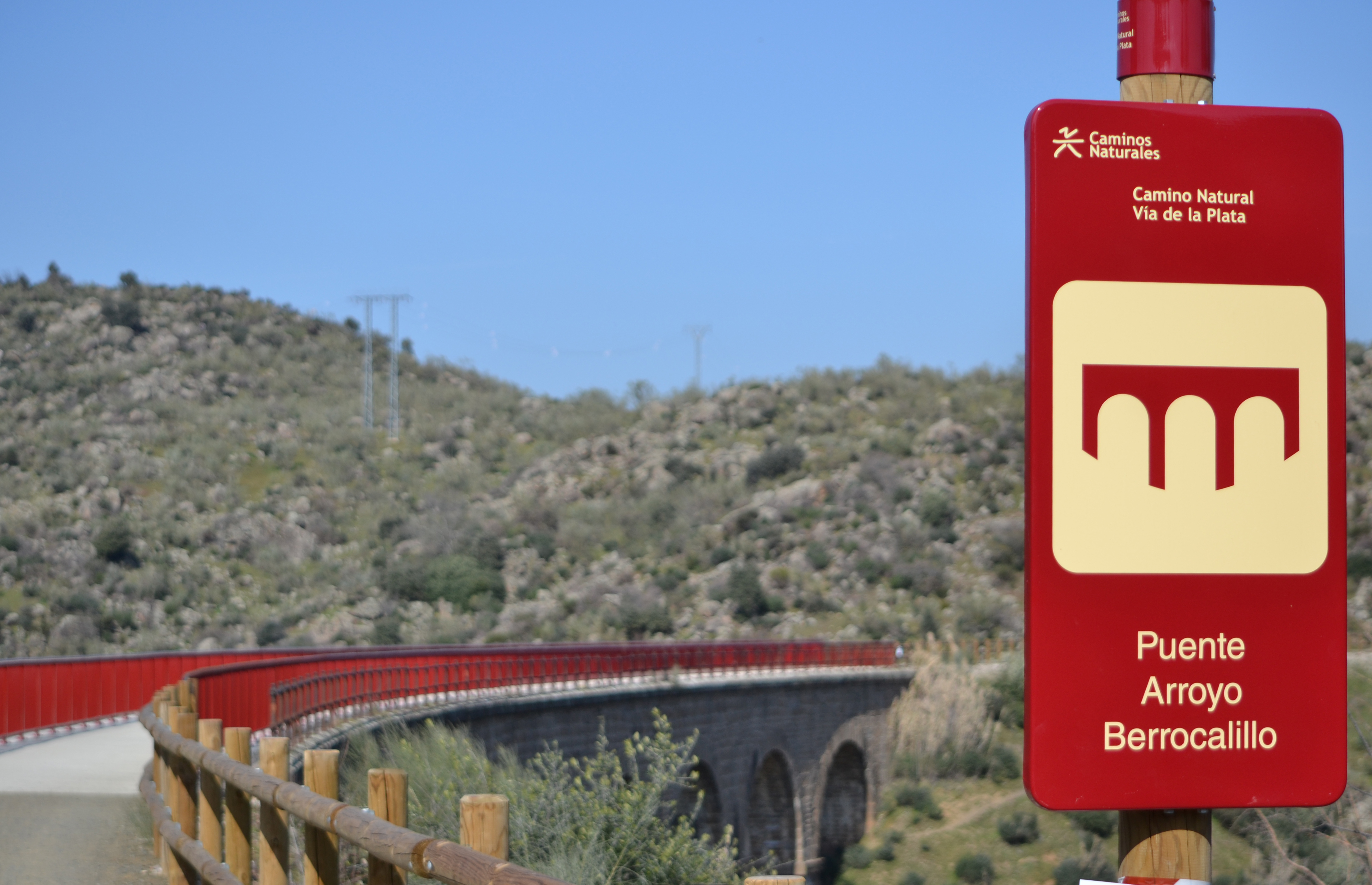
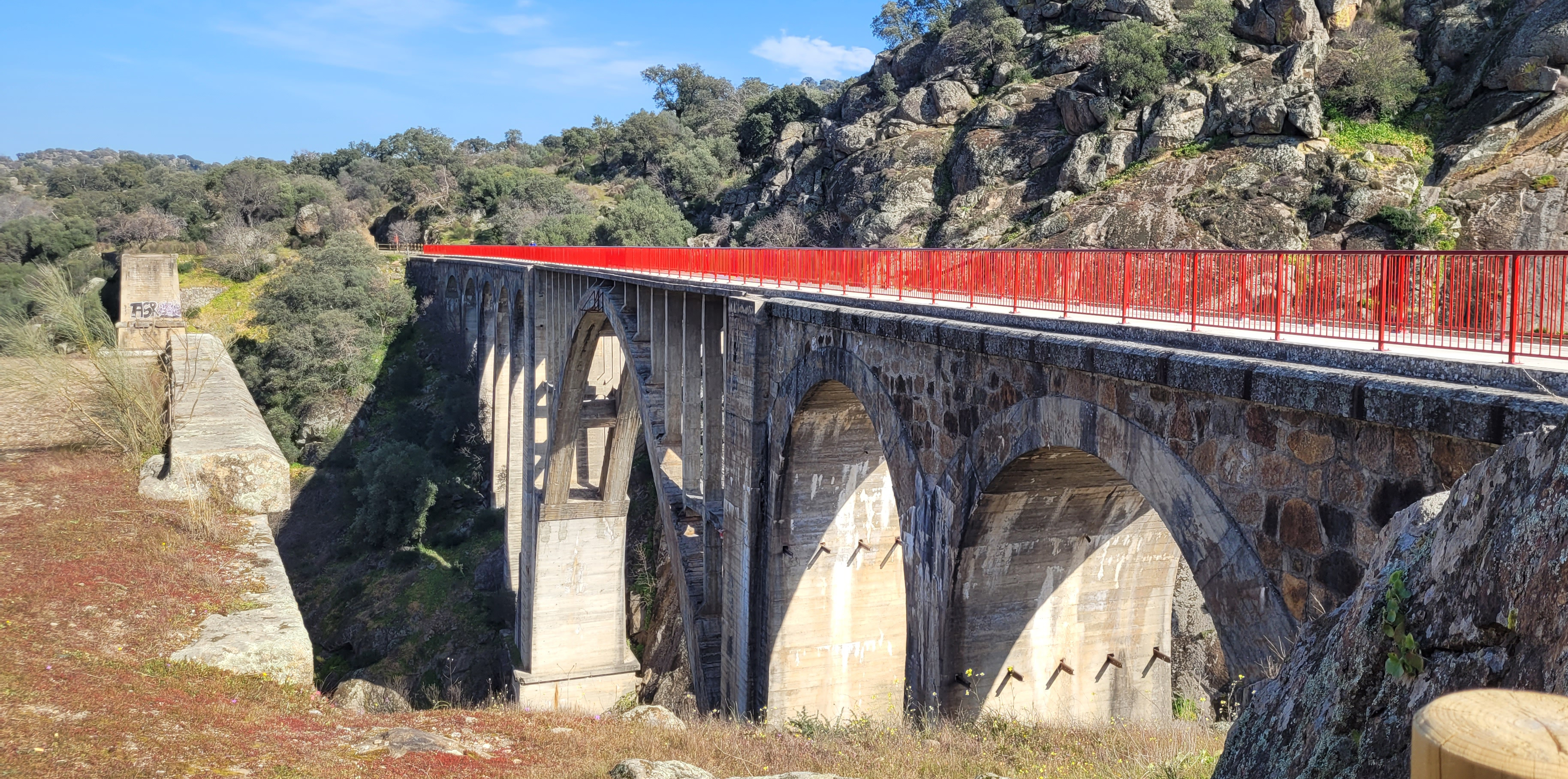
And without neglecting the buildings that were part of the old railway, you will reach the viaduct over the Berrocalillo stream, a bridge built in stone that is around 150 m and features seven spans. And after barely half a kilometre, you will reach, in this case, the impressive viaduct over the River Jerte. This 200 m-long concrete infrastructure has a large central arch directly over the river, flanked by other, smaller arches formed by the pilasters that rest on the ground. Beginning in 1929, this bridge replaced, for logistical reasons, a previous one built in iron and resting on brick and ashlar pilasters. Of the latter bridge, the pilasters remain, just to the left of the modern bridge, as do the bases. In fact, the only that is located to the south has been used to set up a rest area with picnic tables and a viewpoint over the river.

After crossing the Jerte, the trail narrows into a trench, and upon leaving it you will again notice an obvious change in the landscape. Whereas until now it had taken place by the river, in company above all of Mediterranean scrub, today the old railway enters a cork oak forest with holm oaks, which is denser to the east and oak-studded pasture to the west. Before the river and the trail separate once and for all, you can see the “El Berrocalillo” power station, which was opened in the early 20th century.
This section of the trail runs through Mount Valcorchero, one of Estremadura’s two Protected Landscapes, before reaching a pass under the N-630 road, where a viewpoint has been installed with an information panel about Valcorchero.
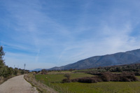
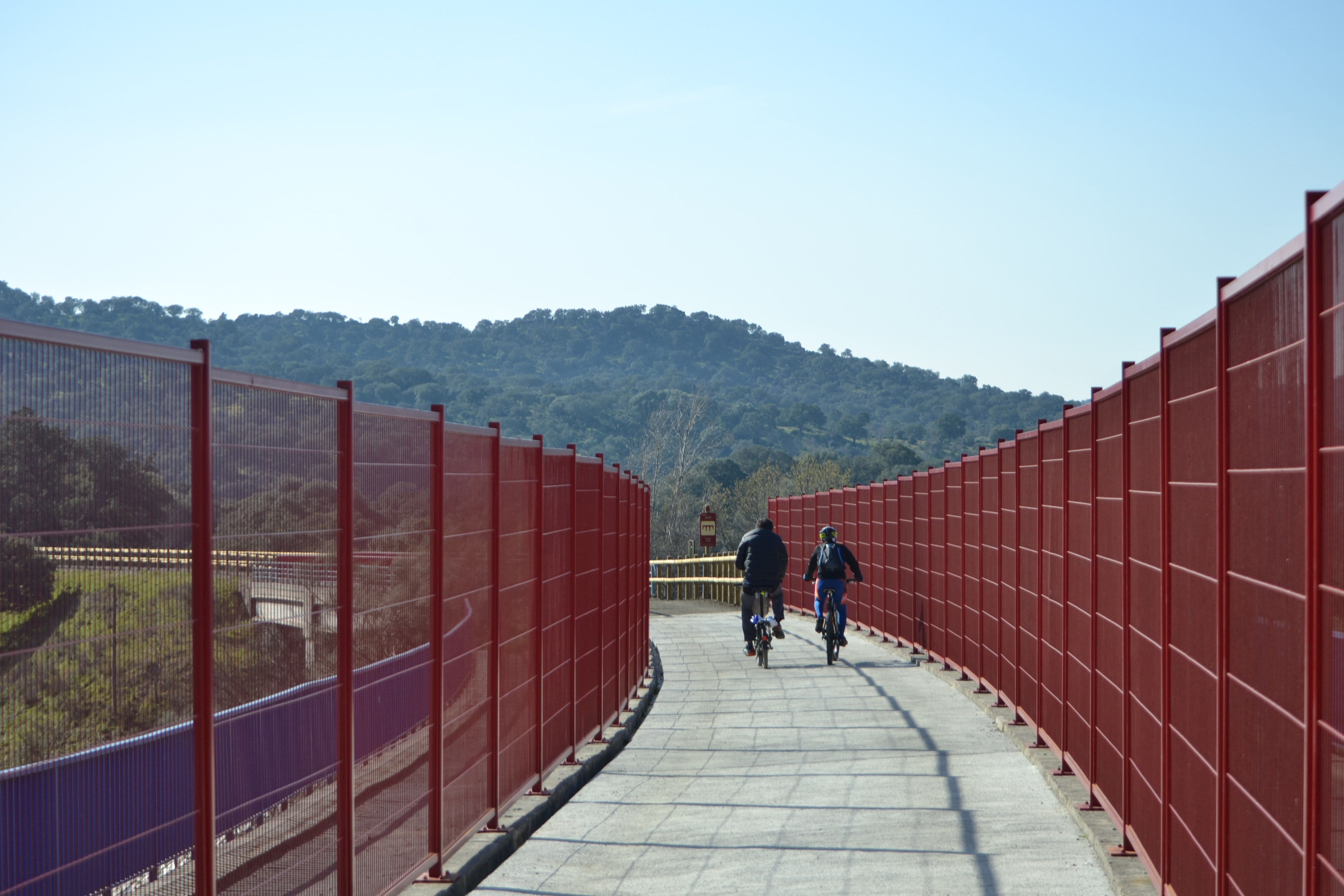
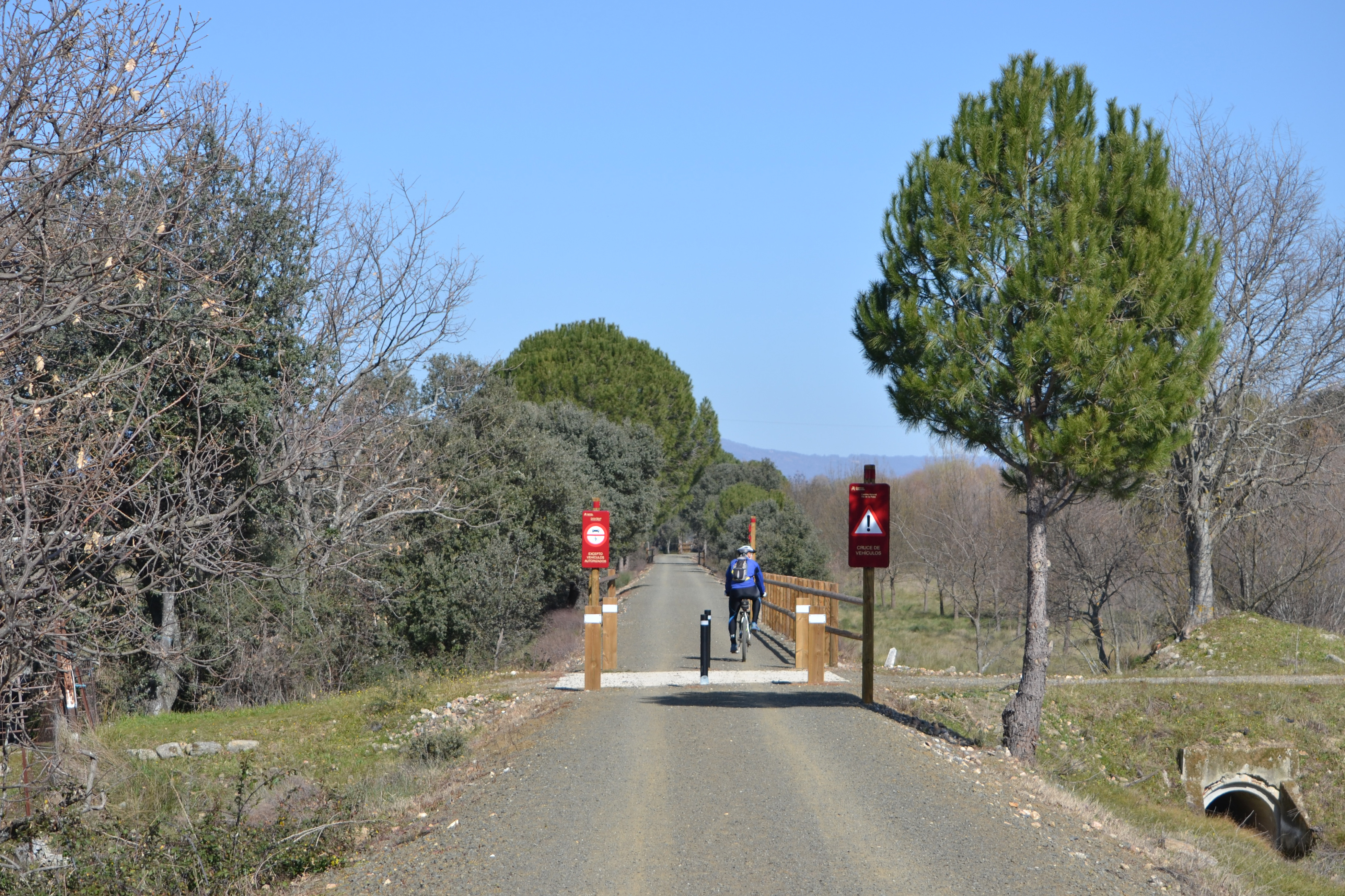
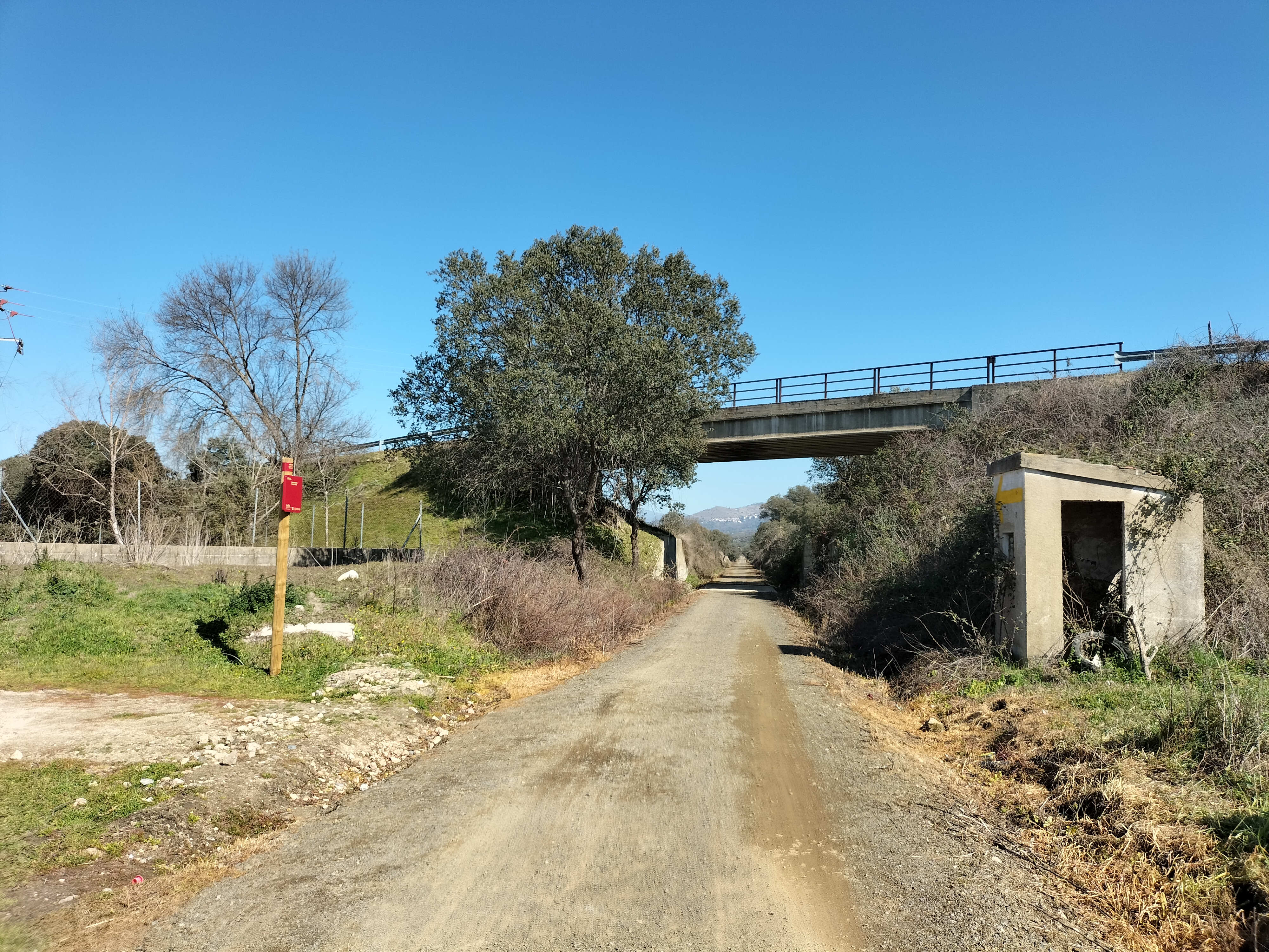
After the road, the route returns to the trenches dug for the railway, with views opening only when you pass through the valley of a stream. This leads to a series of two viaducts, the first over the N-630 and the second over the A-66. Both are properly protected with wooden fences and railings to prevent accidents. The breadth of the view from the top of the bridges offers an interesting panorama of the Traslasierra Mountains; some of the villages on its slopes, such as Villar de Plasencia and Cabezabellosa can be seen.
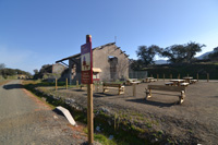
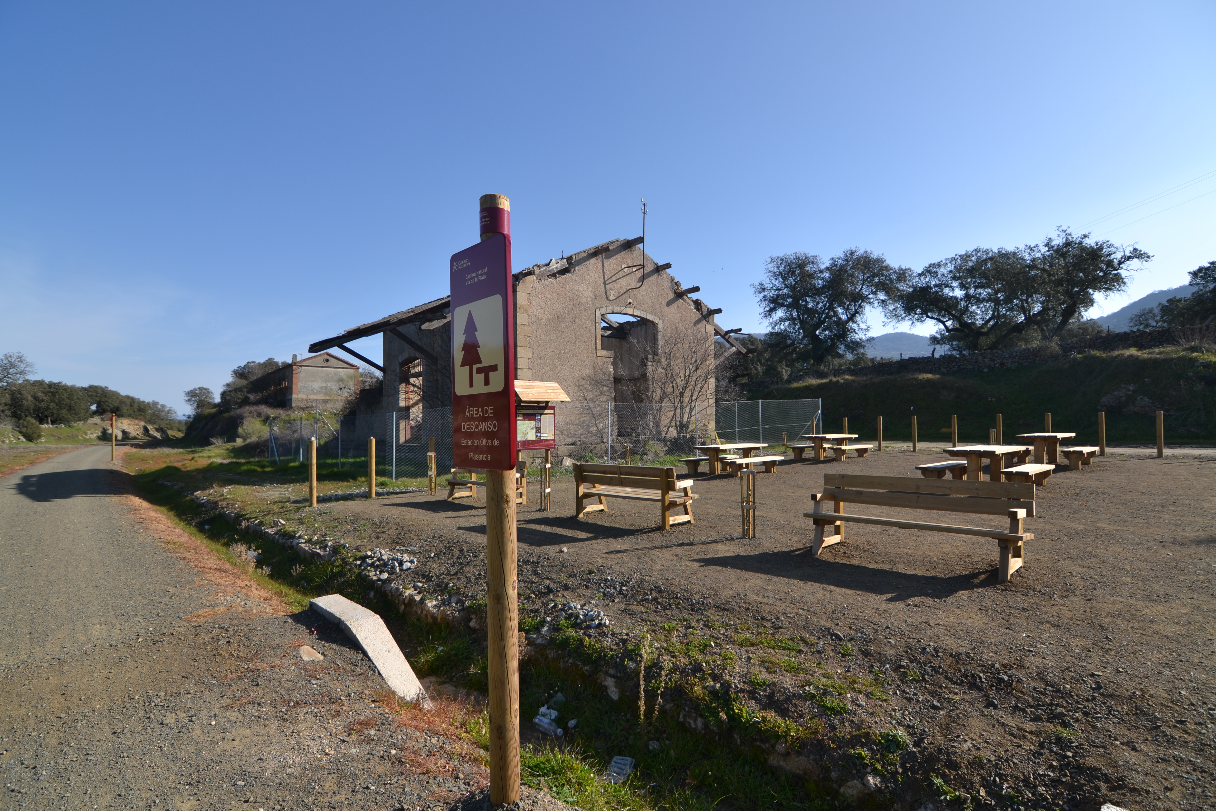
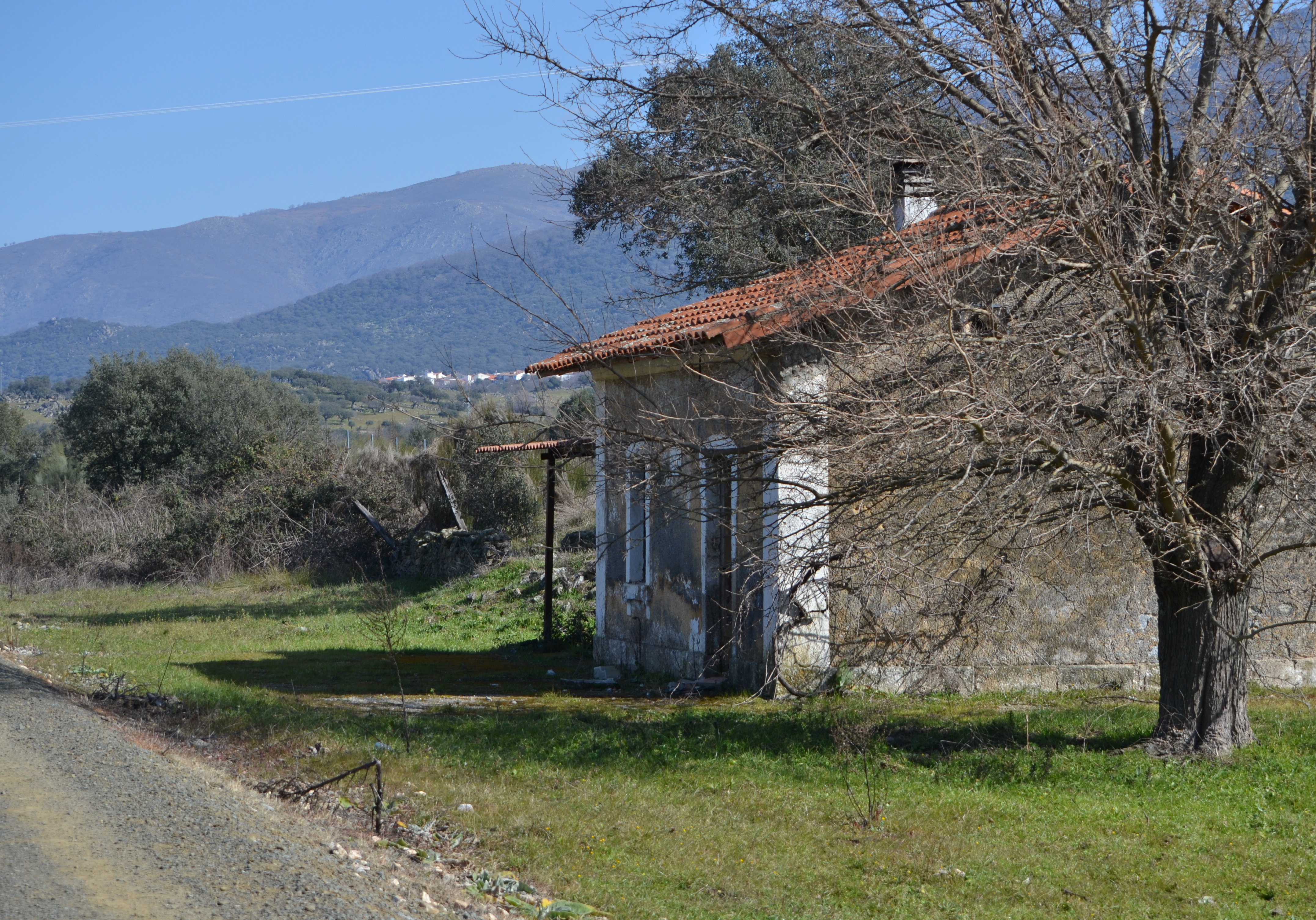
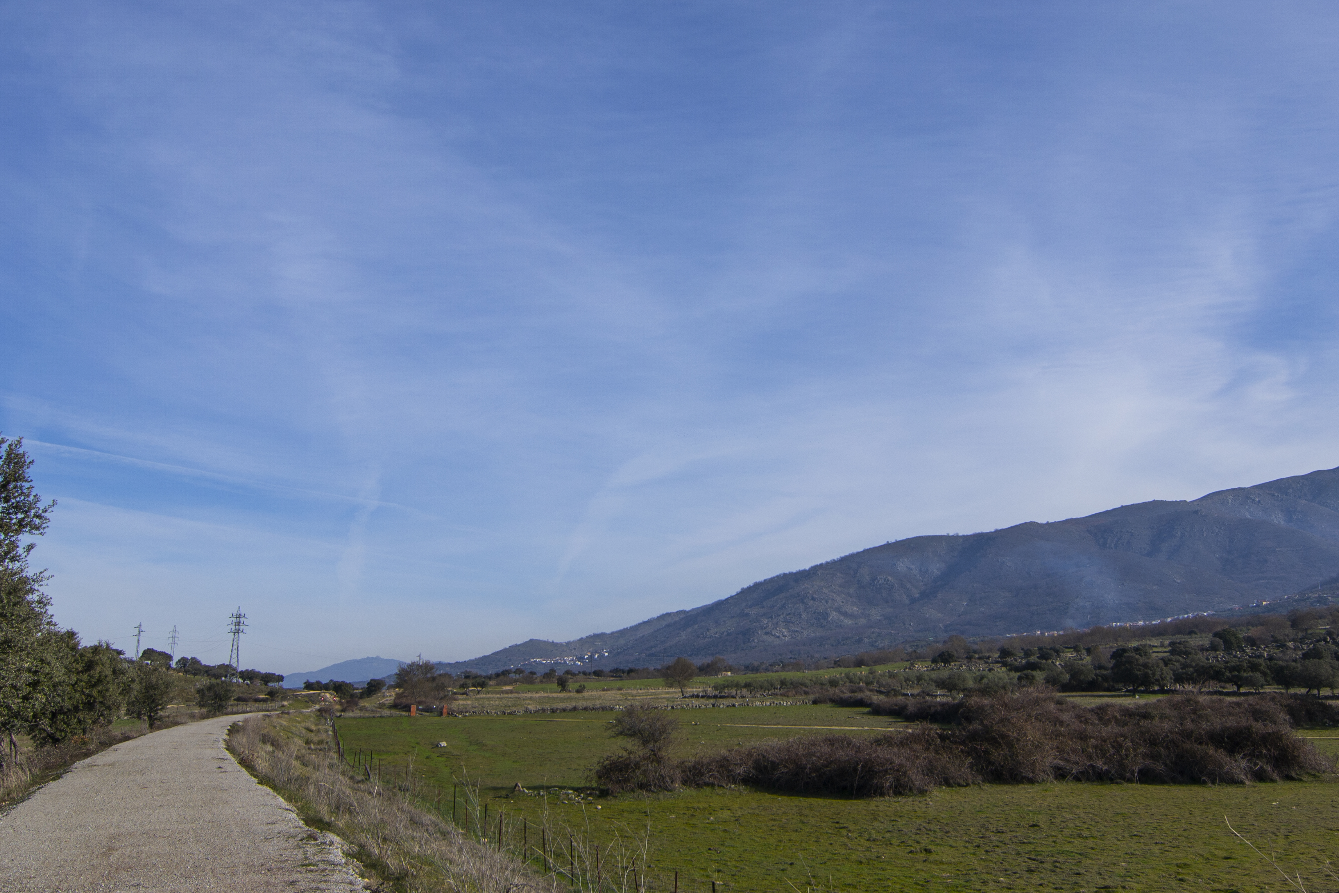
From this point, the itinerary and the two roads that have just crossed will always run in parallel until the end of this section of the Vía de la Plata Nature Trail. On the other side of the A-66, the cork oak is replaced by holm oak and sometimes by pastures for livestock, especially cattle, or crops. The route gradually moves away from the road and, after 1.7 km, you will reach the old Oliva-Almendral station. A couple of buildings from this complex still stand: the loading warehouse and an adjoining house on a hill. Nothing remains of the travellers’ building and an extensive rest area has been built on the plot it occupied.
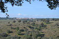
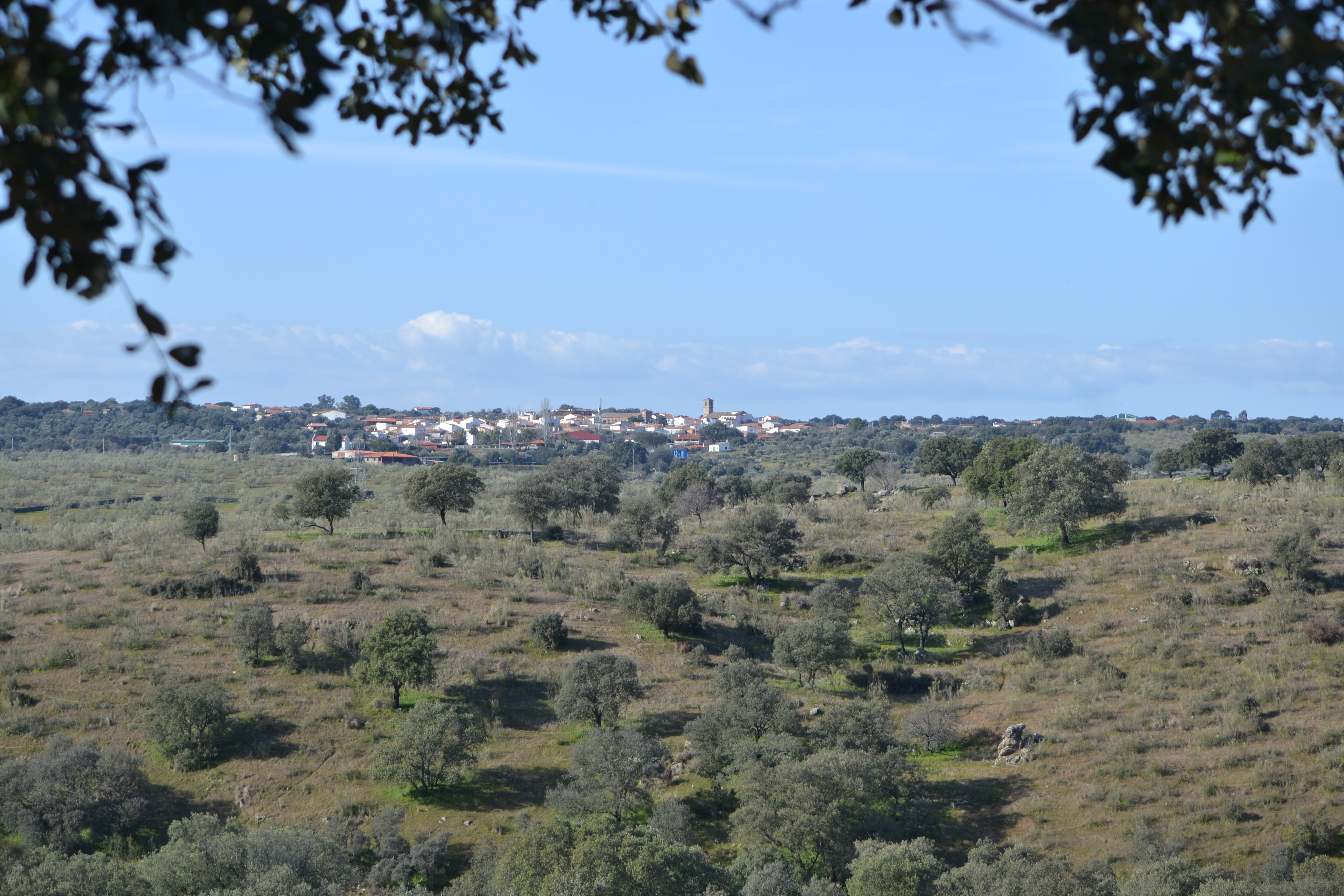
You then abandon this enclave to pass over the CC-121 road, which leads to Oliva de Plasencia. In fact, the silhouette of this village, dominating the meadows and pastureland, will be a constant on the left side of the trail when views open up.
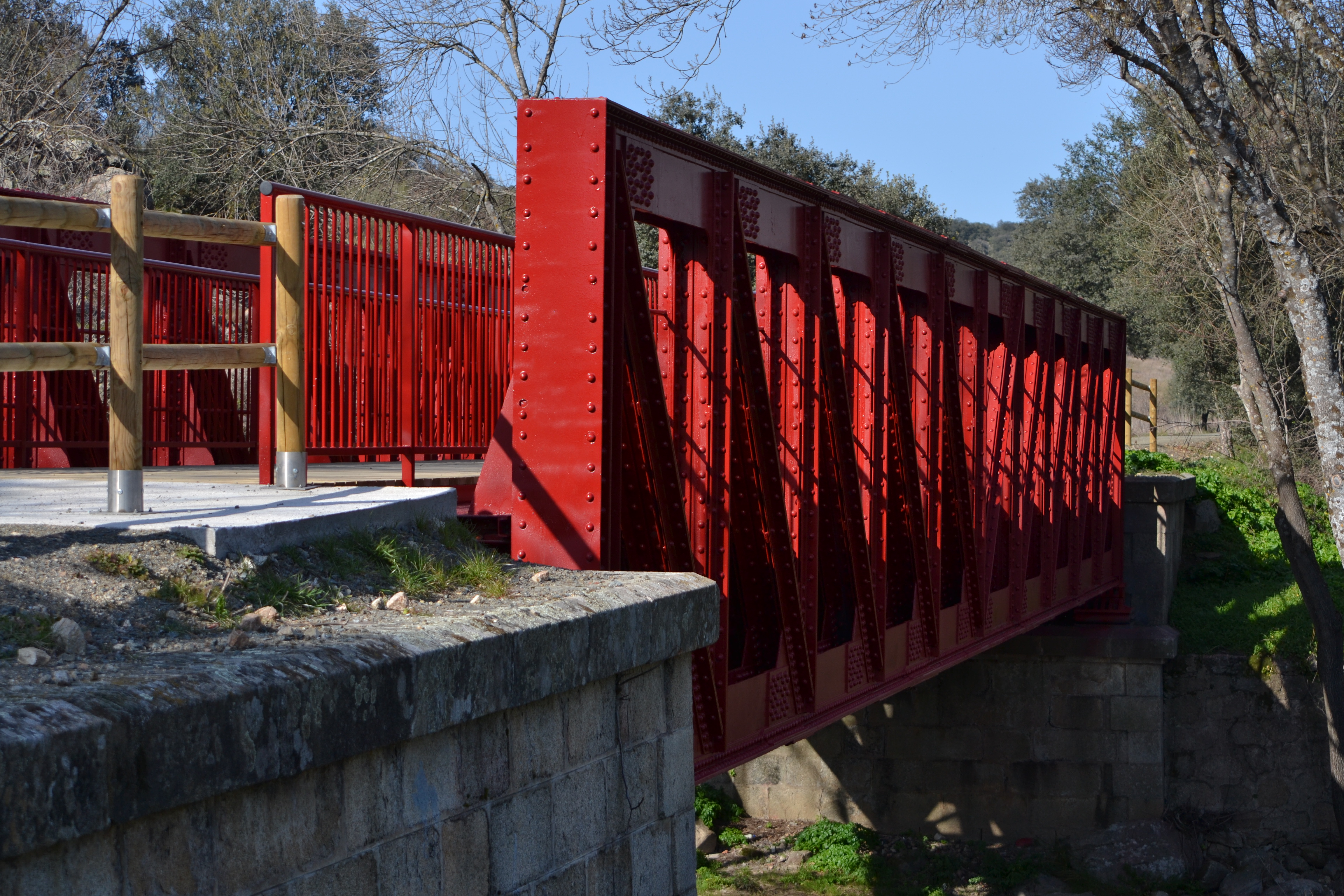
The route then approaches the N-630 again, running practically under it, and it reaches a metal bridge over the La Oliva stream. The traveller will then have to pass by a series of houses with vegetable gardens and livestock. During this stretch, it is more usual to cross some dirt or paved roads connecting this little village with Oliva de Plasencia where there may be motor traffic. The road still hugs closely to the trail, but now at the same level, when it is not the trail that rises higher over it.

It will be necessary to travel a couple of kilometres more to begin to see from afar the sign of a service area located right beside the next milestone on the route: the old Villar de Plasencia station. This service area can be reached after passing under the CC-211 road. This road leads, after rather more than 5 km, to the Roman site of Cáparra, a highly recommended visit to continue to discover the area’s historical heritage, above all concerning the relationship between this Roman settlement and the Vía de la Plata which lends its names to this Nature Trail.
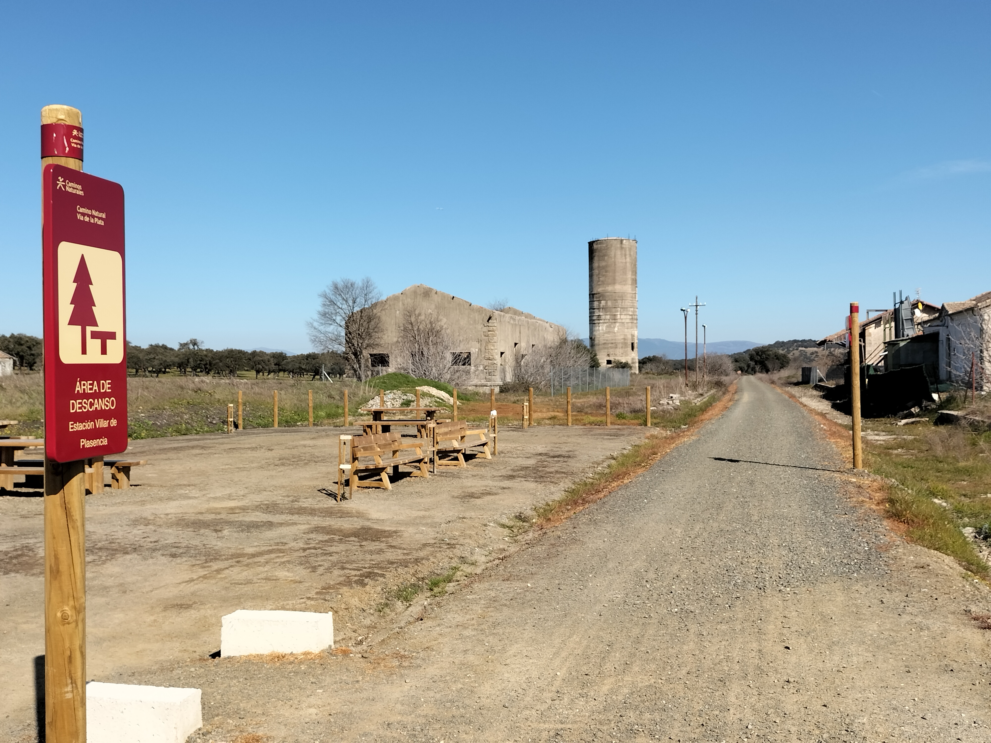
The Villar de Plasencia station is quite a bit larger than the Oliva-Almendral station. In fact, almost all of its buildings and even a water tank have been preserved. Here, too, a large rest area has been set up where you can recover your strength, and the service area also has a bar-restaurant. From here you can access the village of Villar de Plasencia, which is 1.5 km away.
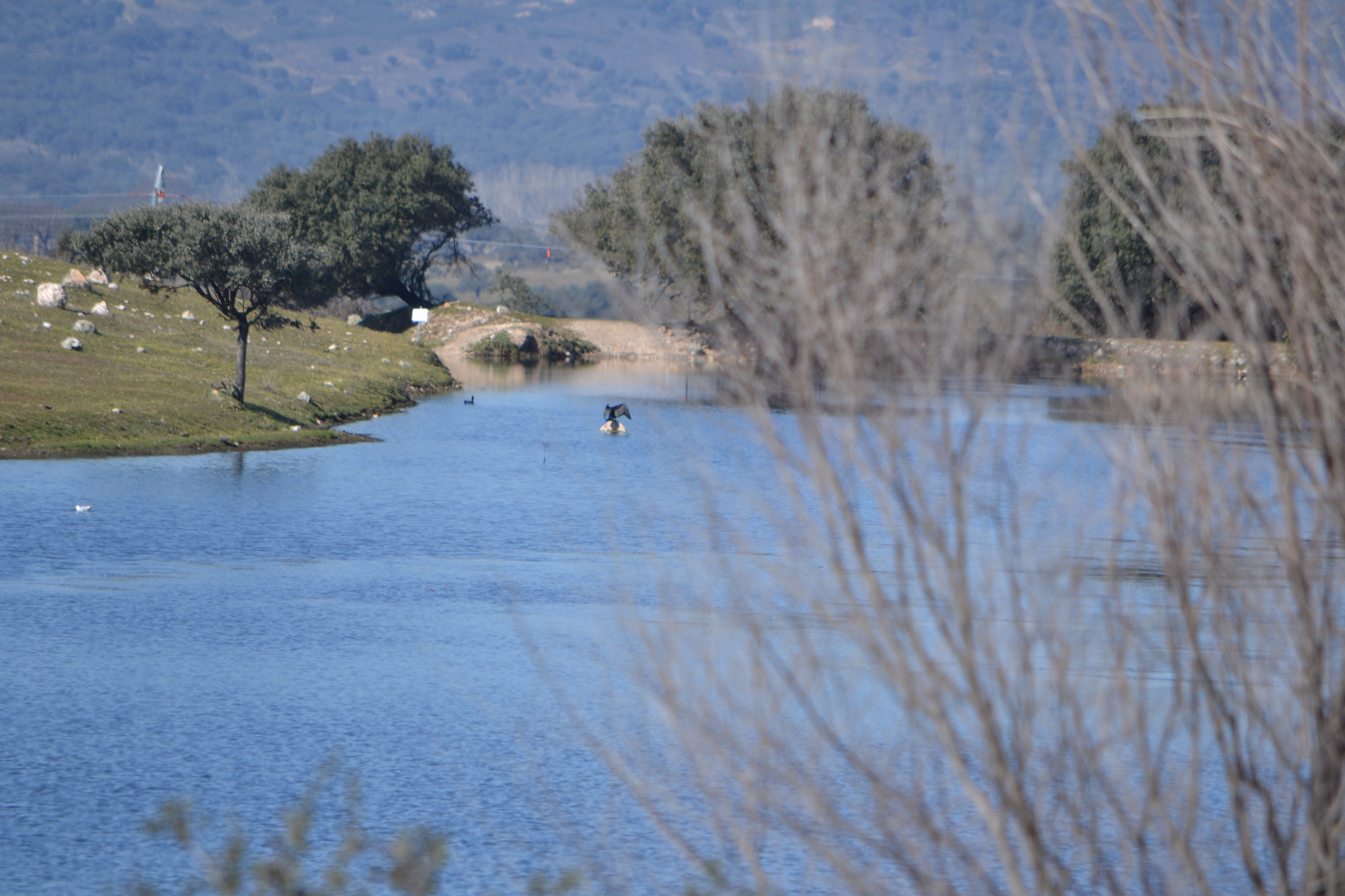
After leaving the old station, you cross a paved road and one kilometre further on you can under the N-630. Immediately thereafter, the trail crosses the Cañada Real de Merinas. It is a livestock route the descends from Villar de Plasencia and, after crossing under then A-66 and the N-630, it continues in parallel to the roads and the Nature Trail. For the next 2 km, the trail runs between the two roads, until it passes under the A-66 at the Jarilla or Cabezaolí reservoir. The waters of this little reservoir are used for irrigation and it is possible to see different types of water birds, such as gulls, ducks and cormorants.
Soon after that, you will cross another paved trail that rises to the village of Jarilla and, after a long straight, in which there are a few pines interspersed among the accompanying holm oaks, you reach a service area at the foot of the road that ascends towards Jarilla, where you can find accommodation and restaurants. A detour will allow you to access this road to reach the village, although to continue the route you have to pass under it.
From the road to Jarilla it is only another kilometre-and-a-half to the municipal boundary between Jarilla and Casas del Monte, where this section of the Vía de la Plata Nature Trail ends and the section between Casas del Monte and Hervás begins.
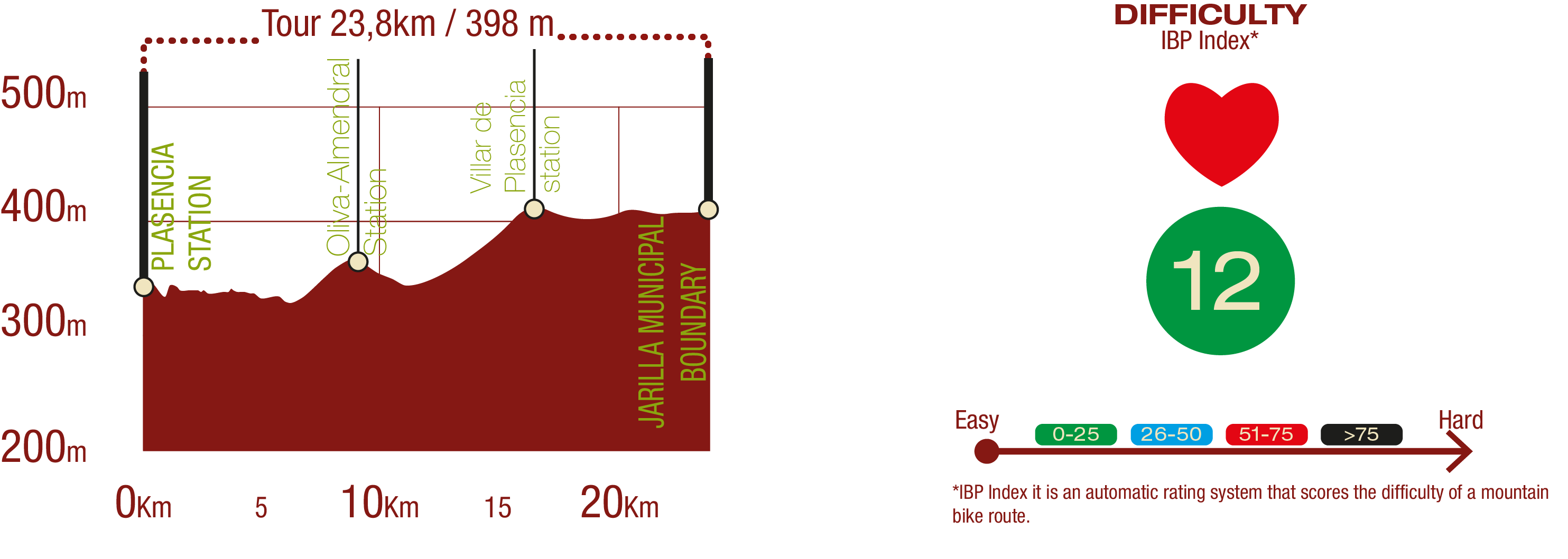
Profile
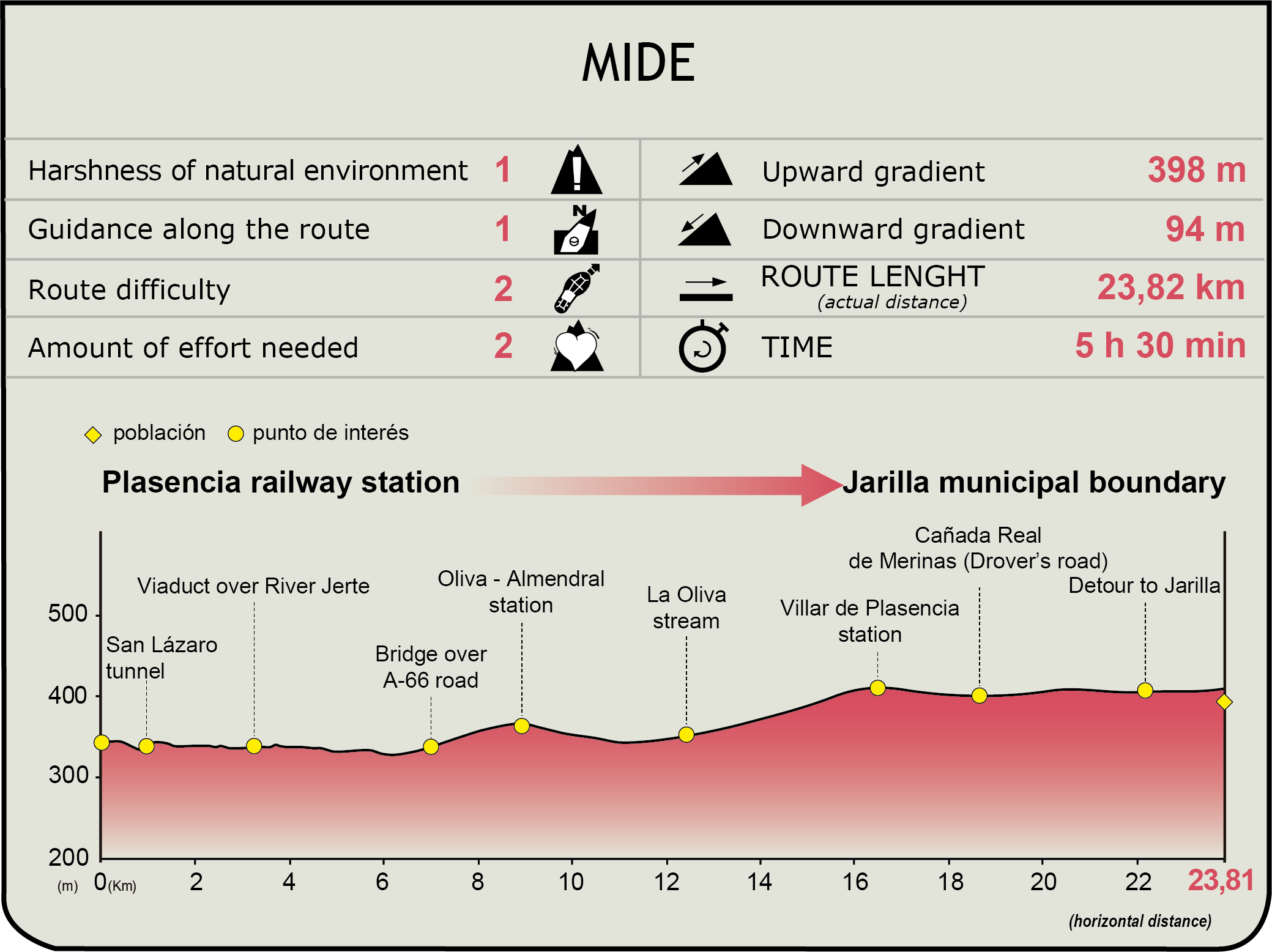
MIDE (Method for the Information of Excursions)
 Harshness of natural environment
- 1. The environment is not risk-free
- 2. There are more than one risk factors
- 3. There are various risk factors
- 4. There are quite a lot of risk factors
- 5. There are many risk factors
 Guidance along the route
- 1. Well defined trails and crossings
- 2. There is a clearly marked trail and signage
- 3. Requires the identification of geographic features and cardinal points
- 4. Requires off-path navigation
- 5. The trail is interrupted by obstacles that have to be gone around
 Route difficulty
- 1. Walking on a flat surface
- 2. Trails with different types of path
- 3. Walking on stepped paths or irregular terrain
- 4. The use of hands or jumping over the terrain is necessary
- 5. The use of hands is required to progress
 Amount of effort needed
- 1. Up to 1 hour of continuous walking
- 2. Between 1 and 3 hours of continuous walking
- 3. Between 3 and 6 hours of continuous walking
- 4. Between 6 and 10 hours of actual walking
- 5. More than 10 hours of continuous walking
Featured
Further information
Plasencia
The city of Plasencia, located in the north of the province of Cáceres, has been inhabited by people since prehistoric times; however, it would be founded as a village in 1186. In that year, the Christian troops that were driving the conquest in this area led to the creation of the city of Plasencia under the Latin motto of Ut placeat deo et hominibus, which in English would be translated as “for the pleasure of God and mankind.”
Its strategic location, halfway between Cáceres, Mérida and Portugal and lying in the heart of the Jerte valley, would make it a key city in the region. Plasencia would peak in the 16th and 17th centuries, many of the monuments that have survived to this day were erected.
Highlights of the city’s architectural heritage include the city wall, of which many access gates are still standing. The city has a rich palatial past that is evident in buildings such as the Marquis of Maribel’s palace, which was built in the 15th century and has been declared an Asset of Cultural Interest. A century earlier, Monroy Palace was built; it is the oldest in the city. The Loaisa Paniagua Palace, the Carvajal Palace and the Almaraz Palace are also part of the extensive architectural legacy of Plasencia, which also boasts numerous stately homes that bear faithful witness of the historical importance of the city. /p>
Moreover, the city is characterised by an extraordinary religious heritage, among which its cathedrals merit special mention. That which is known as the cathedral was built into the 13th century. It would be expanded in the 15th century, and was later declared an Asset of Cultural Interest. For its part, the so-called new cathedral is a monumental building whose construction began in the 16th century.
Plasencia’s churches also stand out among its religious buildings. This is true of the churches of San Nicolás, San Martín, San Pedro and Salvador, all of which were built in the 13th century. In the 15th century, other temples would be erected, such as San Vicente Ferrer and San Esteban churches. Hermitages such as San Lázaro and Nuestra Señora del Puerto sanctuary add greater value to this religious architecture, which also features the four convents dotted around the streets of Plasencia, notably those of the Ildefonsas and those of the Carmelites. This historic city also preserves a major Sephardic legacy, notable among which is the Jewish cemetery in the Berrocal landscape.
As for the natural area surrounding Plasencia, there are numerous hiking routes that explore the immediate vicinity of the city, offering residents and visitors the chance to enjoy a place of especial interest in environmental and ornithological terms. Without leaving the city centre itself, it is also possible to enjoy the natural richness of the area thanks to the River Jerte, which crosses the city and which has become one of the essential points of the municipality.
As for the city’s festivities, there are notable events such as the international folk music festival, which is held in late August each year. The city’s popular festivities take place in early June, while the patron saint festivities in honour of the Virgin del Puerto (Virgin of the Harbour) are held on the Sunday after Resurrection Sunday with a pilgrimage. Moreover, on 16 January, the residents of Plasencia pay homage to San Fulgencio with a pilgrimage enlivened with classic Plasencia dishes and regional music.
Plasencia-Astorga Railway
The Plasencia-Astorga line, also known as Palazuelo-Astorga, was part of the route of the West of Spain railway, a cross-country line that ran from Seville to Gijón.
The railway opened in 1896, and operated until the late 20th century. The passenger service ceased in 1985 and, a few years later, in 1996, good transport would also end. Although there are still sections where trains from other lines run, MAPA’s (Spanish Ministry of Agriculture, Fishing and Food) Nature Trail Programme has restored parts of the line for recreational use.
Multimedia

Downloads
GPS Downloads
Cyclability
PROFILE & DIFFICULTY
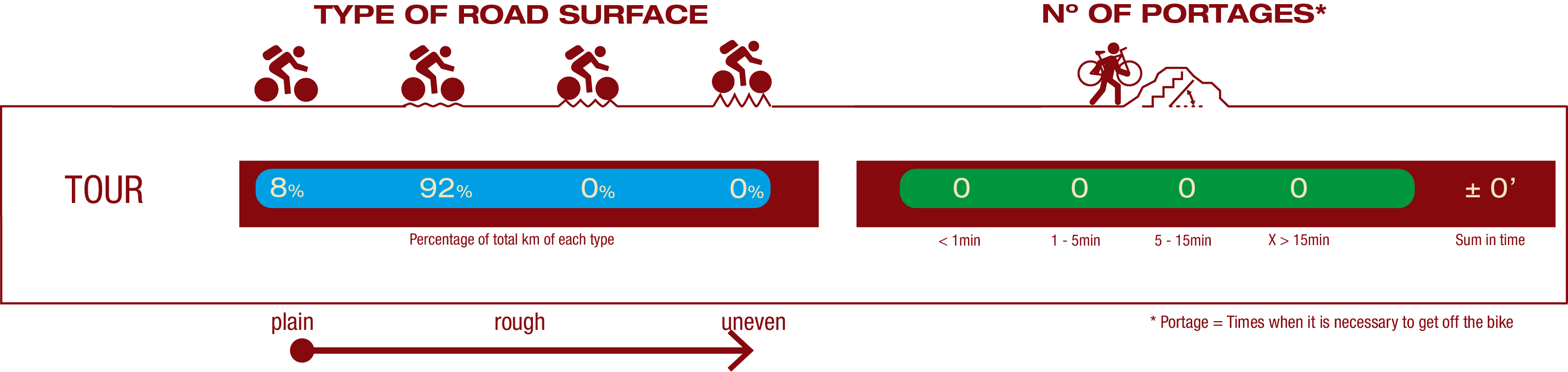
ROAD TYPE & PORTAGES
TEST

SAFETY RECOMMENDATIONS
- Caution at crossroads and on farm access roads.
- Transit by tunnel with artificial lighting.
- Caution when passing through the town centre of Plasencia.
GENERAL RECOMMENDATIONS
-Find out about the technical aspects of the route and the weather on the day.
-Take care of the environment. Take care not to disturb animals or damage vegetation. Respect private areas.
-You must give priority to pedestrians and comply with general traffic rules.
-The environment in which you will be riding is open, free to move around and an area where many activities are carried out (sporting, forestry, livestock and agricultural activities). Always have an understanding, prudent, responsible and respectful attitude.