
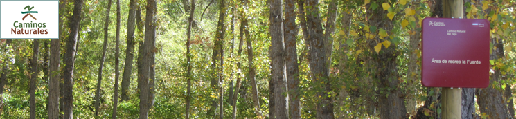
Stage 9: Valtablado del Río - Trillo
Description
Huertas, Nogales and the bridle paths
From the ancient and mostly abandoned bridle paths to state-of-the-art technology at Trillo nuclear plant. A Stage that brings together past and present.
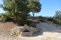
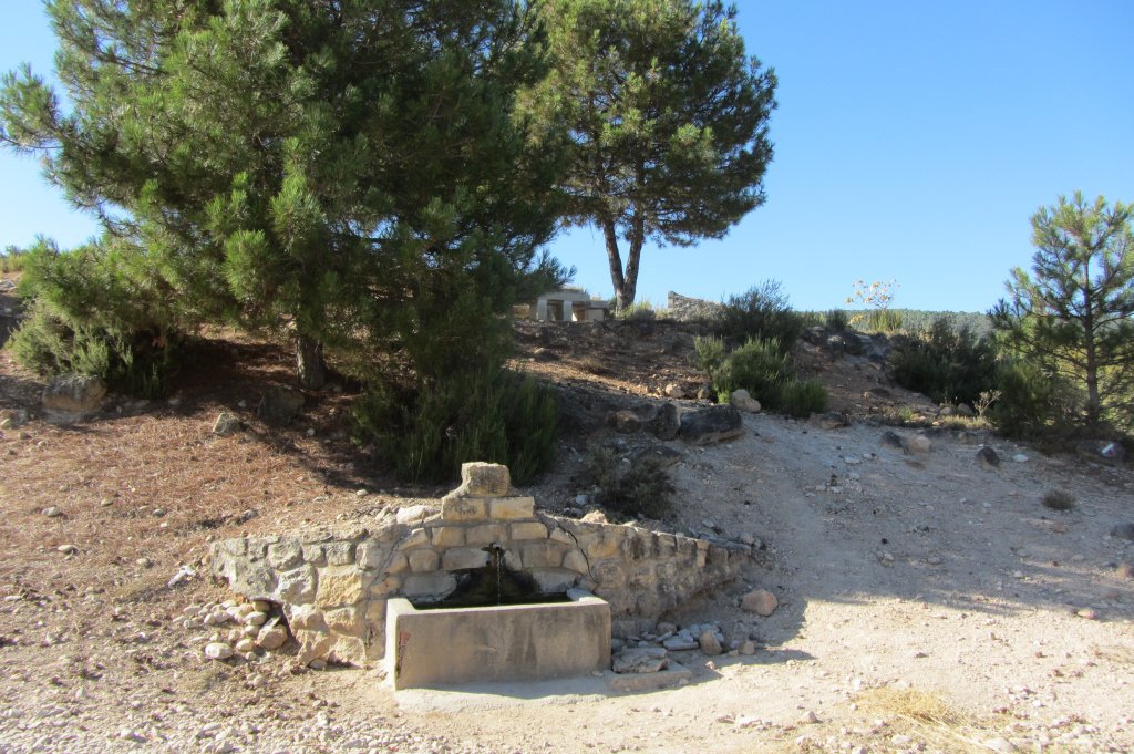
The path leaves Valtablado del Río behind along the GU-929. The first few metres run near the paved road, with Gallego Fountain to the left, and continue onward until it cross the Tagus via the Valtablado stone bridge. Immediately after crossing the bridge, the route moves away from the paved road onto a vehicle track leading to town of Oter. Black pines (Pinus nigra), holm oaks (Quercus ilex) and rosemary bushes (Rosmarinus officinalis) alternate with crop farms and small market gardens.
Although Portuguese oak forests dominate the land, a few pine trees dot the forest, towering over the smaller oak clusters. Despite many interStages, the route continues ahead always on the main path, which runs wedged in by, and very close to, streams that empty into the Tagus. This area is physically characterized by impressive gorges and canyons formed by the river. Although the route leaves behind the Alto Tajo Nature Park, much of it still traverses through the namesake Site of Community Importance (SCI) and Special Protection Area for Birds (SPA).
The track crosses over the Hoz Brook and arrives at the town of Oter. This town, blessed with areas of great natural beauty, is part of the GR-10 that connects the neighbouring towns of Valtablado del Río and Carrascosa de Tajo. Although the traveller can rest in this town, the route itself continues, exiting the town near a farm building.
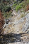
About 500 m further on, flanked by farms on one side and a mountain slope on the other, the Trail arrives at a junction where it bears right onto a path that traverses through a more homogeneous forest landscape. Further on, the Trail narrows and merges onto a bridle path that was used to link villages and transport supplies and goods on horseback, as it is too narrow for vehicles. The route continues to climb along the slope with the steepest gradient, zigzagging until it levels at almost 1,050 m above sea level.
The route continues along a trail that runs for more than three kilometres along this line until Carrascosa del Tajo; a small town with a rich history, successively inhabited by Celts, Romans, Visigoths and Muslims. The current town was founded in the twelfth century. The Trail enters the town via the GU-942, and exits onto the road leading directly to the River Tagus.
The route will cross three waterways in this part of the journey: twice the Palomar Brook, the second time near the Roman ruins at Murel Bridge and the new dam, and once the River Tagus. It then arrives at the Fuente recreation area on the left bank of the Tagus, and to the right of the bridge, where one can rest and recover under the shade of black poplars (Populus nigra).
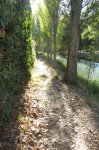
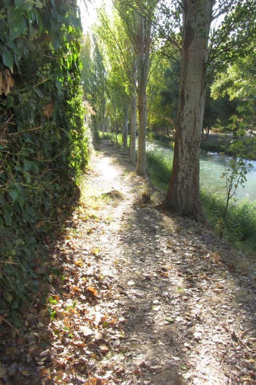
The Trail continues parallel to the Tagus, always along the left bank, and even though it sometimes drifts away from the river, it is still the best guide to reach Trillo, the endpoint of this Stage.
Strolling downstream, the route climbs along a track with a quarry to the right, until it reaches a sign indicating a path to the right leading down to the river. The route temporarily moves away from the Tagus, turning left towards a farm, and further on, continues along a narrow path during approximately 1.3 km. The path widens on arriving near the river, and continues forth. After a long walk along the left bank of the Tagus, sometimes on a narrow angler's path, the Stage drifts away again from the river to arrive at the CM-2115, on which it proceeds until nearly the end of the Stage.
Finally, the Trail turns away from the CM-2115 onto a paved road to the right leading to Trillo, the endpoint of this Stage.
Sites of interest
Profile
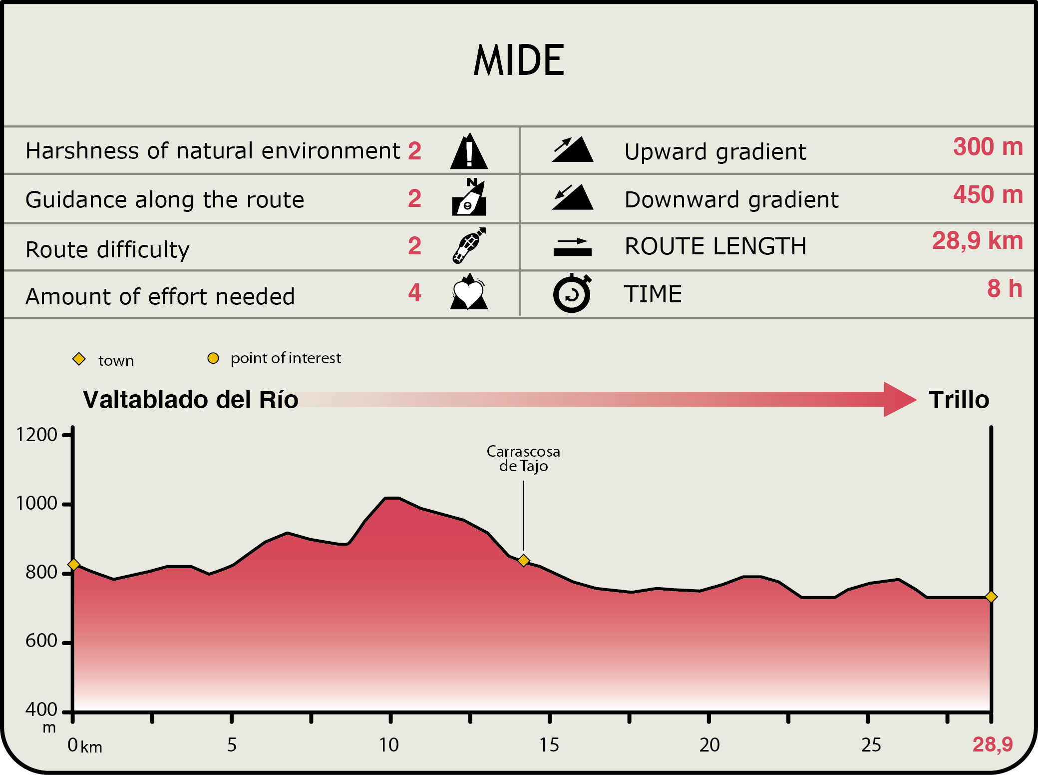
MIDE (Method for the Information of Excursions)
 Harshness of natural environment
- 1. The environment is not risk-free
- 2. There are more than one risk factors
- 3. There are various risk factors
- 4. There are quite a lot of risk factors
- 5. There are many risk factors
 Guidance along the route
- 1. Well defined trails and crossings
- 2. There is a clearly marked trail and signage
- 3. Requires the identification of geographic features and cardinal points
- 4. Requires off-path navigation
- 5. The trail is interrupted by obstacles that have to be gone around
 Route difficulty
- 1. Walking on a flat surface
- 2. Trails with different types of path
- 3. Walking on stepped paths or irregular terrain
- 4. The use of hands or jumping over the terrain is necessary
- 5. The use of hands is required to progress
 Amount of effort needed
- 1. Up to 1 hour of continuous walking
- 2. Between 1 and 3 hours of continuous walking
- 3. Between 3 and 6 hours of continuous walking
- 4. Between 6 and 10 hours of actual walking
- 5. More than 10 hours of continuous walking
Featured
Further information
Trillo
Trillo, located at the border between Carpetania and Celtiberia, was already a famous town in Roman times. The settlement, consolidated after its conquest in the late eleventh century, in times of Alphonse VI, became a part of the "Común de la Villa y Tierra de Atienza", and was governed by a charter.
Infante Don Juan Manuel built, in 1325, the castle whose ruins crown the town. In mid-fifteenth century, it fell under the jurisdiction of the Counts of Cifuentes until it was declared, in 1630, Villa with its own jurisdiction. During this time, the region was populated with awe-inspiring Romanesque architecture, including the churches of Viana and La Puerta. Cistercian architecture, with the Monastery of Ovila at its centre, spread across these frontier lands producing unique examples like the shrine at Morillejo.
The magnificent churches of Trillo, Azañón and Morillejo were built in the sixteenth century, during the heyday of Renaissance. The towns and cities became a showcase of exceptional popular architecture made from stone with adobe and wood frameworks, the main examples being the well-preserved manors at Trillo and Azañón.
Multimedia

Downloads
GPS Downloads
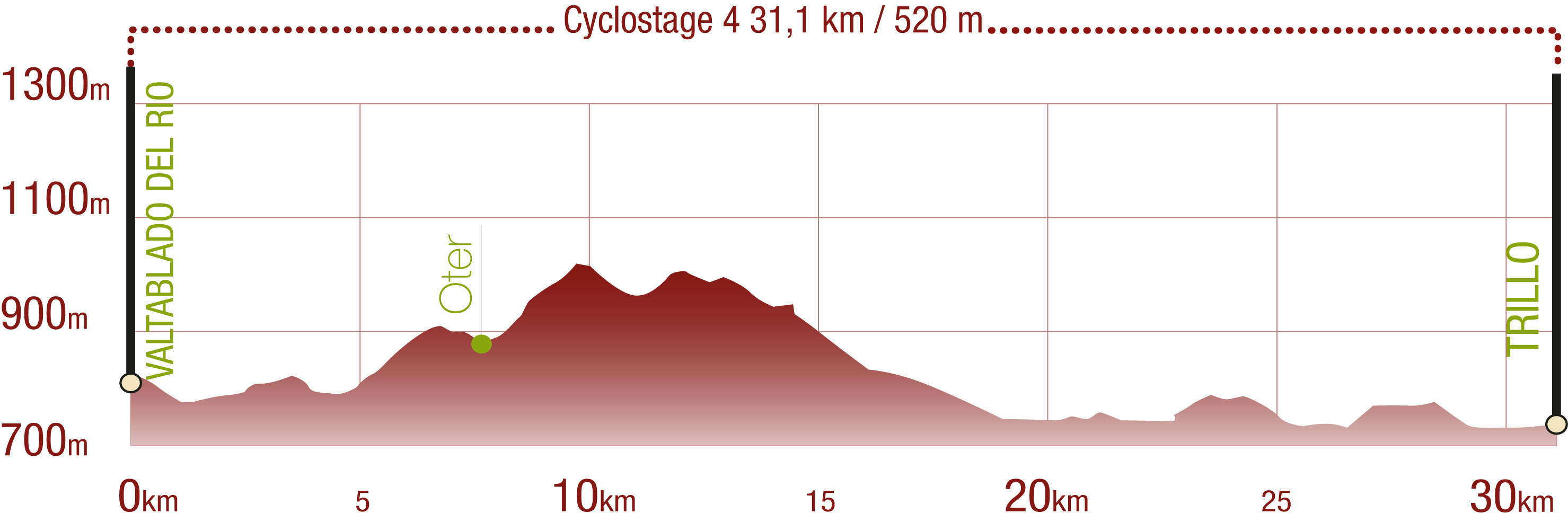
Cyclability
This Cyclostage corresponds to stage 9 of the Nature Trail
PROFILE
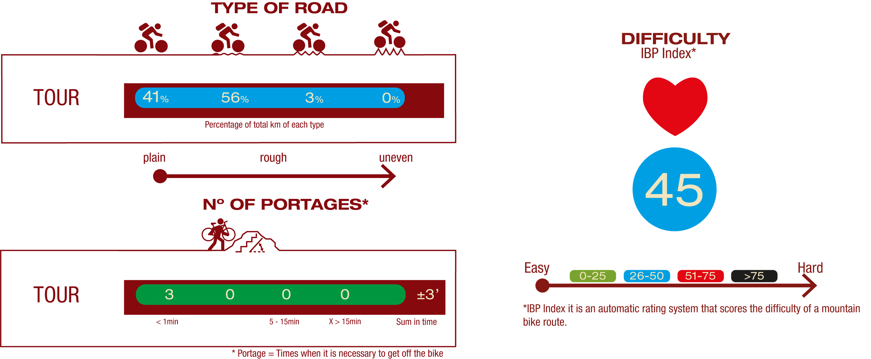
TYPE OF ROAD, PORTAGES & DIFFICULTY
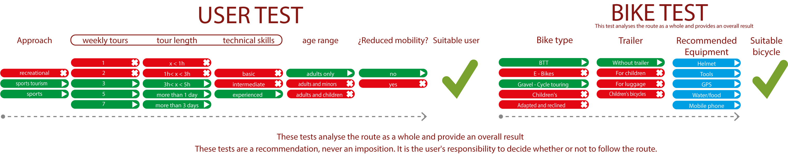
TEST
SAFETY RECOMMENDATIONS
- Sections shared with hikers.
- Transit through the centre of some population centres.
- In cyclostage 1 you will cross a straight tarmac road. Take extreme caution, look for a straight section and proceed to cross at the said straight section.
- In cyclostage 3 you will walk along a stretch close to the riverbed. This area is prone to flooding during the flood season.
GENERAL RECOMMENDATIONS
- Find out about the technical aspects of the route and the weather on the day.
- Take care of the environment. Take care not to disturb animals or damage vegetation. Respect private areas.
- You must give priority to pedestrians and comply with general traffic rules.
- The environment in which you will be riding is open, free to move around and an area where many activities are carried out (sporting, forestry, livestock and agricultural activities). Always have an understanding, prudent, responsible and respectful attitude.