Stage 40: Alcántara - Membrío
Description
Through Los Llanos de Brozas y Alcántara
Los Llanos de Brozas y Alcántara is a vast area of high ecological value that is part of the Natura 2000 network. Traditionally, it has been used for grazing and grain production, hence a biologically rich floodplain ecosystem with a high concentration of birds has been created.
This Stage begins on the outskirts of the town of Alcántara, amidst paved streets confined by slate walls. Further on, a slate ford makes the crossing of the river easier when it carries much water.
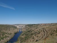
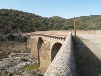
The Trail quickly gains height. Indeed, some areas have stone steps to make the climb easier. Leaving behind the Alcántara Bridge and the River Tagus confined in the bottom of the ravine, this is the moment to enjoy the landscape. A wonderful view of the town of Alcántara can be seen from the top of the hill, with the reservoir in the background, and its famous Roman bridge in the foreground. The remains of the walls that protected the town can also be seen. The path continues up an alley to the outskirts, where the walls disappear and the track widens.
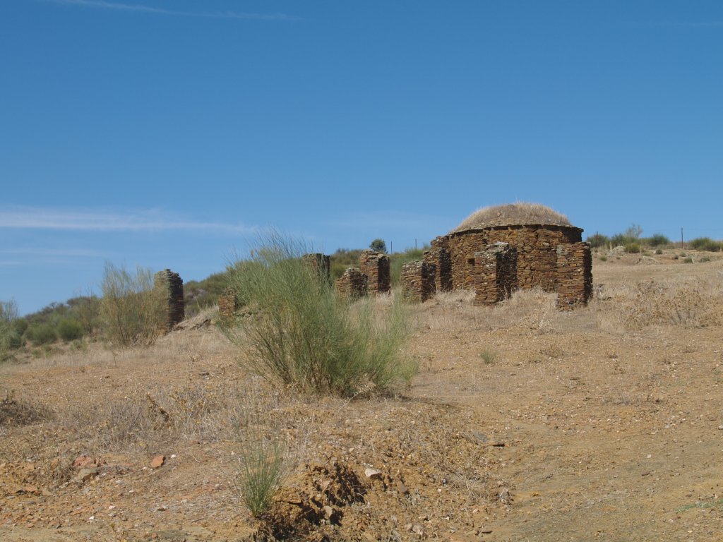
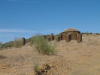
The Trail ventures along Cañada Real de Gata as it moves forward to Los Llanos de Brozas y Alcántara. A few trees still line the path during the first part of the Stage, as well as an occasional traditional "bohío", small huts used in the past by shepherds, which are currently being restored.
The Stage ventures now into Los Llanos, an area wedged between the rivers Tagus and Salor, with a gentle slope and an altitude ranging between 200 and 400 m. The land is crisscrossed by myriad brooks and streams that empty into the two rivers that form its boundary. The Trail is dotted with numerous fords that allow the traveller to cross streams and brooks. There are also small ponds and shallow lagoons were waterfowl can find shelter and bring diversity.
The landscape consists mainly of vast grasslands, dry pastures and broom thickets, with very few trees. The seasons have a strong impact on this enclave. There is widespread shortage of water in the summer, except in very specific points that attract wildlife. These high-value, natural and semi-natural steppes are populated by bird species for whom this is one of few remaining havens, including the Golden Eagle (Aquila chrysaetos), Egyptian Vulture (Neophron percnopterus), Griffon Vulture (Gyps fulvus), Great Bustard (Otis tarda) and Black Stork (Ciconia nigra).
The path crosses several gates during the next 15 km along this floodplain. Leaving Los Llanos behind, the Trail reaches the road linking Alcántara and Membrío (EX-117), running parallel to it for about two kilometres. Several signs indicate that the Trail continues on the opposite side of the road, briefly drifting away from the road.
After passing through a gate, the route continues along a track that soon becomes a path down to the River Salor. Here, the brooms (Cytisus ssp.) and cereal fields give way to typical riparian species. The River Salor flows through the Tagus International Nature Park, and forms the western boundary of the “Llanos de Brozas” Site of Community Importance (SCI). It is also part of the “Llanos de Alcántara y Brozas y Río Tajo Internacional y Riberos” SPA. The traveller will venture through all these sites included in this Stage.
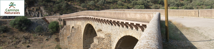
Rustic, wooden steps have been placed in some areas, making the path even narrower in the narrowest parts of this small gorge. The traveller must cross the EX-117 to the opposite side to cross the bridge over the River Salor where the road used to pass. There is a small rest area near the bridge, which may seem familiar, as it is a replica of the Roman bridge of Alcántara. After skirting around the slope, the path merges again with the EX-117, which it must cross again to the opposite side.
After passing through another gate, the Trail climbs down a narrow path, and then climbs up towards a private hunting ground, where the landscape is dominated by holm oaks (Quercus ilex).
Deer emerge from amongst the trees. They do not appear to fear human presence. It is possible to observe them at close range. Leaving the hunting ground behind, the Stage crosses again the EX-117 to the opposite side and continues parallel to the road until it reaches Membrío.
Sites of interest
Profile
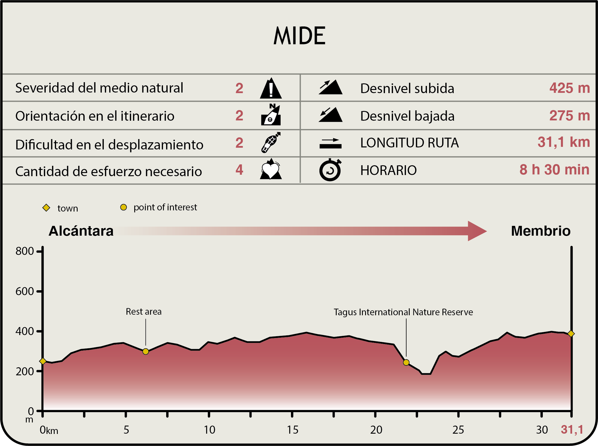
MIDE (Method for the Information of Excursions)
 Harshness of natural environment
- 1. The environment is not risk-free
- 2. There are more than one risk factors
- 3. There are various risk factors
- 4. There are quite a lot of risk factors
- 5. There are many risk factors
 Guidance along the route
- 1. Well defined trails and crossings
- 2. There is a clearly marked trail and signage
- 3. Requires the identification of geographic features and cardinal points
- 4. Requires off-path navigation
- 5. The trail is interrupted by obstacles that have to be gone around
 Route difficulty
- 1. Walking on a flat surface
- 2. Trails with different types of path
- 3. Walking on stepped paths or irregular terrain
- 4. The use of hands or jumping over the terrain is necessary
- 5. The use of hands is required to progress
 Amount of effort needed
- 1. Up to 1 hour of continuous walking
- 2. Between 1 and 3 hours of continuous walking
- 3. Between 3 and 6 hours of continuous walking
- 4. Between 6 and 10 hours of actual walking
- 5. More than 10 hours of continuous walking
Featured
Further information
Tagus International Nature Park
The Tagus International Nature Park (25,088 ha) spans eleven municipalities along the River Tagus, from the Roman bridge of Alcántara to Cedillo Reservoir, as well as many tributaries that empty into the river.
The diversity of wildlife is remarkable, with large shady areas, rich riparian habitats, typical floodplain forests and sub-humid Mediterranean forests.
Many wildlife species found here are considered priority species under the Birds and Habitats Directive, including the Sites of Community Importance (SCI) of Cedillo y Río Tajo, Rivera de Membrío, Rivera de Aurela, Riveras de Carbajo y Calatrucha, Rivera de los Molinos and the local tower and brook; and the Special Protection Areas for Birds (SPA) of Río Tajo Internacional y Llanos de Alcántara y Brozas, included in the Natura 2000 Network.
Anthropomorphic Tombs
The rock-cut tombs, of which the exact date is unknown, can be found throughout the district. It is believed that they may be from the late Roman and Visigoth period (7th c.).
Although they are usually isolated, in some cases they form groups in which the tombs are placed near each other. Most of the tombs face west, and measure 2 m long and 60 cm deep.
Multimedia