
- Home
- Rural Development
- Nature Trails
- Nature Trails
- Central Sector
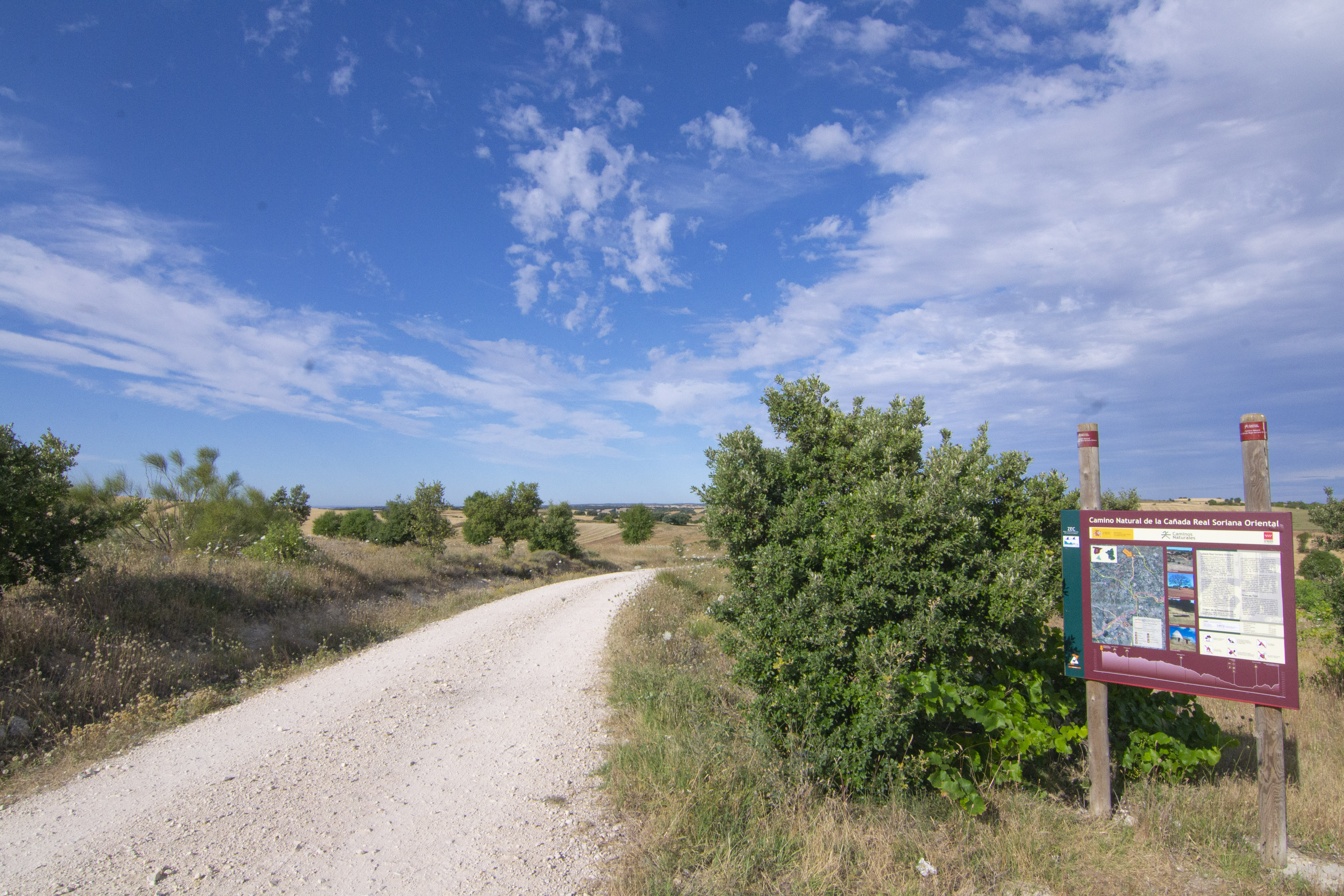
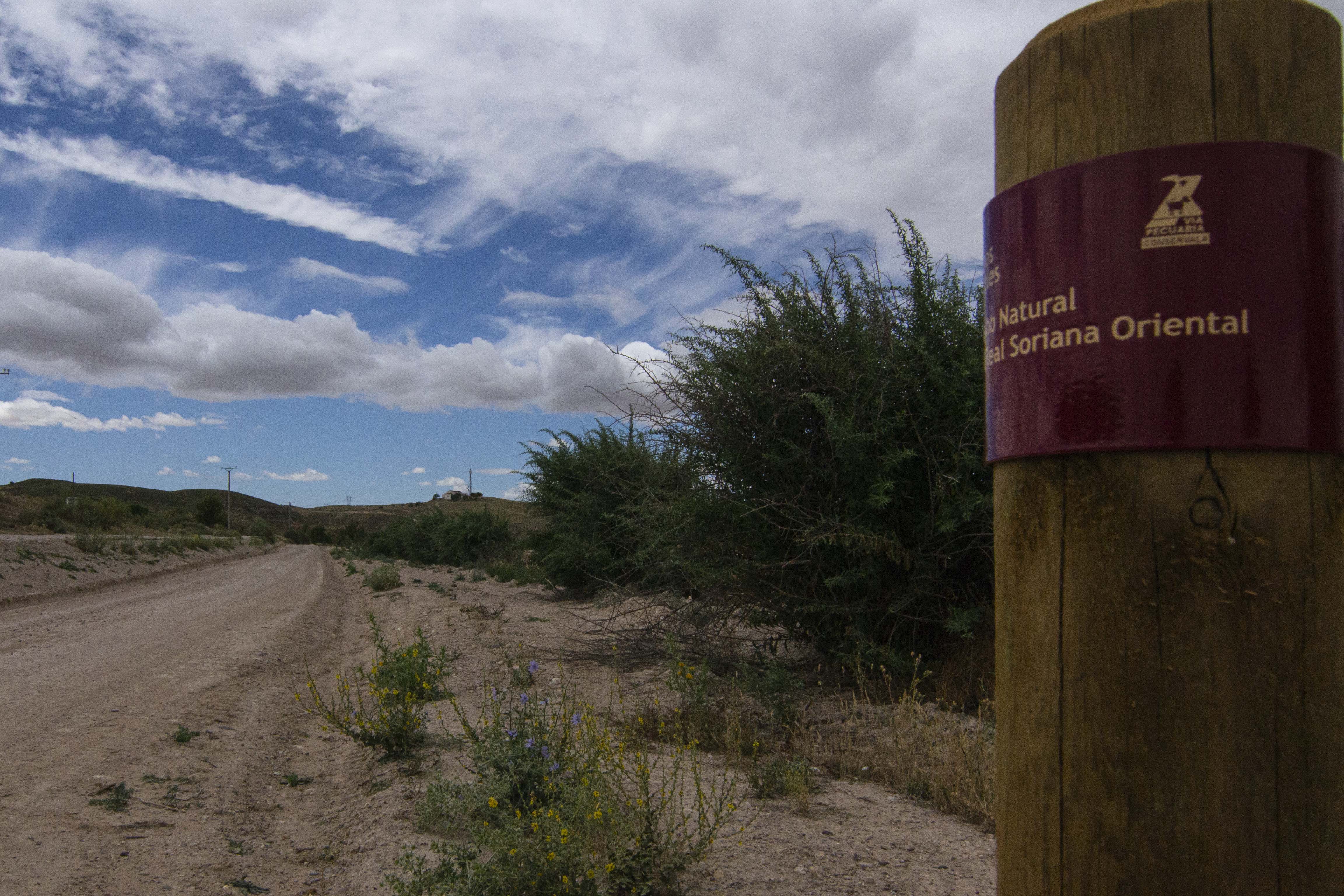
Cañada Real Soriana Oriental Nature Trail
Description
A trek through La Alcarria of Madrid
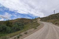
This beautiful route runs through the south-east of Madrid taking advantage of the route of the Cañada Real Soriana Oriental, one of the nine Cañadas Reales or drovers’ roads that cross the Iberian Peninsula from north to south and one of the four that cross the Autonomous Community of Madrid. Along its 30 km, the trail runs through La Alcarria of Madrid, among farmland, moorlands and meadows, allowing trekkers to enjoy the agricultural landscape that marks the main activity of the rural communities of Brea de Tajo, Valdaracete and Fuentidueña de Tajo and transporting them back to a not so distant time when numerous flocks followed these trails on a hard journey in search of food.
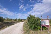
In order to start this Nature Trail, you can leave from Brea de Tajo and follow the Mondéjar trail for some 6 km, as far as the crossroads with the Cañada Real in Castilla-La Mancha territory. You take the Cañada, or drovers’ road, on the left, and, some 250 m from the crossroads, right on the administrative boundary of Madrid and Guadalajara, there is an informative panel that marks the beginning of the Nature Trail, which, in this first section, has a surface that can be enjoyed by trekkers and cyclo-tourists alike.
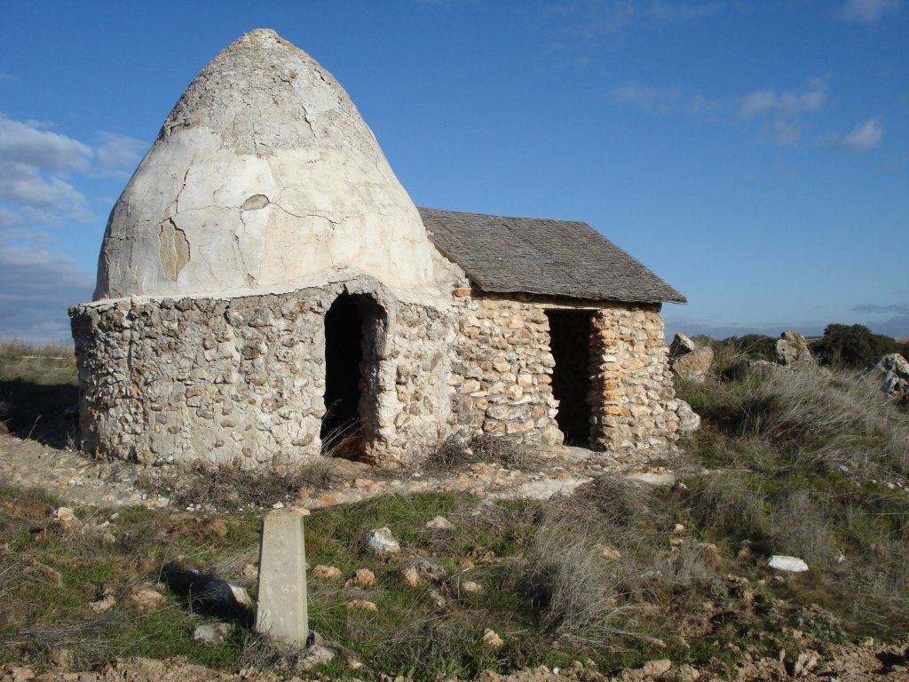
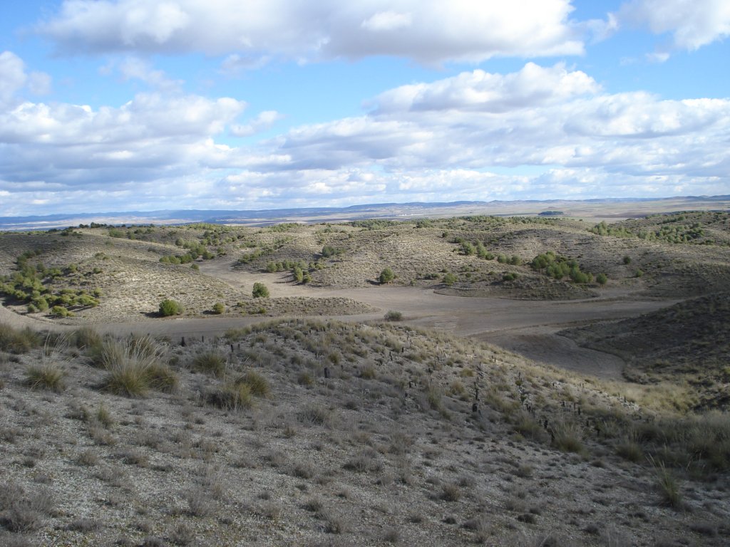
From here, travellers can contemplate the mosaic of colours offered by the landscape and which will accompany them throughout this first part of their trek. Although it is eminently agricultural in nature, the landscape is strewn with Holm-oaks (Quercus ilex), kermes oaks (Quercus coccifera) and brushwood, where the greenish shades of olive trees, vineyards and Mediterranean scrubland contrast with the reddish marl soils of the moorlands, which are rich in clay and highly suited to cereal growing. In less than 1 km, after passing a first crossroads, you can glimpse, on the left of the path, the ruins of one of the old shepherd huts that appear along the route; this one is the "Chozo del Callejón".

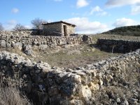
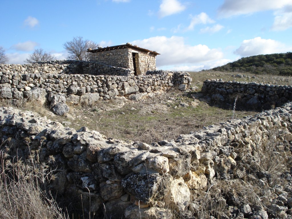
Along most of this section, you can see, demarcated by boundary stones, a strip of uncultivated land that marks the traditional corridor of 90 Castilian yards (75.22 m), which was the width of the Cañadas Reales. After passing over the intersection with the Cañamera trail, the "Chozo del Quiñonero" appears at the foot of the drovers’ road. This hut has been refurbished so that trekkers can admire the characteristics of this traditional building that served to shelter shepherds on their harsh days of transhumance across these spots.
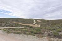
The drovers’ road continues among crop fields and wastelands covered with thyme (Thymus sp.),turpentine (Pistacia terebinthus) and kermes oaks. You enter a spot known as "Las Lomas", a hillock offering a splendid view of the countryside surrounding the trail. After a short but steep descent of some 700 metres, the route reaches the road from Orusco de Tajuña to Brea de Tajo (M-229). At this point, you can take a break from the trail and rest on the stone table with benches that have been outfitted for this purpose.
After crossing the road, the trail makes its way through a first area of olive trees and small Holm and kermes oak trees along with thyme. It then continues across meadowland where you will discover spectacular Holm oak trees. Walkers gradually leave Mount "El Robledal" behind them, an example of Mediterranean scrubland that extended to the south of the autonomous community of Madrid, which was covered with hundred-year-old Holm and gall-oak trees (Quercus faginea). After covering almost 1 km, you will come to an old traditional well known as "El Pozo de la Yesera". Some 300 m from this point, a panel located to the right of the trail marks the presence of the old "Corrales de Calero". Abandoning the path for a moment, travelers can reach this building and evoke bygone times when these infraestructures were used as occasional shelter for shepherds and their flocks.
The drovers’ road continues descending slowly among Holm oak and old olive trees, as far as a crossroads with a trail where there is a rest area with a bicycle park. If you pay attention, you may come across exponents of the fauna that prevails in the area, such as the rabbit (Oryctolagus cuniculus), the hare (Lepus granatensis) and the partridge (Alectoris rufa), as well as traces of activity by other species, such as the fox and the boar. Worthy of note among the birds that, with their flight, accompany travellers on the route are the common woodpigeon (Merops apiaster), the hoopoe (Upupa epops), the magpie (Pica pica) and the royal kite (Milvus milvus), as well as other steppe and crop species.
In some 350 m, the drovers’ road crosses the “Cordel de Merinas” cattle track. The “Cordeles” are the second type of cattle roads in magnitude, after de drovers’ roads, this one runs along the trail from Carabaña to Brea de Tajo, the later town being accessible by way of this trail. Our trail, nevertheless, continues straight ahead, now passing through an area with a prevalence of dry herbaceous crops before crossing, in a little over 1.5 km, the road from Carabaña to Brea de Tajo (M-221), and then, after another 500 m, the road from Valdaracete to Brea de Tajo (M-222). From this crossroads there is also de possibility of taking de “Tren de los 40 días” (forty days train) Greenway. It uses the short lived railway, strategic in nature, built during the Spanish Civil War which runs between the towns of Carabaña and Estremera.
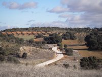
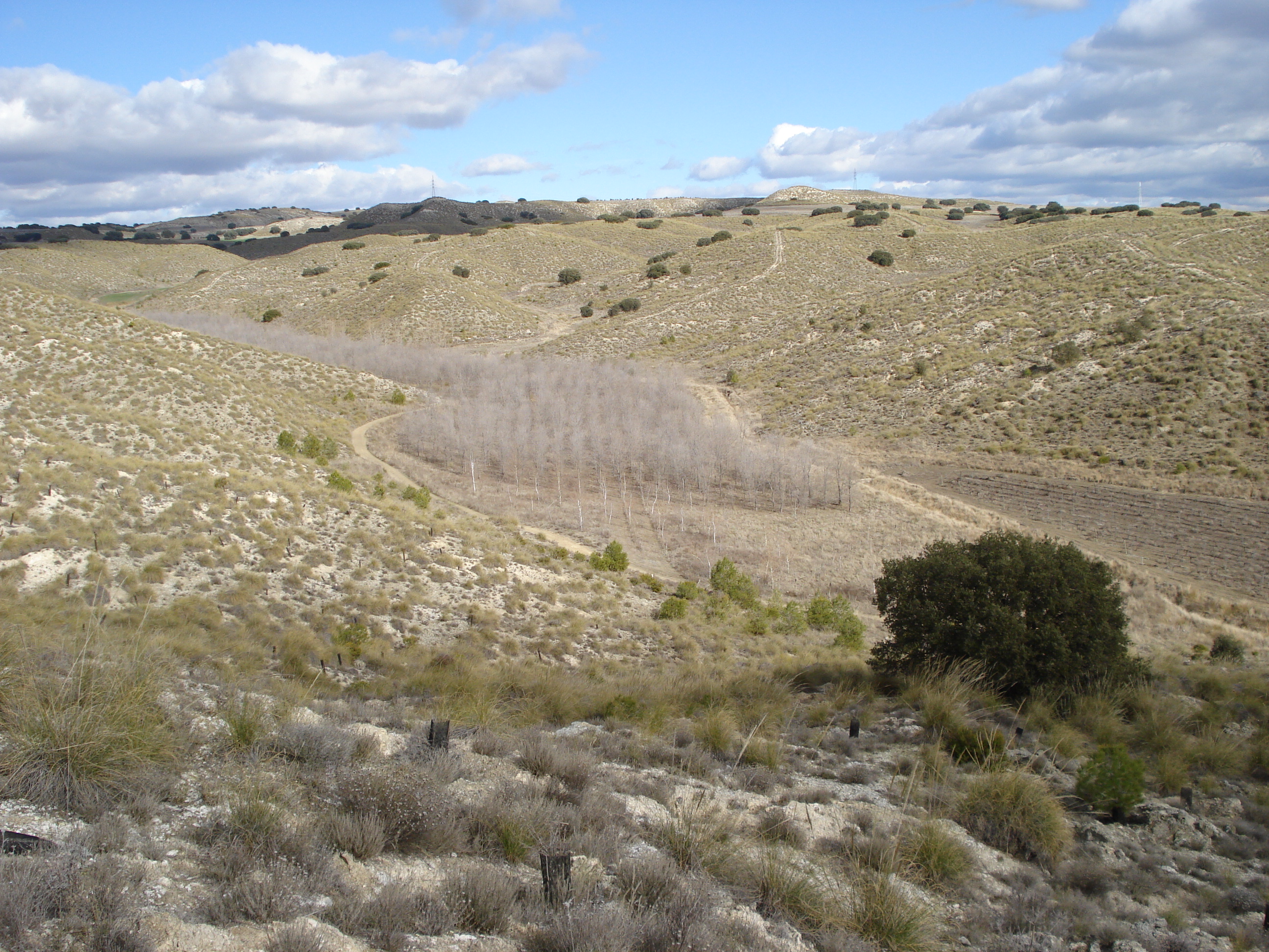
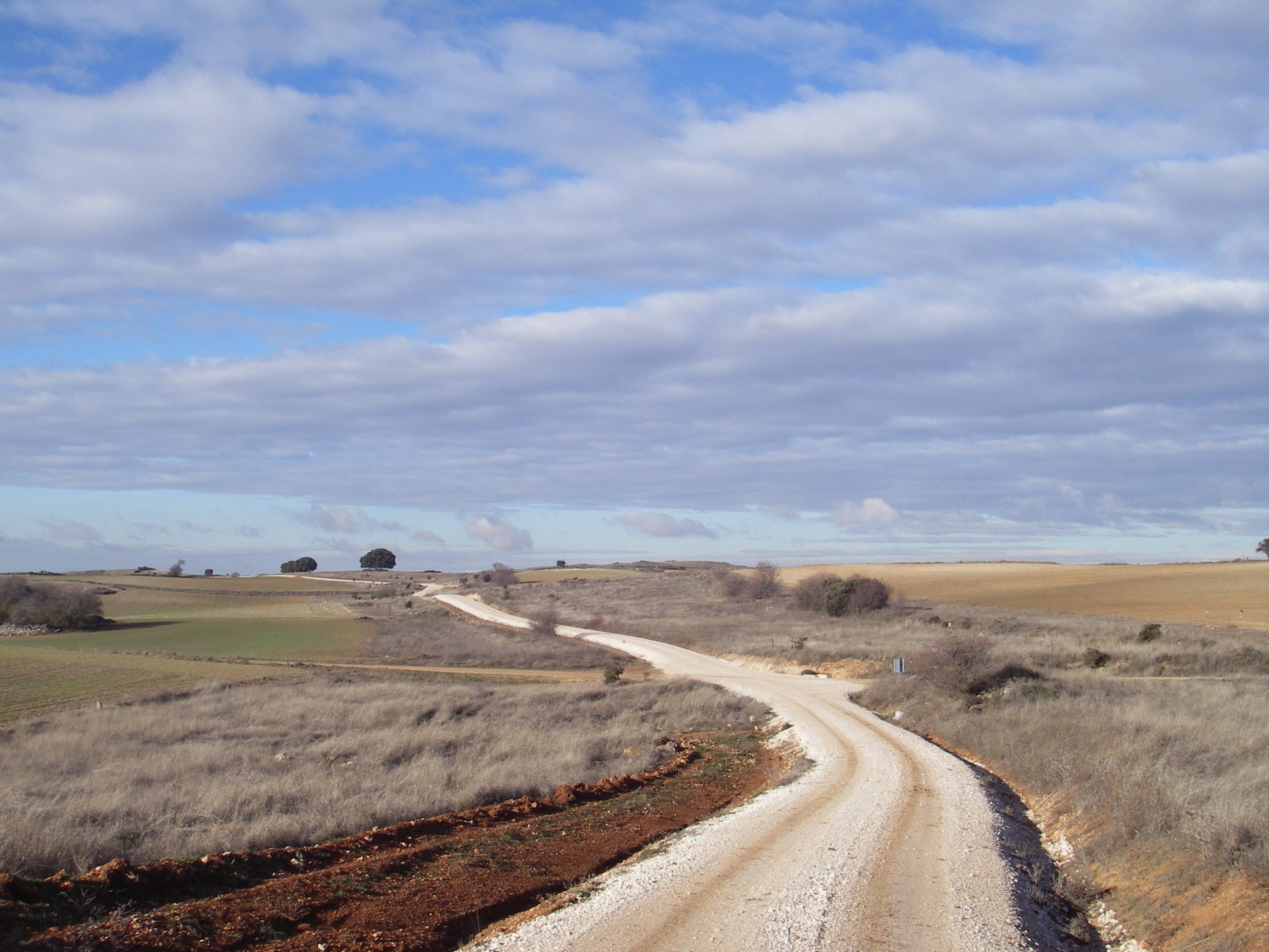
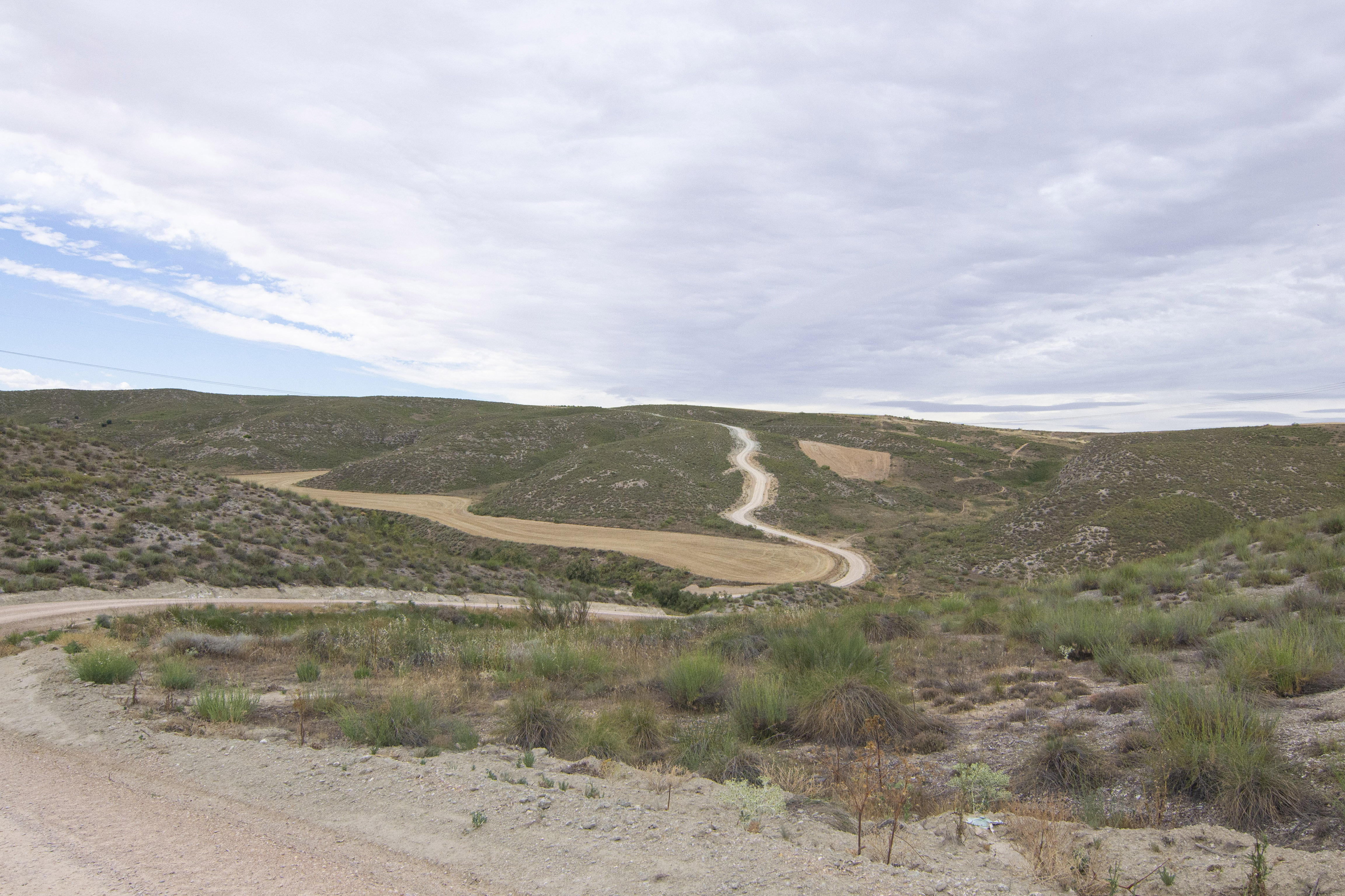
From this point onwards, the trail begins to cross the moorlands of Valdaracete, which, like those of Brea de Tajo, are characterised by deep, dark, chalky soils that are rich in clay and extremely suitable for agricultural purposes. They are mainly used for cereal and olive crops. When the conditions are rainy or frosty, due to the marl-clayey material in the area, the surface of this part of the trail –no longer being gravel- is slippery and trekkers have to make extra effort.
After covering around 1.2 km parallel to the numerous olive plantations that emerge on the left of the trail, the route reaches a hillock that provides visitors with a lovely view of the agrarian landscape in this part of the route. Continuing for another 800 metres, the Cañada Real Soriana intersects with the Valdaracete to Estremera trail. Here, another rest area has been outfitted with a bicycle park, which invites visitors to rest under the shade provided by the Holm and kermes oak trees that occupy the wasteland strips that separate the trail that runs through the centre of the drovers’ road from the cultivated land. After a gentle descent of almost 2 km, the drovers’ road reaches a trail intersection where you must take the path just ahead (following the signals). On the right, trekkers will see the last olive grove that can be found on the route and, on the left, they can enjoy the beautiful views offered by the fertile valley irrigated by the Valeco stream.
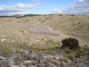
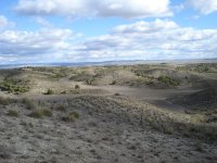
This point marks the beginning of the route across the gypsiferous moorlands that lead to Fuentidueña de Tajo, where a gradual change occurs in the vegetation from here onwards. The Holm and kermes oaks, which have been so representative up to this point on the trail, tend to disappear to give way to vegetation with a prevalence of brushwood formations that are better adapted to this type of soil, and which give the landscape a characteristic greyish colour. In spite of the barren and inhospitable appearance of this landscape, an extremely diverse ecosystem has developed here. Several plant species exist whose surprising adaptations have enabled them to survive on such a hostile land. In this way, the hills are thickly covered with esparto grass Stipa tenacissima), accompanied by sage (Salvia lavandulifolia), lavender (Lavandula latifolia), gorse (Genista scorpius), thyme (Thymus zygis) and Egyptian soapwort root (Gysophila struthium), whereas in the middle and low areas, species such as rock rose (Helianthemum asperum, H. hirtum), needle sunrose (Fumana ericoides, F. thymifolia) and white wormwood (Artemisia herba-alba) stand out.
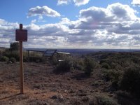
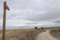
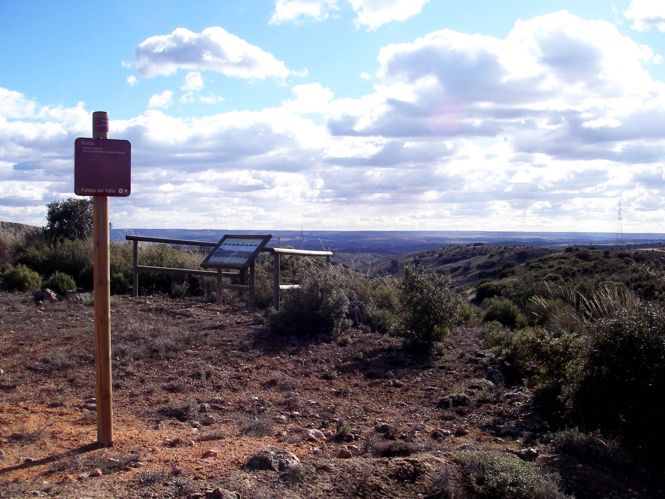
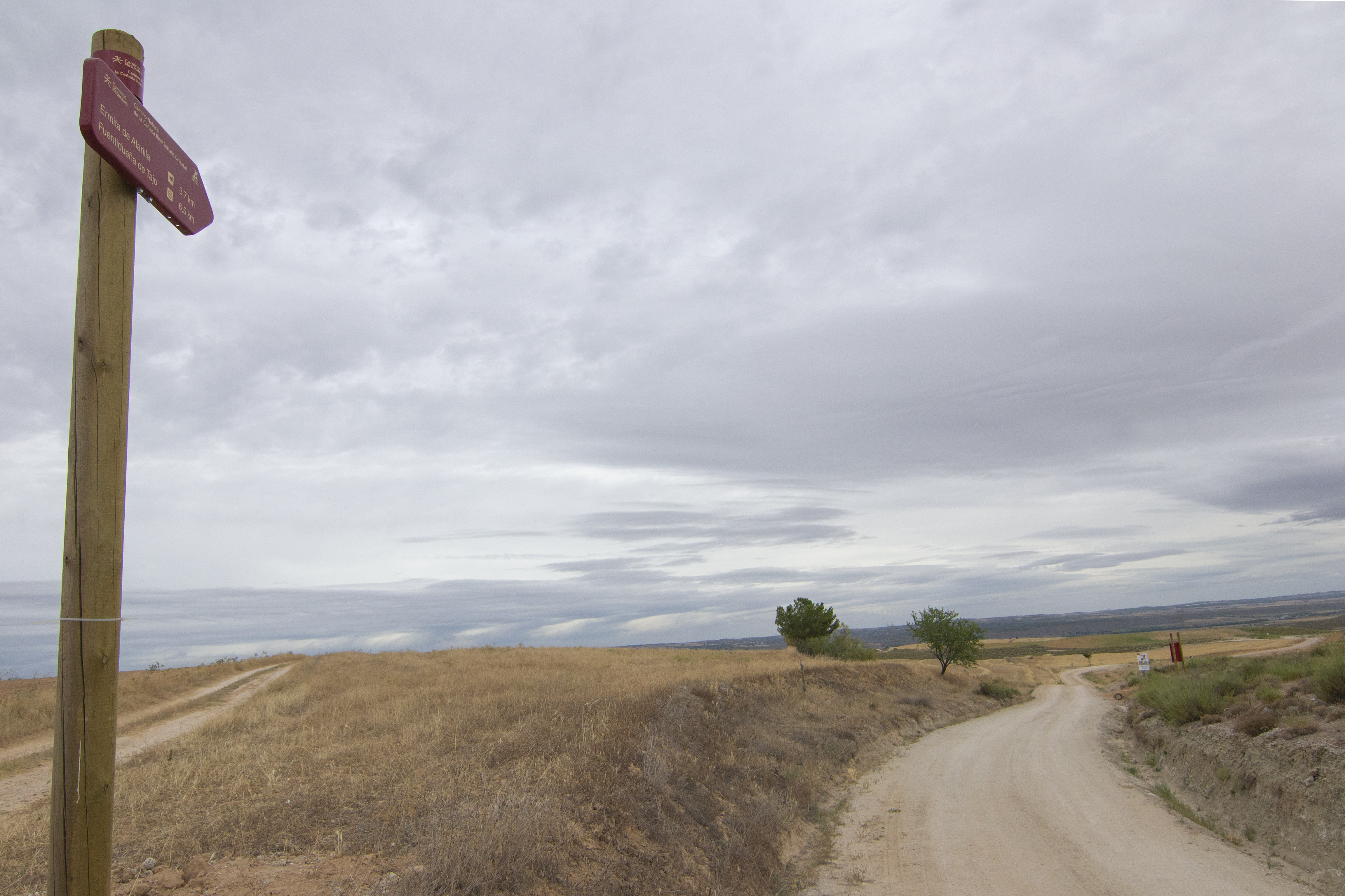
Some 400 m from the crossroads, the trail turns rightwards on a sharp bend protected by a wooden railing, leaving the valley of the Valseco stream on the left. After continuing for another 350 m, you will come to the “Faldas del Valle” viewpoint, from where you can contemplate a beautiful view.
The route now runs across very uneven terrain with steep ascents and descents, and where there is a prevalence of afforestation with Aleppo pine (Pinus halepensis). The gravel covered road and the steeps slopes may be difficult for the unexperienced cyclo tourist, so it’s convenient to be extremely cutious. Once you have reached the intersection with the Fuentesaúco trail, a signpost indicates that the trail continues straight ahead, climbing the Cerro de la Muela, from where you have a beautiful view of the gentle Holm-oak strewn hills. On the sides of the trail, there are numerous feed and drinking troughs for fauna, which once again evidences the suitability of these lands for hunting species of great interest, such as partridges and rabbits, which may occasionally jump out on trekkers.
A sharp descent will lead you to the confluence of the Fuentesaúco ravine and Valseco stream, the latter called the El Valle stream from now onwards. You carry on across the fertile meadow where the appearance of poplars (Populus sp.) and irrigation vineyards (Vitis vinífera) contrasts with the dryness of the hills and slopes framing the valley.
When you have walked some 150 m, the drovers’ road turns rightwards and once again enters, after a hard ascension, a unique, wild landscape formed of these greyish, eroded and dusty hills. The trail twists and twines across these recently afforested slopes, where you will bear witness to the extraordinary protective nature of Stipa tenacissima (a dominant species on grass steppes), thanks to its intricate root system that serves as an anchor, and to its root ball, which retains the soil against erosion.
The moorlands occupied by herbaceous crops strewn with excellent examples of oaks evidence how man has modelled the landscape, as part of the trees that originally populated this land has remained.
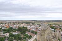
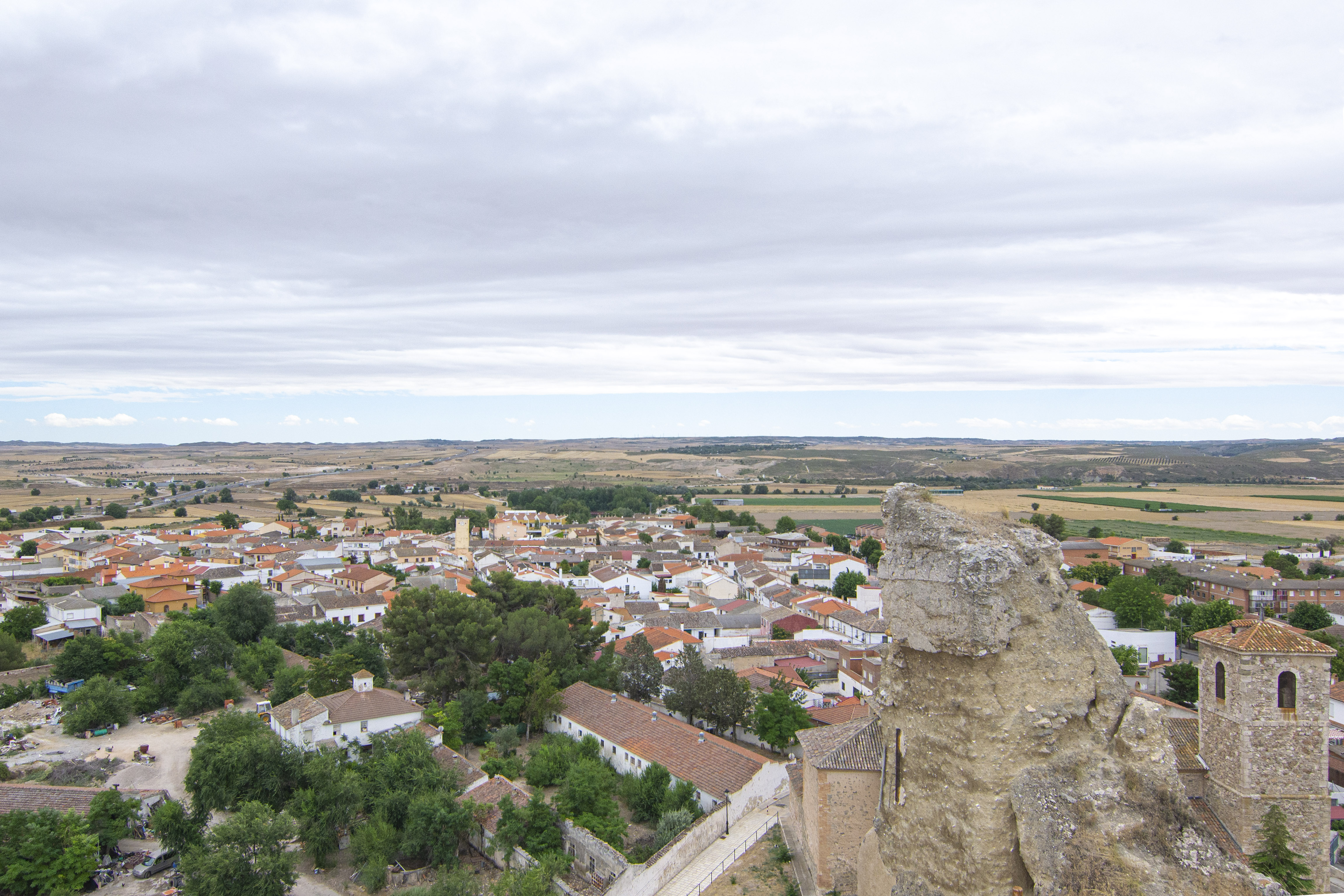
After a steep descent you come to a small stream, where you will find the Santa Elena spring, which is marked by a small tamarisk plant (Tamarix sp.) on the right of the trail, and right after the El Valle stream. The stock route now runs across the bottom of the valley in the direction of Fuentidueña de Tajo, next to fertile agricultural land. In some 500 m, you come to a trail intersection where you have to continue to the right. The silhouette of the Castle of Fuentidueña points out the proximity of the town of Fuentidueña de Tajo.
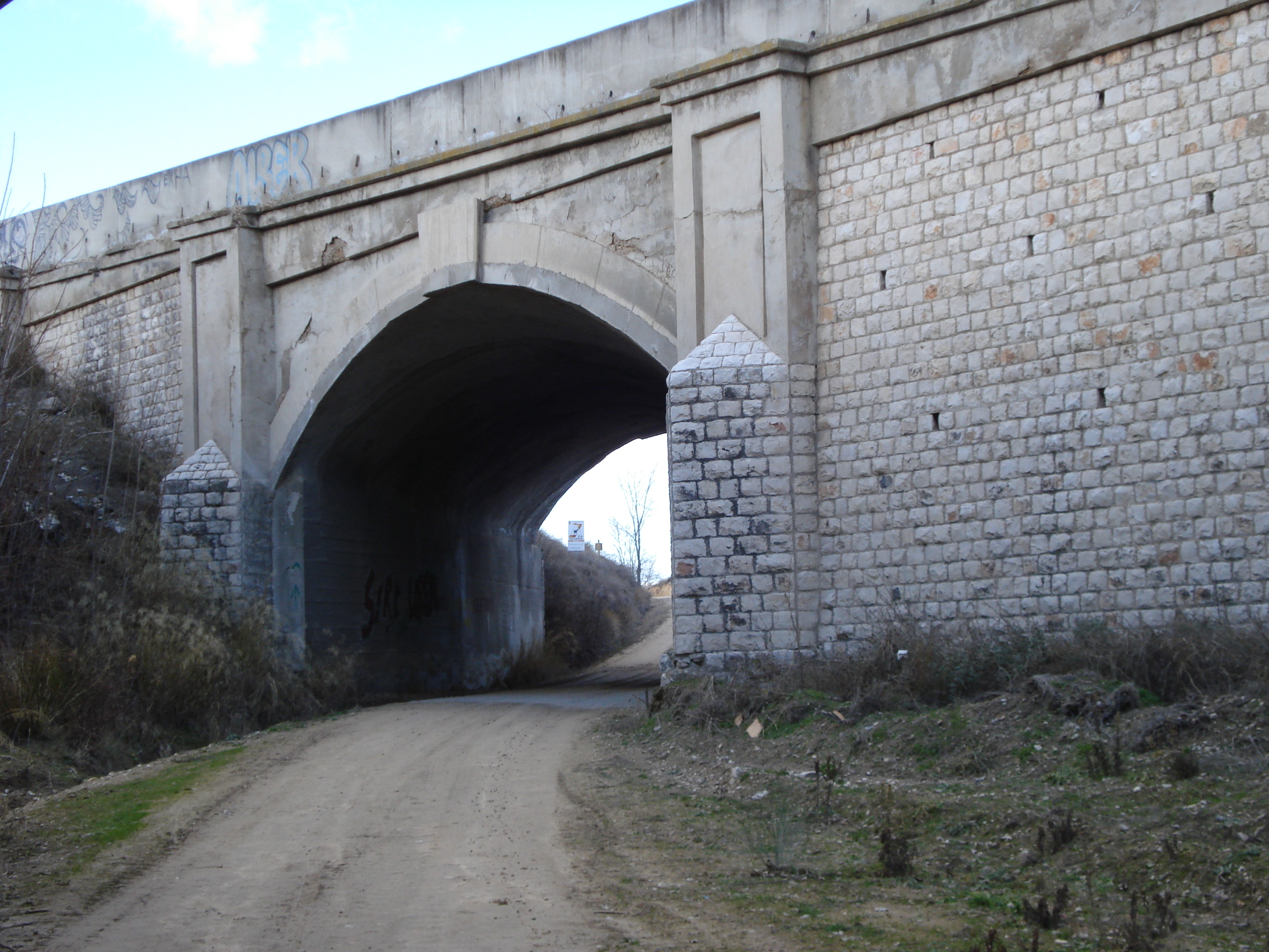
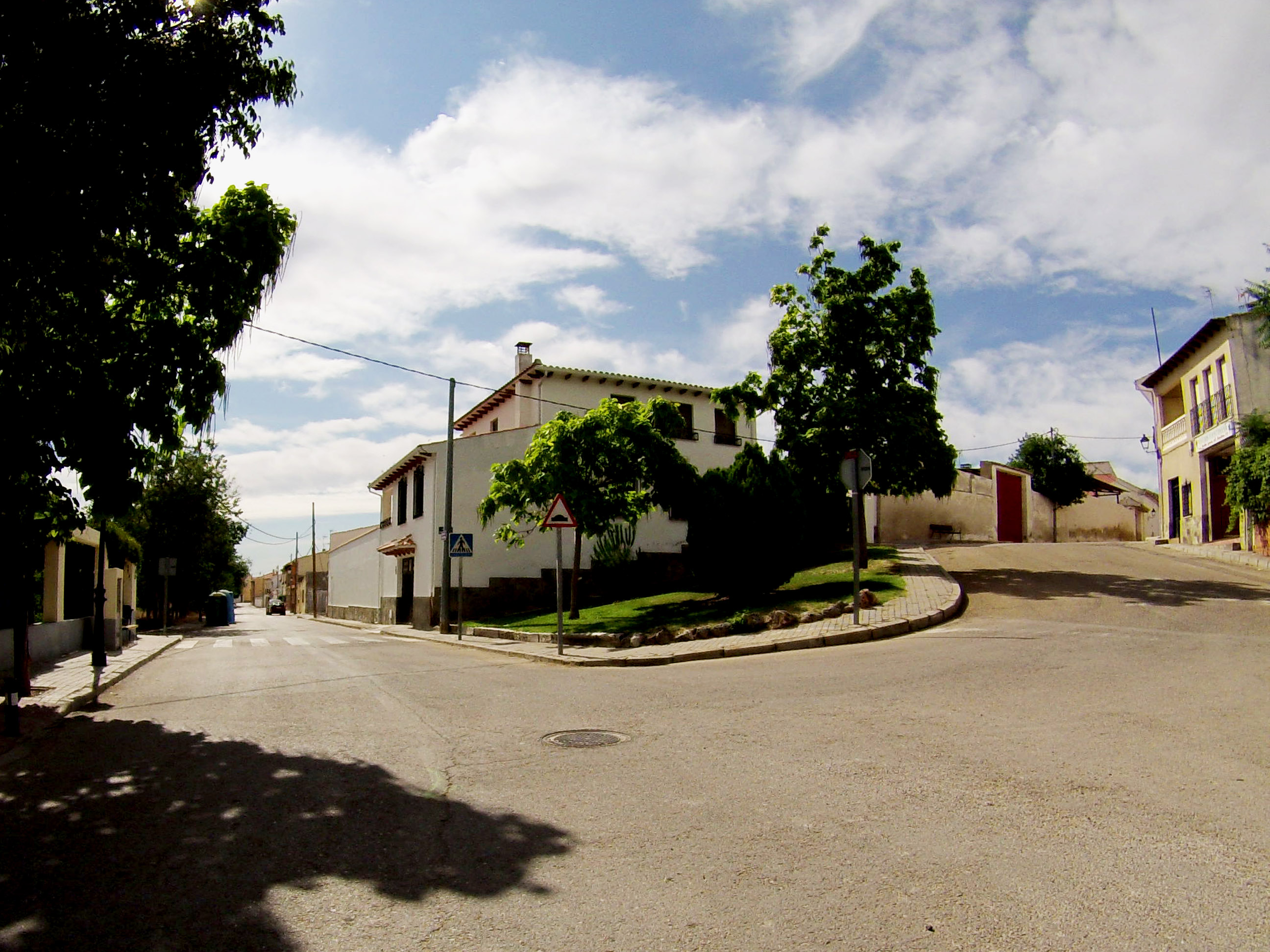
After crossing the A-3 highway via an underpass, you come to the first houses in Fuentidueña; cave houses that were excavated in the hillsides in bygone times and which still serve as housing for some inhabitants in the district of Zurriera. At this point, the trail intersects El Tajo Nature Trail; hence, you should pay attention as the Cañada Real continues straight ahead along the Avenida de la Paz. Once you have crossed the calle Canal and made your way along calle de la Cañada, you continue through calle Bajada al Rio, wich gets to the River Tajo, which is flanked by rich riverside vegetation, where poplars, reeds and tarays serve as shelter for the abundant birdlife and where you will find an informative panel. To reach this same point, the bicycle users must continue along Calle Canal and then turn left at Calle Bajada al Río.
Before continuing along the road and crossing to the other bank of the Tagus River, stop to discover the heritage of Fuentidueña, with the castle (offering impressive panoramic views of the Tagus valley), the Plaza de la Constitución (Constitution Square) and its clock tower (whose machinery is among the oldest in the Community of Madrid) and the church of San Andrés (its current appearance dates from the 17th century, although its origins date back to the 12th century).

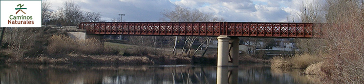
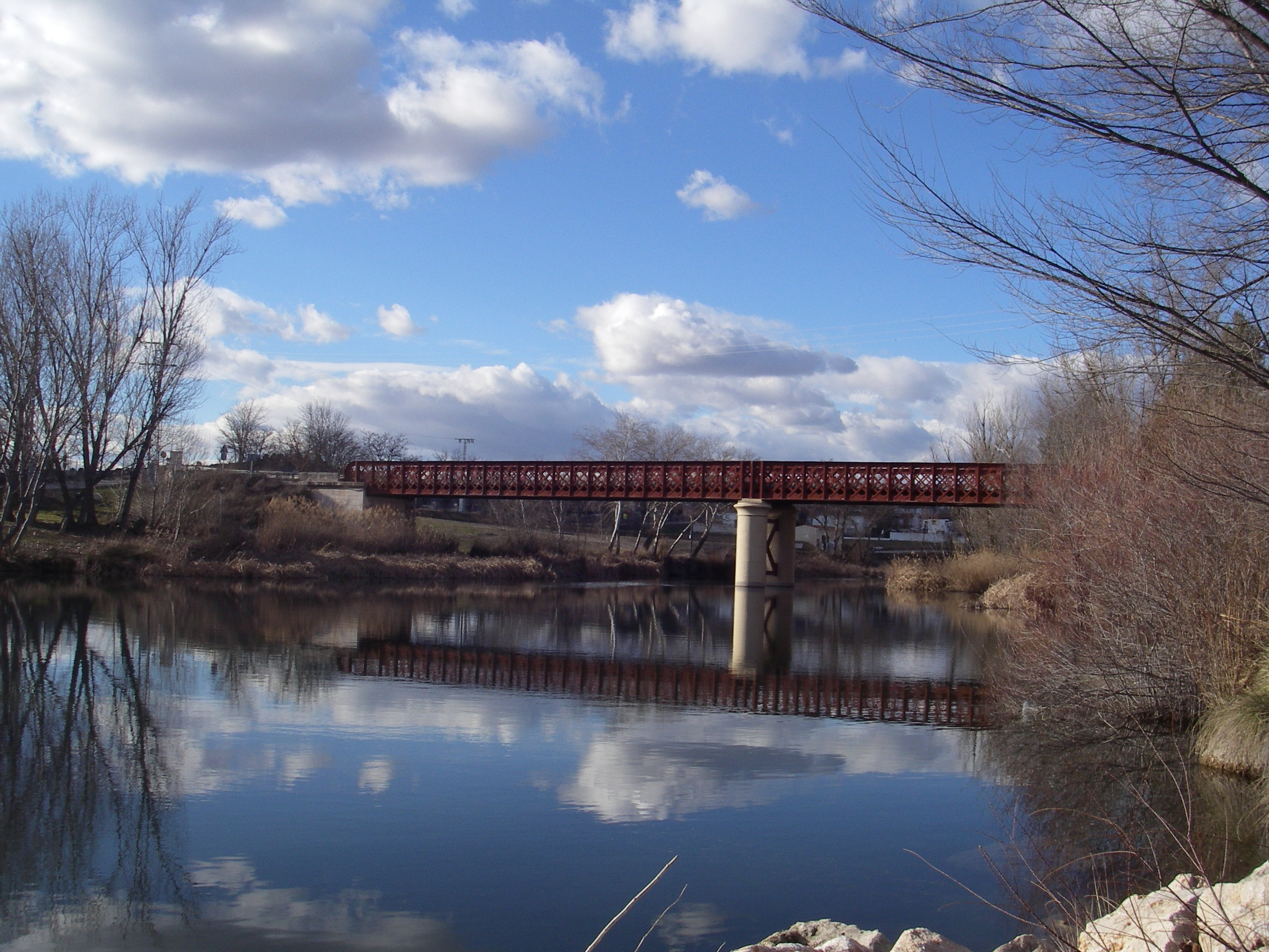
Carrying on along the route, with a view of the unmistakable iron bridge, you walk alongside the Tagus for about 300 m before turning left to cross the river over the bridge. Construction of the bridge began in 1868, after General Prim, as he fled to Levante in 1867, destroyed the old rope pulley boat crossing.
On the other side of the bridge (cross with caution, as you share the path with road traffic), turn right to reach the area known as "Remanso de la Tejera". This is a rest area on the Cañada Real, where shepherds and flocks used to stop before continuing their journey, now it has been transformed into a recreational area inviting you to take a rest and enjoy this bank of the Tagus River.
On leaving the rest area, the path veers to the right, heading away from the Tagus River for a kilometre. To the right of the path, crops dominate the river plain, while in the hills to the left there are frequent areas of aggregate extraction.
A meander in the Tagus brings the river back towards the Nature Trail, just before crossing the Fuentemaría stream, with the view of the Alarilla hermitage on the promontory just ahead. The path climbs steeply, leaving the ravine of the Fuentemaría stream, reaching the turn-off to the hermitage in just under 300 metres. Although the climb to the hermitage requires a little extra effort, it is well worth it for the views of the Tagus valley, right above the river. This simple temple was built on an esplanade once occupied by a border fortress between Muslims and Christians, and is where legend has it that the Virgin of Alarilla appeared before a shepherd.
Returning again to the Cañada, a few hundred metres more of ascent remain, until on the left we pass the track to the Alarilla district, belonging to Fuentidueña de Tajo, and continue our route taking the right-hand turn-off.
For the remainder of the route, the path again passes through a rolling moorland of greyish hills covered with scrubland, interspersed with cultivated areas.
After crossing the Higuerillas stream, the path starts to climb again, leaving rural roads on the right and left leading to the Alarilla district passing next to a farm school.
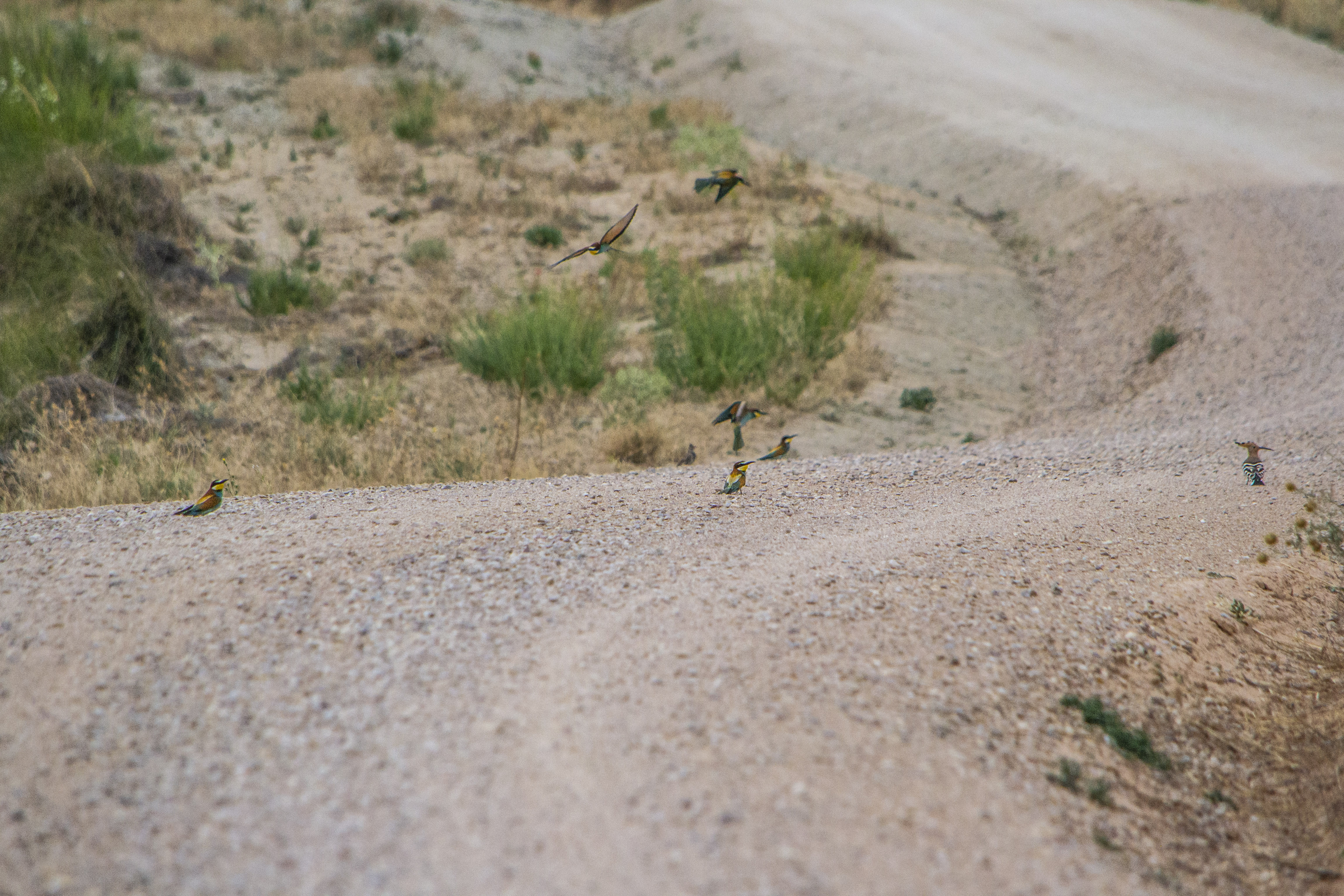
The path then begins to descend, first slightly, then steeply, towards the Vallehermoso stream. After crossing the stream, you start to climb steeply, but the slope becomes less steep after the first 800 m. The last few hundred metres of the route are between cultivated areas on the right and scrubland on the left. In the embankments at the sides of the path you can see the bee-eaters’ nests, and you may catch a glimpse of the birds as you walk along this last stretch.
The Nature Trail ends a few metres from an information panel, at the junction of the Cañada Real Soriana Oriental with the Montrueque road, right on the provincial boundary between the Community of Madrid and the province of Toledo. From this high point, it is worth looking back over the route taken, in the past used not only by livestock, but along which customs, experiences and traditions have travelled from one side of the country to the other.
Map
Puntos de Interés
Profile
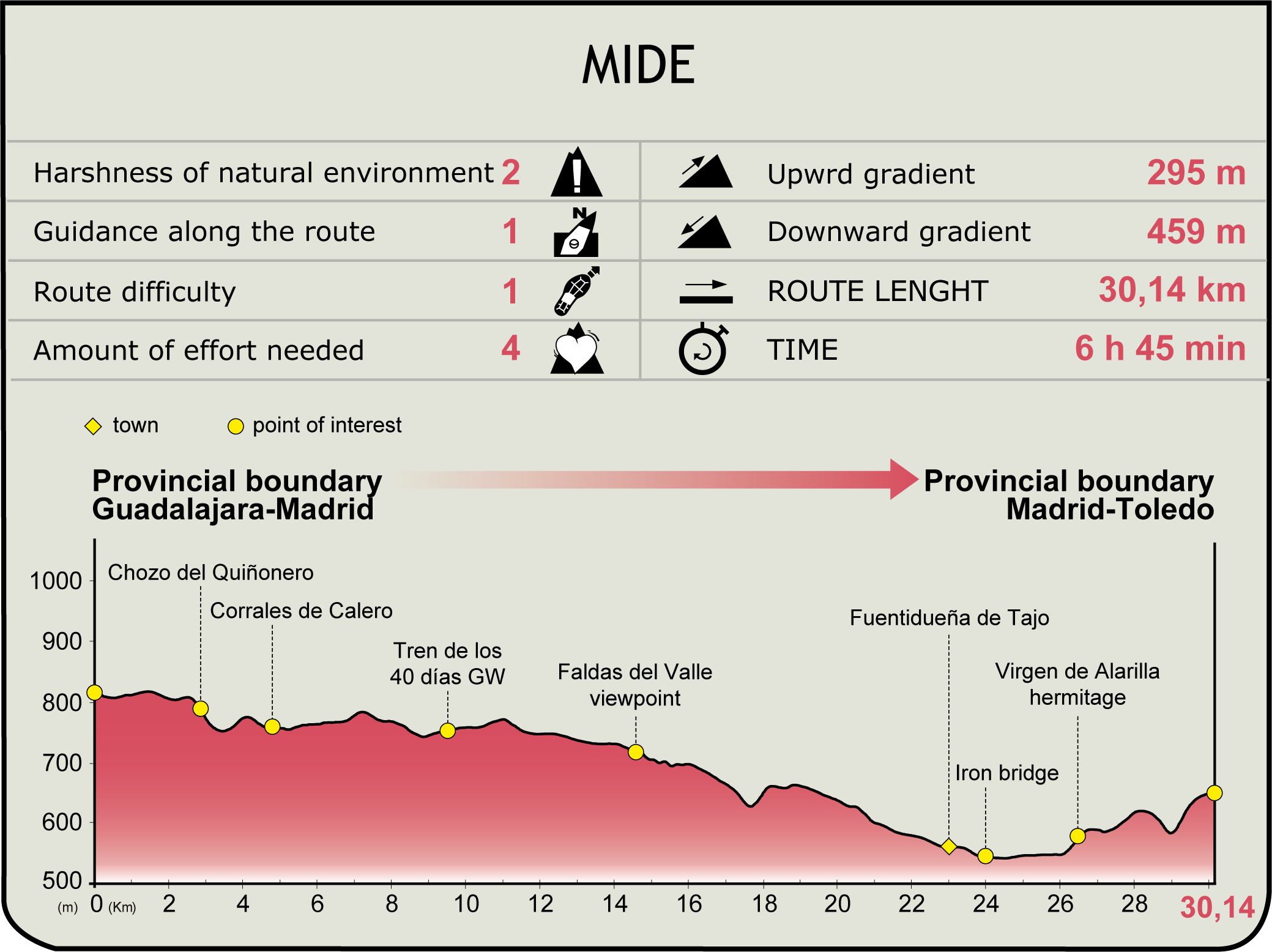
MIDE (Method for the Information of Excursions)
 Harshness of natural environment
- 1. The environment is not risk-free
- 2. There are more than one risk factors
- 3. There are various risk factors
- 4. There are quite a lot of risk factors
- 5. There are many risk factors
 Guidance along the route
- 1. Well defined trails and crossings
- 2. There is a clearly marked trail and signage
- 3. Requires the identification of geographic features and cardinal points
- 4. Requires off-path navigation
- 5. The trail is interrupted by obstacles that have to be gone around
 Route difficulty
- 1. Walking on a flat surface
- 2. Trails with different types of path
- 3. Walking on stepped paths or irregular terrain
- 4. The use of hands or jumping over the terrain is necessary
- 5. The use of hands is required to progress
 Amount of effort needed
- 1. Up to 1 hour of continuous walking
- 2. Between 1 and 3 hours of continuous walking
- 3. Between 3 and 6 hours of continuous walking
- 4. Between 6 and 10 hours of actual walking
- 5. More than 10 hours of continuous walking
Featured
Further information
Cañadas Reales: history-filled drovers’ roads
Drovers’ roads form and extensive network of traditional paths used by transhumant farmers seeking seasonal pastures. Depending on the geographical area, they have been given different names in Spanish; in this way, in Aragón and Navarre they were called "cabañeras"; in Catalonia "carrerades"; in Valencia "cazadores reales" and in Castile "cañadas".
The Cañadas Reales were the drover’s roads that were regulated via a royal edict issued by King Alfonso X "The Wise", which allowed shepherds to move their flocks from the invernaderos (winter pastures) to the agostaderos (summer pastures) and vice versa, following the payment of royalties. The Cañadas Reales were always linked to La Mesta High Council, an extremely powerful farming organisation created in 1273 which was given considerable privileges, enabling transhumance to reach its maximum splendour in this period.
The Cañada Real Soriana Oriental, measuring some 800 km in length, is the longest of the nine Cañadas Reales that cross the Iberian Peninsula, bringing the summer pastures of northern Soria and La Rioja into contact with the Valley of Alcudia and Andalusia, which boast a more agreeable climate in winter. This drovers’ road, which had a width of 90 Castilian yards (some 75 metres) along most of its route, even measured 300 to 800 m wide at the entrance to the Valley of Alcudia.
The decline in the foreign wool trade in the 18th century led to La Mesta’s gradual loss of power and the farmers’ agricultural land being gradually occupied by drover’s roads. The subsequent abandonment of many flocks, the new development of feed in animals’ diets and, above all, the use of new methods of transport, such as the railway or the lorry, were decisive in the deterioration and desertion of most of these tracks, which, in many cases, were terminated by infrastructures such as roads and housing estates, hindering even more so the work of the few shepherds who continued to maintain this traditional and sustainable custom.
At the present time, cattle tracks, which are property of public domain, represent a considerable environmental, recreational and touristic value (such as ecological corridors) for the territory, allowing trekkers and ramblers to discover and enjoy the peninsular landscape through these history-filled trails.
The Merino sheep
This is the most numerous breed of sheep in Spain and the most important worldwide, both in terms of their high numbers as well as owing to the influence they have had on the formation of important new breeds and improving the ovine population on the global level.
Extremely hardy in nature and capable of adapting to different environments, in the past, the main aim of their exploitation was to produce wool. Merino sheep’s wool is thick, curly and whitish and was regarded as the finest and softest of all breeds. This represented enormous wealth for Castile in the 13th century, as the breeding of Merino sheep was chosen above all others, resulting in the founding of La Mesta Royal Council. La Mesta even owned a network of drovers’ roads over which the sheep had priority on their transhumance routes or seasonal migration to warmer sites in the wintertime.
At the present time, the main productive use of the Merino sheep is targeted at obtaining meat and milk for cheese production. In this respect, the "Serena", "Casar" and "Pedroches" cheeses have acquired great fame on account of their high quality.
Shepherd huts and Merino sheep pens
Along this Nature Trail, you can see different examples of traditional rural structures that were used as shelter by shepherds and their flocks on their long transhumant journeys.
The chozos or shepherds’ huts had a circular or rectangular layout and were made out of limestone. They were generally assembled using a little mortar, which sheltered the shepherds both at night and in times of inclement weather. They used to be built with thick walls measuring some 3 m high and finished off with a “cone” type roof where small outlets or vents were opened to let out the smoke from the fires lit inside them.
The shepherds’ huts also used to have a series of adjacent pens where the cattle was collected, distributed and kept. These pens were rectangular in shape and their walls, which had various heights, were built in limestone, as were the huts.
Fuentidueña de Tajo
Fuentidueña de Tajo is a small municipality to the southeast of the Autonomous Community of Madrid, located in the fertile region of Las Vegas, which the River Tajo has been modelling on its way through over the centuries. At a height of 467 m, it is the second lowest municipality in the Community, second to Villa del Prado.
This town has a rich historic-artistic heritage, which includes the noteworthy Castle of Santiago or Castle of Los Piquillos, which stands over the municipality bearing witness to the importance of this site during the Reconquista. It was one of the strategic enclaves in the advance of the Christian kingdoms. The castle, which dates back to the 12th century, is currently in ruins, with only part of the wall and of the homage tower left standing. Numerous historic characters have passed through its ruins, such as Doña Urraca (the wife of Alfonso I "the Battler"), Alfonso VI and Alfonso VIII, and several illustrious personages, such as Pedro Manrique and Álvaro de Luna (Marquis of Villena), were imprisoned behind its walls.
In addition to the Castle of Los Piquillos, worthy of note for their artistic and cultural interest are the Clock Tower, built over an arch, and which houses one of the oldest machines in the Autonomous Community of Madrid; the Plaza de la Constitución, a typical quadrangular Castilian square with whitewashed houses and wrought-iron balconies; the Baroque-style church of San Andrés Apóstol, built over a small 12th- century chapel; Fuentidueña Bridge, whose construction was attributed to Ignacio Echevarría, with the collaboration of the French engineer Alexandre Gustave Eiffel; and the chapel of Alarilla, which is the destination of the unusual water procession of the Embarkation of Nuestra Señora de la Virgen de Alarilla, a festivity that has been declared of National Tourist Interest by the Autonomous Community. On the outskirts, there are still several cave houses that have been dug in the ground, which were already used by old settlers on these lands.
Multimedia

Downloads
GPS downloads
Brochure and maps
Cyclability
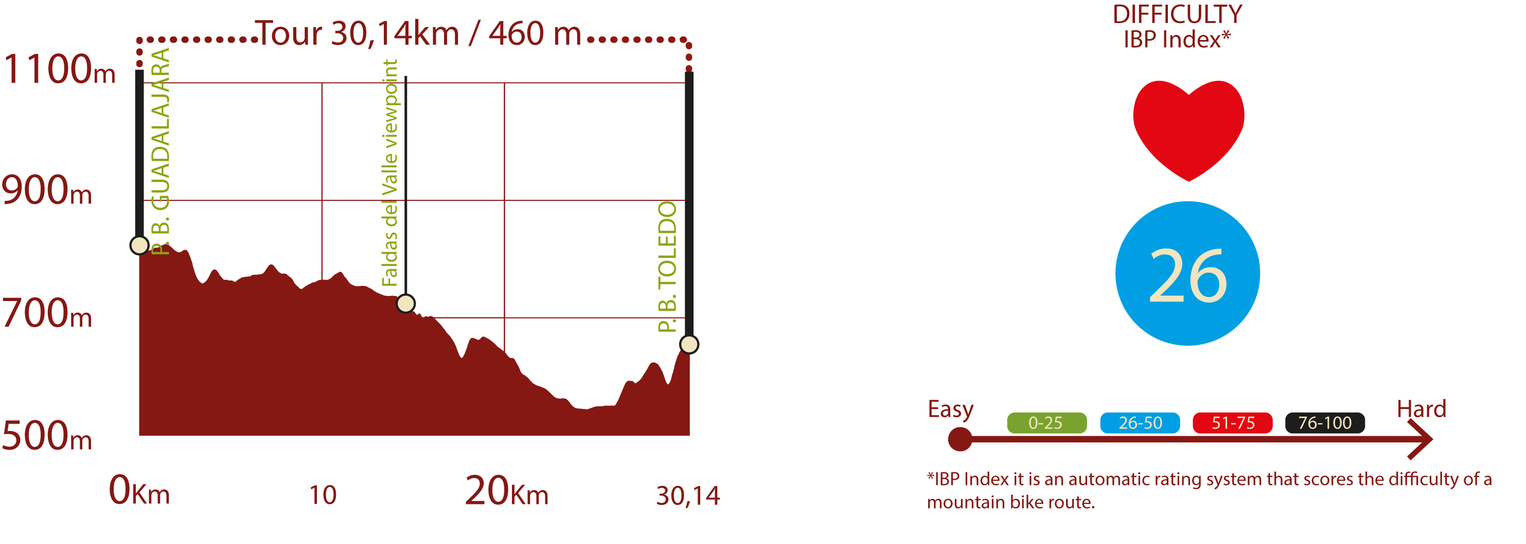
PROFILE & DIFFICULTY
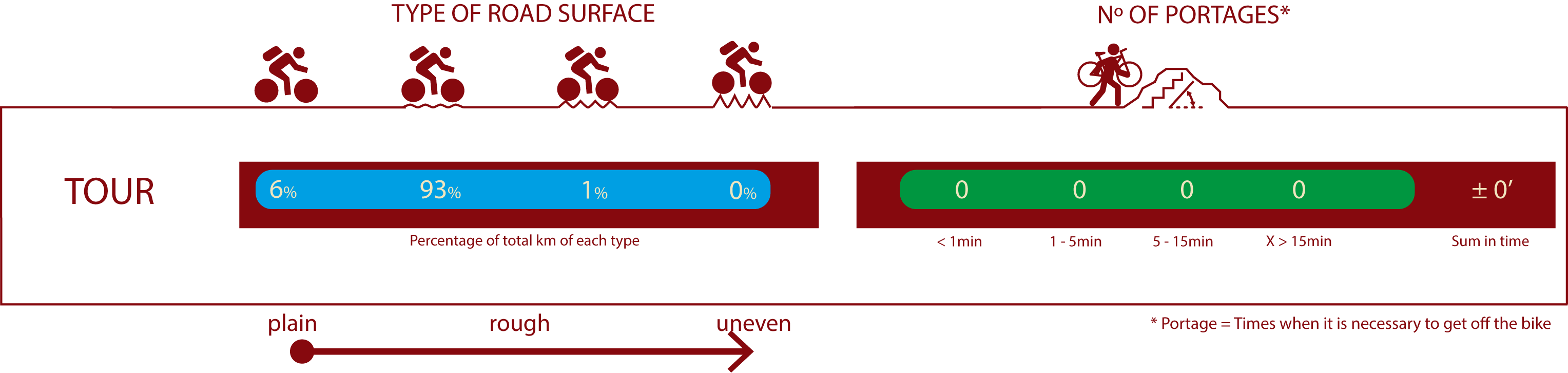
ROAD TYPE & PORTAGES
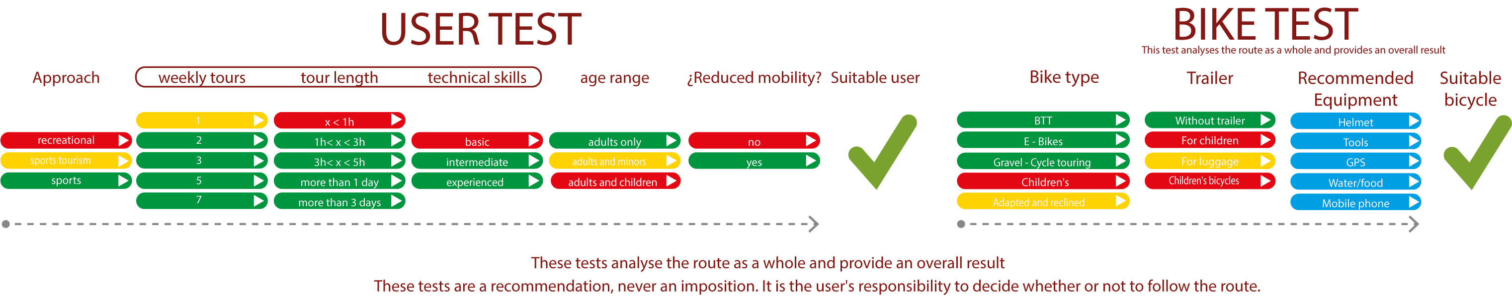
TEST
SAFETY RECOMMENDATIONS
-Caution on steep climbs and descents (some on natural terrain where there may be small gullies) in the vicinity of the Faldas del Valle viewpoint and after passing the Alarilla hermitage.
-Caution at the crossings of the M-221, M-222 and M-229 roads, at the numerous crossings of dirt tracks and when passing through the town centre of Fuentidueña de Tajo.
GENERAL RECOMMENDATIONS
-Find out about the technical aspects of the route and the weather on the day.
-Take care of the environment. Take care not to disturb animals or damage vegetation. Respect private areas.
-You must give priority to pedestrians and comply with general traffic rules.
-The environment in which you will be riding is open, free to move around and an area where many activities are carried out (sporting, forestry, livestock and agricultural activities). Always have an understanding, prudent, responsible and respectful attitude.