
- Home
- Rural Development
- Nature Trails
- Nature Trails
- Central Sector
Stage 6: Cuenca – Villar de Olalla
Description
From the narrow valley carved in the rock to the meanders of the Júcar.
A short stage that takes in the monumental city Cuenca as seen from the banks of the river Júcar, discovering the Bridge of San Antón and El Bosque de Acero, before ascending to the Mirador de Cuenca in the Sierra del Bosque, and finally ambling through farmland to Villar de Olalla.
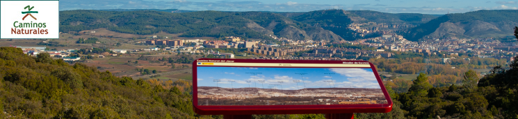
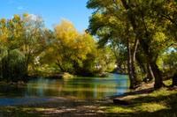
Stage 6 begins next to the interpretative panel located at the recreation area of Recreo Peral, at the northern end of the city of Cuenca. The route follows an asphalt track, with the river Júcar on the right and the picturesque city of Cuenca, a UNESCO World Heritage Site since 1996, rising on the left over the rocky cliffs.
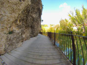
After climbing some steps and following the Caminos Naturales signs, the road changes, taking a dirt track that goes off to the right and comes even closer, if that’s possible, to the river Júcar. Shortly after, we cross a wooden bridge that's the starting point of a spectacular stretch of wooden footbridge anchored in the rock, curving in time with the sound that marks the final part of the Hoz del Júcar.
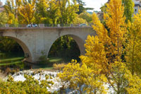
Without pausing, but taking in the surrounding environment, we reach the Parque de la Trinidad, where a new wooden bridge crosses the Huécar River at the point where it flows into the Júcar River, a point known as junta de los ríos or the meeting of the rivers. We ascend a flight of stairs still inside the park, to turn right onto Avenida Virgen de la Luz, which after a few metres leads us to the well-known de San Antón bridge. This infrastructure not only allows you to cross to the other side of the river, but also gives those who arrive here an impressive panoramic view of the church of the Virgen de la Luz.
The church is left behind, and the path turns to the left along the Avenida de los Alfares and before descending another a flight of steps that takes us back to the banks of the Júcar. Once again, we must cross the course of this beautiful river using a wooden bridge, after which we turn right and walk through gallery forests, with the river Júcar our faithful companion to the right.
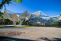
Almost without realising it, we advance through the city of Cuenca immersed in the tranquillity offered by the river and its pleasant riverside promenade. After passing a gauging station Júcar River Basin Authority and crossing several roads and the old railway bridge, we find ourselves before a curious building known as El Bosque de Acero (The Steel Forest). This futuristic construction was inaugurated in 2010 and designed in the studio of famed architect Rafael Moneo. It serves as a spectacular venue for all manner of socio-cultural events.
At this point we pass kilometre point 2, and leave our travel companion the river Júcar behind. Turning left, we rise a few meters after a short section of steps along the Moscas river. Taking another left, we emerge back onto the Ronda Oeste, to continue along the pavement or cycle lane. Cross the aforementioned Ronda Oeste at the purpose-installed traffic lights, where, in addition, an interpretative panel indicates we are leaving the city of Cuenca.
After a right turn, a short stretch shared with traffic begins, requiring the necessary precautions. This section ends at kilometre marker 3 to continue along the pavement or cycle lane at Pasaje de Abengózar, where the route momentarily returns to the course of the river Júcar.
On reaching a roundabout we continue along the dirt road on the left. We won’t lose the trail, however, as the areas has several Caminos Naturales signposts guiding us towards the Hospital Universitario de Cuenca, thus completing the fourth kilometre of the stage.
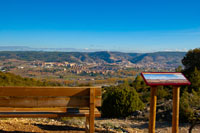
Following the signs, we zigzag right and left, crossing the N-320 road via an underpass. On returning to the surface, the route climbs for 1 kilometre through ramps that do require some degree of effort, rewarded by the presence of Mediterranean scrubland, mainly holm oaks (Quercus ilex), with an undergrowth of scrub and aromatic plants of great interest. And at the top, a bench and a lectern-type panel offer a well-deserved rest to enjoy the views of the city from this viewpoint behind the Mirador de Cuenca.
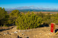
Then it's time to begin the descent, this time on a dirt track that soon turns into a path, we must follow the Caminos Naturales markers to complete this fast-paced stretch through vegetation and substrates rich in gypsum. At the end of the path, you continue along a wide dirt track, while the landscape that flanks the traveller changes radically, as the Mediterranean scrubland gives way to farmland. In addition, small streams with their gallery forest and pockets of shrub and tree vegetation dot the landscape, forming a mosaic of special beauty.
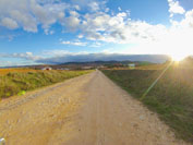
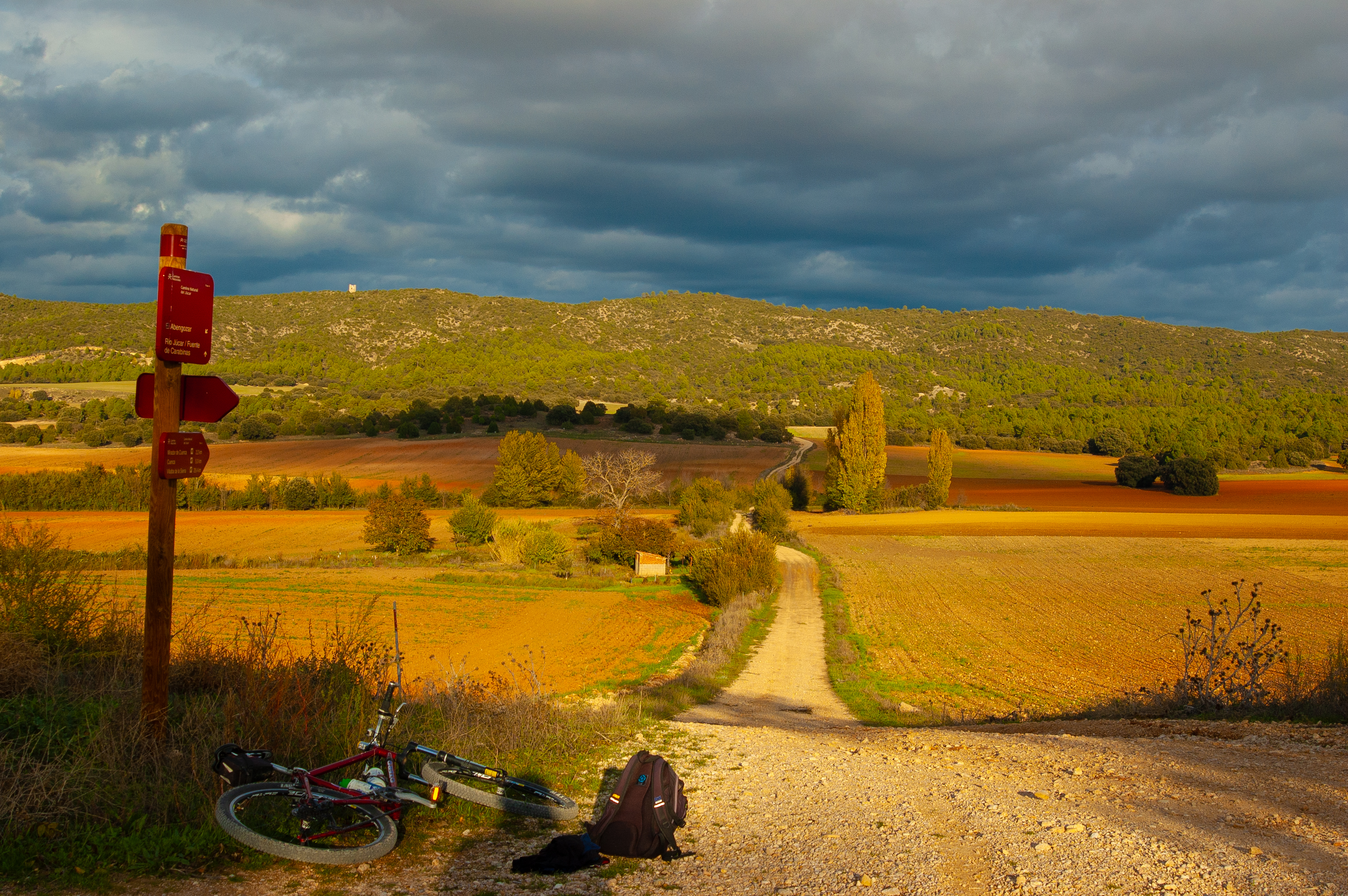
The route reaches an uninhabited village known as La Abengózar, turning left at this point, and from then on, the kilometres continue along a wide, gently sloping path, moving away from the Sierra del Bosque and approaching the town that marks the end of the stage.
Shortly after passing kilometre point 10, the traveller enters Villar de Olalla via Calle Abengózar. Strolling through this beautiful Cuenca village following the Caminos Naturales urban marker plaques, until we reach a zebra crossing on the N-420 road and, passing that, we reach the interpretative panel marking the end of stage 6 of the Júcar Nature Trail.
Sites of interest
Profile
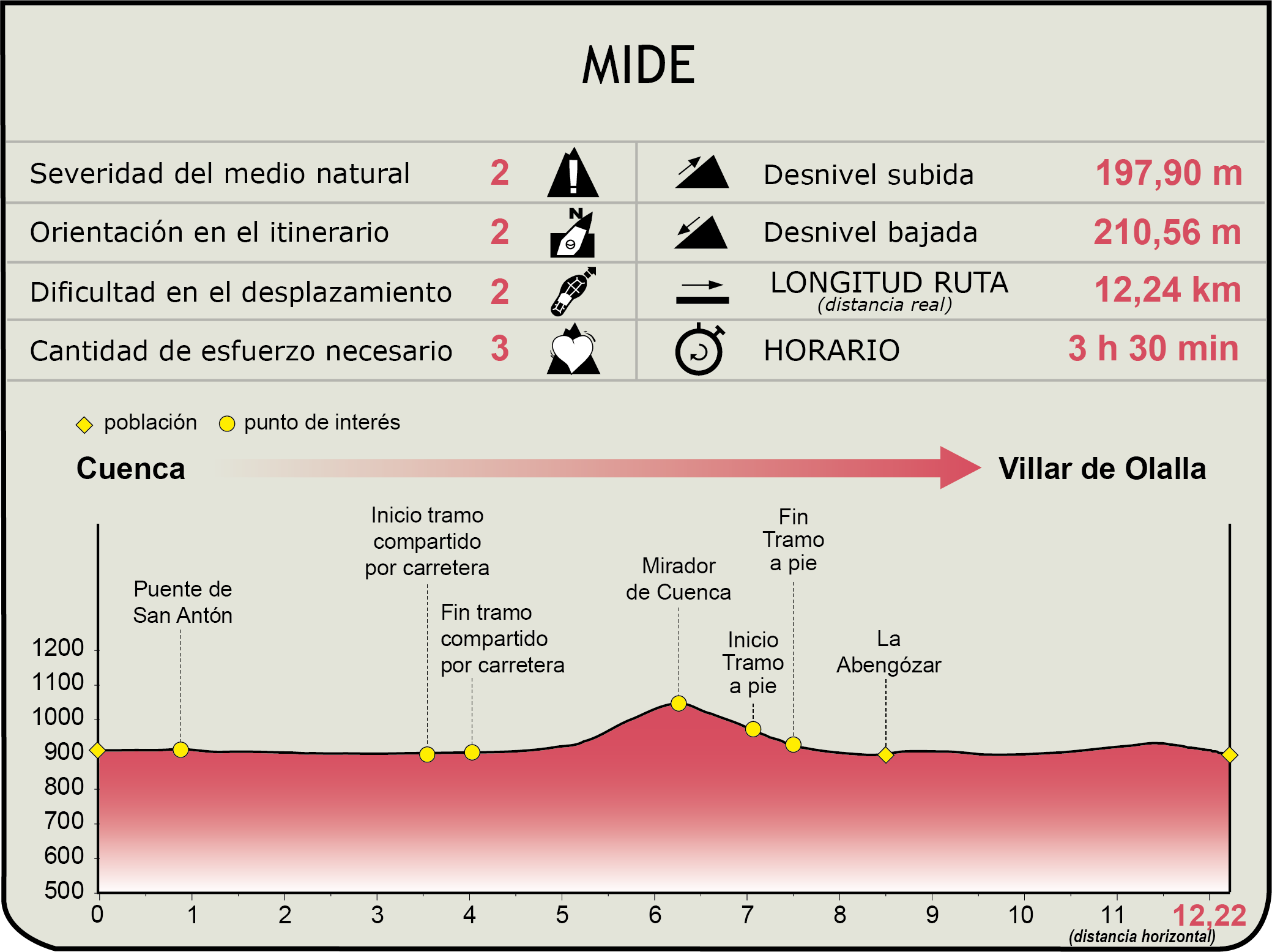
MIDE (Method for the Information of Excursions)
 Harshness of natural environment
- 1. The environment is not risk-free
- 2. There are more than one risk factors
- 3. There are various risk factors
- 4. There are quite a lot of risk factors
- 5. There are many risk factors
 Guidance along the route
- 1. Well defined trails and crossings
- 2. There is a clearly marked trail and signage
- 3. Requires the identification of geographic features and cardinal points
- 4. Requires off-path navigation
- 5. The trail is interrupted by obstacles that have to be gone around
 Route difficulty
- 1. Walking on a flat surface
- 2. Trails with different types of path
- 3. Walking on stepped paths or irregular terrain
- 4. The use of hands or jumping over the terrain is necessary
- 5. The use of hands is required to progress
 Amount of effort needed
- 1. Up to 1 hour of continuous walking
- 2. Between 1 and 3 hours of continuous walking
- 3. Between 3 and 6 hours of continuous walking
- 4. Between 6 and 10 hours of actual walking
- 5. More than 10 hours of continuous walking
Featured
Further information
Villar de Olalla
Villar de Olalla is a small municipality located in the county of Serranía de Cuenca, in the province of Cuenca. Its mountainous setting, characterised by hills and forests, is about 10 km south-east of the provincial capital.
Archaeological discoveries in the area suggest the history of this village dates back to the Bronze Age, as attested by the Los Escalones site, located on the hill of the same name, and a concentration of tombs in a nearby valley.
There are also traces that indicate that there was some Roman presence in the El Bosque mountain range, the natural border between Villar de Olalla and the Cuenca city limits. There is possible evidence of villas and mills near the rivers San Martín and Júcar. Added to this is the presence of the Roman bridge of Villar de Olalla. The Visigoth presence is associated with the creation of the settlement on the hill of San Lorenzo, also used as a necropolis. After the Christian conquest, the population persisted on the same hill, but later, due to the outbreak of plagues, it moved to the other bank of the river San Martín, where it settled definitively.
Villar de Olalla preserves traditional architectural elements, including houses in the typical rural style of the region. The Parish Church, built in the 16th century and dedicated to the Nativity of Our Lady, is a highlight. It is a Latin cross church with a barrel-vaulted choir. There is also a small shrine dedicated to the Virgen del Villar. A construction of simple appearance where the image of the patron saint resides.
Multimedia


Downloads
GPS Downloads
Cyclability
This Cyclostage corresponds to stage 6 and stage 7 of the Nature Trail
PROFILE

TYPE OF ROADS, PORTAGES & DIFFICULTY

TEST

SAFETY RECOMMENDATIONS
- Mountain bike trails with several stretches of footpaths of different lengths and difficulty.
- Extreme caution should be exercised and all information for cyclists should be read carefully, and the trip should be abandoned if in doubt.
- There are walking section where cyclists must dismount, sections of path, sections with rocky outcrops, sections with loose stony ground, demanding ascents and long descents.
RECOMENDACIONES GENERALES
- Find out about the technical aspects of the route and the weather on the day.
- Take care of the environment. Take care not to disturb animals or damage vegetation. Respect private areas.
- You must give priority to pedestrians and comply with general traffic rules.
- The environment in which you will be riding is open, free to move around and an area where many activities are carried out (sporting, forestry, livestock and agricultural activities). Always have an understanding, prudent, responsible and respectful attitude.