
- Home
- Rural Development
- Nature Trails
- Nature Trails
- Central Sector
- Humedales de la Mancha
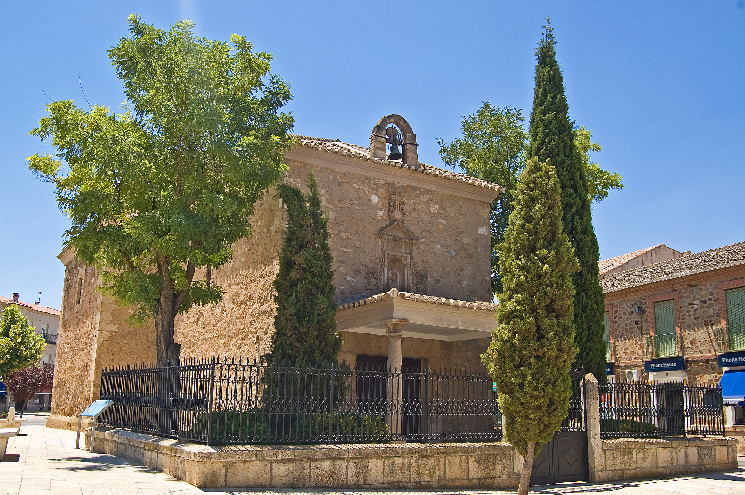
Stage 1: Villacañas – Quero
Description
La Mancha Wetlands welcome the traveller with its northernmost lagoons
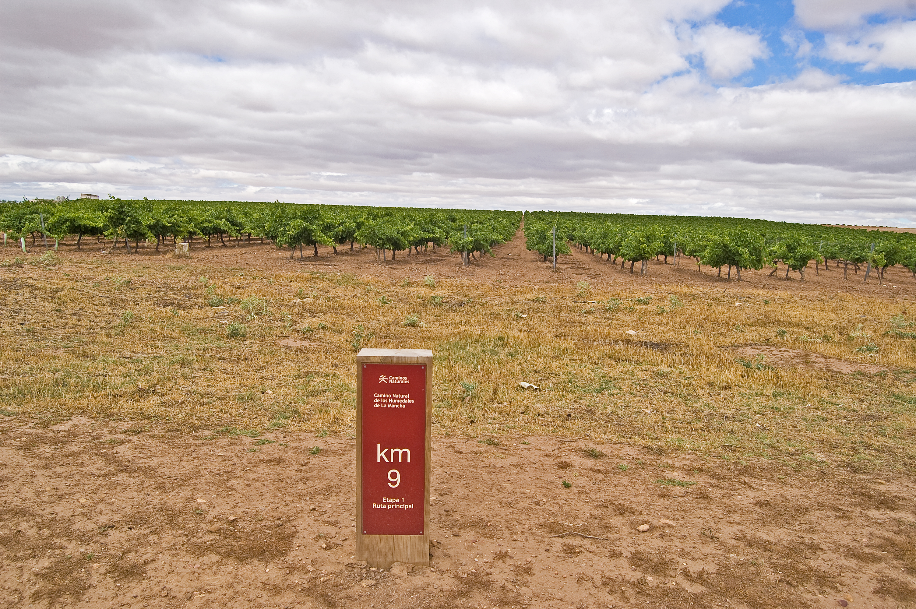
The first stage of the La Mancha Wetlands Nature Trail runs across Toledo’s lands throughout almost 27 km. After exploring Villacañas and its typical silos, the traveller will visit the town's lagoon complex, starting with the Laguna Larga and moving forward to the Laguna de Tirez and the Laguna de Peñahueca. Between these last two lagoons, the River Riánsares flows into the River Gigüela forming the Laguna del Taray in the municipality of Quero. Leaving behind the Lagunas y Albardinales del Gigüela Nature Reserve, the trail reaches the town of Quero, escorted by its restored windmill.
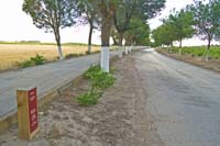
The first stage of the La Mancha Wetlands Nature Trail starts at the connection to the Trenillo Natural Trail. Right after, you will cross the CM-410 road, taking extreme precautions, and leave the town of Villacañas on the right.
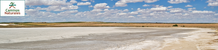
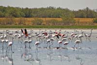
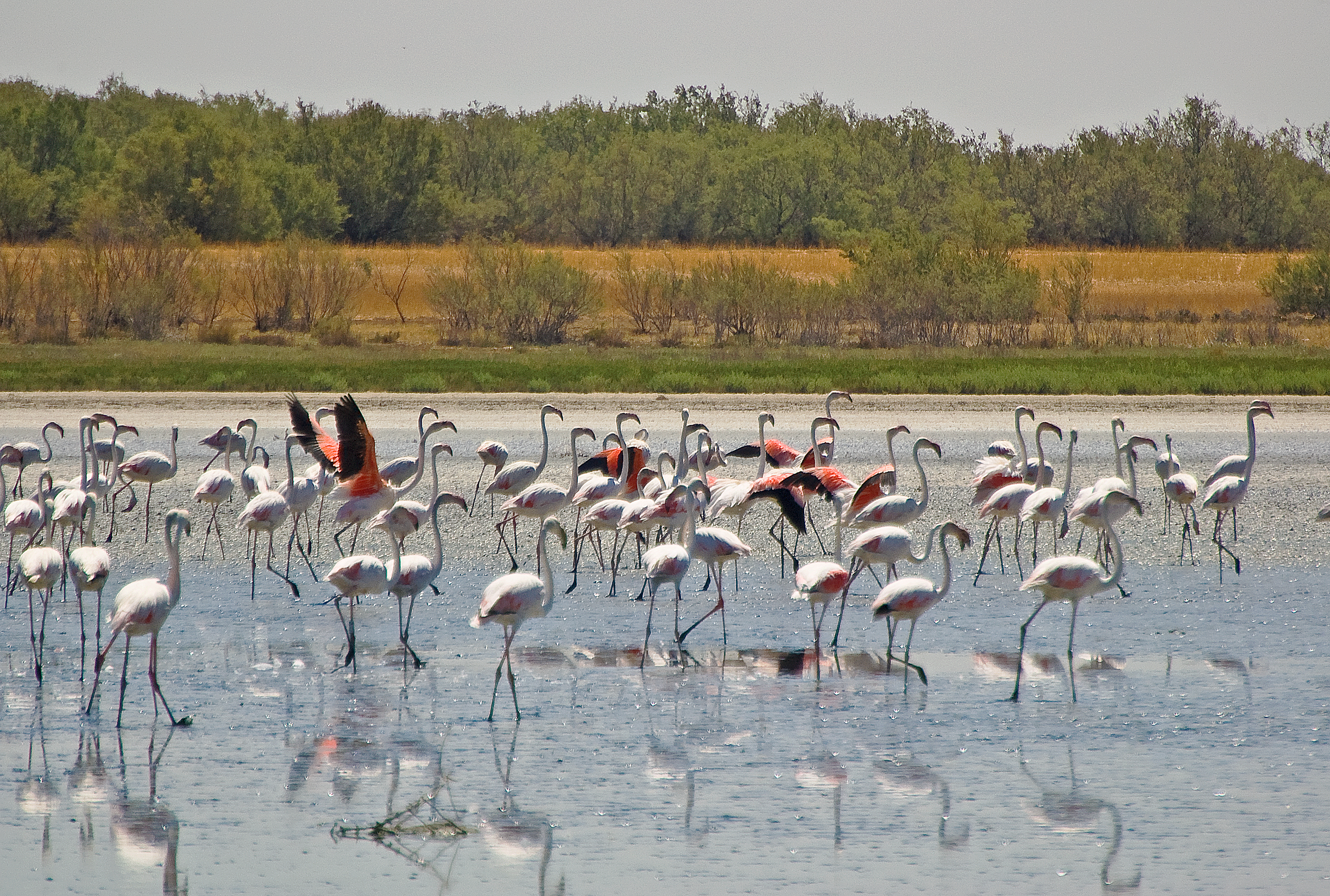
Then, also on the right side, you will see the beginning of the 900 m detour that leads to the Laguna Larga de Villacañas (endorheic, anthropomorphised lagoon with a surface of 84 ha that receives treated wastewater from the wastewater treatment plant (EDAR) of Villacañas. It contains different species of aquatic flora and numerous species of microcrustaceans and algae that favour the right habitat for a large number of aquatic birds), and in particular to the Flamingo Observatory, where you will enjoy the beautiful landscape and its biodiversity, especially the flamingo community (Phoenicopterus roseus) that resides in this environment.
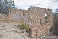
Back on the main trail, you will be delighted with the landscape that surrounds the right side of the lagoon as you move away, little by little, from this natural environment. A few metres after passing by kilometre point 3, the itinerary reaches the ruins of the Molino en Medio. From this mill, the trail moves forward in parallel to the River Riánsares, always on the left side. This Arab mill used water from the River Riánsares to grind wheat thanks to a cogwheel, a mobile circular stone with a central hole to insert the grain and that was mounted on a fixed stone, and thus making flour.
You will continue your journey throughout the Cañada Real Soriana Oriental that witnessed the cattle’s seasonal mobility for centuries. After leaving the Molino de Abajo behind, you will cross the Madrid-Cádiz railway line by an overpass and reach kilometre point 7 of this stage.
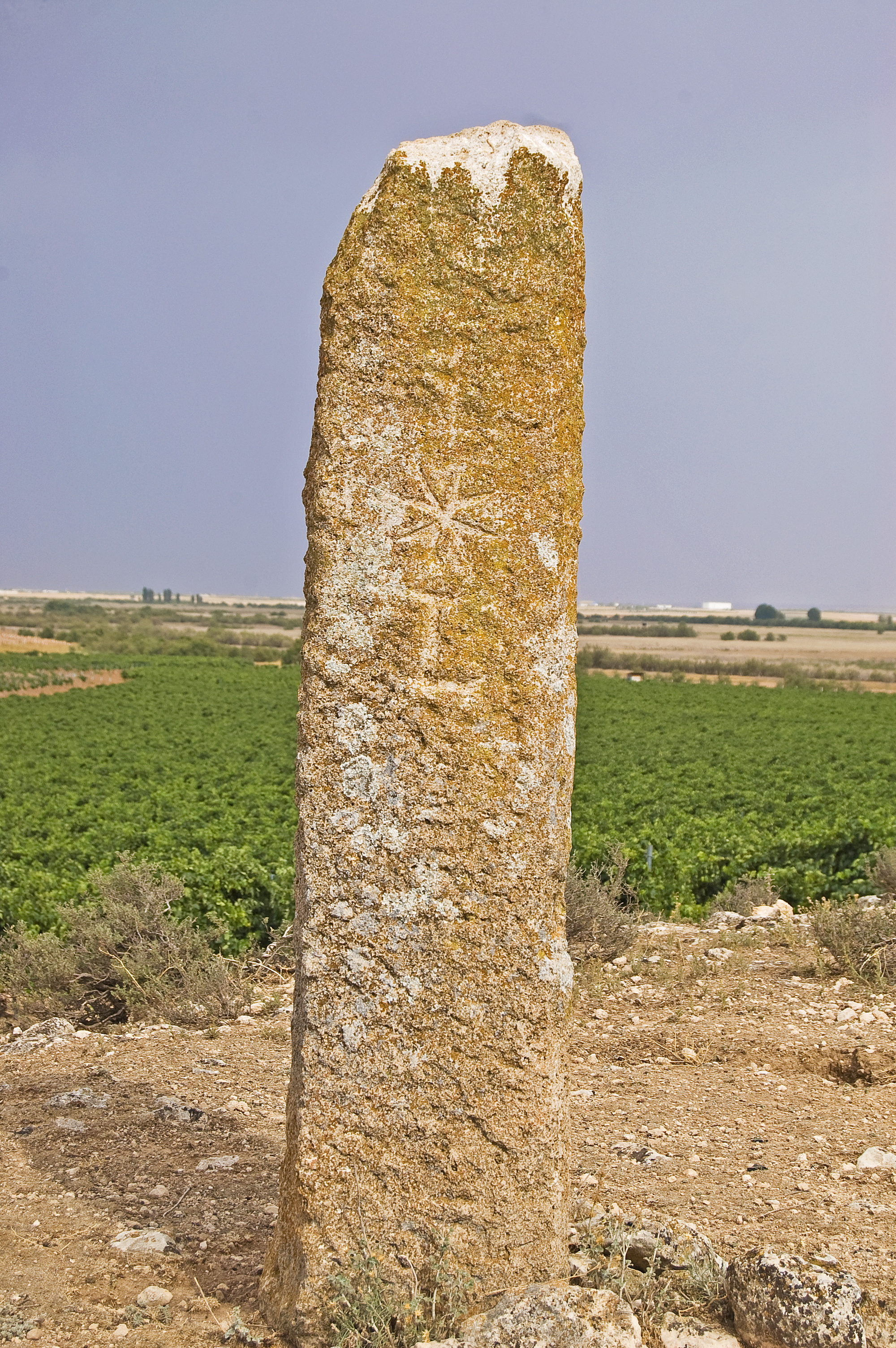
Two kilometres afterwards, the trail continues to the west, leaving the River Riánsares in the proximity of its mouth in the River Gigüeña, forming the Laguna del Taray (lagoon with a surface of 120 ha, formed by the alluvial deposits of the rivers Gigüela and Riánsares. Its sheet of water is permanent throughout the year and its fluvial nature causes its hypo-saline character; it can have a maximum depth of 2.5 m. The vegetation of its banks is mainly composed of reed beds and bulrush that attract numerous water bird species). The ruins known as Las Casas Romanas are located just a few metres before reaching kilometre 10 of this stage. After walking for a kilometre, you will see the Hito de la Costera on the left side, with the cross from the Order of St. John carved in stone, which has served as a territorial limitation since the period of the Reconquista.
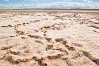
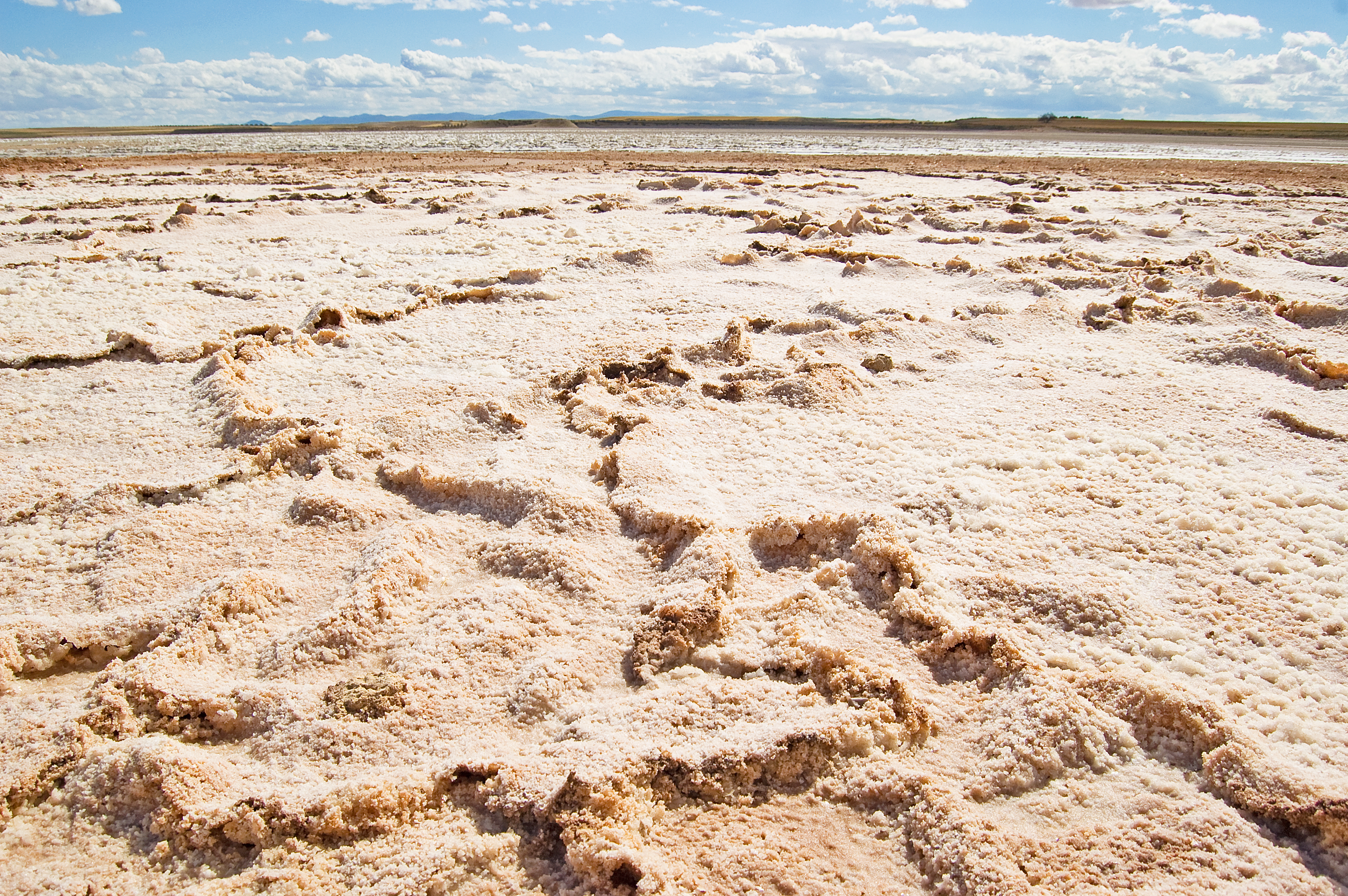
Continuing along the Cañada Real Soriana Oriental, you will cross the TO-3077 road, with the utmost care, to immediately reach the Laguna de Tirez (endorheic, hyper-saline lagoon with a surface of 89 ha that receives its water intake from the runoff, being completely linked to rainfall as a result. Saltpetre, which was exploited in the past, gives it a characteristic smell. The high concentration of salt causes the formation of saline efflorescences in summer, when it remains completely dry). You will enjoy its spectacular panoramic view for almost 2 km.
A few metres before reaching kilometre point 15, the trail turns left, leaves the Cañada Real Soriana Oriental behind and crosses the TO-3077 road again, reaching shortly after the Laguna de Peñahueca (endorheic, hyper-saline lagoon with a surface of 120 ha that receives its water intake from the runoff, being completely linked to rainfall as a result.
The effect of the salt extraction activities, significant in the past, are visible in its basin. It shelters important populations of insect species, whose biological cycle is linked to saline plan species). In this lagoon, you will appreciate the great value of its environment thanks to a small botanical itinerary and the Pagaza observatory. After passing by kilometre point 17, the lagoon will begin disappearing in the distance.
Two kilometres afterwards, you will cross the River Gigüela through a bridge and enter into the Lagunas y Albardinales del Gigüela Nature Reserve. Along the path that surrounds this flood-plain area, you will continue leaving the tamarisks on the right side and rain-fed crops and some vineyards on the left.
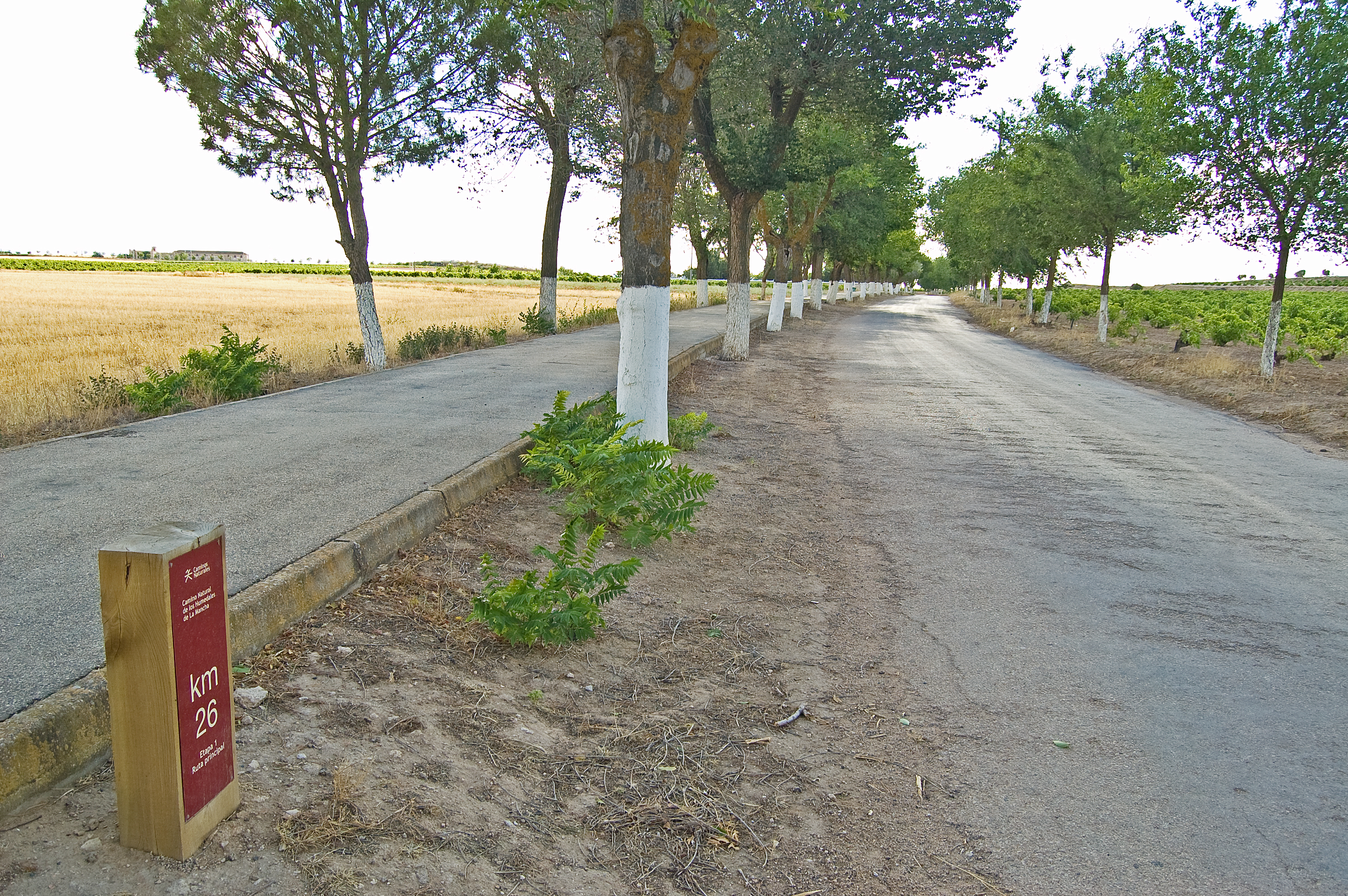
At kilometre point 23, the itinerary turns right and crosses the albardines until it reaches a livestock holding that precedes the overpass on the Madrid-Cádiz railway line.
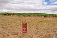
A rest area belonging to the Don Quijote Route and the municipal cemetery indicate the proximity to the town of Quero and the end of this first stage. You will take the wooded Las Viñas street, turn right on Cristóbal Colón street and reach the roundabout to continue through the Ronda Pueblo until its junction with the CM-3130 road that crosses the city or the Castilla-La Mancha avenue, as it is known in the town. At this point, the interpretation panel marks the end of this first stage of the La Mancha Wetlands Nature Trail between the towns of Villacañas and Quero (Toledo).
Laguna Larga branch
A less than 1 km branch that draws from the Main Route and continues to reach the Laguna Larga de Villacañas, specifically the Flamingo Observatory, where you can enjoy this natural environment.
Map
Puntos de Interés
Municipio
Vegetación
Profile
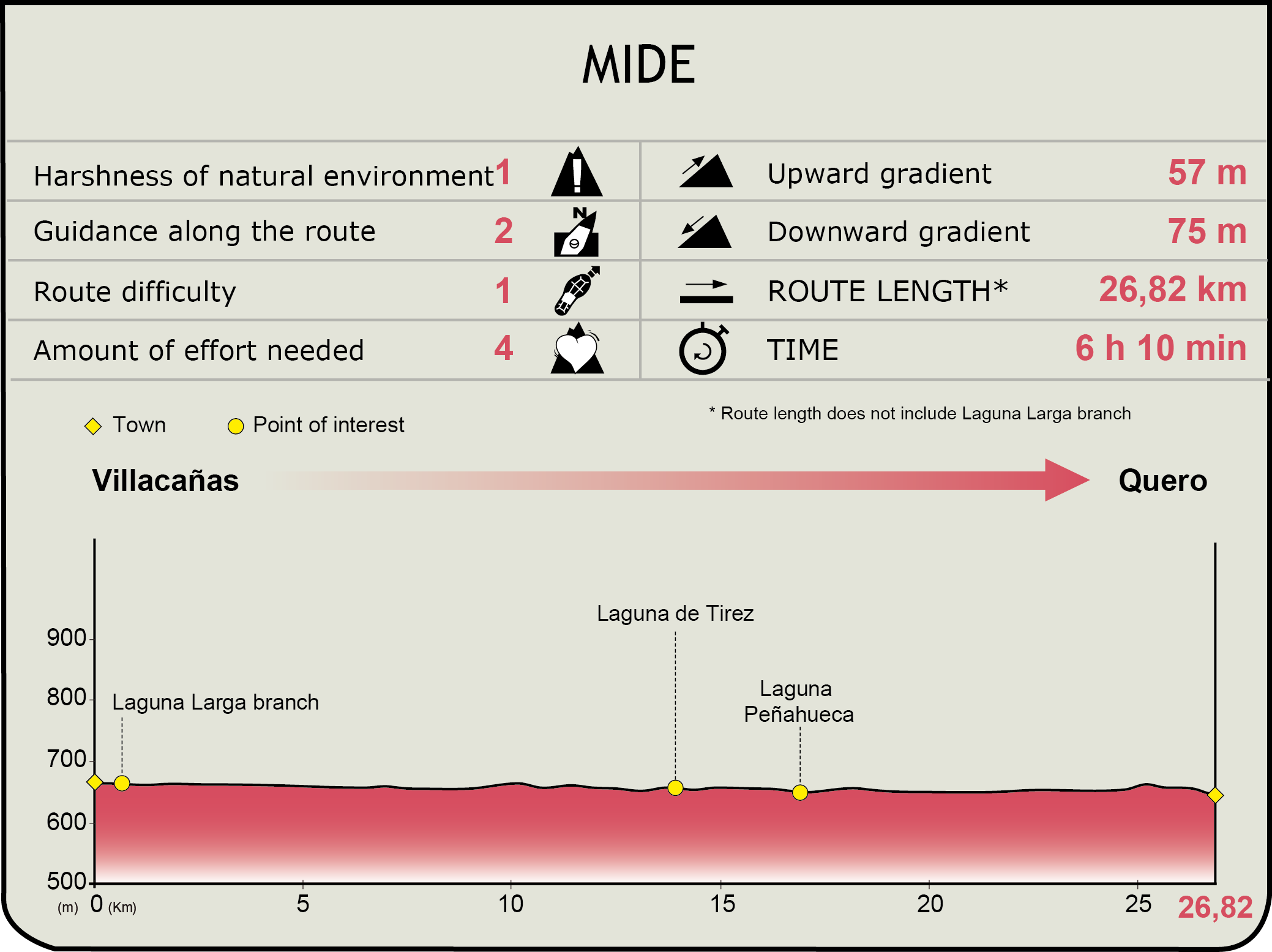
MIDE (Method for the Information of Excursions)
 Harshness of natural environment
- 1. The environment is not risk-free
- 2. There are more than one risk factors
- 3. There are various risk factors
- 4. There are quite a lot of risk factors
- 5. There are many risk factors
 Guidance along the route
- 1. Well defined trails and crossings
- 2. There is a clearly marked trail and signage
- 3. Requires the identification of geographic features and cardinal points
- 4. Requires off-path navigation
- 5. The trail is interrupted by obstacles that have to be gone around
 Route difficulty
- 1. Walking on a flat surface
- 2. Trails with different types of path
- 3. Walking on stepped paths or irregular terrain
- 4. The use of hands or jumping over the terrain is necessary
- 5. The use of hands is required to progress
 Amount of effort needed
- 1. Up to 1 hour of continuous walking
- 2. Between 1 and 3 hours of continuous walking
- 3. Between 3 and 6 hours of continuous walking
- 4. Between 6 and 10 hours of actual walking
- 5. More than 10 hours of continuous walking
Featured
Further information
Villacañas
Town in the province of Toledo, located in the region of La Mancha. Various remains and ruins from different settlements have been found; up to four settlements existed within the town, which have now disappeared: Borregas, Ormeña, Ormeñuela and Tirez.
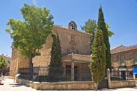
The Carta Puebla de Villacañas population chart was granted in 1230 by the Order of Knights of the Hospital of Saint John of Jerusalem. Another important chapter in the town's history was the disentailment carried out in the 18th century, which resulted in the restructuring of land ownership and the emergence of labourers or unskilled farm labourers. They were poor families who worked the land, compelled to reside in poor underground houses, known as "silos", due to their economic situation. The architectural, ethnographic and cultural value of these buildings has resulted in its declaration as an historic-artistic site, specifically a Heritage of Cultural Interest. The Nuestra Señora de la Asunción Church is also worth visiting.
The economic sector, linked to agriculture for years, is currently based on vines, wheat and olive trees. Moreover, a large industry mainly linked to the wood sector and the production of doors promotes employment both in the town and in the region. Among the local festivities, the most important celebration is the Cristo de la Viga day (1 May), which has been awarded Regional Tourist Interest status,
La Mancha Wetlands
Protected Natural Space with a surface area over 14,000 ha included within the Natura 2000 network as a Specially Protected Area (SPA) and a Specially Protected Area for Birds (SPAB). This territory covers discontinuously the provinces of Toledo, Ciudad Real and Cuenca. It possesses a Biosphere Reserve status called La Mancha Húmeda, and many of its lagoons are classified as Natural Reserves.
It is characterised by a clear continental character and a smooth relief, dotted by numerous shallow saline lagoons with a great seasonality that leads to its complete dryness during the summer period. This unique features increase the botanical and zoological value of this environment. In terms of vegetation, numerous species adapted to the hyper-saline conditions grow in this wide lagoon areas, notably a broad sample of protected and endangered species included in the national and regional catalogues.
The zoological value is mainly concentrated in the bird population that find shelter in this environment, both as a stop in their migratory routes and throughout the year. For these reasons, the importance of preserving and conserving these spaces and its flora and fauna population must be a shared commitment.
Multimedia

Downloads
Descargas de GPS
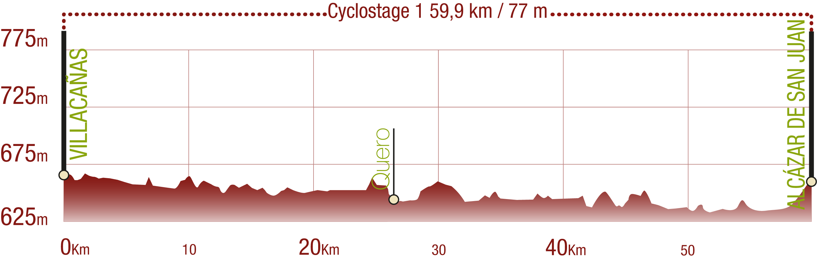
Cyclability
This cyclostage corresponds to stages 1 to 3 of the Nature Trail
PROFILE
TYPE OF ROAD, PORTAGES & DIFFICULTY

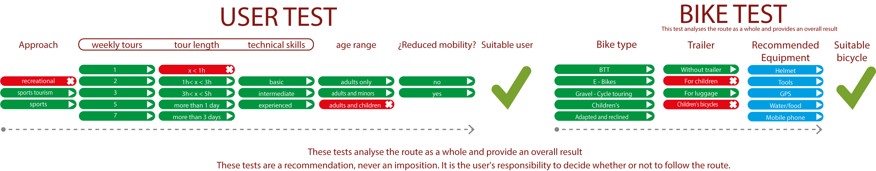
TEST
SAFETY RECOMMENDATIONS
- Sections shared with hikers and agricultural vehicles.
- Transit through the centre of some population centres.
GENERAL RECOMMENDATIONS
- Find out about the technical aspects of the route and the weather on the day.
- Take care of the environment. Take care not to disturb animals or damage vegetation. Respect private areas.
- You must give priority to pedestrians and comply with general traffic rules.
- The environment in which you will be riding is open, free to move around and an area where many activities are carried out (sporting, forestry, livestock and agricultural activities). Always have an understanding, prudent, responsible and respectful attitude.