
- Home
- Rural Development
- Nature Trails
- Nature Trails
- Central Sector
- Humedales de la Mancha
Stage 5: Pedro Muñoz – Las Mesas
Description
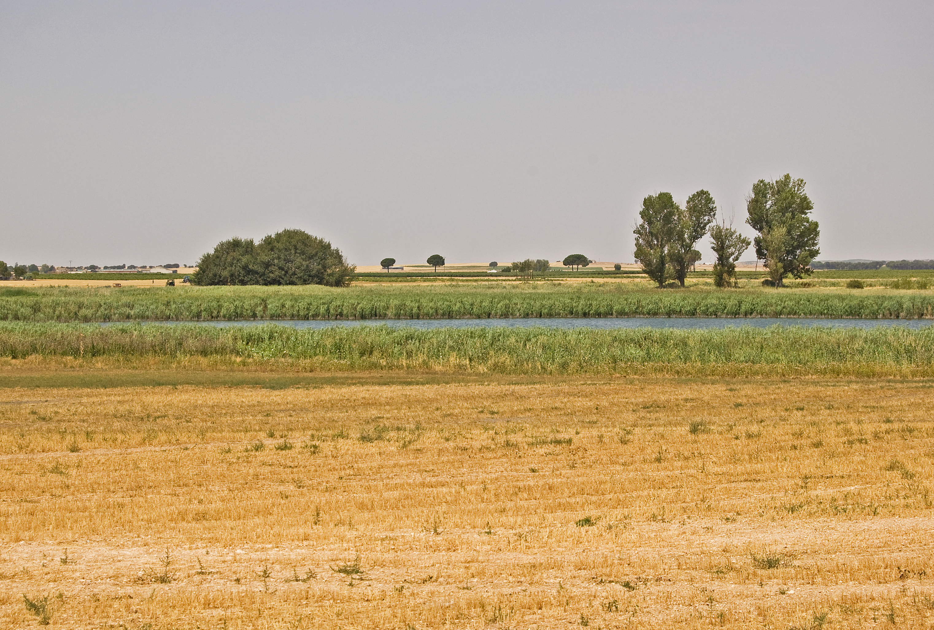
Pass by the Manjavacas lagoon complex before the Laguna del Taray Chico provides the perfect ending.
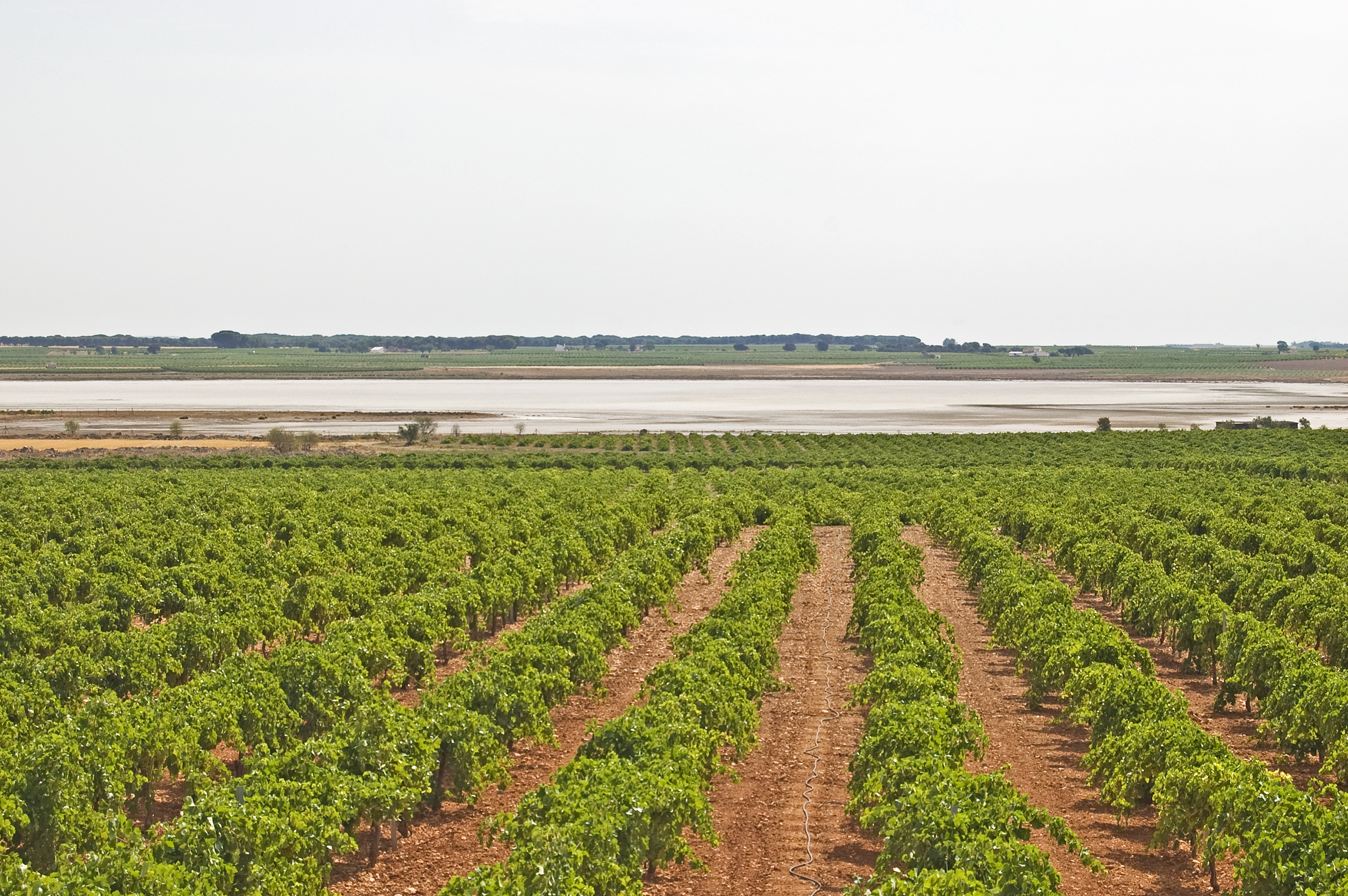
After leaving the town of Pedro Muñoz behind, followed by a section of vineyards, you are welcomed by the Laguna de Alcahozo. The almost 15 km detour, which is just a little less than this fifth and final stage, visits the entire Manjavacas lagoon complex in the province of Cuenca. Once back on the Main Route, and surrounded by vineyards, the town of Las Mesas is reached. Here, after visiting the town centre, another detour takes the traveller to the evergreen Laguna del Taray Chico.
The fifth and final stage of the La Mancha Wetlands Nature Trail starts in the east of the town of Pedro Muñoz at the interpretation panel for this purpose.
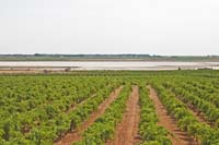
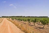
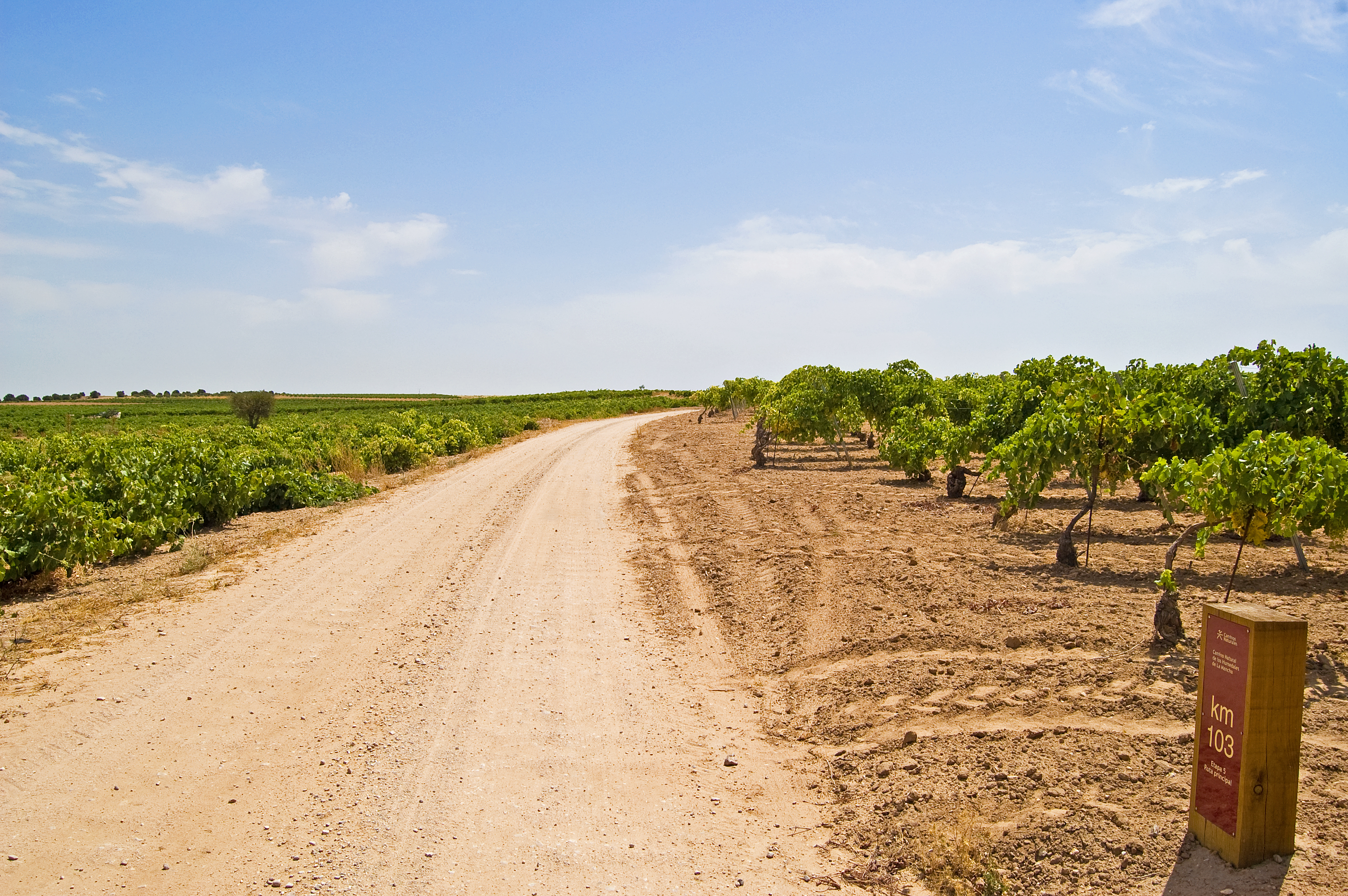
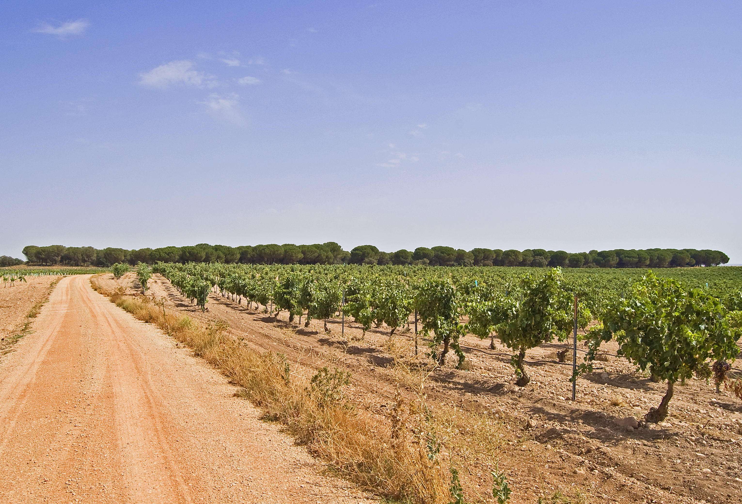
This town is left via an asphalt track surrounded by trees on each side which provide some welcome shade. In this shared section, the vineyards line both sides of the trail, which, after going past kilometre point 90 of the Main Route, turns into a dirt path whilst staying equally as wide.
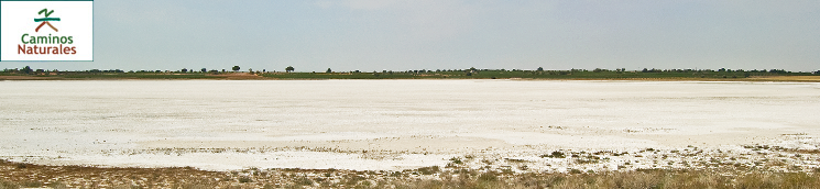
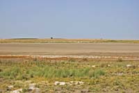
The three following kilometres are completed among vineyards and a gentle slope, advancing along a cattle road known as Vereda de los Serranos. The Laguna de Alcahozo can be seen before your eyes, and you should take the trail on the left at the next detour, leaving the previously mentioned cattle road. A new turn to the left leads to a short decline down to the edge of the Laguna de Alcahozo (an endorheic, hyper-saline lagoon with a surface of 72 ha which solely depends on the water run-off, thus being particularly seasonal. The prolonged absence of water bodies influences the flora and fauna, with this being a habitat for wader reproduction). Here, bird lovers can delight at the large observatory.

The trail continues along the flood plain, with the lagoon always staying on the right hand side. Shortly after kilometre point 95, take a trail on the right which gets wider along the way. This continues bordering the lagoon, and after kilometre point 96 the trail distances itself little by little from this natural space. With no let up, and after another kilometre, a trail is reached on the left which marks the beginning of the Complejo Lagunar de Manjavacas detour.
The vineyards continue to be the star of the show within the landscape, and when you reach the crossing that marks the end of the Complejo Lagunar de Manajavacas detour to the left of the Main Route, a stand of stone pines also enriches the scenery. Not long after the stand, once again on the left, you pass just 200 m from the Laguna de Melgarejo. At the same time, you reach kilometre point 100 of the Main Route and then continue easterly towards the end of the stage.
Shortly after kilometre point 102, the trail crosses the River Saona (and then runs alongside it for nearly 2 km through the town of Socuéllamos), where you can enjoy a typical riverside woodland. The trail continues among vineyards and rainfed crops and, two kilometres later, the path becomes an asphalt one which soon crosses the Ánimas River.
Now, in the town of Las Mesas in the province of Cuenca, the trail advances along Calle Camino de la Hontanilla. After crossing the CM-3102 road, it continues along Calle Pedro Muñoz, immediately turning right on Calle Nueva. This zigzagging through the town continues on the left on Calle Molino, and then on the right on Calle Pérez Galdos, on the left once again along Calle del Pozo, on the right on Calle Medicina and finally on the left on Travesía Medicina.
Once in Plaza España, you will take the third exit along Calle Príncipe, going uphill to then turn right onto Calle de San Cristóbal. Continue along said road, on the left there is a replica of a windmill and not long afterwards, at the end of the town, there is an interpretation panel which shows the fifth and final stage of the La Mancha Wetlands Nature Trail and the beginning of the Laguna del Taray Chico detour.
Manjavacas lagoon complex branch
This is an almost 15 km long detour which starts at the pathway crossroads just after kilometre point 97 of the Main Route.
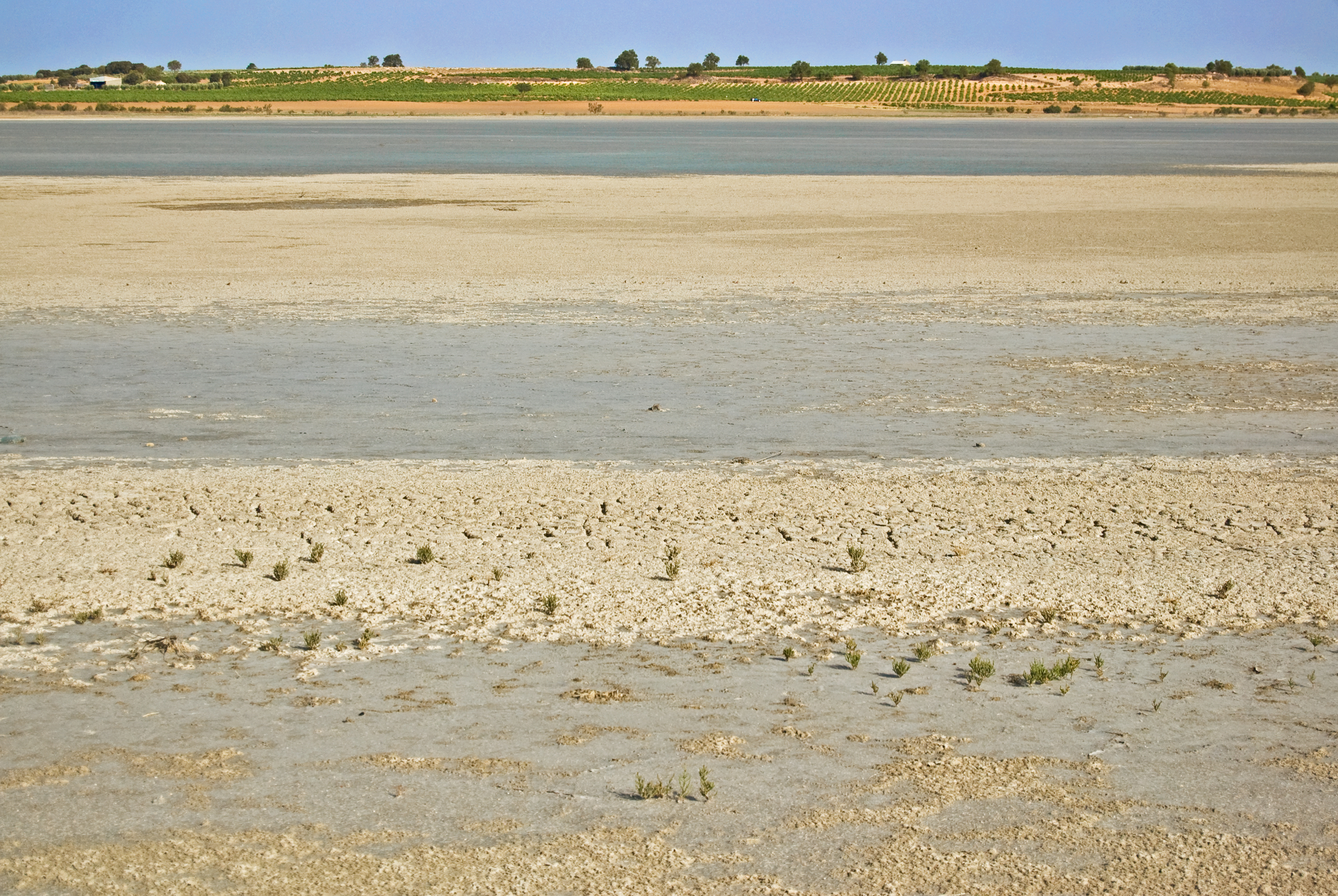
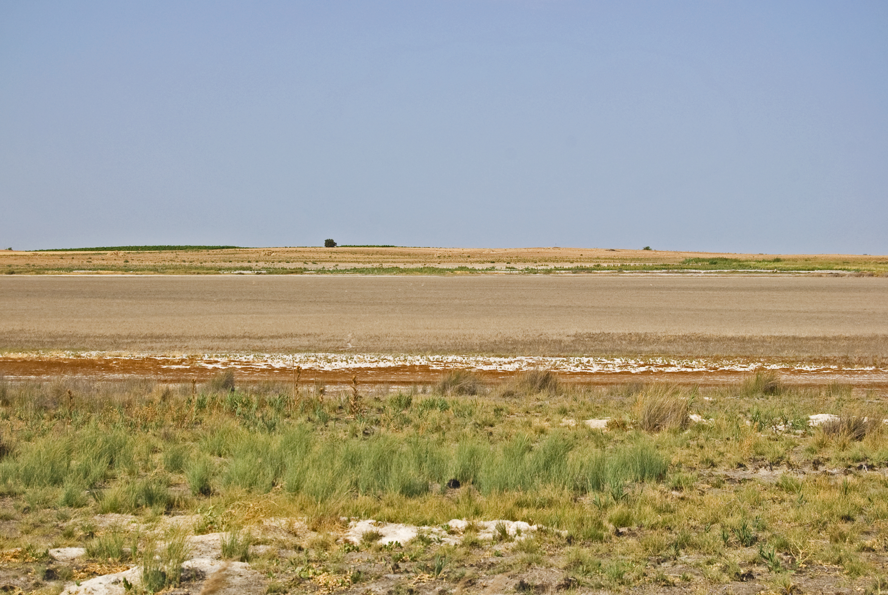
It goes through vineyards and after a small incline the first kilometre of the detour is completed. Turn left on the CRP-1266 road just after the stand of holm oaks (Quercus ilex). After just over 200 m on this road, you turn left and this shared section comes to an end. Take the dirt track and you will reach kilometre point 2 and the great Laguna de Manjavacas (a lagoon with a surface area of 236 ha which receives its waters from the EDAR de Mota del Cuervo, and therefore has a high amount of nutrients and an average amount of salinity. Due to the large distance that separates the lagoon basin from the town of Mota del Cuervo, this practically dries up in the summer, and during other seasons it is home to large colonies of flamencos).
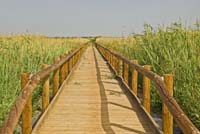
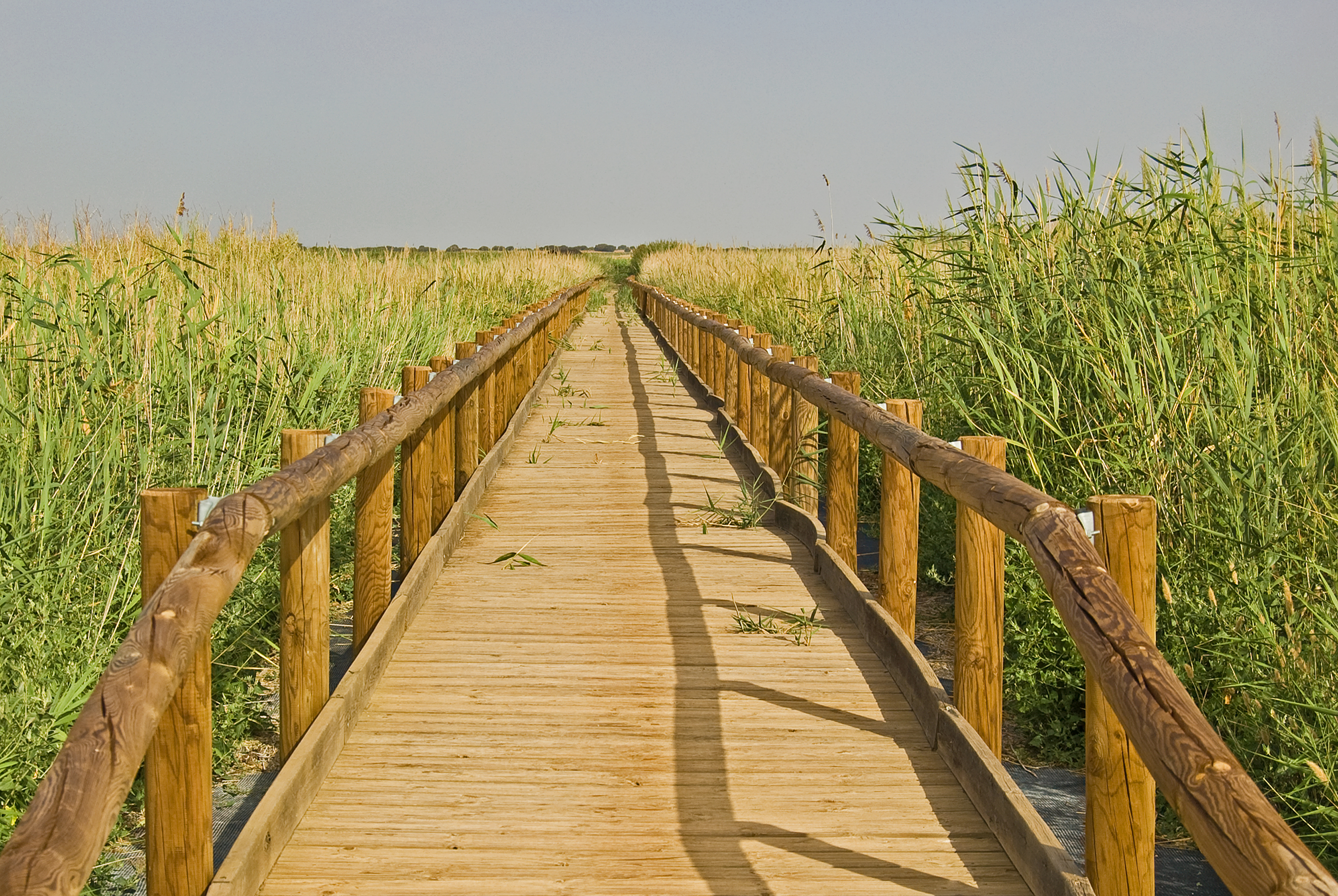
As you descend, the Laguna de Manjavacas will be on your right and at kilometre point 3 of the detour you will reach the bird observatory. Just before reaching the next kilometre point, you will leave the wide trail for a detour on the left which, just a few metres afterwards becomes a breath-taking wooden footbridge which immerses you in the surrounding of the Laguna de Manjavacas, specifically at the Mother Ditch.
At the end of this footbridge, the Manjavacas Ringing Station can be seen, and the trail continues in a northerly direction along a dirt track. For a few metres the trail runs parallel to the CUV-1001 road. When coming away from said road, it becomes an asphalt trail and goes through a large pine mass which marks the beginning of the Nuestra Señora de Manjavacas shrine recreational area. After passing by the resting area on the Don Quijote Route, a high observatory is reached whereby you can enjoy outstanding panoramic views of the area, with the Laguna de Manjavacas stealing the spotlight.
Kilometre point 6 is reached after turning to the right and the Nuestra Señora de Manjavacas shrine stands before your eyes after you turn right once again.
The trail continues and crosses the CUV-1001, it then runs alongside this road towards Las Mesas for just 50 m and it then leads onto an asphalt path on the left. Just after kilometre point 7, the path climbs over the Mother Ditch, whose waters run underneath. The path now becomes a dirt track and continues through vineyards and rain-fed crops, it then turns to the right and heads in a southerly direction after kilometre point 8.
The Laguna de Sánchez Gómez (a lagoon with a surface area of 55, made up of run-off and aquiferous waters. It is a very special natural water feature within Europe, with its most important aspect being its chlorinated magnesium sulphate waters. It is home to both migratory and more stable populations of waders), appears just a few metres after the change in direction and it stays on your left as you travel from north to south.
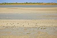
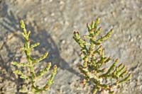
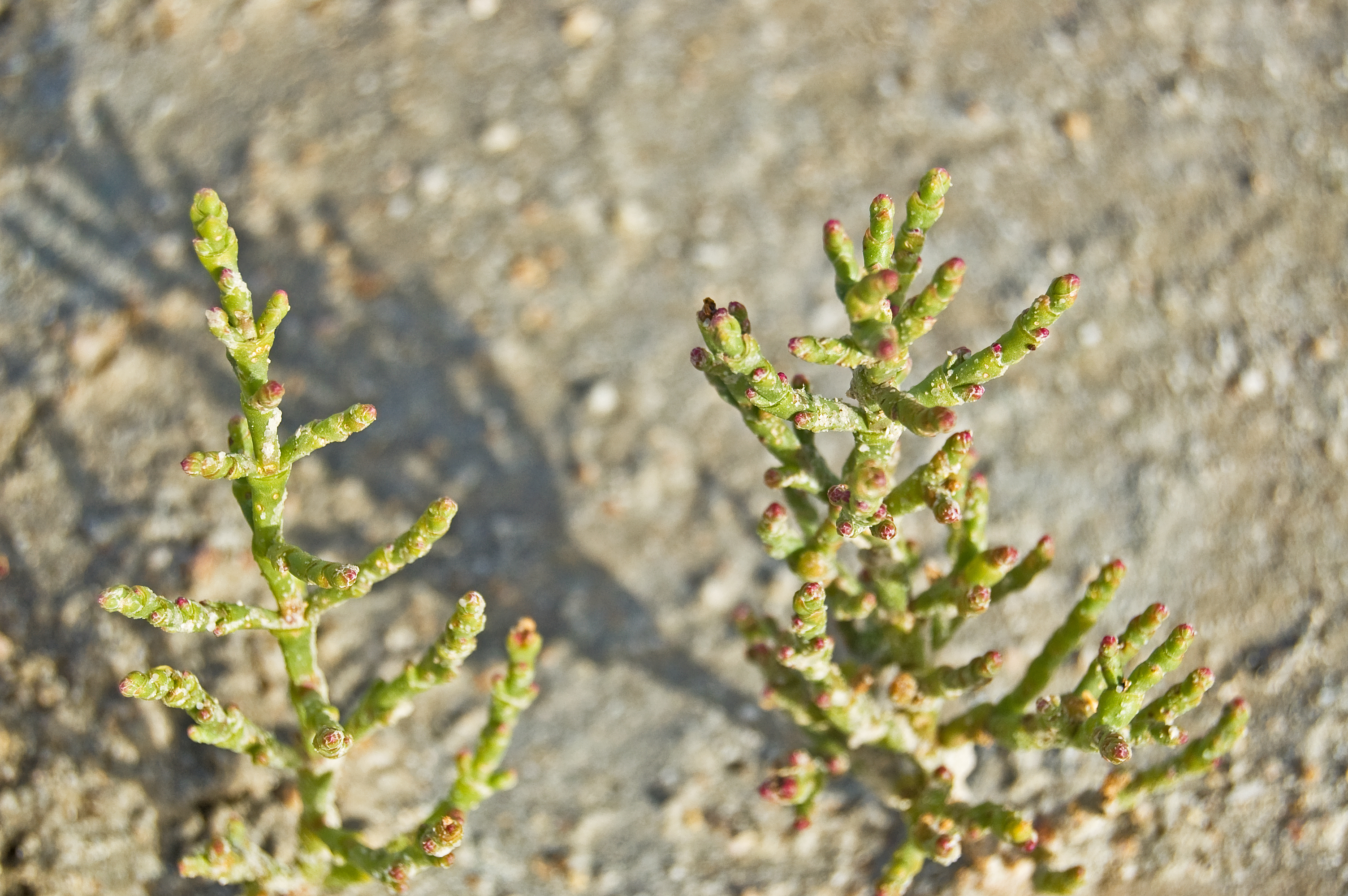
The end of the Laguna de Sánchez Gómez is marked by a dip on the left of the trail, and here the Laguna de la Dehesilla begins (this is a 19 ha large endorheic, saline lagoon, depending on the run-off. It is characterised by its defined seasonality. In the summer it is completely dry with various reddish tones due to Salicornia populations in the lagoon basin) to the right of the trail.
Head in the same direction, and after passing by the ruins known as the Casa de Castaño and the Casa de Chico, you will cross the CUV-1001 road. After the road, the trail heads slightly downhill and is lined by vineyards on both sides, it then enters a stand of stone pines (Pinus pinea) which offers some welcome shade. Whilst always continuing south, the trail passes through two sections of this tree-covered area. After the second area, vineyards once again cover the earth and this Manjavacas lagoon complex detour comes to an end and joins the Main Route just after kilometre point 99.
Laguna del Taray Chino detour:
The Laguna del Taray Chico detour starts at the end of Calle San Cristóbal, in the town of Las Mesas, in Cuenca. It ends at the final point of the fifth stage of the Camino Natural de los Humedales de La Mancha, where the Main Route comes to an end. You will pass by the Carrasquilla creek along a tree-lined asphalt path. Not long after going past kilometre point 1, this becomes a dirt track and gently goes uphill for less than a kilometre. The vineyards are, once again, the star of the show. Despite this, the closeness to the neighbouring town of Las Pedroñeras can be appreciated due to the garlic (Allium sativum) fields which can be seen, as you are now within a Protected Geographical Indication area of garlic called "Ajo Morado de Las Pedroñeras".
After kilometre point 4 you will always be able to see the Laguna del Taray Chico on your left. The trail turns to the left and reaches kilometre point 5, where it turns to the left once again and leads towards the Laguna del Taray Chico (a lagoon with a surface area of 21 ha which receives waters from the Taray creek. It has water all year long with a maximum depth of 1.5 m. Under these conditions, a dense reed coverage proliferates, which completely surrounds the lagoon, providing it with a certain amount of protection and calmness. That is why many bird species, including the white-headed duck, have chosen it as a breeding place), this is where the section which gives this detour its name comes to an end. The last 600 metres of this detour take you through the town of Las Pedroñeras, as this lagoon is spread across this town and Las Mesas.
Map
Puntos de Interés
Municipio
Vegetación
Profile
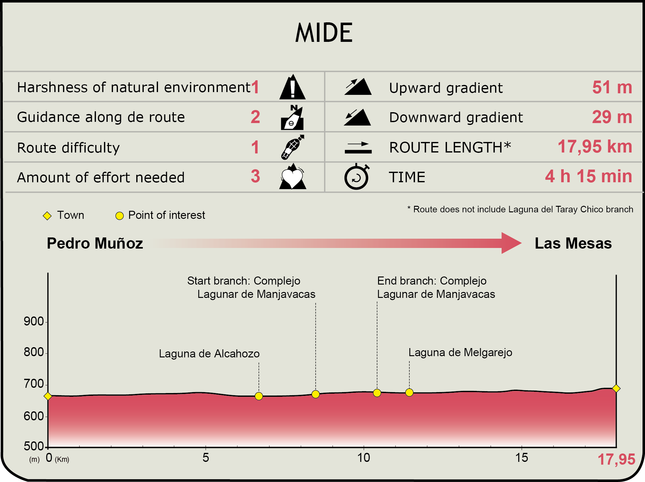
MIDE (Method for the Information of Excursions)
 Harshness of natural environment
- 1. The environment is not risk-free
- 2. There are more than one risk factors
- 3. There are various risk factors
- 4. There are quite a lot of risk factors
- 5. There are many risk factors
 Guidance along the route
- 1. Well defined trails and crossings
- 2. There is a clearly marked trail and signage
- 3. Requires the identification of geographic features and cardinal points
- 4. Requires off-path navigation
- 5. The trail is interrupted by obstacles that have to be gone around
 Route difficulty
- 1. Walking on a flat surface
- 2. Trails with different types of path
- 3. Walking on stepped paths or irregular terrain
- 4. The use of hands or jumping over the terrain is necessary
- 5. The use of hands is required to progress
 Amount of effort needed
- 1. Up to 1 hour of continuous walking
- 2. Between 1 and 3 hours of continuous walking
- 3. Between 3 and 6 hours of continuous walking
- 4. Between 6 and 10 hours of actual walking
- 5. More than 10 hours of continuous walking
Featured
Further information
Pedro Muñoz
A town in the province of Ciudad Real which belongs to the region of La Mancha. Remains found at the Cerro de la Nieve suggest that this was a Carpetani town. The fort was put to use in the Roman period and to this day the bridge over the River Záncara still remains. After the Alans, Visigoths and Moors, the area was left completely unpopulated, and its re-population did not begin again until the 13th century thanks to the Order of Santiago. In the year 1410, epidemics caused the town to be abandoned. A century later the re-population commenced, and this progressed both demographically and economically until the present day, apart from the period of hunger which occurred in the post-war period.
These days Pedro Muñoz has a wide business network made up of three key pillars, the agriculture sector (particularly vineyards) which is connected with part of its industry and finally the service sector. Many traditional solariega manor houses have been conserved, some of which are emblazoned, the architectural heritage is completed by the San Pedro Apóstol church and the Ntra. Sra. de los Ángeles and Ntra. Sra. del Buen Parto chapels. The festivities of the patron saint Virgen de los Ángeles take place between the 1st and 7th August.
Las Mesas
A small town in the province of Cuenca, located in the region of La Mancha. In the past it was called Las Mesas Rubias (the Blonde Mesas) as its main crop was cereal and so during the summer the land glistened with this colour. Not much is known about its history, with the first written document being found from the 13th century, thus it can be assumed that it had a similar history to its neighbouring towns. Its economy is based on agriculture, and vineyards reign supreme among the other crops.
The architectural heritage is focused on religious buildings, such as the Ntra. Sra. de la Asunción church and three chapels: San Isidro, San Cristóbal and Santo Niño de la Bola. Festivities take place on the third Sunday in August, in honour the town's patron saint, Santo Niño de la Bola.
Multimedia
Downloads
Descargas de GPS
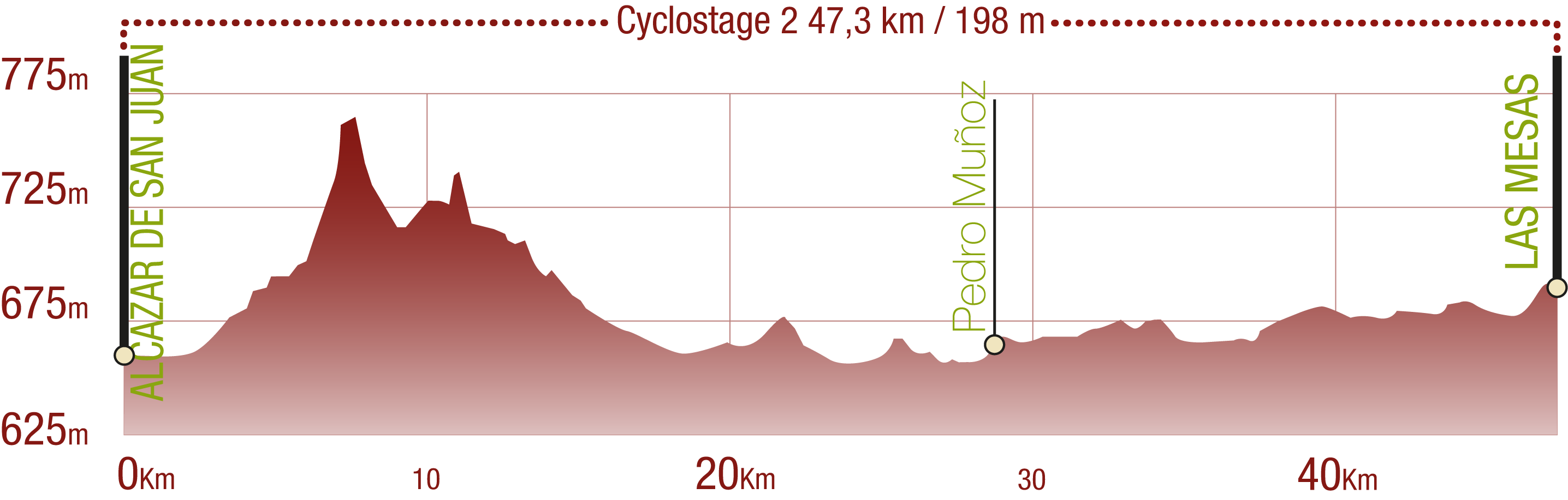
Cyclability
This cyclostage corresponds to stages 4 & 5 of the Nature Trail
PROFILE
TYPE OF ROAD, PORTAGES & DIFFICULTY
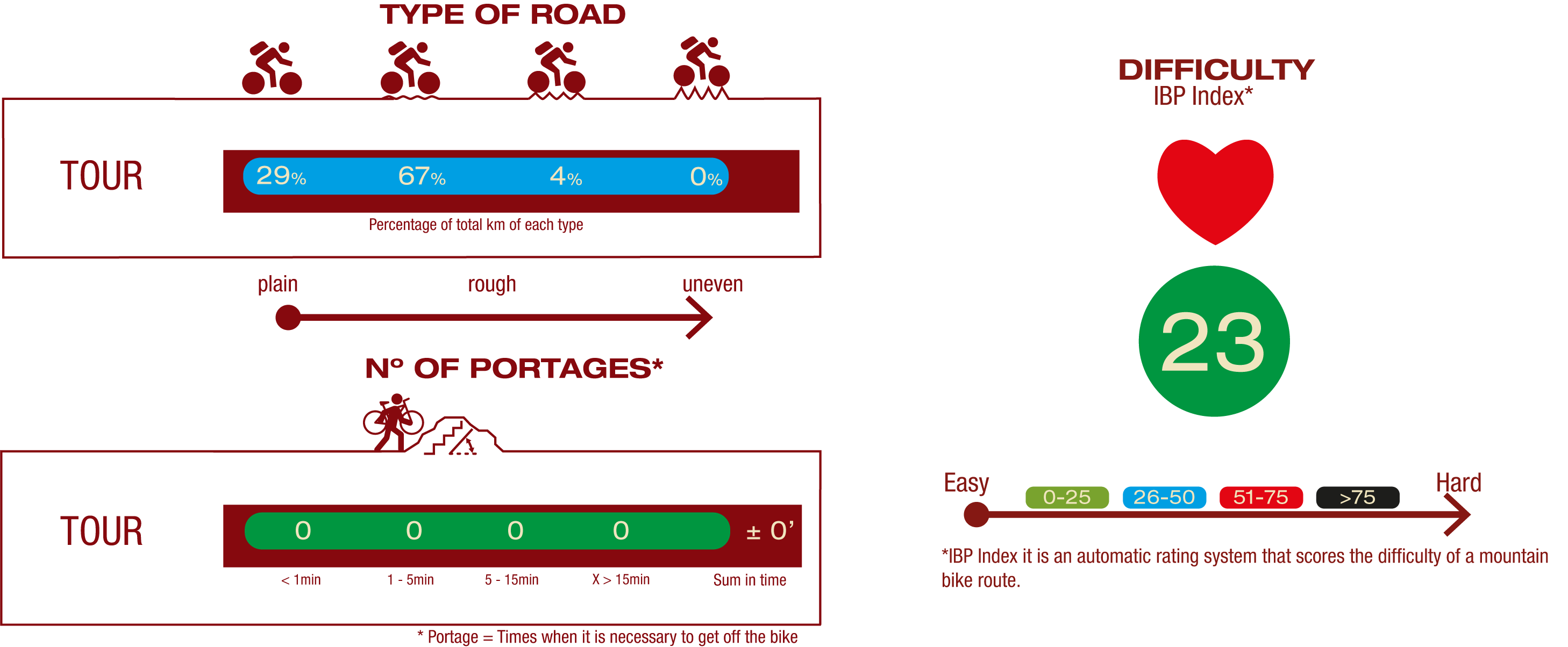
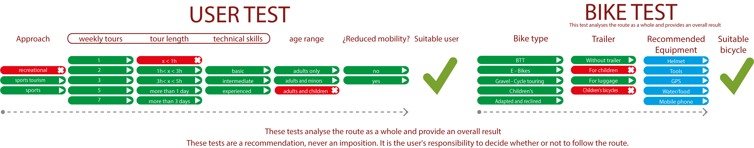
TEST
SAFETY RECOMMENDATIONS
- Sections shared with hikers and agricultural vehicles.
- Transit through the centre of some population centres.
GENERAL RECOMMENDATIONS
- Find out about the technical aspects of the route and the weather on the day.
- Take care of the environment. Take care not to disturb animals or damage vegetation. Respect private areas.
- You must give priority to pedestrians and comply with general traffic rules.
- The environment in which you will be riding is open, free to move around and an area where many activities are carried out (sporting, forestry, livestock and agricultural activities). Always have an understanding, prudent, responsible and respectful attitude.