
- Home
- Rural Development
- Nature Trails
- Nature Trails
- Central Sector
- Humedales de la Mancha
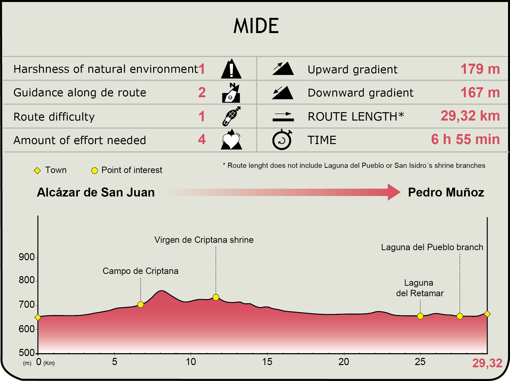
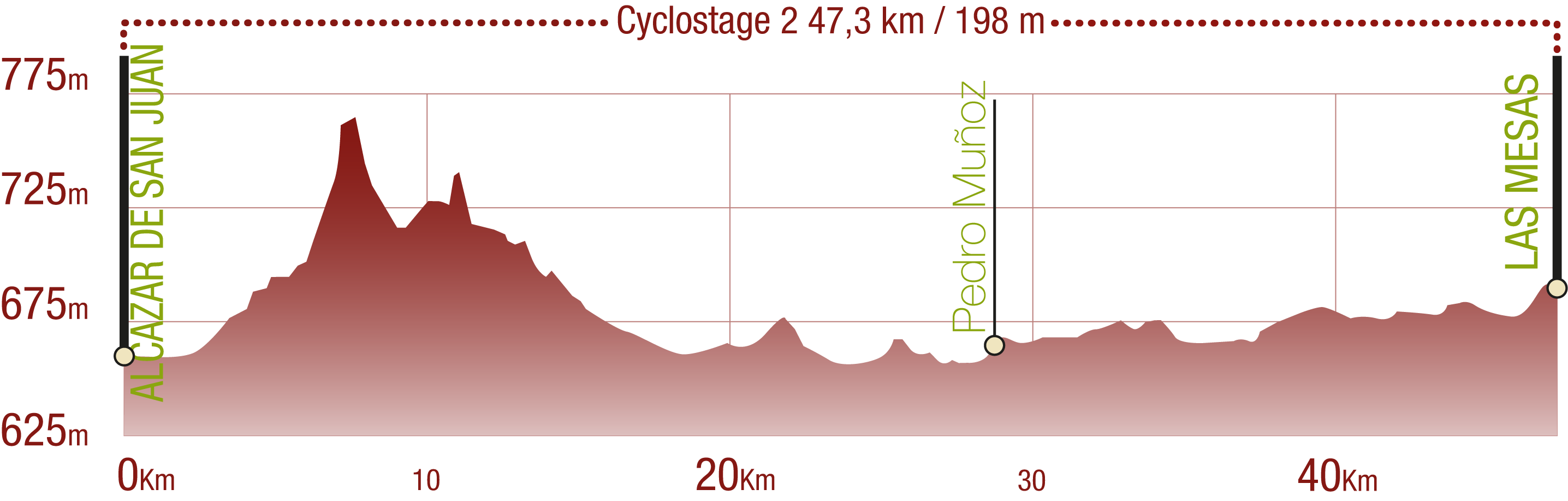
Stage 4: Alcázar de San Juan – Pedro Muñoz
Description
Do you see over yonder, friend Sancho, thirty or forty hulking giants? I intend to do battle with them and slay them.
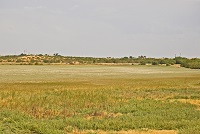
The longest stage of the La Mancha Wetlands Nature Trail, with more than 29 km, begins its itinerary to the south-west of Alcázar de San Juan and reaches Campo de Criptana, the town where Don Quijote confused the windmills with giants. A vast extension of vineyards covers the land until reaching the Laguna del Retamar that precedes the town of Pedro Muñoz, where the Laguna del Pueblo and the San Isidro Shrine are visited through detours.
The fourth stage of the La Mancha Wetlands Nature Trail connects the towns of Alcázar de San Juan and Pedro Muñoz.
This stage begins to the south-east area of this town, next to a precast concrete industry, where the paved path becomes a dirt path. After a smooth ascent, you will reach kilometre point 61 of the Main Route and enjoy the spectacular panoramic view over the windmills of the town.
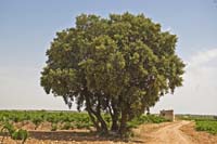
Vineyards draw all the attention in these vast plains. After passing by kilometre point 63 and continuing a descent, you will reach a large-sized white poplar (Populus alba) known as El Viejo Sabio, where the trail is paved again.
The trail continues with a smooth descent until reaching an unprotected level-crossing that crosses the railway line. You must cross the lines with the utmost care and then enter the town of Campo de Criptana through the Pozo Hondo industrial park. Always towards the north and after crossing two roundabouts through the crosswalks, you will take the cycle lane or the pavement on the right, depending on how you are travelling, that runs parallel to the CM-3166 road.
Before entering the next roundabout, you will cross the mentioned road and turn left on Avenida de los Siete Molinos. At the end of the avenue, you will turn right on Calle Quero and then right on Calle Cencibel, which a few metres afterwards becomes Travesía Alcázar. You will keep ascending Calle San Isidro and cross the CM-3105 road at the end of the street.
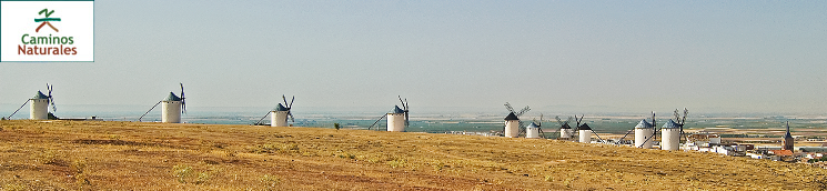
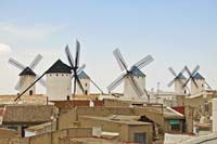
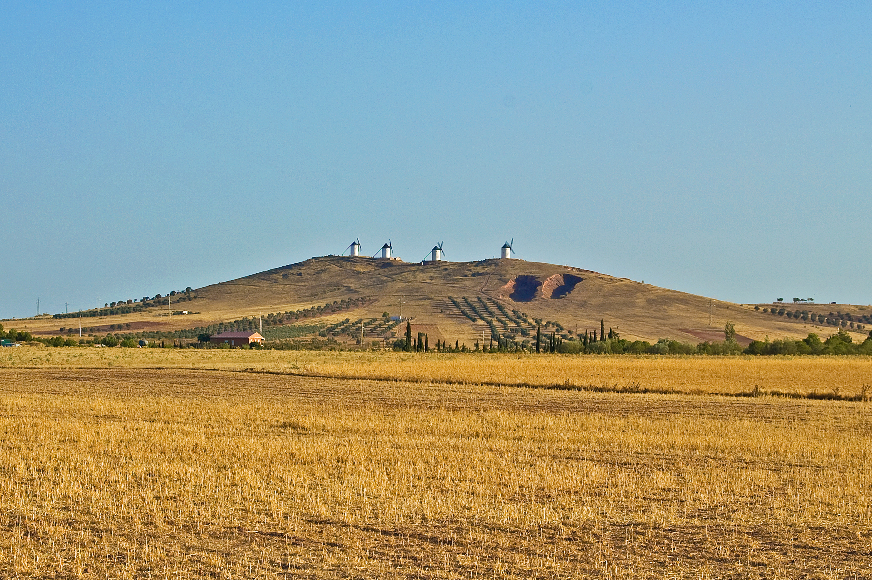
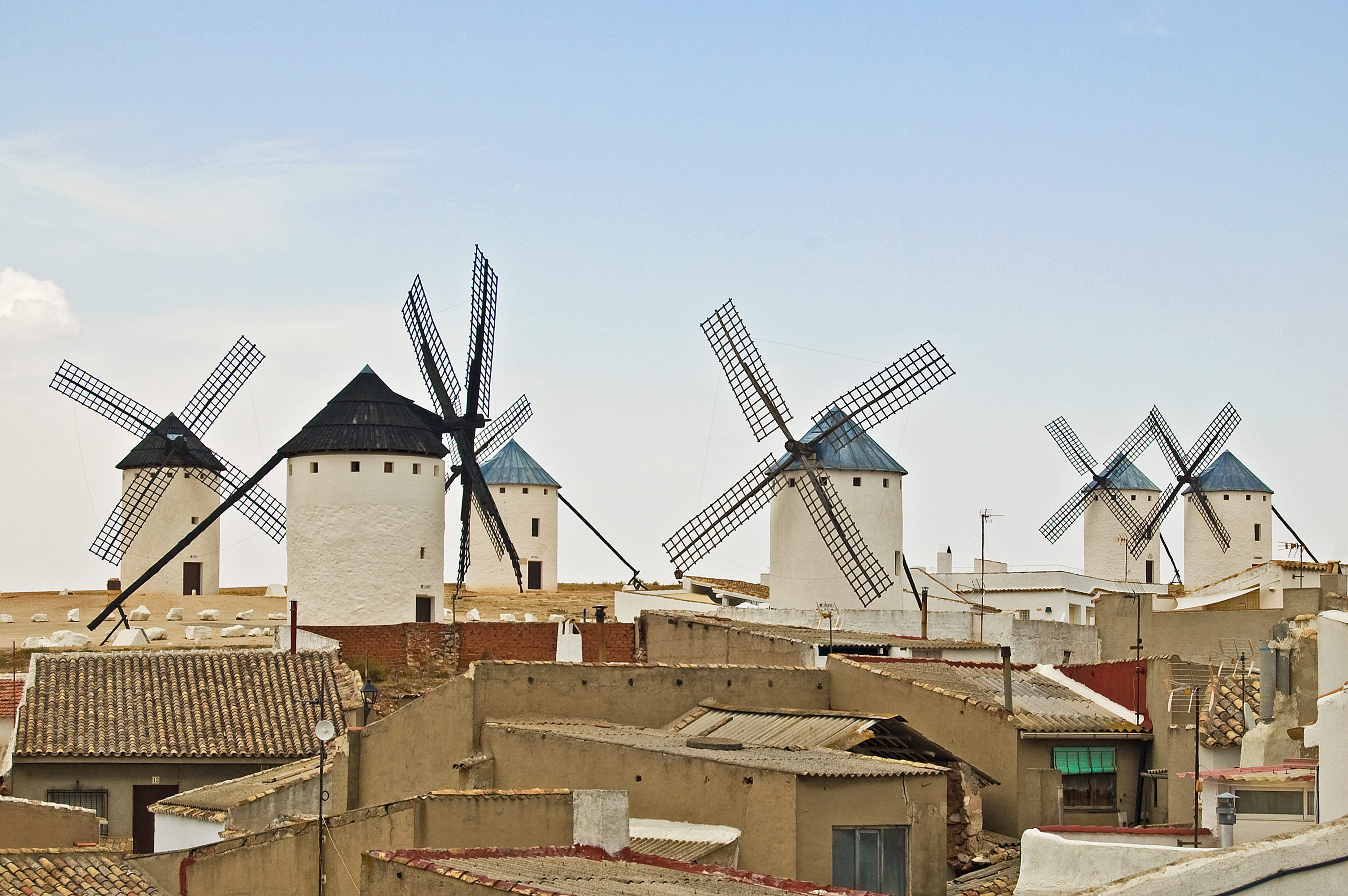
The trail follows the first exit on the right, which later becomes a dirt path. Continuing the ascent, you will reach kilometre point 67 and leave behind the ruins of several windmills. Right after, the ascent ends and you will discover, on the right side of the trail and standing as giants, the windmills of Campo de Criptana, preserved in perfect condition, which were declared a Site of Cultural Interest in 1978.

After recovering from the impression caused by this architectural spectacle, the trail begins descending and, a few metres afterwards, is paved. The traveller gets closer to the municipality of Campo de Criptana a few metres after passing by kilometre point 68 through the Huertos street.
Afterwards you will turn left on Travesía Eras, then right on Calle Moro and left again on Calle Santa Águeda. The zigzag continues with a right turn on Calle Delicias, a left turn on Calle Mira, a right turn on Calle García Lorca and then a left turn on Travesía García Lorca. Finally, you must turn right on Calle Cantera and then left on Calle Virgen de Criptana, which will lead you outside this town that is also worth visiting.
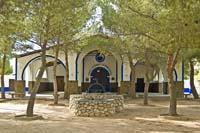
You will walk along a paved path that initiates the ascent to the Virgen de la Criptana Shrine. A few metres afterwards, you will pass by kilometre point 69 of the Main Route. The rows of trees that flank the paved path, mainly consisting of pines, will offer you a pleasant shadow.
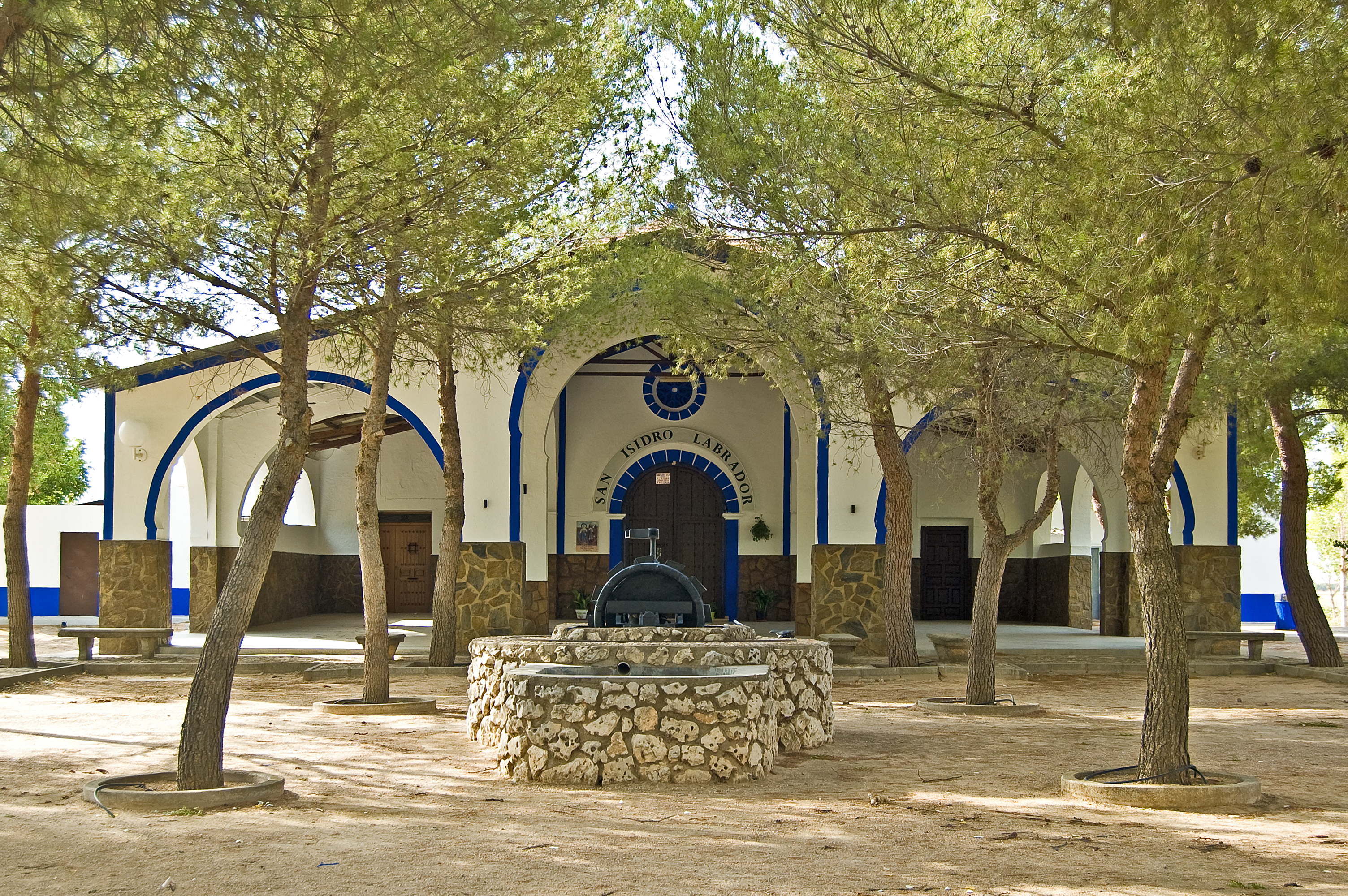
After surpassing kilometre point 70, you will discover the Pozo de la Virgen well and a fountain you can use to cool off. Right after you will reach the ascent to the Virgen de la Criptana Shrine, which offers, apart from its architectural and religious value, a stunning panoramic view of the vast plains.
You will initiate the descent along a dirt path, leaving behind kilometre point 71 and a rest area of the Quijote Route, and crossing a few metres afterwards the CR-1101 road with the utmost care. The trail becomes a paved track again, as on both sides there are several open-cast quarries. After a small climb and leaving the access to the last quarry on the left, the trail becomes a dirt path and approaches a new area of agricultural crops predominated by vineyards.
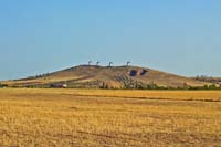
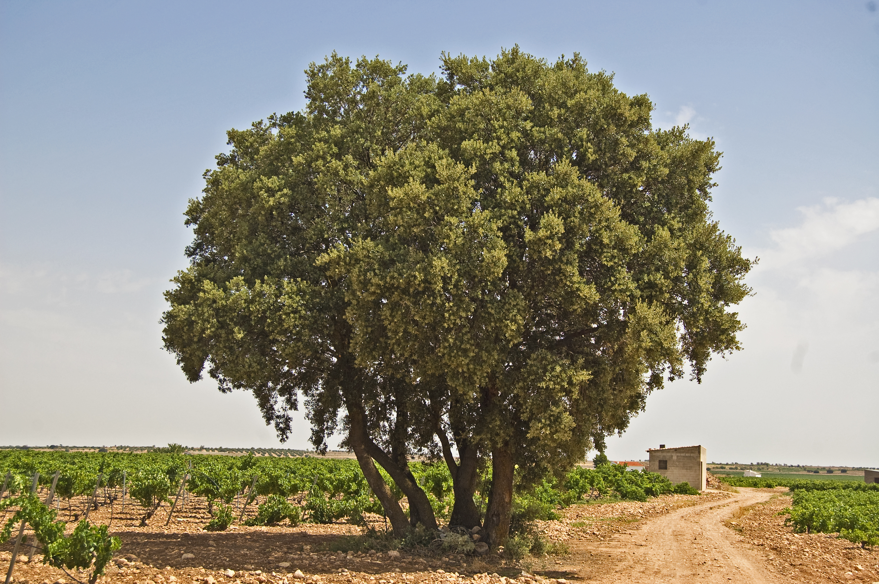
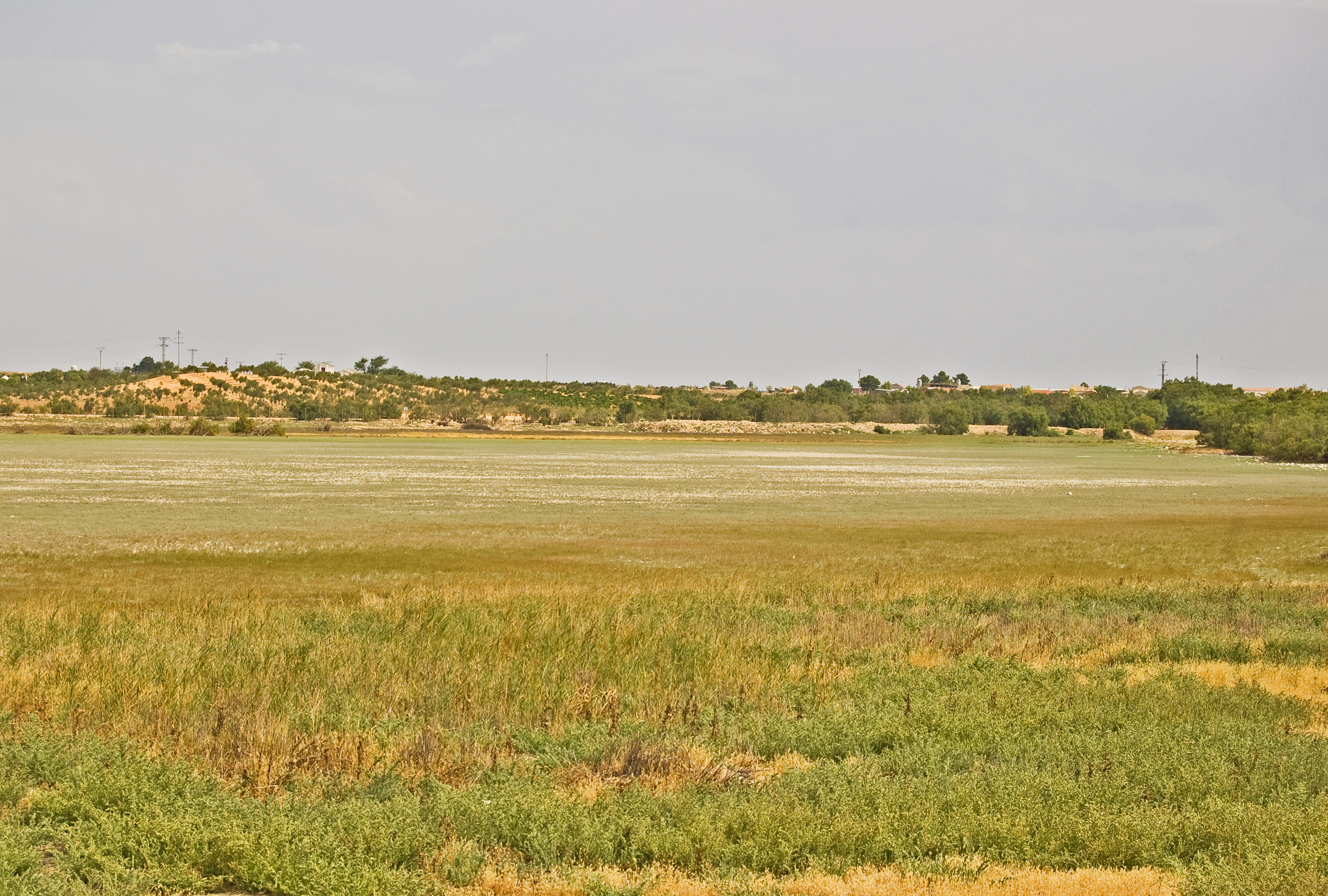
Along the kilometres, some smooth ascents and descents will delight all the cyclo tourism lovers. At kilometre point 80 the landscape is dotted by large-sized oaks (Quercus ilex) and, at the second junction, the trail turns right and initiates a smooth ascent. After several ascents and descents, the change from crops to rain-fed cereal becomes visible in the landscape, and the trail reaches kilometre point 84 of the Laguna del Retamar (endorheic, hyper-saline lagoon with a surface of 90 ha and a strong seasonality, as it depends on the annual rainfall. For this reason, a wide sample of steppe-land bird species populates its surroundings, as well as different species typical of the wetlands).
After surpassing this lagoon, the trail reaches the town of Pedro Muñoz in less than 3 kilometres. Turning into the left on the first paved street you will reach kilometre point 87 next to an interpretation panel; then you must turn right and carefully cross the CM-3103 road through the crosswalk. This is the starting point of the Laguna del Pueblo detour.
Back in the Main Route trail and within the town of Pedro Muñoz, you must head south-west until you reach the roundabout that connects the CM-3103 road and the N-420 road, known as Avenida de la Constitución by the locals. Then you must turn left and take that avenue, and then turn right on Calle Doctor Fernando Mayordomo.
After several crossings, you must turn left on Calle Carlos Gazaran and then right on Calle Maestro Juan de Ávila, which becomes Calle de Velázquez after a crossing. A new zigzag will make you turn left again on Calle del Saliente and finally turn right on Calle Sorolla to leave Pedro Muñoz, where the interpretation panel marks the end of the fourth stage of the La Mancha Wetlands Nature Trail between the towns of Alcázar de San Juan and Pedro Muñoz.
Laguna del Pueblo branch
This detour starts just after the “el Humedal de Don Quijote” Nature Interpretation Centre in Pedro Muñoz. Once the path ends and after walking a small section along the side of the CM-3103 road, you will take a dirt trail on the right. Keeping the safety fence and the tamarisks of the Laguna del Pueblo on your right hand side, continue following the signs, briefly leaving the sides of the lagoon to then continue parallel to the safety fence once again. After kilometre point 1 of this detour the tamarisks will gradually start to disappear, which will allow you to see the lagoon basin of this wetland (an endorheic, saline lagoon with a surface of 185 ha which currently receives waters from the fresh waters treated in Pedro Muñoz. It is located in the north, close to the town centre, and such non-natural factors have always had a large influence on its state of conservation. As it has water all year long, it is home to reed beds, bullrushes and saltmarsh bulrushes).
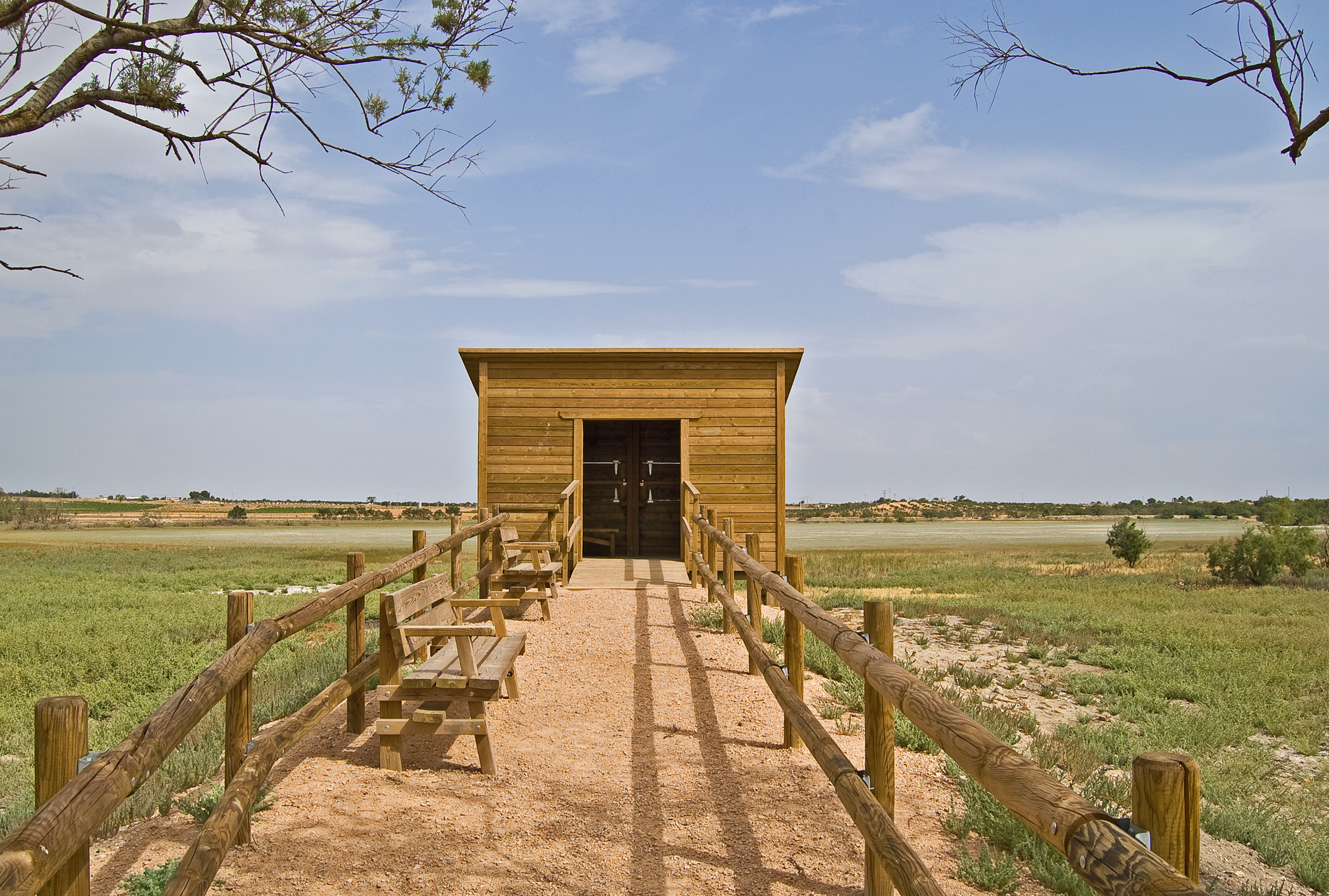
Not long after reaching the most northerly point of this natural space, you will reach the Laguna del Pueblo bird Observatory, where you can enjoy the fantastic richness of fauna that is found here. The trail keeps close to the lagoon, heading south towards kilometre point 2. At the next crossroads, take the left San Isidro Shrine detour on the left.
The Laguna del Pueblo detour continues along the path on the right, bordering the lagoon and tamarisks take the spotlight once again, covering your view of the lagoon basin. Once you enter the town again, you turn left onto Calle de la Laguna, bringing this Laguna del Pueblo detour to an end on the Avenida de la Constitución (N-420), where it joins up with the Camino Natural de los Humedales de La Mancha Main Route once again.
San Isidro Shrine branch
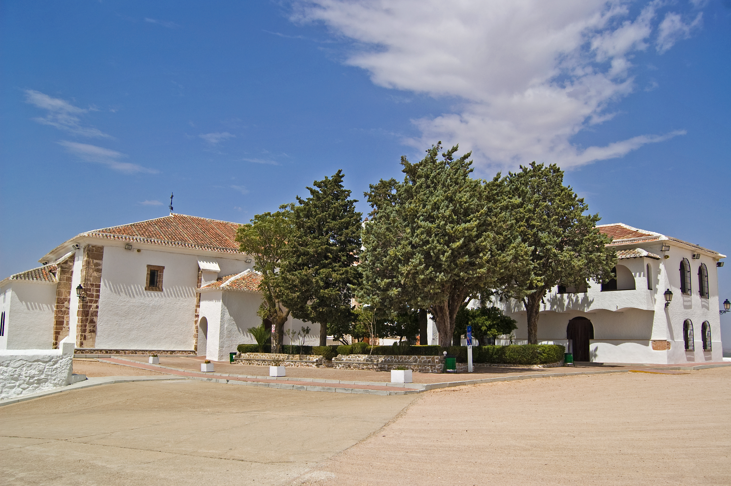
The San Isidro Shrine Detour starts at the Laguna del Pueblo Detour. By means of a wide dirt track you will come close to the N-420 road, but before you reach it the trail turns left and runs alongside said road. After an overpass, you will start an uphill section which leads towards to San Cristóbal shrine which was opened in 1987.
The path continues straight, leaving the shrine behind and heading north towards the Laguna de Navalafuente (an endorheic, saline lagoon with a surface of 40 which is dry most of the year. It was turned over and drained in the past, and many trails go through the lagoon basin. For these reasons, vegetation has been altered and it is now covered of salt meadows), a few metres after the San Cristóbal shrine you will reach the San Isidro shrine which marks the end of this short detour.
Map
Puntos de Interés
Información
Vegetación
Profile
MIDE (Method for the Information of Excursions)
 Harshness of natural environment
- 1. The environment is not risk-free
- 2. There are more than one risk factors
- 3. There are various risk factors
- 4. There are quite a lot of risk factors
- 5. There are many risk factors
 Guidance along the route
- 1. Well defined trails and crossings
- 2. There is a clearly marked trail and signage
- 3. Requires the identification of geographic features and cardinal points
- 4. Requires off-path navigation
- 5. The trail is interrupted by obstacles that have to be gone around
 Route difficulty
- 1. Walking on a flat surface
- 2. Trails with different types of path
- 3. Walking on stepped paths or irregular terrain
- 4. The use of hands or jumping over the terrain is necessary
- 5. The use of hands is required to progress
 Amount of effort needed
- 1. Up to 1 hour of continuous walking
- 2. Between 1 and 3 hours of continuous walking
- 3. Between 3 and 6 hours of continuous walking
- 4. Between 6 and 10 hours of actual walking
- 5. More than 10 hours of continuous walking
Featured
Further information
Campo de Criptana
A town in the province of Ciudad Real which is situated within the region of La Mancha. It was first populated in the Neolithic period. A Moorish castle once stood where the Virgen de Criptana shrine is currently found. The town was re-populated in 1328 after the reconquest, by the Order of Santiago, and after the fusion of the towns of Criptana and Campo, it started to be known as Campo de Criptana, as it is nowadays.
The town's glory days were in the 16th century. It was in this period when the majority of the monuments which are still preserved these days were built. The most stand-out of which is the group of windmills which was the inspiration for the famous battle of Don Quijote against the giants in Miguel de Cervantes' literary masterpiece.
These days a total of ten windmills remain, three of which from the 16th century; although at the time there were 34. Its economy is based mainly on agriculture, the services sector, the building sector and the wine industry. The patron saint festivities honour the Santísimo Cristo de Villajos and the Santísima Virgen de Criptana.
Multimedia
Downloads
Descargas de GPS
Cyclability
This cyclostage corresponds to stages 4 & 5 of the Nature Trail
PROFILE
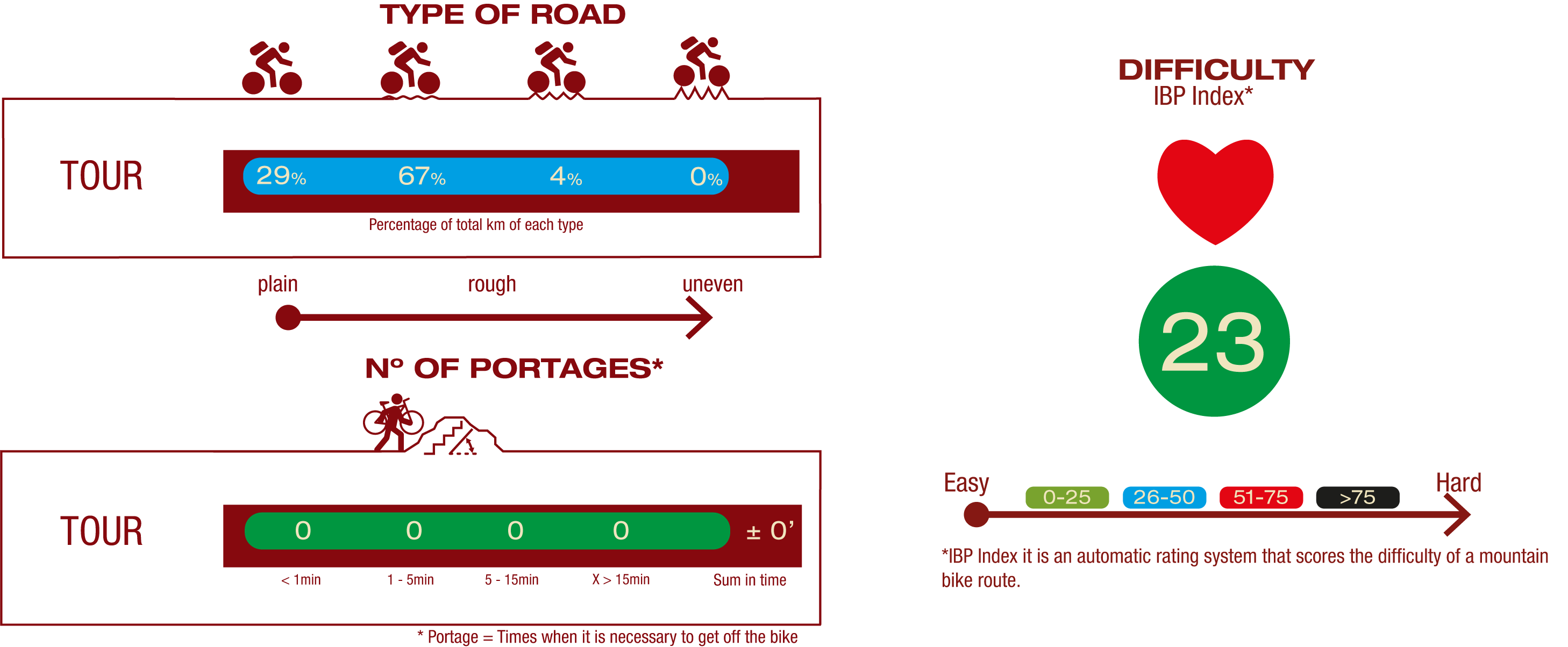
TYPE OF ROAD, PORTAGES & DIFFICULTY
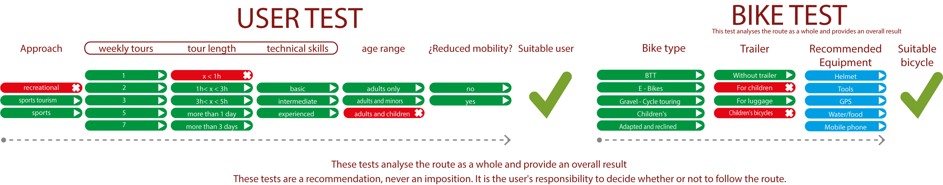
TEST
SAFETY RECOMMENDATIONS
- Sections shared with hikers and agricultural vehicles.
- Transit through the centre of some population centres.
GENERAL RECOMMENDATIONS
- Find out about the technical aspects of the route and the weather on the day.
- Take care of the environment. Take care not to disturb animals or damage vegetation. Respect private areas.
- You must give priority to pedestrians and comply with general traffic rules.
- The environment in which you will be riding is open, free to move around and an area where many activities are carried out (sporting, forestry, livestock and agricultural activities). Always have an understanding, prudent, responsible and respectful attitude.