
- Home
- Rural Development
- Nature Trails
- Nature Trails
- Central Sector
- Humedales de la Mancha
Stage 3: Villafranca de los Caballeros – Alcázar de San Juan
Description
From Villafranca de los Caballeros (Toledo) to Alcázar de San Juan (Ciudad Real), the traveller will find numerous wetlands.
The third stage, with almost 19 km, harbours a large number of wetlands. The trail begins at the Laguna Grande de Villafranca, explores the Laguna de la Sal and leaves the province of Toledo crossing the River Gigüela, whose basin indicates the limit between provinces. In Ciudad Real the traveller will reach the Laguna de las Yeguas, soon afterwards the Laguna del Camino de Villafranca and finally the Laguna de la Veguilla. The town of Alcázar de San Juan is the starting point of the Junta de los Ríos detour. The third stage ends after crossing the town, which is also worth a visit.
The third stage of the La Mancha Wetlands Nature Trail connects the towns of Villafranca de los Caballeros and Alcázar de San Juan. This stage begins at the Abuela roundabout, in the residential area of Laguna Grande in Villafranca de los Caballeros.
You will pass by kilometre point 41 of the Main Route along Avenida de la Laguna Grande, reach the Puerta de las Lagunas roundabout and continue circling and enjoying the Laguna Grande de Villafranca de los Caballeros along Avenida de la Laguna Chica.
At the interpretation panel, the trail turns right and continues along Calle Polvorín, leaving behind the Laguna Grande de Villafranca de los Caballeros. At the end of this street, you must carefully cross the CM-3130 road and continue straight along the dirt path.

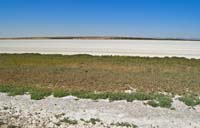
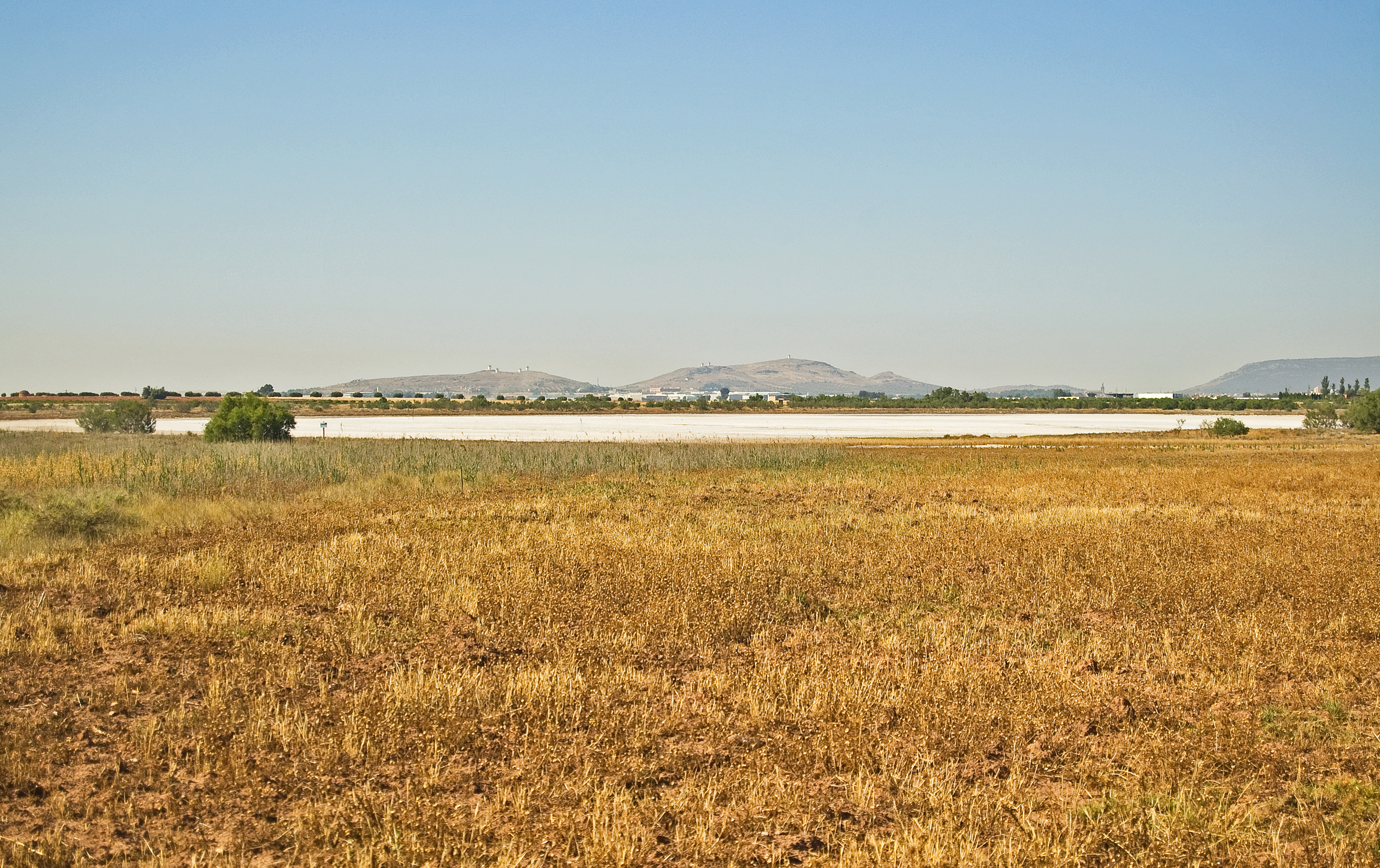
At the next intersection, the trail turns right and continues along a path that leads to the Laguna de la Sal (endorheic, shallow lagoon with a surface of 30 ha and a strong seasonality that allows the existence of partridges and rabbits. The vegetation is clearly influenced by this seasonality, and therefore species as albardine, tamarisks and some specimens of the Limonium sp. genus are highly common in this area). The trail descends, approaching the lagoon basin and turns left, always keeping the lagoon on the right side and moving away from it, little by little, surrounded by rain-fed crops, olive groves and vineyards.
After crossing the Cerro Miguel, you will head to the River Gigüela basin. Upon reaching the river, the trail turns right, narrows and continues parallel to the river. The itinerary leaves the province of Toledo after kilometre point 45 and ventures into Ciudad Real after crossing the River Gigüela through a bridge and turning to the left. From this point the trail becomes wider and begins a small ascent where the crops draw all the attention.
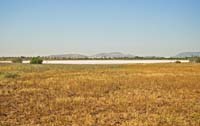
The trails continues its descent and reaches a solar farm used to produce photovoltaic power, located on the right side of the path, where you will see the Laguna de las Yeguas (lagoon with a surface of 66 ha and an endorheic and hyper-saline nature that results in the absence of aquatic vegetation. A wide variety of plant species adapted to high concentrations of salt are distributed over its banks, serving as a nesting place for diverse bird species, such as the Kentish plover). From this spot, after kilometre point 49, the panoramic view of the Laguna de Las Yeguas on the right side is breathtaking.
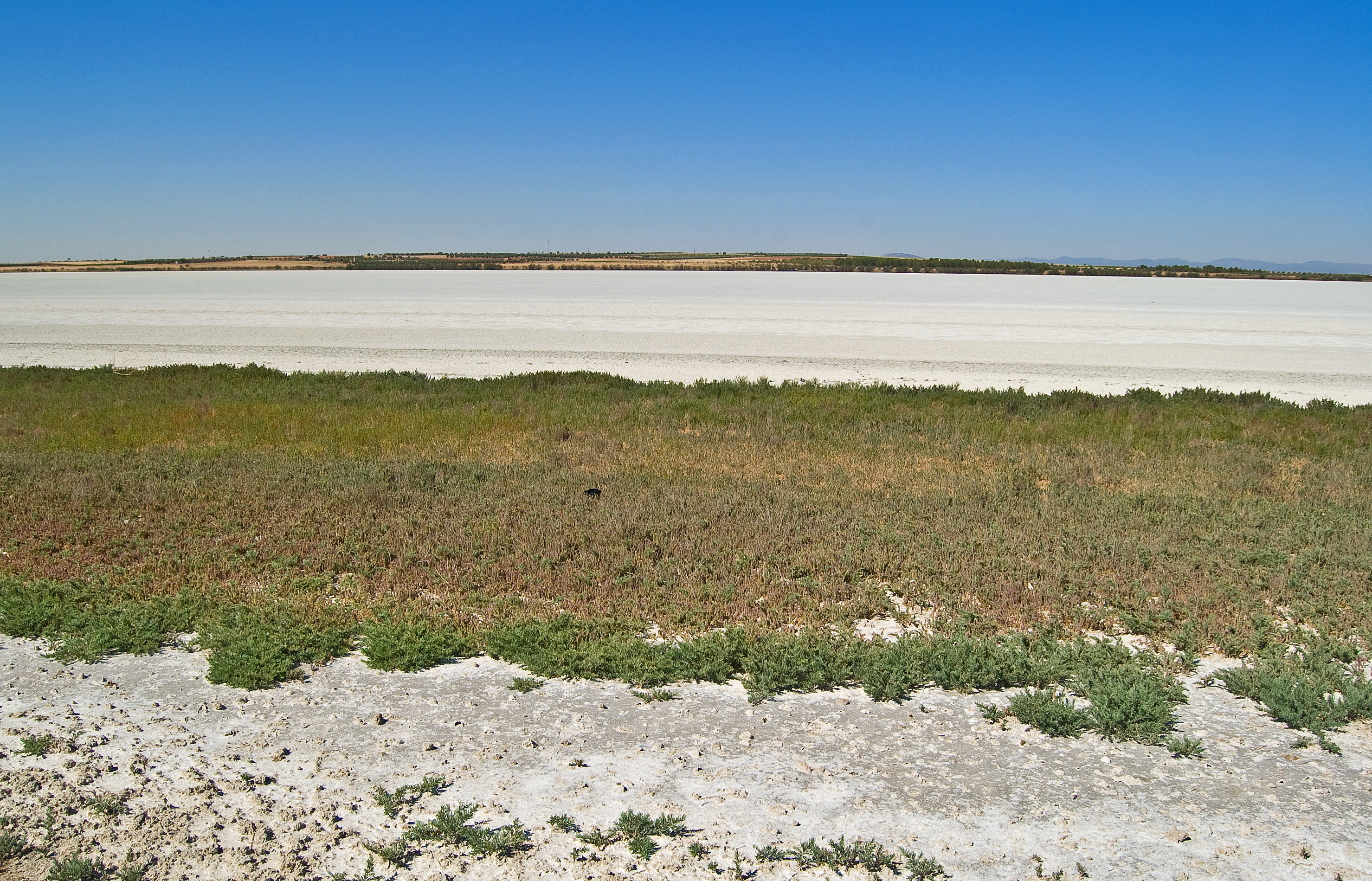
After several low hills, whose slope and length do not require much effort, the trail turns right and reveals the Laguna del Camino de Villafranca (endorheic, hyper-saline lagoon with a surface of 185 ha, connected to the Laguna de la Veguilla, which receives treated wastewater from the wastewater treatment plant (EDAR) of Alcázar de San Juan. It contains different waders populations). The trail continues with the lagoon on its right side, so you will be able to bear witness to the vast length of this wetland.
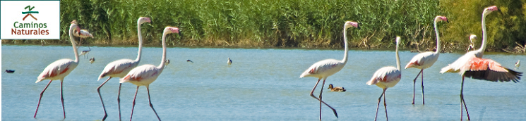
At kilometre point 53, the trail passes the basin of the Creek Albardial by means of an overpass and in less one kilometre it reaches the Laguna de la Veguilla (lagoon with a surface of 85 ha and endorheic nature which receives treated wastewater from the wastewater treatment plant (EDAR) of Alcázar de San Juan and has water throughout the year. It shelters diverse species: white-headed ducks, flamingos, avocets, black-winged stilts, etc. It is the biggest biodiversity nucleus in La Mancha Wetlands).
The trail continues towards Alcázar de San Juan and enters this town through the Emilio Castro industrial park. There,you will turn right on Vía Polígono Residencial Alces which, after turning left, becomes Avenida de los Institutos.
This avenue leads to a roundabout in which the industrial park ends. The trail crosses the CM-3165 road (or Avenida Adolfo Suarez) through the crosswalk and takes the bicycle lane located on the right side, leaving the beautiful Alces park on the left side. Without leaving the bicycle lane, it turns left on Avenida Herencia.
This is the starting point of the Junta de los Ríos detour that connects, after over 15 km, the La Mancha Wetlands Nature Trail and the Guadiana Nature Trail.
A few metres after taking the avenue, you must cross through the crosswalk and continue along Avenida Pablo Iglesias. The bicycle lane in this wide avenue allows touring cyclists to move comfortably, and its broad pavement does likewise for hikers or pedestrians. You will pass by sports facilities, houses and a cooperative wine-growers association, and at the end of the avenue the trail turns left and takes Avenida de Cervera. Two rows of trees will offer you a pleasing shade, and you must turn right on Calle Recreo after walking approximately 400 m. The trail continues along until reaching Calle Federico Álvarez and Paseo de San Isidro until leaving the town.
Once the railway lines have been crossed through an underpass, the trail turns left and, after an unprotected level-crossing of the railway branch that services the precast concrete industry, the third stage of the La Mancha Wetlands Nature Trail ends.
Junta de los Ríos branch
The Junta de los Ríos detour begins at the south-west limit of the Alces park. After crossing Avenida Herencia through the crosswalk, the trail turns right on Avenida de la Cruz Roja and right after it reaches the small basin of the Creek Serna.
Continuing along this avenue and after passing by a residential area located on the left side, the paved trail becomes a dirt path and leaves the town of Alcázar de San Juan.
The landscape, predominantly consisting of rain-fed crops, turns yellow and ochre in the summer. The trail gets closer to the CM-42 motorway, known as Autovía de los Viñedos, and runs underneath it. After passing by it, it turns right and then turns left, and continues running in parallel to the drainage canal of the EDAR of Alcázar de San Juan.
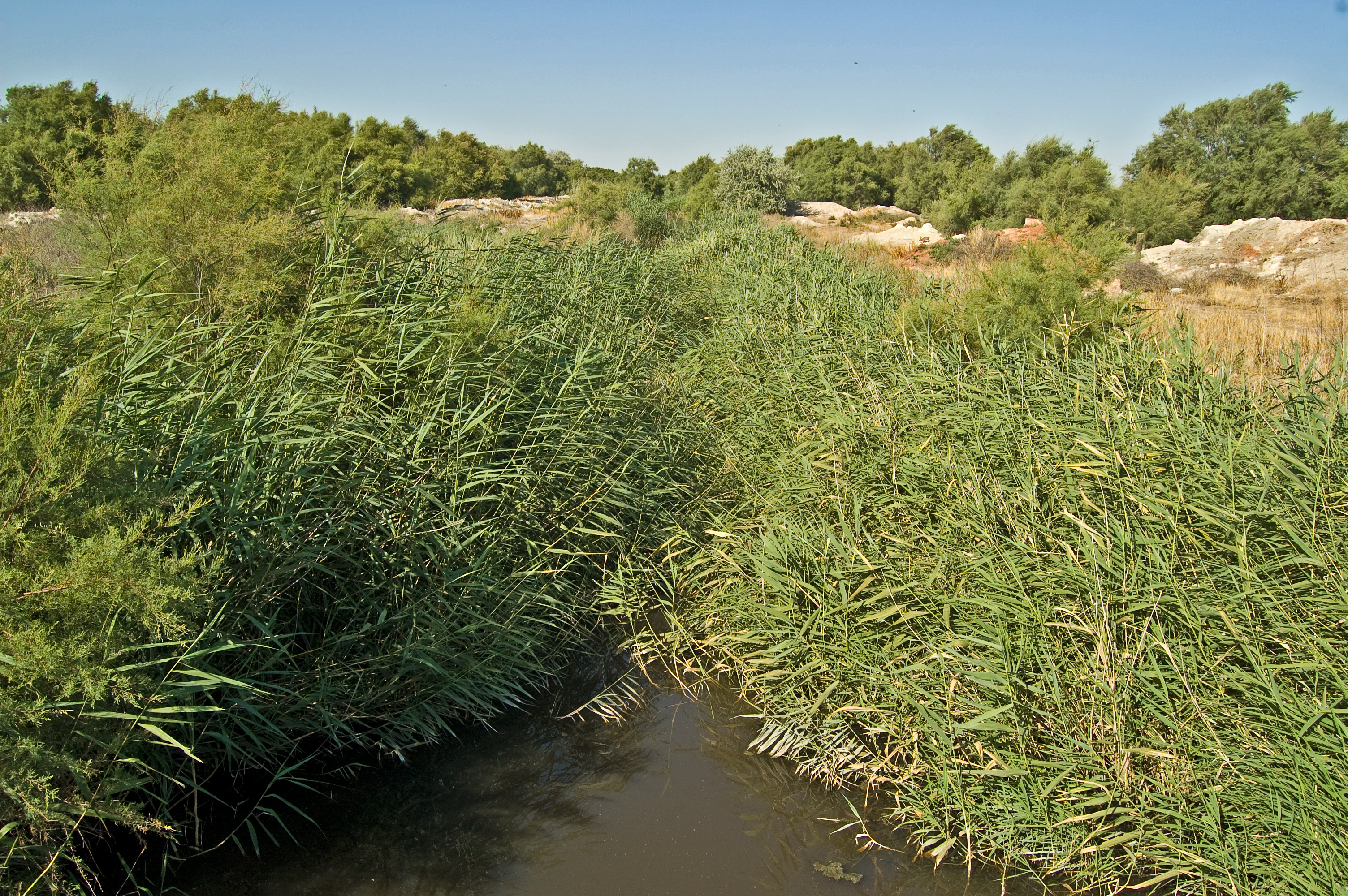
Olive trees and tamarisks invade the landscape, characterized by rain-fed crops. After several kilometres and passing by kilometre point 6, the trail turns left, then right and then left again to finally cross the canal before it flows into the River Gigüela, taking the traveller into the renowned Junta de los Ríos.
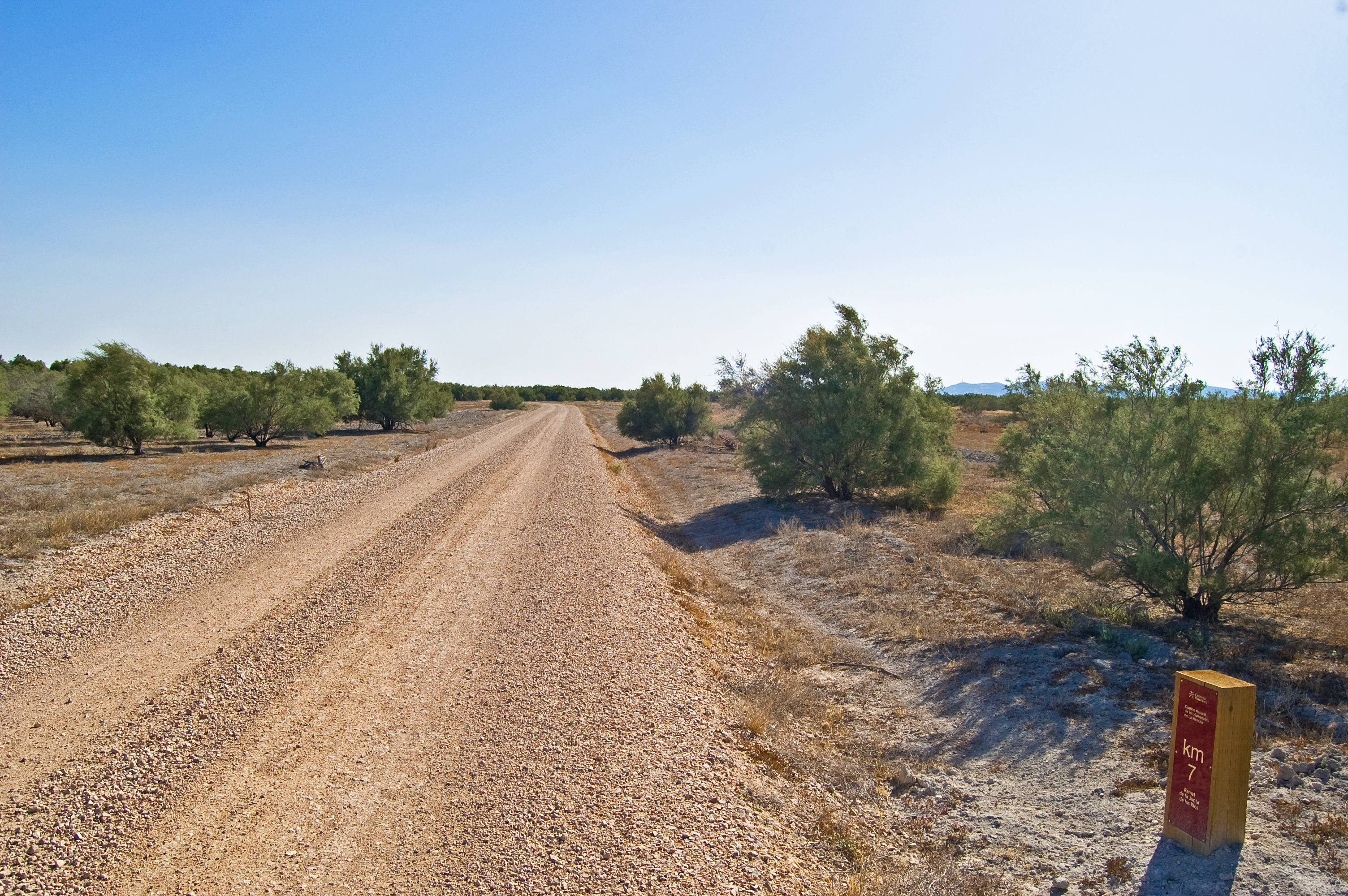
The trail turns right, running parallel to the cattle road known as Cordel de Cádiz, leaving a vast repopulation of tamarisks on the right side and the rain-fed crops on the left side.
A few metres before reaching kilometre point 10, the Laguna de Cerro Mesado is located on the left of the trail. One kilometre afterwards, you will abandon the Cordel de Cádiz and reach Casas del Destete and the Junta de los Ríos bird observatory.
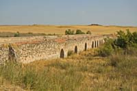
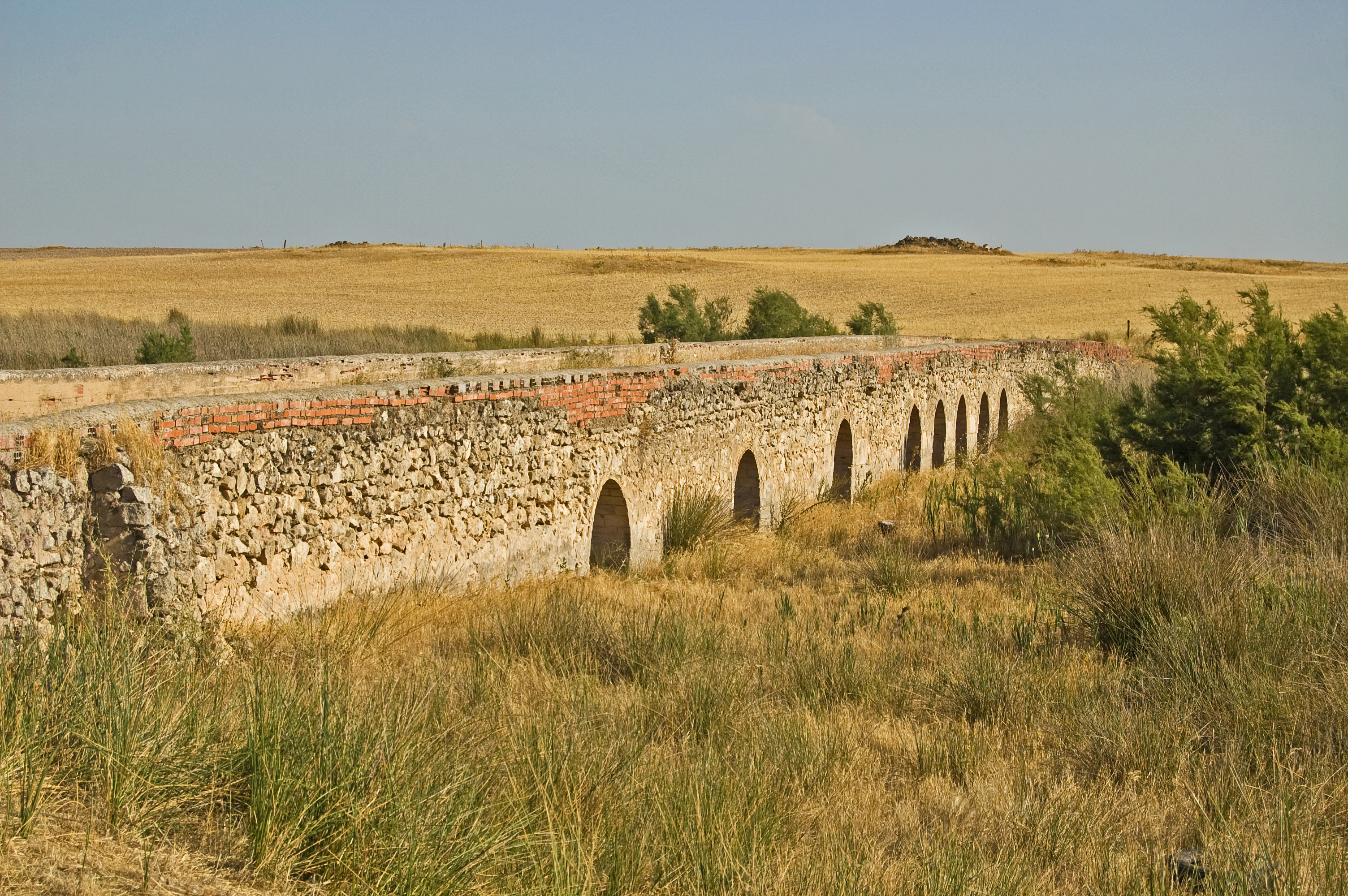
In the east direction, the trail continues in parallel to the River Záncara and turns right to cross it through a 9-arch stone bridge after passing by kilometre point 13.
A low hill between rain-fed crops leads you to kilometre point 15, which precedes the interpretation panel which indicates the end of the Junta de los Ríos detour in Stage 4 of the Guadiana Nature Trail
Map
Puntos de Interés
Información
Vegetación
Profile
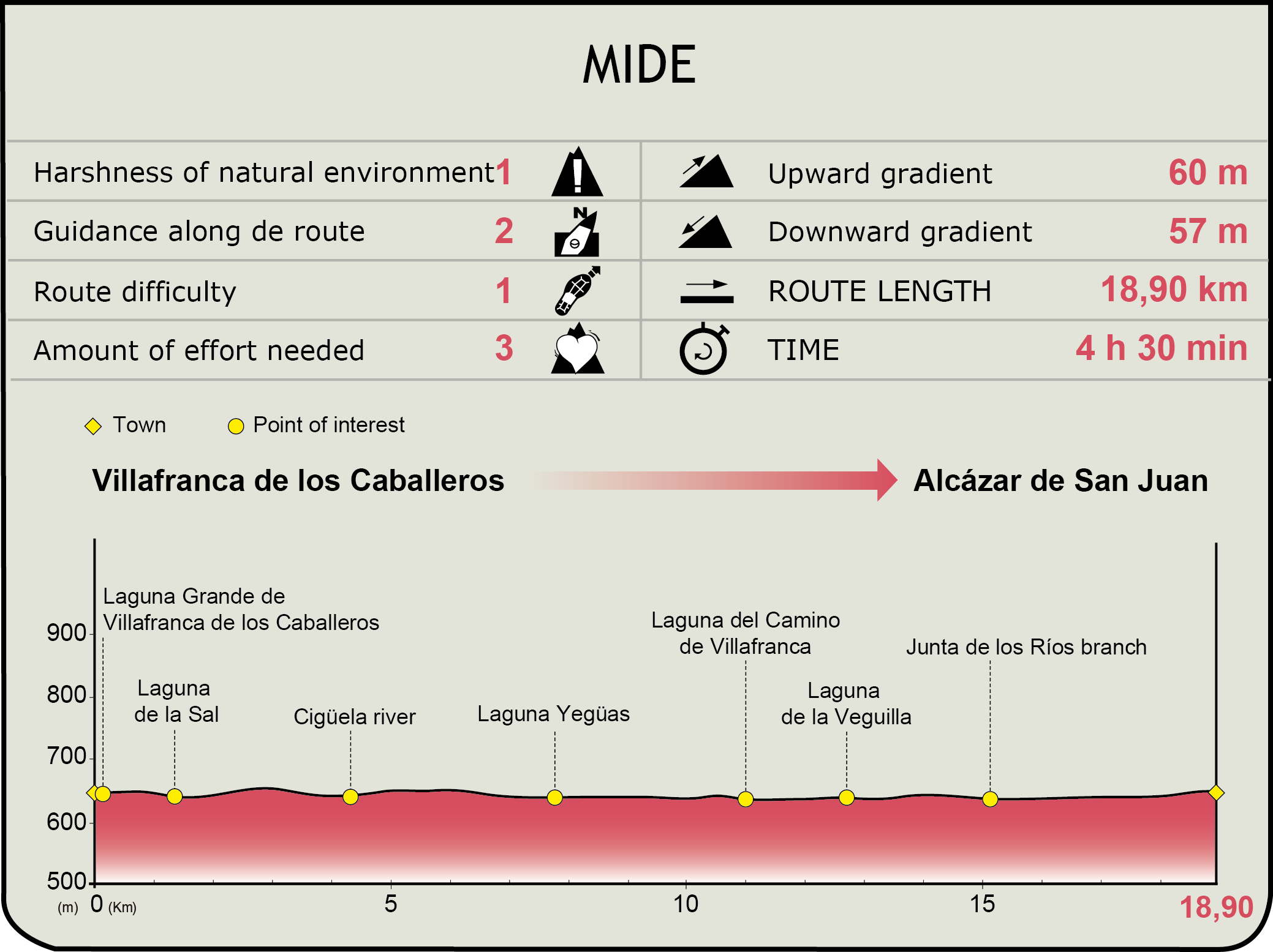
MIDE (Method for the Information of Excursions)
 Harshness of natural environment
- 1. The environment is not risk-free
- 2. There are more than one risk factors
- 3. There are various risk factors
- 4. There are quite a lot of risk factors
- 5. There are many risk factors
 Guidance along the route
- 1. Well defined trails and crossings
- 2. There is a clearly marked trail and signage
- 3. Requires the identification of geographic features and cardinal points
- 4. Requires off-path navigation
- 5. The trail is interrupted by obstacles that have to be gone around
 Route difficulty
- 1. Walking on a flat surface
- 2. Trails with different types of path
- 3. Walking on stepped paths or irregular terrain
- 4. The use of hands or jumping over the terrain is necessary
- 5. The use of hands is required to progress
 Amount of effort needed
- 1. Up to 1 hour of continuous walking
- 2. Between 1 and 3 hours of continuous walking
- 3. Between 3 and 6 hours of continuous walking
- 4. Between 6 and 10 hours of actual walking
- 5. More than 10 hours of continuous walking
Featured
Further information
Villafranca de los Caballeros
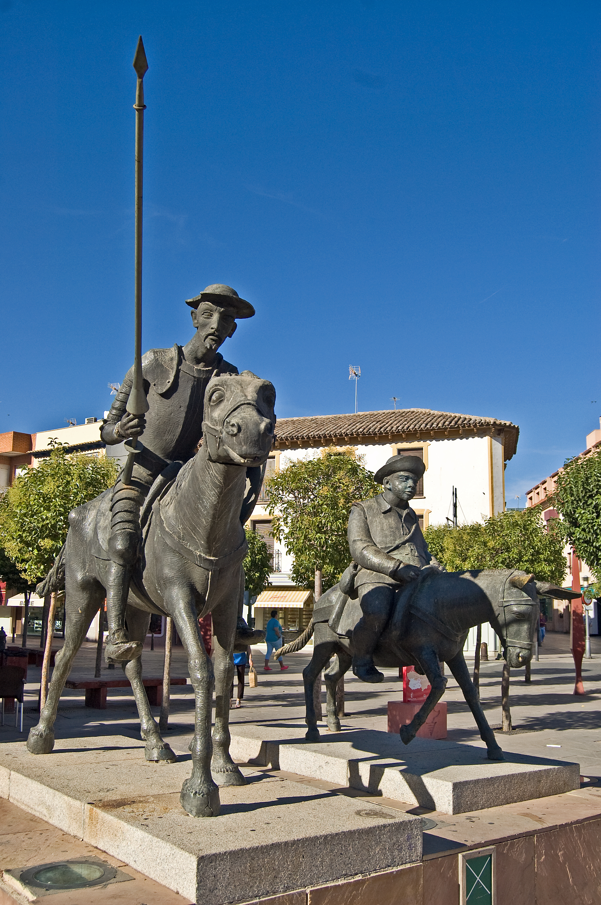
A town in the province of Toledo that belongs to the region of La Mancha. The surroundings of the River Amarguillo have been inhabited for centuries, as its waters secured the fertility of the nearby lands. Remains of Iberian, Roman and Muslim settlements have been found and dated, and the population was strengthened after the Reconquista. Apart from the different settlements, the River Amarguillo has been a great modelling element of the town with its frequent floods, as it has caused floodings that devastated numerous houses and destroyed crops; for this reason, it has undergone some channelling works.
The Ntra. Sra. de la Asunción Church, the Cristo the Sta. Ana Shrine and the San Isidro Shrine are just an example of the local architecture, as well as the Miguel de Cervantes monument located next to the city council The economy is based on agriculture and on a rising tourism linked to the Laguna Grande and the Laguna Chica de Villafranca de los Caballeros.
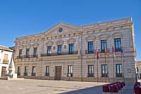
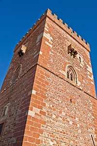
Alcázar de San Juan
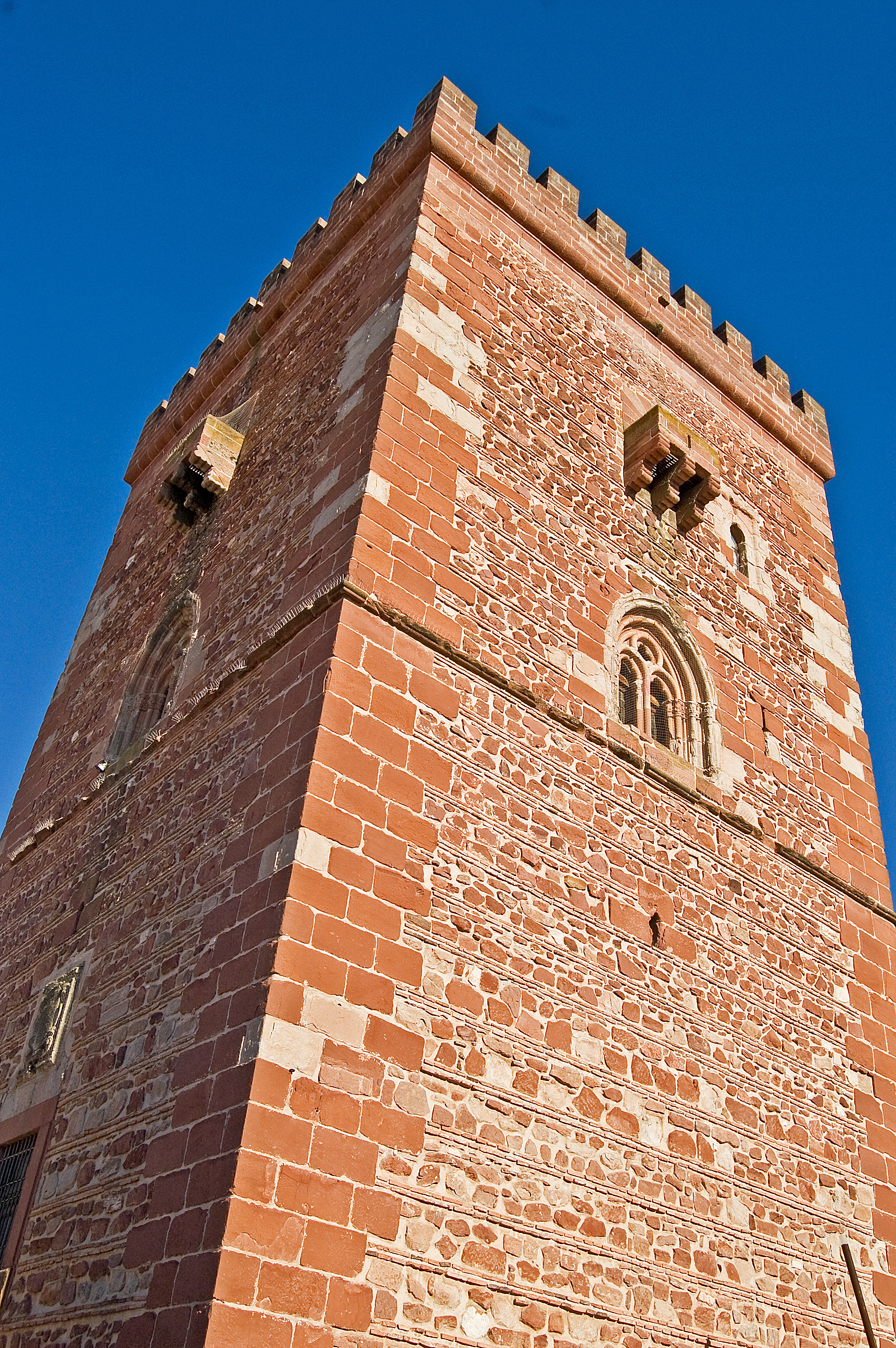
A town in the province of Ciudad Real where different remains from the Stone Age have been found. Some mosaics of the Roman period have been discovered in this area. After the Visigoth settlements, the Arab conquest transforms this town into an important defensive complex known as Al-kasar, which was the origin of its current name.
During the Reconquista, the Order of St. John repopulated the town. In the 16th century an important gunpowder factory was built and it remained in operation until 1868. The economy, previously based on the railway due to its geographic location, is currently linked to a solid, diverse industrial and commercial network supplemented by the touristic and agricultural activity.
The rich architectural heritage is vast: the Turret of the Grand Prior, different churches built in honour of San Francisco, Santa María, Santa Quiteria and the Santísima Trinidad, and the city council, which served as a casino in the past, are the most representative sites. The local festivities take place between September 2 and 8, just before the harvest.
Multimedia

Downloads
Cyclability
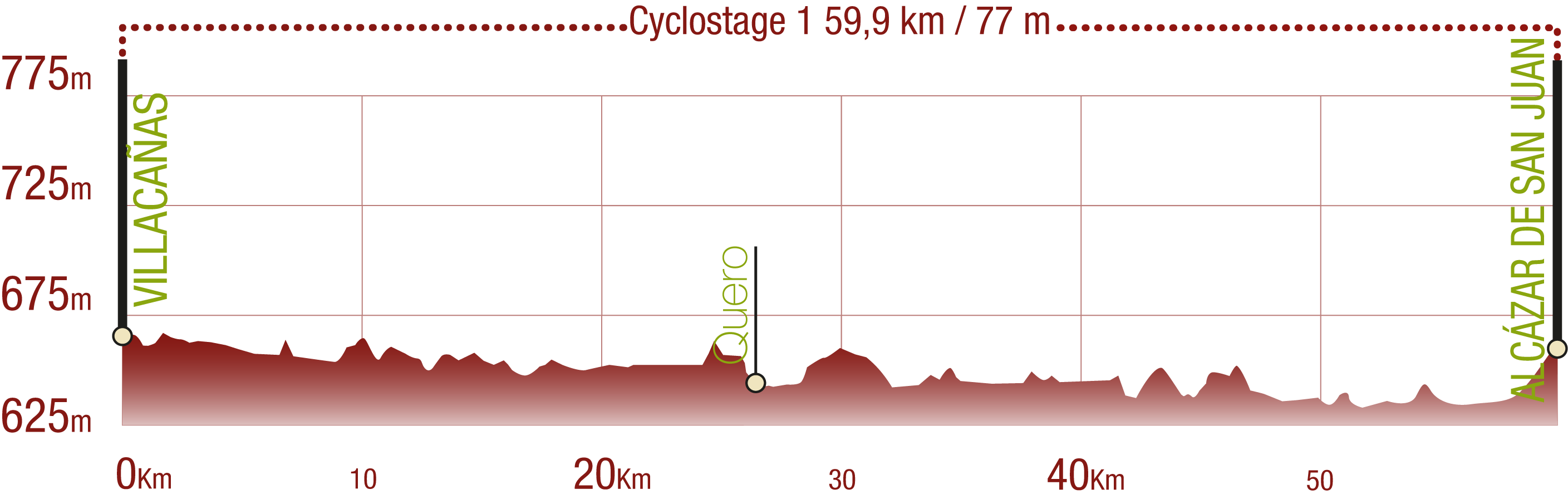
This cyclostage corresponds to stages 1 to 3 of the Nature Trail
PROFILE
TYPE OF ROAD, PORTAGES & DIFFICULTY

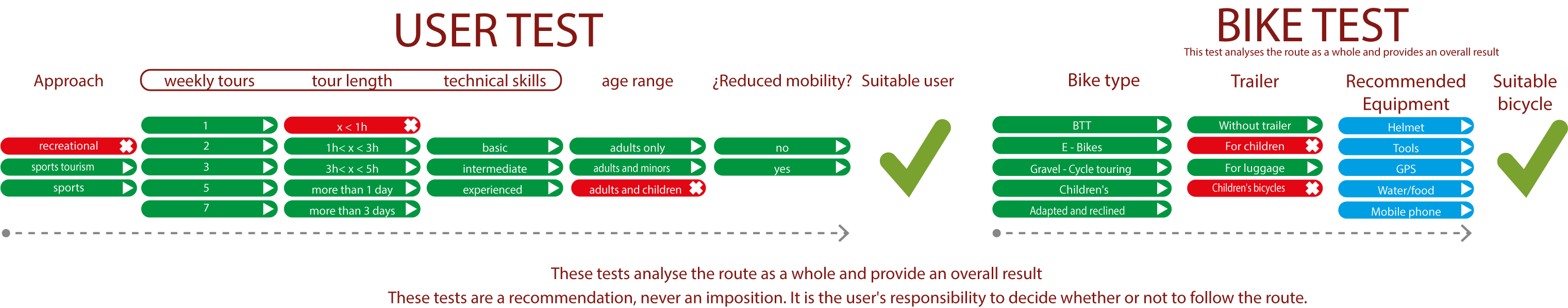
TEST
SAFETY RECOMMENDATIONS
- Sections shared with hikers and agricultural vehicles.
- Transit through the centre of some population centres.
GENERAL RECOMMENDATIONS
- Find out about the technical aspects of the route and the weather on the day.
- Take care of the environment. Take care not to disturb animals or damage vegetation. Respect private areas.
- You must give priority to pedestrians and comply with general traffic rules.
- The environment in which you will be riding is open, free to move around and an area where many activities are carried out (sporting, forestry, livestock and agricultural activities). Always have an understanding, prudent, responsible and respectful attitude.