
- Home
- Rural Development
- Nature Trails
- Nature Trails
- Central Sector
- Humedales de la Mancha
Stage 2: Quero – Villafranca de los Caballeros
Description
From salt extraction activities to medicinal baths: from the Laguna Grande de Quero to the Laguna Grande de Villafranca de los Caballeros.
This short stage of approximately 14 km winds through Quero (Toledo), exploring its Laguna Grande and the River Gigüela, and diving into the Lagunas y Albardinales del Gigüela. Afterwards it circles the Laguna Chica de Villafranca de los Caballeros to finally reach the Laguna Grande de Villafranca de los Caballeros.
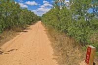
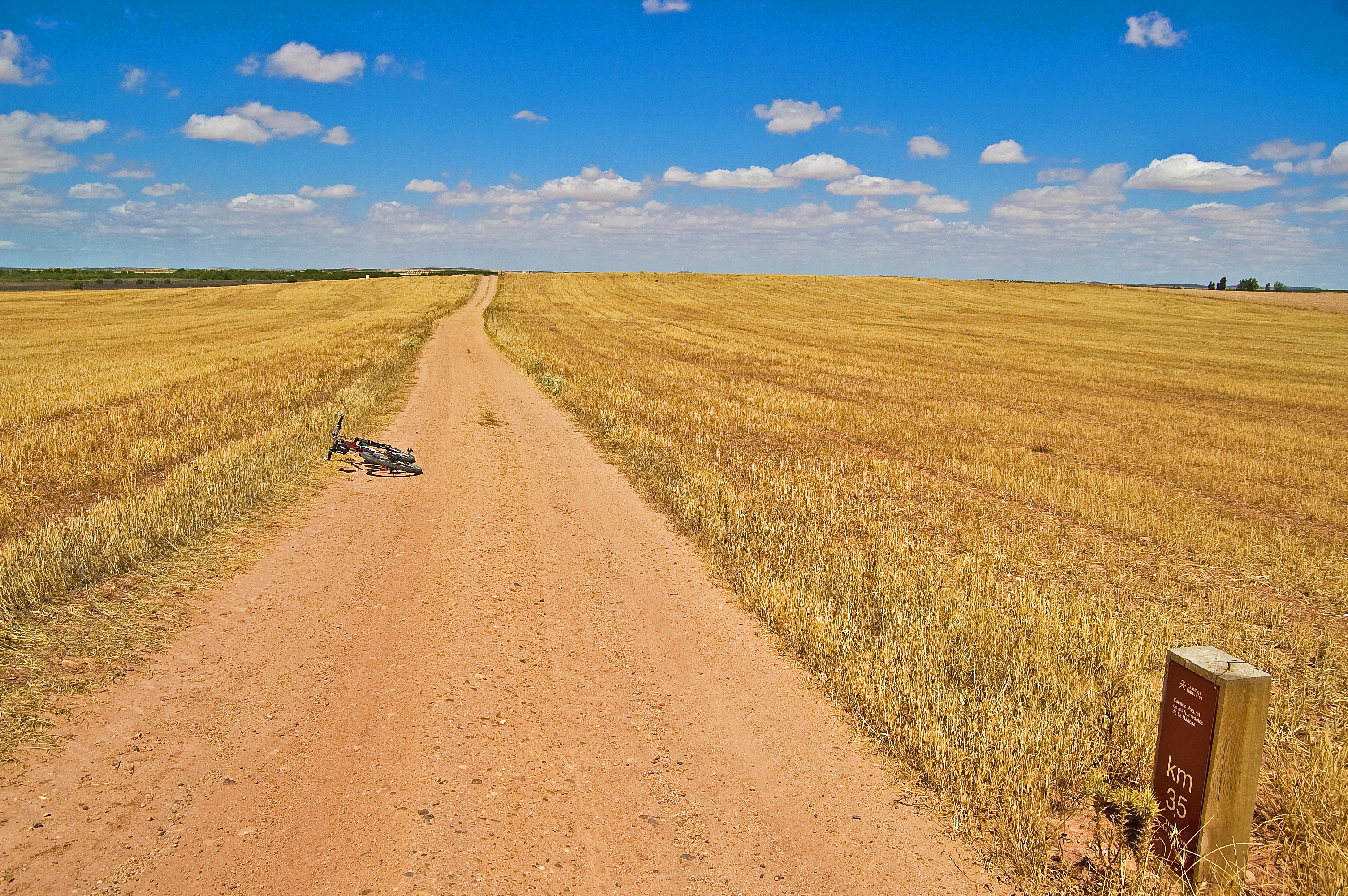
The second stage of the La Mancha Wetlands Nature Trail starts in the town of Quero. It continues along Avenida de Castilla-La Mancha (CM-3130 road) towards the south-west until it gets to kilometre point 27 of the Main Route. When you find a roundabout at the entrance to the town, you must take the dirt path on the left, surrounding the roundabout.
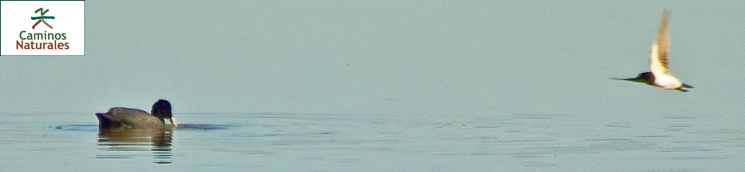
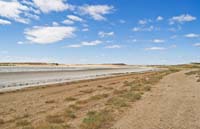
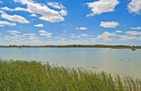
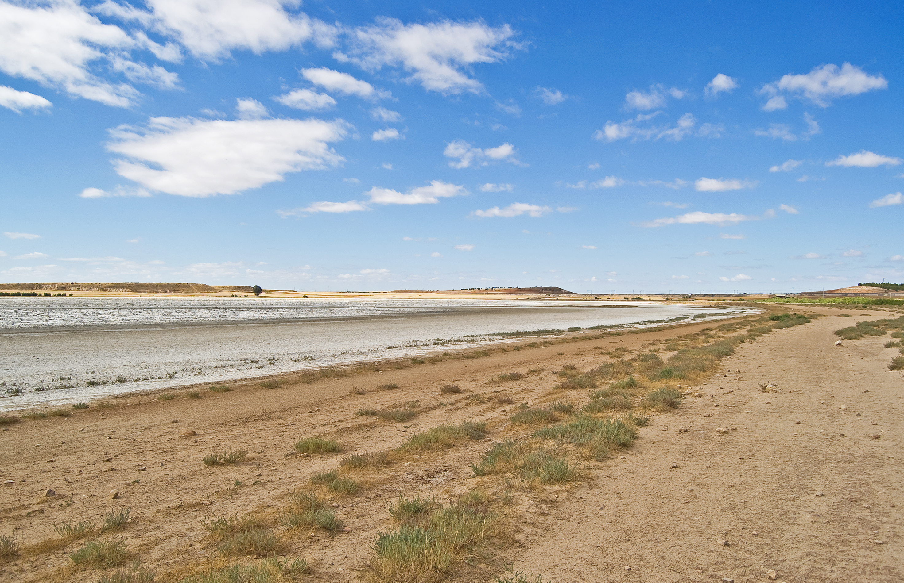
The trail continues in parallel to the CM-3130 road and to the Cañada Real Soriana Oriental, which witnessed the transhumance movements of the livestock for centuries. At the same time, and always on the left side of the trial, you will enjoy the landscape of the Laguna Grande de Quero (endorheic, hyper-saline lagoon with a surface of 72 ha, located south-west of the town of Quero. It was historically exploited for the extraction of salt and brine; currently, the lagoon basin partially preserves the slope of the old pools). At certain times, the salt accumulated in the surface reflects the sunlight, offering a stunning visual spectacle.
A few metres after kilometre point 28 and after crossing a flood-plain pass, the trail is paved. At this point you will also find an interpretation panel.
After leaving the Laguna Grande de Quero behind, you will cross the Madrid-Cádiz railway line by an underpass and reach the Quero wastewater treatment plant (EDAR). Once these facilities have been crossed, the trail becomes a dirt path again and it continues parallel to the CM-3130 road.
The smooth climb which starts after crossing the railway line comes to an end at kilometre point 30. Walking along the trail, flanked by a road on the right and rain-fed crops on the left, you will cross several flood-plain passes and reach, right after point kilometre 32, the Lagunas y Albardinales del Gigüela Nature Reserve.
You must cross the CM-3130 road with the utmost care and go along it for about 200 m, always on the correct side depending on whether you are going on foot or by bicycle.
At kilometre point 34, the dirt path continues and goes parallel to the CM-3130 road on the right side. A few metres afterwards, you must go along the road again for about 125 m towards Quero. Once this section is completed, you must turn left to start an ascending dirt path that leads to the flood-plain area of the Laguna Grande and the Laguna Chica de Villafranca de los Caballeros, as indicated on a panel located in an intersection.
After kilometre point 36, the trail turns left and continues flanked by large-sized tamarisks on both sides, as the species of this genus are well adapted to this saline environment. A new kilometre point marks a turn to the left and, in a southerly direction, a repopulated area of stone pines (Pinus pinea) will accompany you on the left side of the trail.
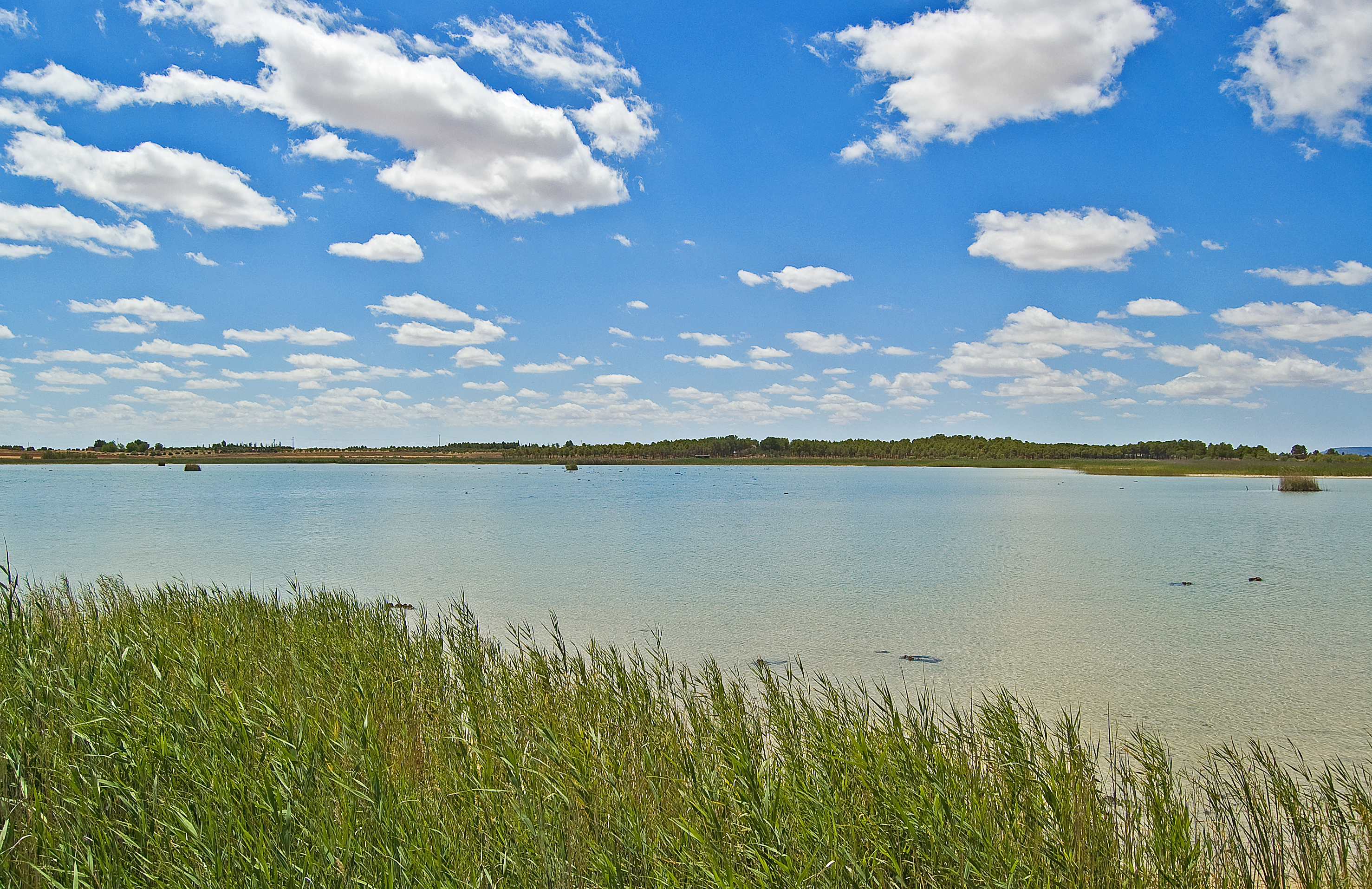
The track turns left continuing the stone pines area and starts a smooth descent towards the Laguna Chica de Villafranca de los Caballeros (lagoon with a surface of 37 ha that receives water intake from the River Gigüela via the Caz de las Lagunas canal. It contains water almost all year, although its volume is drastically reduced during the summer period. It is connected to the Laguna Grande de Villafranca de los Caballeros. It contains a broad sample of charophytes with reed and cattail formations in its banks, and serves as a shelter for different species of passerine birds).
The trail continues on the right side, but the signposting invites you to turn left and walk the approximately 300 m between the intersection and the bird observatory of the Laguna Chica de Villafranca de los Caballeros, where you can enjoy the richness of the fauna and the beautiful scenery.
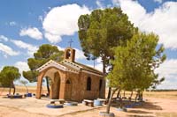
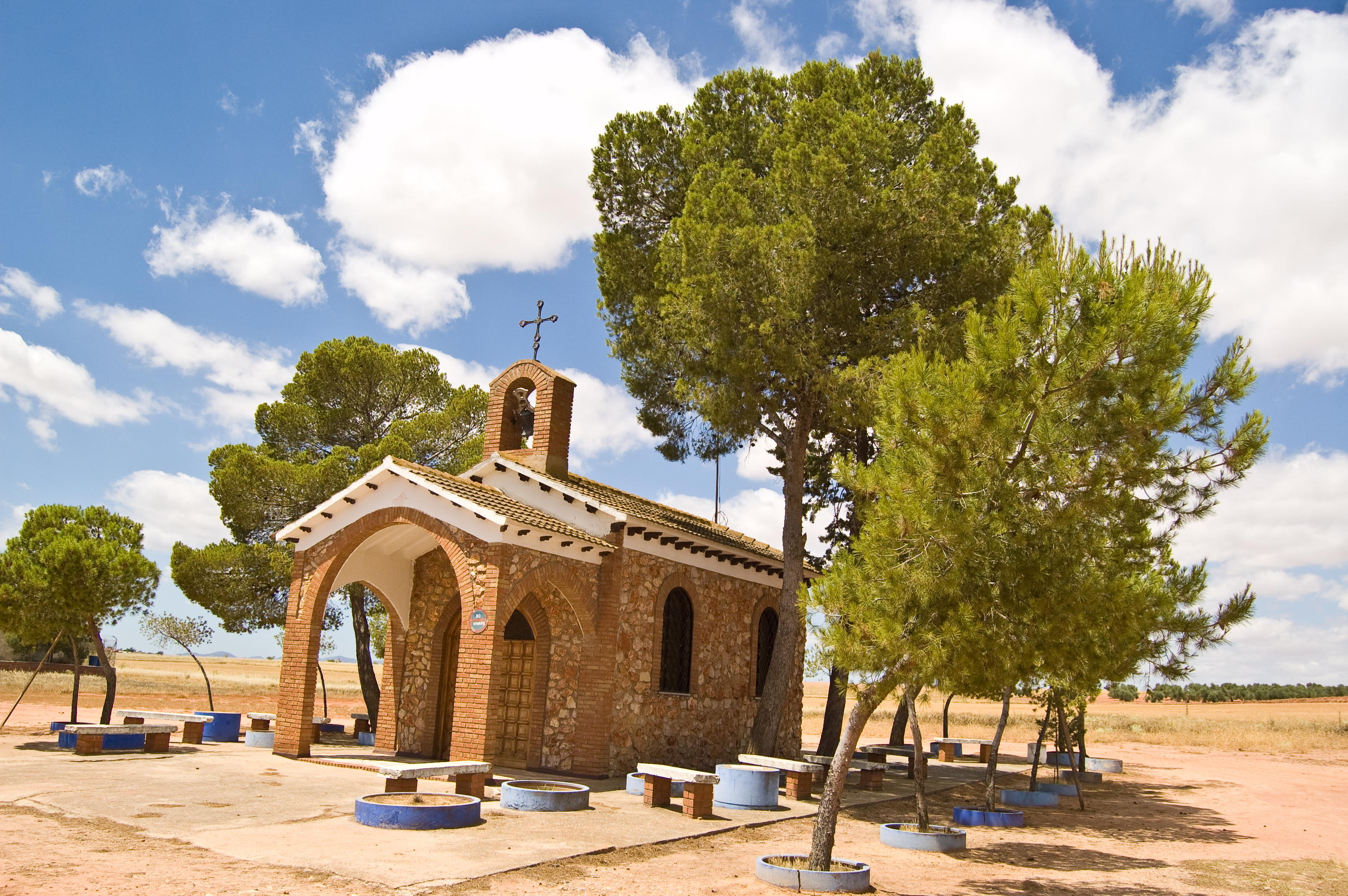
Back on the trail, you will continue the route flanked by the Laguna Chica de Villafranca de los Caballeros on the left and cereal crops and vineyards on the right. After kilometre point 39, a repopulated area of Aleppo pines (Pinus halepensis) separates the two lagoons. The San Cristóbal Shrine, founded in 1980, marks the beginning of the Laguna Grande de Villafranca de los Caballeros (lagoon with a surface of 72 ha that receives its water intake from the River Gigüela via the Caz de las Lagunas canal, connected to the Laguna Chica de Villafranca de los Caballeros. Since the 18th century it has been a bathing area due to the claimed curative properties of its water. Many second homes, accommodations and different restaurants have been built along its banks, resulting in the creation of an area known as Urbanización de las Lagunas).
A few metres afterwards, you will find two floating fishing posts and, right after kilometre point 40, the Laguna Grande de Villafranca de los Caballeros resting area, where the trail is paved.
The Lagunas Grande y Chica de Villafranca de los Caballeros Interpretation and Education Centre indicates that the trail is entering the residential area surrounding the Laguna Grande. It continues along Avenida de la Laguna Grande until reaching the Abuela roundabout, where an interpretation panel indicates the end of this second stage of the La Mancha Wetlands Nature Trail between Quero and Villafranca de los Caballeros.
Map
Puntos de Interés
Información
Infraestructura
Vegetación
Profile
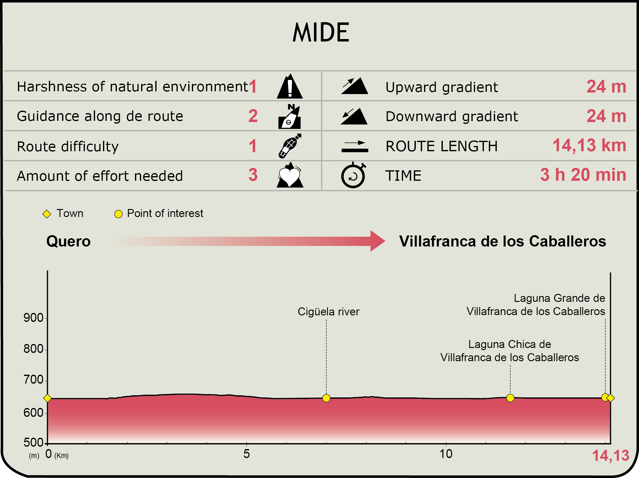
MIDE (Method for the Information of Excursions)
 Harshness of natural environment
- 1. The environment is not risk-free
- 2. There are more than one risk factors
- 3. There are various risk factors
- 4. There are quite a lot of risk factors
- 5. There are many risk factors
 Guidance along the route
- 1. Well defined trails and crossings
- 2. There is a clearly marked trail and signage
- 3. Requires the identification of geographic features and cardinal points
- 4. Requires off-path navigation
- 5. The trail is interrupted by obstacles that have to be gone around
 Route difficulty
- 1. Walking on a flat surface
- 2. Trails with different types of path
- 3. Walking on stepped paths or irregular terrain
- 4. The use of hands or jumping over the terrain is necessary
- 5. The use of hands is required to progress
 Amount of effort needed
- 1. Up to 1 hour of continuous walking
- 2. Between 1 and 3 hours of continuous walking
- 3. Between 3 and 6 hours of continuous walking
- 4. Between 6 and 10 hours of actual walking
- 5. More than 10 hours of continuous walking
Featured
Further information
Quero
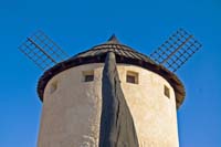
Town of the province of Toledo that belongs to the region of La Mancha, whose origins date back to Palaeolithic period, although some remains from subsequent ages have been found, since the natural deposits of water have attracted inhabitants over the years. Salt extraction activities in the Laguna Grande date back to the Roman period and were continued until the end of the 20th century, when the economy was based on agricultural and salt activities depending on the time of the year. The architectural heritage is particularly reflected on religious buildings, such as the Ntra. Sra. de la Asunción Church, the Ntra. Sra. de las Nieves Shrine and the Soledad Shrine. The restored windmill and another partially preserved mill are also worth noting.
Multimedia


Downloads
Descargas de GPS
Cyclability
This cyclostage corresponds to stages 1 to 3 of the Nature Trail
PROFILE
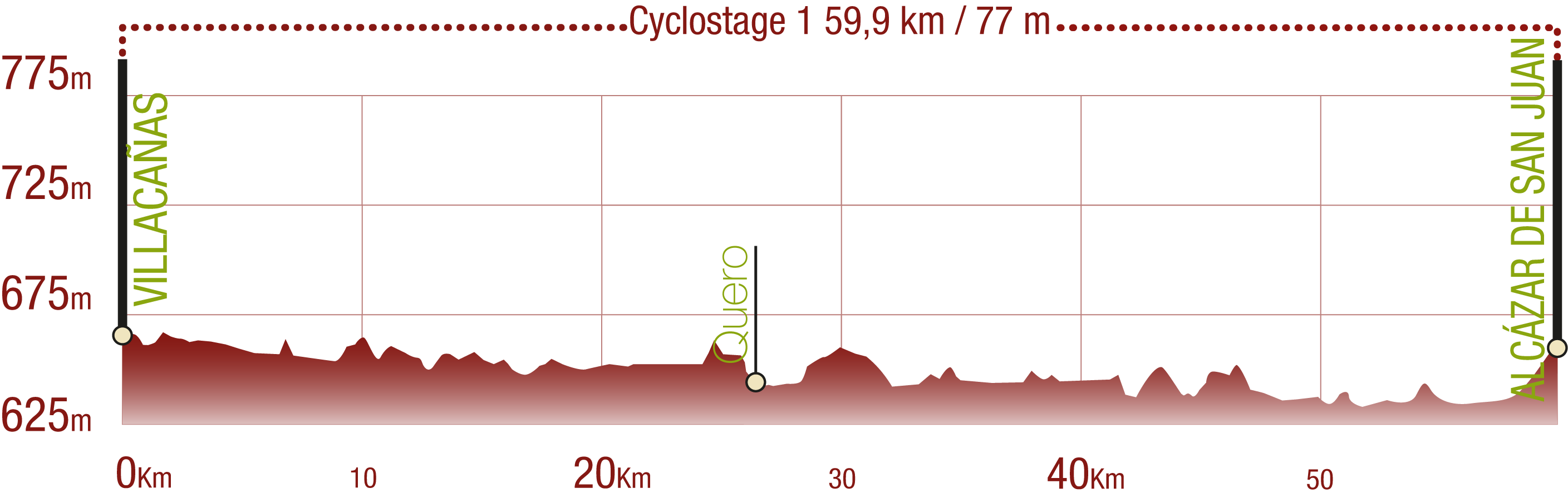
TYPE OF ROAD, PORTAGES & DIFFICULTY

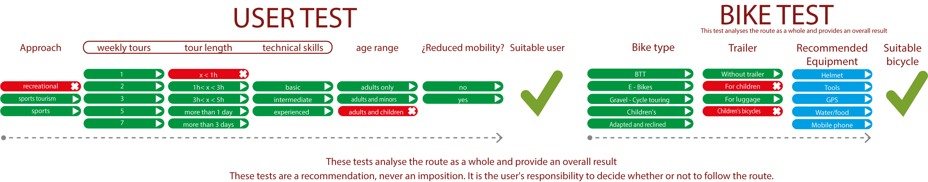
TEST
SAFETY RECOMMENDATIONS
- Sections shared with hikers and agricultural vehicles.
- Transit through the centre of some population centres.
GENERAL RECOMMENDATIONS
- Find out about the technical aspects of the route and the weather on the day.
- Take care of the environment. Take care not to disturb animals or damage vegetation. Respect private areas.
- You must give priority to pedestrians and comply with general traffic rules.
- The environment in which you will be riding is open, free to move around and an area where many activities are carried out (sporting, forestry, livestock and agricultural activities). Always have an understanding, prudent, responsible and respectful attitude.