Stage 44: Villablanca - Ayamonte
Description
Smells of the sea
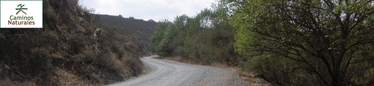
This Stage, which begins at Villablanca, is easy and comfortable as it runs through mostly flat terrain, with barely any slopes. One can begin to feel the breeze from the nearby ocean.
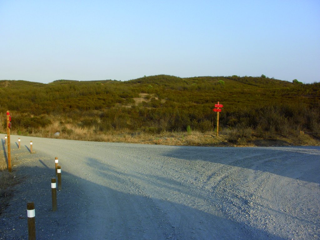
Leaving Villablanca behind, the first few kilometres of this Stage run along the so-called Camino de Zaballa. As in the previous Stage, this one is also easy to walk with low difficulty, and begins with a gentle descent.
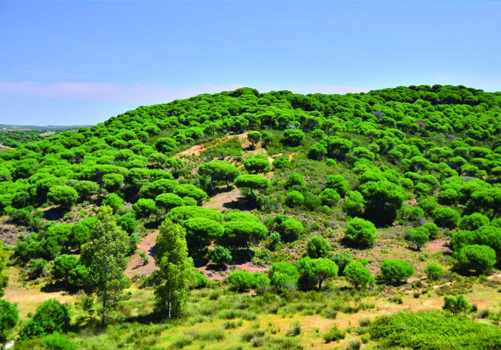
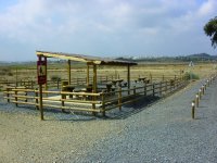
It overlaps with Stage 43 until La Estacada Rest Area. This is the last of the modern rest areas built to provide shelter for cyclists and hikers travelling this 850-kilometre Nature Trail that is now ending. As in Stage 43, the route runs along Vereda de la Zaballa. The landscape is typical Mediterranean scrubland, dominated by several tree species, including kermes oak (Quercus coccifera), wild olive (Olea europaea var. sylvestris), Aleppo pine (Pinus halepensis) and stone pine (Pinus pinea). There are also thickets of rockrose (Cistus spp.), yellow broom (Cytisus scoparius) and rosemary (Rosmarinus officinalis). The landscape is framed by olive trees, which abound in this Stage.
The wildlife consists of rabbit (Oryctolagus cuniculus), hare (Lepus europaeus), and deer (Cervus elaphus) as well as a variety of bird species, including Common Hoopoe (Upupa epops), Song Thrush (Thurdus philomelos) and Woodpigeon (Columba palumbus).
After 6.5 km from Villablanca, the route turns left at an intersection, heading towards Ayamonte. Further on, the path reaches a ford on Almendras Creek.
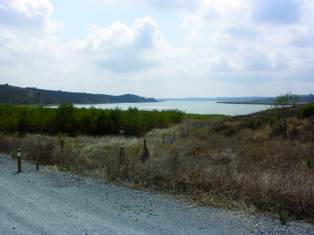
Past the creek, the Trail continues another 150-200 m, parallel to the left bank of Grande Creek. The route approaches the River Guadiana, along which it will run for a long stretch, sometimes in parallel, and sometimes drifting away, but always with stunning views.
The route traverses through Costa Esuri Housing Estate, a community of mostly vacation homes. Past this housing development, the route reaches an intersection, turning left towards el Regajo del Pozo del Alcalde, spanned by a bridge.
As in previous Sections, the Trail ventures through mostly flat terrain with gentle slopes and an unchanging landscape of isolated pinewoods next to eucalyptus groves, holm oaks (Quercus ilex), olive and wild olive trees, as well as typical Mediterranean shrub. The only exception is the riparian vegetation that can be found near the streams and rivers mentioned above.
La Guerrera-La Pedraza Rest Area, perfectly equipped for hikers, is the next place of interest in this Stage.
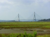
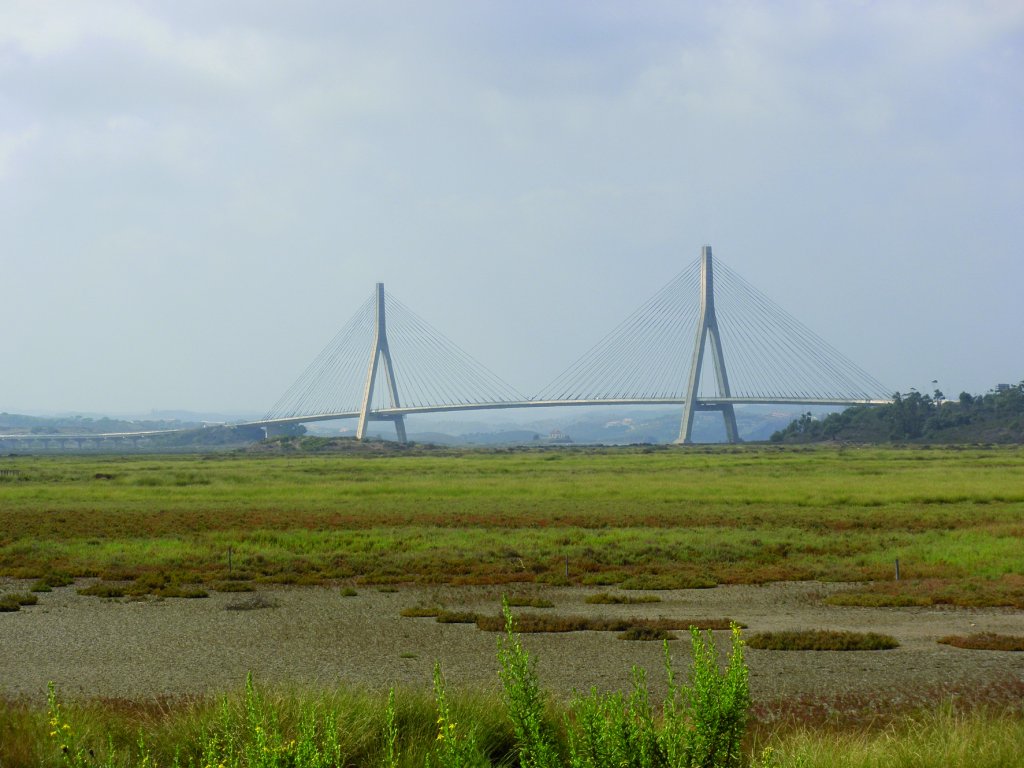
The Stage crosses through an underpass the A-49 motorway linking Spain and Portugal. Past this point, the route traverses through an industrial park, taking the right exit at the roundabout. The Trail ventures through the marshlands at the mouth of the River Guadiana, from where one can see the Guadiana International Bridge.
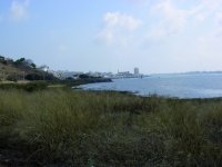
The Stage ends at the edge of Ayamonte, where the River Guadiana empties into the Atlantic Ocean.
Sites of interest
Profile
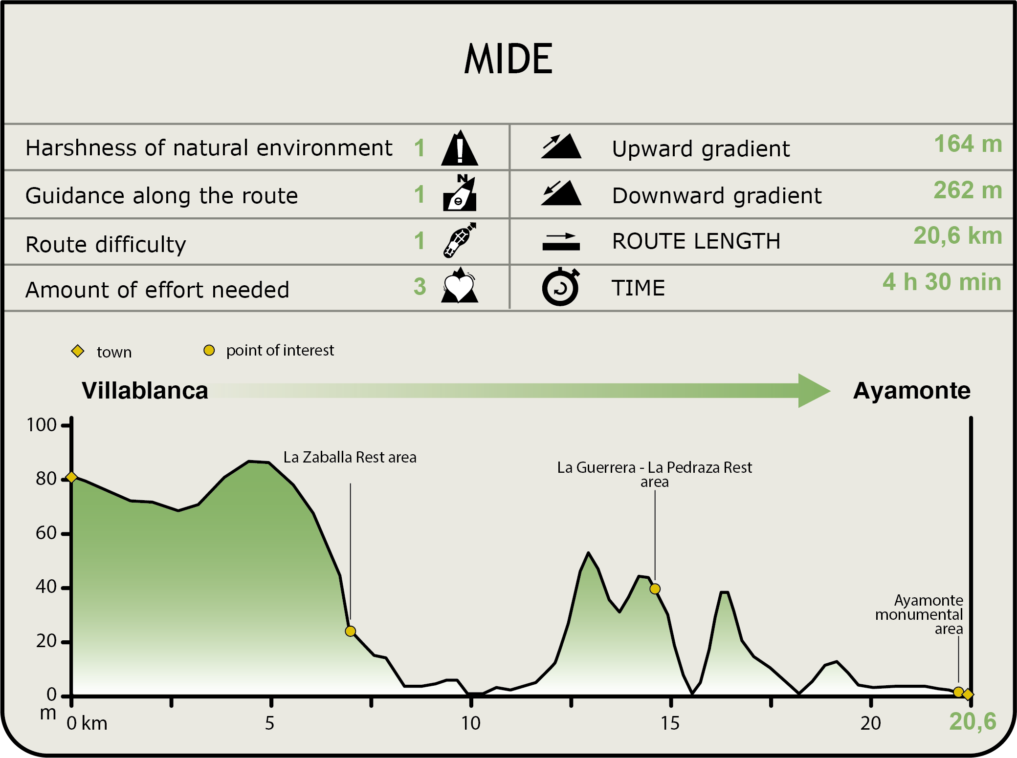
MIDE (Method for the Information of Excursions)
 Harshness of natural environment
- 1. The environment is not risk-free
- 2. There are more than one risk factors
- 3. There are various risk factors
- 4. There are quite a lot of risk factors
- 5. There are many risk factors
 Guidance along the route
- 1. Well defined trails and crossings
- 2. There is a clearly marked trail and signage
- 3. Requires the identification of geographic features and cardinal points
- 4. Requires off-path navigation
- 5. The trail is interrupted by obstacles that have to be gone around
 Route difficulty
- 1. Walking on a flat surface
- 2. Trails with different types of path
- 3. Walking on stepped paths or irregular terrain
- 4. The use of hands or jumping over the terrain is necessary
- 5. The use of hands is required to progress
 Amount of effort needed
- 1. Up to 1 hour of continuous walking
- 2. Between 1 and 3 hours of continuous walking
- 3. Between 3 and 6 hours of continuous walking
- 4. Between 6 and 10 hours of actual walking
- 5. More than 10 hours of continuous walking
Featured
Further information
Guadiana International Bridge
Guadiana International Bridge links Ayamonte in Huelva province with Castro Marin in Faro District (Portugal). The bridge was built by a Spanish-Portuguese consortium in 1991. The bridge spans 666 meters over the river, and rises about 20 m. It has two, 100-metre high triangular pillars. The sheer size of the structure makes the bridge visible from many kilometres away.
Las Marismas de Isla Cristina Nature Site
Las Marismas de Isla Cristina is a protected area that was designated a Nature Site in 1989. It covers 2,145 ha, and spans two municipalities: Ayamonte and Isla Cristina.
It is located at the mouth of the River Carreras. Its most representative wildlife includes Spoonbills, Storks, Terns and other waders. Stone pines, Phoenician junipers, Spanish lavender, rosemary and shrubby sea-blite are some of the most notable plant species.
Marshes are wet lowlands that are flooded by seawater at high tide. They are usually close to the mouth of a river. These ecosystems rely on tidal activity, rendering them almost immune to seasonality.
In terms of the landscape, one must differentiate between those areas where the ecosystem has been affected by human activity, and those that have not and are better preserved.
Ayamonte
Some people say that Ayamonte dates back to the ancient Tartessus civilization. Ptolemy identified this city as Canaca. The etymology of the name, documented at least since the tenth century, is not clear. It may mean "on the bridge", or it could derive from the name of an Arab warlord.
The numerous remains found from different periods attest to the rich and time-honoured history of this place. In 1239, Sancho II of Portugal reconquered the settlement, and in 1335, it was definitely won over by the Castilians. During the sixteenth and seventeenth centuries, Ayamonte was one of the most important towns in coastal Huelva. It saw its population grow significantly in the second half of the nineteenth century. Starting in 1920, the area underwent major industrialization, primarily of the canning industry.
Owing to its many natural attractions, tourism is a major source of income for Ayamonte, which also has an important fishing industry. The River Guadiana is the heart of the city that extends along its left bank. On the opposite bank sit the Portuguese towns of Vila Real de Santo Antonio and Castromarín, with whom it shares the estuary of this great river. Until 1992, when the Puente del Centenario that links Spain and Portugal was opened, both people and vehicles were ferried across the river. This ferry is still in operation. One can take a trip from Ayamonte on the sightseeing boat that sails upstream on the River Guadiana, stopping at several Portuguese towns, on its way to Sanlúcar de Guadiana.
Multimedia