Stage 41: Cuartel Cañaveral - El Granado - Sanlúcar de Guadiana
Description
Guadiana's ports and canals
The first part of this Stage is somewhat difficult. The road, flanked by lush vegetation, traverses through rugged terrain with continuous ups and downs. From the beginning, it runs parallel to the River Guadiana, along its left bank, until it reaches Puerto de La Laja, where the road turns east towards the town of El Granado. Further on, it drifts back to the Guadiana, where the route ends at Sanlúcar. The Stage crosses trenches, small bridges and tunnels built for the railroad that once transported minerals from the county’s inland areas.
Once the Stage through the province of Badajoz has been completed, the Guadiana reappears as the natural border between Spain and Portugal. The route traverses through Andévalo County, where the landscape is shaped by Mediterranean scrubs, primarily two indigenous species, holm oak (Quercus ilex) and cork oak (Quercus suber).
The Stage begins at the HU-6400, between the Km 10 and 11 milestones, in the direction from Pomarao (Portugal) to El Granado (Huelva). Close to the starting point is El Chanza Reservoir; however, visits are not allowed.
The Casa Cuartel Cañaveral Hostel is 200 m further on. There is also a rest area with picnic tables and benches under the shade of tall eucalyptus (Eucalyptus spp.) trees and stunning views of the River Guadiana.
This Stage is a combination of mountain landscape with several very steep slopes and vegetation typical of a Mediterranean sclerophyllous forest, and riparian landscape and vegetation along the River Guadiana. In the early morning and at dusk, one can see deer (Cervus elaphus) and wild boars (Sus scrofa).
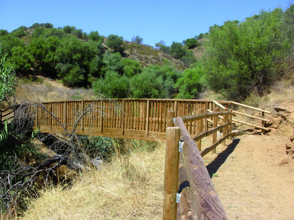
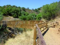
The route runs parallel to the River Guadiana, towards Puerto de La Laja, with wooden railings at the steepest areas. Steps with wooden guards have been cut into the ground in the areas with the largest differences in height. There are also wooden footbridges over numerous ravines and creeks that dot the Trail.
Past Puerto de La Laja, a well-equipped rest area with a viewpoint offers stunning views of the river. This rest area has panels with detailed information on the features and characteristics of this area and the route.
From here, the Trail drifts away from the River Guadiana to the east, crossing first a short tunnel, and then the HU-6400 to continue straight ahead. Although the Trail still ventures through a mountainous region, the dense vegetation gives way to a far less compact landscape. There are also a few scattered livestock farms. Countless wind turbines dot the upper reaches of the hills.
Past the footbridge, the Trail approaches the water canal fed by El Chanza Reservoir, and continues towards an intersection where one may either continue straight ahead towards El Granado (five kilometres), or turn right to Sanlúcar de Guadiana (nine kilometres).
El Granado Branch
If one continues to El Granado, about halfway into the route, there is an intersection where the right path leads to the Shrine of La Rábida, just a few metres away. Back on the main path, the route continues towards El Granado, where this alternative route ends.
El Granado is home to the 15th-century shrine of the Santísima Trinidad, the Church of Santa Catalina, and an ethnographic museum with farm tools and old windmills.
Main Route
One must take the road to Sanlúcar de Guadiana to continue along the main route. The path crosses the HU-6400 again. It ventures straight ahead through a mountain landscape with sparse vegetation dominated by scrub. The Stage crosses several properly prepared fords. Modern wind turbines can be seen, at all times, throughout the route. The Trail offers spectacular views as it runs along the River Guadiana.
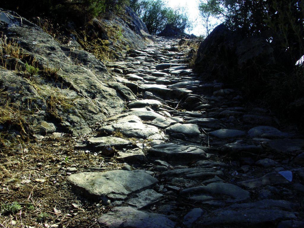
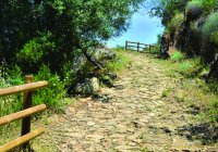
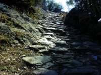
Further on, the track becomes a path, and the terrain is more uneven and steeper. A creek crosses the path for about 50 m. A little over one kilometre from the town of Sanlúcar, the Trail reaches a Roman road.
Once in Sanlúcar, there is a properly maintained rest area where the Stage ends. The parish church of Nuestra Señora de las Flores and San Marcos Castle are worth a visit. It should be noted that Sanlúcar has a small port, where ferrymen cross the River Guadiana to reach the small Portuguese village of Alcoutim.
Finally, it should be highlighted that the entire Stage traverses through the “Andévalo Occidental” SCI (Site of Community Importance), where endangered species such as the Black Stork (Ciconia nigra). live. These two Sections are the ones that venture closest to the Guadiana in the “Río Guadiana y Ribera del Chanza” SCI.
Sites of interest
Profile
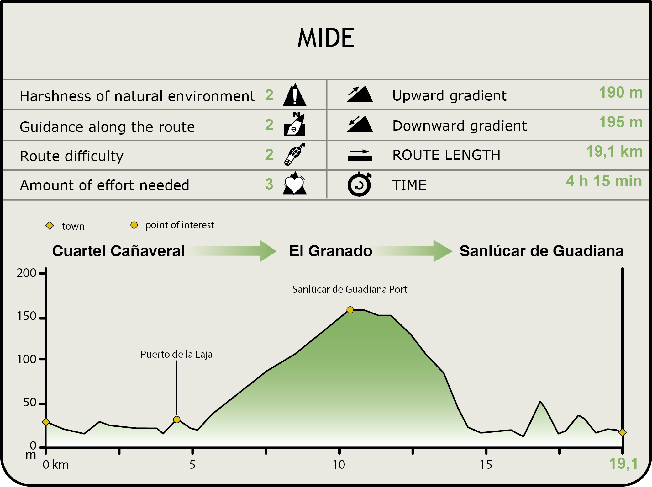
MIDE (Method for the Information of Excursions)
 Harshness of natural environment
- 1. The environment is not risk-free
- 2. There are more than one risk factors
- 3. There are various risk factors
- 4. There are quite a lot of risk factors
- 5. There are many risk factors
 Guidance along the route
- 1. Well defined trails and crossings
- 2. There is a clearly marked trail and signage
- 3. Requires the identification of geographic features and cardinal points
- 4. Requires off-path navigation
- 5. The trail is interrupted by obstacles that have to be gone around
 Route difficulty
- 1. Walking on a flat surface
- 2. Trails with different types of path
- 3. Walking on stepped paths or irregular terrain
- 4. The use of hands or jumping over the terrain is necessary
- 5. The use of hands is required to progress
 Amount of effort needed
- 1. Up to 1 hour of continuous walking
- 2. Between 1 and 3 hours of continuous walking
- 3. Between 3 and 6 hours of continuous walking
- 4. Between 6 and 10 hours of actual walking
- 5. More than 10 hours of continuous walking
Featured
Further information
Casa Cuartel Cañaveral
Smuggling has always been rife in this border area divided by the river. To prevent this activity, several Guardia Civil barracks were built along the river at Cañaveral, Puerto de La Laja and Cumbres de San Blas. All kind of products, including, sugar, coffee, and tobacco were smuggled, mostly in the 1940s. The smugglers would hide in the ravines during the day, and continue towards different destinations in Huelva in the dark of the night.
El Puerto de La Laja
Puerto de la Laja belongs to the parish of El Granado. In the late 19th century and early 20th century, it had an important shipping dock. Indeed, it was the last navigable point in the River Guadiana, where the mineral ore extracted from inland mines where brought by train to be shipped. It is currently listed as a Site of Industrial Interest.
Multimedia