Stage 31: La Zarza - Mérida
Description
Along the River Matachel
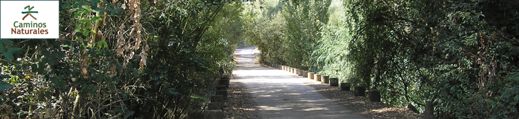
This Stage runs along the River Matachel, a subsidiary on the left bank of the Guadiana, populated with the best examples of Mediterranean riparian undergrowth. This idyllic path, flanked by trees, leads to the city of Mérida. The old "Fábrica de la Luz", which today houses "El Berrocal" Interpretation Centre, is an interesting stop halfway through the route.
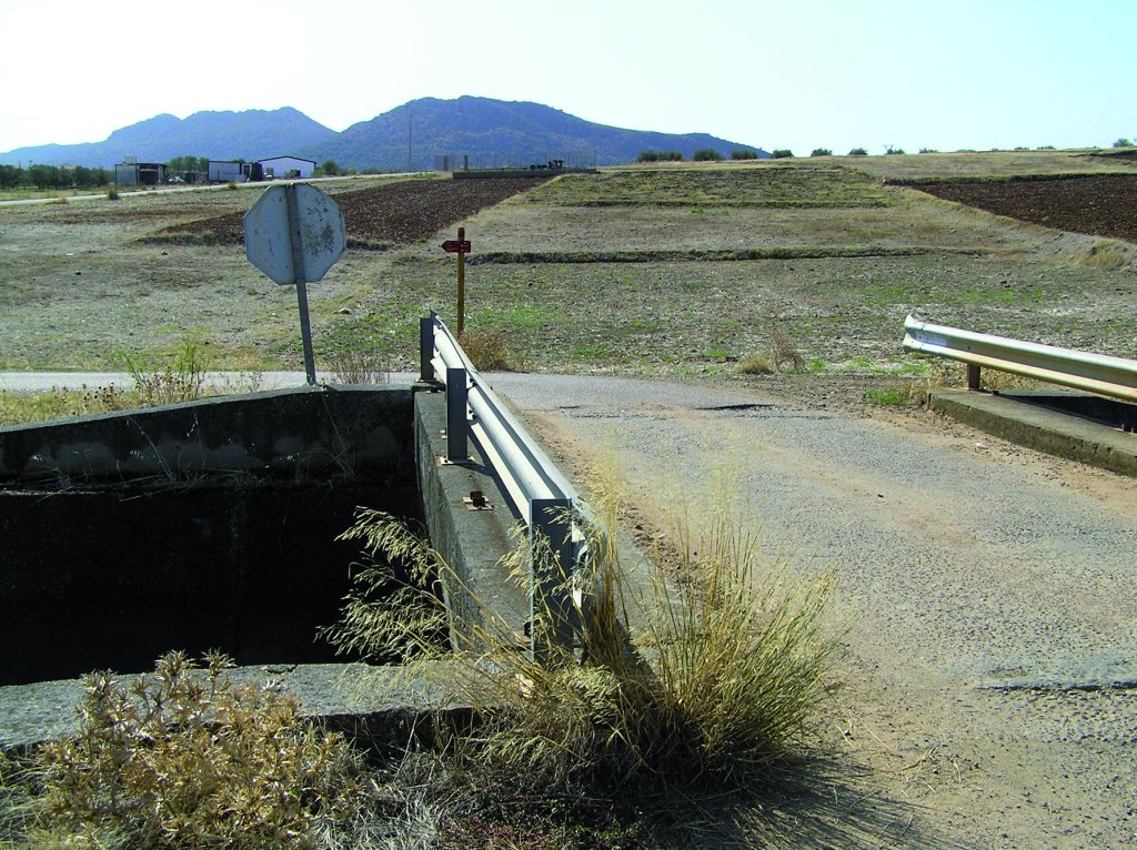
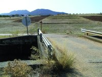
The Sections begins at the outskirts of La Zarza. It immediately crosses the EX-105 that links Mérida and Guareña. About 50 m further on is an intersection with the Zújar Canal, which the route crosses to continue along a dirt road.
The path continues between livestock buildings until the first bridge on the River Matachel. Here stands a restored water mill open to visitors. There are also information panels on “Corredores ecofluviales de la provincia de Badajoz”.
The River Matachel, a subsidiary on the left bank of the Guadiana, collects the water coming from other equally important basins, including Retín, Valdemedel, San Juan and Palomillas. The best examples of Mediterranean coastal undergrowth grace the banks, including European ash (Fraxinus excelsior), willow (Salix sp.), crack willow (Salix fragilis) and oleander (Nerium oleander). This area of the Guadiana River is part of the “Río Guadiana Alto-Zújar” SCI (Site of Community Importance).
Wildlife, particularly birds, abound in the county, where the most representative raptor species can be found, including Imperial Eagle (Aquila adalberti), Griffon Vulture (Gyps fulvus), Golden Eagle (Aquila chrysaetos), There is also a large variety of corvids, insect-eating birds, etc.
The banks of River Matachel are an extraordinary habitat for Great Egrets (Egretta alba), White Storks (Ciconia ciconia), Great Crested Grebes (Podiceps cristatus) and many other waterfowl. The steppe areas are populated with Great Bustards (Otis tarda) and Little Bustards (Tetrax tetrax).
Throughout the county, one can see Mediterranean forests that have adapted over time to human activity. Different types of vegetation coexist in a relatively small area, owing to the transitional nature of this space and other variables, including exposure to the sun or elevation.
The traveller will see junipers (Juniperus oxycedrus) in the shady, higher reaches of the mountains, as well as cork oaks (Quercus suber), and strawberry trees (Arbutus unedo), different rockrose species (Cistus sp.), holm oaks (Quercus ilex), fields full of grain, and riparian vegetation, such as common reed (Phragmites australis) and tamarisks (Tamarix canariensis) which provide shade along the different rivers.
The presence of mammals, including wild boar (Sus scrofa), genet (Genetta genetta), Egyptian mongoose (Herpestes ichneumon), least weasel (Mustela nivalis) and fox (Vulpes vulpes), bears witness to the rich fauna of this area in terms of quantity and quality of different biotopes.
The Stage crosses the River Matachel two more times before it reaches the left bank of the Guadiana to continue downstream. The route not only approaches the river, but also the BA-089 that links the towns of Alange and Mérida, along which it continues until it reaches the latter. The route runs between the river and the road, which it can be accessed via dirt roads.
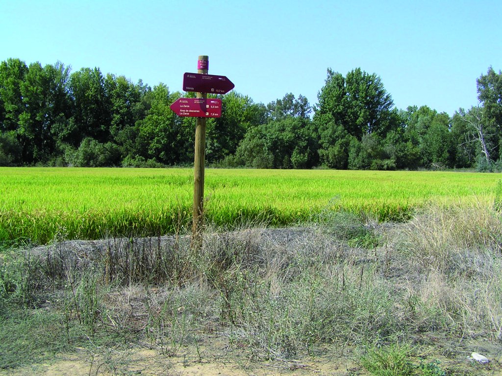
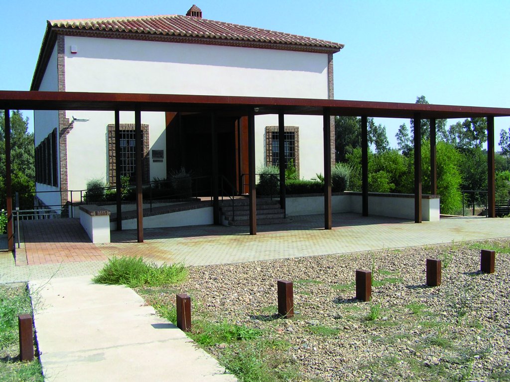
Past the last crossing over the Matachel, there is a path exclusively for hiking and cycling, with horizontal bollards and signs that discourage its use by other types of users. From here, the route advances under the shade of trees -ashes, willows and crack willows (Salix fragilis)that surround the river. After about 7.5 km, the route arrives at an old mill, known as "Fábrica de la Luz", which now houses the "El Berrocal" Interpretation Centre managed by the Guadiana River Authority. The Trail uses a wooden bridge to cross to the opposite side of the stream next to the water mill. To reach the bridge, one must first turn right, then left to continue along the path.
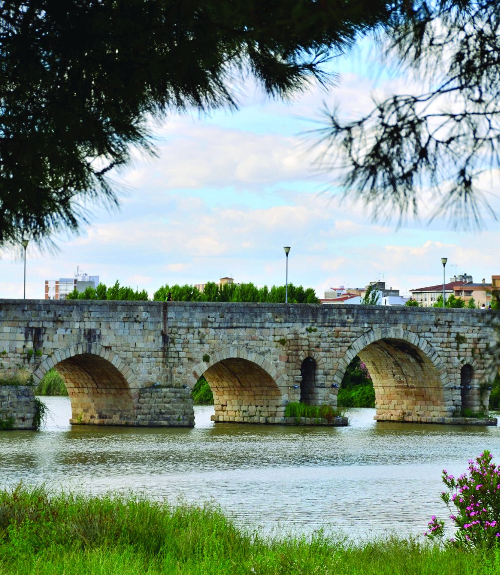
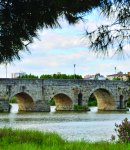
The Stage continues towards Mérida along a road that is sometimes paved, sometimes dirt, but always in good condition. The last stretch of the Stage passes under the N-V bridge that leads to a riverside park, very close to Mérida's Roman bridge, where one can rest.
Sites of interest
Profile
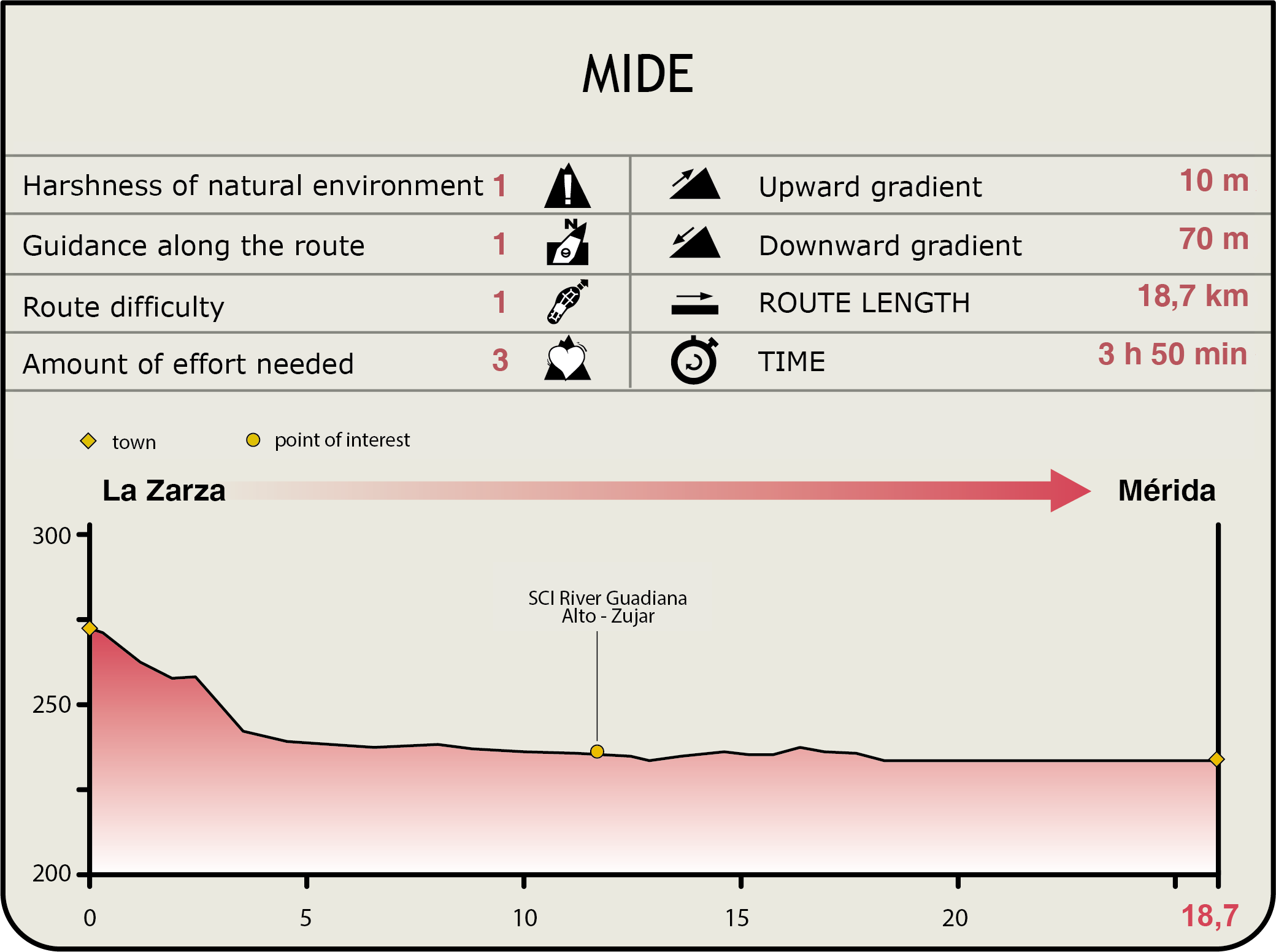
MIDE (Method for the Information of Excursions)
 Harshness of natural environment
- 1. The environment is not risk-free
- 2. There are more than one risk factors
- 3. There are various risk factors
- 4. There are quite a lot of risk factors
- 5. There are many risk factors
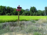
 Guidance along the route
- 1. Well defined trails and crossings
- 2. There is a clearly marked trail and signage
- 3. Requires the identification of geographic features and cardinal points
- 4. Requires off-path navigation
- 5. The trail is interrupted by obstacles that have to be gone around
 Route difficulty
- 1. Walking on a flat surface
- 2. Trails with different types of path
- 3. Walking on stepped paths or irregular terrain
- 4. The use of hands or jumping over the terrain is necessary
- 5. The use of hands is required to progress
 Amount of effort needed
- 1. Up to 1 hour of continuous walking
- 2. Between 1 and 3 hours of continuous walking
- 3. Between 3 and 6 hours of continuous walking
- 4. Between 6 and 10 hours of actual walking
- 5. More than 10 hours of continuous walking
Featured
Further information
Mérida
Founded by Emperor Augustus, the city was intended as a retirement settlement for war veterans. The town was built in the likeness of Rome, with a checkerboard layout. Worthy of note are several large civil buildings, including the theatre and amphitheatre, connected by an impressive road. For over 50 years now, the two buildings are the venue of the summer Festival of Classical Theatre.
The Circus Maximus, practically the only one of its kind that can be still be seen in its entirety, was intended for chariot races. The Roman bridge, almost 800 m long, was the second longest in the Roman Empire.
Hydraulic infrastructures of note include the Los Milagros Aqueduct that carried water from Proserpina Reservoir to the city, the San Lazaro Aqueduct, rebuilt in the sixteenth century, and the sewage system with collectors and vaulted galleries for pipes that distributed water across the city.
The streets of Mérida are rich in monuments, including the Temple of Diana, the municipal and provincial forums, Trajan's Arch and Mitra's House. The National Museum of Roman Art, designed by the architect Rafael Moneo, was built to accommodate this legacy of Roman civilization. Following the conquest of the city by the Christians, and the arrival of the Order of Santiago, the Arab fortress was transformed into a Convent of the Order, and currently the seat of the Government of Extremadura. Other buildings of import are the Basilica of Santa Eulalia, dedicated to the martyr and patron saint of the city, and the Cathedral of Santa María at Plaza de España.
Multimedia