Stage 30: Valverde de Mérida - La Zarza
Description

Traversing through olive groves along the Zújar Canal
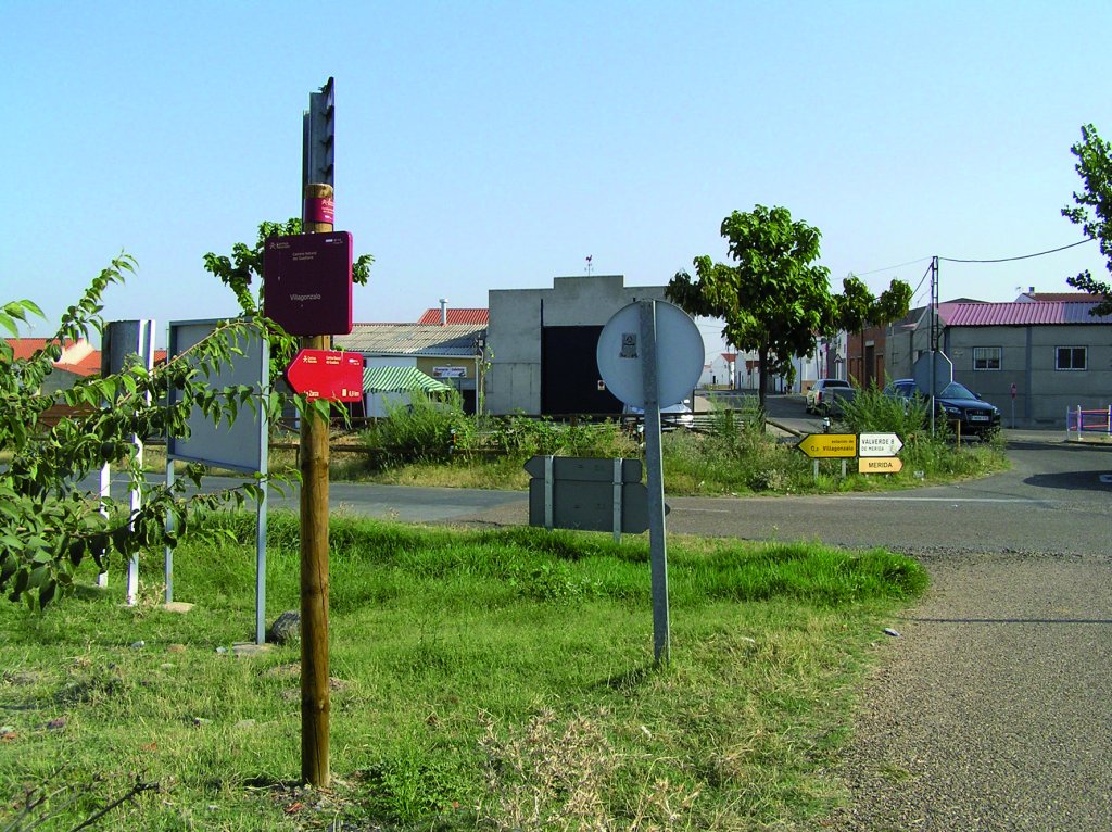
Stage 30 leaves behind the settlement villages and irrigated fields of corn and rice to venture through olive groves: an excellent natural setting for bird and game species that live in riparian lands. The route passes through the pre-Roman towns of Villagonzalo and La Zarza.
The route begins at Valverde de Mérida, from where it retraces the path followed by the previous Stage to reach this town. It now heads towards the rest area along the river. In the few first stretches, the route crosses two intersections with the EX-307, and a bridge over the River Guadiana (refer to Stage 29). It then arrives at the intersection with the previous Stage, from where it heads to Valverde. For about 1.5 km, it runs along a dirt road next to the riverbank, until it reaches the BA-154 towards Villagonzalo. From here, it continues parallel to the road until this town.

Bird and game species abound in this wonderful natural setting next to the river. The Trail runs within the “Guadiana Alto-Zújar” SCI (Site of Community Importance). Cornalvo and Sierra Bermeja Nature Park, which comprises 10,000 ha of interesting flora and fauna endemic to the Extremaduran dehesa, is well worth a visit.
One can witness the contrast between vast fields of rice and corn, olive groves, orchards, vineyards and magnificent oak trees on dehesas where sheep graze. However, the River Guadiana is still central to the landscape and the livelihood of farmers, who have seen their lives improve owing to the vast expanses of irrigated land. Most of the land is cultivated and irrigated with water from the River Zújar.
Villagonzalo, which can be seen near the left bank of the Guadiana, has closer ties with Guareña than with Mérida. The town, which sits high atop a vast plain, is surrounded by mountain ranges and hills, including Los Cantos and Hospital. The territory is drained by the River Guadiana, and the Caballo and San Juan creeks.
Valverde de Mérida - La Zarza Alternative Route
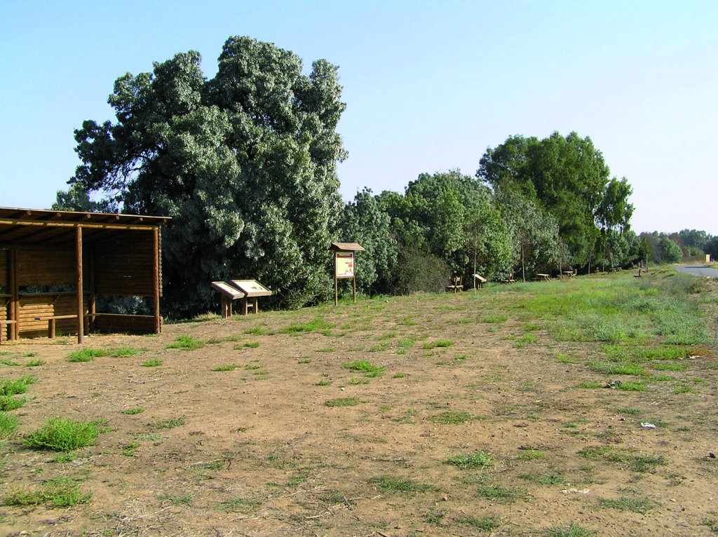
The Trail traverses through the town towards the alternative route leading to the River Guadiana. The route runs along a road leading to the railway station, and continues on a dirt road to a recreational area with information panels on the county's flora and fauna, situated at the mouth of Valdesilos Creek.
Main Route

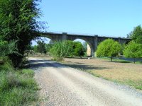
The main route, which is mostly flat with an occasional gentle slope, continues along a clearly marked, paved road, flanked by olive groves. It soon turns sharply to the right towards the banks of the River Guadiana. The route crosses under the railroad tracks, then continues left parallel to them and a road, until the paved road becomes a dirt road. The Trail continues along this dirt road towards the river, and then runs downstream parallel to its left bank during about 1.6 km.
The route reaches the railroad again, next to a rest area and a catch-and-release fishing zone. The “Corredores ecofluviales de la provincia de Badajoz” trails, which are part of the Extremadura Nature Trail network, traverses through this area. After crossing below the road and continuing to the left, there is a dirt road leading to La Zarza. The road is now paved and continues for about 1.7 km to the Zújar Canal Aqueduct, which it crosses via an overpass.
From here to the edge of the town, the route continues along a road flanked by cornfields that leads to an intersection with the EX-105 to La Zarza. Caution should be exercised when crossing the road. The town sits next to Calvario Mountain Range, very close to the where the River Matachel empties into the Guadiana, and near Alange Dam. The town has extremely steep streets owing to its location on the foothills. Indeed, the town is divided into two sections: the upper Stage where the locals live is the oldest; and the lower, modern Stage is inhabited by "chumberos". This Stage ends in the town’s rest area, next to a few panels with information about the county.
The mountain range popularly known as "Las Calderitas" is home to some interesting rock paintings. Although the access is conveniently signposted, the visitor may contact La Zarza's town hall for further information and instructions on how to get there.
Sites of interest
Profile
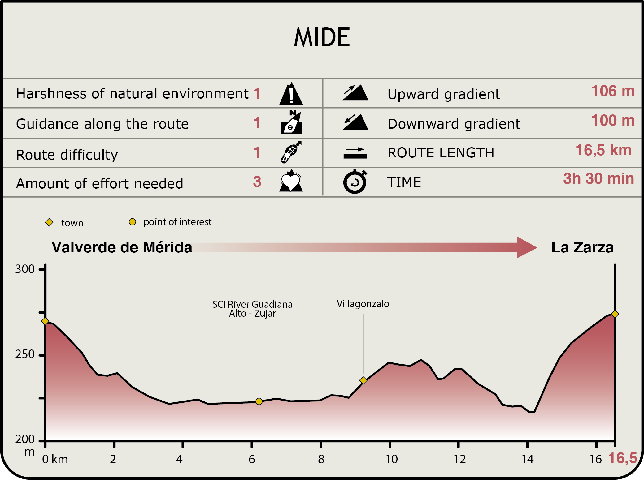
MIDE (Method for the Information of Excursions)
 Harshness of natural environment
- 1. The environment is not risk-free
- 2. There are more than one risk factors
- 3. There are various risk factors
- 4. There are quite a lot of risk factors
- 5. There are many risk factors
 Guidance along the route
- 1. Well defined trails and crossings
- 2. There is a clearly marked trail and signage
- 3. Requires the identification of geographic features and cardinal points
- 4. Requires off-path navigation
- 5. The trail is interrupted by obstacles that have to be gone around
 Route difficulty
- 1. Walking on a flat surface
- 2. Trails with different types of path
- 3. Walking on stepped paths or irregular terrain
- 4. The use of hands or jumping over the terrain is necessary
- 5. The use of hands is required to progress
 Amount of effort needed
- 1. Up to 1 hour of continuous walking
- 2. Between 1 and 3 hours of continuous walking
- 3. Between 3 and 6 hours of continuous walking
- 4. Between 6 and 10 hours of actual walking
- 5. More than 10 hours of continuous walking
Featured
Further information
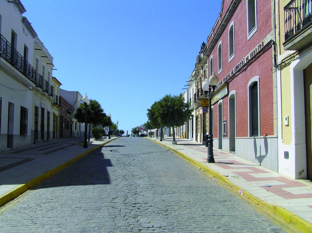
Valverde de Mérida
This town, founded in pre-Roman days, is located at the upstream end of a large meander in the River Guadiana on its way to Mérida. Given its proximity to Emerita Augusta and its fertile lands, it has always played a key role in the provision of supplies to the city. Witness to the above are the remains of Roman villas and small hydraulic works.
It also played host to the Spanish-Portuguese wars in the fourteenth and fifteenth centuries. The Church of Santa Marina, with granite masonry walls and buttresses, stands out amidst the whitewashed walls of its quiet streets.
Multimedia