Stage 25: Orellana la Vieja - Valdivia
Description
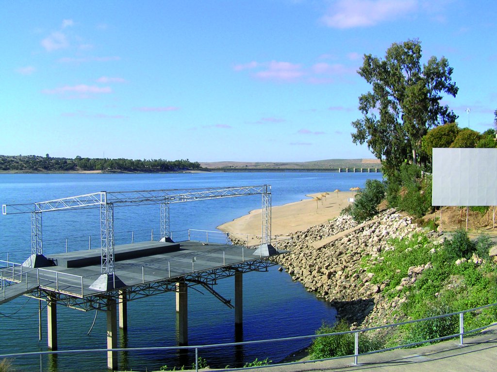
From Extremadura's freshwater beach at Vegas Altas
The Stage begins at Orellana la Vieja ("Extremadura's Costa Dulce") and ends in the irrigated fields of Extremadura's Vegas Altas. The route, which runs along Orellana's secondary canal, is not only interesting but also fresh, as its traverses through irrigated orchards.
The Stage begins in the town of Orellana la Vieja, in the northeast of the province. The town is located in a transition zone between the counties of La Serena, Siberia (Montes del Guadiana) and Vegas Altas del Guadiana, at the base of Orellana Reservoir.
The area has a variety of contrasting landscapes: from low mountain ranges, with the highest peak reaching 600 m, to vast plains (most of the municipal district is a slate belt); meadows of great natural and ecological interest, and reservoirs and flooded areas, which bring great value and best characterise Orellana la Vieja. Indeed, its condition as an inland freshwater sea creates many opportunities for tourism.
Angling is essential for the development of Orellana la Vieja, in particular pike (Esox lucius) and perch (Perca fluviatilis), Orellana Reservoir is an emblematic site for practicing this sport.
Additionally, this protected area that has been designated as “Embalse de Orellana y Sierra de Pela” SCI (Site of Community Importance) and SPA (Special Protection Area for Birds). The area and the municipal district plays host to a variety of bird species, including Black Stork (Ciconia nigra), European White Stork (Ciconia ciconia), European Marsh Harrier (Circus pygargus), Lesser Kestrel (Falco naumanni), Great Bustard (Otis tarda), Little Bustard (Tetrax tetrax), Eurasian Stone Curlew (Burhinus oedicnemus), Black-bellied Sandgrouse (Pterocles orientalis), Collared Pratincole (Glareola pratincola) and European Roller (Coracias garrulus). Other species of great interest are the ocellated lizard (Lacerta lepida), garden dormouse (Eliomys quercinus) and common midwife toad (Alytes obstetricans).
There are also many buildings of historic value in the area, such as the 16th-century parish church of Inmaculada Concepción, built in Gothic and Mudejar style; the Convent of San Benito or Dominicas, an interesting 16th-century Renaissance building; and, the Altamirano Castle-Palace, which was originally a fortified house dating back to the 13th century.
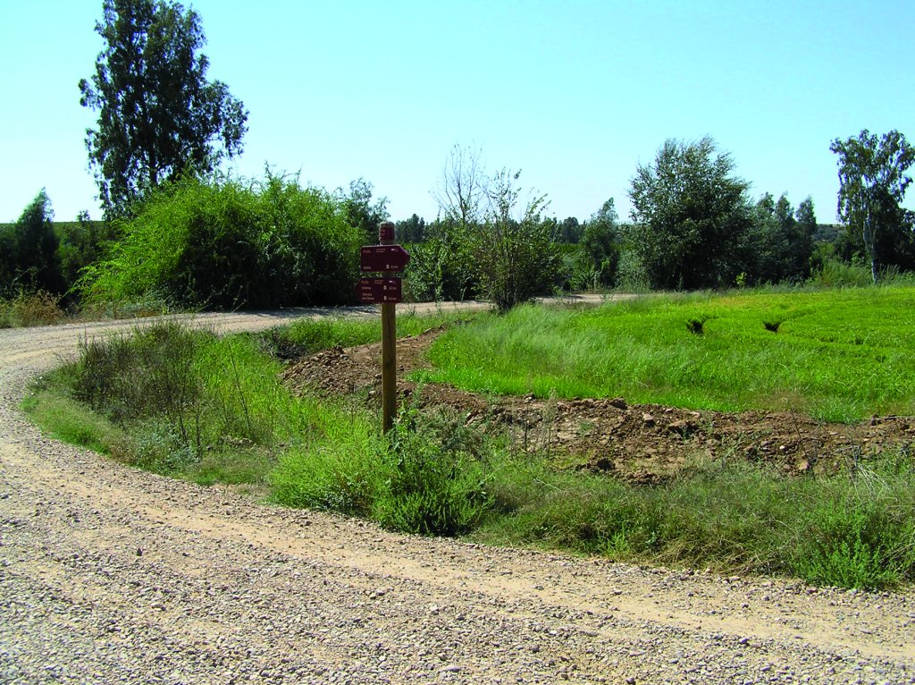
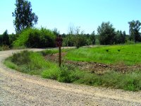
The Stage first runs through the municipality of Orellana, along a path leading to La Coronada. It heads down this path until it turns onto a track to the left that traverses through quiet dehesas towards the Orellana Canal, and then along the River Guadiana. On the path to La Coronada, before the track to the left, is a signposted shortcut leading to the river, where it merges again with the Trail that heads to the Canal and the river. This shortcut is especially appealing in spring as it leads to a pond that is dry in summer.
On main path to Orellana Canal, the route heads to an intersection with a bridge that it crosses in the direction of the River Guadiana. Once on the banks, the Trail runs always parallel to the river for approximately four kilometres. From here, it drifts away, through a typical livestock dehesa, towards the BA-6348, which it reaches near Almendros Hill. This road heads towards Orellana's secondary canal.
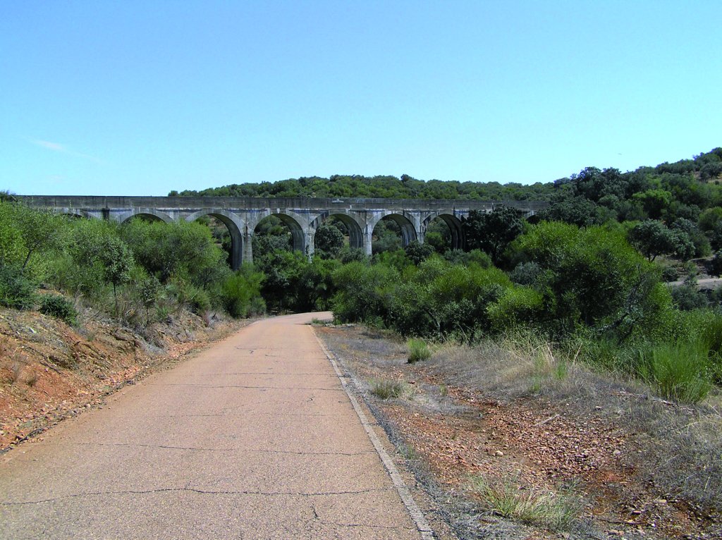
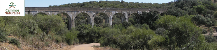
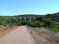
Once the route reaches Orellana's secondary canal, it runs almost entirely along a paved track parallel to the canal. It ventures along gentle slopes with interesting views of the flood plains, next to aqueducts typical of this type of hydraulic works.
The route traverses through different areas, including Puercas de Acá and Puercas de Allá, Molino del Batán, Cortijo del Boticario, until it reaches a junction where the paved path ends to continue along a dirt track.
As the Trail draws closer to the town of Valdivia, the dehesa landscape gradually gives way to fruit orchards. The stretch shared by Sections 25 and 26 begins at the point where the road in and out of Valdivia begins. There is also a rest area with a beach on the left bank of the river. The traveller can to rest at the end of the Stage, or before starting a new one.
Sites of interest
Profile
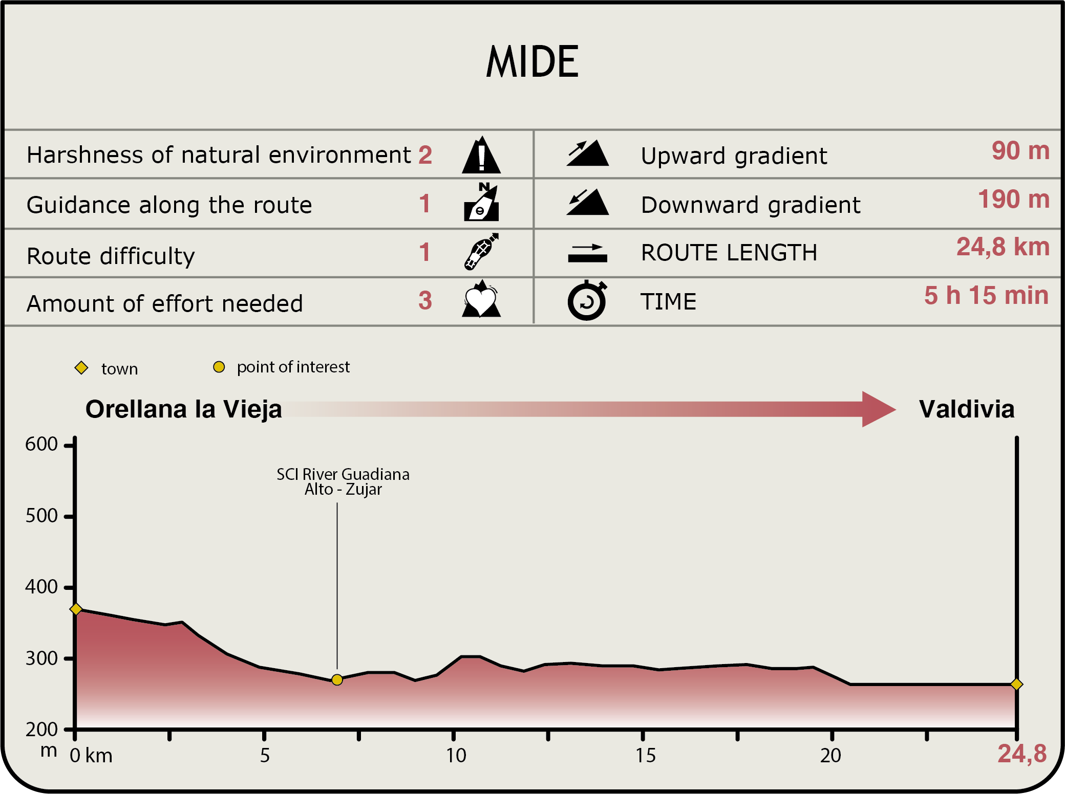
MIDE (Method for the Information of Excursions)
 Harshness of natural environment
- 1. The environment is not risk-free
- 2. There are more than one risk factors
- 3. There are various risk factors
- 4. There are quite a lot of risk factors
- 5. There are many risk factors
 Guidance along the route
- 1. Well defined trails and crossings
- 2. There is a clearly marked trail and signage
- 3. Requires the identification of geographic features and cardinal points
- 4. Requires off-path navigation
- 5. The trail is interrupted by obstacles that have to be gone around
 Route difficulty
- 1. Walking on a flat surface
- 2. Trails with different types of path
- 3. Walking on stepped paths or irregular terrain
- 4. The use of hands or jumping over the terrain is necessary
- 5. The use of hands is required to progress
 Amount of effort needed
- 1. Up to 1 hour of continuous walking
- 2. Between 1 and 3 hours of continuous walking
- 3. Between 3 and 6 hours of continuous walking
- 4. Between 6 and 10 hours of actual walking
- 5. More than 10 hours of continuous walking
Featured
Further information
Leisure and nature
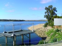
Orellana is an important tourist resort that makes the most of the reservoir. The reservoir, jointly with irrigated agriculture, has been the two factors that have invigorated the local economy that depended on rain-fed farming. The "Playa Costa Dulce" project, the only inland beach awarded a European Union blue flag, has promoted tourism in the area. In addition to bathing, all kinds of water sports are practiced in the reservoir, including recreational fishing, one of the main natural attractions of the region.
The landscape between Orellana la Vieja and Badajoz, which the Guadiana Nature Trail traverses, has changed significantly in the second half of the twentieth century. Owing to the water piping laid out under the Plan Badajoz, traditional rain-fed crops and open dehesas have given way to a green mosaic of irrigated fields.
The geographical area in and around Orellana Reservoir has been designated an SPA. Albuera and Orellana are the only wetlands in Extremadura that have been listed as Ramsar Wetlands of International Importance.
The riverbeds and banks of the rivers Guadiana and Zújar, downstream from Orellana Reservoir, are also located in a protected area (Río Guadiana Alto Zújar SCI). This area is noted for its rich diversity in fish species and population of otters. The extraction of gravel from rivers has created artificial lagoons where riparian wildlife finds shelter, including reed, bulrush, Iberian nase, tench (Tinca tinca) and carp.
However, the primitive ecosystem has been affected. Indigenous flora and fauna can only be found in gallery forests along the riverbanks.
Multimedia