Stage 24: Puebla de Alcocer - Orellana la Vieja
Description
A long walk through the Extremaduran dehesa
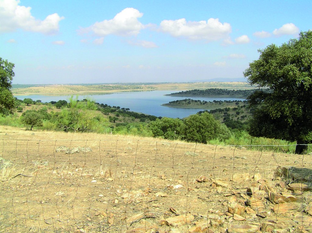
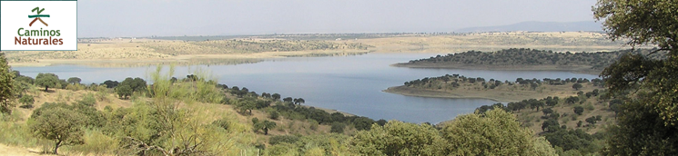
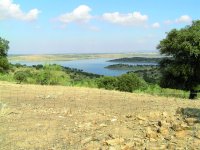
Stage 24 runs through oak forests and meadows, skirting around Orellana Reservoir, the largest fresh water reservoir in Extremadura, where angling and water sports are practiced in harmony with nature, hardly disturbed by human activity.
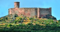
This Stage begins at the outskirts of Puebla de Alcocer, a town located in the Extremaduran Siberia, perched on the north slopes of Sierra del Castillo or Sierra de Lares, at an altitude of 527 m above sea level, in a privileged setting overlooking the entire valley. The route heads towards Orellana Reservoir, past Orellana de la Sierra, and ends at Orellana la Vieja. This 32 km route traverses through protected areas, including “Embalse de Orellana y Sierra de Pela” SCI (Site of Community Importance) and SPA (Special Protection Area for Birds). It should also be noted that this area was designated an Area of Regional Interest.
It ventures through pasturelands, oak forests, olive groves, and large, private sheep and goat farms. This area offers fishing and sailing enthusiasts the best conditions to enjoy their sports, surrounded by beautiful landscapes, including Carneril Island and Cogolludo. This is the ideal setting for outdoor tourism.
Sierra de Pela is a huge mountain island with a mixed landscape of river valley and plain, where irrigated crops, grain fields, pastures, meadows and scrubland alternate. It is one of the most biodiverse places in Extremadura.
Oak forests, typically in the form of dehesas, dominate the landscape of the plains. They also occur, albeit less commonly, in the inaccessible, higher reaches and shaded slopes of the mountains. The creeks and tails of the reservoir are populated with riparian scrub, including oleander (Nerium oleander), Ibero-African shrubby spurge (Flueggea tinctoria) and African tamarisk (Tamarix africana).
Birds are the most important wildlife in the area. The dominant bird species in the mountains are Golden Eagle (Aquila chrysaetos), Bonelli's Eagle (Hieraaetus fasciatus), Osprey (Pandion haliaetus), Griffon Vulture (Gyps fulvus), Egyptian Vulture (Neophron percnopterus), Eurasian Crag Martin (Ptyonoprogne rupestris), Blue Rock Thrush (Monticola solitarius) and Lesser Kestrel ().
The dehesa-covered slopes that lead right down to the edge are populated with Great Spotted Cuckoo (Clamator glandarius), Common Magpie (Pica pica), European Turtle Dove (Streptopelia turtur) and Azure-winged Magpie (Cyanopica cyanus), amongst others. Moreover, Orellana Reservoir is part of a group of reservoirs located in eastern Extremadura.
The Trail runs almost entirely along a well-marked, passable, sand track. The route starts at the outskirts of Puebla de Alcocer, where Stage 23 ended, and heads straight ahead to the intersection with the previous Stage, where it turns left to continue along Cordel de las Merinas, as Stage 23 did until its endpoint. When almost at the EX-103, the route turns sharply to the right, heading towards Orellana Reservoir. The landscape clearly reflects the livestock farming tradition in the area. On the way to the reservoir, the route passes next to sheepfolds, livestock buildings, drinking troughs for animals, pens, etc.
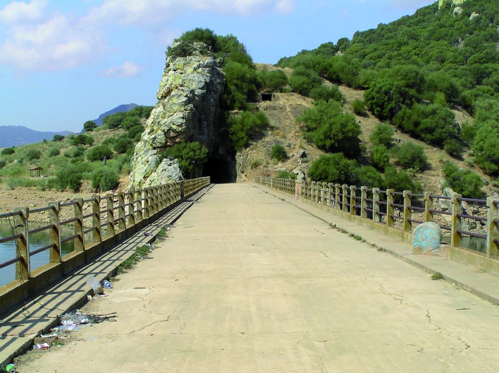
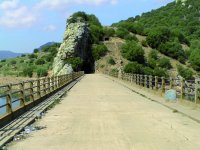
The route crosses the reservoir via a bridge in perfect conditions with stunning views of the water. Past the bridge, on Cogolludo Hill, are the remains of the ancient city of Lacimurga, closed to the public.
The route continues along a dirt road through dehesas with private farms on both sides. The route winds up and down over a mix of terrain. As the path crowns the hills along the Trail, one can enjoy spectacular views of the reservoir. The Stage arrives at a level crossing with the EX-115, along which it runs for a few metres. Caution should be exercised as the road carries heavy traffic.
Soon after this junction, the road reaches the path to Orellana de la Sierra.
The last stretch of the Stage traverses through the municipal district of Orellana la Vieja. The town is located in a transition zone between the counties of La Serena, Siberia (Montes del Guadiana) and Vegas Altas del Guadiana. The route from Orellana de la Sierra continues along a dirt road until it reaches the EX-115 at a signposted intersection. It turns onto a dirt track between private livestock farms raising primarily cattle. The route, with an open landscape, is easy and mostly level.
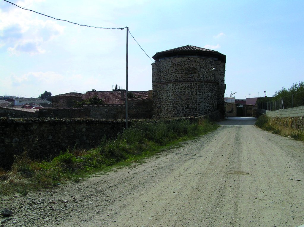
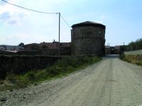
It enters Orellana La Vieja, the endpoint of this Stage, through clearly marked streets until it reaches the Escuela Taller de la Comarca. It is an interpretation centre open to the public and the endpoint of this Stage.
Sites of interest
Profile
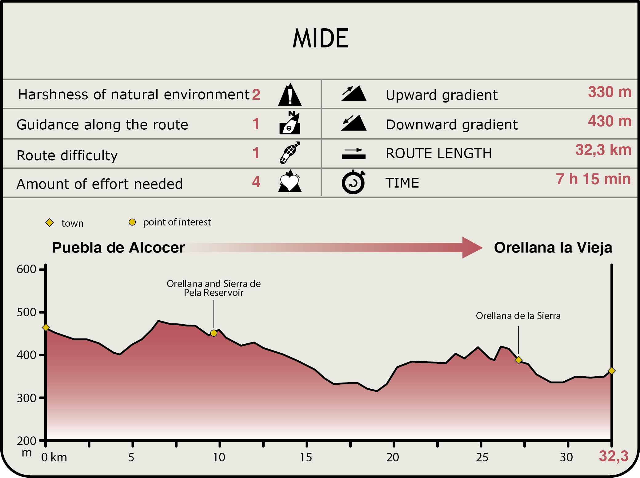
MIDE (Method for the Information of Excursions)
 Harshness of natural environment
- 1. The environment is not risk-free
- 2. There are more than one risk factors
- 3. There are various risk factors
- 4. There are quite a lot of risk factors
- 5. There are many risk factors
 Guidance along the route
- 1. Well defined trails and crossings
- 2. There is a clearly marked trail and signage
- 3. Requires the identification of geographic features and cardinal points
- 4. Requires off-path navigation
- 5. The trail is interrupted by obstacles that have to be gone around
 Route difficulty
- 1. Walking on a flat surface
- 2. Trails with different types of path
- 3. Walking on stepped paths or irregular terrain
- 4. The use of hands or jumping over the terrain is necessary
- 5. The use of hands is required to progress
 Amount of effort needed
- 1. Up to 1 hour of continuous walking
- 2. Between 1 and 3 hours of continuous walking
- 3. Between 3 and 6 hours of continuous walking
- 4. Between 6 and 10 hours of actual walking
- 5. More than 10 hours of continuous walking
Featured
Further information
Orellana Reservoir
Orellana Reservoir has been designated a Special Protection Area for Birds. One can view many bird species, including Black Stork ((Ciconia nigra), ), European White Stork(Ciconia ciconia), Marsh Harrier (Circus pygargus), Lesser Kestrel (Falco naumanni), Great Bustard (Otis tarda), Little Bustard (Tetrax tetrax), Eurasian Stone Curlew (Burhinus oedicnemus), Black-bellied Sandgrouse (Pterocles orientalis), Collared Pratincole (Glareola pratincola) and European Roller (Coracias garrulus). Other species of great interest are the ocellated lizard (Lacerta lepida), garden dormouse (Eliomys quercinus) and common midwife toad (Alytes obstetricans).
Orellana Reservoir, which is entirely located within the protected area, is one of the two wetlands in Extremadura (along with Albuera) that are considered a RAMSAR Wetland of International Importance. It is also the largest reservoir (5,084 ha) in the middle Stage of the River Guadiana. The upstream reservoirs of García de Sola and Cíjara feed into Orellana.
Multimedia