Stage 2: Ruidera - Argamasilla de Alba
Description
Through Ruidera's lower lagoons, amidst reeds, holm oaks and crops
This Stage begins in the lower lagoons of "Lagunas de Ruidera" Nature Reserve and Site of Community Importance, characterised by a thick cover of reeds, bulrushes and sedges, which waterfowl use for shelter and nesting. It continues through a Mediterranean forest, along the shores of Peñarroya Reservoir, and ends at Argamasilla de Alba, on a gently rolling plateau with croplands and vineyards.
The first half of this Stage of the Trail traverses through “Lagunas de Ruidera” Nature Reserve and Site of Community Importance, formed by the Peñarroya Reservoir and three of the fifteen lagoons situated within these protected areas.

The Stage begins in the town of Ruidera, at the intersection between Ruidera-Los Villares road (CR-650) and the N-430. According to popular belief, Ruidera takes its name from the sound of the waters of the high Guadiana as they fall from one lagoon to another. They are the "roideras" that have been heard for centuries in the silence of Campo de Montiel.
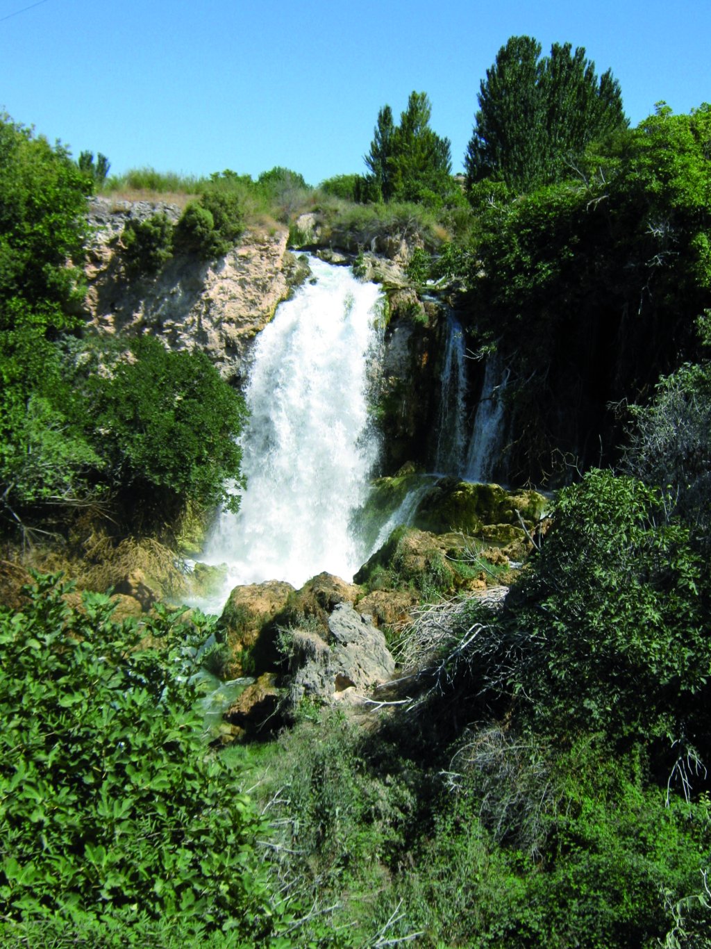
From the intersection, the route turns to the left toward the lagoons, over the bridge on Rey Lagoon. About 400 m further on, the route overlaps with the N-430 until the first slip road to the right with a sign indicating "El Hundimiento" Viewpoint and a nearby car park. The viewpoint is accessed by a flight of stairs leading down to a platform from where the waterfall is visible. It is undoubtedly the most spectacular of all waterfalls in the Nature Park.
The Hundimiento separates the upper lagoons from the lower lagoons (Cueva Morenilla and Cenagal or Cenagosa). They are all very similar: shallow with highly degraded tuff barriers, and almost completely covered by a thick and towering blanket of cattails or bulrushes (Typha angustifolia) and reeds (Phragmites australis).

One can access Cueva Morenilla Lagoon turning right onto a slip road next to a poplar stand. From here, the Trail heads towards Coladilla Lagoon: a very shallow lagoon with very thick deposits of silt and sediment, where waterfowl find an excellent habitat amongst reeds and bulrushes.
Leaving Coladilla Lagoon behind, the Trail advances towards a group of small houses called "Casas de Caoba", located next to a slip road. The route continues straight ahead, arriving almost immediately at Cenagosa Lagoon, where the water is concealed by marsh vegetation.
The different lake ecosystems and surrounding environment make this an ideal place for watching the bird species (waterfowl, forest and steppe birds) that coexist in a relatively small space.
Some waterfowl species that can be found in the Nature Park include the Great Crested Grebe (Podiceps cristatus), Common Coot (Fulica atra), Mallard(Anas platyrhynchos) and Marsh Harrier (Circus aeruginosus). Other species use the Park to breed in the summer, including the Purple Heron (Ardea purpurea); whist other arrive in winter, such as the Tufted Duck(Aythya fuligula), Great Cormorant (Phalacrocorax carbo) and Grey Heron(Ardea cinérea).
The mountains surrounding the lakes are home to various species endemic to the Mediterranean forest, including Bonelli's Eagle (Hieraaetus fasciatus), Eurasian Eagle-owl (Bubo bubo) and Red-legged Partridge (Alectoris rufa).
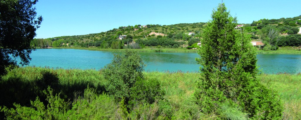
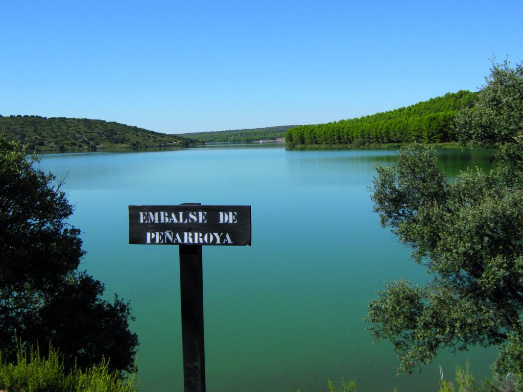
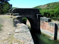
The Trail continues ahead until it reaches Villanueva Canal with a small bridge called "Puente de la Esclusa”, of which little remains, just a few bridges and the sluice gates. The Stage heads towards a fork with a large oak (Quercus ilex) in the middle. The route continues to the right towards "Batan de la Zarza” farmstead. One kilometre further on begins Peñarroya Reservoir, where the river leaves Campo de Montiel behind. Further ahead on the path, there is a good view of the water and the "dehesas" that dot the forest landscape.
The route skirts around the reservoir. The vegetation found here depends on the greater or lesser tolerance to soil moisture. Holm and kermes oaks (Quercus coccifera) have a low tolerance to water, and are found higher up the slopes of the reservoir. Whereas rosemary (Rosmarinus officinalis) also prefers lean soil and the sunniest slopes; gorse (Genista hirsuta) thrives better in shady areas. Reeds grow near the shore. In summer, buttercups (Ranunculus sp.) blanket the shallow waters of the tail of the reservoir with their white flowers.
The Trail crosses three fords over small seasonal creeks that empty into the reservoir. After crossing the last ford, the route veers left, drifting away from the reservoir into the forest. At the top is an intersection where the route turns left, venturing forth, during 3 km, through an agricultural landscape of grain fields, vineyards and a few almond groves, towards Zuñiga's House. The steppe is home to bird species endemic to this ecosystem, including Great Bustard (Otis tarda), Little Bustard (Tetrax tetrax), Eurasian Stone Curlew (Burhinus oedicnemus), Montague's Harrier (Circus pygargus) and Red Partridge.

The Trail continues ahead through holm oaks until it arrives at Peñarroya Canal, at the intersection where the canal, the road and the bridge on the River Guadiana meet. Peñarroya Canal supplies water from the namesake reservoir to the Zona Regable de Peñarroya, located between Tomelloso and Argamasilla de Alba (7,842 ha).
The route turns left after crossing the canal, and continues parallel to the River Guadiana. Next to the first houses, the Trail crosses a bridge to reach the left bank, and continues parallel to the river. Further on, the route arrives at "Molino San José" farmstead, with a bridge similar to the one described above. However, the path continues straight ahead until it reaches a road over the river. The left and right canal of the Zona Regable de Peñarroya come together at this point.
The Trail crosses the overpass above the road, then turns left, and 100 m further on takes the path on the opposite side. After crossing the road, the Trail continues straight ahead, parallel to the left bank of the River Guadiana River, flanked by young pines until it reaches another overpass above the CM-3109, along whose left lane it continues until it arrives at a relief road for the CN-310 to Argamasilla de Alba. Here it first turns right to cross the River Guadiana, and then left towards an underpass. From here, the Trail runs along the right bank of the river until it reaches Argamasilla de Alba, where the Stage ends. According to Cervantine tradition, Argamasilla de Alba is the certain "place of La Mancha" whose name Cervantes did not want to remember.
Sites of interest
Profile
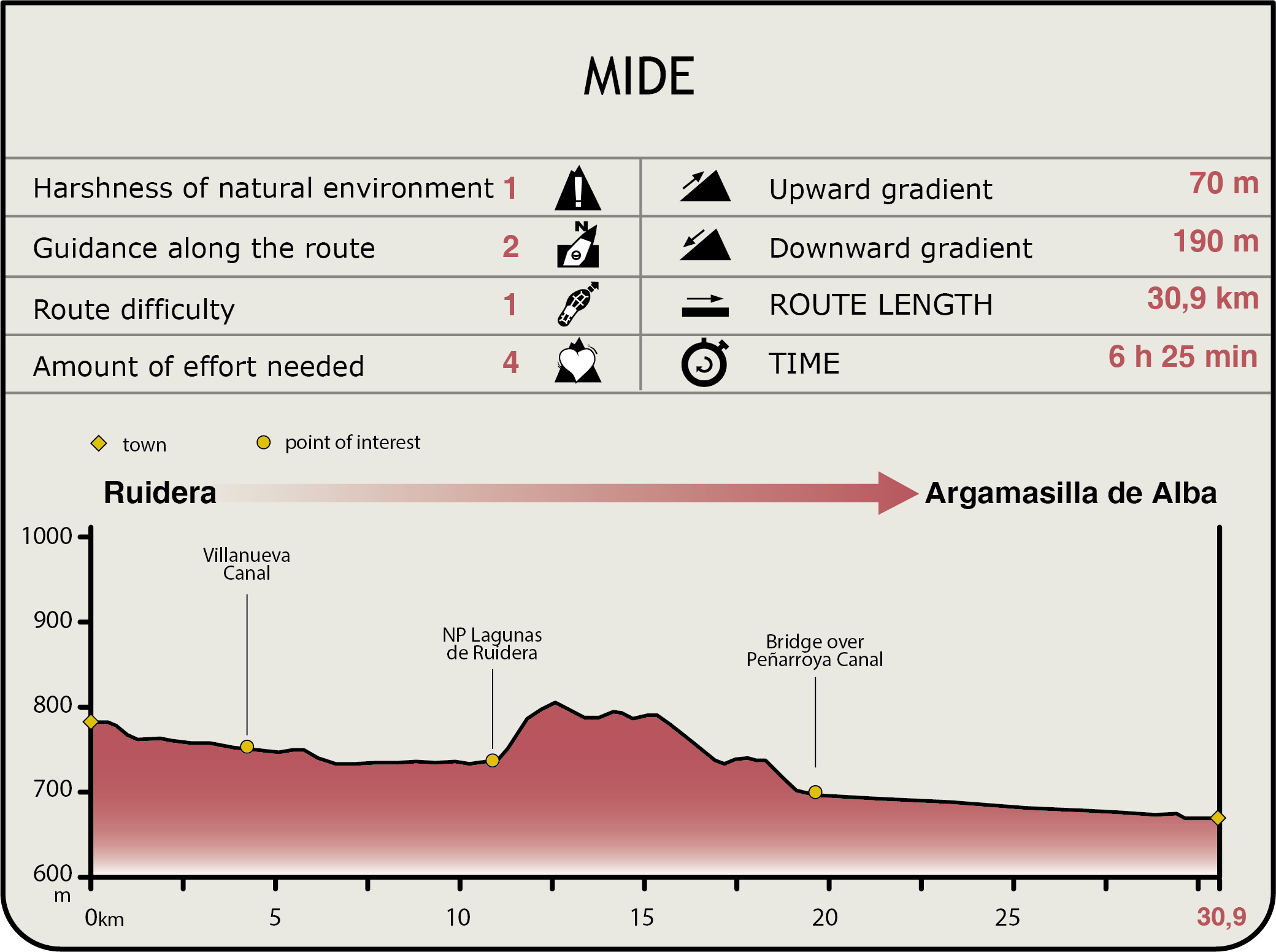
MIDE (Method for the Information of Excursions)
 Harshness of natural environment
- 1. The environment is not risk-free
- 2. There are more than one risk factors
- 3. There are various risk factors
- 4. There are quite a lot of risk factors
- 5. There are many risk factors
 Guidance along the route
- 1. Well defined trails and crossings
- 2. There is a clearly marked trail and signage
- 3. Requires the identification of geographic features and cardinal points
- 4. Requires off-path navigation
- 5. The trail is interrupted by obstacles that have to be gone around
 Route difficulty
- 1. Walking on a flat surface
- 2. Trails with different types of path
- 3. Walking on stepped paths or irregular terrain
- 4. The use of hands or jumping over the terrain is necessary
- 5. The use of hands is required to progress
 Amount of effort needed
- 1. Up to 1 hour of continuous walking
- 2. Between 1 and 3 hours of continuous walking
- 3. Between 3 and 6 hours of continuous walking
- 4. Between 6 and 10 hours of actual walking
- 5. More than 10 hours of continuous walking
Featured
Further information
Peñarroya castle
Peñarroya Castle is a medieval fortress commissioned by the Order of Saint John. The purpose of the fortress was to ensure the economic utilisation of the land, rental of grazing land, tax collection, and protection of peaceful inhabitants. It also served as the Order's warehouse or "safe deposit".
Strategically located on a cliff, where Peñarroya Reservoir was built, the castle underwent major modifications in the 14th and 16th centuries. It still preserves the calvary, moat, main medieval wall, keep, Muslim necropolis and a 17th century, decadent Baroque chapel that is worth a visit.
Multimedia