Stage 16: Refugio de Valhondillo - Villarta de los Montes
Description
Through Bueyes Mountain Range; towards Cíjara Reservoir
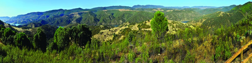
This Sections ventures through the highlands of Bueyes Mountain Range and the area surrounding Cíjara Reservoir, on its way to Villarta de los Montes: the endpoint. The route first passes through stone pine forests, which soon give way to Mediterranean holm oaks without “dehesas”, and an area where both share dominance.
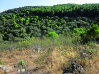
The Stage starts at Refugio de Valhondillo, a forest refuge located in a stone pine(Pinus pinea) forest, high up in the Bueyes Mountain Range, along which the Trail initially ventures. The forest is unique in that the dense undergrowth of strawberry trees (Arbutus unedo), attracts the fallow deer (Dama dama) and deer (Cervus elaphus) that live in the surrounding holm oak forests, where they forage for acorns.
The Trail traverses through the pinewood. The nearby pine-covered slopes through which one has just passed, or will soon pass, can be seen through a few clearings. Elsewhere, a few tall pines stand in areas that have been cleared for forestry work. There is a vantage point at the edge of the pinewood with views of the surrounding mountains and the River Guadiana at the bottom of the valley, where the river widens as it approaches Cíjara Reservoir. Equally impressive is the view of the forest through which the route has passed. Throughout the remainder of the Stage, oak forests dominate the landscape, sharing space with the pinewoods high up in the mountain.

Zahurdas Viewpoint is located within the Cíjara Regional Game Reserve. It is a great place to rest and contemplate the southern slopes of Montes de Toledo. It consists of 25,000 ha of public woodland. This is the best spot on the Nature Trail to view large herbivores such as deer, fallow deer, roe deer and mouflon.
Past the viewpoint, the landscape changes drastically. The pinewoods disappear completely and holm oaks dominate the scenery. The land is covered with scrub holm oaks interspersed with rockrose (Cistus sp.) or heather(Erica sp.) thickets. The long path down to Cíjara Reservoir is dotted with crossroads, shepherd shelters and sheepfolds.
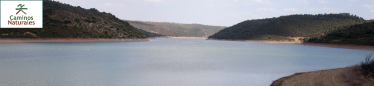
Once at the reservoir, the Trail skirts around its south shore, occasionally drifting away from the water to circumvent nearby hills or cross ravines that carry tributaries of the Guadiana. There is not a single farm throughout the route.
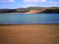
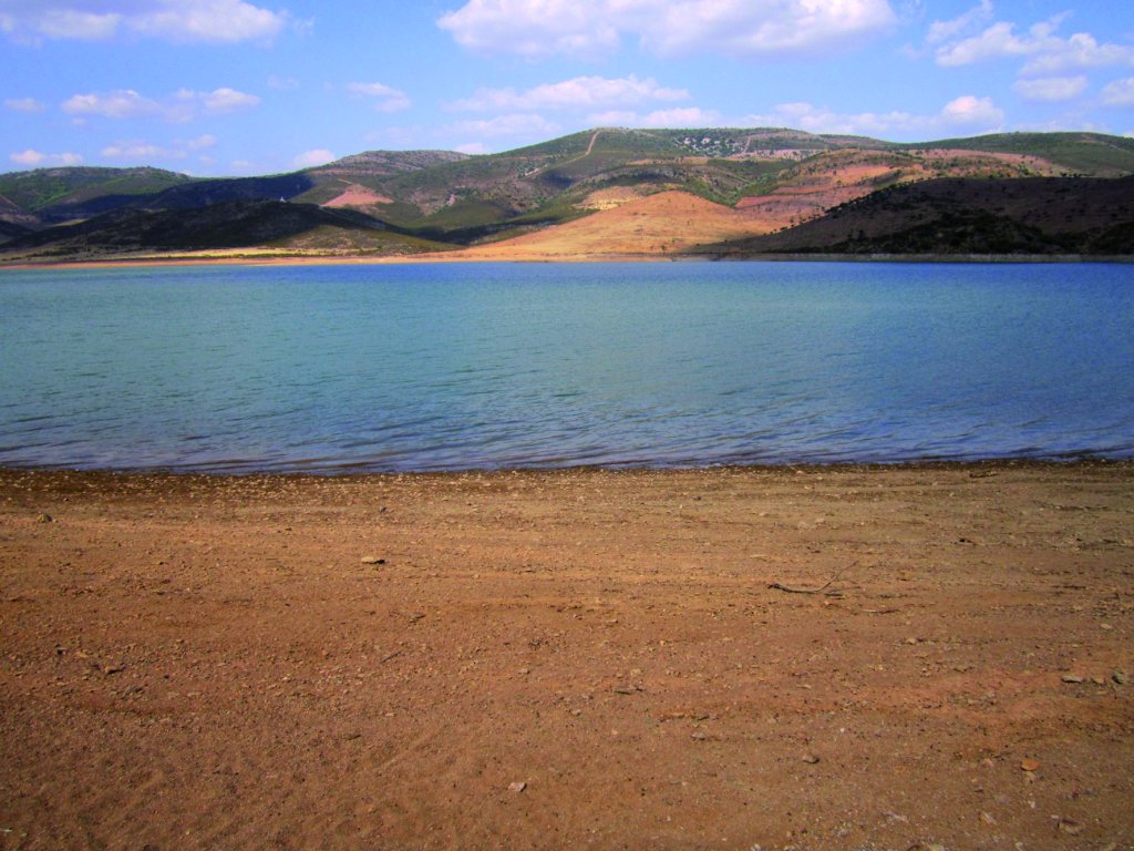
The current low level of water has exposed quite a realistic beach in the stretch of the Trail that passes closest to the impounded water. Although this is not an officially designated bathing area, bathing is allowed in the reservoir. Indeed, it is a common practice in other areas of this reservoir and two other nearby reservoirs of the Guadiana (Orellana and García-Sola).
The last stretch of the Trail heads through an oak wood, where the holm oaks are more tree than bush. An occasional dehesa with pastures is carved out of the wood, although there is no evidence Merino sheep in the area. The landscape is dominated by a viaduct on the BA-7216, the road from Villarta de los Montes. This impressive engineering work links both sides of the reservoir.
As the Trail moves away from the reservoir, it reaches the road to Villarta de los Montes, along which it runs for 70 metres until the edge of the town. Here it continues along a dirt path leading into the main square of the town.
Sites of interest
Profile
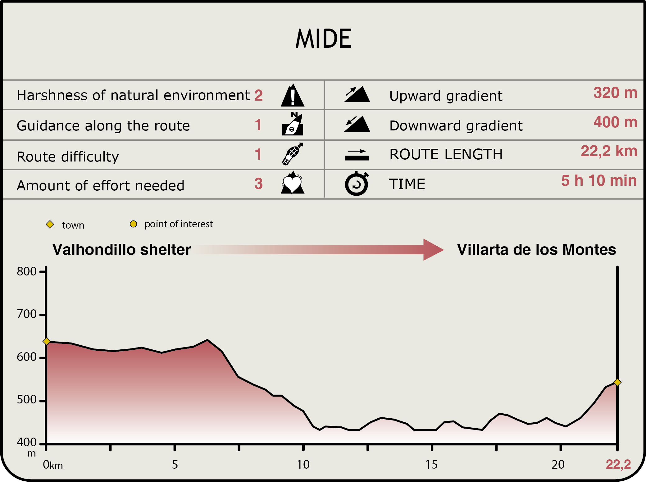
MIDE (Method for the Information of Excursions)
 Harshness of natural environment
- 1. The environment is not risk-free
- 2. There are more than one risk factors
- 3. There are various risk factors
- 4. There are quite a lot of risk factors
- 5. There are many risk factors
 Guidance along the route
- 1. Well defined trails and crossings
- 2. There is a clearly marked trail and signage
- 3. Requires the identification of geographic features and cardinal points
- 4. Requires off-path navigation
- 5. The trail is interrupted by obstacles that have to be gone around
 Route difficulty
- 1. Walking on a flat surface
- 2. Trails with different types of path
- 3. Walking on stepped paths or irregular terrain
- 4. The use of hands or jumping over the terrain is necessary
- 5. The use of hands is required to progress
 Amount of effort needed
- 1. Up to 1 hour of continuous walking
- 2. Between 1 and 3 hours of continuous walking
- 3. Between 3 and 6 hours of continuous walking
- 4. Between 6 and 10 hours of actual walking
- 5. More than 10 hours of continuous walking
Featured
Further information
Cíjara Reservoir
Cíjara Reservoir was built in 1956 on the Guadiana River, in the enclave known as Portillo del Cíjara, which is the boundary between the provinces of Badajoz, Cáceres, Ciudad Real and Toledo. The reservoir has a storage capacity of 1,670 hm3, with a total basin area of 21,180 km2. The dam has a height of 72.9 m and length of 295 m. The flooded area is 6,350 ha, with a tail length of 45 km.
The reservoir is located within the Cíjara National Game Reserve, with beautiful spaces within the 25,000 ha protected area. Furthermore, Cíjara Reservoir is one of the best national fishing reserves in Extremadura. The vegetation is composed of Mediterranean forest and scrubland, although some areas are also populated with reforestation pine and eucalyptus (Eucalyptus spp.).
Cíjara Reservoir has several recreational areas with car parks and picnic areas with barbecue pits. The most popular activities are bathing (summer) and water sports such as boating and fishing. It is also possible to enjoy hiking, mountain bike, equestrian trails, hunting, bird watching and environmental education.
Multimedia