Stage 11: Corral de Calatrava - Los Pozuelos de Calatrava
Description
Along the River Guadiana on its way through Campo de Calatrava
Section 11 escorts the River Guadiana on its way through Campo de Calatrava County. It runs along the river through a narrow, steep-sided valley that opens onto Campo de Calatrava plain.
The Section starts in the centre of Corral de Calatrava, next to the church of Nuestra Señora de la Anunciación. It heads out of the town via a wide street that leads to a crossroads near the Shrine of San Anton and San Isidro.
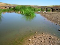
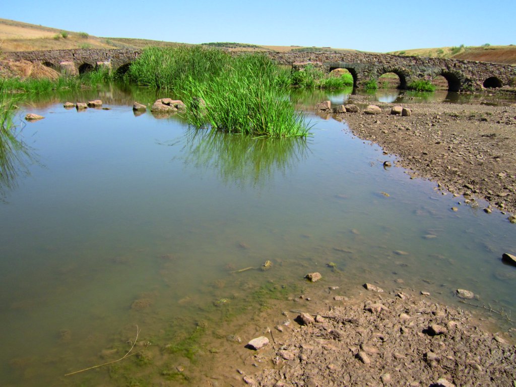
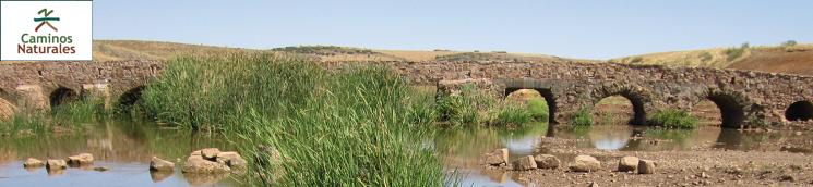
The Trail turns right and ventures through meadows. Past a few hills, it reaches the River Guadiana, close to a recently rebuilt beautiful stone masonry bridge. The river is devoid of trees or shrubs, although the banks and bed are populated with reed thickets that slow the already scarce current.
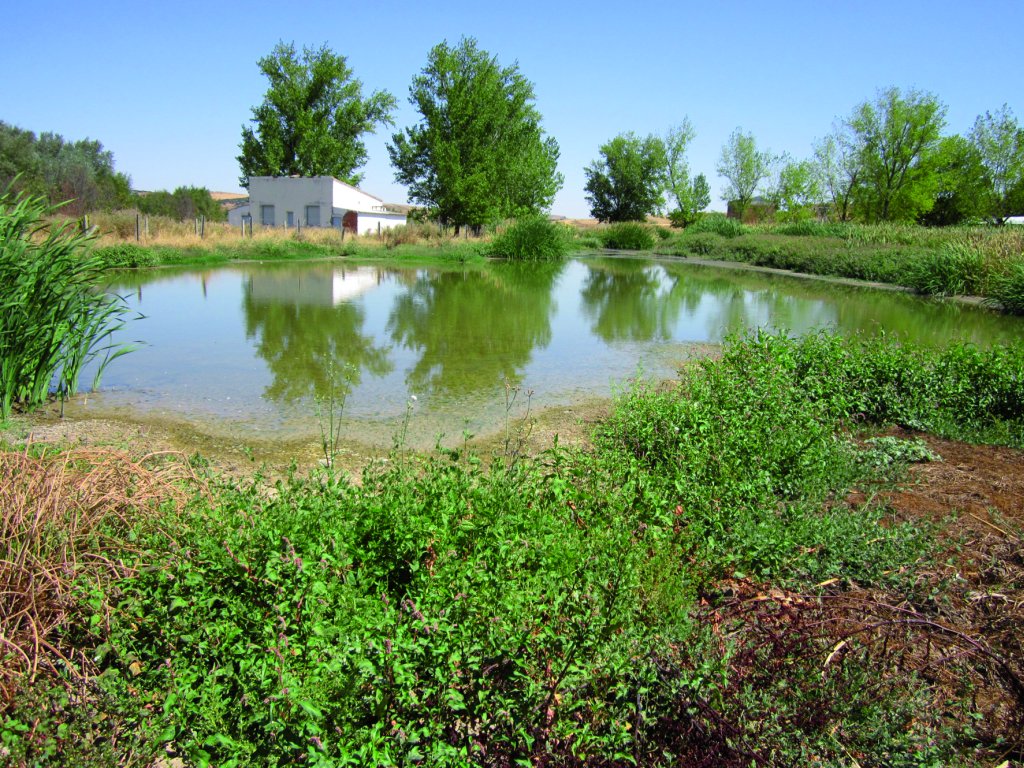
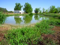
The Trail continues along the left bank throughout the whole Section. The dirt road, which runs close to the slope of the river terrace, is initially good. After one kilometre, it reaches a diversion dam that probably serves the power plant located on the left bank. Soon after, the dirt road merges onto an old paved path that is narrow and quite irregular. At the beginning of the path is a naturalised lagoon with abundant herbaceous vegetation and shrubs along its perimeter. Waterfowl find here an alternative shelter to the River Guadiana, which runs less than 150 m away. The traveller may be surprised by the presence of Grey Herons (Ardea cinérea), They serve as a reminder that the Trail traverses through “Ríos de la cuenca media del Guadiana y laderas vertientes” SCI (Site of Community Importance) and SPA (Special Protection Area for Birds).
The Trail gradually drifts away from the river until it reaches the CR-P-4124. The landscape here is agricultural, with vast plains under rain-fed crops on the left, and undergrowth or croplands on the right bank. The riparian vegetation of the River Guadiana is denser, with an abundance of trees.
The Trail continues along a local road for more than one kilometre, leaving the Guadiana flood plains to the right, with abundant trees and dense grasslands and reed thickets. The path continuously drifts towards and away from the river. The ruins of Valbuena Mill, closely linked to a masonry bridge, are located in this stretch. Although both buildings are derelict, they clearly have historical and cultural interest. At the beginning of the bridge over the Guadiana, the path moves away from the CR-P-4124, and continues parallel to the river thereafter along the foot of the left slope, drifting towards and away from the river depending on the width of the valley and the river's topography.
Throughout the remainder of the Section, the Guadiana Valley is used for farming. Isolated poplars (Populus sp.) and ashes (Fraxinus sp.) dot the river and boundaries of the cultivated plots. The valley slopes are dotted with sparse scrubland dominated by yellow broom(Retama sphaerocarpa), and a few creeping holm oaks (Quercus ilex), The path crosses over two ancient masonry bridges, one of which is in very bad condition and barely passable. It is therefore necessary to make a short detour to climb down to and cross the dry river.
In the final kilometre, the Trail ventures along the edge of a large holm oak and kermes oak (Quercus coccifera) forest on both sides of the valley.
The entrance and exit to Pozuelos de Calatrava takes place near Puente de las Ovejas, a heritage element of great value, where Sections 11 and 12 merges. This bridge is part of the next section. The path, which runs along the so-called Camino del Martinete, is perpendicularly intersected by Cañada Real Soriana, a cattle track along which Section 12 heads if one turns right. To the left, the path heads down the final stretch of this Section, which leads to Pozuelos de Calatrava.

In this final stretch to Pozuelos, which begins on a small hill, the Trail is wedged between vertical slopes covered by shrub, including thyme (Thymus sp.), and a few isolated, creeping holm and kermes oaks. At the top, the path passes next to Fuente del Piojo, a natural spring that feeds a cattle trough. From here, it heads along a plateau with a few livestock farms on both sides of the path and a small olive grove.
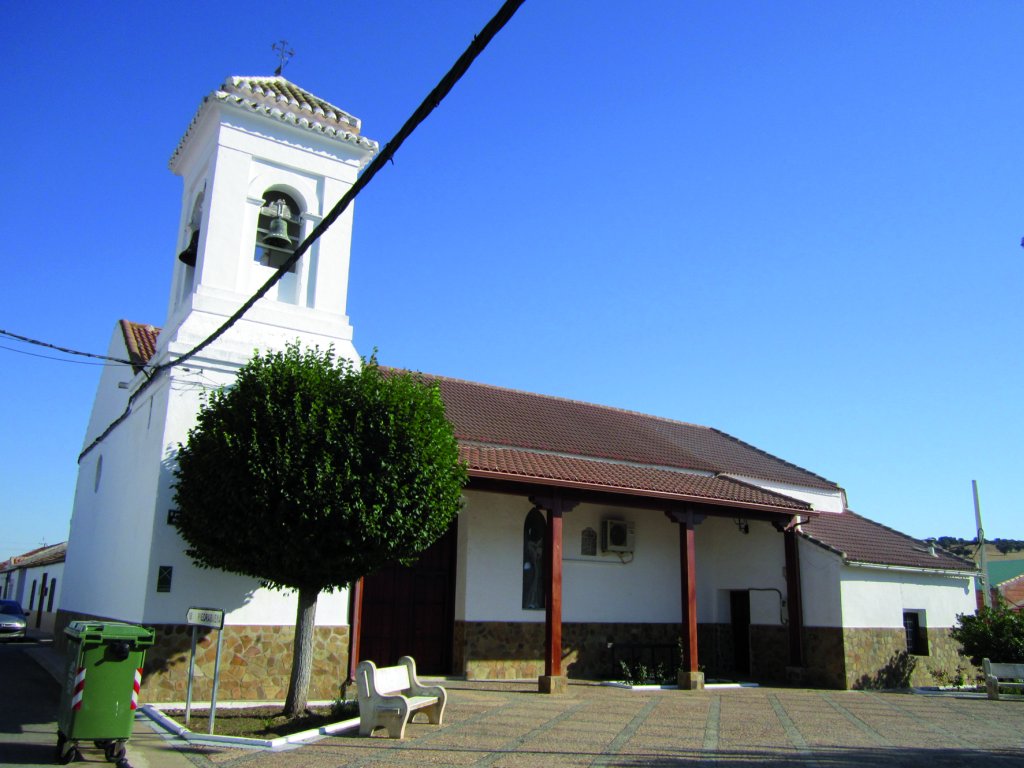
The route reaches the north end of the small plateau, with stunning views of the Campo de Calatrava Plain, with Pozuelos at the foot of the slope and Corral de Calatrava to the right. The Trail heads down the slope and ends in the parish church of San Juan Bautista. Opposite this building is a square with benches where one can rest before venturing forth along the River Guadiana in Section 12.
Sites of interest
Profile
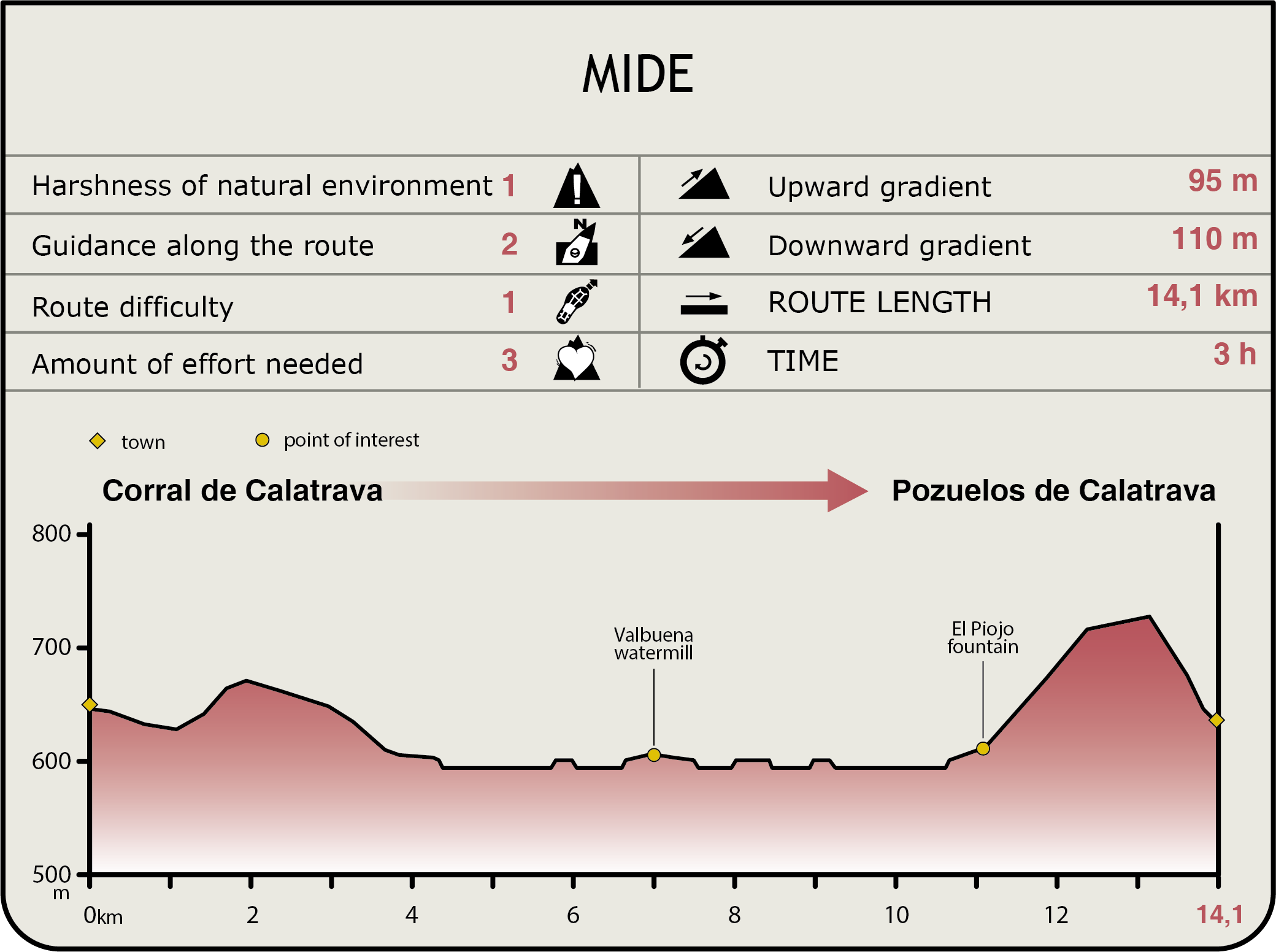
MIDE (Method for the Information of Excursions)
 Harshness of natural environment
- 1. The environment is not risk-free
- 2. There are more than one risk factors
- 3. There are various risk factors
- 4. There are quite a lot of risk factors
- 5. There are many risk factors
 Guidance along the route
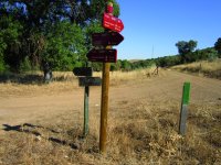
- 1. Well defined trails and crossings
- 2. There is a clearly marked trail and signage
- 3. Requires the identification of geographic features and cardinal points
- 4. Requires off-path navigation
- 5. The trail is interrupted by obstacles that have to be gone around
 Route difficulty
- 1. Walking on a flat surface
- 2. Trails with different types of path
- 3. Walking on stepped paths or irregular terrain
- 4. The use of hands or jumping over the terrain is necessary
- 5. The use of hands is required to progress
 Amount of effort needed
- 1. Up to 1 hour of continuous walking
- 2. Between 1 and 3 hours of continuous walking
- 3. Between 3 and 6 hours of continuous walking
- 4. Between 6 and 10 hours of actual walking
- 5. More than 10 hours of continuous walking
Featured
Multimedia