Stage 10: Valverde - Corral de Calatrava
Description
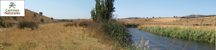
Through Calatrava's fields, along the River Guadiana
The path runs along the River Guadiana through pastures, arable crops and olive fields, and ventures into the “Ríos de la cuenca media del Guadiana y laderas vertientes” Site of Community Importance (SCI) and Special Protection Area for Birds (SPA).
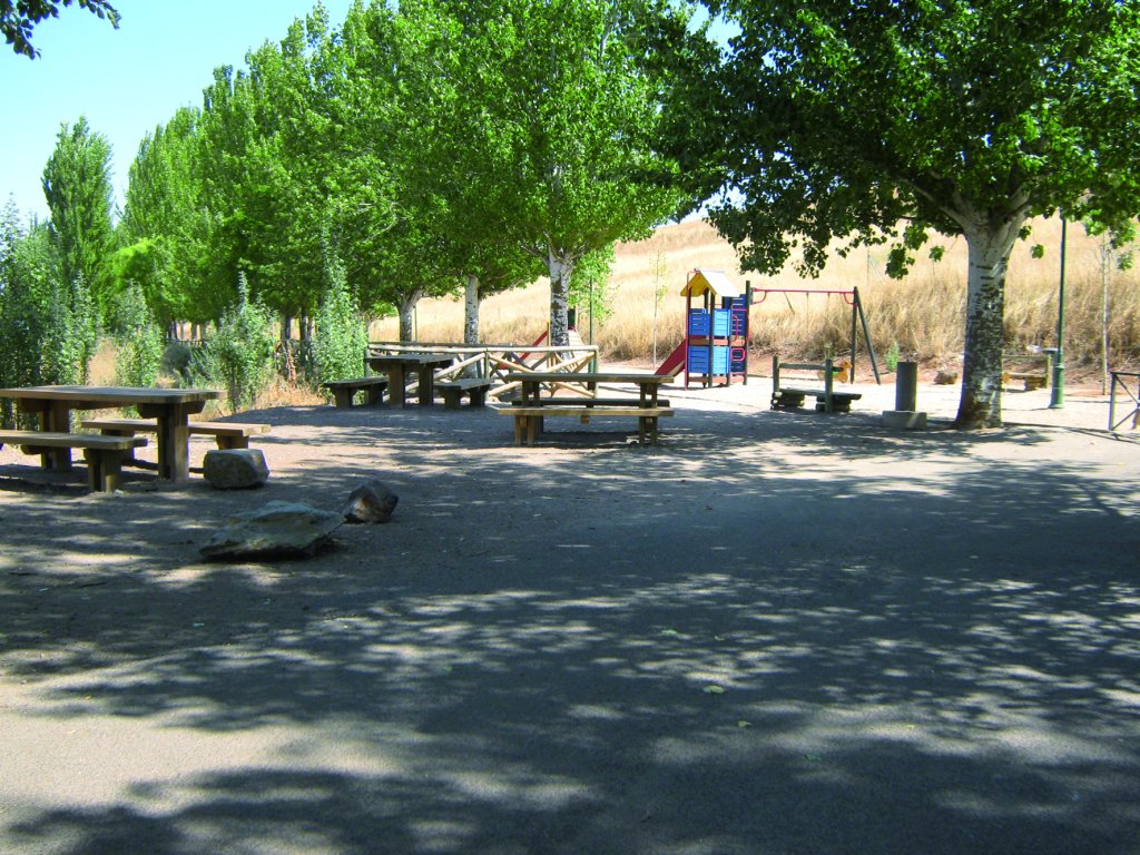
This Stage begins in the Valverde Rest Area at Campo de Calatrava. La Posadilla Lagoon and the crater are located 2.5 km from the town (refer to Stage 9). The Trail continues up from the rest area, past the water tank from where one can enjoy a stunning view of Valverde. It continues along the hill between plane trees (Platanus x hispánica), small-leaf limes (Tilia cordata) and acacias (Acacia sp.) until it begins to climb down to the river, from where one can see a sweeping view of the Guadiana and its surroundings.
The Stage crosses the bridge on the river, turns right, next to a group of derelict houses, and about 100 m further on, turns onto a narrow path wedged between the wall of a house and the fence of a farmstead. The route skirts around the medieval wall of Alarcos Castle, witness to one of the most important battles between Christians and Almohads in 1195. It then reaches the crossroads to Alarcos Archaeological Park (left), about which Stage 9 provides more information.
During the next 1.5 km, the route runs along a paved road shared with motorised vehicles leading to Poblete de Alarcos. It then takes a slip road to the right. For safety reasons, it is advisable to use a vehicle in this stretch. The route continues along a dirt road.
The route passes next to a large irrigation pond surrounded by irrigated crops, situated opposite the Casablanca farmstead. It then turns left towards the River Guadiana where poplars (Populus sp.) with a White Stork (Ciconia ciconia).

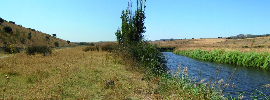
The road continues left until it reaches the river, then runs parallel to the Guadiana, through flocks of sheep and numerous Cattle Egrets (Bubulcus ibis). The river is lined with young riparian vegetation, primarily ash (Fraxinus sp.) and poplar.
To the left is a farmhouse in disrepair that is still used to store the harvest. Further on, the Trail turns right, past an access gate to a private hunting reserve with stone walls on either side. After about one kilometre, the route turns right again onto a farm road, which also merges with the path from the private hunting reserve mentioned previously. This is a very wide country road in very good condition.
The Stage continues straight ahead between large fields of crop, always along the River Guadiana. From here on, the road deteriorates with potholes. Cyclists should proceed with caution.

The route reaches "Corral de los Toros", a fenced property with a large earthen jar outside. It then heads down a bend to the right that lead to the riverbank. Soon after, the path winds ahead between "Casas de Alfalá", two livestock farms, until it reaches a fork where it turns right.
The Trail heads towards Cerro Pelón, with a few scattered holm oaks(Quercus ilex). From here, the route ventures into the protected area called "Ríos de la cuenca media del Guadiana y laderas vertientes" SCI and SPA. This whole area has been designated a Critical Area for the recovery of the Spanish Imperial Eagle (Aquila adalberti), the Iberian lynx(Lynx pardinus) and the Black Stork (Ciconia nigra).
Past the forest, the path passes next to a group of derelict houses called "Casas del Camaril", and continues along the river, skirting around "Las Cabezas" Hill, covered with thick holm oak forests. After a sharp bend, the route arrives at another group of derelict houses. The path is flanked with riparian vegetation.
The ruins of Rodezno Mill, surrounded by poplars, elms, rosebushes (Rosa canina), brambles(Rubus ulmifolius) and rushes (Juncus sp.), is located less than one kilometre further on. Following the road along a small hill, the Stage drifts away from the River Guadiana and approaches the River Jabalón before the tributary empties into the former.
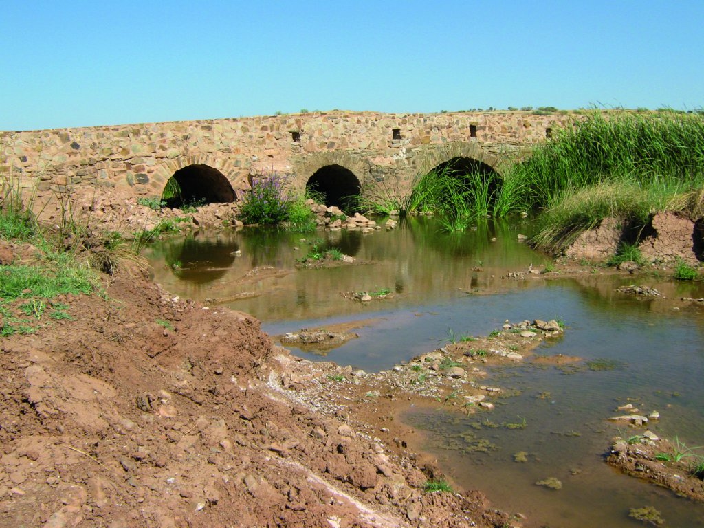
Large rocks prevent vehicles from accessing the bridge over which the path crosses. At the next junction, the right path leads to Stage 11; and, the path straight ahead leads to Corral de Calatrava, the endpoint of Stage 10

One can enjoy stunning views of the river as the path climbs up a wide path shared by Sections 10 and 11. The landscape consists of grassland, with a scattering of holm oaks in the background. After proceeding through flat terrain for a while, the Trail takes a right bend and begins to climb down. From here, one can see the town of Calatrava that stands about 1.5 km away. At the intersection, the path turns left onto a paved road leading to Corral de Calatrava, which it crosses just before reaching a small irrigation ditch.
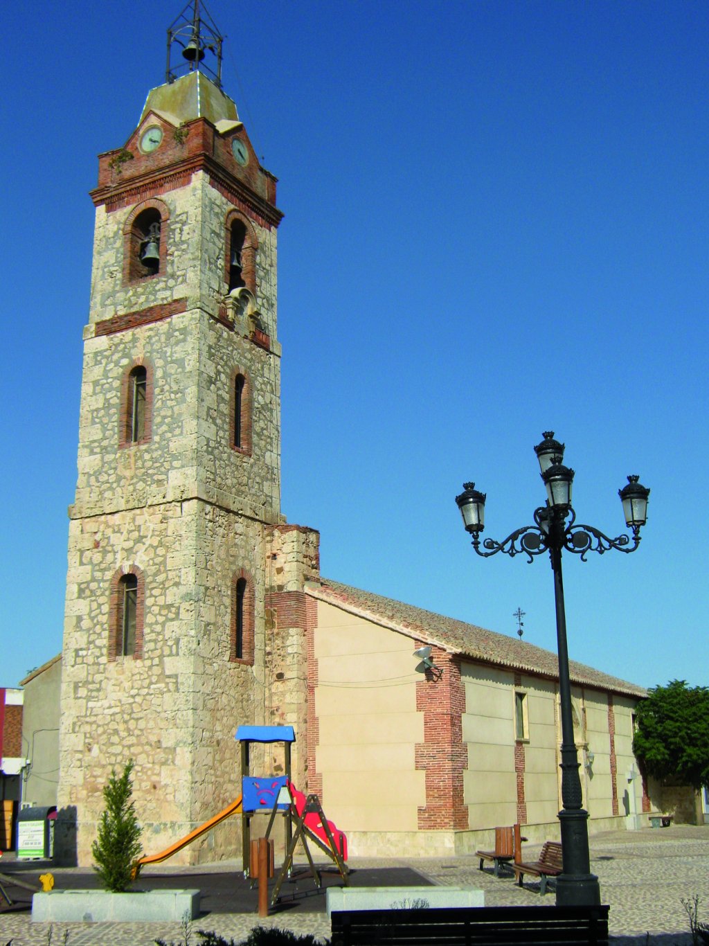
Near the town, and next to the shrine of San Antón and San Isidro, is a Caminos Naturales sign. However, the Stage ends in the town centre. Hence, the path turns left along Ancha Street until it arrives at the Church of Nuestra Señora de la Anunciación, opposite the Guardia Civil. The church is a Gothic-Mudejar building, probably from the late 15th or early 16th century.
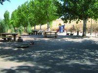
Sites of interest
Profile
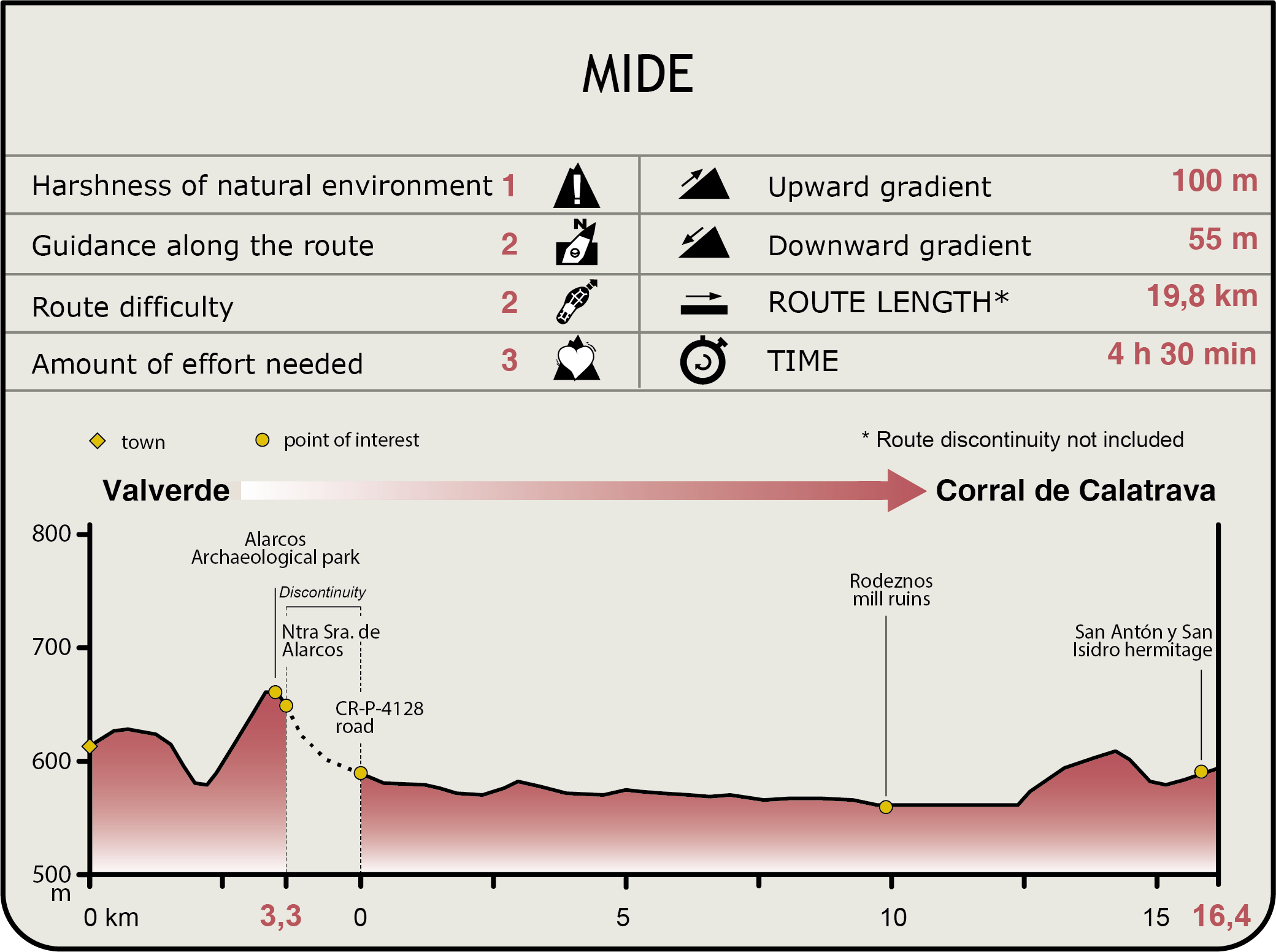
MIDE (Method for the Information of Excursions)
 Harshness of natural environment
- 1. The environment is not risk-free
- 2. There are more than one risk factors
- 3. There are various risk factors
- 4. There are quite a lot of risk factors
- 5. There are many risk factors
 Guidance along the route
- 1. Well defined trails and crossings
- 2. There is a clearly marked trail and signage
- 3. Requires the identification of geographic features and cardinal points
- 4. Requires off-path navigation
- 5. The trail is interrupted by obstacles that have to be gone around
 Route difficulty
- 1. Walking on a flat surface
- 2. Trails with different types of path
- 3. Walking on stepped paths or irregular terrain
- 4. The use of hands or jumping over the terrain is necessary
- 5. The use of hands is required to progress
 Amount of effort needed
- 1. Up to 1 hour of continuous walking
- 2. Between 1 and 3 hours of continuous walking
- 3. Between 3 and 6 hours of continuous walking
- 4. Between 6 and 10 hours of actual walking
- 5. More than 10 hours of continuous walking
Featured
Further information
Multimedia