
- Home
- Rural Development
- Nature Trails
- Nature Trails
- Central Sector
- Canal de Mª Cristina y sus ramales
María Cristina Canal and branches Nature Trail
Description
Near quiet water
This canal, whose construction begun in 1804 under the reign of King Charles IV, was built to drain the pooled waters from around Albacete into the River Júcar. This enabled the use of previously uncultivated land for agriculture, and improved the health conditions of the population. Today, this network of canals has virtually lost its original purpose due to decreasing water levels, with the exception of the city of Albacete, where it is still used as the main sewer.
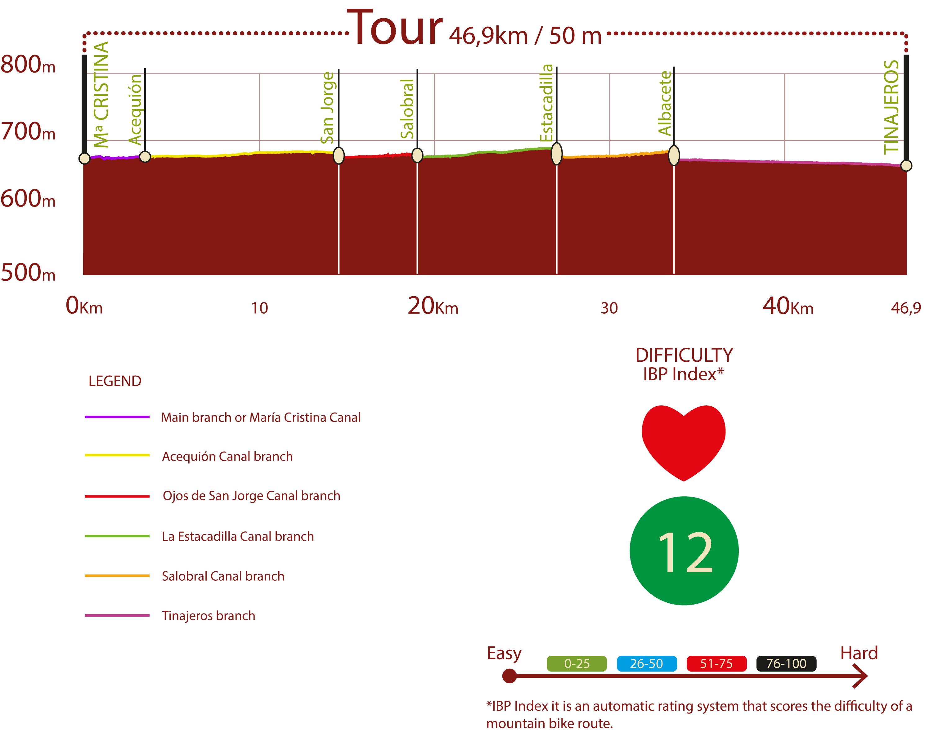
For optimal development, the Trail has been divided into five itineraries that concur with the layout of the major canals of this exceptional feat of engineering.
Main branch or María Cristina Canal
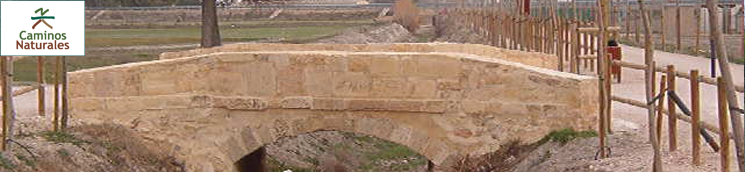
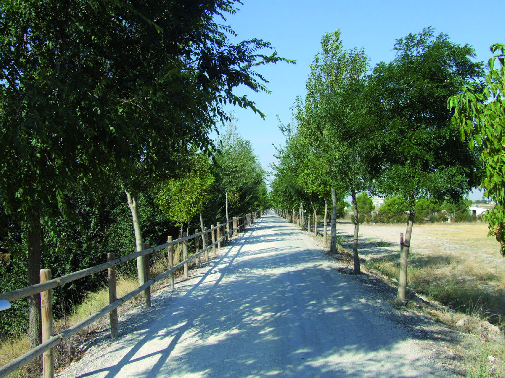
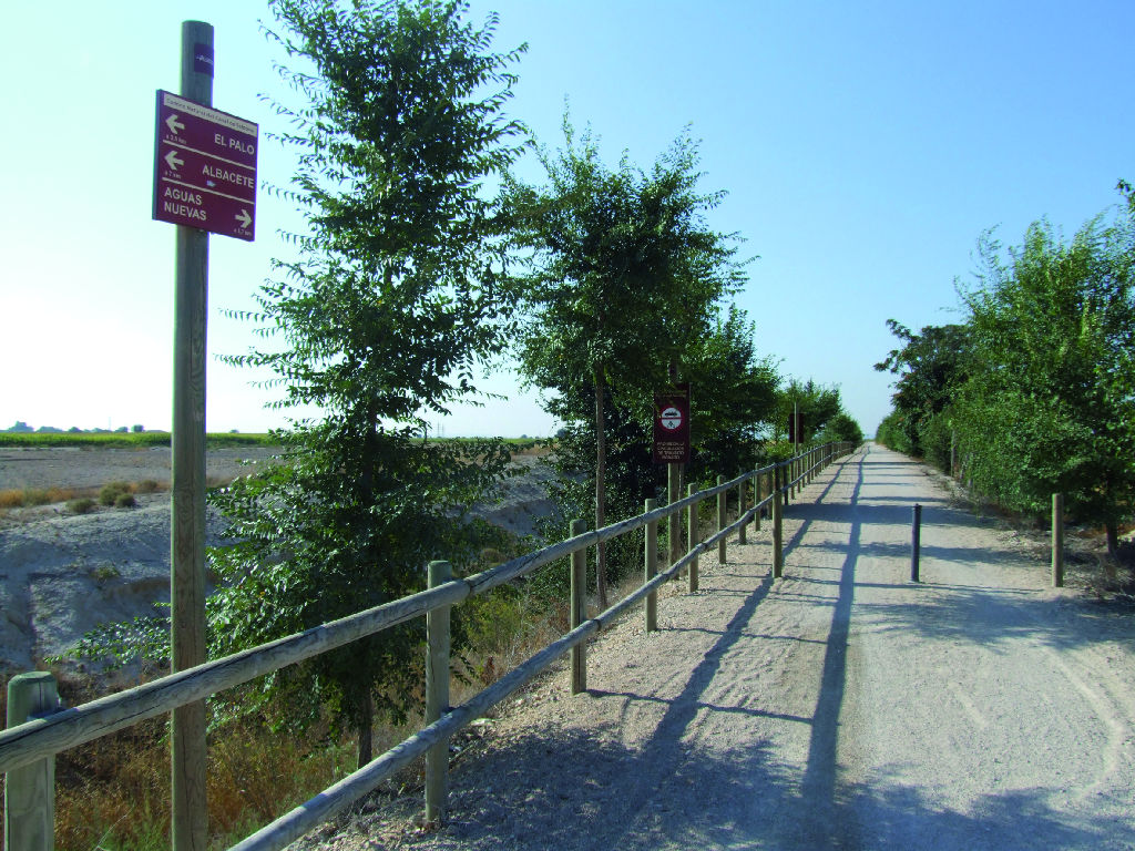
The route begins at Fiesta del Árbol Park, on the outskirts of Albacete, and continues along the right bank of María Cristina Canal. Shortly before the first kilometre, there is an information panel on the geographical and geological features of the area. It then heads through the underpass of the road to Barrax, N-430. About 200 m further on along the left bank of the Canal, it crosses over a bridge. The Trail continues now on the right side of the Canal. Three kilometres ahead it reaches a place called "El Palo", with a recreation area and drinking water. The route crosses another bridge and continues along the left side of the Canal, where 230 m later it arrives at a fork that marks the end of this route.
Ojos de San Jorge Canal Itinerary
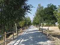
Starting at the fork with the main route, this itinerary continues along the right path that runs parallel to El Acequión Canal. Leaving behind the underpass below the Linares-Albacete motorway, A-32, it arrives at Huerta del Rey recreation area. At the fork where the route meets El Acequión Canal, it continues along the left branch that runs parallel to the place called Huerta del Rey.
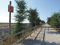
About 120 m from KM 7, the route reaches the intersection with Alcaraz Greenway, and continues along the path that runs perpendicular to the latter. It then passes the crossing that gives access to the nearby Acequión Canal and the Route of Don Quixote. Past a sports area, the Trail gently winds its way to a recreation area where it ends.
Acequión Canal Itinerary
This itinerary, which is about ten kilometres long, begins immediately before Huerta del Rey, at a fork where it takes the right branch that runs along the right side of the Canal. The route continues until the intersection with Cordel de Leniza. A few metres further on is a small rest area, from where the route continues along Sierra de Alcaraz Greenway via the left path.
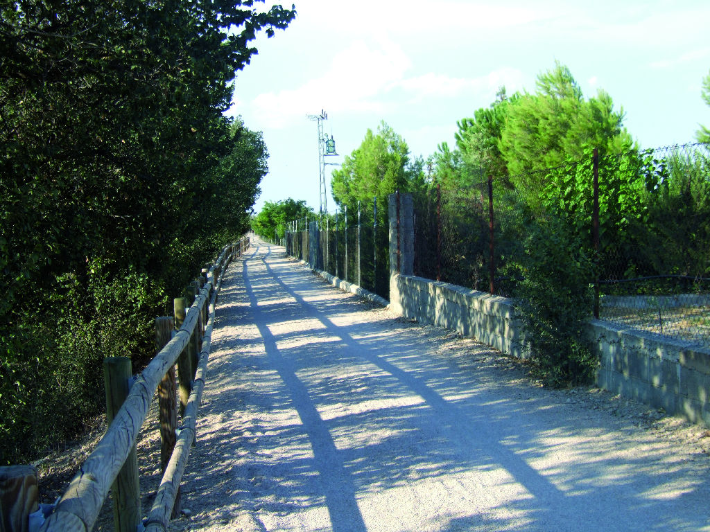
The Trail continues to an intersection that gives access to the road to Barrax, N-430, and the Ojos de San Jorge itinerary, about 7.4 km from the end. In the last few kilometres, the route arrives again at a crossroads that connects with the road to Barrax and the junction with La Lobera Canal. Just before another crossroads, which yet again gives access to N-430, there are several bollards on the path. Past the bollards, the Trail crosses a bridge over the canal and past a second set of bollards to continue along the left side of the canal to the N-430 underpass.
To the left of the path is a sports park. The route continues straight ahead and approaches an estate. Shortly after passing the KM 14 milestone, the Trail crosses a bridge and continues along the left side of the Canal to the dry lagoon of El Acequión and trailend.
Salobral Canal Itinerary
The Salobral itinerary leads to the town of Aguas Nuevas and begins at the confluence of El Salobral and La Estacadilla Canals. The first section runs straight along the right side of Salobral Canal. After about 500 m, it reaches the intersection with Cordel de Balazote that supplies water to El Plantío housing development. Further on, the Trail makes a bend to the left and, after about 400 m, reaches the N-322 underpass on the road to Jaen.
It then reaches the intersection with the road to La Bacariza, 5.7 km from the end of this itinerary, and continues straight ahead to later turn to the right. To the left is a sports park and Los Prados housing development, around which the route skirts. Starting at kilometre 9, the canal carries water, thus the vegetation contrast with the cropland on the opposite side of the Trail. Soon after, it turns right and crosses the Andalusian Drover's Trail to reach the end of the itinerary. The town of Aguas Nuevas, accessible by a rural road, is 700 m further along this route.
Estacadilla Canal Itinerary
This route starts past the place known as “El Palo”. At the fork, which is about 230 m away, it continues along the left path parallel to the Salobral Canal. Past the KM 4 milestone, the route crosses a bridge over the canal and continues along the path to the right, parallel to La Estacadilla Canal.
Further on, it crosses the Linares-Albacete motorway (A-32) underpass, and then continues along the left side of La Estacadilla Canal, until it gradually moves away from the road. The route heads to an intersection with the road that gives access to a housing development, the Ojos de San Jorge Canal and the road to Jaen (N-322). After the intersection, the route leaves a sports park to the left and crosses a bridge, switching to the left side of the Canal.
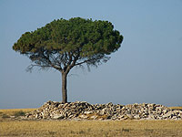
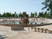
The old restored lock gates of the Canal can be seen in the final stretch. The landscape is dominated by uncultivated plots alternating with reforestation. There are also numerous rabbit burrows. The Alcaraz Greenway starts here.
Map
Puntos de Interés
Municipio
Orografía
Profile
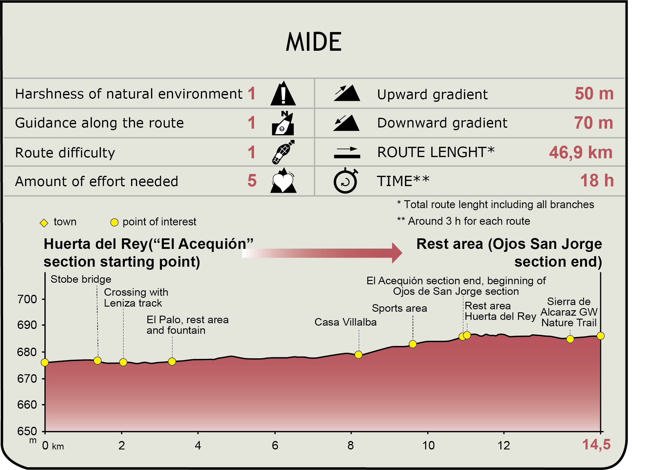
MIDE (Method for the Information of Excursions)
 Harshness of natural environment
- 1. The environment is not risk-free
- 2. There are more than one risk factors
- 3. There are various risk factors
- 4. There are quite a lot of risk factors
- 5. There are many risk factors
 Guidance along the route
- 1. Well defined trails and crossings
- 2. There is a clearly marked trail and signage
- 3. Requires the identification of geographic features and cardinal points
- 4. Requires off-path navigation
- 5. The trail is interrupted by obstacles that have to be gone around
 Route difficulty
- 1. Walking on a flat surface
- 2. Trails with different types of path
- 3. Walking on stepped paths or irregular terrain
- 4. The use of hands or jumping over the terrain is necessary
- 5. The use of hands is required to progress
 Amount of effort needed
- 1. Up to 1 hour of continuous walking
- 2. Between 1 and 3 hours of continuous walking
- 3. Between 3 and 6 hours of continuous walking
- 4. Between 6 and 10 hours of actual walking
- 5. More than 10 hours of continuous walking
Featured
Further information
"El Palo"
The prevailing theory is that this place takes its name from a bridge or walkway that existed when lock gates were used to regulate the water channelled through María Cristina Canal to the city of Albacete.
Until well into the twentieth century, this place was used by the less affluent residents of Albacete for leisure activities and bathing. The stagnant waters found here were used for irrigating the agricultural belt around the city. Its decline began with the gradual drying up of the surface waters throughout the region. Currently, the area carries water only after heavy rains.
Converted today into a rest area of the Nature Trail, this space has recovered the high sentimental value it has for the older citizens of Albacete.
Aguas Nuevas
From a legal perspective, it is a relatively new minor administrative division attached to the town of Albacete. The settlement was first inhabited by tenant farmers in the 1960s, drawn to this area by the possibility of using aquifer water for irrigating the lands, and the existence of the network of canals over which the Nature Trail runs.
Its main value is its unique urban model at the provincial and national levels. It basic structure is reminiscent of the modular architecture of Vegaviana (Cáceres), designed by the architect Fernández del Amo at the request of the Instituto Nacional de Colonización. Although its original configuration has been partially effaced by modern urban growth, the town is still attractive to visitors.
Multimedia

Downloads
GPS downloads
Brochure and maps
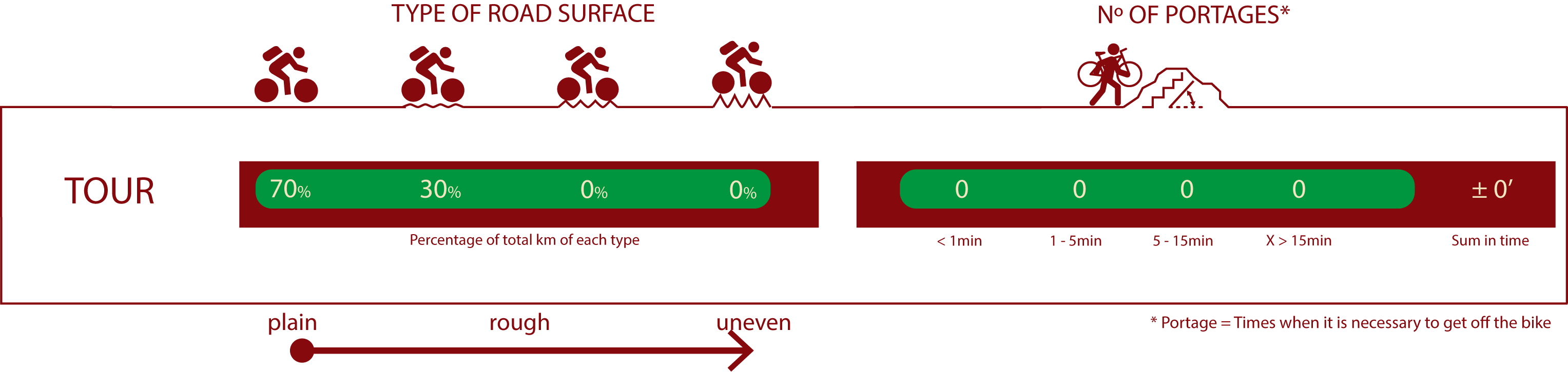
Cyclability
PROFILE & DIFFICULTY
ROAD TYPE & PORTAGES
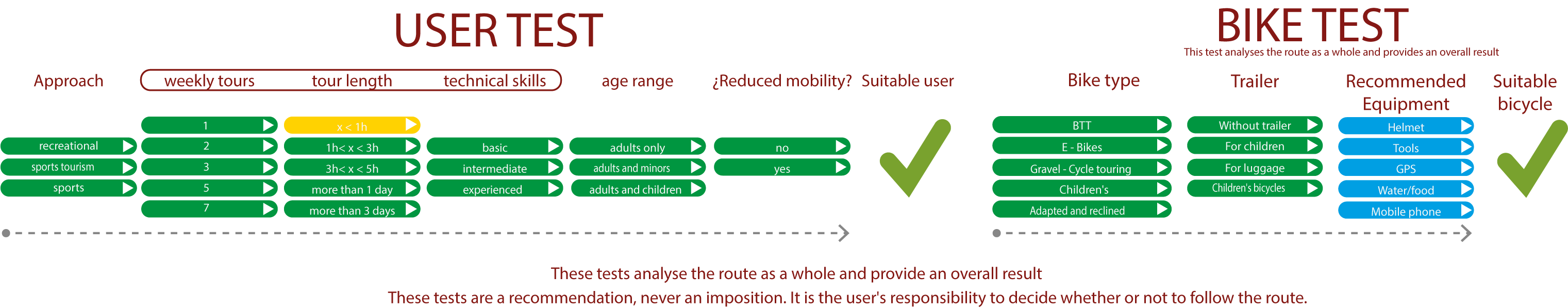
TEST
SAFETY RECOMMENDATIONS
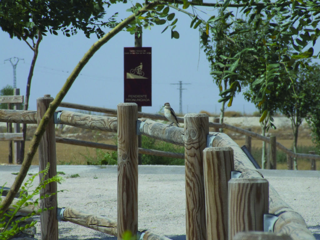
-There are four underpasses for crossing the A-32 (2), N-430 and N-322 roads, which may be waterlogged and even flooded in periods of heavy rain. .
-Note the absence of wooden fences on a large part of the branch of the Canal de los Ojos de San Jorge, along several kilometres of the branch of the Canal de La Estacadilla and on practically the whole of the branch to Tinajeros, with the consequent risk of falling into the aforementioned canals.
-Caution should also be exercised at the numerous crossroads and, to a greater extent, at road crossings and on asphalted access tracks to built-up areas.
GENERAL RECOMMENDATIONS
- Find out about the technical aspects of the route and the weather on the day.
- Take care of the environment. Take care not to disturb animals or damage vegetation. Respect private areas.
- You must give priority to pedestrians and comply with general traffic rules.
- The environment in which you will be riding is open, free to move around and an area where many activities are carried out (sporting, forestry, livestock and agricultural activities). Always have an understanding, prudent, responsible and respectful attitude.