
- Home
- Rural Development
- Nature Trails
- Nature Trails
- Central Sector
- Cañada Real Soriana Occidental
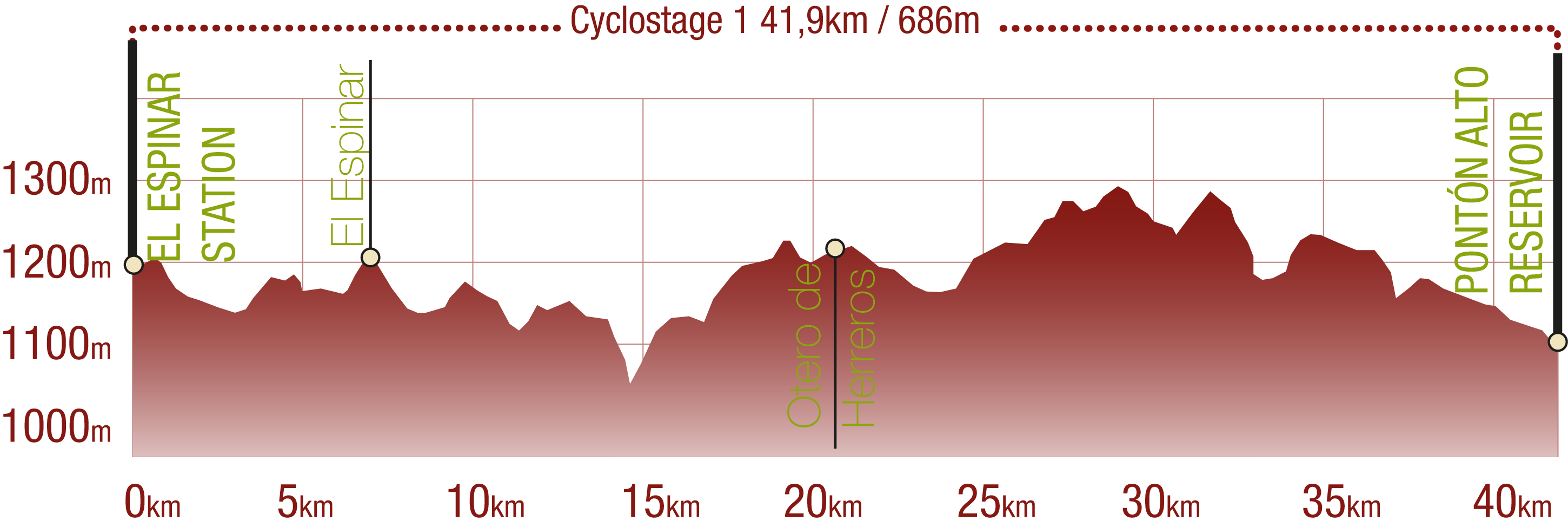
Stage 1: El Espinar-Otero de Herreros
Description
The tracing of the Cañada Real Soriana Occidental serves as a guide from the Valley of river Moros.
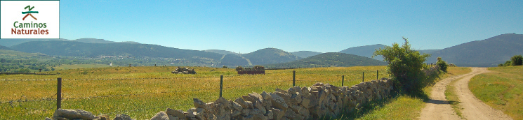
The road leaves El Espinar behind and crosses the Pinilla and Tejera creeks by their reconstructed stone bridges. Before descending to the bank of the river Moros, the path crosses a gate and accesses the Cañada Real Soriana Occidental drover's way, whose tracing it will follow across the entire province of Segovia. After leaving behind the town of Los Ángeles de San Rafael, which is a main communications hub, and crossing the Sierra del Quintanar at a mid-slope level, the stage finishes when it reaches the Otero de Herreros Station.
Stage 1 of the Cañada Real Soriana Occidental Nature Trail runs from the town of El Espinar to the town of Otero de Herreros. It starts next to the town cemetery and the recreational area where the last stage ended. Kilometre point seven (kilometre points are numbered consecutively along the whole Nature Trail) is located next to the information panel which indicates the end of the previous stage and the beginning of this one.
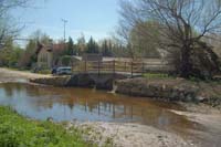
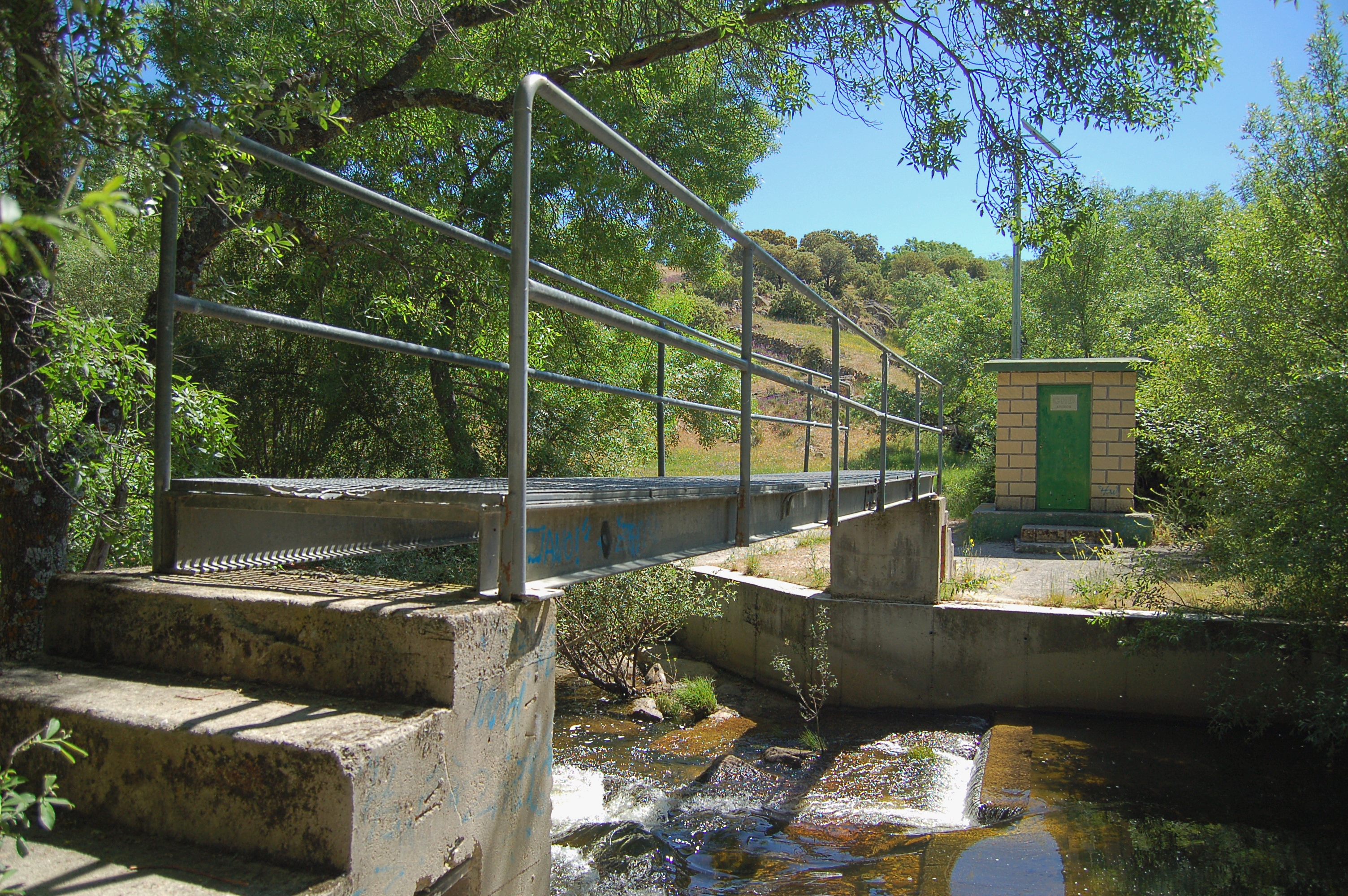
The road goes slightly down the dirt path, leaving industrial premises to the left, which are the last buildings of the town. The train continues across pastures and crosses the N-VI road by a subterranean passing. It is here that the descending section ends. Shortly afterwards, the trail crosses the Pinilla creek, where the old stone bridge has been made operational again thanks to a limited renovation.
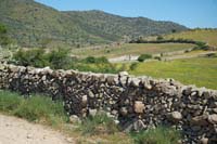
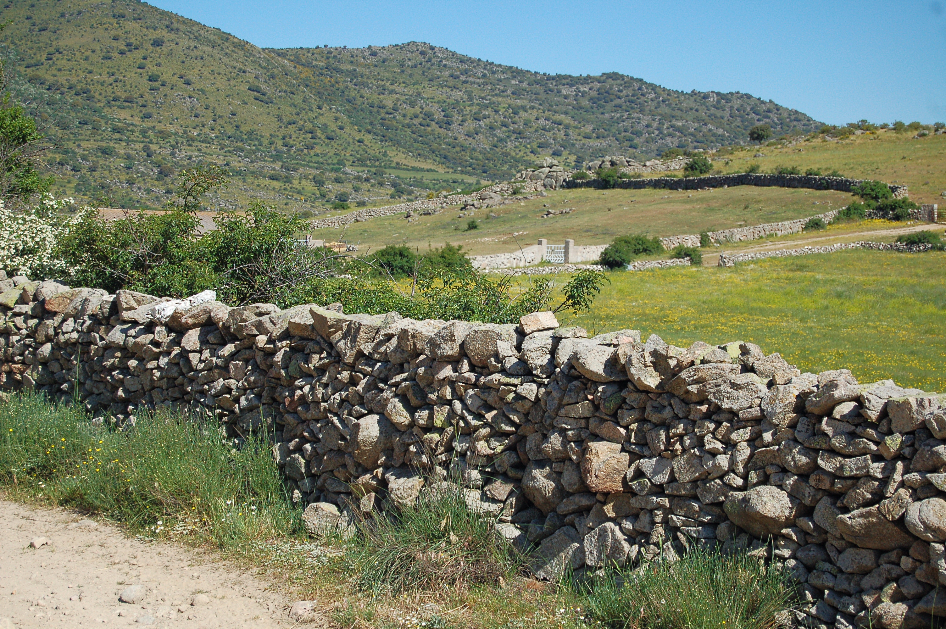
The trail continues to kilometre point 9, just before a new subterranean crossing, this time for the AP-6 highway. A meat factory is left to the right as the trail goes up and down among a landscape dominated by pastures, divided by the traditional stone walls.
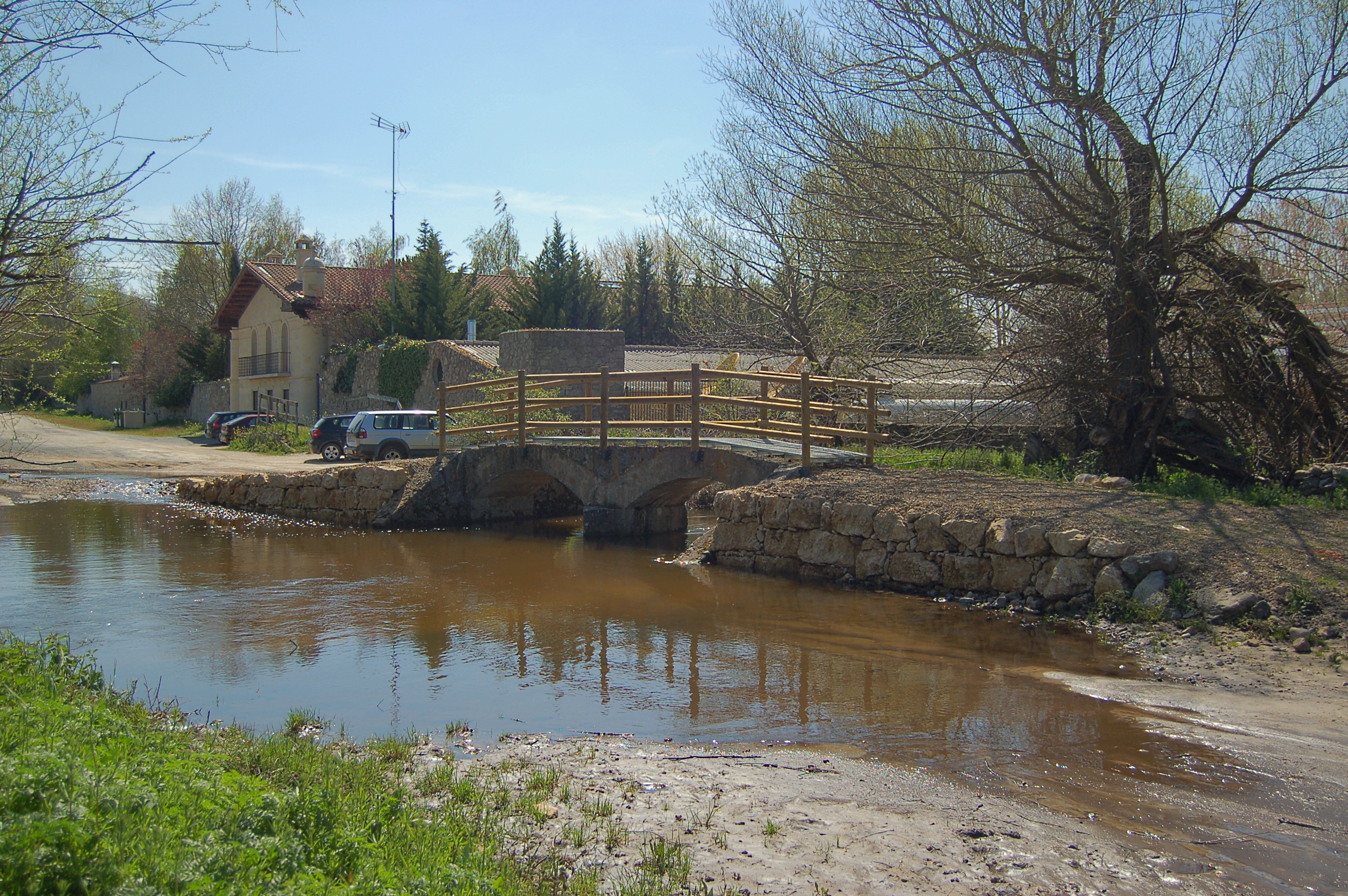
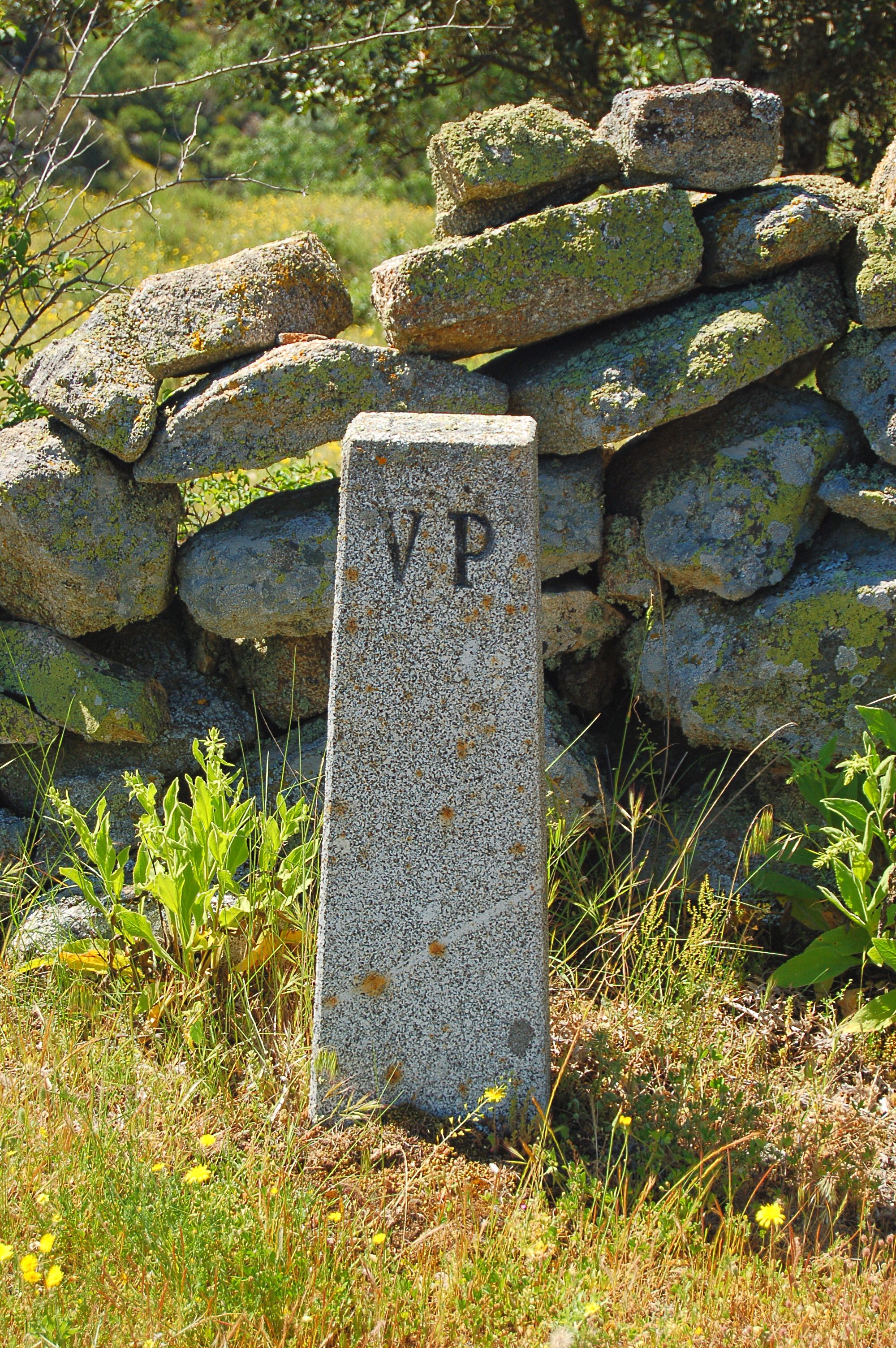
After turning left twice, the trail goes down until crossing the Tejera creek by another renovated stone bridge. Immediately afterwards, it turns right and starts climbing a fairly steep slope. In mid-climb, the traveller finds the first gate of the many that will be found along the Cañada Real Soriana Occidental Nature Trail, and which attest to the shepherding origins of the trail. These gates are not an obstacle to continue the journey; the traveller must simply open and close the gates behind them as they cross them to prevent livestock from escaping freely.
In kilometre point 13 the landscape becomes a sparse mass of oaks, many rocky outcrops and pastures under the trees. After crossing a new gate, the trail goes down. At the following crossing, the road to the right must be taken. Signals belonging to the cattle road lead the traveller to kilometre point 14, where the trail turns into an increasingly steep narrow path which descends to the gauging point by the river Moros, which the trail crosses.
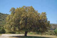
Once the river has been crossed, a steep climb begins for a little over 200 m, and ends in a recreational area next to kilometre point 15, by a magnificent holm oak (Quercus ilex). Those who travel along the Cañada Real Soriana Occidental Nature Trail by bike will be challenged by both the section down to the river and up to the hill. Don't be ashamed to get off the bike and walk these sections if you feel safer.

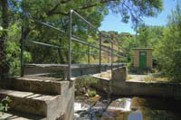
The climb continues by the wide track and takes the path to the right, crossing the suburban area of Los Ángeles de San Rafael, with the houses to the right and a golf course to the left. Shortly after kilometre point 16, the trail crosses the road leading to this golf course is crossed (please proceed with the utmost care). After several crossroads, all properly signalled, the trail runs down to a wastewater treatment plant. Near this plant, the trail continues between low holm oaks and riverside vegetation. From this point, and for the next 250 m, the trail becomes a steep climb.
At kilometre point 17, the trail crosses a suburban street and continues climbing, leaving the houses behind and crossing pastures with sparse trees. It turns left, by the service road of the AP-61 highway and shortly afterwards kilometre 18 a subterranean tunnel crosses the highway. Once crossed, the trail goes up, crossing the N-603 road by a new subterranean crossing, and continues parallel to this latter road.
Shortly after kilometre point 19, the trail goes down to a new gate for cattle, with a special door for travellers to its left. Once this gate has been crossed, the trail continues to run down and the first hoses of the trail station neighbourhood of Otero de Herreros may be seen.
A residential area lies to the left of the road and the road has to be carefully crossed. At the other side, the traveller finds an interpretation panel marking the end of stage 1 of the Cañada Real Soriana Occidental Nature Trail between El Espinar and Otero de Herreros.
Map
Puntos de Interés
Orografía
Vegetación
Profile
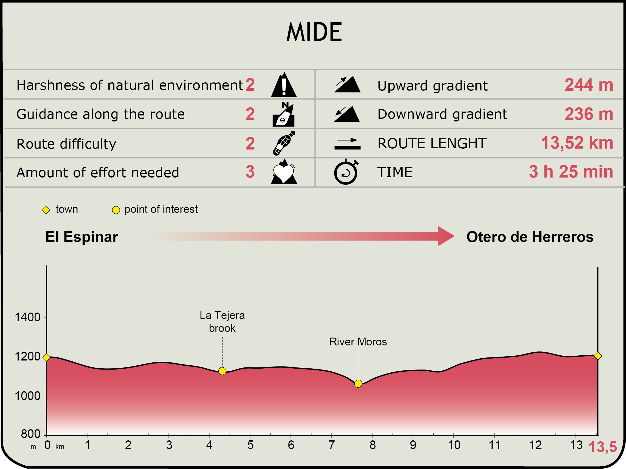
MIDE (Method for the Information of Excursions)
 Harshness of natural environment
- 1. The environment is not risk-free
- 2. There are more than one risk factors
- 3. There are various risk factors
- 4. There are quite a lot of risk factors
- 5. There are many risk factors
 Guidance along the route
- 1. Well defined trails and crossings
- 2. There is a clearly marked trail and signage
- 3. Requires the identification of geographic features and cardinal points
- 4. Requires off-path navigation
- 5. The trail is interrupted by obstacles that have to be gone around
 Route difficulty
- 1. Walking on a flat surface
- 2. Trails with different types of path
- 3. Walking on stepped paths or irregular terrain
- 4. The use of hands or jumping over the terrain is necessary
- 5. The use of hands is required to progress
 Amount of effort needed
- 1. Up to 1 hour of continuous walking
- 2. Between 1 and 3 hours of continuous walking
- 3. Between 3 and 6 hours of continuous walking
- 4. Between 6 and 10 hours of actual walking
- 5. More than 10 hours of continuous walking
Featured
Further information
Otero de Herreros
Municipality of the province of Segovia located at the foot of the La Mujer Muerta subrange. Remains of Celtic settlements have been found, as proof that they started mining the area, as the Romans afterwards did extensively, and which may be the reason behind the name of the village ("Herreros" means "Blacksmiths") The old village was located near the road to Valdeprados. However, it was abandoned in the 15th century and only some ruins remain. Since the 15th century, the new town was built on top of an isolated hill ("Otero" in Spanish), ad that is the origin of the current location and of the town name, Otero de Herreros. The San Justo y San Pastor church, the Nuestra Señora de la Adrada shrine and San Roque shrine form the religious architectural heritage, and the most significant civil building is the Casona del Moral manor. The patron saint festivities honour San Justo and San Pastor and take place the first weekend in August.
La Cañada Real Soriana Occidental
The Cañada Real Soriana Occidental is a traditional cattle road used for centuries by herds of Merino sheep in their search for pastures. Today, all cattle roads are regulated by Act 3/95, of 23 March, on Drovers’ Road, , and constitute imprescriptible, inalienable, unattachable goods, formally owned by Regional Governments. The most important among cattle roads are the type called drovers' roads, due to the fact that they are 75 m wide. In Spanish they are called "cañada real", the mention of "real" ("royal") having been granted by King Alfonso XI of Castile due to the importance of these roads for the economy at the time. In current times, their use as cattle road has diminished and been complemented by other compatible uses, such as public and environmental uses.
This drovers' road is one of the most important in the country. It runs along 700 km from the north-east of the Province of Soria to the western end of the province of Badajoz, and it crosses the provinces of Segovia, Ávila, Salamanca and Cáceres.
Multimedia

Downloads
GPS Downloads
Cyclability
This Cyclostage corresponds to stages 0, 1 & 2 of the Nature Trail
PROFILE
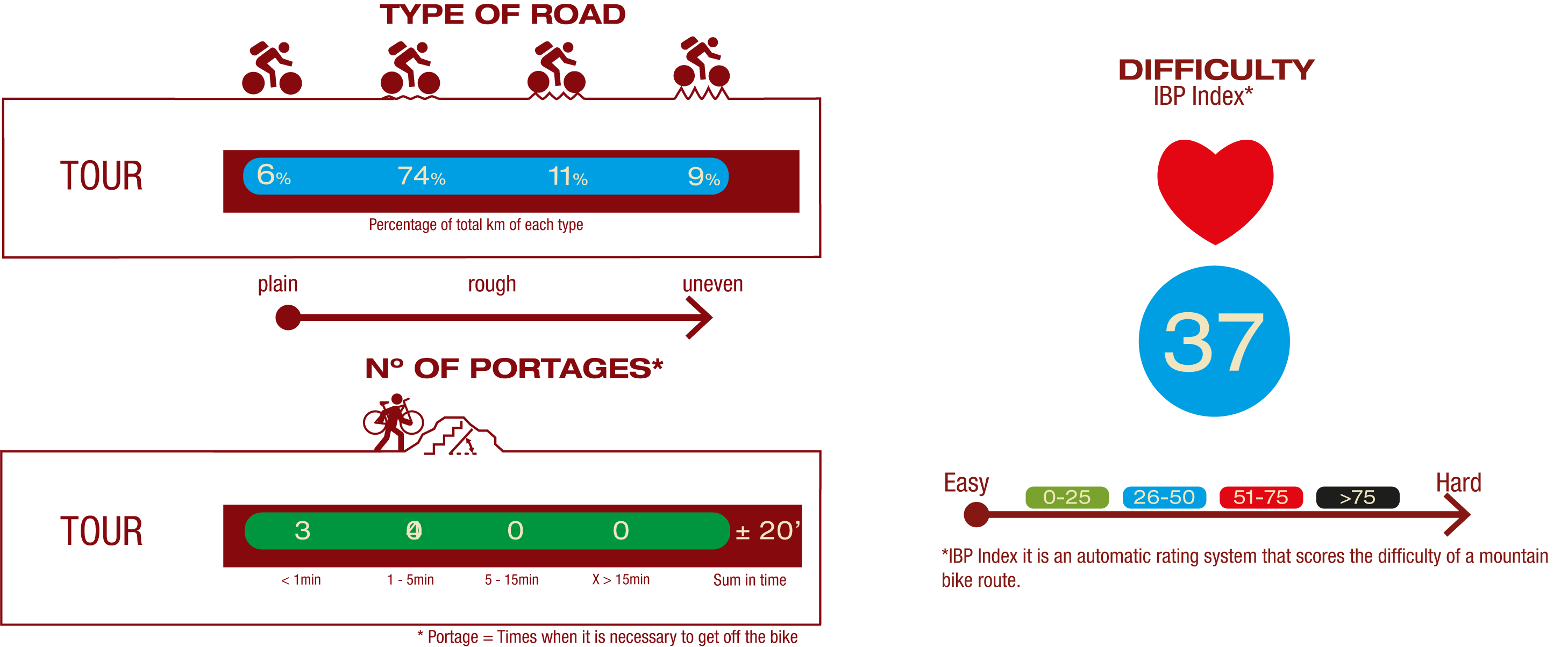
TYPE OF ROAD, PORTAGES & DIFFICULTY
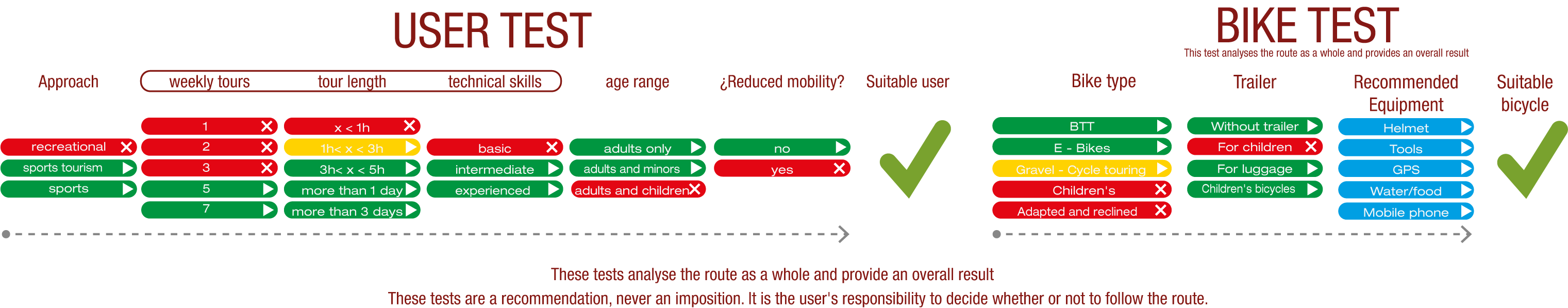
TEST
SAFETY RECOMMENDATIONS
- Sections shared with hikers.
- Transit through the centre of some population centres.
- The Nature Trail presents, in stage 3, the crossing of a paved road across a solid line. Although there is enough visibility, extreme caution, and crossing dismounted, is advised.
GENERAL RECOMMENDATIONS
- Find out about the technical aspects of the route and the weather on the day.
- Take care of the environment. Take care not to disturb animals or damage vegetation. Respect private areas.
- You must give priority to pedestrians and comply with general traffic rules.
- The environment in which you will be riding is open, free to move around and an area where many activities are carried out (sporting, forestry, livestock and agricultural activities). Always have an understanding, prudent, responsible and respectful attitude.