
- Home
- Rural Development
- Nature Trails
- Nature Trails
- Central Sector
- Cañada Real Soriana Occidental
Stage 8: Riaza-Ayllón
Description
This eighth stage, characterised by soft hills, starts in the arcaded square of Riaza and ends in the monumental village of Ayllón.
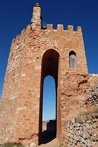
It starts with a stroll around Riaza, where its arcaded square, the Nuestra Señora del Manto church and the San Juan Bautista shrine are a good example of the beauty of this town. After a shared section, this stage is marked by a descendant slope, which crosses a dense patch first of Pyrenean oaks and then oaks, and finally a small pine patch. After leaving to the right the church of the village of Santa María de Riaza, the trail reaches Ayllón, which is a fantastic ending for this Cañada Real Soriana Occidental Nature Trail .
Running for over 24 km, the eighth and last stage of the Cañada Real Soriana Occidental Nature Trail is the longest, but it has a very mild tracing that runs between the pretty towns of Riaza and Ayllón.
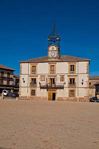
The stage begins at the information panel next to the indoor sports centre of Riaza. The trail continues thought the length of Calle Cañada la Estación before turning left by Calle Santiago Apóstol until this crosses the Calle Raserillo Alto. Taking this road, which leads to the right, the trail arrives to Calle Zacarías Martín (to the left). The trail continues along this latter road until reaching Calle Julio Gonzalo Ramos which leads, finally, to the arcaded square of Riaza, presided by the town hall.
After enjoying the views of this historic square, the trail continues along the Travesía Mayor, which leads to the nearby Nuestra Señora del Manto church. Already in the Plaza de Don Luis Gonzalo Vitoria, the trail does down and right along the Calle Alfonso VIII to a parking lot and, shortly afterwards, to the San Juan Bautista shrine.
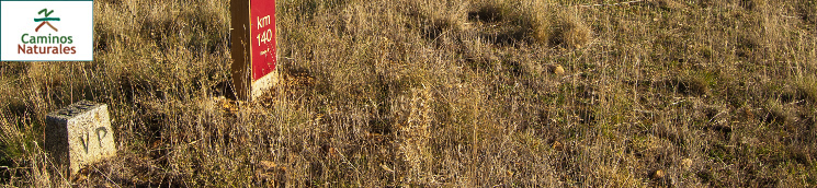
At this point, a an asphalt road marks the shared section which starts in the Calleja San Juan and then turns right to the road that leads to the Prado Pinilla suburban area. After leaving industrial premises to the left, the trail goes up to cross the N-110 road by a bridge. Once the road has been crossed, the trail takes a dirt path to the left and soon afterwards reaches kilometre point 125.
The traveller keeps walking a leaves behind a dense patch of Pyrenean oak (Quercus pirenaica) to the left and estates consisting in pastures dotted with Pyrenean oaks to the right. Slowly, the scattered trees become patches and, a few metres after kilometre point 126, the trail turns right and heads north.
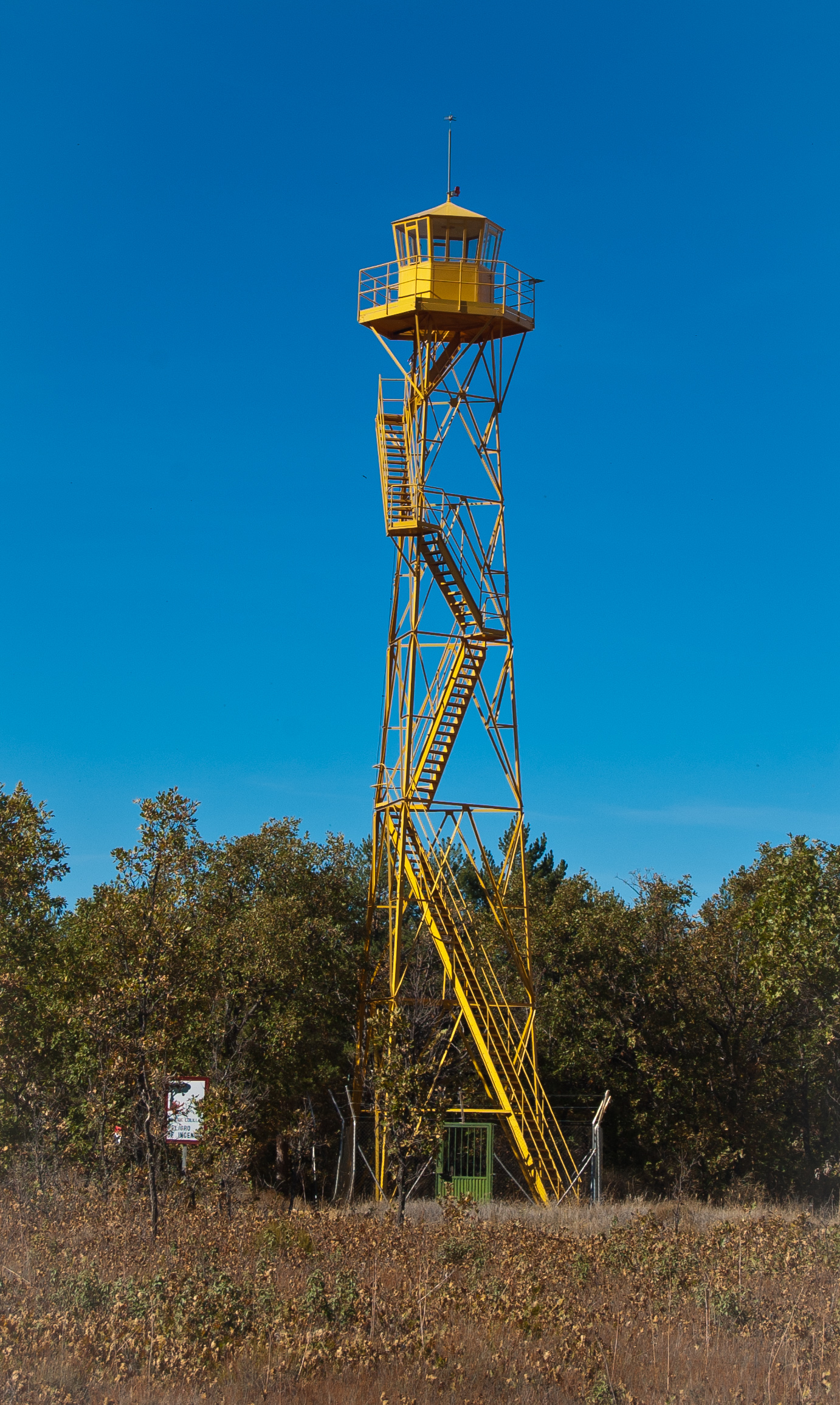
Signs that Pyrenean oaks were used for lumber in the past remain, and, after passing by kilometre point 127, a fire control tower can be seen. The traveller must again cross the road of the Prado Pinilla residential area (please proceed with utmost care).
At the other side of the road, the la Cañada Real Soriana Occidental drover's way is clearly defined, since its area is densely flanked with Pyrenean oaks, behind which grain crops stretch.
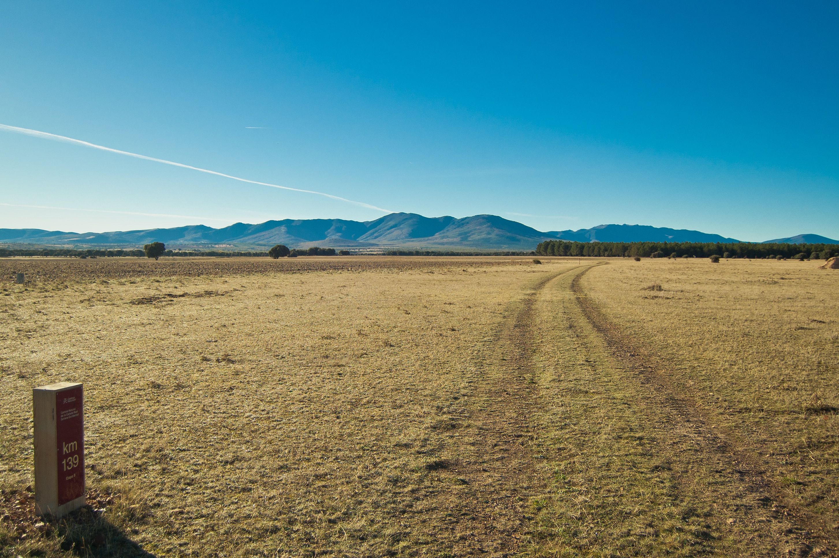
This characteristic landscape surrounds kilometre point 128, located in a mild downhill section. After the following kilometre point, the bush covers beyond the cattle road and some oaks (Quercus ilex) may be observed among the Pyrenean oaks .

This mild downhill section leads the traveller into the municipality of Fresno de Cantespino. As the road unfolds, oaks, and not Pyrenean oaks, become the dominant species. The path becomes wider before reaching kilometre point 132.
Afterwards, it crosses the road SG-V-9115 (please proceed with utmost care) and continues slowly down among the oaks, where the traveller may enjoy a lovely walk or ride in the lush woods.
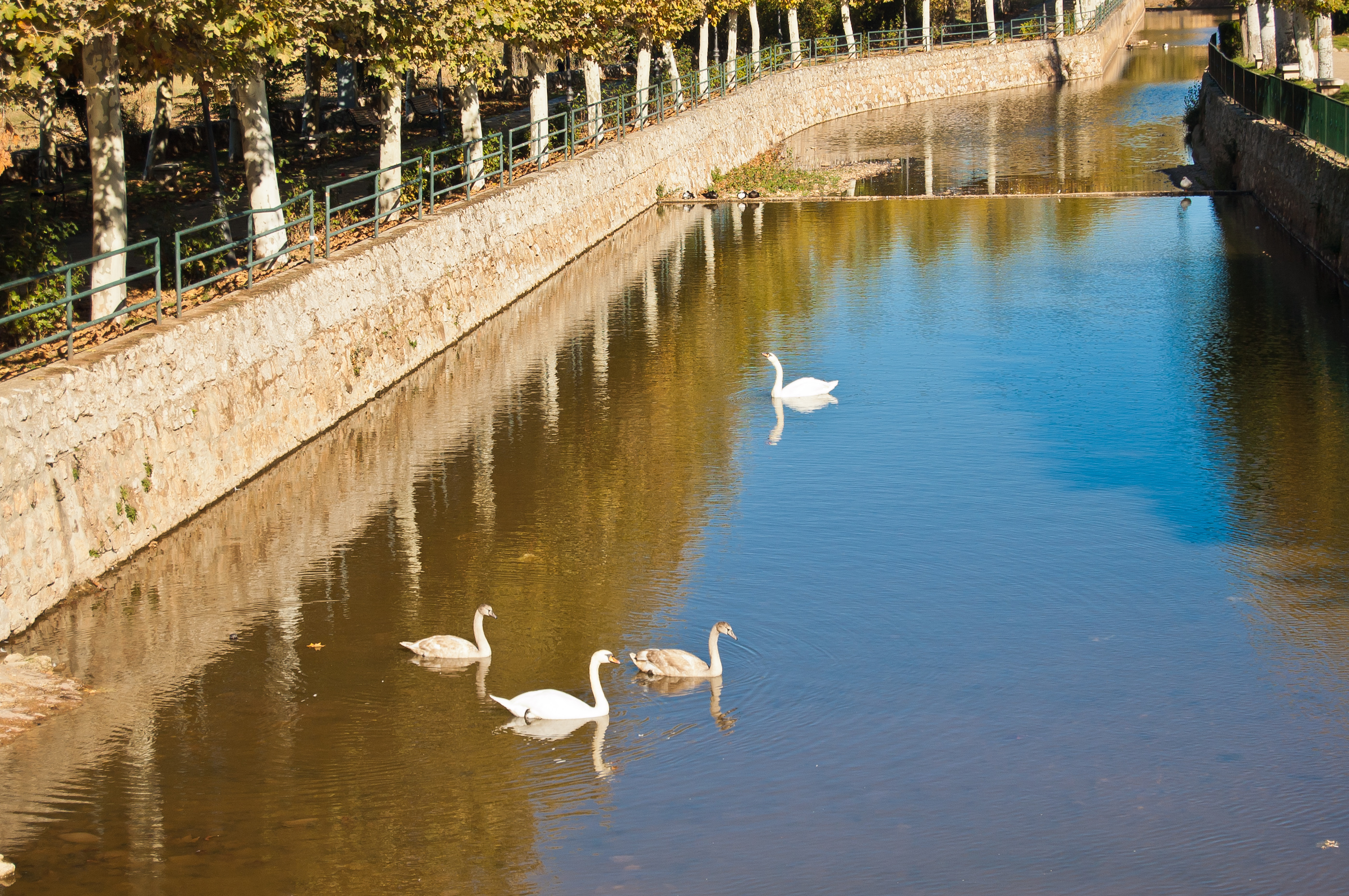
From kilometre point 134, the trail enters in the municipality of Corral de Ayllón. One kilometre further down the road, the trail turns ninety degrees to the right by a path that enters the municipality of Ayllón and continues in-between both municipalities, before ending in that of Ayllón. The canal on the Monte creek is crossed by means of a wooden bridge, and provides a change of scenery after walking in the large oak woods.
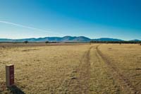
After leaving behind kilometre 137, the road turns left and leaves the dense oak woods to enter in a repopulation pine woods from which the traveller emerges at the Camino Saldaña resting area. Once they have regained their strength, they cross the SG-V-9116 road (please proceed with utmost care). The road leaves finally behind the tree masses and crosses grassland, where the traveller will be stunned by the open landscape.
The traveller arrives at a new crossroads, this time with road SG-V-9111. At first, they may walk for a few metres by the side of the road, but later the traveller will be forced to take the road. From this point, they must proceed with the utmost care and walk in the appropiate side (which will be different for those who walk and for those who ride a bicycle).
After kilometre point 141, and just before arriving at the crossroads with road N-110, the trail takes the path to the left leaving the road behind.
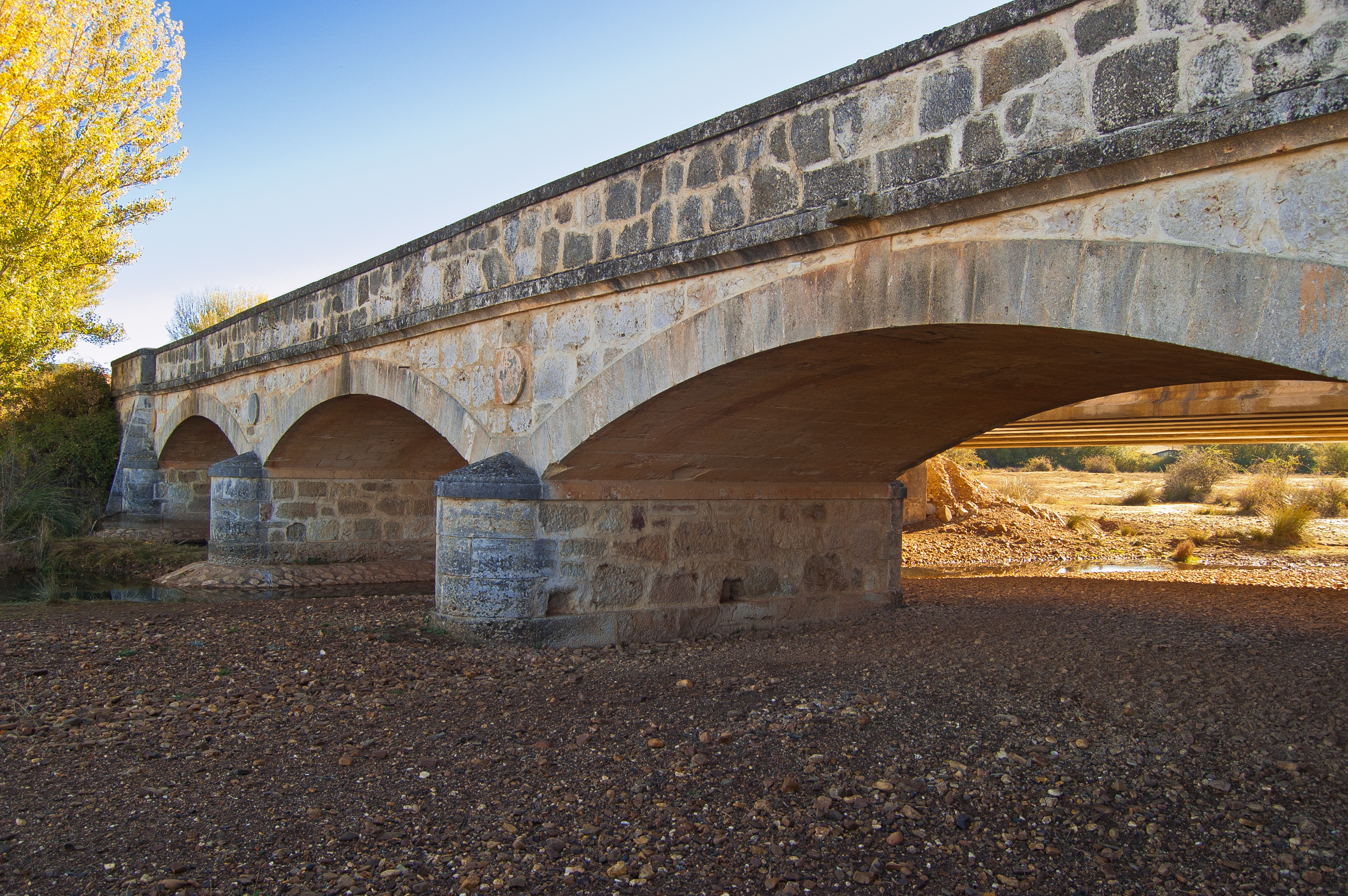
In a few metres, the tracing changes from a dirt path to an asphalt road and back to a dirt path, and crosses the three-arch bridge over the river Riaza. After going down a mild slope, the traveller arrives at the Camino de las Cuevas resting area and may take a break in the cool shadows of their poplars. At the other side of the road stands the village of Santa María de Riaza, dominated by the church of Nuestra Señora de la Natividad.
At the first forking after leaving behind the resting area and kilometre point 134, the trail takes the path that lies to the right. A short section uphill ends in a turn to the right where a new kilometre point may be found among agricultural land. Shortly afterwards, an overpass crosses the N-110 road and the road goes down to its final destinations.
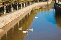
A crossroad and the presence of livestock at both sides of the road evidences that the town lies nearby. The traveller must go straight on. At the following crossroads, the trail turns right to arrive to the town of Ayllón by the Calle Molino de Ramos, where kilometre point 146 is located, just by the frontón court and the town public pool. At the end of the street, the trail turns left, goes down by the service track of Avenida de la Reconquista, which, shortly before reaching the river Aguisejo, changes its name to Calle del Conde de Valdellano. Just after crossing the river and just in front of the medieval arc which gives access to the historical centre of Ayllón, the traveller shall find the information panel that marks the end of this eight stage of the Cañada Real Soriana Occidental Nature Trail.
Map
Puntos de Interés
Hidrografía
Infraestructura
Vegetación
Profile
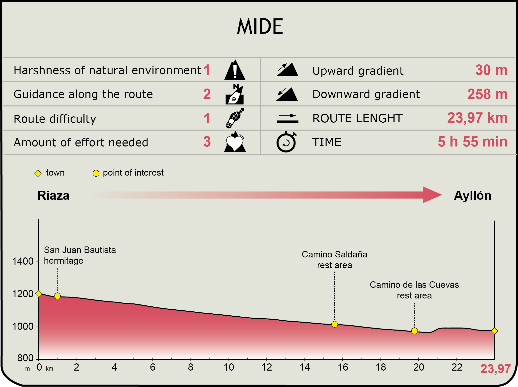
MIDE (Method for the Information of Excursions)
 Harshness of natural environment
- 1. The environment is not risk-free
- 2. There are more than one risk factors
- 3. There are various risk factors
- 4. There are quite a lot of risk factors
- 5. There are many risk factors
 Guidance along the route
- 1. Well defined trails and crossings
- 2. There is a clearly marked trail and signage
- 3. Requires the identification of geographic features and cardinal points
- 4. Requires off-path navigation
- 5. The trail is interrupted by obstacles that have to be gone around
 Route difficulty
- 1. Walking on a flat surface
- 2. Trails with different types of path
- 3. Walking on stepped paths or irregular terrain
- 4. The use of hands or jumping over the terrain is necessary
- 5. The use of hands is required to progress
 Amount of effort needed
- 1. Up to 1 hour of continuous walking
- 2. Between 1 and 3 hours of continuous walking
- 3. Between 3 and 6 hours of continuous walking
- 4. Between 6 and 10 hours of actual walking
- 5. More than 10 hours of continuous walking
Featured
Further information
Ayllón
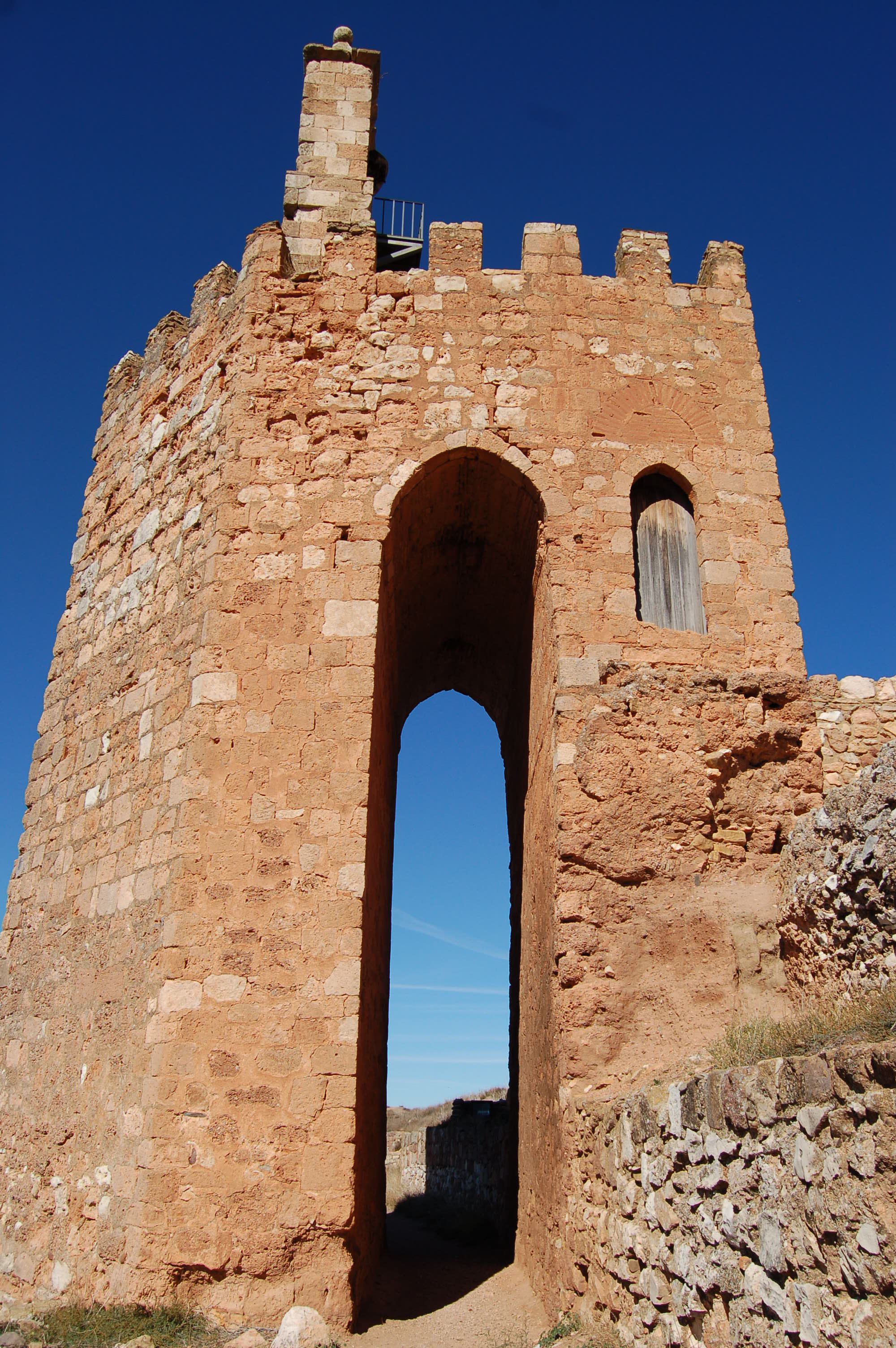
Town in the north-eastern edge of the province of Segovia, near the borders with the provinces of Soria and Guadalajara. Presumably, its origins lie in a Celtiberian settlement at the site of the Cerro, which was subsequently destroyed in the Roman era. The Arabs built a city enclosed by walls, of which only the La Martina Watchtower remains.
After the Christian reconquest, the city experimented an important economic growth, at the same time that livestock farming and transhumance in the area increased, since Ayllón was the seat of one of the biannual meetings of the Council of the Mesta, an important association of transhumant sheep farmers. Currently, the town is based on agriculture and livestock farming, and tourism is increasing its importance.
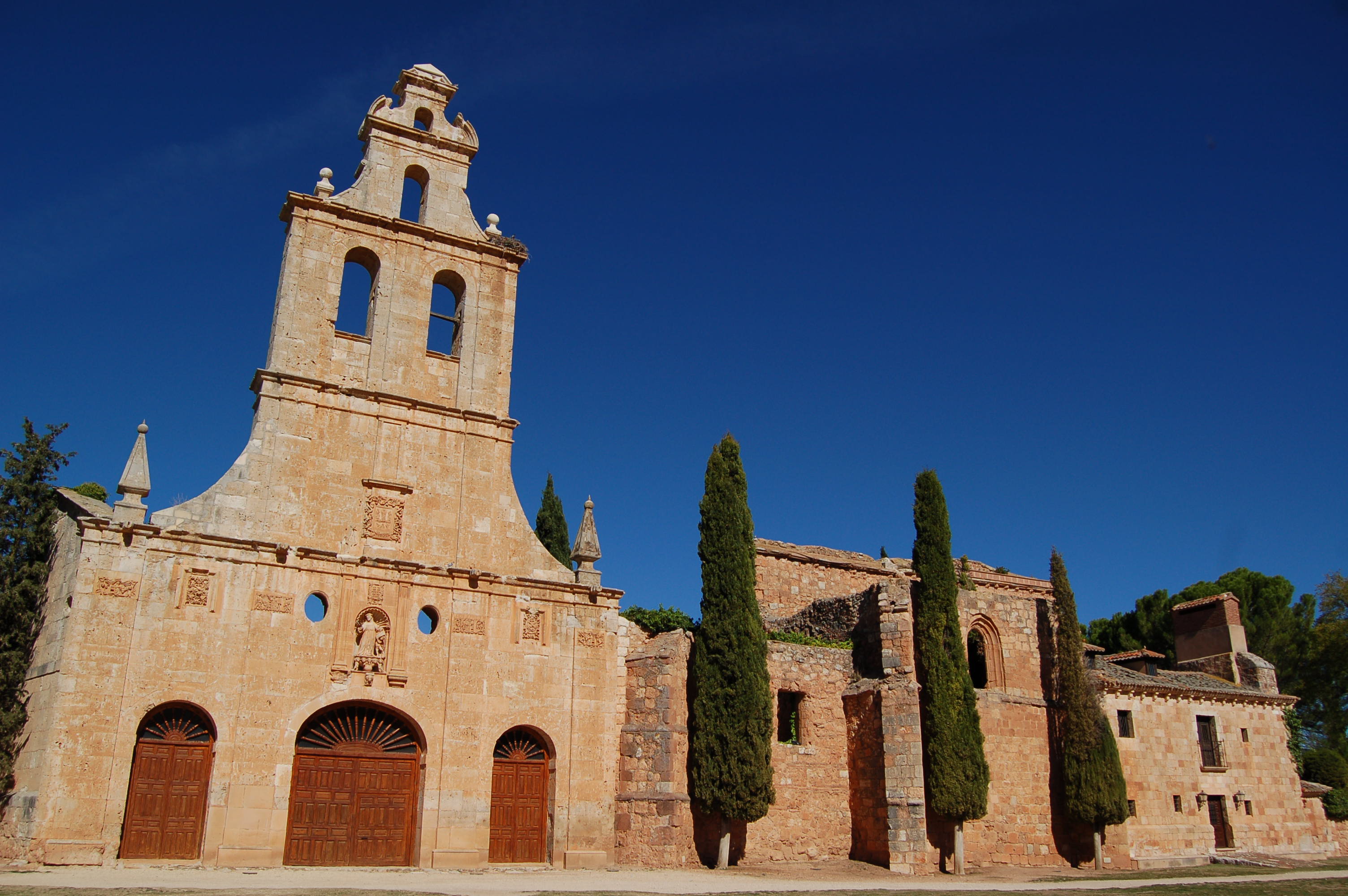
The town boasts a rich architectural heritage, among which the Plaza Mayor, the Town Hall and the San Miguel church stand out. The Santa María la Mayor church, the former San Francisco de Asís convent, the Palacio de Contreras, the Casa de la Torre and the medieval arc are also noteworthy. The patron saint festivities are held on the 29th September and honour San Miguel. A fair called Medieval Ayllón is held the last weekend of July. The town is surrounded by a magnificent natural environment, with several Protected Natural Spaces in the vicinity.
Cañada Real Soriana Occidental in the province of Segovia. “Esquileos” (shearing houses) and “Lavaderos” (wool washing houses)
The Cañada Real Soriana Occidental is an old long range cattle road which connects the Cameros region, in La Rioja, with Olivenza lands, in the province of Badajoz. It comes into Segovia in the Tierra de Ayllón, reaching for the mountain hillside next to Riaza. Going along Somosierra and Guadarrama mountain ranges, it goes all through the province until reaching Villacastín, where it crosses to the province of Ávila.
Associated with cattle activities, it was indispensable the shearing and wool washing houses. It is this Segovia stretch of the road which had more infrastructures of that kind, counting as much as thirteen shearing places, with a capacity to shear more than three thousand sheep per season, and five wool washing houses. The more significant of these buildings were the Iturbieta (or Santillana) shearing houses and the Alfaro washing-shearing house, both of them built by the middle of the 18th century. Today, other than the two aforementioned buildings, the only facility which remains whole is the Cabanillas del Monte shearing house, of much smaller size, but maintaining all the typical elements of these buildings.
Multimedia

Downloads
GPS Downloads
Cyclability
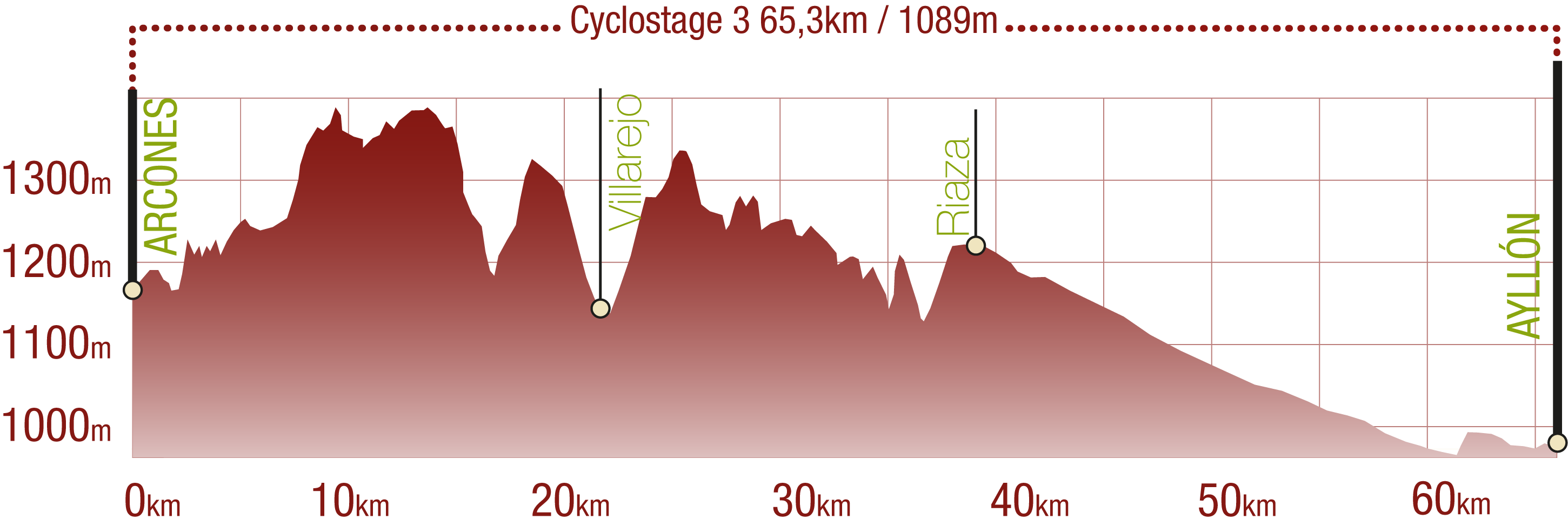
This Cyclostage corresponds to stages 6, 7 & 8 of the Nature Trail
PROFILE
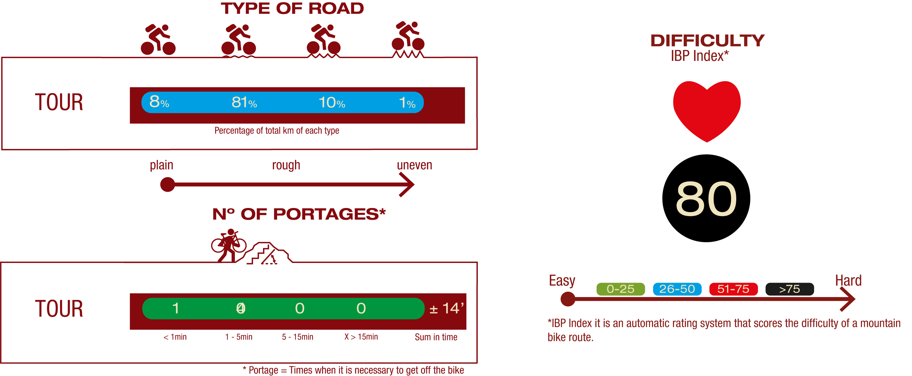
TYPE OF ROAD, PORTAGES & DIFFICULTY
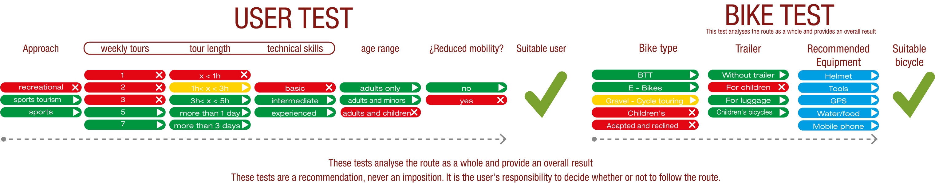
TEST
SAFETY RECOMMENDATIONS
- Sections shared with hikers.
- Transit through the centre of some population centres.
- The Nature Trail presents, in stage 3, the crossing of a paved road across a solid line. Although there is enough visibility, extreme caution, and crossing dismounted, is advised.
GENERAL RECOMMENDATIONS
- Find out about the technical aspects of the route and the weather on the day.
- Take care of the environment. Take care not to disturb animals or damage vegetation. Respect private areas.
- You must give priority to pedestrians and comply with general traffic rules.
- The environment in which you will be riding is open, free to move around and an area where many activities are carried out (sporting, forestry, livestock and agricultural activities). Always have an understanding, prudent, responsible and respectful attitude.