
- Home
- Rural Development
- Nature Trails
- Nature Trails
- Central Sector
- Cañada Real Soriana Occidental
Stage 7: Villarejo-Riaza
Description
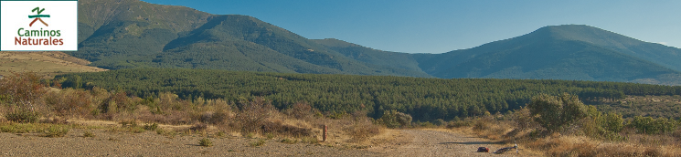
A new section that encounters rivers and creeks, woods of Scots pine and Pyrenean oak, and that led the traveller to the beautiful town of Riaza.
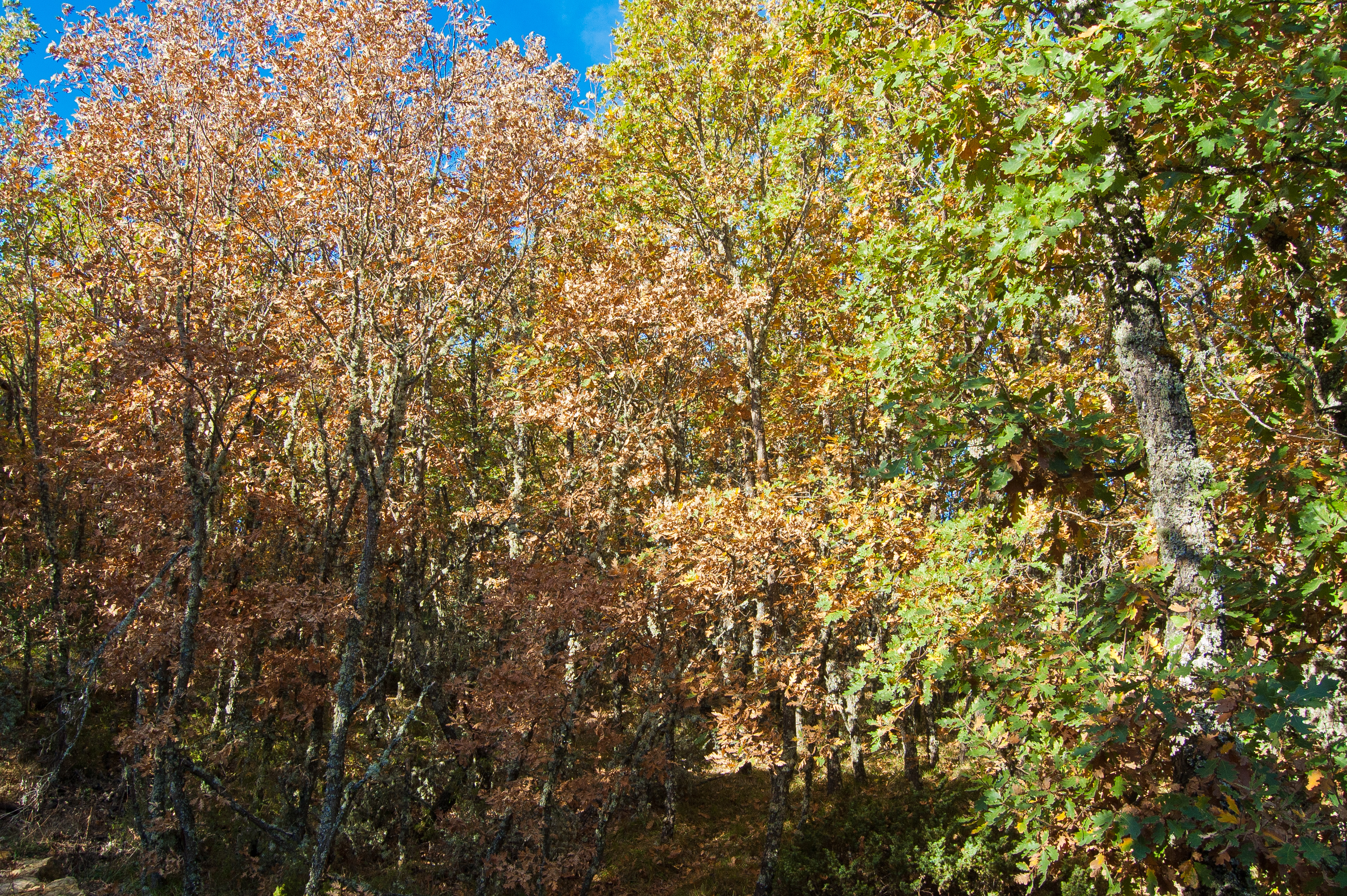
This is one of the most densely wooded areas of the whole trail. The trail starts by crossing a dense patch of Pyrenean oak; the central section of the stage runs across a cross a patch of Scots pines, and goes through a new patch of Pyrenean oak before reaching the town of Riaza.
The seventh stage of the Cañada Real Soriana Occidental Nature Trail starts in the town of Villarejo, at the information panel which marks the start of the stage, and shares the section that leads from the drover's way to the town with the previous stage. This seventh stage starts at the south-east edge of the village of Villarejo, in an area close to the town hall of the municipality.
The stage begins by going up a mild slope. As the trail comes close to the Chorrón creek, typical riverside vegetation, including a poplar patch, may be seen to the right of the tracing. Afterwards, the vegetation consists mainly on Pyrenean oaks (Quercus pirenaica) and pastures with grasses.
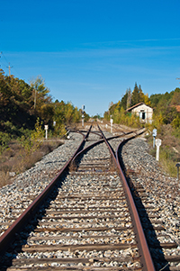
The trail hits a gate with a revolving door for pedestrians and afterwards a subterranean pass that crosses the old railway line. Shortly afterwards, the uphill section ends by turning right; at this point, the section shared with the sixth stage ends.

Immediately after the turn, the resting area of Portera Carrancha and shortly afterwards kilometre point 107. After a short ford, the trail starts going up to the next milestone, where the trail goes down a slope across the heart of the Pyrenean oak wood, which is especially lovely by bike.
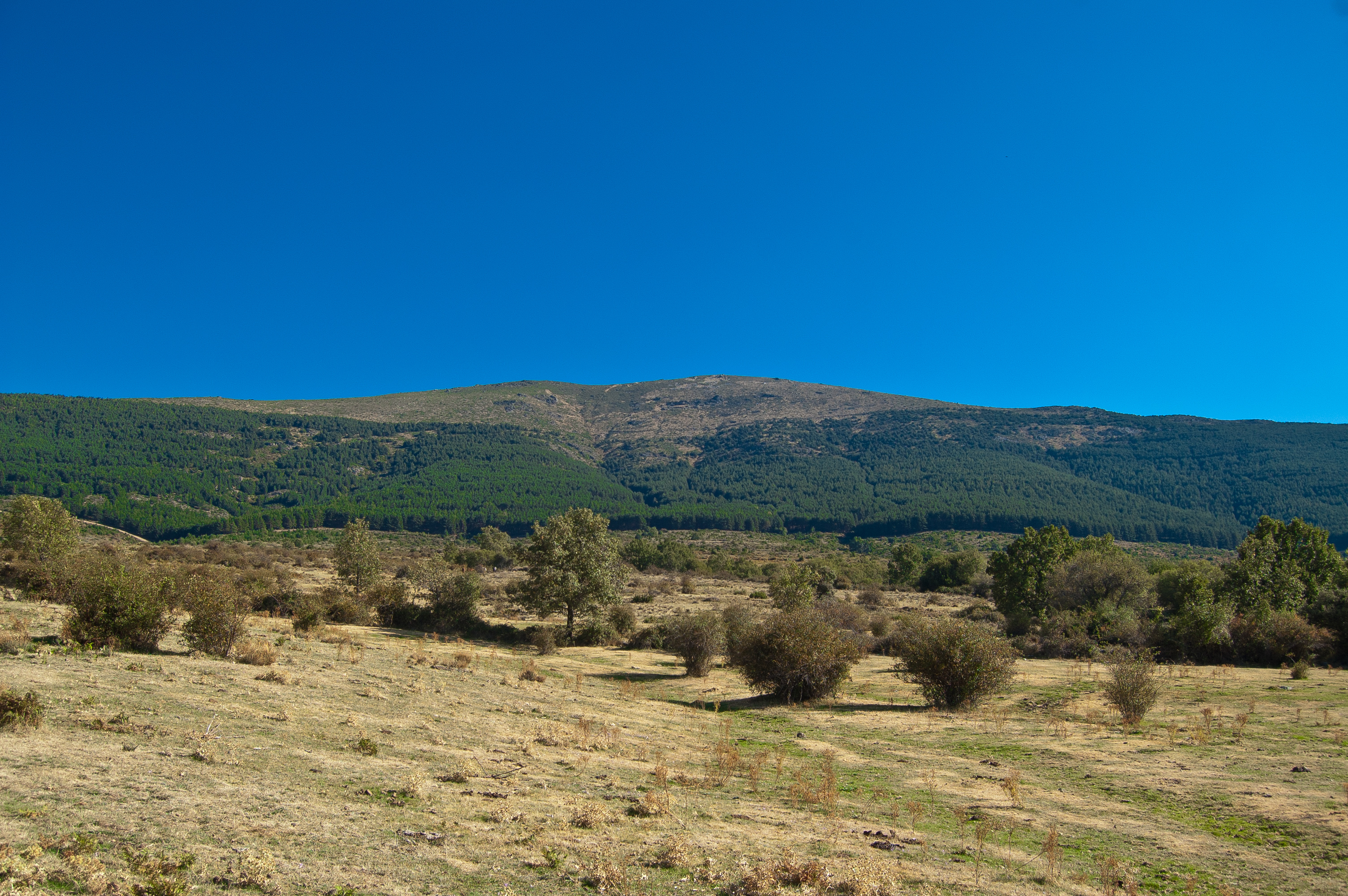
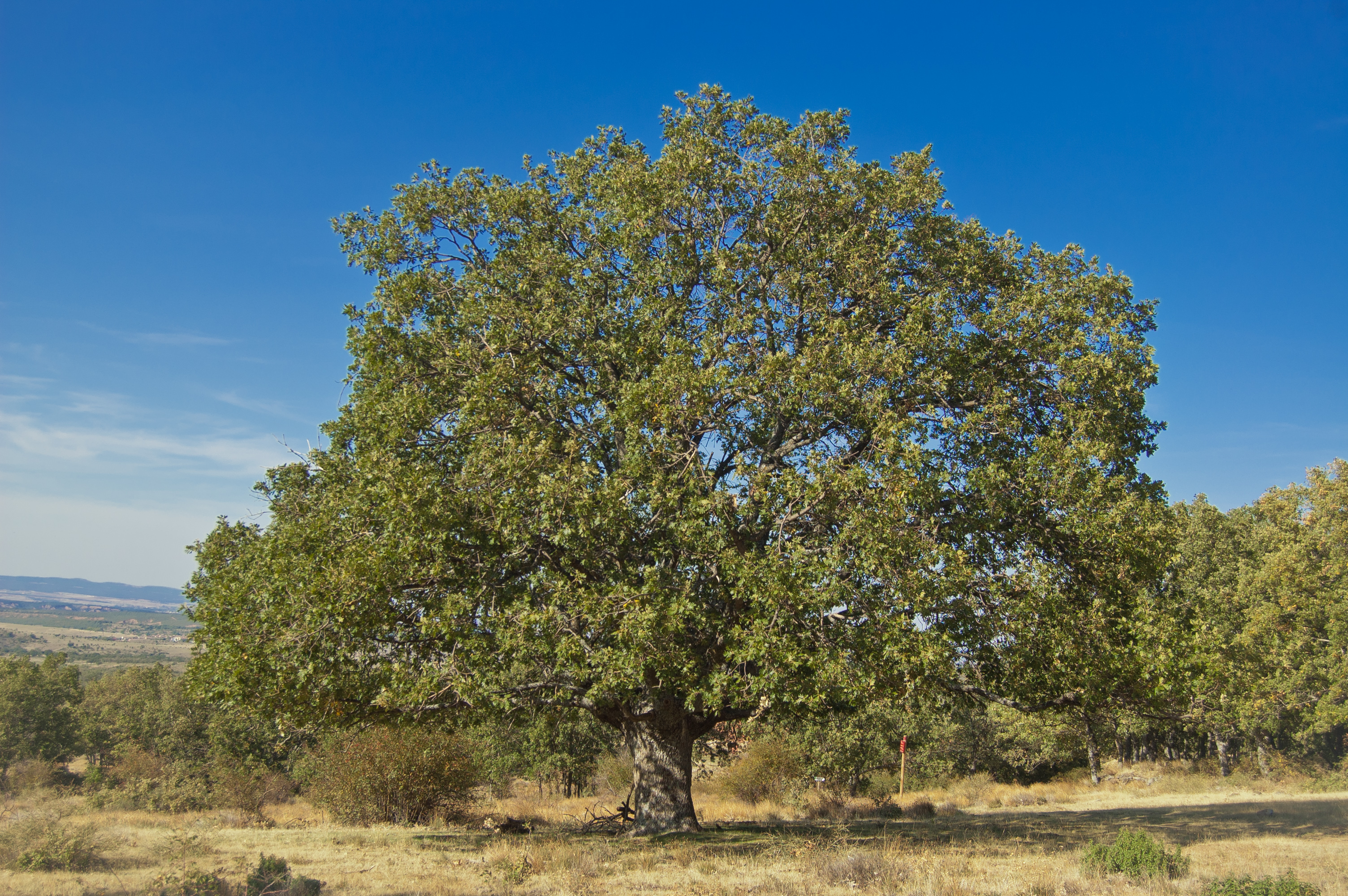
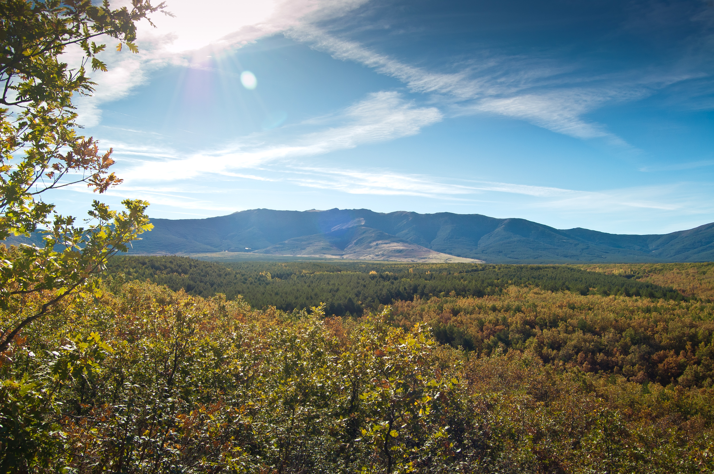
A gigantic Pyrenean oak marks the start of the dirt path that lies to the right and is to be taken. The road continues going down to the Garganta creek and then up. From this point, a section where the trail combines uphill and downhill section begins. . After the first uphill section, the trail comes close to a mass of Scots pines that lie to the right of the road.
When the trail leaves the wide path to take the deviation to the left, kilometre point 111 is reached. The trail runs parallel to the fence that encloses the area called the Monte Raso, in the municipality of Cerezo de Arriba.
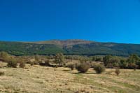
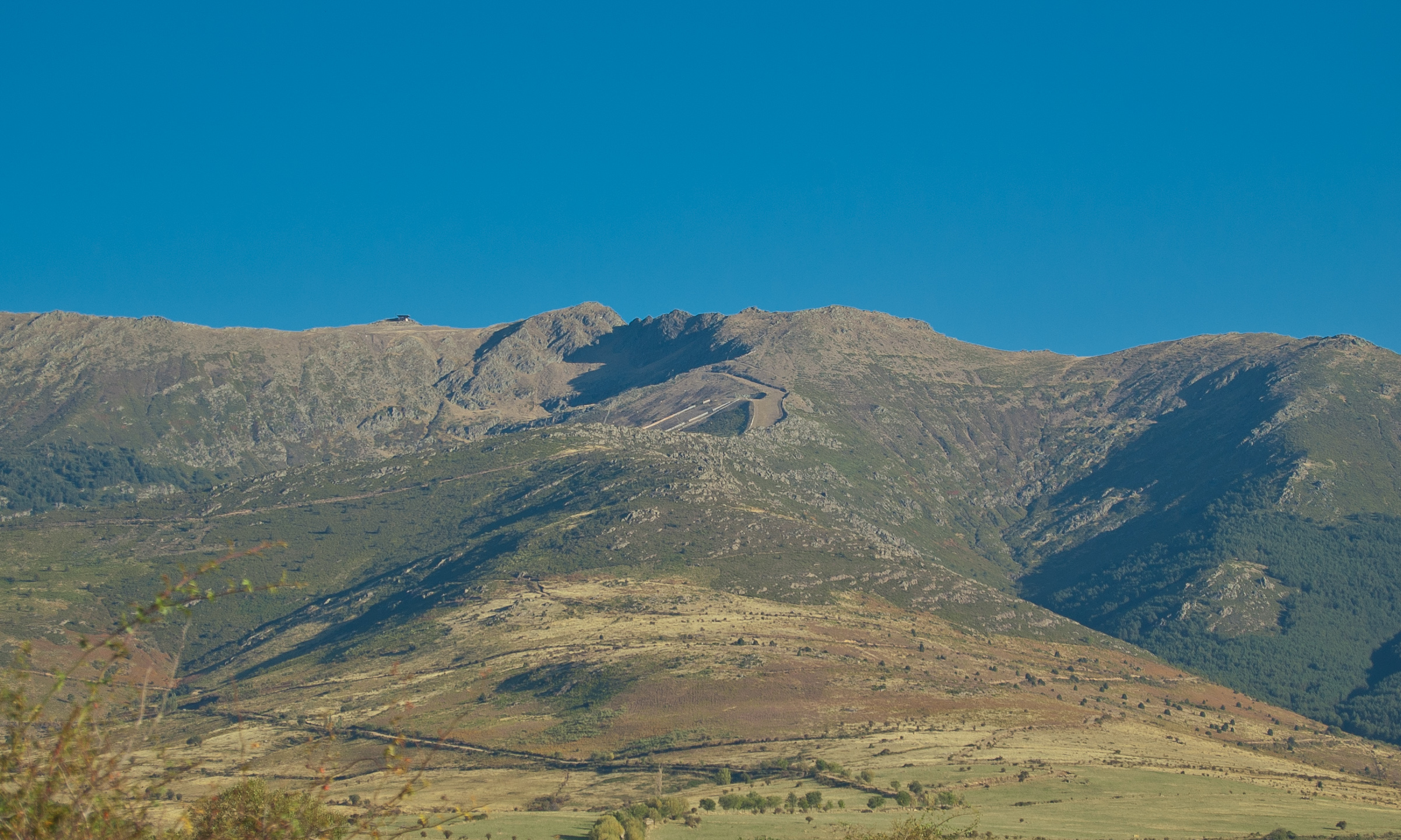
The uphill and downhill section does not end until after kilometre point 113. Up to that point, the traveller walks under the looming mass of Scots pines to the right of the road. In this section, they must pass a gate with a revolving door for pedestrians. Once on the wide path and after passing the Buitrera creek and the river Cerezuelo reaches kilometre point 114. An information panel stands to the right, from where there is a view of the La Pinilla ski resort.
Before reaching the road, the trail takes the path to the left and crosses a new revolving door for pedestrians. After a few meters, it takes a track parallel both to the fences and to the road SG-115. Shortly after passing kilometre point 115, the track returns to the path and leads the traveller to a new revolving door. Once this door has been crossed, the trail turns left by the asphalt road and passes behind the old railway tracing, in order to re-ascend among riverside vegetation and cross the SG-115 road (please proceed with utmost care).
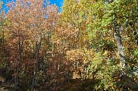
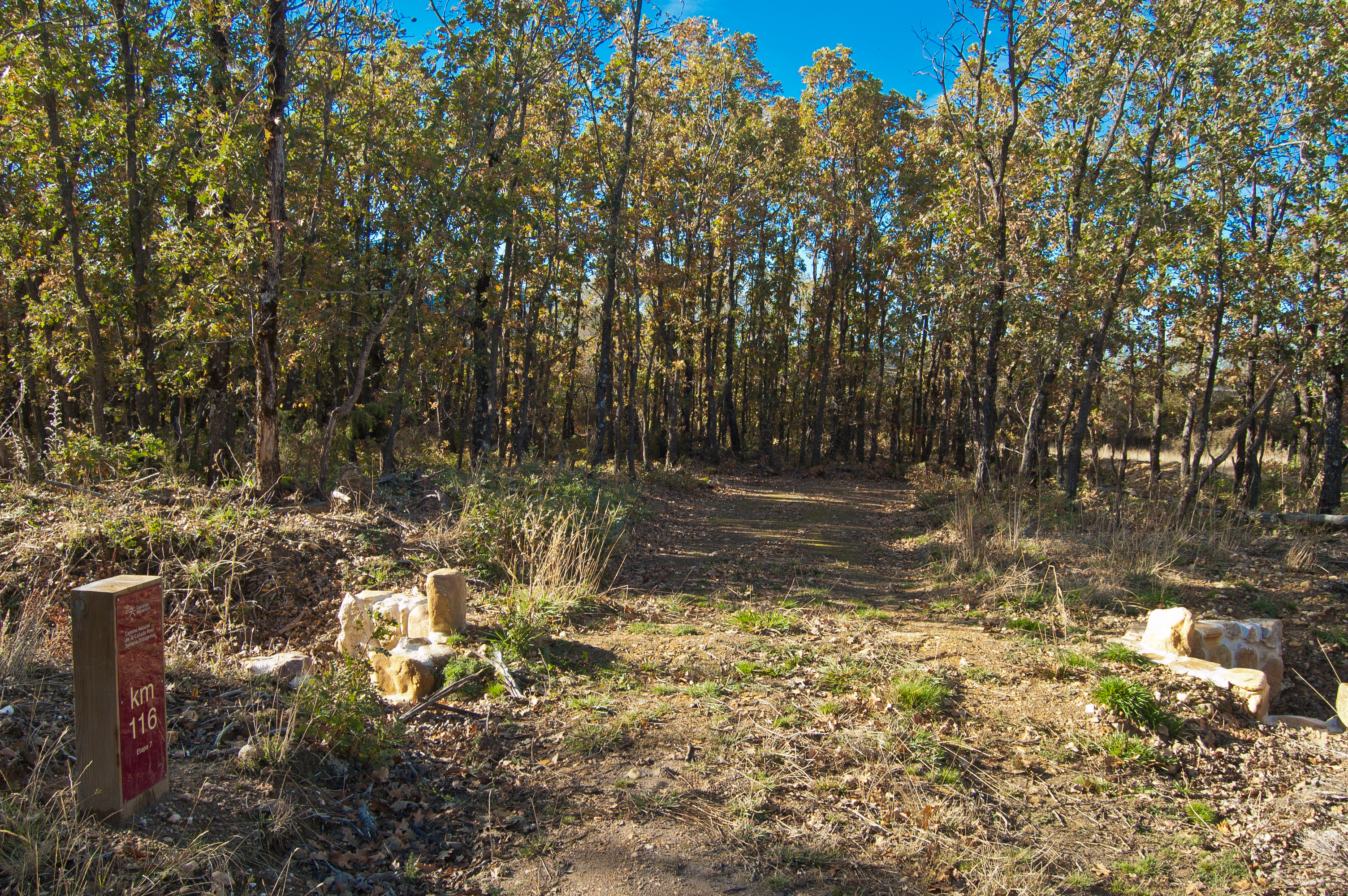
A new revolving door awaits the traveller at the other side of the road. The tracing turns right and heads north, and it reaches kilometre point 116, at a water spring of the river Cerezuelo. This section of the Cañada Real Soriana Occidental drover's way is nested in a dense patch of Pyrenean oaks which offers its cool shadow in summer and an spectacular display of colour in autumn, thanks to the markedly marcarescent nature of this species, which makes dry leaves to remain in the branches for a long time.
A small meadow and a crossroads stand before a new revolving door, less than 500 after which there is a new revolving door and a ford mark the end of the downhill section, which leads to the river Valseco and the Ortigosas creek.
The trail goes up once again by a steel slope. The climb is nonetheless worth the effort due to the breathtaking views. The slope ends as the trees scatter, and turns into pasture. Kilometre point 118 is reached at this point. The downhill section, until the following milestones, ends at the point where the river Serrano is crossed. A few metres afterwards the trail becomes a wide path and goes up again under the old railway line, very close to the Riaza station. Shortly after kilometre point 120 the climb ends and the traveller finds a cattle grid next to a crossroads which connects this trail with another route.
A flat section follows, flanked by trees, and a new cattle grid prevents animals from passing. Shortly afterwards the trail leaves the dirt path and continues along the green asphalt bicycle lane which lies straight ahead, and which leads to the town of Riaza. The trail continues along this bicycle lane by the Calle Cañada la Estación, crosses it (please proceed with utmost care) and continues to the left of this road. The bicycle lane turns left by the Avenida del Doctor Antonio García Tapia and the trail crosses the street a few metres after (again proceed with utmost care).
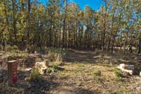
It continues along the Calle Cañada la Estación, which now becomes a dirt path, and shortly afterwards crosses the road SG-112, popularly known as the road to Riofrío (again proceed with utmost care). The trail continues either by the pavement or the road of the Calle Cañada la Estación until reaching the indoor sports centre of Riaza, where an information panel marks the end of this seventh stage of the Cañada Real Soriana Occidental Nature Trail between Villarejo and Riaza.
Map
Puntos de Interés
Información
Orografía
Vegetación
Profile
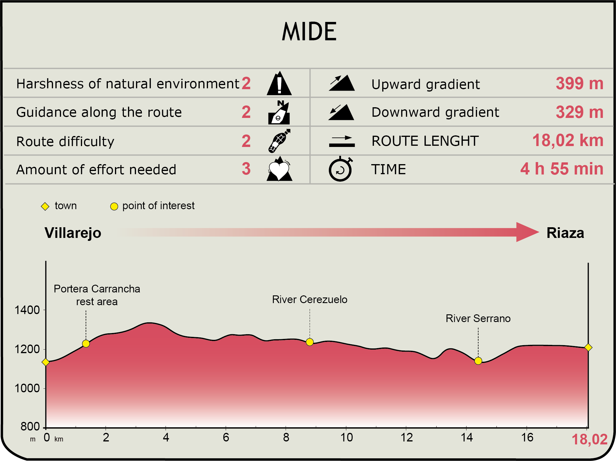
MIDE (Method for the Information of Excursions)
 Harshness of natural environment
- 1. The environment is not risk-free
- 2. There are more than one risk factors
- 3. There are various risk factors
- 4. There are quite a lot of risk factors
- 5. There are many risk factors
 Guidance along the route
- 1. Well defined trails and crossings
- 2. There is a clearly marked trail and signage
- 3. Requires the identification of geographic features and cardinal points
- 4. Requires off-path navigation
- 5. The trail is interrupted by obstacles that have to be gone around
 Route difficulty
- 1. Walking on a flat surface
- 2. Trails with different types of path
- 3. Walking on stepped paths or irregular terrain
- 4. The use of hands or jumping over the terrain is necessary
- 5. The use of hands is required to progress
 Amount of effort needed
- 1. Up to 1 hour of continuous walking
- 2. Between 1 and 3 hours of continuous walking
- 3. Between 3 and 6 hours of continuous walking
- 4. Between 6 and 10 hours of actual walking
- 5. More than 10 hours of continuous walking
Featured
Further information
Riaza
Town in the province of Segovia located at the foot of Sierra de Ayllón. Probably, it was first populated in ancient times by different settlers, but these did not built a stable, permanent town that prevailed for centuries. It was not until the 11th century, during the Reconquest, where a permanent settlement was established by the River Aza ("Río Aza" in Spanish), from which the toen finally took its name.
It started as a village of blacksmiths, who had been granted privileges for extracing ore. Centuries after, with at the peak of the transhumance, Riaza gained special significance as a centre of wool manufacturing. The town boasts a rich architectural heritage of which its arcaded square, presided by the 18th centurt town hall, is the finest example. Behind the town hall stands the Renaissance church of Nuestra Señora del Monte, patroness of the town, for whom an annual festival is held from 8 October. The town's economy is based on agriculture and livestock farming, although the tourist sector is gaining importance thanks to the prettiness of the village and its magnificent natural surroundings.
Riaza beech and oak forests Nature Trail
Riaza serves as the starting point to another route in the Nature Trail Programme, the Riaza beech and oak forests Nature Trail.
This nature trail is a group of seven paths, of different length and difficulty, which allows the traveler to go all over the Segovia side of “sierra de Ayllón” (Ayllón mountain range): walk among the well-known “pueblos rojos y negros” (red and black villages), enjoy the amazing views to both sides of the mountain range from “Collado de los Infantes” (Infantes mountain pass) or the astonishing panoramic view of Segovia province from Piedras Llanas viewpoint, walk between oak trees in the river Riofrío valley or a simple bike ride around Riaza’s outskirts are just a few examples of what this Nature Trail has to offer.
Multimedia

Downloads
GPS Downloads
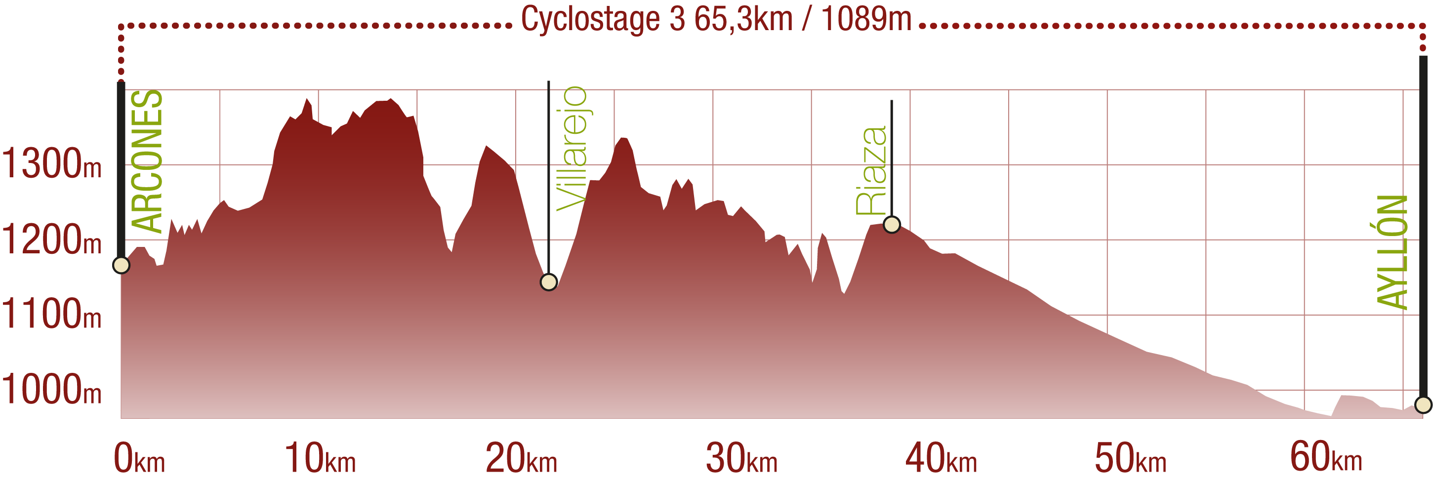
Cyclability
This Cyclostage corresponds to stages 6, 7 & 8 of the Nature Trail
PROFILE
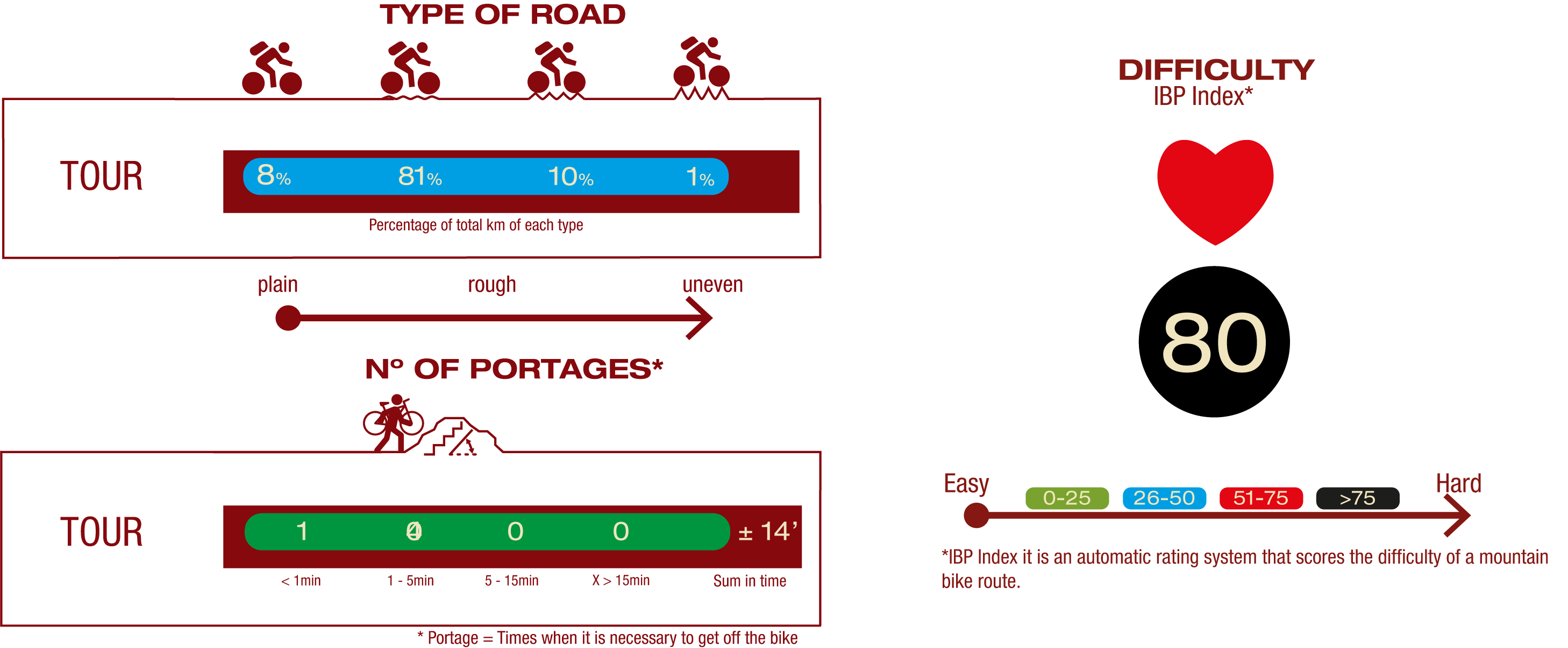
TYPE OF ROAD, PORTAGES & DIFFICULTY
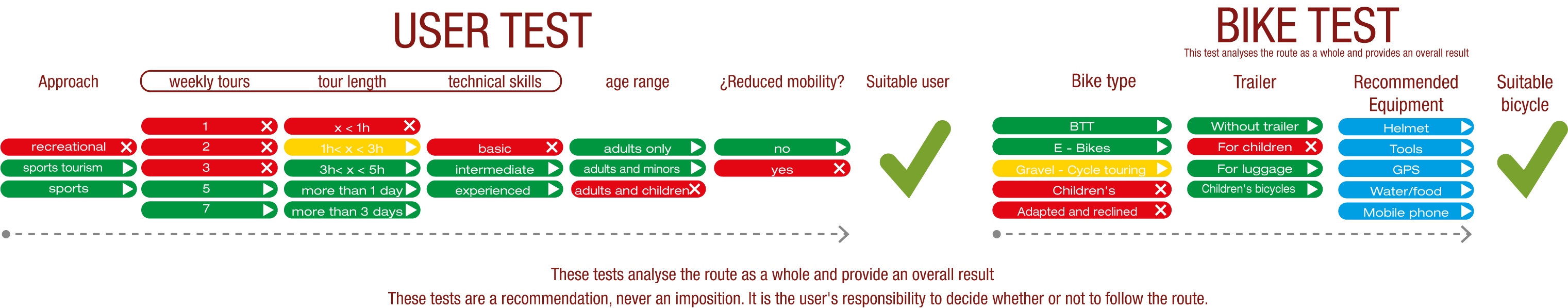
TEST
SAFETY RECOMMENDATIONS
- Sections shared with hikers.
- Transit through the centre of some population centres.
- The Nature Trail presents, in stage 3, the crossing of a paved road across a solid line. Although there is enough visibility, extreme caution, and crossing dismounted, is advised.
GENERAL RECOMMENDATIONS
- Find out about the technical aspects of the route and the weather on the day.
- Take care of the environment. Take care not to disturb animals or damage vegetation. Respect private areas.
- You must give priority to pedestrians and comply with general traffic rules.
- The environment in which you will be riding is open, free to move around and an area where many activities are carried out (sporting, forestry, livestock and agricultural activities). Always have an understanding, prudent, responsible and respectful attitude.